VILLAGE GREENS
Staten Island
Geographic Setting
Bounded by the West Shore Expressway to the north, Arden Avenue to the northeast, Vespa Avenue to the southeast, Rosedale Avenue to the south, and Huguenot Avenue to the west, Village Greens occupies a carefully planned residential enclave within Staten Island’s southern interior, nestled between Arden Heights to the north and Huguenot to the south. It stands as one of the borough’s most distinctive examples of modern suburban design—a self-contained community built in the 1970s to balance green space, family life, and architectural uniformity.
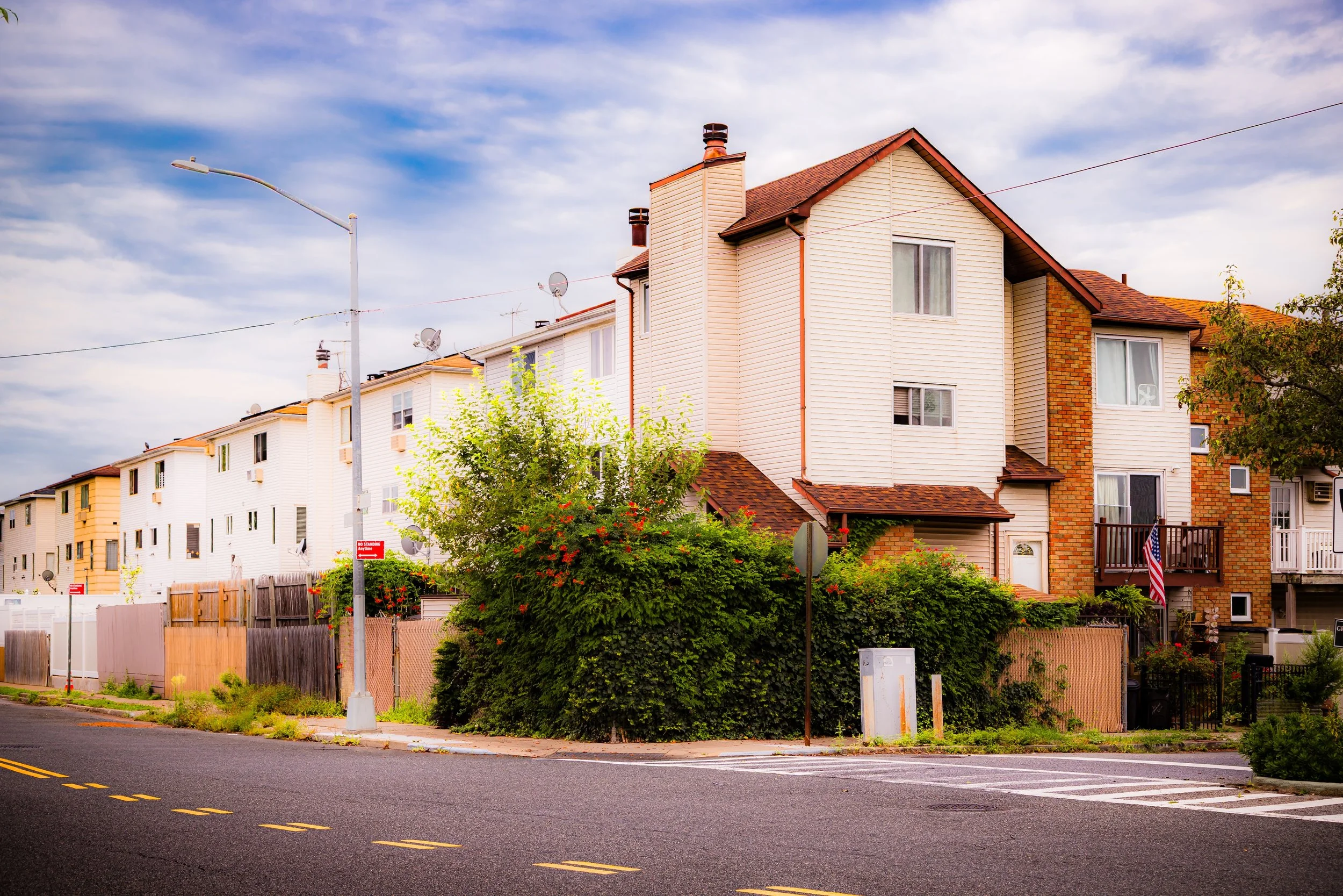
The neighborhood’s layout is defined by curving roads, cul-de-sacs, and landscaped parkways that diverge from the rigid grids of earlier development. Low-rise townhouses and attached homes are arranged around shared lawns, playgrounds, and walking paths, creating the “village” effect for which it was named. To the west and north, the West Shore Expressway provides swift access to other parts of Staten Island and New Jersey, while to the east and south, quiet streets taper into greenbelts and wetlands bordering Arden Woods and Blue Heron Park. The result is a planned suburban environment that manages to feel both accessible and enclosed—a neighborhood designed to create community in harmony with its landscape.
Etymology
The name Village Greens was chosen in the early 1970s to reflect the community’s organizing principle: a modern suburban “village” set amid green open spaces. Drawing inspiration from the English tradition of the village green—a communal parkland at the center of town life—developers envisioned a new type of Staten Island neighborhood where landscaped common areas, rather than individual yards alone, would define residential identity.
The concept was part of a national shift in postwar suburban planning toward more integrated, environmentally conscious design. In the case of Village Greens, the name captured both the layout’s social ideal—neighbors connected through shared courtyards and recreation—and its literal topography: open lawns and tree-lined walkways threaded through a former stretch of woodlands between Huguenot and Arden Heights.
The Neighborhood
Origins through the 19th and Early 20th Centuries
Before its transformation into a planned community, the land that now forms Village Greens was a patchwork of farms, woodlots, and undeveloped tracts typical of Staten Island’s South Shore interior. During the 18th and 19th centuries, it formed part of the agricultural hinterland associated with nearby Huguenot and Woodrow. The area’s gently rolling terrain and proximity to Arden Avenue—an early route linking Richmondtown to the island’s southern coast—made it ideal for small-scale farming and dairy operations.
By the early 20th century, the landscape remained largely rural, with scattered farmhouses and dirt lanes but few permanent institutions. Staten Island’s southern development lagged far behind its northern and eastern shores, and this area’s isolation preserved its pastoral character well into the postwar era. Even after the construction of the West Shore Expressway in the 1970s, the land south of Arden Heights was still characterized by meadows, woodlands, and wetlands—an open canvas for the borough’s next experiment in community planning.
Mid–Late 20th Century: A Planned Suburb for a Changing City
The birth of Village Greens was a product of the 1970s suburban expansion that followed the opening of the Verrazzano-Narrows Bridge (1964), which transformed Staten Island from a largely rural borough into a commuter suburb for New York City. Amid rapid, often haphazard growth, planners sought to create model communities that avoided the congestion, zoning conflicts, and environmental degradation common in unregulated development.
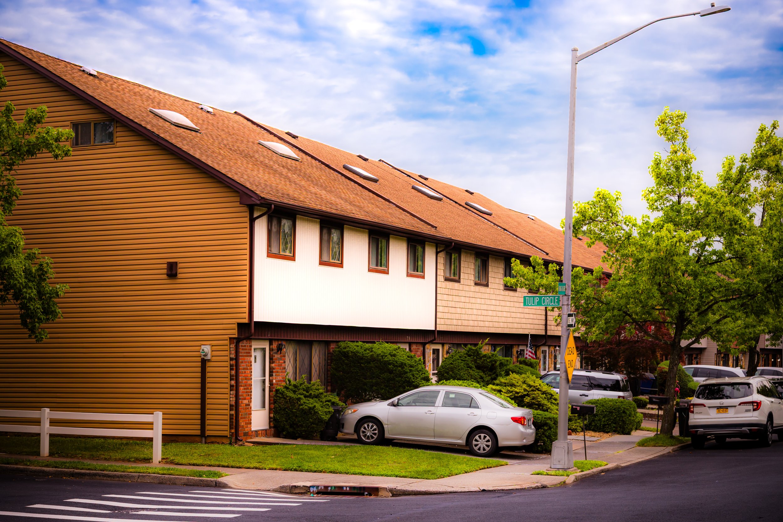
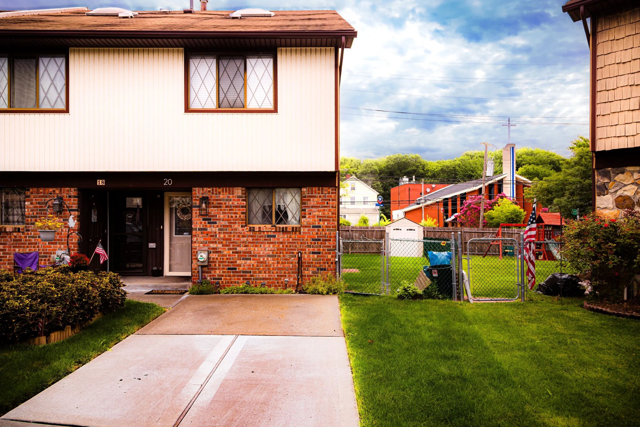
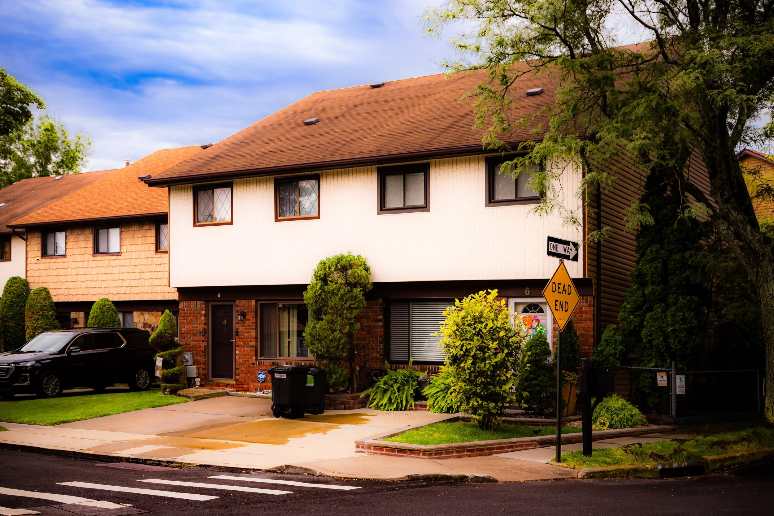
In 1972, the Levitt Corporation—famed builders of Levittown on Long Island—was commissioned to construct Staten Island’s first fully planned townhouse community. The site, chosen for its accessibility and relative isolation, became Village Greens, a 250-acre development designed around landscaped “greenbelts,” pedestrian paths, and recreational amenities. The community’s layout emphasized human-scale design: curved streets discouraged through traffic, parking lots were discreetly positioned behind houses, and every cluster of homes opened onto shared lawns or gardens.
At the heart of the community stood Village Greens Park, featuring playgrounds, ball fields, and open lawns for recreation. A network of internal walking paths connected residents to small commercial zones along Arden Avenue and to surrounding neighborhoods. The architecture—low-rise brick townhouses and semi-attached homes with gabled roofs and uniform color palettes—reflected contemporary suburban aesthetics: modern, efficient, and family-oriented.
Village Greens was one of the first Staten Island communities built under the principles of planned-unit development (PUD), a zoning model that allowed for flexible use of land while preserving open space. Its success influenced later residential projects across the borough, from Arden Heights condominiums to newer complexes in Prince’s Bay and Charleston.
Village Greens Video Coming Soon
Late 20th Century: Community Identity and Stability
By the 1980s and 1990s, Village Greens had matured into a cohesive and stable neighborhood, distinguished by its unique organization and strong civic culture. The Village Greens Homeowners Association (VGHA) managed communal property, maintained landscaping, and organized events, reinforcing the sense of collective responsibility envisioned by the original developers.
Residents embraced the community’s quiet, walkable design. Families enjoyed easy access to schools, parks, and local shopping, while the proximity to the West Shore Expressway made commuting convenient. Although modest in scale compared to Staten Island’s single-family subdivisions, Village Greens cultivated a reputation for safety, neighborliness, and careful upkeep.
At the same time, the surrounding landscape was changing dramatically. The gradual closure of the Fresh Kills Landfill (1948–2001) and the emergence of Freshkills Park to the north transformed the area from a borderland of environmental decline into a frontier of ecological renewal. The park’s expansion has since positioned Village Greens on the edge of one of the largest rewilding projects in the world—a literal green frontier consistent with the community’s founding ideals.
21st Century: A Model of Suburban Design amid Ecological Renewal
In the 21st century, Village Greens continues to stand as a model of thoughtful suburban planning within Staten Island’s evolving landscape. The neighborhood’s layout—compact yet verdant—has aged gracefully, its pedestrian paths and courtyards now shaded by mature trees planted during its founding. The balance between private and shared space remains central to its appeal: residents enjoy the privacy of townhouse living alongside the openness of communal lawns and parks.
Proximity to Arden Heights Woods, Blue Heron Park, and the growing expanse of Freshkills Park has reinforced the community’s connection to nature. Wildlife sightings—herons, deer, foxes—are increasingly common in surrounding greenbelts. The community’s infrastructure, initially ahead of its time, has adapted well to modern sustainability goals, with stormwater retention basins and green corridors that mirror the principles now championed by urban ecologists.
The Village Greens Homeowners Association continues to coordinate community events, environmental initiatives, and beautification efforts. Annual gatherings, cleanups, and children’s parades maintain a sense of small-town intimacy within the larger metropolis. Nearby schools and civic organizations, including Intermediate School 75 and local youth leagues, serve as focal points for family life.
Though surrounded by Staten Island’s sprawl, Village Greens remains distinct—a neighborhood intentionally designed for balance: between density and open space, individuality and community, the built and the natural.
Village Greens Photo Gallery
Spirit and Legacy
The spirit of Village Greens is rooted in design and intention. Where much of Staten Island grew organically—or chaotically—this neighborhood was planned with purpose: to create harmony between human settlement and natural form. Its legacy lies not only in architecture or layout but in the sense of belonging that careful planning can foster.
For longtime residents, Village Greens represents a promise fulfilled: a suburban dream realized without the loss of landscape or neighborly connection. For urban planners and historians, it stands as an enduring experiment in livable design—a reminder that the best communities are those built around both people and place.
New York City
Use this custom Google map to explore where every neighborhood in all five boroughs of New York City is located.
The Five Boroughs
One of New York City’s unique qualities is its organization in to 5 boroughs: Manhattan, Brooklyn, Queens, The Bronx, and Staten Island. These boroughs are part pragmatic administrative districts, and part vestiges of the region’s past. Each borough is an entire county in New York State - in fact, Brooklyn is, officially, Kings County, while Staten Island is, officially Richmond County. But that’s not the whole story …
Initially, New York City was located on the southern tip of Manhattan (now the Financial District) that was once the Dutch colony of New Amsterdam. Across the East River, another city was rising: Brooklyn. In time, the city planners realized that unification between the rapidly rising cities would create commercial and industrial opportunities - through streamlined administration of the region.
So powerful was the pull of unification between New York and Brooklyn that three more counties were pulled into the unification: The Bronx, Queens, and Staten Island. And on January 1, 1898, the City of New York unified two cities and three counties into one Greater City of New York - containing the five boroughs we know today.
But because each borough developed differently and distinctly until unification, their neighborhoods likewise uniquely developed. Today, there are nearly 390 neighborhoods, each with their own histories, cultures, cuisines, and personalities - and each with residents who are fiercely proud of their corner of The Big Apple.


