
MANHATTANVILLE
Manhattan
Geographic Setting
Set between 122nd and 135th Streets, stretching from Riverside Drive and the Hudson River east to St. Nicholas Park, Manhattanville occupies one of the most historically layered and visually striking landscapes in Upper Manhattan. The neighborhood lies within a natural hollow — a shallow valley carved by the long-vanished Manhattanville Creek — framed by the rising cliffs of Morningside Heights to the south and Hamilton Heights to the north. Today, Manhattanville stands at the crossroads of history and transformation: once a 19th-century village, later an industrial powerhouse, and now a center of education, culture, and architectural renewal anchored by Columbia University’s Manhattanville campus.
Etymology and Origins
The name Manhattanville was first used in 1806, when Jacob Schieffelin, a merchant and philanthropist, laid out a small village near the intersection of what are now 125th Street and Broadway. The name reflected both geography and aspiration — a “village of Manhattan,” conceived as a suburban retreat from the crowded city to the south. Its location, along the Bloomingdale Road (the precursor to Broadway), made it an important waypoint for travelers moving north and west toward the Hudson River ferries.
Before European settlement, the area had been part of the Lenape homeland, rich in fish, forest, and freshwater streams. The Dutch colonists who arrived in the 1600s farmed the fertile lowlands and built country estates along the riverbanks.
The Neighborhood
18th–19th Centuries: Village on the Road to Bloomingdale
During the Revolutionary War, the ridges surrounding Manhattanville formed a strategic line of defense. The Battle of Harlem Heights in 1776 unfolded just south of here, with American troops using the natural terrain to repel British forces. After the war, the quiet valley resumed its pastoral rhythm.
When Schieffelin founded Manhattanville in the early 19th century, he envisioned a self-contained village with houses, shops, and churches. St. Mary’s Church, built in 1823 and still standing on 126th Street, became the spiritual heart of the community and remains the oldest active church building in Harlem.
Throughout the 19th century, Manhattanville grew as a transportation hub. Stagecoaches, and later streetcars, connected it to downtown; the Hudson River Railroad opened nearby in 1851, accelerating development. The village became a blend of small industry and genteel residences — breweries, stone yards, and workshops sharing space with leafy lanes and modest villas.
Late 19th Century: Industry and Immigration
By the late 1800s, as the city expanded northward, Manhattanville evolved from rural hamlet to industrial neighborhood. Factories, warehouses, and stables clustered around 125th Street and Twelfth Avenue, taking advantage of proximity to the river and rail lines. The Manhattanville Viaduct, completed in 1905, carried Broadway over the valley — an engineering marvel that reshaped the local topography and remains one of Upper Manhattan’s most dramatic urban structures.
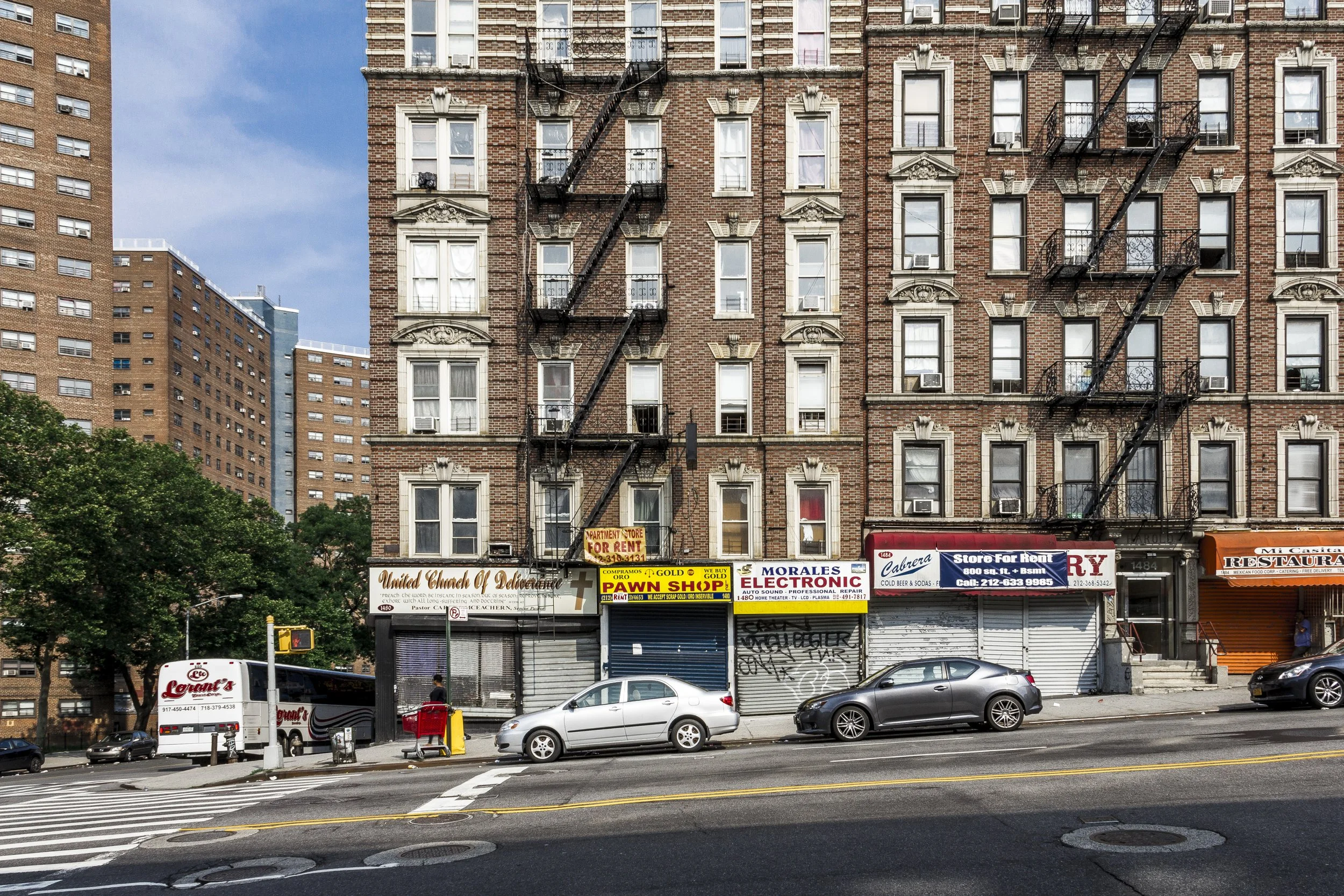
The population diversified rapidly. Irish, German, and later Italian immigrants settled in the area, joined by African-American families moving north during the early waves of the Great Migration. The neighborhood’s mix of working-class tenements and industrial jobs fostered a strong, pragmatic community identity — neither affluent nor bohemian, but deeply tied to labor and faith.
Early 20th Century: Factories, Faith, and Community
By the early 1900s, Manhattanville was thriving as a manufacturing district. Milk processing plants, bakeries, and metal works operated along the waterfront, while small groceries and churches filled the residential streets above. The New York Central Railroad’s 135th Street freight yard and the Riverside Drive viaduct gave the neighborhood its distinctive layered landscape of bridges, arches, and stone retaining walls.
Religious and educational institutions reinforced the area’s civic fabric. The Academy of the Sacred Heart (founded in 1841, later Manhattanville College) began here before relocating upstate, while numerous Catholic and Protestant missions served the working population. Despite modest means, the community sustained strong local traditions — parades, church festivals, and close-knit block associations that defined daily life well into the mid-20th century.
Manhattanville Photographic Tour
Mid-20th Century: Decline and Resilience
After World War II, Manhattanville’s industrial base began to erode. Shipping and manufacturing declined along the Hudson; the elevated rail lines and warehouses fell silent. Many working families moved to the Bronx or suburbs, replaced by new waves of Puerto Rican and Dominican residents.
By the 1960s, urban renewal projects and disinvestment had left portions of the neighborhood struggling. Yet even amid hardship, the spirit of community persisted. Union Theological Seminary, The Riverside Church, and City College of New York (just to the east) remained beacons of education and activism. The area’s churches and community groups provided social services and advocated for housing rights, forming a local safety net that endured through turbulent decades.
Late 20th Century: Seeds of Change
In the final decades of the 20th century, Manhattanville began to attract attention for its architectural potential and strategic location. Artists and small manufacturers took over vacant industrial spaces; neighborhood organizations such as the Manhattanville Houses Tenant Association fought for improved public housing and quality of life.
At the same time, larger institutions eyed the area’s underused land as an opportunity for expansion. Columbia University, long based on the nearby Morningside Heights plateau, began acquiring property in the 1990s for a proposed new campus that would integrate advanced research, arts, and community facilities.
21st Century: Columbia’s Expansion and the New Manhattanville
The 21st century has brought dramatic change. Columbia’s Manhattanville Campus, a 17-acre development stretching from 125th to 133rd Streets between Broadway and Twelfth Avenue, represents one of the most ambitious urban university projects in the nation. Designed by Renzo Piano Building Workshop and Skidmore, Owings & Merrill, the campus replaces old warehouses with transparent glass pavilions housing laboratories, performance spaces, and cultural venues such as the Lenfest Center for the Arts and the Forum.
The project, while controversial for its scale and displacement concerns, has also delivered new public plazas, retail spaces, and improved infrastructure, reknitting the long-severed connection between Broadway and the Hudson River.
Beyond the university footprint, the surrounding neighborhood has experienced a quieter renaissance. Restaurants, cafés, and small galleries have opened along Twelfth Avenue’s Viaduct Row, blending industrial grit with creative energy. Public housing remains central to the area’s population, preserving a measure of socioeconomic diversity even as new development rises nearby.
Manhattanville Photo Gallery
Architecture and Atmosphere
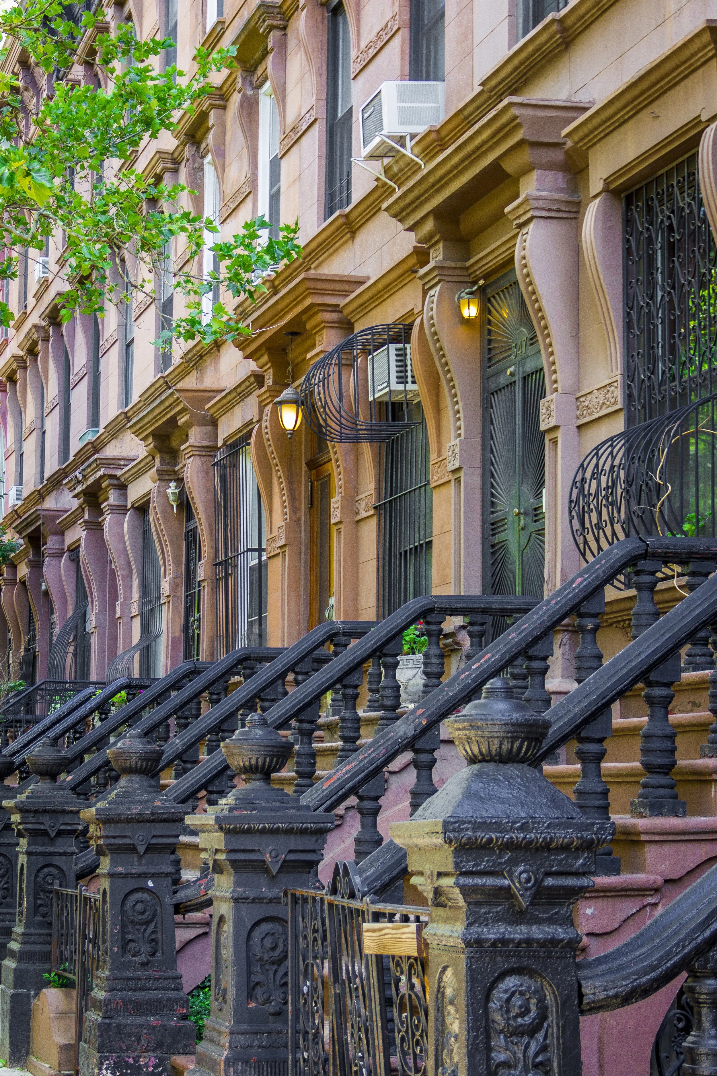
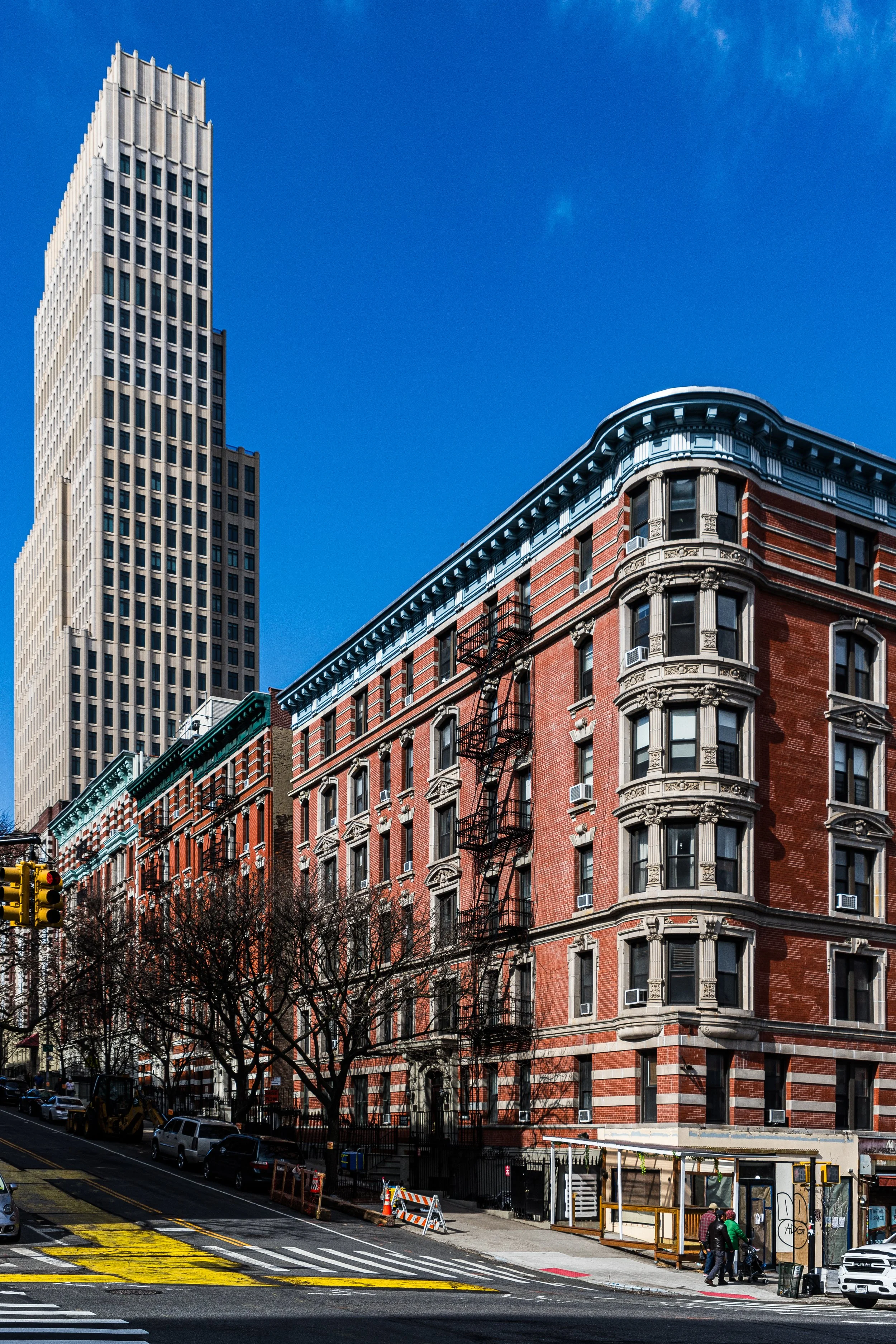
Architecturally, Manhattanville is a study in contrast — a layered composition of eras and materials. The steel arches of the viaduct, the brick warehouses of the industrial age, and the glass forms of Columbia’s modern campus coexist within a single glance. Along Old Broadway, a few 19th-century rowhouses still stand, their stoops and cornices weathered but proud.
The atmosphere is one of transformation anchored by memory. Freight trains no longer run beneath the viaduct, yet the echo of industry remains. Students and workers mingle at street cafés; church bells ring beside the hum of construction. The Hudson, once hidden behind warehouses, now glints between glass towers, its presence reasserted in the neighborhood’s daily rhythm.
Spirit and Legacy
Manhattanville’s legacy is reinvention rooted in geography. Its valley has always gathered the forces of the city — commerce, faith, education, and migration — and reshaped them into new forms. It is a place that has known both hardship and vision, both erasure and renewal.
New York City
Use this custom Google map to explore where every neighborhood in all five boroughs of New York City is located.
The Five Boroughs
One of New York City’s unique qualities is its organization in to 5 boroughs: Manhattan, Brooklyn, Queens, The Bronx, and Staten Island. These boroughs are part pragmatic administrative districts, and part vestiges of the region’s past. Each borough is an entire county in New York State - in fact, Brooklyn is, officially, Kings County, while Staten Island is, officially Richmond County. But that’s not the whole story …
Initially, New York City was located on the southern tip of Manhattan (now the Financial District) that was once the Dutch colony of New Amsterdam. Across the East River, another city was rising: Brooklyn. In time, the city planners realized that unification between the rapidly rising cities would create commercial and industrial opportunities - through streamlined administration of the region.
So powerful was the pull of unification between New York and Brooklyn that three more counties were pulled into the unification: The Bronx, Queens, and Staten Island. And on January 1, 1898, the City of New York unified two cities and three counties into one Greater City of New York - containing the five boroughs we know today.
But because each borough developed differently and distinctly until unification, their neighborhoods likewise uniquely developed. Today, there are nearly 390 neighborhoods, each with their own histories, cultures, cuisines, and personalities - and each with residents who are fiercely proud of their corner of The Big Apple.


