TODT HILL
Staten Island
Geographic Setting
Within the interior heights of Staten Island, Todt Hill rises as a long, wooded ridge whose contours still feel more Appalachian than metropolitan. In the bounds you’ve set—Ocean Terrace and Richmond Road to the north, down toward Four Corners Road and Amboy Road to the south—the landscape reads like a slow climb through alternating rooms of forest and lawn. Todhunter Avenue, Todt Hill Road, and Bard Avenue wind upward in that particular Staten Island way: not as a grid’s assertion, but as a negotiation with slope, stone, and older tree lines. To the west, the ground loosens into the green spill of LaTourette Park and the wider Staten Island Greenbelt—a conserved interior that keeps the ridge from becoming just another scenic backdrop.
What gives this place its drama is the abruptness of its edges. The ridge’s eastern face falls away quickly toward Grasmere and Dongan Hills, creating those sudden, private “overlooks” where the city feels far below, as if lowered on a pulley. Geologically, the hill is part of a serpentine-bearing formation and is widely described as the highest natural point in New York City—often given as about 401 feet—an odd little superlative that explains the air of altitude even when you’re still among front lawns and driveways.
Etymology and Origins
The name “Todt” carries a suitably gothic syllable, and the old explanations tend to agree on the core idea: “Tod/Todt” is linked to “death,” via Dutch and/or German usage, with local tradition frequently connecting the word to burial grounds in the area. One persistent historical anchor for that association is Moravian Cemetery, established in the 18th century and long prominent on Staten Island’s cultural map; it doesn’t sit on the summit, but it helps explain why “death” clings to the ridge in the popular imagination.
At the same time, Todt Hill’s “origin story” is not only linguistic but environmental: a high, rocky, wind-exposed ridge that once looked stark in places, flanked by darker woods, is exactly the kind of land that invites metaphor—quietness mistaken for gloom, stillness mistaken for omen. Before the neighborhood name hardened into real-estate certainty, the ridge functioned as a natural borderland: pasture giving way to woodland, cultivated clearings giving way to the island’s interior thickets, with paths and property lines often following what the terrain permitted rather than what surveyors preferred.
The Neighborhood
18th–19th Century: Forested Frontier to Gentleman’s Estate
During the colonial era, Todt Hill remained sparsely settled and heavily wooded. Its steep slopes made it ill-suited to farming, but its elevation and relative isolation attracted landowners seeking solitude and status. In the early 1800s, prominent Staten Island families—including the Crochers, Mersereaus, and Tysons—acquired large tracts for country estates and hunting preserves.
The hill’s most famous landmark from this period was the Moravian Cemetery, established in 1740 along Richmond Road at the base of the hill. It remains Staten Island’s oldest active burial ground and one of the most historic in New York. The cemetery’s rolling terrain and monumental statuary later became the resting place of the Vanderbilt family, whose mausoleum, designed by Richard Morris Hunt in 1885, crowns a wooded knoll overlooking the island’s east shore. The Vanderbilt Mausoleum and surrounding cemetery effectively anchor Todt Hill’s northern slope in a landscape of memory and majesty.
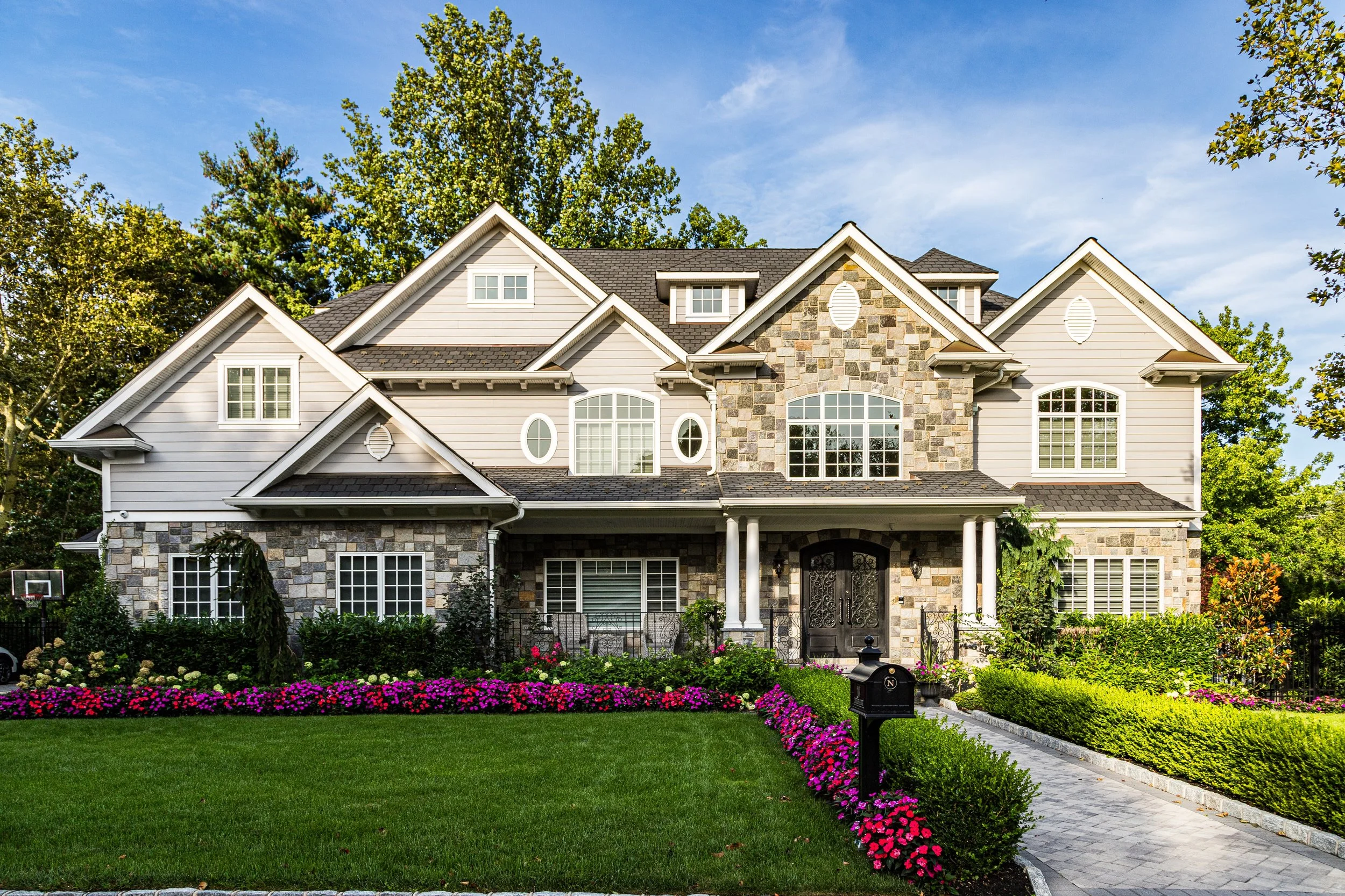
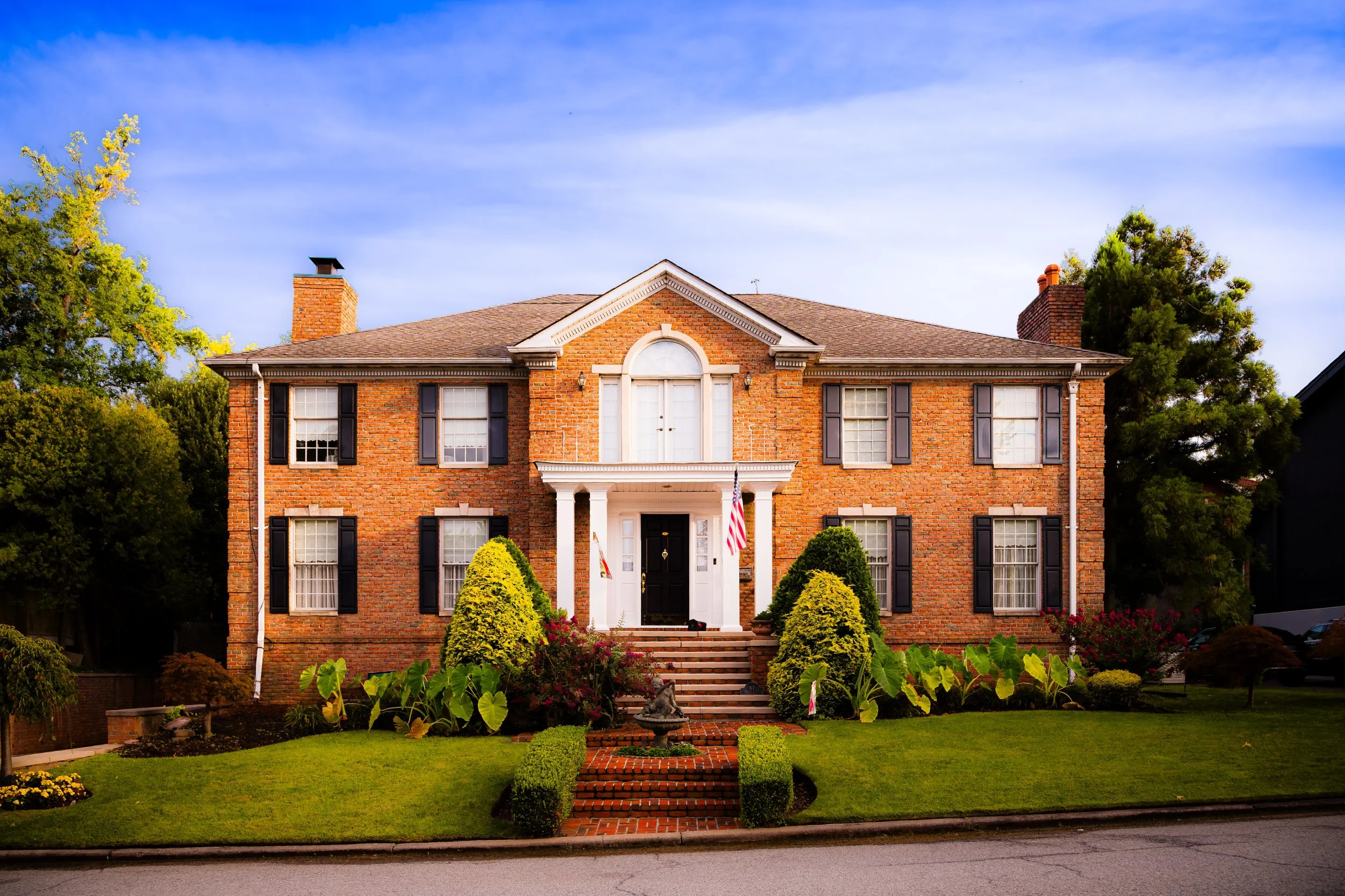
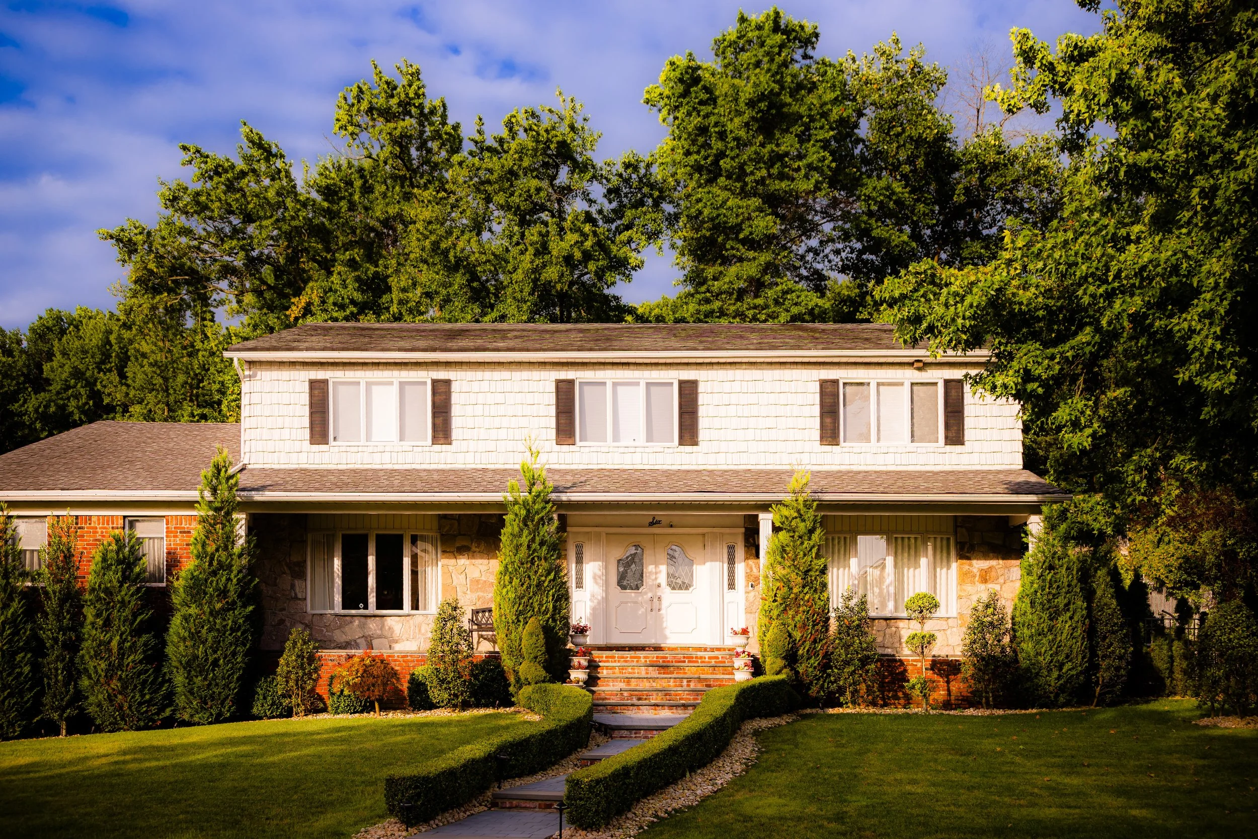
By the late 19th century, Todt Hill had evolved into an enclave of wealth and refinement. Paved carriage roads and rustic lanes connected elegant country homes surrounded by stone walls and formal gardens. Wealthy Staten Islanders built Italianate villas and Tudor-style manors that took full advantage of the views and seclusion. Early photographs show winding driveways shaded by oaks, with sweeping lawns giving way to glimpses of the sea. Even then, Todt Hill was synonymous with privacy and prestige.
Early–Mid 20th Century: Exclusive Suburb Above the City
With the arrival of the automobile and the consolidation of Staten Island into Greater New York (1898), Todt Hill became an early model for the modern suburban ideal—spacious lots, curving roads, and proximity to both nature and Manhattan. The Todt Hill Road was improved and extended, connecting the ridge to Richmondtown and Grasmere, while smaller private lanes led to stately residences hidden in the woods.
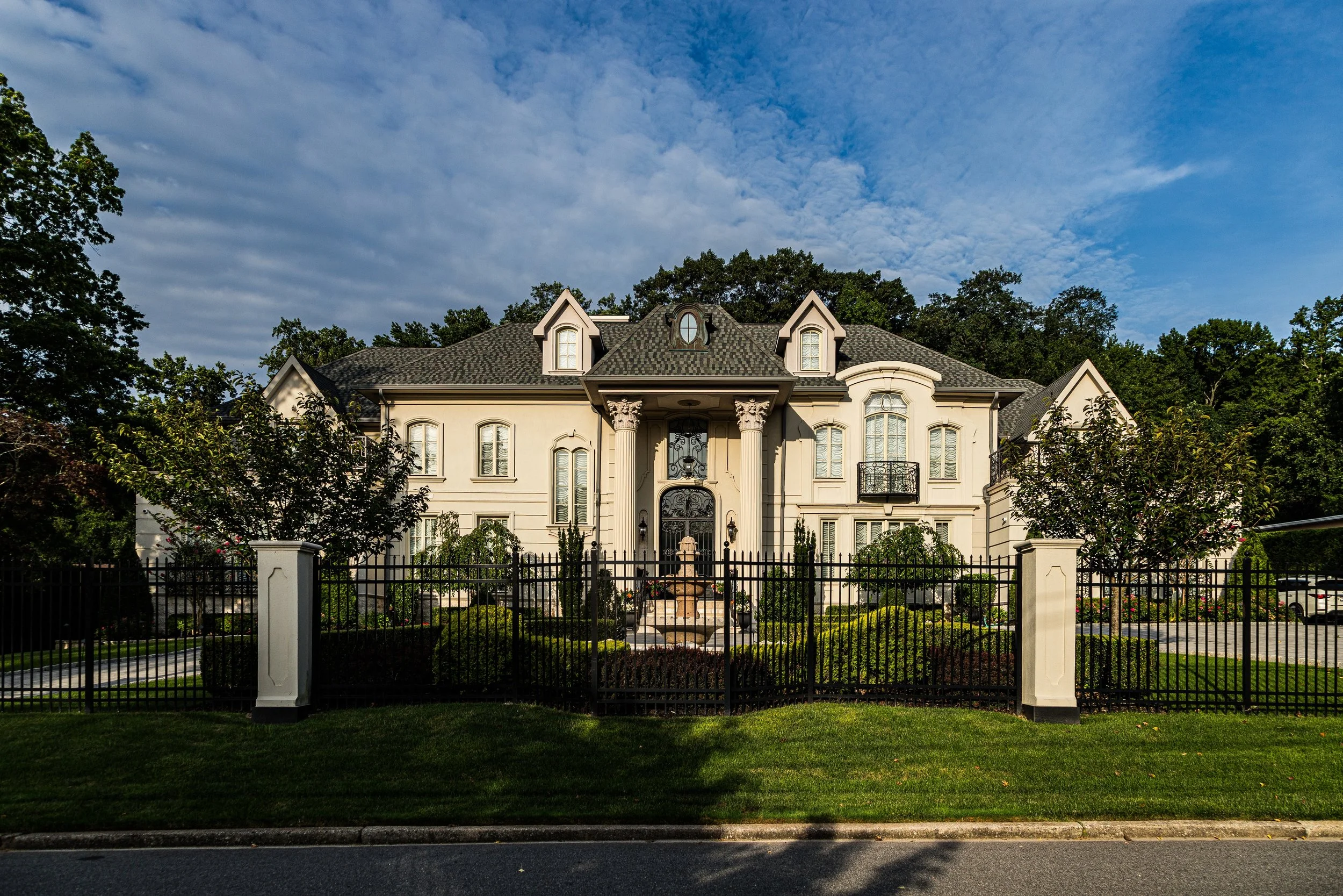
In the 1920s–1930s, architects designed some of Staten Island’s most distinguished homes here: Georgian Revivals, English Tudors, and Mediterranean villas graced the hillside. Among them rose the St. Charles Seminary (later the St. Charles Monastery of the Passionists, founded 1920), its red-tiled roofs and chapel spires visible through the trees—a spiritual counterpart to the Vanderbilt Mausoleum below. The monastery’s contemplative presence reinforced the area’s aura of stillness and sanctuary.
By mid-century, Todt Hill had solidified its reputation as Staten Island’s most exclusive neighborhood. Its residents included judges, industrialists, clergy, and civic leaders who valued its elevation both literal and symbolic. Zoning regulations preserved its low density; no commercial corridors intruded upon its forested streets. Even as much of Staten Island suburbanized in the 1950s–1970s, Todt Hill retained its rural character, buffered by parks and the cemetery’s green expanses.
Todt Hill Video Coming Soon
Late 20th Century
By the late 1900s, Todt Hill’s modern personality had sharpened: large-lot residential streets, deep setbacks, winding approaches, and a sense that the neighborhood’s most important “landmark” was often the absence of intrusion—no grid, few straightaways, and a geography that made even short drives feel like leaving one world for another. The Staten Island Greenbelt became the crucial counterweight to development pressure, keeping the ridge’s spine wooded and ensuring that the hill remained a living topography instead of a mere name on a map.
This era also exposed a classic New York paradox: “Todt Hill” as a symbol could mean elite hillside estates, while nearby the city’s public-housing reality existed in the same general orbit—different street rhythms, different histories, different expectations, all compressed into a single borough that outsiders rarely bother to read closely. That tension—between the secluded and the shared—became part of the neighborhood’s late-century truth.
21st Century
In the present century, Todt Hill continues to function as Staten Island’s vertical signature: a place where elevation and enclosure still confer identity. The hill’s woods remain a practical ecosystem (stormwater, habitat, temperature relief) and a cultural one (an inherited sense that the island’s interior should stay interior). Hiking paths, protected tracts, and “forever wild” rhetoric around the Greenbelt reinforce that the ridge is not simply scenic; it is structurally important to how Staten Island breathes.
At the same time, the neighborhood’s residential character leans ever more toward seclusion and high-end reinvestment, with the hillside lots and the views toward the east continuing to command a premium—less because the city changed, and more because the hill stubbornly didn’t. In a metropolis that constantly remakes itself, Todt Hill’s most marketable trait may be its refusal to become convenient.
Todt Hill Photo Gallery
Spirit and Legacy
Todt Hill’s legacy is written in grade and grain: the steep pitch underfoot, the serpentine geology beneath the soil, and the long-standing negotiation between what can be built and what should be kept. Its roads behave like sentences with subordinate clauses—turning, qualifying, doubling back—because the land demands that kind of language. And the neighborhood’s spirit lives in the way it stages Staten Island’s central theme: an island with an interior, a city with a forest, a skyline whose most meaningful “peak” is sometimes a quiet ridge line behind the houses.
New York City
Use this custom Google map to explore where every neighborhood in all five boroughs of New York City is located.
The Five Boroughs
One of New York City’s unique qualities is its organization in to 5 boroughs: Manhattan, Brooklyn, Queens, The Bronx, and Staten Island. These boroughs are part pragmatic administrative districts, and part vestiges of the region’s past. Each borough is an entire county in New York State - in fact, Brooklyn is, officially, Kings County, while Staten Island is, officially Richmond County. But that’s not the whole story …
Initially, New York City was located on the southern tip of Manhattan (now the Financial District) that was once the Dutch colony of New Amsterdam. Across the East River, another city was rising: Brooklyn. In time, the city planners realized that unification between the rapidly rising cities would create commercial and industrial opportunities - through streamlined administration of the region.
So powerful was the pull of unification between New York and Brooklyn that three more counties were pulled into the unification: The Bronx, Queens, and Staten Island. And on January 1, 1898, the City of New York unified two cities and three counties into one Greater City of New York - containing the five boroughs we know today.
But because each borough developed differently and distinctly until unification, their neighborhoods likewise uniquely developed. Today, there are nearly 390 neighborhoods, each with their own histories, cultures, cuisines, and personalities - and each with residents who are fiercely proud of their corner of The Big Apple.


