GRAVESEND
Brooklyn
Geographic Setting
Situated between Coney Island to the south and Bensonhurst to the north, Gravesend is one of Brooklyn’s most historically layered neighborhoods—an extraordinary place where the 17th century still faintly shapes the 21st. It is bounded roughly by Avenue P to the north, Stillwell Avenue and Coney Island Creek to the south, McDonald Avenue to the east, and West 1st Street to the west. Its quiet streets—lined with single-family homes, small apartment buildings, and corner shops—follow the irregular pattern of a 1640s English colonial town plan, making Gravesend not only one of Brooklyn’s oldest neighborhoods but also one of its most enduring.
Etymology and Origins
Gravesend holds a singular place in American history: it was the only English-founded town among Brooklyn’s original Dutch settlements, and one of the first in the New World to guarantee religious freedom to all residents. The name likely derives from the English coastal town of Gravesend in Kent, though some have speculated a Dutch origin from ’s-Gravesande (“the Count’s Beach”).
Its founder, Lady Deborah Moody, was a remarkable figure—an English noblewoman and religious dissenter who fled persecution in Massachusetts Bay for her beliefs in Baptist and Anabaptist doctrine. In 1645, she secured a land patent from the Dutch governor William Kieft, granting her and her followers a settlement along the sandy shores of southwestern Long Island. Gravesend thus became both the first English colony in New Netherland and one of the earliest communities in America established on principles of tolerance and self-governance.
The Neighborhood
17th and 18th Centuries: A Colonial Stronghold
Lady Moody’s original town plan—laid out in a perfect square divided into four quadrants by intersecting roads—remains visible today between Village Road North, Village Road South, Village Road East, and Village Road West. Within this quadrangle, early settlers built modest wooden houses and a meetinghouse that served as both church and town hall.
The soil proved sandy but fertile enough for crops and grazing, and the nearby creeks provided fishing and salt hay. Gravesend’s early economy revolved around agriculture and trade with neighboring Dutch villages such as Flatlands and New Utrecht. Despite occasional conflicts with the Dutch authorities and Native peoples, the settlement prospered.
During the American Revolution, Gravesend’s loyalist leanings and strategic coastal position made it a site of military importance. British troops landed along its shore in August 1776 during the Battle of Long Island, using it as a staging ground for their advance on Brooklyn Heights. After the war, the area returned to its agricultural rhythms, producing vegetables, oysters, and hay for the growing city.
19th Century: From Village to Urban Frontier
Throughout the 1800s, Gravesend retained its rural charm even as the surrounding borough urbanized. The establishment of Gravesend Bay as a resort and boating area brought summer visitors, and new roads—particularly Stillwell Avenue and Neptune Avenue—linked the old town to Coney Island and the expanding transit network.
In 1864, racing magnate Leonard Jerome and others founded the Sheepshead Bay Racetrack nearby, and Gravesend became associated with the glamour of horse racing and leisure. Wealthy families built summer homes along the shore, while farmers sold off portions of their land for development. By the 1880s, small suburban communities such as Bath Beach and West Brighton had sprung up around the old village, foreshadowing the urban grid that would soon absorb it.
The consolidation of Brooklyn into Greater New York City in 1898 ushered in major change. Electric trolley lines and later the Culver elevated train brought city commuters within reach, transforming the quiet farmlands into a stable, middle-class enclave.
Early 20th Century: The Modern Neighborhood
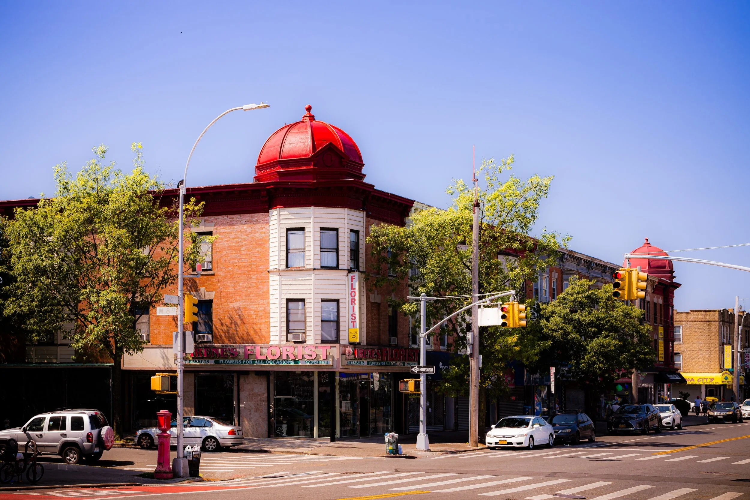
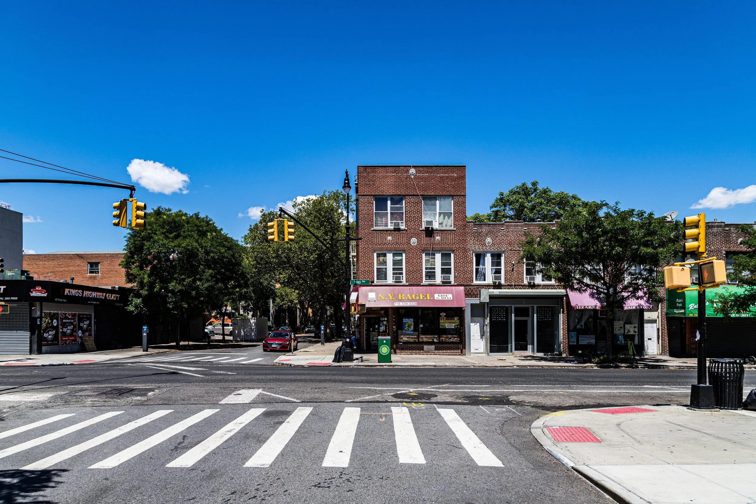
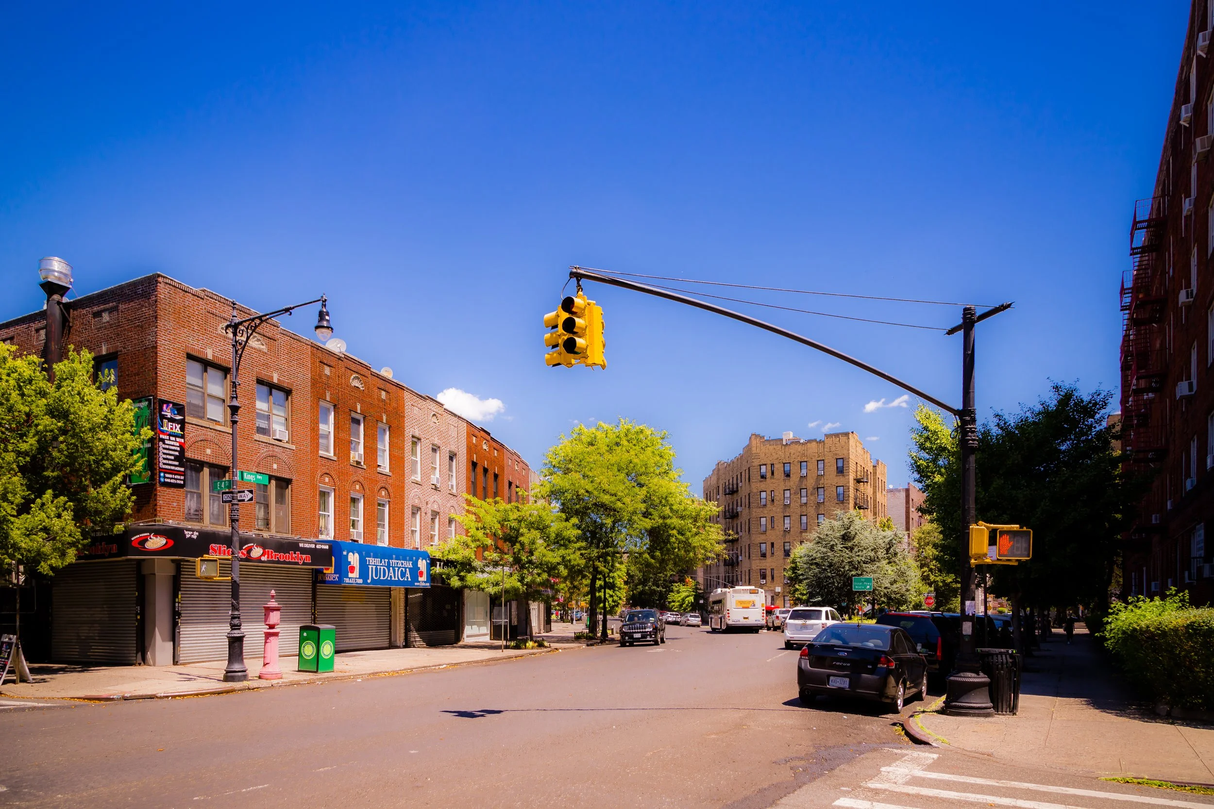
By the early 1900s, Gravesend had become a fully developed residential neighborhood. Brick rowhouses and single-family homes replaced the old farms, while small commercial strips appeared along Avenue U, Stillwell Avenue, and McDonald Avenue. The neighborhood’s population reflected Brooklyn’s diversity—Italians, Jews, and Irish forming the dominant groups. Churches, synagogues, and schools rooted the community in a blend of traditions that persists to this day.
The early 20th century also brought new landmarks. The Gravesend Cemetery, resting place of Lady Moody herself, remains one of the city’s oldest burial grounds. The Gravesend Reformed Church, rebuilt in 1833, still occupies its colonial site.
Gravesend Video Coming Soon
Mid-20th Century: Community and Continuity
Through the 1940s and 1950s, Gravesend prospered as a quiet, working- and middle-class neighborhood. Modest rowhouses, bungalows, and two-family homes filled the streets, while schools and parish halls buzzed with community life. Kings Highway and Avenue U became lively shopping corridors.
By the latter half of the 20th century, new waves of residents—particularly from Italy, Syria, and later Russia, China, and Pakistan—added to the cultural mosaic. Despite these demographic shifts, Gravesend retained its reputation for neighborliness and civic pride. Residents tended gardens, celebrated block parties, and preserved the area’s old-world rhythm.
Architecture and Streetscape
Gravesend’s architectural mix reflects its long evolution. Colonial remnants stand near early-20th-century homes and postwar apartment buildings. Within the historic quadrangle, modest wood-frame houses evoke the village’s rural past, while along West 2nd Street and Highlawn Avenue, rows of brick and stucco homes reflect the aspirations of the 1920s and 1930s. The neighborhood’s small scale and tree-lined streets maintain an intimacy rare in New York.
21st Century: Preservation and Change
Today, Gravesend remains both one of Brooklyn’s most historically significant and most quietly livable neighborhoods. Though surrounded by denser districts, it continues to embody the spirit of a small town within the city. Local preservationists have worked to protect the original village grid and its landmarks, ensuring that Lady Moody’s vision of tolerance and stability endures amid the tides of change.
The community’s diversity has deepened: Italian bakeries stand beside Chinese restaurants, halal markets beside kosher delis. Yet the neighborhood’s character—rooted in family, faith, and self-reliance—remains remarkably consistent.
Gravesend Photo Gallery
Spirit and Legacy
Gravesend’s legacy is one of endurance and idealism. Founded on freedom of conscience, it has weathered centuries of transformation while preserving its essential calm. To walk its quiet lanes, past the centuries-old church and the simple grave of Lady Deborah Moody, is to step into the living origin story of Brooklyn itself.
New York City
Use this custom Google map to explore where every neighborhood in all five boroughs of New York City is located.
The Five Boroughs
One of New York City’s unique qualities is its organization in to 5 boroughs: Manhattan, Brooklyn, Queens, The Bronx, and Staten Island. These boroughs are part pragmatic administrative districts, and part vestiges of the region’s past. Each borough is an entire county in New York State - in fact, Brooklyn is, officially, Kings County, while Staten Island is, officially Richmond County. But that’s not the whole story …
Initially, New York City was located on the southern tip of Manhattan (now the Financial District) that was once the Dutch colony of New Amsterdam. Across the East River, another city was rising: Brooklyn. In time, the city planners realized that unification between the rapidly rising cities would create commercial and industrial opportunities - through streamlined administration of the region.
So powerful was the pull of unification between New York and Brooklyn that three more counties were pulled into the unification: The Bronx, Queens, and Staten Island. And on January 1, 1898, the City of New York unified two cities and three counties into one Greater City of New York - containing the five boroughs we know today.
But because each borough developed differently and distinctly until unification, their neighborhoods likewise uniquely developed. Today, there are nearly 390 neighborhoods, each with their own histories, cultures, cuisines, and personalities - and each with residents who are fiercely proud of their corner of The Big Apple.


