SOUTH SLOPE
Brooklyn
Geographic Setting
Bounded by 10th Street to the northeast and Prospect Park West to the east, with Green-Wood Cemetery forming its sweeping southwestern edge, South Slope occupies the transitional slope of western Brooklyn where the hill descending from Prospect Park meets the industrial flats of Gowanus. The neighborhood extends westward to 5th Avenue between 24th Street and the Gowanus Parkway, then continues along 4th Avenue northward to 10th Street—an area that bridges the historic brownstone core of Park Slope with the mixed-use landscapes of Sunset Park and Gowanus.
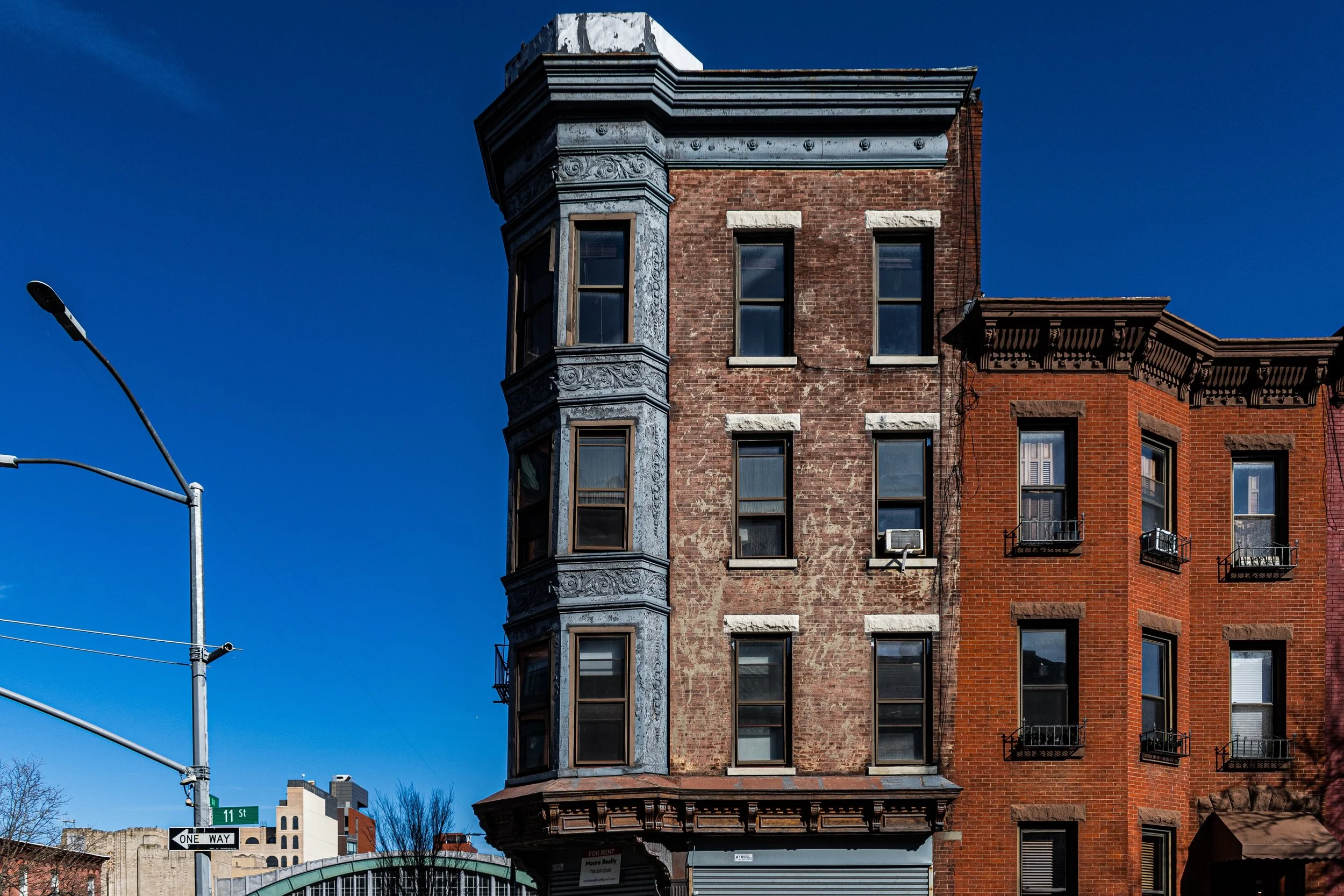
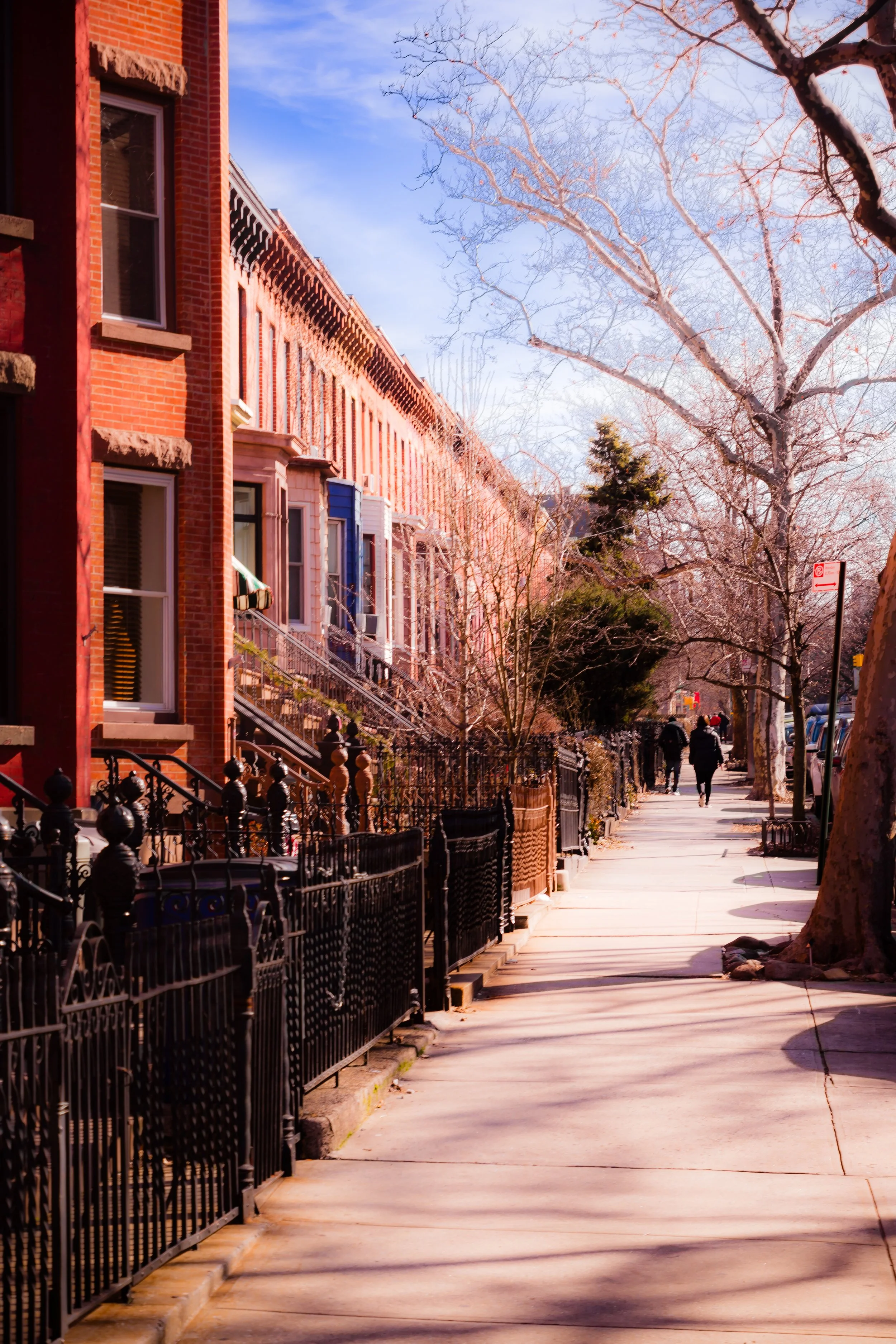
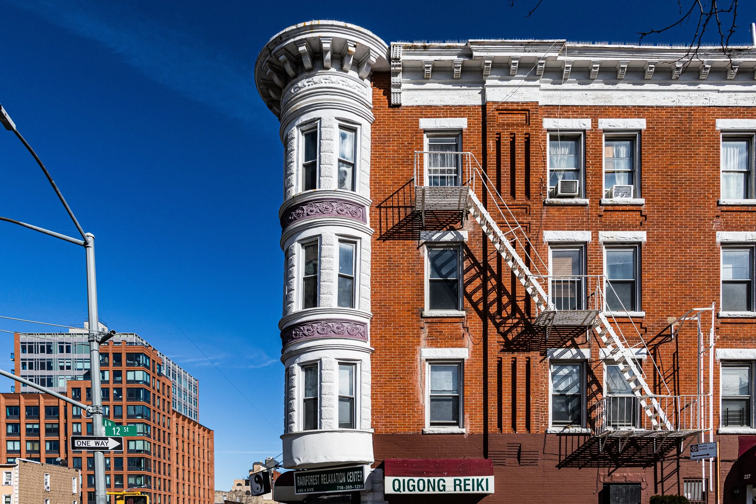
Its streets ascend gently toward Prospect Park, offering long, cinematic views of church spires, brownstone stoops, and—on clear days—the distant towers of Lower Manhattan. Architecturally, South Slope retains much of the 19th-century rowhouse rhythm that defines Park Slope, but with a grittier, humbler edge: brick and brownstone townhouses, converted carriage houses, and low-rise apartment buildings punctuated by corner delis, cafés, and small parks. Along 5th Avenue, independent restaurants and music venues form a lively corridor of neighborhood commerce, while Prospect Park West provides a green, dignified eastern boundary of leafy calm. The juxtaposition of civic beauty and working-class roots gives South Slope its enduring balance between refinement and realism.
Etymology and Origins
The name “South Slope” is a relatively recent invention—popularized in the 1980s–1990s as the southern section of Park Slope reasserted its identity amid citywide renewal. Yet its topography and lineage date back more than two centuries. The land once formed part of the Town of South Brooklyn, an agricultural tract stretching from Flatbush Road (today’s Flatbush Avenue) to the Gowanus Creek.
During the 17th and 18th centuries, Dutch and English settlers farmed these slopes, cultivating grains, vegetables, and orchards on the rich glacial soil. The area remained largely rural through the early 1800s, dotted with farmhouses and mills serving nearby Gowanus Bay, where small shipyards and tanneries operated. The construction of Green-Wood Cemetery (1838–1842) transformed the area’s southern horizon, turning the once-pastoral ridge into a monumental landscape of marble and elm trees.
By the 1860s, with the creation of Prospect Park under Frederick Law Olmsted and Calvert Vaux, the adjacent hillside began to attract residential development. Builders and speculators, inspired by the park’s success, subdivided farmland into urban lots—laying out the foundations of what would later be known as Park Slope and, by extension, South Slope.
The Neighborhood
19th Century: Growth along the Hill
The late 19th century was South Slope’s formative period. The opening of the Fifth Avenue elevated railway (1889) and the expansion of horse-drawn streetcars along 9th and 10th Streets made the area newly accessible to downtown Brooklyn and Manhattan commuters. Developers erected rows of brownstone and brick townhouses between 10th and 20th Streets, aimed at clerks, artisans, and small merchants rather than the wealthier professionals who dominated northern Park Slope.
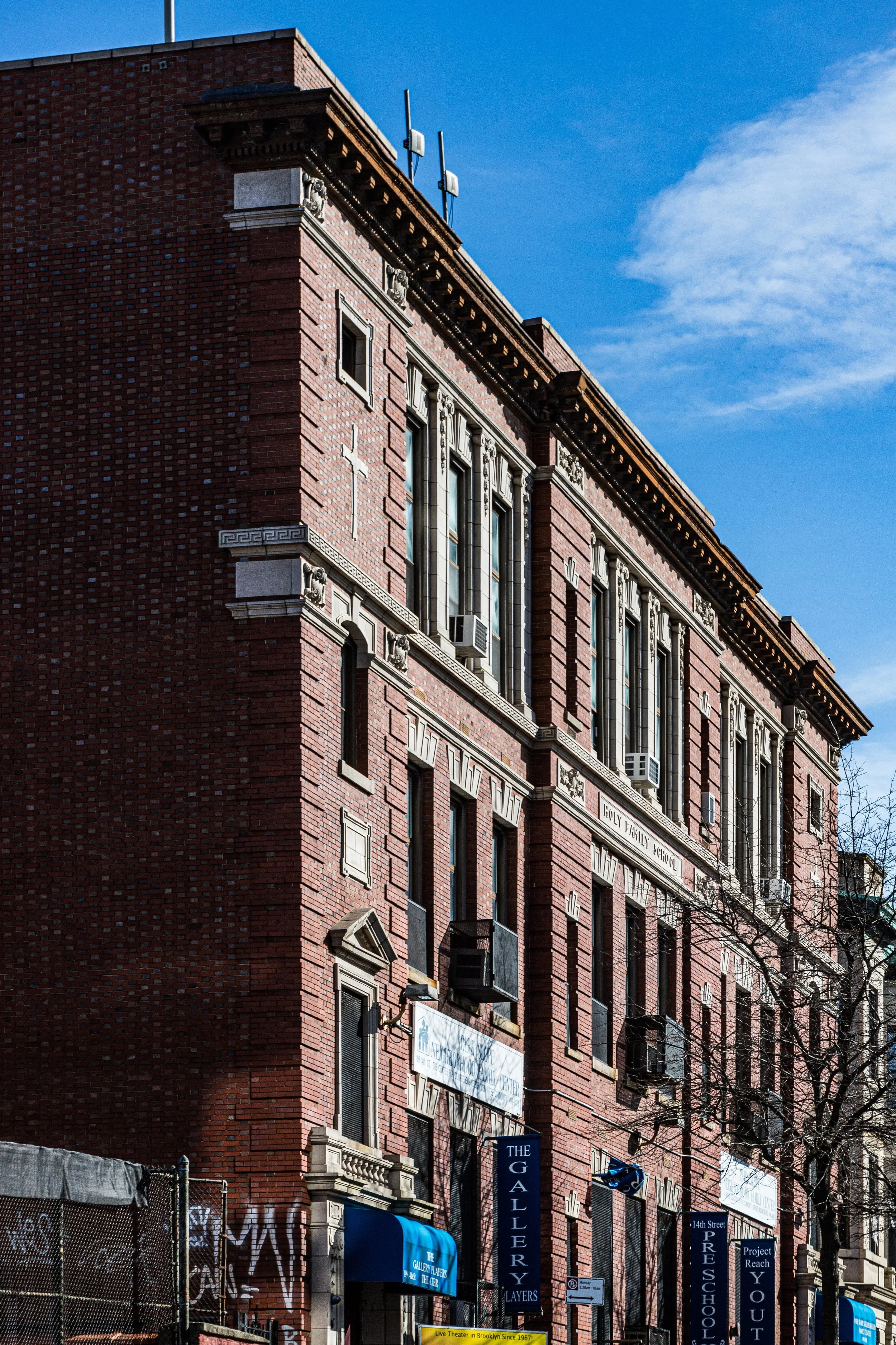
The architectural character reflected this middle-class pragmatism: smaller lots, fewer embellishments, but the same attention to proportion and light. Italianate, Neo-Grec, and Romanesque Revival details—brownstone lintels, arched doorways, and stoops—defined much of the housing stock still visible today. Churches such as Holy Name of Jesus (founded 1878) and St. John the Evangelist (1888) served growing Irish and German immigrant congregations, while nearby schools and union halls anchored civic life.
At the district’s edge, 5th Avenue evolved into a working-class commercial corridor lined with groceries, taverns, and hardware stores. To the southwest, Green-Wood Cemetery lent the area both grandeur and quiet, its gates and tree-lined perimeters shaping the slope’s boundaries as clearly as Prospect Park did to the east.
Early–Mid 20th Century: Working-Class Brooklyn
Through the first half of the 20th century, South Slope matured as a largely working- and middle-class enclave. The Fourth Avenue subway line (R train), completed in 1915, reinforced its commuter appeal. Families of Irish, Italian, and Polish descent filled the modest rowhouses, while laborers and tradesmen worked in nearby factories along the Gowanus Canal, in Sunset Park’s shipping yards, or in the small workshops that dotted 4th and 5th Avenues.
Unlike its northern neighbor, South Slope never became a district of mansions or cultural institutions; its identity remained grounded in community stability and proximity to work. Neighborhood life centered on parishes, public schools, and local storefronts. The Gowanus Expressway, completed in 1941, sliced along its southwestern edge, introducing noise and shadows but also solidifying its urban borders.
By the 1950s–1960s, as industry declined and families moved outward to the suburbs, property values fell. Many brownstones were subdivided into apartments or boardinghouses. Yet even during the city’s lean decades, South Slope’s housing stock endured, and its reputation as a quiet, neighborly extension of Park Slope persisted.
South Slope Photographic Video
Late 20th Century: Rediscovery and Redefinition
The 1970s–1990s brought slow but steady revitalization. As nearby Park Slope experienced a brownstone revival led by preservationists and new homeowners, the lower-priced properties of South Slope drew artists, teachers, and young families seeking space and authenticity. The name “South Slope,” once merely directional, gained cachet as real estate agents and residents sought to distinguish the area’s character—less grand than Park Slope proper but equally rich in community texture.
During this era, 5th Avenue transformed from a corridor of auto shops and taverns into a mix of antique stores, diners, and immigrant-owned businesses, reflecting the area’s growing Latino population, particularly Puerto Rican, Mexican, and Dominican families. The resulting cultural blend reshaped the neighborhood’s rhythms: bodegas beside brownstone stoops, Spanish-language churches alongside century-old parishes, and block parties that echoed the diversity of modern Brooklyn.
By the late 1990s, the Prospect Expressway corridor—once a symbol of decline—had become a visual boundary between revival and reinvention, as brownstone restorations multiplied northward from 18th and 19th Streets.
21st Century: The Slope Reimagined
In the 21st century, South Slope has emerged as a distinct and thriving micro-neighborhood, balancing historic charm with contemporary life. The rezoning of Fourth Avenue (2003) encouraged mid-rise apartment construction, introducing new residents and reshaping the western edge into a modern boulevard lined with glass-and-brick buildings. Meanwhile, the interior blocks between 6th and 8th Avenues have retained their 19th-century character, their restored stoops and gardens testifying to ongoing preservation.
The population today is a dynamic mix of young professionals, artists, longtime working-class families, and newcomers from across the globe. Cafés and bistros—many family-run—fill 5th Avenue, while beloved institutions like Toby’s Public House, South Slope Eatery, and Sidecar coexist with Dominican bakeries and taco shops. The proximity to Prospect Park, Green-Wood Cemetery, and multiple subway lines sustains the area’s appeal as both urban and residential.
Civic engagement remains strong: community gardens flourish on formerly vacant lots, and the South Slope–Greenwood Heights Preservation Alliance advocates for responsible development that respects the district’s low-rise fabric. The neighborhood’s blend of quiet domesticity, creative vitality, and working-class memory gives it a distinctive warmth within Brooklyn’s ever-changing landscape.
South Slope Photo Gallery
Spirit and Legacy
The spirit of South Slope lies in its humble beauty and enduring balance—a neighborhood where old Brooklyn meets new in human scale. It carries the DNA of the city’s evolution: farmland turned street grid, tenement transformed into family home, and factory corridor reborn as café row. Its slope, both literal and symbolic, mirrors Brooklyn’s story of ascent—rising from the working-class foundation that built it to the diverse, vibrant community that sustains it today.
New York City
Use this custom Google map to explore where every neighborhood in all five boroughs of New York City is located.
The Five Boroughs
One of New York City’s unique qualities is its organization in to 5 boroughs: Manhattan, Brooklyn, Queens, The Bronx, and Staten Island. These boroughs are part pragmatic administrative districts, and part vestiges of the region’s past. Each borough is an entire county in New York State - in fact, Brooklyn is, officially, Kings County, while Staten Island is, officially Richmond County. But that’s not the whole story …
Initially, New York City was located on the southern tip of Manhattan (now the Financial District) that was once the Dutch colony of New Amsterdam. Across the East River, another city was rising: Brooklyn. In time, the city planners realized that unification between the rapidly rising cities would create commercial and industrial opportunities - through streamlined administration of the region.
So powerful was the pull of unification between New York and Brooklyn that three more counties were pulled into the unification: The Bronx, Queens, and Staten Island. And on January 1, 1898, the City of New York unified two cities and three counties into one Greater City of New York - containing the five boroughs we know today.
But because each borough developed differently and distinctly until unification, their neighborhoods likewise uniquely developed. Today, there are nearly 390 neighborhoods, each with their own histories, cultures, cuisines, and personalities - and each with residents who are fiercely proud of their corner of The Big Apple.


