HILLCREST
Queens
Geographic Setting
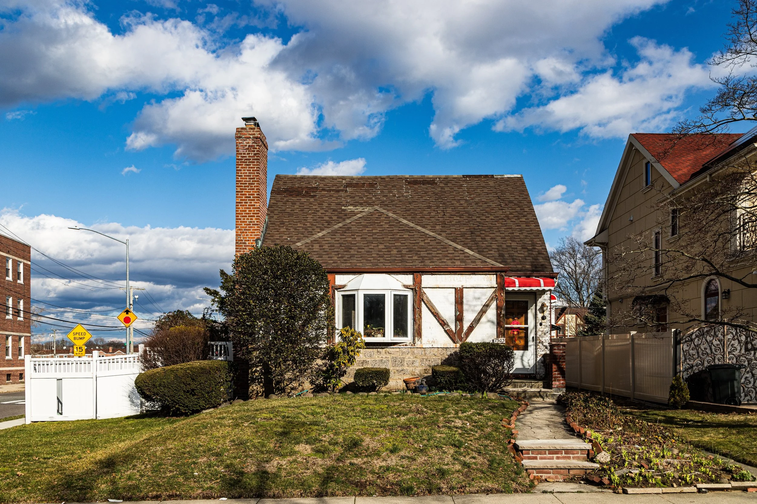
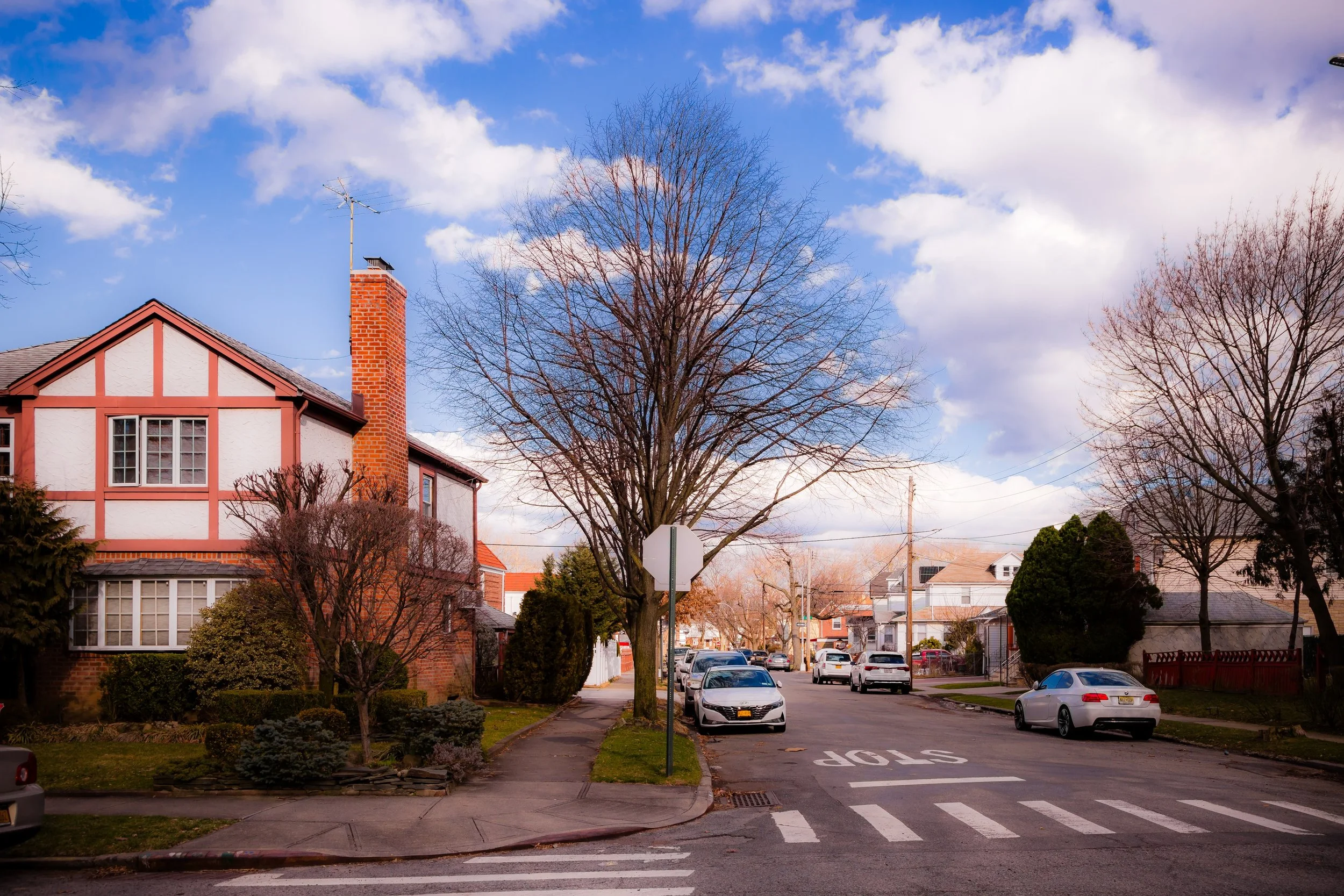
Bounded by Parsons Boulevard to the west, 73rd Avenue to the north, Utopia Parkway to the east, and Union Turnpike to the south, Hillcrest occupies a gently elevated stretch of central Queens—an aptly named neighborhood situated on the rising terrain east of Flushing and north of Jamaica Estates. The district’s leafy residential streets, brick houses, and calm civic rhythm distinguish it as one of the borough’s quietest, most community-oriented enclaves. Though modest in size, Hillcrest’s location places it at a vital crossroads of education, faith, and family life: between the bustling commercial corridors of Queens Boulevard and the serene lawns of St. John’s University, whose campus forms its southern boundary and cultural heart.
The area’s major thoroughfares—Union Turnpike, Parsons Boulevard, and Utopia Parkway—frame a grid of intimate side streets lined with single- and two-family homes, punctuated by small apartment houses and corner shops. The neighborhood rises gently from west to east, offering occasional glimpses of the Manhattan skyline through breaks in the treetops. Within its borders are several long-established institutions—Hillcrest High School, P.S. 154, and the Hillcrest Jewish Center—that reflect the area’s historic emphasis on education and civic engagement. Despite its proximity to major transit lines and highways, Hillcrest maintains a suburban sense of remove: a small community tucked between the commercial bustle of Flushing and the academic calm of Jamaica Estates.
Etymology and Origins
The name “Hillcrest” was adopted in the early 20th century to describe the district’s defining topography—a “crest of hills” rising between Flushing Meadows to the north and the lower lands of Jamaica to the south. Before suburban development, this terrain formed part of the Town of Flushing’s farmland, a gently rolling landscape of orchards, meadows, and scattered woodlots. Roads such as Parsons Boulevard and Utopia Parkway trace colonial-era routes once used by Dutch and English settlers traveling between Flushing and Jamaica.
The area remained largely rural through the 19th century, its few farmhouses surrounded by open fields and nurseries. When Queens became part of Greater New York City in 1898 and electric trolley service extended along Union Turnpike, developers began to envision this elevated plateau as an ideal suburban site—close to the expanding city yet removed from its congestion. Early maps labeled the area simply “High Ground” or “Upland,” but by the 1920s, real estate firms began marketing it as “Hillcrest,” a name that emphasized both its geography and its aspirational tone.
The Neighborhood
Early–Mid 20th Century: Suburban Growth and Civic Foundations
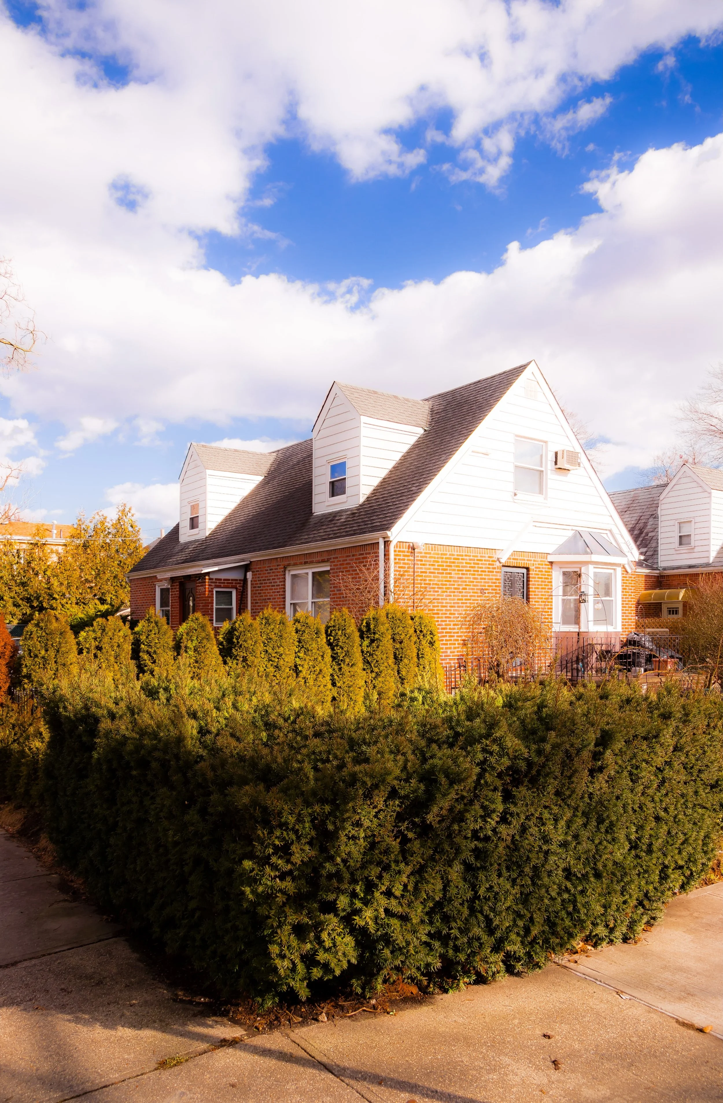
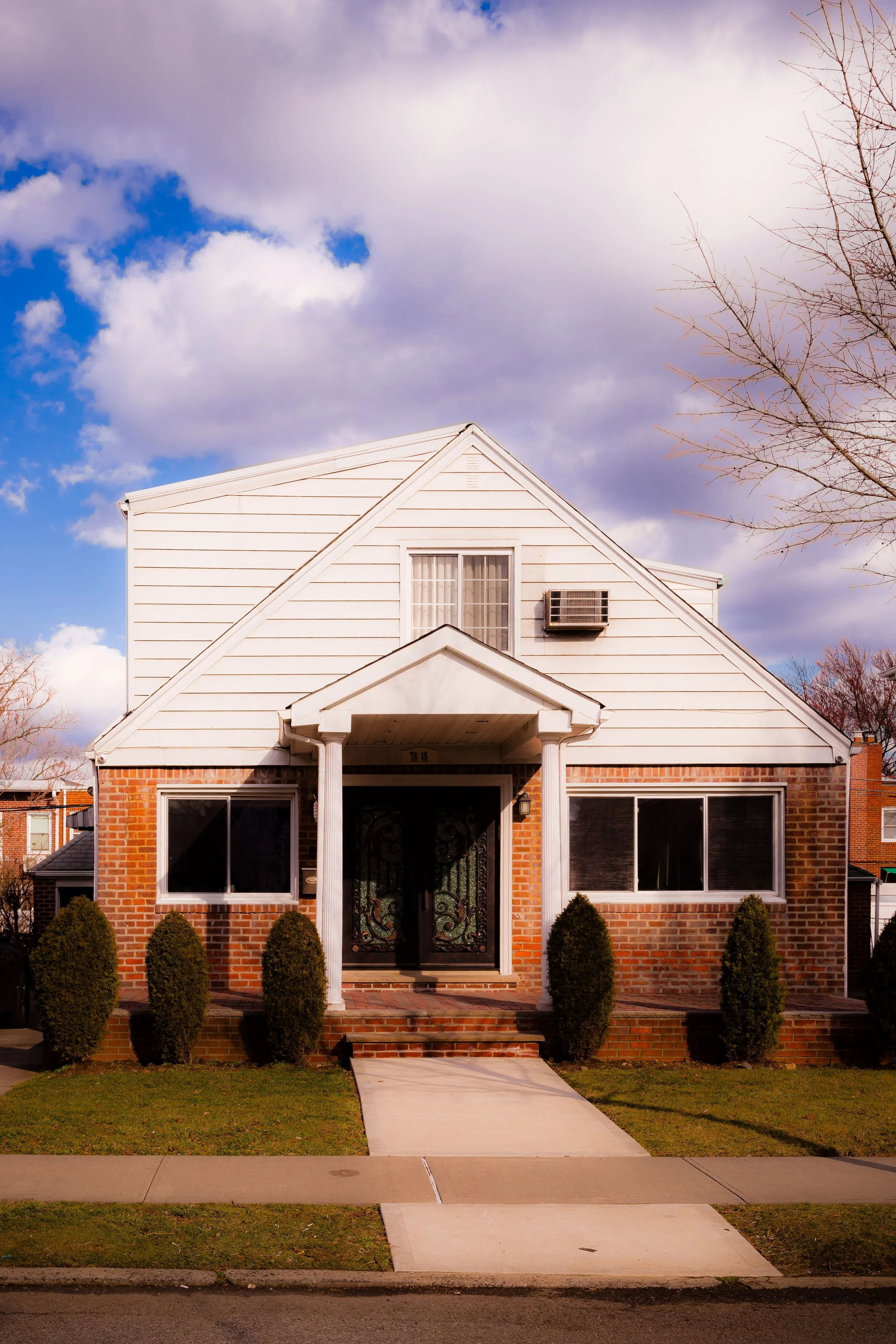
Hillcrest’s modern identity took shape between the 1920s and 1950s, when much of Queens was being transformed from farmland into middle-class residential neighborhoods. Developers subdivided the area’s large tracts into tidy grids of detached and semi-detached homes—brick Colonials, Tudors, and Cape Cods with small front gardens and driveways. The housing stock reflected the prevailing ideals of postwar suburban living: modest but well-built, emphasizing stability, privacy, and access to good schools.
The proximity of St. John’s University, which relocated to its Union Turnpike campus in 1955, became a defining feature. The university’s tree-shaded lawns and academic architecture lent the surrounding neighborhood an air of cultivated calm. Many faculty and staff settled nearby, and local businesses along Union Turnpike—bookstores, cafés, and diners—grew to serve both students and residents.
During this same period, Hillcrest High School (opened 1971) was established to serve the growing population of central Queens. Its name was deliberately chosen to reflect neighborhood pride and reinforce the community’s identity. Churches, synagogues, and civic organizations flourished, among them the Hillcrest Jewish Center (founded 1947) and the Church of St. Nicholas of Tolentine, both of which remain vital neighborhood anchors.
Mid–Late 20th Century: A Middle-Class Enclave in Transition
Through the 1960s and 1970s, Hillcrest epitomized the aspirations of New York’s middle class. Its residents—initially a mix of Jewish, Irish, and Italian families—maintained the area’s small-town character through block associations and community events. While nearby Jamaica and Flushing underwent rapid demographic change, Hillcrest’s owner-occupied housing and low-rise zoning preserved its stability.
By the late 20th century, new immigrant communities began to settle in Hillcrest, enriching its cultural landscape. Families from South Asia, East Asia, the Caribbean, and Eastern Europe joined longtime residents, drawn by good schools, quiet streets, and proximity to the educational institutions and hospitals of central Queens. The area’s small commercial strips along Parsons Boulevard and Union Turnpike evolved accordingly: kosher delis and Italian bakeries giving way to halal groceries, South Asian cafés, and multicultural eateries that reflect the borough’s broader transformation.
Despite demographic shifts, Hillcrest’s underlying civic ethos remained remarkably consistent. Local associations continued to advocate for green spaces, traffic safety, and neighborhood preservation. The presence of Kissena Corridor Park to the north and Cunningham Park just beyond the eastern boundary provided residents with ready access to open space, reinforcing the area’s suburban feel within the city grid.
Hillcrest Photographic Video
21st Century: Education, Stability, and Suburban Character
In the 21st century, Hillcrest remains one of Queens’ most quietly stable communities—a place where change occurs gradually and thoughtfully. The neighborhood’s housing stock has been well maintained, with many homes renovated but few replaced by large-scale developments. Zoning protections and active civic engagement have preserved its low-rise skyline and leafy character.
Education continues to define the area’s identity. St. John’s University anchors the southern edge, its student population enlivening local businesses and shaping the rhythm of Union Turnpike. Hillcrest High School, despite its large enrollment, maintains strong community ties through partnerships with the university and local organizations. The neighborhood’s schools—P.S. 154, P.S. 165, and M.S. 217—reflect the cultural and linguistic diversity of modern Queens, where dozens of languages are spoken in classrooms that remain academic centers of excellence.
Civic groups, such as the Hillcrest Estates Civic Association, remain active advocates for infrastructure maintenance, flood control, and tree preservation, while environmental initiatives link the community to the green corridors of Kissena Park and Cunningham Park. Residents take pride in the area’s balance: quiet streets with city access, stability with inclusion, and tradition with adaptability.
Hillcrest Photo Gallery
Spirit and Legacy
Hillcrest’s legacy is one of elevation—both literal and figurative. Perched on its gentle rise between Flushing and Jamaica, it has long represented a vision of attainable urban tranquility: modest homes, strong schools, and an enduring sense of community. Its diversity today mirrors Queens itself, yet its spirit remains rooted in the same principles that guided its founding a century ago—education, civic life, and the belief that a neighborhood’s strength lies in the everyday ties between its residents.
New York City
Use this custom Google map to explore where every neighborhood in all five boroughs of New York City is located.
The Five Boroughs
One of New York City’s unique qualities is its organization in to 5 boroughs: Manhattan, Brooklyn, Queens, The Bronx, and Staten Island. These boroughs are part pragmatic administrative districts, and part vestiges of the region’s past. Each borough is an entire county in New York State - in fact, Brooklyn is, officially, Kings County, while Staten Island is, officially Richmond County. But that’s not the whole story …
Initially, New York City was located on the southern tip of Manhattan (now the Financial District) that was once the Dutch colony of New Amsterdam. Across the East River, another city was rising: Brooklyn. In time, the city planners realized that unification between the rapidly rising cities would create commercial and industrial opportunities - through streamlined administration of the region.
So powerful was the pull of unification between New York and Brooklyn that three more counties were pulled into the unification: The Bronx, Queens, and Staten Island. And on January 1, 1898, the City of New York unified two cities and three counties into one Greater City of New York - containing the five boroughs we know today.
But because each borough developed differently and distinctly until unification, their neighborhoods likewise uniquely developed. Today, there are nearly 390 neighborhoods, each with their own histories, cultures, cuisines, and personalities - and each with residents who are fiercely proud of their corner of The Big Apple.


