GREENWOOD HEIGHTS
Brooklyn
Geographic Setting
Perched on the western slope of central Brooklyn, Greenwood Heights is a compact, hilly neighborhood nestled between Park Slope, Sunset Park, and the monumental grounds of Green-Wood Cemetery, from which it takes its name. It is bounded roughly by 9th Avenue and 15th Street to the north, 36th Street to the south, Eighth Avenue to the east, and Third Avenue to the west. Though small in scale—barely two dozen blocks—Greenwood Heights embodies Brooklyn’s essential duality: a working-class past transformed by reinvention, yet anchored in heritage and topography that predate the modern city itself.
Etymology and Origins
The neighborhood’s name arises from its proximity to Green-Wood Cemetery and its gently sloping “heights,” part of the same glacial ridge that runs through Prospect Park and Bay Ridge. The term Greenwood Heights came into common use in the late 20th century as residents sought to distinguish their community from the larger areas of Park Slope and Sunset Park that flank it. Historically, however, the land was once known simply as the South Slope of Greenwood Hill—a landscape defined by farms, quarries, and, later, factories that supplied the growing metropolis of Brooklyn.
Before colonization, this ridge formed part of the ancestral homeland of the Canarsee Lenape, who fished the Gowanus marshlands below and traversed the high ground on trails linking the harbor to the interior plains. After Dutch settlement in the 1640s, the area became part of the township of New Utrecht, its fertile slopes worked by farmers whose homesteads dotted the hillside for more than two centuries.
The Neighborhood
18th–19th Centuries: Battle and Burial Ground
The Revolutionary War brought this quiet farmland into history. On August 27, 1776, during the Battle of Long Island, American troops under General Stirling fought British and Hessian forces across these very hills, retreating toward the fortified ridge where Green-Wood Cemetery now stands. The terrain’s steep rises and gullies provided both obstacle and refuge, and artifacts from the battle have occasionally been unearthed during later construction.
In 1838, the establishment of Green-Wood Cemetery transformed the area’s identity. The cemetery’s rolling hills, landscaped ponds, and grand mausoleums redefined the southern Brooklyn skyline, and the surrounding farmland began to attract residential and industrial development. Quarrying of the glacial ridge yielded brownstone for Brooklyn’s rowhouses, while the nearby Gowanus Canal, completed in the 1860s, brought factories and warehouses to the lowlands.
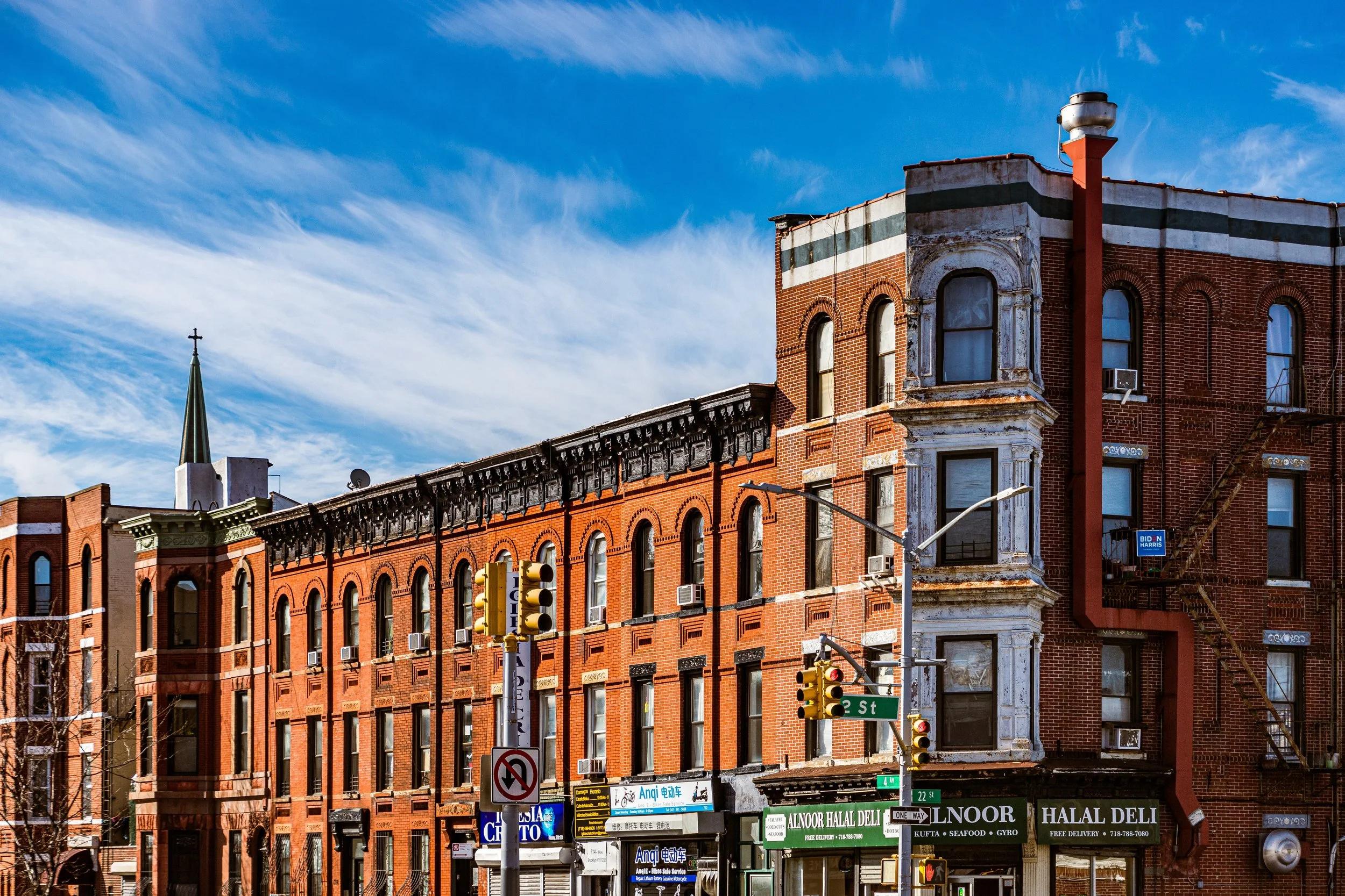
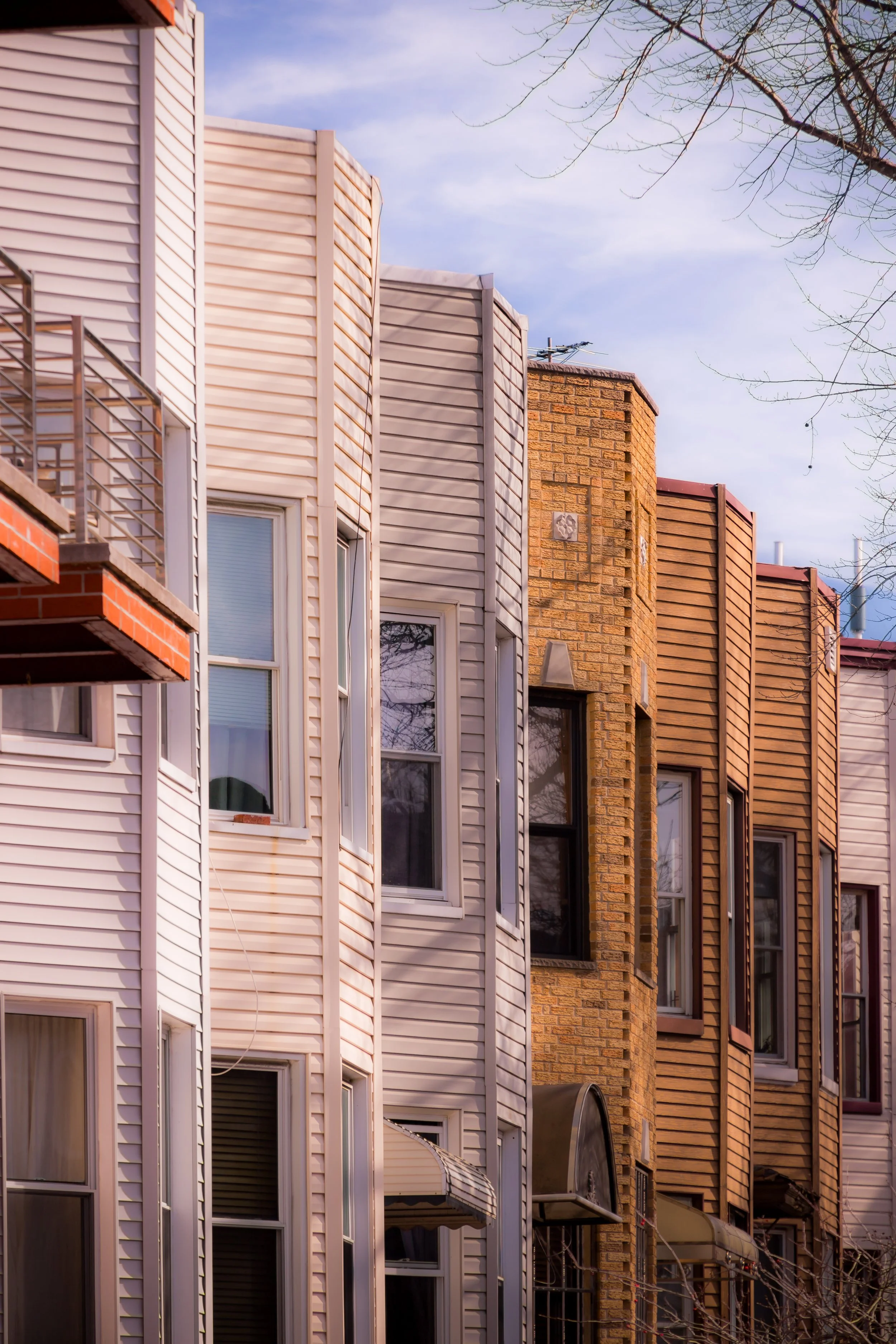
By the late 19th century, working-class housing—brick and wood-frame rowhouses—had filled the slopes north and west of the cemetery. Immigrant laborers, many of them Irish, Italian, and later Polish, built modest homes and opened shops along Fifth Avenue, Sixth Avenue, and Prospect Avenue. The area’s elevated vantage points offered views of the harbor and, before the rise of industry, the Statue of Liberty herself.
Early 20th Century: A Neighborhood of Workers and Worship
Through the early 20th century, Greenwood Heights matured into a solid working-class enclave. The elevated BMT subway lines (today’s D, N, and R trains) and trolley routes along Fifth Avenue connected residents to the factories of the waterfront and the warehouses of Red Hook.
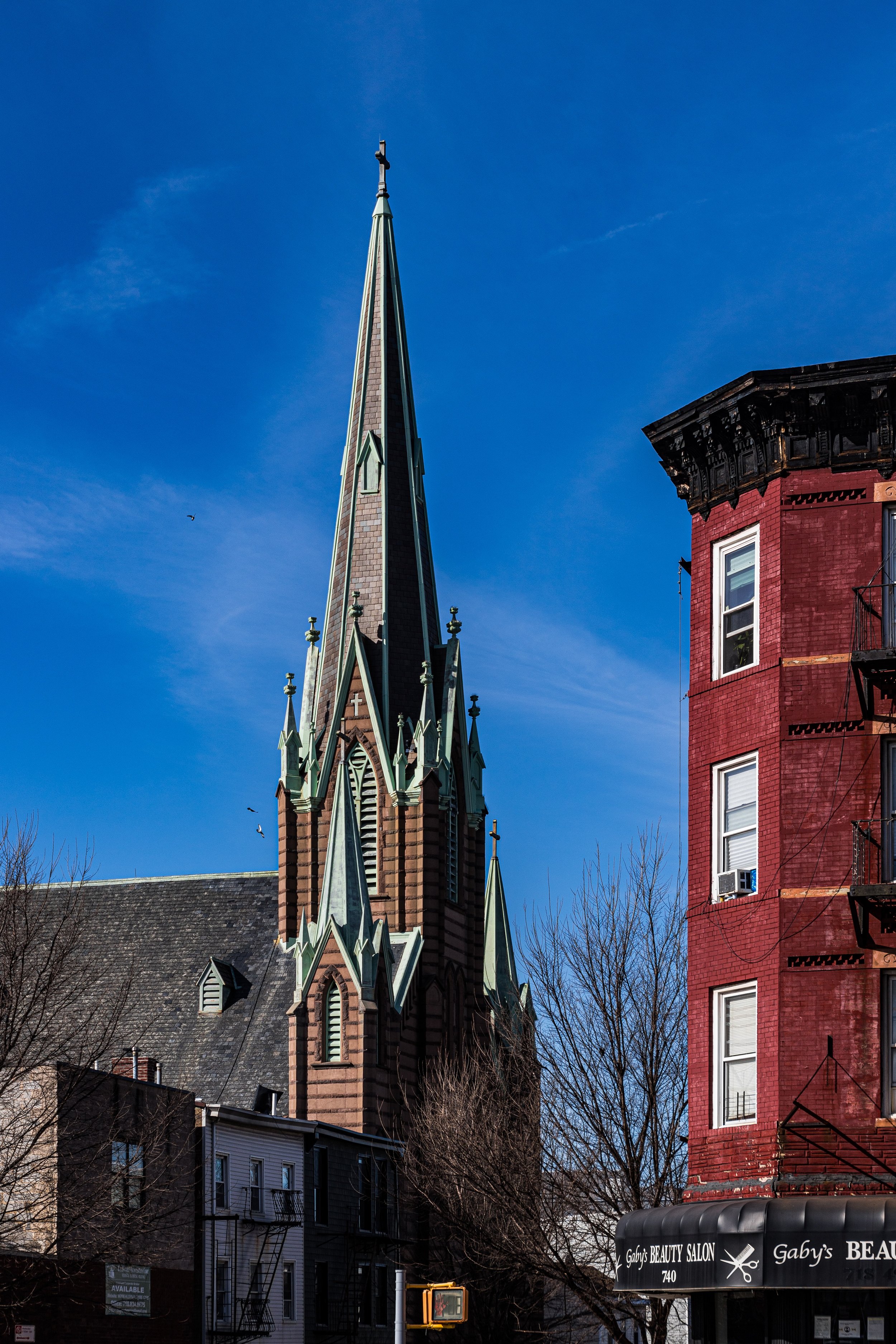
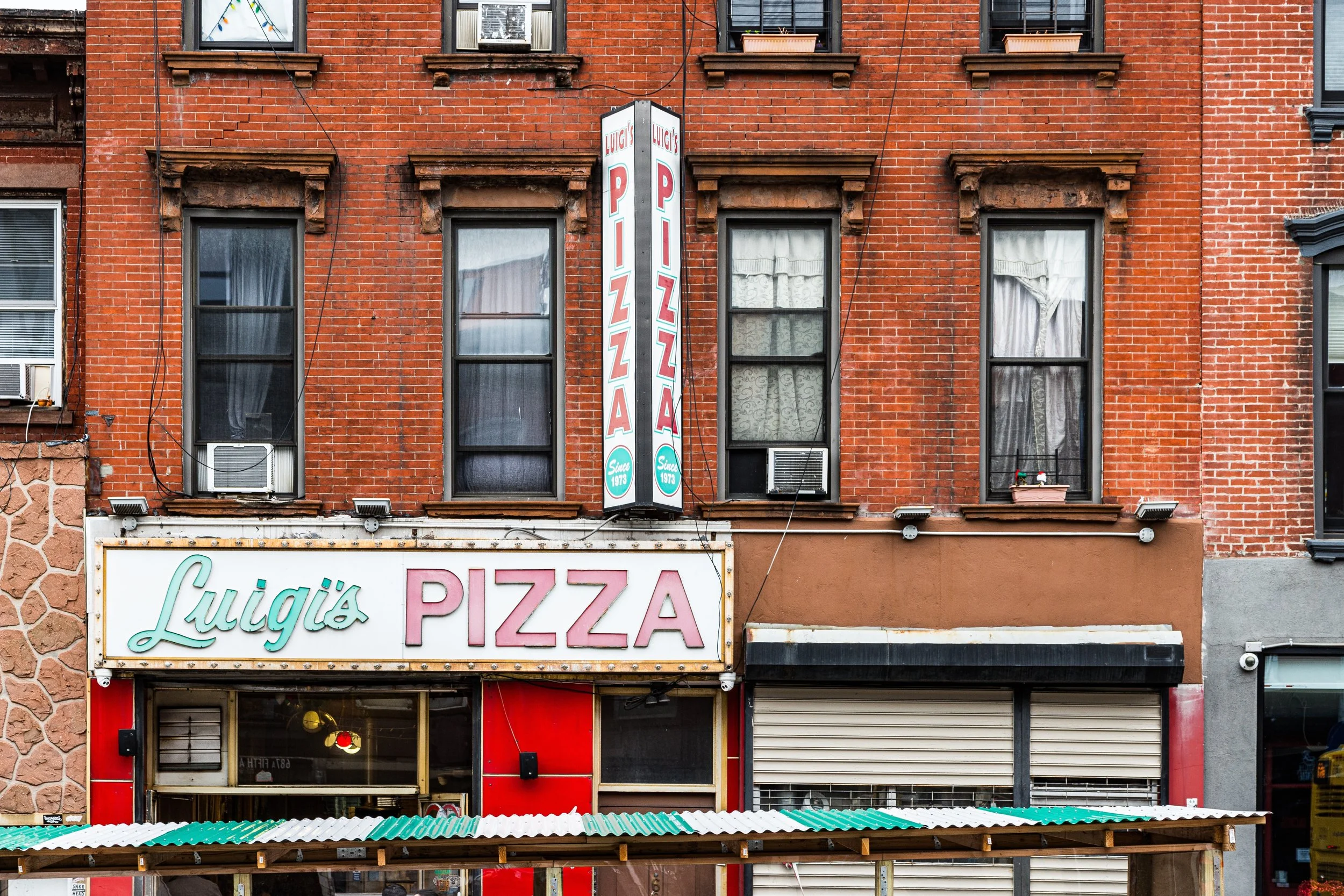
Rows of two- and three-story rowhouses alternated with small apartment buildings, their stoops crowded with families on summer evenings. Churches such as Immaculate Heart of Mary (founded 1893) and Our Lady of Czestochowa–St. Casimir, reflecting the neighborhood’s Polish heritage, became anchors of spiritual and social life. Bakeries, butcher shops, and corner taverns along Fifth and Sixth Avenues served as gathering places for generations.
The character of the neighborhood was practical and proud—defined by craftsmanship, faith, and family. The shadow of Green-Wood Cemetery lent solemnity but also calm; residents often described the park-like expanse as their “backyard,” a place for Sunday walks and quiet reflection.
Greenwood Heights Photographic Video
Mid- to Late 20th Century: Change and Challenge
Postwar decades brought flux. As shipping declined along the waterfront and factories closed, many residents moved outward to suburban Brooklyn or Long Island. In the 1960s and 1970s, the area suffered from neglect, and property values fell. Yet Greenwood Heights never collapsed: its housing stock, sturdy and human-scaled, provided a foothold for new arrivals. Puerto Rican, Dominican, and Mexican families revitalized blocks once considered fading, and the neighborhood’s cultural composition broadened.
By the 1980s, the area had become a quiet refuge—affordable, family-oriented, and under the radar of the city’s development boom. Longtime residents maintained block associations and parish communities that kept the neighborhood cohesive through difficult years.
21st Century: Rediscovery and Revival
The turn of the millennium brought Greenwood Heights renewed attention. Rising prices in Park Slope and Sunset Park pushed new residents into its boundaries, drawn by its tree-lined streets and prewar architecture. Old industrial buildings were converted into artists’ studios and lofts, and local cafés and boutiques appeared along Fifth Avenue.
While gentrification altered the demographic balance, community groups worked to retain the area’s inclusive spirit. The Greenwood Heights Civic Association and historic preservation advocates secured landmark protection for several 19th-century structures, including the Weir Greenhouse, an elegant 1880s Victorian glasshouse that once served as Green-Wood Cemetery’s floral supplier and now functions as its visitor center.
Today, the neighborhood is a mosaic of old and new Brooklyn: lifelong residents, young professionals, and immigrant families sharing stoops and sidewalks. The proximity to Green-Wood Cemetery provides an ever-present sense of calm and space rare in urban life.
Greenwood Heights Photo Gallery
Architecture and Atmosphere
Architecturally, Greenwood Heights blends the domestic vernacular of southern Brooklyn with touches of late Victorian grace. Red- and brown-brick rowhouses with cornices and ironwork line steeply graded streets, punctuated by turn-of-the-century apartment houses and converted industrial buildings. From many rooftops, one can see the harbor to the west and the gothic spires of Green-Wood to the east—a juxtaposition of the living city and the monumental quiet beyond.
The streets hum softly rather than roar: children play on stoops, church bells sound over tree canopies, and the faint toll of the cemetery gate marks the hour. Greenwood Heights remains at once connected to Brooklyn’s energy and somehow apart from it.
Spirit and Legacy
Greenwood Heights embodies resilience and rediscovery. Its hills bear the memory of battle, its stone supplied the borough’s architecture, and its people—immigrant, working-class, and creative—have sustained it through every cycle of change.
New York City
Use this custom Google map to explore where every neighborhood in all five boroughs of New York City is located.
The Five Boroughs
One of New York City’s unique qualities is its organization in to 5 boroughs: Manhattan, Brooklyn, Queens, The Bronx, and Staten Island. These boroughs are part pragmatic administrative districts, and part vestiges of the region’s past. Each borough is an entire county in New York State - in fact, Brooklyn is, officially, Kings County, while Staten Island is, officially Richmond County. But that’s not the whole story …
Initially, New York City was located on the southern tip of Manhattan (now the Financial District) that was once the Dutch colony of New Amsterdam. Across the East River, another city was rising: Brooklyn. In time, the city planners realized that unification between the rapidly rising cities would create commercial and industrial opportunities - through streamlined administration of the region.
So powerful was the pull of unification between New York and Brooklyn that three more counties were pulled into the unification: The Bronx, Queens, and Staten Island. And on January 1, 1898, the City of New York unified two cities and three counties into one Greater City of New York - containing the five boroughs we know today.
But because each borough developed differently and distinctly until unification, their neighborhoods likewise uniquely developed. Today, there are nearly 390 neighborhoods, each with their own histories, cultures, cuisines, and personalities - and each with residents who are fiercely proud of their corner of The Big Apple.


