LINDEN HILL
Queens
Geographic Setting
Bounded by the Whitestone Expressway to the west, 25th Avenue to the north, 154th Street to the east, and Northern Boulevard to the south, Linden Hill occupies a compact rise between Flushing and Whitestone, forming one of northern Queens’ most distinct yet often-overlooked residential enclaves. The neighborhood takes its name from the natural ridge—once crowned by stands of linden trees—that slopes gently toward the Flushing River and the Flushing Bay waterfront.
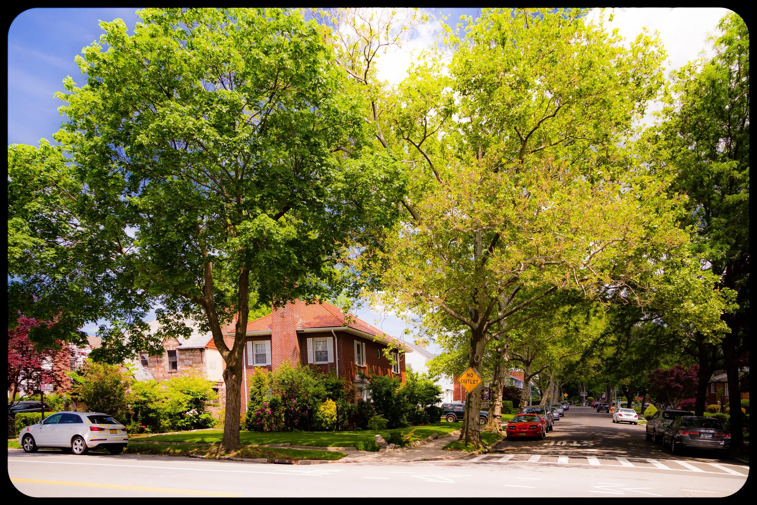
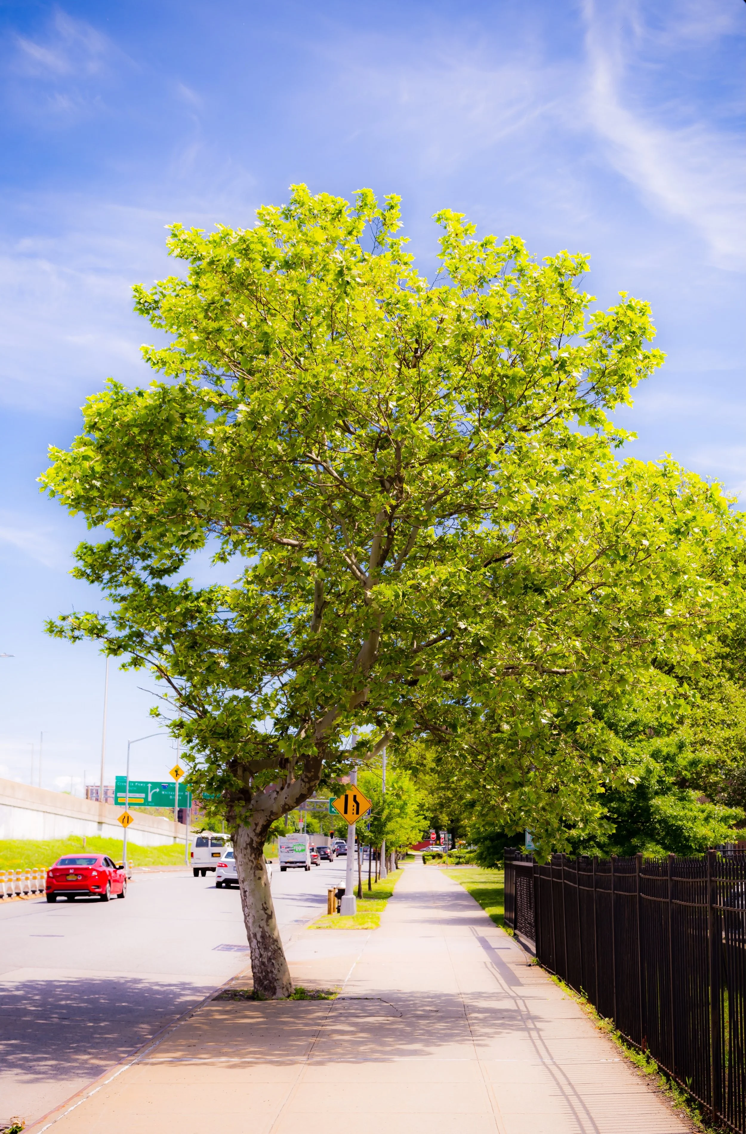
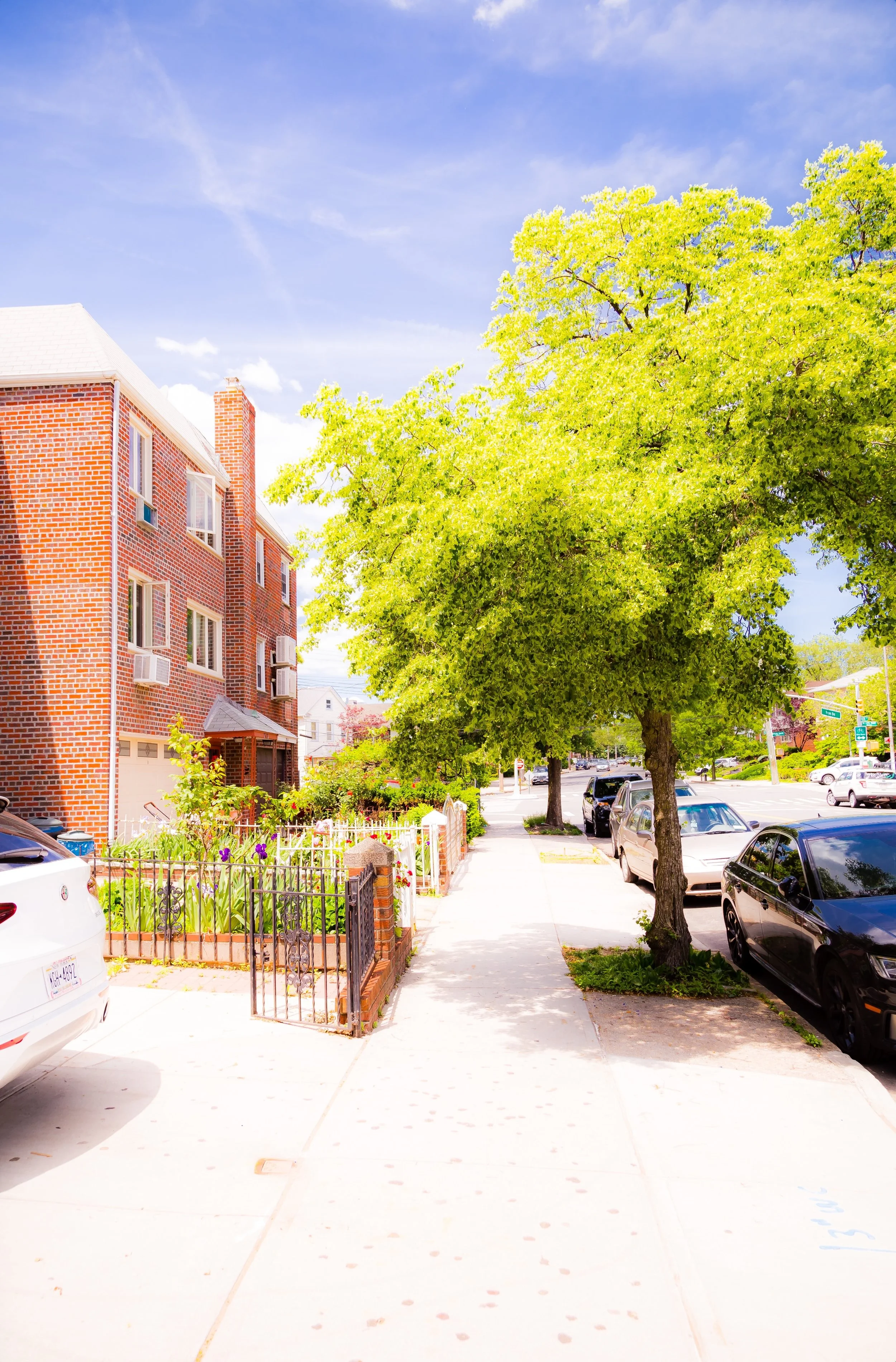
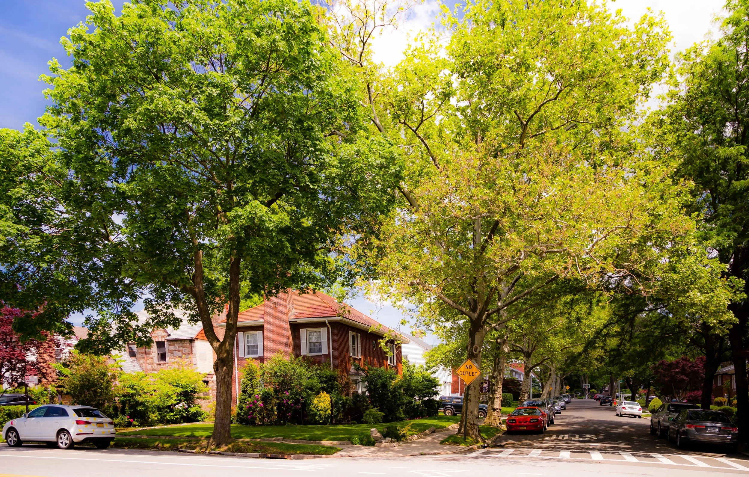
Today, Linden Hill presents a striking contrast of landscapes: on its lower western edge, the elevated lanes of the Whitestone Expressway and clusters of mid-century apartment complexes; to the east, quiet tree-lined streets of brick rowhouses, co-ops, and semi-detached homes that look toward the tidy avenues of Murray Hill. The area’s topographical ridge defines its identity, offering elevated views toward LaGuardia Airport and the Manhattan skyline on clear evenings. The neighborhood’s main internal routes—Parsons Boulevard, 154th Street, and 26th Avenue—form gentle curves around the hill’s crest, connecting residential blocks to nearby Flushing’s commercial core and the expressway network that links Queens to the Bronx and beyond.
Despite its proximity to major arteries, Linden Hill retains a surprising sense of enclosure and calm. Its green courtyards, low-rise housing, and well-kept sidewalks reflect the planned, self-contained vision that shaped its mid-20th-century development—a vision that still defines its character today.
Etymology and Origins
The name “Linden Hill” emerged in the 19th century, when this portion of northern Queens was still rural farmland and small estates. The title likely refers to the abundance of American linden trees (Tilia americana) that grew along the ridge separating Flushing Creek from the plains of Whitestone. Early land records from the Town of Flushing, then a pastoral community of Dutch and English settlers, describe the area as part of the “Flushing Heights” district—a mix of orchards, nurseries, and burial grounds situated along the route that would later become Northern Boulevard.
By the mid-1800s, the area was known for its cemeteries and gardens, most notably Linden Hill Cemetery, established in 1842 by the Lutheran Church of Manhattan as a rural burial ground. Though this original Linden Hill Cemetery lies a few miles southwest in Ridgewood, its name became associated more broadly with several high points across Queens—this Flushing section included—where lindens and rolling hills characterized the terrain.
The modern neighborhood began taking shape in the early 20th century, when the expansion of Northern Boulevard and the construction of Flushing’s trolley and bus lines opened the area for residential development. Yet its definitive transformation awaited the post–World War II era, when city planners sought to address housing shortages through new, modernist apartment complexes designed for working- and middle-class families.
The Neighborhood
Mid-20th Century: The Rise of Planned Housing
The 1940s through the 1960s were the formative decades for Linden Hill’s contemporary identity. As Flushing expanded northward, city officials and private developers turned the ridge between Northern Boulevard and 25th Avenue into a model residential district. The Linden Hill Houses, a large-scale cooperative housing complex, was completed in 1958 under the supervision of the United Housing Foundation and architect Seymour Jarmul. Comprising red-brick, twelve-story towers set amid landscaped courtyards and playgrounds, the development offered affordable, high-quality housing to thousands of families—many of them veterans and civil servants.
This era’s urban design emphasized light, air, and greenery. Broad lawns, tree plantings, and walking paths were integral to the plan, creating a suburban atmosphere within city limits. Smaller adjacent developments—such as Linden Towers and Linden Terrace—followed in the 1960s, expanding the cooperative model and solidifying Linden Hill’s reputation as a stable, middle-income community.
The neighborhood’s proximity to Whitestone and College Point provided residents with convenient shopping, schools, and employment opportunities, while the expressway and Q25/Q34 bus lines ensured accessibility to downtown Flushing and Manhattan. Churches and civic organizations quickly formed, including the Linden Hill Cooperative Association, which remains active in community affairs.
Late 20th Century: Stability, Immigration, and Quiet Transformation
Through the 1970s and 1980s, Linden Hill retained its identity as a solidly middle-class enclave amid the broader demographic and economic shifts reshaping Queens. While nearby Flushing evolved into a bustling international center of commerce and immigration, Linden Hill’s residential core maintained a quieter rhythm. The neighborhood’s housing cooperatives—well-managed and owner-occupied—helped preserve stability even as the surrounding borough experienced rapid diversification.
By the 1980s, new residents from Korea, China, and Taiwan began settling in Linden Hill, attracted by its relative affordability, proximity to Flushing’s Chinatown, and reputation for safety. Over time, the area’s population came to reflect the borough’s global mosaic, with Chinese, Korean, Latino, and Eastern European families joining older Italian- and Jewish-American households. Shops along nearby Northern Boulevard began offering bilingual signage and Asian groceries, while long-established delis and bakeries adapted to serve an increasingly diverse clientele.
Despite gradual change, the physical character of the neighborhood remained intact: cooperative towers surrounded by open lawns, smaller homes nestled along quiet streets, and mature linden trees arching over the sidewalks—a living echo of the area’s name.
Linden Hill Video Coming Soon
21st Century: A Hidden Corner of North Queens
In the 21st century, Linden Hill continues to balance tradition and transformation. Its strategic location—within walking distance of downtown Flushing yet insulated from its congestion—has made it one of the borough’s most quietly desirable neighborhoods. The cooperative complexes, including the Linden Hill Houses and Linden Towers, remain predominantly owner-occupied, supported by strong boards and active resident associations. These groups oversee continual renovations, landscaping projects, and community programming that reinforce the neighborhood’s self-sufficient ethos.
Demographically, the neighborhood today reflects the full diversity of Queens. Many residents are first- and second-generation immigrants from East Asia, South Asia, and the Caribbean, alongside older families who have lived in the area for decades. Public schools such as P.S. 214 Cadwallader Colden and nearby J.H.S. 194 serve multilingual student populations, while parks and greenways—especially the adjoining Kissena Corridor Park—link Linden Hill to the borough’s larger ecological and recreational network.
With its combination of urban convenience, cooperative housing, and garden-like calm, Linden Hill has remained relatively resistant to gentrification pressures that have reshaped parts of western Queens. Its residents continue to describe it as “a neighborhood that feels like a small town above the city,” where tree canopies and courtyard benches still shape daily life.
Bowery Photo Gallery
Spirit and Legacy
Linden Hill’s spirit is rooted in balance—between density and openness, community and individuality, old and new. Its name, born of trees and topography, captures the enduring relationship between landscape and livability that has defined the neighborhood for more than a century.
At twilight, as the breeze moves through the linden trees along Parsons Boulevard and the lights flicker in the red-brick towers overlooking the expressway, Linden Hill feels at once secluded and connected—a ridge of calm above the hum of Queens. Its legacy lies not in spectacle but in steadiness: a quietly thriving, green-topped hill that remains faithful to its origins as a place where urban life and suburban peace meet in enduring harmony.
New York City
Use this custom Google map to explore where every neighborhood in all five boroughs of New York City is located.
The Five Boroughs
One of New York City’s unique qualities is its organization in to 5 boroughs: Manhattan, Brooklyn, Queens, The Bronx, and Staten Island. These boroughs are part pragmatic administrative districts, and part vestiges of the region’s past. Each borough is an entire county in New York State - in fact, Brooklyn is, officially, Kings County, while Staten Island is, officially Richmond County. But that’s not the whole story …
Initially, New York City was located on the southern tip of Manhattan (now the Financial District) that was once the Dutch colony of New Amsterdam. Across the East River, another city was rising: Brooklyn. In time, the city planners realized that unification between the rapidly rising cities would create commercial and industrial opportunities - through streamlined administration of the region.
So powerful was the pull of unification between New York and Brooklyn that three more counties were pulled into the unification: The Bronx, Queens, and Staten Island. And on January 1, 1898, the City of New York unified two cities and three counties into one Greater City of New York - containing the five boroughs we know today.
But because each borough developed differently and distinctly until unification, their neighborhoods likewise uniquely developed. Today, there are nearly 390 neighborhoods, each with their own histories, cultures, cuisines, and personalities - and each with residents who are fiercely proud of their corner of The Big Apple.


