CONCORD
Staten Island
Geographic Setting
Bounded by Richmond Road to the west, the Staten Island Expressway to the north, Mosel Avenue to the east, Gateway Drive to the southeast, and West Fingerboard Road to the south, Concord lies at the base of Staten Island’s northeastern hills, where the island’s oldest inland roads meet the busy modern arteries leading to the Verrazzano-Narrows Bridge. The neighborhood sits just south of Grasmere and Dongan Hills, forming a compact, residential pocket bordered by parkland, steep ridges, and transit corridors. Its geography bridges two eras: to the west, Richmond Road—one of the island’s oldest colonial routes—winds through a landscape of historic churches and early homes, while to the north, the expressway hums with 21st-century motion.
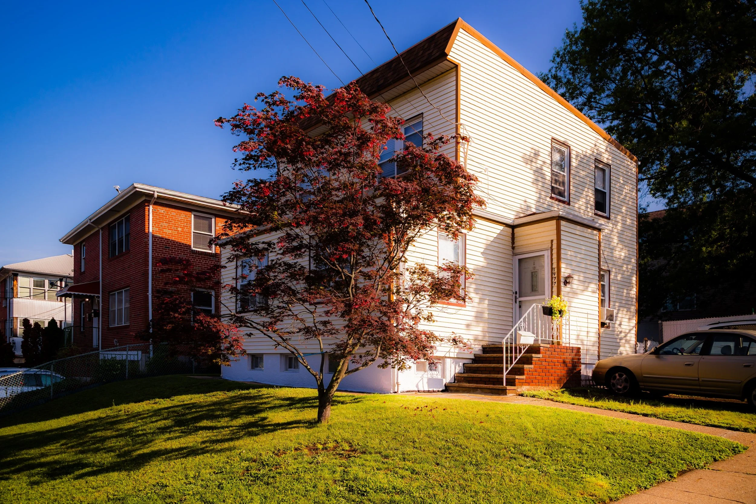
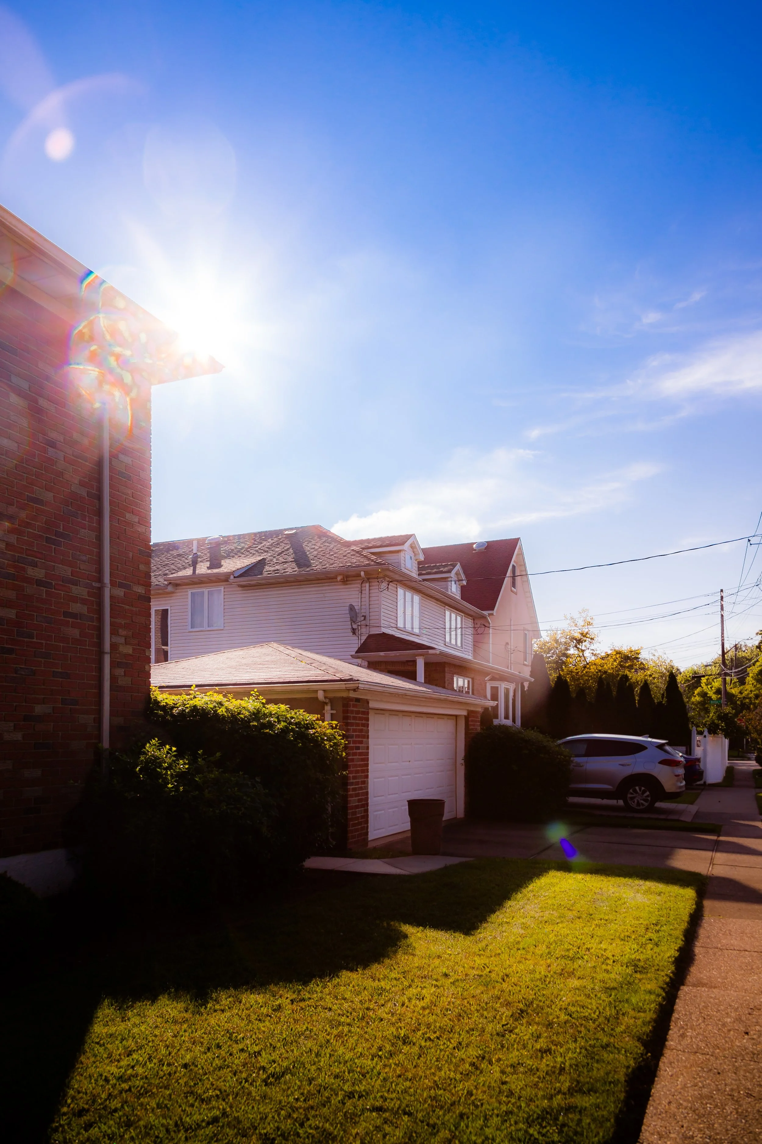
Within these boundaries, Concord is characterized by a diverse mix of single-family homes, brick rowhouses, apartment buildings, and small commercial strips. Its streets rise gently from the marshy edges near Fingerboard Road toward the elevated terrain of Todt Hill’s lower slopes. The area’s central spine, Targee Street, carries the pulse of local life—connecting residents to schools, churches, and corner shops—while side streets retain a quiet, neighborly atmosphere shaded by mature oaks and maples. Though compact, Concord’s setting makes it one of Staten Island’s most strategically placed communities: near downtown St. George to the north, the expressway’s bridge approach to the east, and the tranquil greenbelt to the southwest.
Etymology
The name Concord reflects a 19th-century spirit of civic idealism. The term, meaning “harmony” or “unity,” was likely chosen by developers in the mid-1800s who sought to promote the area as a peaceful residential enclave along Richmond Road—then a rural thoroughfare connecting Staten Island’s villages. Some accounts suggest it may have been inspired by Concord, Massachusetts, symbol of American independence and small-town virtue.
By the late 1800s, the name had taken firm root, appearing on real estate maps and early directories as “Concord Village.” The title reflected both aspiration and geography: a midpoint of connection between the harborfront towns to the north and the agricultural uplands to the south. Today, “Concord” remains one of Staten Island’s most enduring neighborhood names, its meaning—community in balance—still resonant with its lived reality.
The Neighborhood
Origins through the 19th Century
Before suburbanization, the land that became Concord was part of the Town of Southfield, a district of small farms, orchards, and woodlots stretching inland from the shore. In the 18th and early 19th centuries, settlers of Dutch, English, and French Huguenot descent cultivated the area’s fertile slopes, using Richmond Road as the main route between New Dorp and Tompkinsville. The district’s gently rolling topography, dotted with brooks and stands of cedar, made it suitable for mixed agriculture—hayfields, dairy cattle, and small-scale produce farms supplying local markets.
By the 1840s, as ferry service from Staten Island to Manhattan improved, the northern part of Southfield began to attract commuters and tradesmen. Land along Richmond Road was subdivided into building lots, and the village of Concord gradually took shape. Modest cottages, boarding houses, and small inns appeared, joined by churches and schools that served the growing population. The First Baptist Church of Staten Island, established nearby, became an early anchor of community life.
The neighborhood’s position between the coastal settlements and the island’s interior made it a natural crossroad. By the late 19th century, it had grown into a self-sufficient village of craftsmen, teamsters, and ferry workers—quiet, working-class, and distinct from the resort culture that flourished closer to the water at South Beach and Clifton.
Early 20th Century: Growth and Transition
In the early 1900s, Concord evolved from rural hamlet to established residential community. The paving of Richmond Road and the expansion of public transit linked it more directly to St. George and the Staten Island Ferry. Two-family homes and apartment buildings began to appear, reflecting the borough’s gradual urbanization. The area’s proximity to the commercial corridors of Tompkinsville and Stapleton made it a practical choice for families seeking a quieter environment within reach of the island’s industrial north shore.
During this period, Concord’s streets took on much of their present form. Wooden cottages stood beside newer masonry homes, and small neighborhood businesses lined Victory Boulevard and Targee Street. Churches and civic organizations multiplied, including Catholic, Protestant, and later Orthodox congregations, mirroring the island’s increasing diversity.
The neighborhood remained modest but cohesive. Local children attended P.S. 48 and nearby schools, while residents found work at the shipyards, breweries, and factories that lined the harbor. Life in Concord blended small-town intimacy with urban proximity—its narrow lanes and tree-shaded sidewalks a contrast to the bustle of Bay Street below.
Concord Video Coming Soon
Mid–Late 20th Century: Highways and Housing Change
The mid-20th century brought sweeping transformation. The construction of the Staten Island Expressway (1950s–1960s) cut across Concord’s northern edge, reshaping its borders and accelerating development pressures. Where once stood open fields and large homesteads, expressway ramps and access roads now dominated, linking the neighborhood directly to the Verrazzano-Narrows Bridge (1964). The new infrastructure brought both opportunity and upheaval—convenient access for commuters, but also noise, traffic, and the displacement of older homes.
In the postwar years, public and private housing developments expanded along Targee Street and adjacent blocks. The Stapleton Houses and later Park Hill Apartments, though technically outside Concord’s strict boundary, profoundly influenced its social fabric, as families moved between the adjoining neighborhoods. Local schools and civic associations adapted to serve a more urbanized, diverse population.
By the 1970s and 1980s, Concord had become emblematic of Staten Island’s mid-island balance: solidly working-class, ethnically mixed, and geographically central. Its residents—Italian, Irish, Puerto Rican, Polish, and later African and Asian families—contributed to a complex social mosaic that reflected the borough’s broader demographic shifts. Amid the encroaching expressway and modernization, Concord retained its distinct residential character and deep local pride.
21st Century: Renewal and Resilience
In the 21st century, Concord remains a dynamic and transitional neighborhood—poised between the renewal of Staten Island’s North Shore and the stability of its inland communities. Proximity to the Verrazzano Bridge, the Staten Island Expressway, and the Bay Street Corridor redevelopment has made Concord an increasingly strategic location. Former industrial and vacant lots along Mosel Avenue and Fingerboard Road have been repurposed for housing and small commercial ventures, while infrastructure upgrades have improved drainage and pedestrian safety in an area historically prone to runoff from the hills.
Despite urban pressures, Concord retains the intimate, residential scale that has defined it for more than a century. Small parks, schoolyards, and community centers anchor neighborhood life, while nearby Clove Lakes Park and Silver Lake Park offer expansive green refuge. The community’s population today is notably diverse, representing a wide range of ethnic and cultural backgrounds—Caribbean, Filipino, South Asian, Italian, and Eastern European—each adding to the area’s evolving identity.
New housing construction and home restorations have signaled gradual reinvestment, though affordability remains a concern. Still, the sense of local cohesion—neighbors greeting one another at corner stores, children walking to nearby schools, long-established families and new arrivals coexisting—continues to define Concord’s enduring appeal.
Concord Photo Gallery
Spirit and Legacy
The spirit of Concord lies in its name: harmony amid change. From its 19th-century beginnings as a pastoral village to its modern role as an urban crossroads, it has embodied the values of adaptation, coexistence, and quiet perseverance. Its landscape tells the story of Staten Island itself—a place where old farm roads meet expressways, where clapboard houses stand beside new developments, and where the city’s pulse meets the island’s calm.
Concord’s legacy is one of resilience and connection. Its hills have witnessed the transformation of Staten Island from farmland to metropolis, yet its community remains rooted in the human scale of neighborhood life.

New York City
Use this custom Google map to explore where every neighborhood in all five boroughs of New York City is located.
The Five Boroughs
One of New York City’s unique qualities is its organization in to 5 boroughs: Manhattan, Brooklyn, Queens, The Bronx, and Staten Island. These boroughs are part pragmatic administrative districts, and part vestiges of the region’s past. Each borough is an entire county in New York State - in fact, Brooklyn is, officially, Kings County, while Staten Island is, officially Richmond County. But that’s not the whole story …
Initially, New York City was located on the southern tip of Manhattan (now the Financial District) that was once the Dutch colony of New Amsterdam. Across the East River, another city was rising: Brooklyn. In time, the city planners realized that unification between the rapidly rising cities would create commercial and industrial opportunities - through streamlined administration of the region.
So powerful was the pull of unification between New York and Brooklyn that three more counties were pulled into the unification: The Bronx, Queens, and Staten Island. And on January 1, 1898, the City of New York unified two cities and three counties into one Greater City of New York - containing the five boroughs we know today.
But because each borough developed differently and distinctly until unification, their neighborhoods likewise uniquely developed. Today, there are nearly 390 neighborhoods, each with their own histories, cultures, cuisines, and personalities - and each with residents who are fiercely proud of their corner of The Big Apple.


