ERASMUS
Brooklyn
Geographic Setting
Bounded by Rogers Avenue to the west and Brooklyn Avenue to the east, and stretching from Clarendon Road north to Clarkson Avenue, Erasmus lies at the historic heart of central Flatbush—a compact but distinguished enclave defined by its early educational heritage, late-Victorian housing, and the steady hum of civic life around Flatbush Avenue and Church Avenue. Nestled between Prospect Lefferts Gardens to the north and East Flatbush to the south, Erasmus forms a critical hinge between old and new Brooklyn, where tree-shaded blocks and 19th-century institutions preserve the district’s historic soul amid the borough’s modern churn.
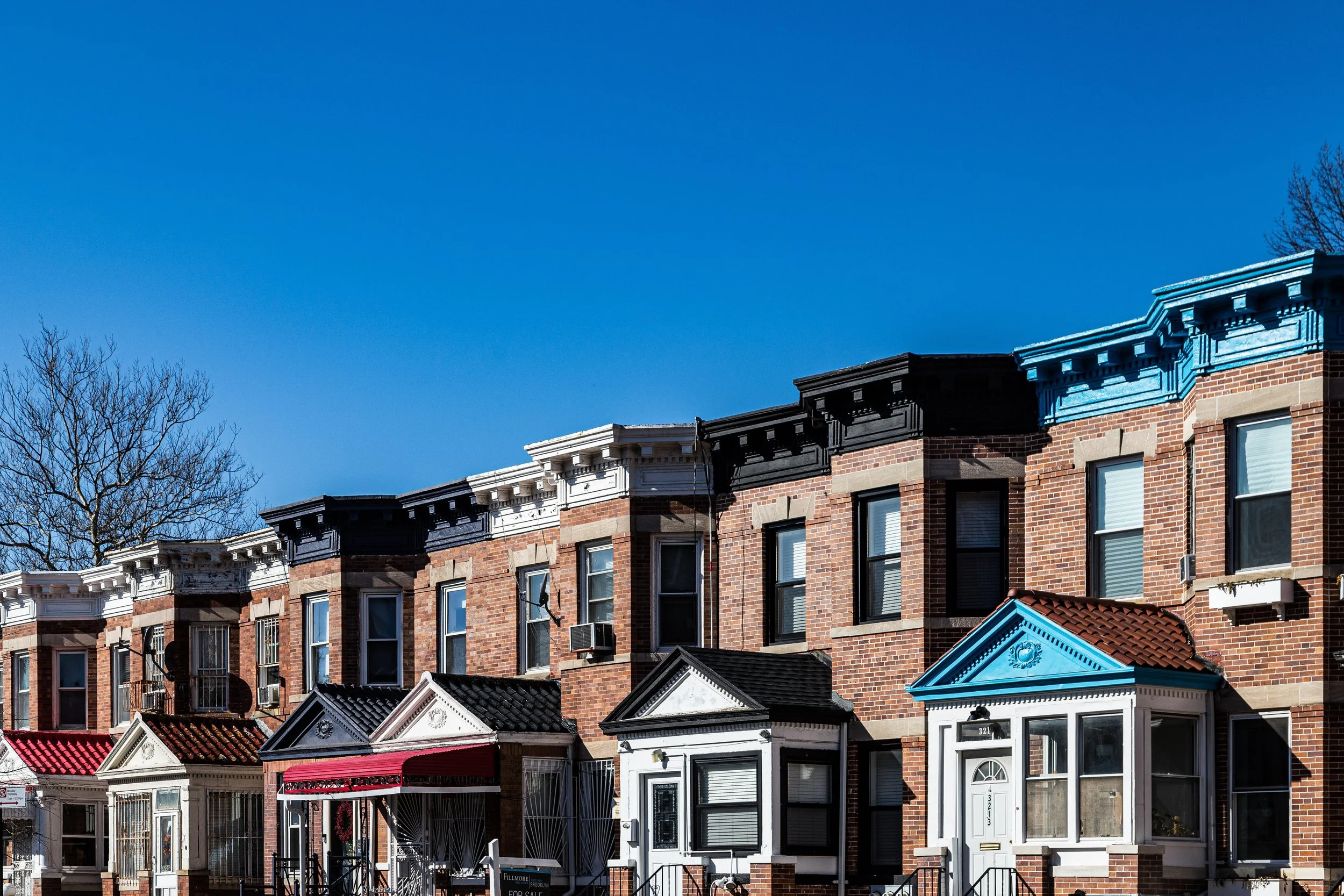
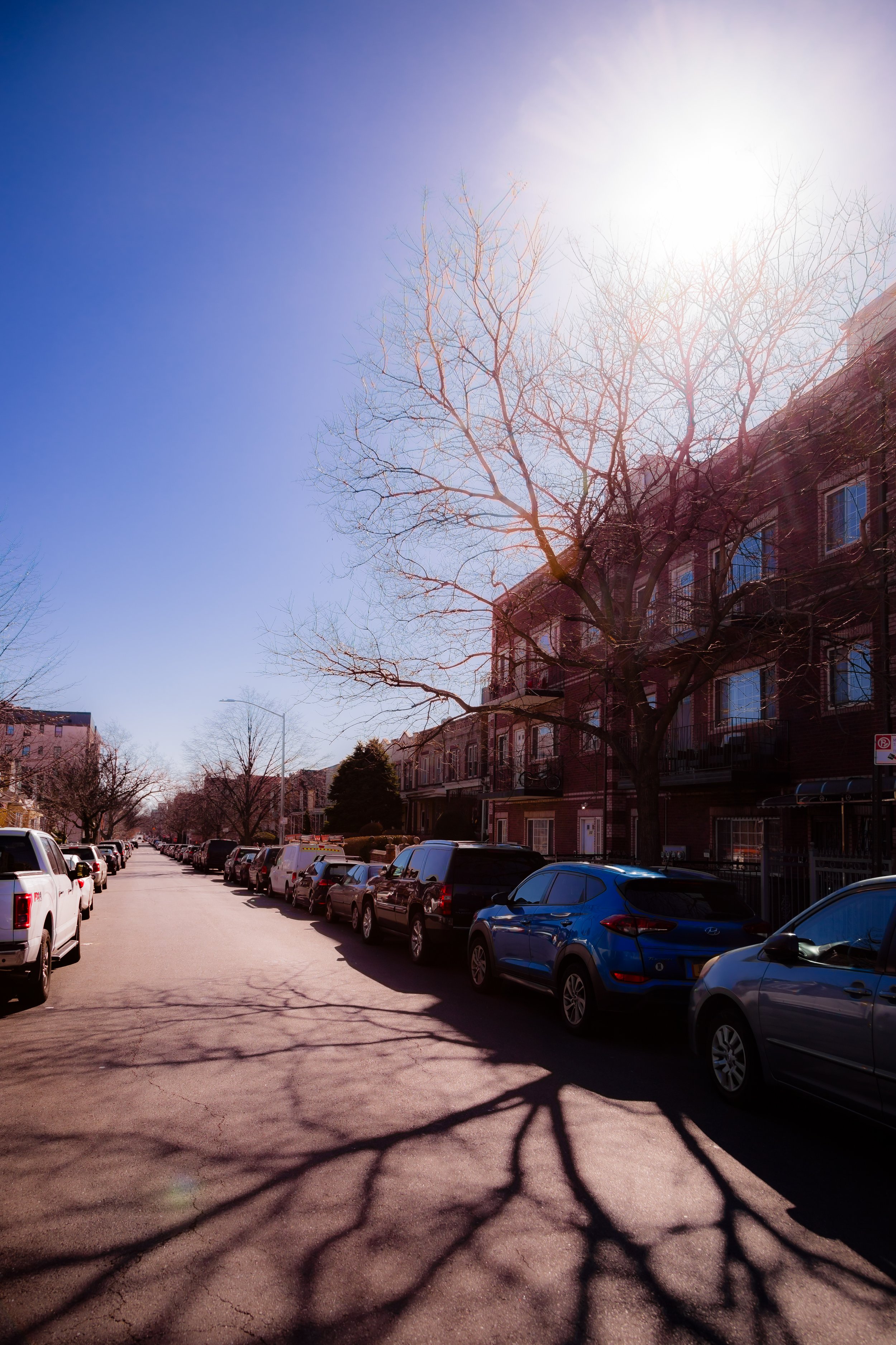
The neighborhood’s physical character is defined by its dignified rowhouses and freestanding early 20th-century homes, a mix of limestone, brownstone, and brick set along Albany Avenue, Fenimore Street, and Snyder Avenue. On its northern edge, the monumental Erasmus Hall High School—founded in 1786 and expanded in Gothic Revival splendor in the early 20th century—stands as both namesake and anchor, dominating Flatbush Avenue with its crenellated towers and ivy-clad façades. Around it, small businesses, churches, and cultural institutions reflect the area’s deeply rooted diversity, while quiet residential streets just beyond maintain an enduring air of urban stability.
Etymology and Origins
The name Erasmus derives from Erasmus Hall, one of the oldest educational institutions in the United States, itself named for the 16th-century Dutch humanist Desiderius Erasmus. The school was established in 1786 by the Dutch Reformed Church and local citizens of the village of Flatbush, then a pastoral farming community of Dutch-descended families. Among its early trustees were signers of the Declaration of Independence, including John Jay and Alexander Hamilton, reflecting the intellectual aspirations of a young republic still defining its civic identity.
The area surrounding the school gradually adopted the name “Erasmus,” signifying both the educational and moral stature associated with the institution. For much of the 19th century, this remained the nucleus of old Flatbush—a semi-rural settlement marked by elm-lined lanes, church spires, and estates stretching toward what are now Clarendon Road and Clarkson Avenue.
The Neighborhood
18th–19th Century: From Village Green to Urban Grid
In the 18th century, this district was part of the colonial town of Flatbush, founded by Dutch settlers in the 1650s as Vlacke Bos—“flat woods.” Its main road, now Flatbush Avenue, linked the farming hamlets of south Brooklyn with the ferry to Manhattan. Around this spine grew a cluster of civic and religious buildings: the Flatbush Reformed Dutch Church (1654), the parsonage, and by the 1780s, Erasmus Hall Academy. The school’s original Federal-style building still stands within the high school courtyard—a National Historic Landmark and one of the oldest surviving structures in Brooklyn.
During the 19th century, Flatbush evolved from village to suburb. Horsecar and trolley lines connected it to downtown Brooklyn by the 1850s, and the neighborhood surrounding Erasmus Hall filled with elegant Victorian and Edwardian homes, often owned by teachers, merchants, and civil servants. Clarendon Road and Clarkson Avenue, then semi-rural lanes, marked the edge of cultivated farmland, beyond which stretched the truck gardens and meadows that would later become East Flatbush.
By the 1890s, following Brooklyn’s consolidation into Greater New York, the area around Erasmus Hall became a desirable residential district—quiet, leafy, and conveniently located near the new Prospect Park and Flatbush Avenue trolley line.
Early–Mid 20th Century: Education and Civic Life at the Core
The early 20th century cemented Erasmus’s identity as an educational and civic hub. The original Erasmus Hall Academy was absorbed into the public school system in 1896, becoming Erasmus Hall High School, which soon expanded into a sprawling Gothic Revival complex (1904–1939) designed by C. B. J. Snyder, the city’s Superintendent of School Buildings. Its architecture—arched cloisters, carved limestone façades, and a central quadrangle—was modeled on the great universities of Europe, symbolizing Brooklyn’s ambitions as an urban center of learning.
Erasmus Hall High became one of New York’s most renowned public schools, producing graduates such as Barbra Streisand, Neil Diamond, and Bobby Fischer. Around it, the neighborhood flourished as a stable, middle-class enclave of Jewish, Italian, and Irish families. Apartment houses along Flatbush Avenue and Church Avenue complemented the older freestanding homes east of Rogers and Brooklyn Avenues. The area’s civic life revolved around its schools, churches, and small shops, with Albany Avenue and Church Avenue forming neighborhood centers of daily commerce.
The 1930s–1950s were the district’s golden years—when Erasmus symbolized both academic excellence and Brooklyn’s upward mobility. Yet the seeds of transformation were already being sown: rising automobile use, suburban migration, and demographic change would soon reshape the area’s fabric.
Erasmus Photographic Video
Late 20th Century: Transition and Tenacity
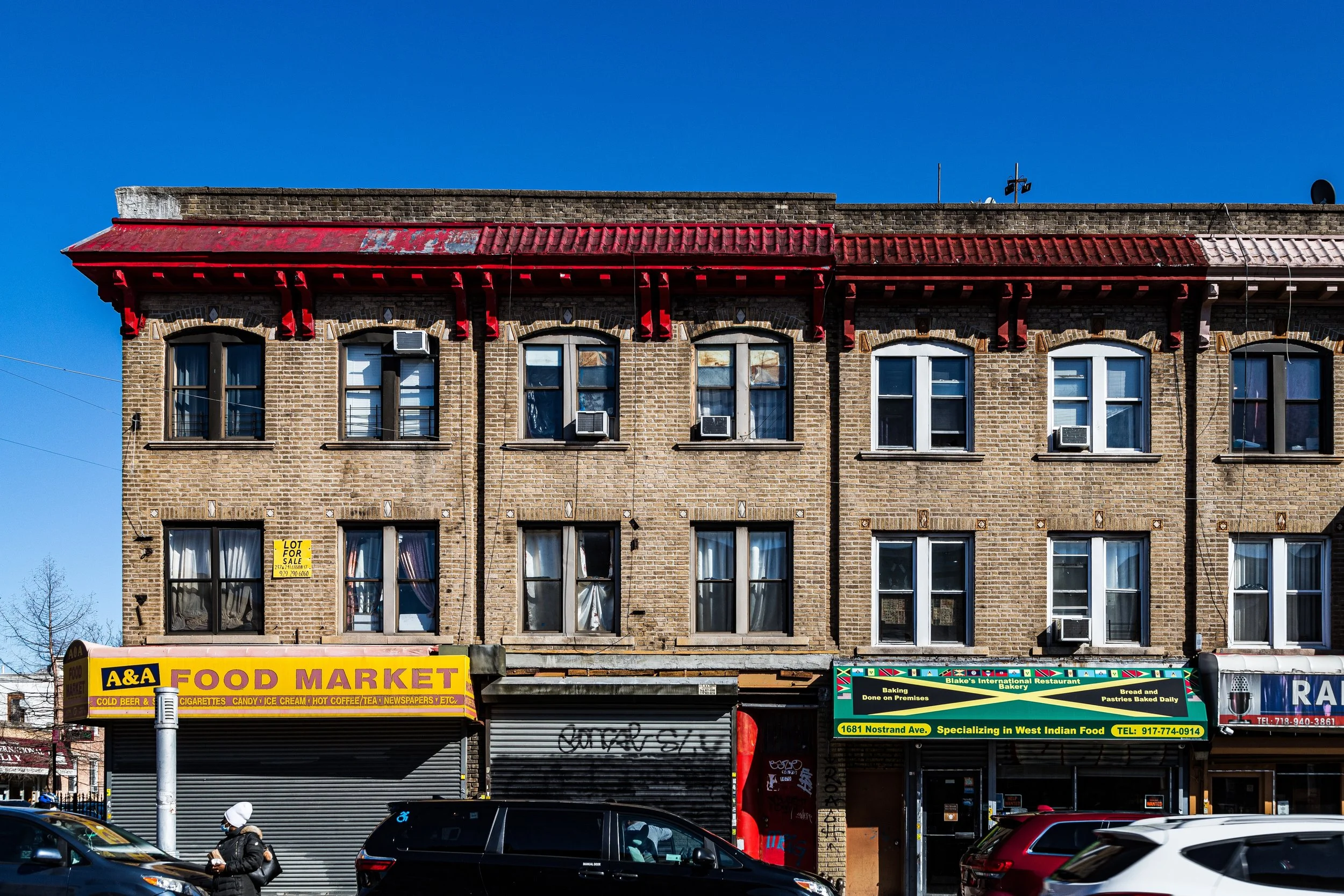
In the 1960s–1980s, Erasmus mirrored the story of central Brooklyn itself—a neighborhood in flux, facing both decline and renewal. As white flight accelerated and housing patterns shifted, African American and Caribbean families—many from Jamaica, Trinidad, Barbados, and Haiti—settled in the area, drawn by its solid housing stock and access to transit. The commercial spine along Flatbush Avenue adapted quickly, with West Indian groceries, bakeries, and travel agencies replacing older delicatessens and shoe shops.
The school that had given the neighborhood its name also changed. Erasmus Hall High School, once a premier academic institution, struggled through decades of underfunding and overcrowding as citywide challenges mounted. Yet the community remained resilient. Local churches—such as Holy Cross Roman Catholic Church (founded 1897) and St. Jerome’s Episcopal—anchored new immigrant congregations, while civic groups fought to maintain the area’s architectural heritage and residential stability.
Despite the turbulence of the late 20th century, Erasmus never lost its sense of place. Its streets retained the distinctive Brooklyn mix of attached brick homes, front stoops, and community gardens, and its residents—teachers, nurses, shopkeepers, and retirees—continued to embody the quiet perseverance that defines much of Flatbush.
21st Century: Revitalization and Cultural Continuity
In the 21st century, Erasmus has experienced a modest but steady revival. The Erasmus Hall Educational Campus, now housing several small specialized high schools, underwent major restoration, and the landmarked 18th-century academy building was reopened to the public as a heritage site. The neighborhood surrounding it benefits from both stability and reinvestment: long-time Caribbean families live beside newer professionals and students drawn by proximity to Prospect Park, Brooklyn College, and the 2 and 5 subway lines at Flatbush Avenue.
New cafés and bookstores have appeared along Flatbush Avenue, complementing the vibrant Caribbean restaurants and markets that define the district’s flavor. Clarkson Avenue and Clarendon Road, once quiet residential borders, have become lively corridors linking Erasmus to East Flatbush’s broader commercial network. While development pressures from Prospect-Lefferts Gardens edge closer each year, Erasmus retains a distinct sense of modesty and continuity—a neighborhood where heritage is not frozen in time but lived daily through its institutions, families, and faith communities.
Erasmus Photo Gallery
Spirit and Legacy
Erasmus’s legacy is one of education, endurance, and evolution. It stands as the intellectual and historical heart of Flatbush—its name synonymous with learning, its streets echoing with the layered histories of those who have passed through. From Dutch farmers to immigrant families, from scholars of the Enlightenment to graduates of Brooklyn’s public schools, the neighborhood embodies the ideal of steady progress through knowledge and community.
New York City
Use this custom Google map to explore where every neighborhood in all five boroughs of New York City is located.
The Five Boroughs
One of New York City’s unique qualities is its organization in to 5 boroughs: Manhattan, Brooklyn, Queens, The Bronx, and Staten Island. These boroughs are part pragmatic administrative districts, and part vestiges of the region’s past. Each borough is an entire county in New York State - in fact, Brooklyn is, officially, Kings County, while Staten Island is, officially Richmond County. But that’s not the whole story …
Initially, New York City was located on the southern tip of Manhattan (now the Financial District) that was once the Dutch colony of New Amsterdam. Across the East River, another city was rising: Brooklyn. In time, the city planners realized that unification between the rapidly rising cities would create commercial and industrial opportunities - through streamlined administration of the region.
So powerful was the pull of unification between New York and Brooklyn that three more counties were pulled into the unification: The Bronx, Queens, and Staten Island. And on January 1, 1898, the City of New York unified two cities and three counties into one Greater City of New York - containing the five boroughs we know today.
But because each borough developed differently and distinctly until unification, their neighborhoods likewise uniquely developed. Today, there are nearly 390 neighborhoods, each with their own histories, cultures, cuisines, and personalities - and each with residents who are fiercely proud of their corner of The Big Apple.


