DUMBO
Brooklyn
Geographic Setting
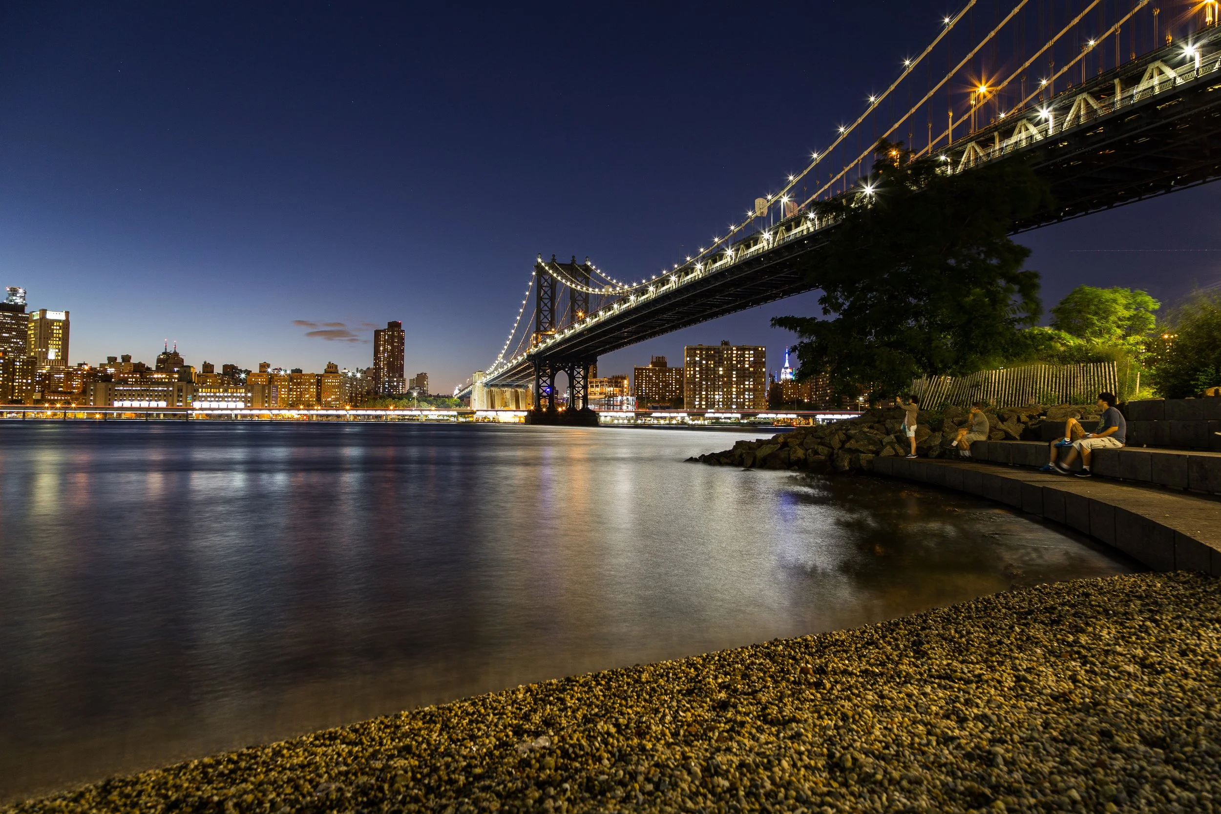
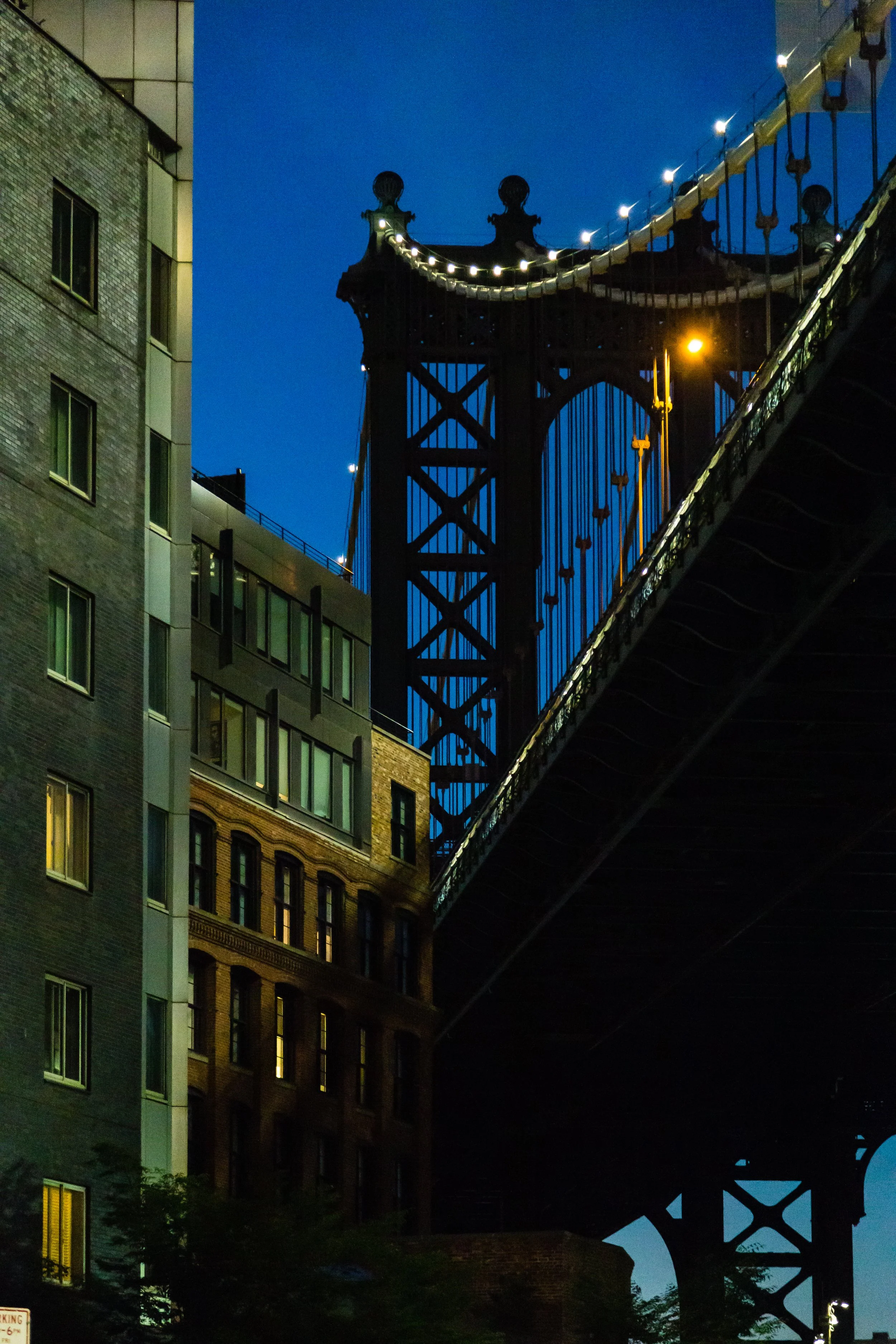
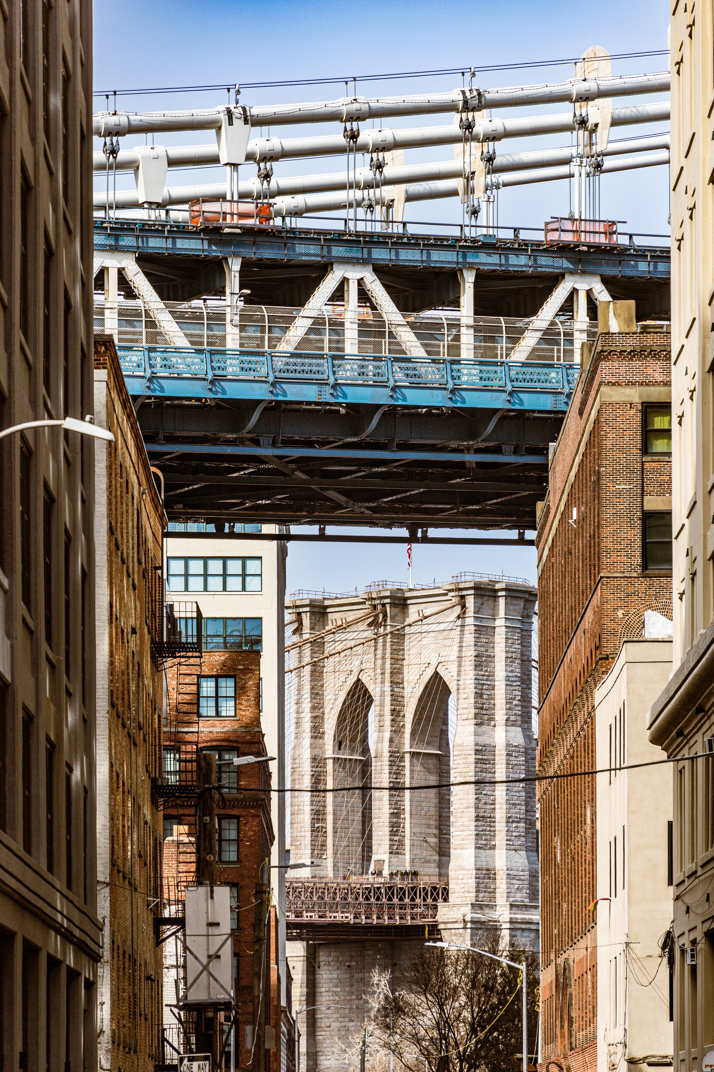
Bounded by the Brooklyn Bridge to the west and Bridge Street to the east, and stretching north of York Street to the East River, DUMBO—short for Down Under the Manhattan Bridge Overpass—occupies one of the most iconic landscapes in New York City. Wedged between the twin anchorages of the Brooklyn and Manhattan Bridges, this compact waterfront neighborhood is a masterclass in industrial geometry and modern reinvention. Cobblestone streets wind through canyons of 19th-century brick warehouses, while glass-walled condominiums and tech offices rise beside century-old ferry slips. The East River’s tides lap at restored piers, reflecting both the Manhattan skyline and Brooklyn’s own history of labor, commerce, and creativity.
The neighborhood’s physical character remains unmistakable: massive masonry loft buildings, originally designed for storage and manufacturing, dominate the narrow blocks of Water Street, Front Street, and Plymouth Street. Overhead, the steel lattice of the Manhattan Bridge rumbles like a living machine, and beyond it, the graceful stone towers of the Brooklyn Bridge frame the sky. The Empire Stores, Jane’s Carousel, and Main Street Park now occupy the waterfront where stevedores and ferrymen once worked. Few places in New York contain so many eras in such tight proximity—industrial, post-industrial, and now digital—all visible within a single glance toward the river.
Etymology and Origins
Though the acronym “DUMBO” dates only to the late 1970s, coined by artists who hoped the unglamorous name would deter developers, the area’s history reaches back to Brooklyn’s maritime origins. In the 18th and 19th centuries, this section of the East River shore was known as Fulton Landing, after Robert Fulton’s steam ferry, which began service to Manhattan in 1814, revolutionizing cross-river travel and accelerating Brooklyn’s growth.
By the mid-19th century, this district—then part of the city of Brooklyn’s industrial waterfront—was dominated by the Empire Stores, Arbuckle Brothers Coffee Company, and the Robert Gair Company, whose cardboard-box factory pioneered mass packaging. Rail spurs from the waterfront connected to the Brooklyn Navy Yard and Brooklyn Bridge rail lines, making the area one of the most productive industrial corridors in America. Its geography—flat, riverfront land with deep docks—made it ideal for shipping and storage.
The name Down Under the Manhattan Bridge Overpass emerged long after the factories fell silent, transforming an industrial zone into a brand of urban rebirth.
The Neighborhood
19th Century: Industrial Powerhouse of the East River
During the 19th century, DUMBO’s waterfront thrummed with energy. Steamboats, barges, and cargo ships lined the docks, while workers loaded coffee, sugar, paint, and paper into the cavernous brick warehouses that still define the neighborhood. The Empire Stores (built 1869–1885) served as coffee and dry-goods warehouses, their thick Scholes bricks and iron shutters designed to withstand river damp and fire. The Gair Buildings, constructed between 1888 and 1910, represented the cutting edge of industrial architecture: steel-frame lofts with massive windows that flooded work floors with light.
The Manhattan Bridge, completed in 1909, literally overshadowed the district, while the nearby Brooklyn Bridge (1883) transformed Fulton Landing into one of the most trafficked gateways in the world. Beneath their stone arches and iron cables, generations of dockworkers, machinists, and teamsters made their living—many of them Irish, Italian, or Eastern European immigrants who lived in nearby Vinegar Hill and Brooklyn Heights.
Factories along Front, Pearl, and Jay Streets produced everything from machinery to printed labels. The Eagle Warehouse (1893), designed by Frank Freeman, stored paper for the Brooklyn Eagle newspaper and still stands as a Romanesque landmark of brick solidity. By the turn of the century, this area was not a neighborhood but an engine room—an industrial powerhouse feeding Brooklyn’s and New York’s growing economies.
Early–Mid 20th Century: Decline of the Working Waterfront
The prosperity of DUMBO’s industrial era began to ebb in the mid-20th century. Advances in transportation—especially containerization—shifted shipping to deepwater ports in New Jersey, rendering Brooklyn’s shallow docks obsolete. The once-busy warehouses emptied, and by the 1960s, the area’s cobblestone streets were largely deserted. The Brooklyn Bridge off-ramps and Manhattan Bridge overpasses turned the district into a tangle of shadowed viaducts and echoing alleys.
During this period, city planners viewed the area as expendable: a warehouse zone to be demolished or repurposed for infrastructure. Yet a few stalwart businesses held on—metalworks, printers, and small manufacturers. Among them was Robert Gair’s cardboard empire, which continued production well into the 1950s. By the 1970s, as manufacturing left the city entirely, the empty lofts and vast spaces began to attract artists and photographers drawn to the light, space, and isolation.
It was in this era that the name DUMBO was coined—reportedly by a group of artists who lived in the former factories and feared gentrification would soon arrive. They succeeded only temporarily.
DUMBO Photographic Video
Late 20th Century: Artists, Pioneers, and the Birth of a Name
By the 1980s, DUMBO had become Brooklyn’s answer to SoHo—a frontier of creative reuse. Painters, sculptors, and photographers converted old factory floors into studios and live-work lofts. The neighborhood’s gritty romance—its cobblestones, river fog, and bridge shadows—became a backdrop for films, fashion shoots, and album covers.
In 1981, real estate investor David Walentas and his company Two Trees Management began purchasing much of the industrial property, envisioning a mixed-use neighborhood of artists’ studios, tech offices, and residences. His long-term stewardship, controversial at the time, would ultimately define DUMBO’s modern identity. Two Trees restored historic warehouses, reactivated ground floors with galleries and shops, and preserved the district’s industrial bones even as it evolved into one of New York’s most desirable addresses.
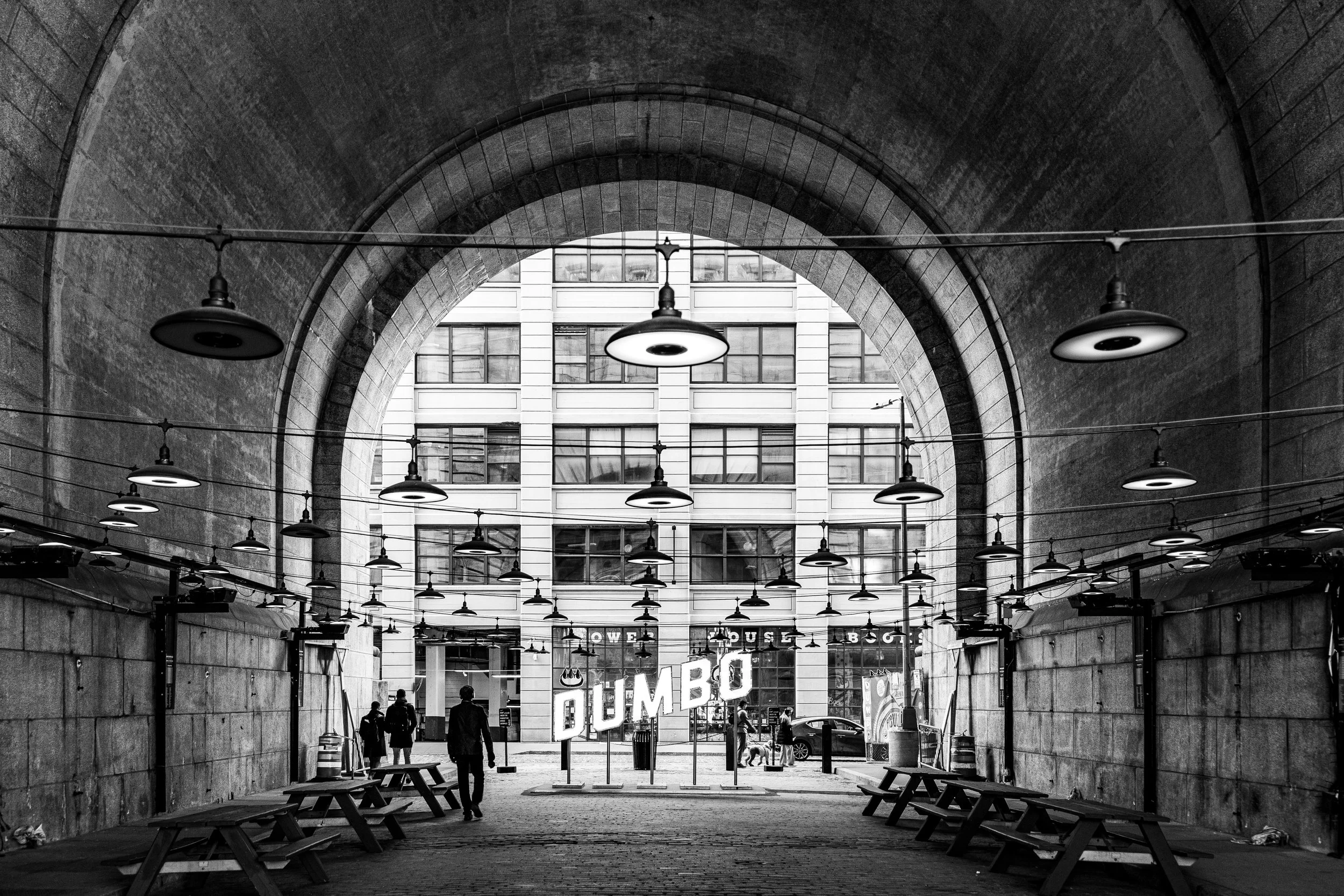
The Manhattan Bridge Archway, long neglected, was reclaimed as public space; Plymouth and Water Streets were repaved with salvaged Belgian block; and the riverfront, once off-limits, began its transformation into parkland.
21st Century: From Industrial Ruin to Creative Capital
The new millennium crowned DUMBO as one of New York’s most dynamic urban success stories. The creation of Brooklyn Bridge Park (begun 2008) reconnected the waterfront to public life, adding lawns, piers, and promenades along the East River. The Empire Stores were reinvented as a mixed-use complex housing offices, shops, and the Time Out Market, while St. Ann’s Warehouse, a performance space inside a restored tobacco warehouse, became one of the city’s most respected cultural institutions.
The neighborhood’s population grew rapidly as residential conversions filled the old lofts, and new architecture—such as the Dock Street Building (2014) and One John Street (2016)—added contemporary glass forms to the brick skyline. The tech and design sectors found a home here, earning DUMBO its reputation as the nucleus of Brooklyn’s “Tech Triangle,” alongside Downtown Brooklyn and the Navy Yard.
Despite soaring property values, the neighborhood has retained much of its authenticity through careful preservation and design review. The DUMBO Historic District, designated in 2007, protects more than 90 industrial buildings, ensuring that the texture of the 19th-century waterfront remains visible beneath the modern skyline. The hum of the bridges above and the sparkle of the river below form the neighborhood’s eternal soundtrack.
DUMBO Photo Gallery
Spirit and Legacy
DUMBO’s legacy is one of transformation through reinvention. From 19th-century manufacturing to 20th-century abandonment to 21st-century innovation, it embodies Brooklyn’s evolution from workshop to world stage. Its beauty lies in its contradictions: iron bridges casting shadows on cobblestones, century-old warehouses housing startups, and a working waterfront reborn as a cultural commons.
New York City
Use this custom Google map to explore where every neighborhood in all five boroughs of New York City is located.
The Five Boroughs
One of New York City’s unique qualities is its organization in to 5 boroughs: Manhattan, Brooklyn, Queens, The Bronx, and Staten Island. These boroughs are part pragmatic administrative districts, and part vestiges of the region’s past. Each borough is an entire county in New York State - in fact, Brooklyn is, officially, Kings County, while Staten Island is, officially Richmond County. But that’s not the whole story …
Initially, New York City was located on the southern tip of Manhattan (now the Financial District) that was once the Dutch colony of New Amsterdam. Across the East River, another city was rising: Brooklyn. In time, the city planners realized that unification between the rapidly rising cities would create commercial and industrial opportunities - through streamlined administration of the region.
So powerful was the pull of unification between New York and Brooklyn that three more counties were pulled into the unification: The Bronx, Queens, and Staten Island. And on January 1, 1898, the City of New York unified two cities and three counties into one Greater City of New York - containing the five boroughs we know today.
But because each borough developed differently and distinctly until unification, their neighborhoods likewise uniquely developed. Today, there are nearly 390 neighborhoods, each with their own histories, cultures, cuisines, and personalities - and each with residents who are fiercely proud of their corner of The Big Apple.


