CLAREMONT
The Bronx
Geographic Setting
Bounded by East 167th Street to the south, Grand Concourse to the west, the Cross Bronx Expressway to the north, then Fulton Avenue south to Claremont Parkway, east to Webster Avenue, and back down to E 167th Street, Claremont sits at the geographic center of the Bronx—a neighborhood perched on the ridge between the Bronx River valley and the heights of Morrisania. Despite its compact size, Claremont possesses a striking topography: hilly streets, broad western boulevards, and pockets of parkland that catch light and breeze from all sides.
At its heart lies Claremont Park, a 38-acre green oasis that gives the neighborhood its name and character. Once part of the historic Morris family estate, the park anchors the community like a natural amphitheater surrounded by dense city blocks. Webster Avenue, Clay Avenue, and Fulton Avenue form its eastern corridors of motion—arteries of small businesses, schools, and churches—while the Grand Concourse to the west provides an elegant boundary of Art Deco apartment houses and civic buildings. The Cross Bronx Expressway, cut through the northern edge in the mid-20th century, reshaped the landscape but also fixed Claremont’s identity as a distinct hilltop enclave within the wider South Bronx.
Etymology
The name “Claremont” dates to the late 19th century, when the area’s park and surrounding residential streets were being planned as part of the Bronx’s expansion northward from Morrisania. Borrowed from the Latin clarus mons, meaning “bright hill” or “clear mountain,” the name aptly describes both the area’s elevation and its openness.
When Claremont Park was dedicated in 1884, the name symbolized refinement and prospect—a genteel vision for a district intended to blend urban living with access to fresh air and greenery. The name carried a genteel echo of other 19th-century “heights” and “hills” neighborhoods—Mount Eden, Mount Hope, Tremont—each invoking height as health and dignity.
The Neighborhood
Origins through the 19th Century
Claremont’s early history is intertwined with the Morris family, who owned vast estates stretching across the South Bronx. The land that would become Claremont Park formed part of the Morris homestead, later purchased by the city in 1884 to provide a public green for the growing borough. At that time, the area around it was only lightly settled—farm lots, carriage roads, and clusters of cottages near Webster Avenue.
The creation of Claremont Park coincided with the Bronx’s transformation from countryside to suburb. The arrival of the New York Central Railroad and the opening of Third Avenue and Webster Avenue as through-routes drew small-scale housing developments and institutions. The city’s decision to preserve the hilly core as parkland kept a sense of openness even as the grid closed in. By the 1890s, advertisements for homes near “beautiful Claremont Park” promised fresh air, panoramic views, and quick access to downtown via the Harlem Line.
Early 20th Century: A Neighborhood Takes Shape
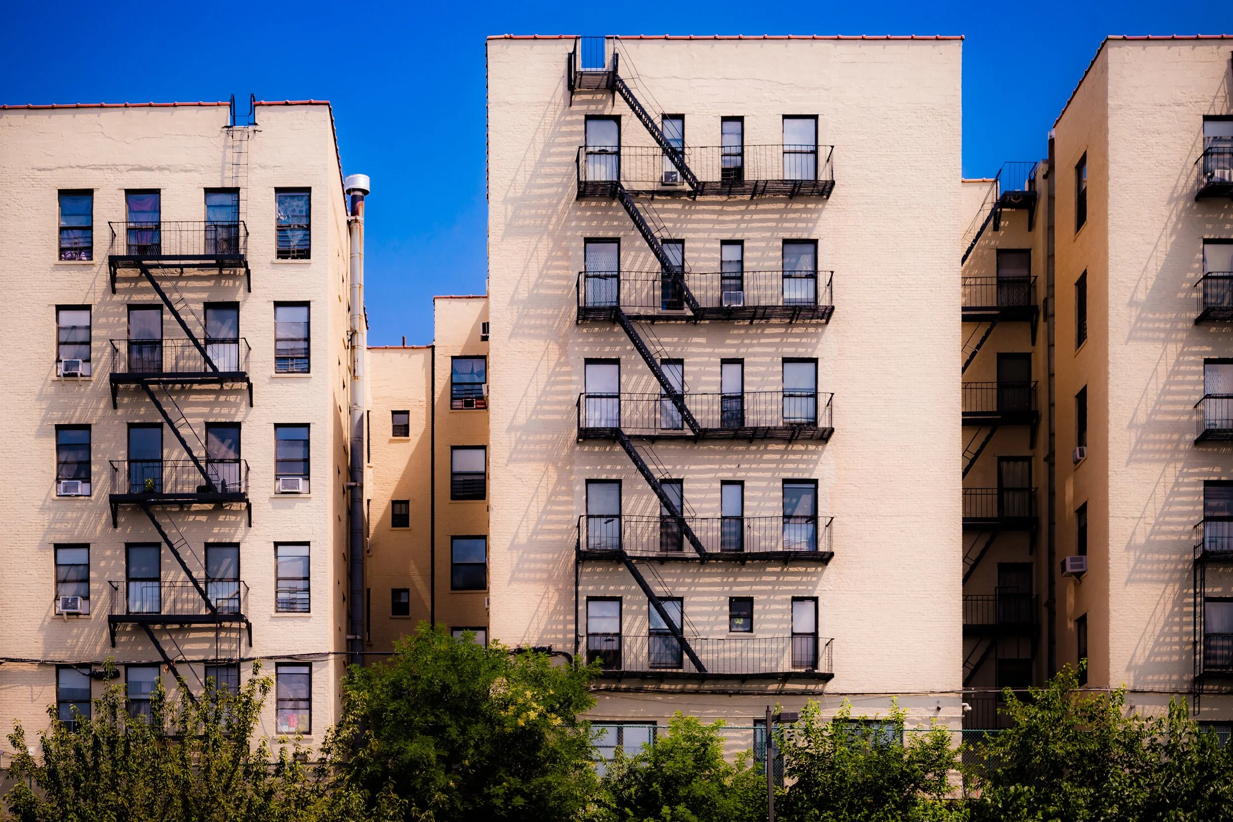
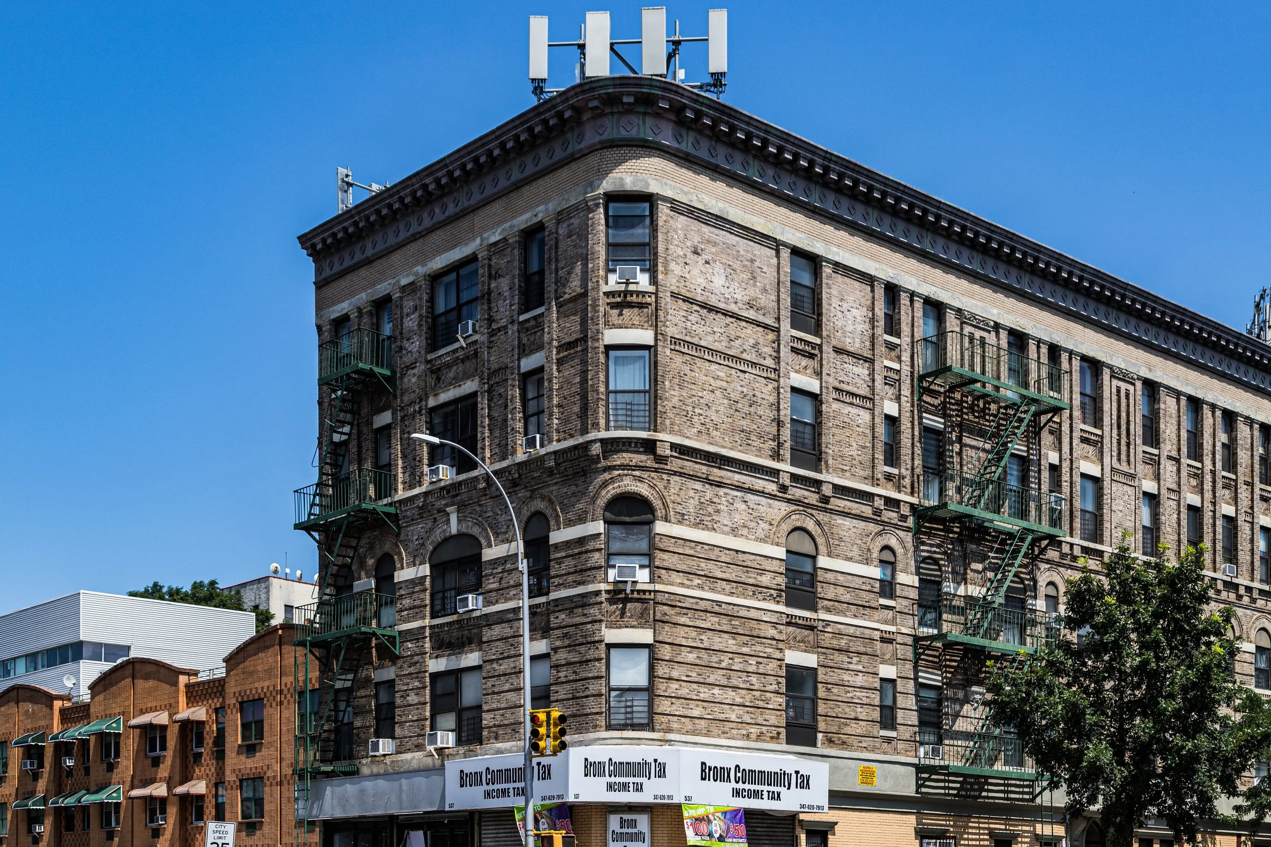
By the 1910s and 1920s, Claremont had filled in with a mixture of five-story prewar apartment houses along Clay, Fulton, and Webster Avenues, and more ornate Art Deco and Renaissance Revival buildings along the Grand Concourse. The park’s rolling topography and stately trees provided both recreation and civic pride. Claremont Parkway, a curved street skirting the park’s southern edge, became one of the Bronx’s most picturesque residential lanes, lined with brick rowhouses and low apartment blocks that overlooked lawns and tennis courts.
The population was largely Jewish, Italian, and Irish working-class families, many moving north from the Lower East Side and East Harlem. Schools, synagogues, and parishes followed: PS 42, Claremont Temple, and St. Joseph’s Church each became fixtures of local life. The Grand Concourse, completed in 1909, elevated the western border into a boulevard of apartment palaces, linking Claremont directly to Yankee Stadium and downtown Manhattan.
In the 1930s, the neighborhood’s density increased but remained balanced by the park’s open space. Webster Avenue became a commercial strip filled with groceries, delis, and movie theaters, while streetcars ran up Third Avenue to Fordham. Claremont represented the Bronx ideal: affordable, urbane, self-contained, and green.
Claremont Video Coming Soon
Mid–Late 20th Century: Displacement and Survival
The construction of the Cross Bronx Expressway (1948–1972) marked a turning point. The highway’s cut severed Claremont from Mount Eden and Morris Heights, displacing hundreds of families and destabilizing blocks along Fulton Avenue and Webster Avenue. At the same time, demographic changes accelerated: Jewish and Italian residents moved to the suburbs, replaced by African-American and Puerto Rican families seeking better housing from overcrowded tenements farther south.
By the 1970s, Claremont—like much of the South Bronx—was struggling with disinvestment, redlining, and waves of building abandonment. Fires destroyed several apartment houses along Fulton Avenue and Webster Avenue, and the once-proud Grand Concourse lost many of its landmark buildings to neglect. Yet Claremont Park remained a refuge; its lawns, though worn, continued to host ballgames, picnics, and neighborhood gatherings.
Local residents organized through tenant associations and community groups such as the Claremont Neighborhood Center, which opened in the early 1980s. With support from city agencies and nonprofits, abandoned lots were cleared for community gardens, and new infill housing began to rise. Despite hardship, the neighborhood’s geographic cohesion—anchored by the park—helped sustain a core of residents committed to rebuilding.
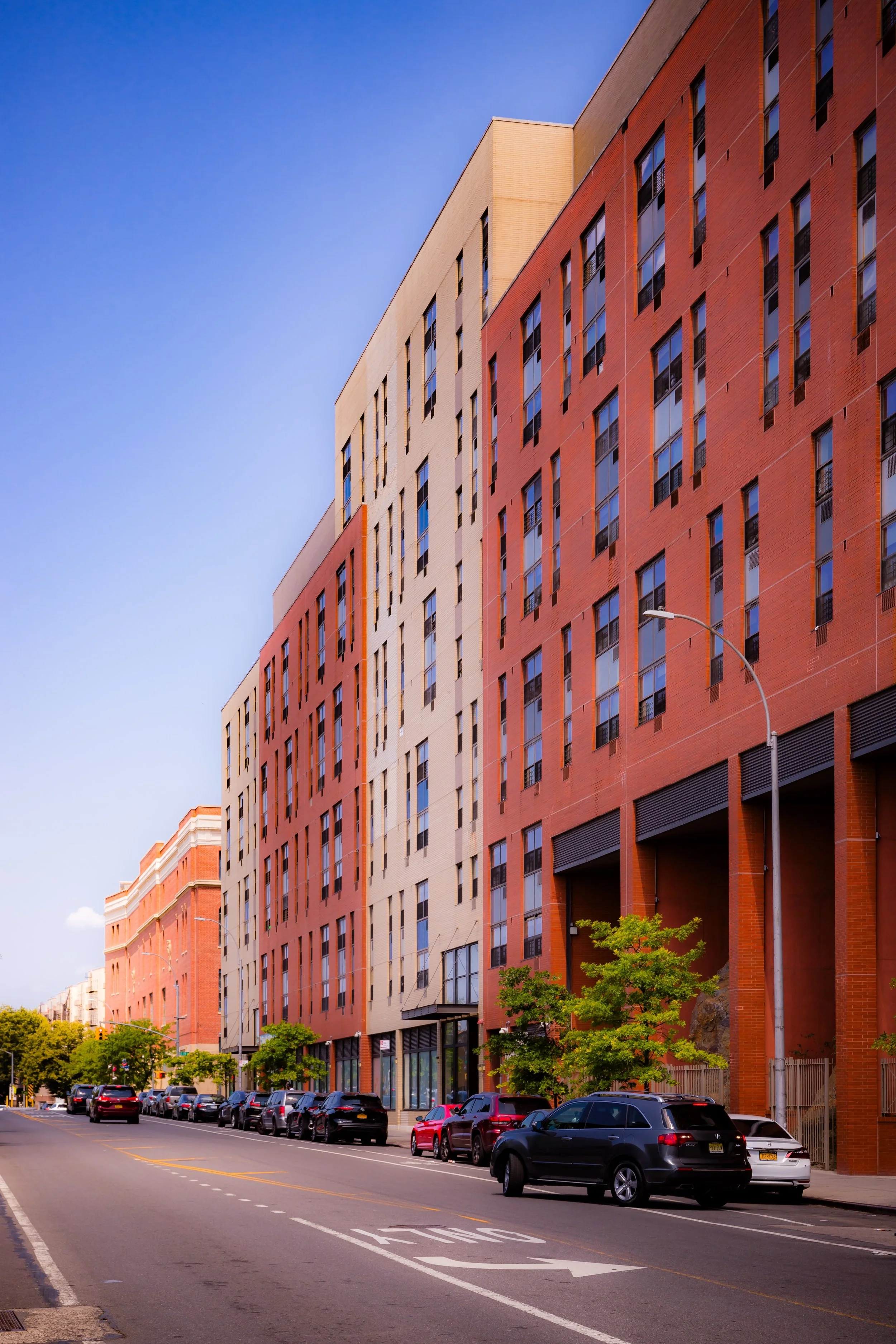
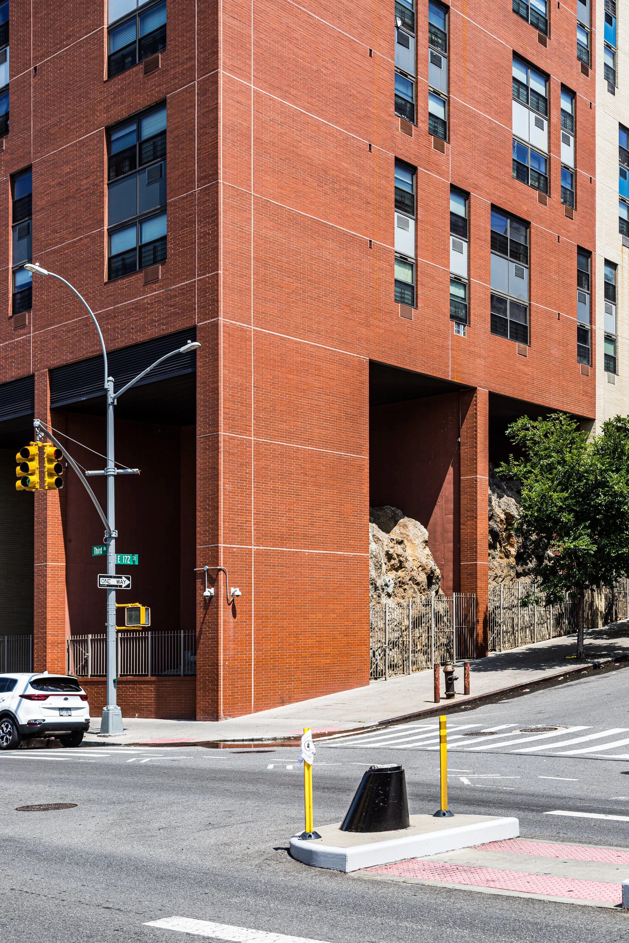
21st Century: Revival on the Hill
In the 21st century, Claremont has reemerged as one of the South Bronx’s most vibrant and improving neighborhoods. New affordable housing developments have replaced derelict lots along Fulton Avenue and Claremont Parkway, while renovations to Claremont Park—including new playgrounds, lighting, and landscaping—have restored its role as the community’s heart. The park’s historic mansion, once the home of Gouverneur Morris Jr., has been stabilized as a cultural landmark.
The population today reflects the Bronx’s global diversity: Puerto Rican, Dominican, West African, and Mexican families, alongside a growing number of students and professionals drawn by the neighborhood’s transit access and park proximity. Webster Avenue has regained vitality with small businesses—cafés, delis, and cultural centers—while the Grand Concourse showcases renewed Art Deco restorations. The park hosts farmer’s markets and music festivals that connect Claremont’s past to its resilient present.
The intersection of E 170th Street and Webster Avenue has become a local hub, with new housing, childcare centers, and community gardens forming a walkable village within the dense Bronx grid.
Claremont Photo Gallery
Spirit and Legacy
Claremont’s spirit is defined by endurance through elevation—both literal and figurative. Perched above the borough’s bustle, it has witnessed cycles of prosperity, loss, and rebirth without losing its civic heart. Its park, streets, and people tell a continuous story of adaptation: from genteel suburb to working-class enclave to community-driven revival.
New York City
Use this custom Google map to explore where every neighborhood in all five boroughs of New York City is located.
The Five Boroughs
One of New York City’s unique qualities is its organization in to 5 boroughs: Manhattan, Brooklyn, Queens, The Bronx, and Staten Island. These boroughs are part pragmatic administrative districts, and part vestiges of the region’s past. Each borough is an entire county in New York State - in fact, Brooklyn is, officially, Kings County, while Staten Island is, officially Richmond County. But that’s not the whole story …
Initially, New York City was located on the southern tip of Manhattan (now the Financial District) that was once the Dutch colony of New Amsterdam. Across the East River, another city was rising: Brooklyn. In time, the city planners realized that unification between the rapidly rising cities would create commercial and industrial opportunities - through streamlined administration of the region.
So powerful was the pull of unification between New York and Brooklyn that three more counties were pulled into the unification: The Bronx, Queens, and Staten Island. And on January 1, 1898, the City of New York unified two cities and three counties into one Greater City of New York - containing the five boroughs we know today.
But because each borough developed differently and distinctly until unification, their neighborhoods likewise uniquely developed. Today, there are nearly 390 neighborhoods, each with their own histories, cultures, cuisines, and personalities - and each with residents who are fiercely proud of their corner of The Big Apple.


