WOODSIDE
Queens
Geographic Setting
Bounded by 31st Avenue to the north, the Brooklyn-Queens Expressway (BQE) to the east and south, and a western border running north from the BQE along 58th Street to Queens Boulevard, west to 52nd Street, then north on Woodside Avenue to Northern Boulevard, and finally along 49th Street to 31st Avenue, Woodside lies at the western edge of Queens—just east of Sunnyside and west of Jackson Heights. It occupies a crossroads of geography and culture: part commuter hub, part historic village, and part immigrant melting pot, where elevated trains rumble overhead and old frame houses stand shoulder to shoulder with brick co-ops and apartment towers.
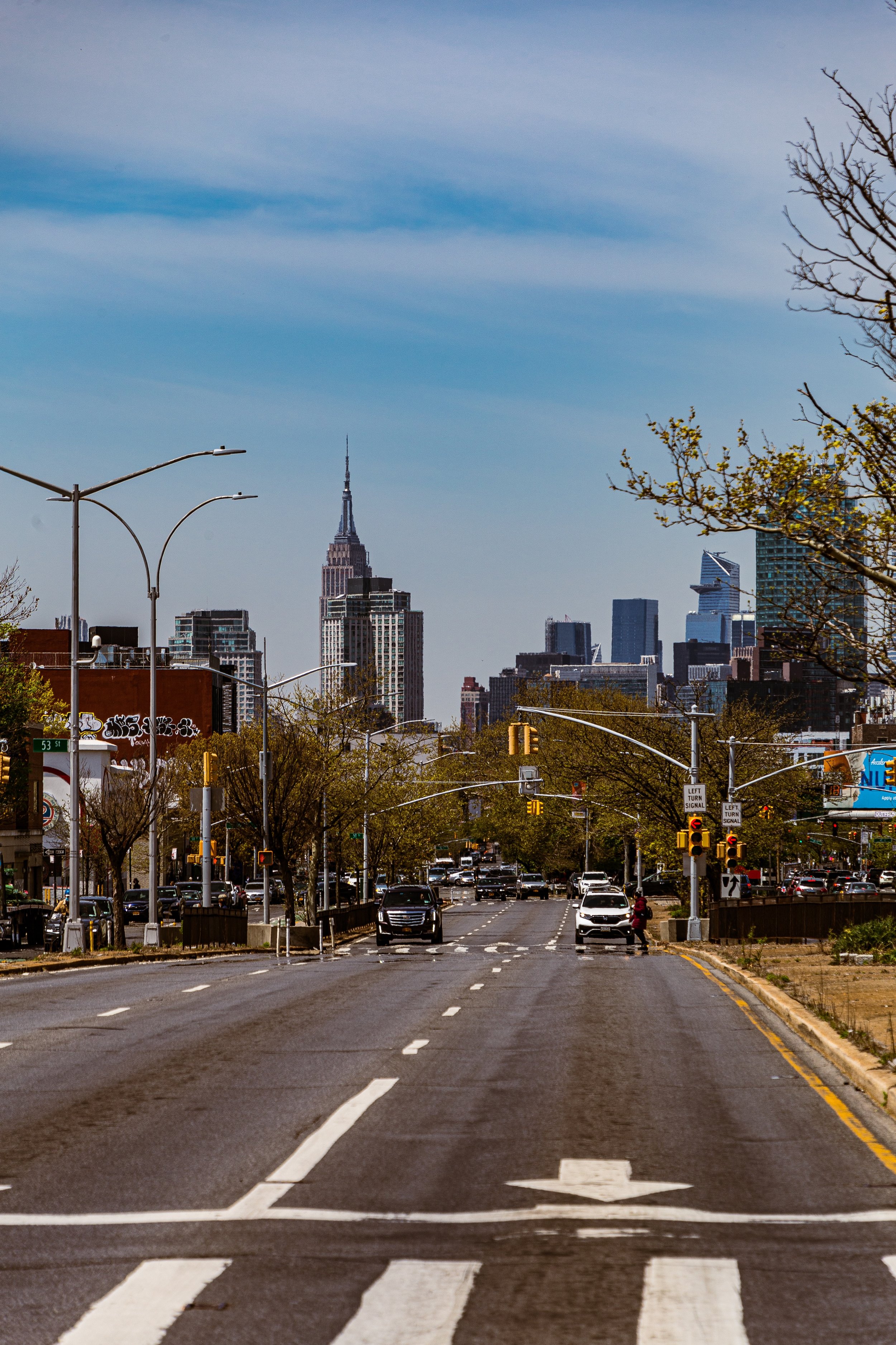
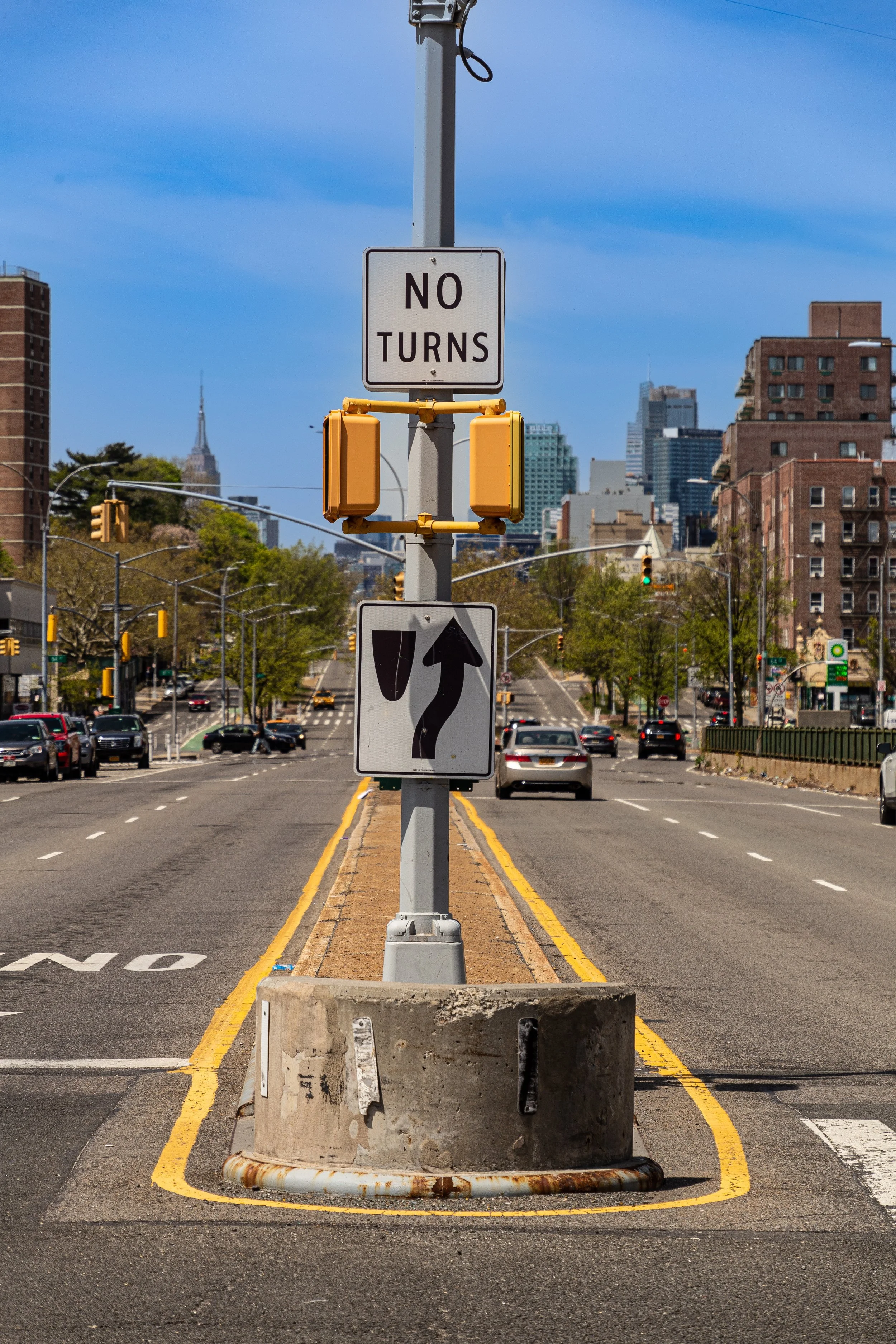
At its heart runs Roosevelt Avenue, one of the borough’s great transit spines, paralleled by the No. 7 train whose elevated tracks define the rhythm of daily life. Queens Boulevard slices diagonally through the district, carrying traffic toward Long Island City and Jamaica, while Northern Boulevard and Skillman Avenue provide secondary commercial corridors. The neighborhood’s residential character varies block by block—from early 20th-century wood-frame houses and rowhomes to mid-century apartment complexes and newer condominiums. Its diversity, density, and accessibility make it quintessential Queens: vibrant, polyglot, and always in motion.
Etymology and Origins
The name “Woodside” dates to the 1650s, when the area formed part of the Dutch and later English-settled Town of Newtown (now Elmhurst). Early records describe “a point of land covered in fine woods,” likely referring to the oak and chestnut forests that once lined the area’s hills overlooking the Meadowlands of Newtown Creek. By the mid-19th century, when urban expansion from Long Island City and Hunters Point began to reach the area, developer Benjamin W. Hitchcock coined the name “Woodside” formally in 1867, promoting it as a rustic retreat for New Yorkers seeking fresh air and affordable lots along the Long Island Rail Road line.
The LIRR’s Woodside Station, established in 1869, became the neighborhood’s nucleus, drawing small clusters of houses, inns, and shops. The land—then crisscrossed by meadows, farms, and dirt roads—offered both pastoral beauty and convenient access to Manhattan via ferry and rail. This early vision of Woodside as a “country suburb within reach of the city” would shape its evolution for generations.
The Neighborhood
Late 19th–Early 20th Century: Suburban Beginnings and Immigrant Growth
In the decades between 1870 and 1910, Woodside transformed from farmland into a suburban village. The opening of the Queens Boulevard trolley (1896) and later the extension of the IRT Flushing Line (7 train, completed 1917) accelerated development, drawing Irish, German, and Italian immigrants who built modest frame houses on narrow lots.
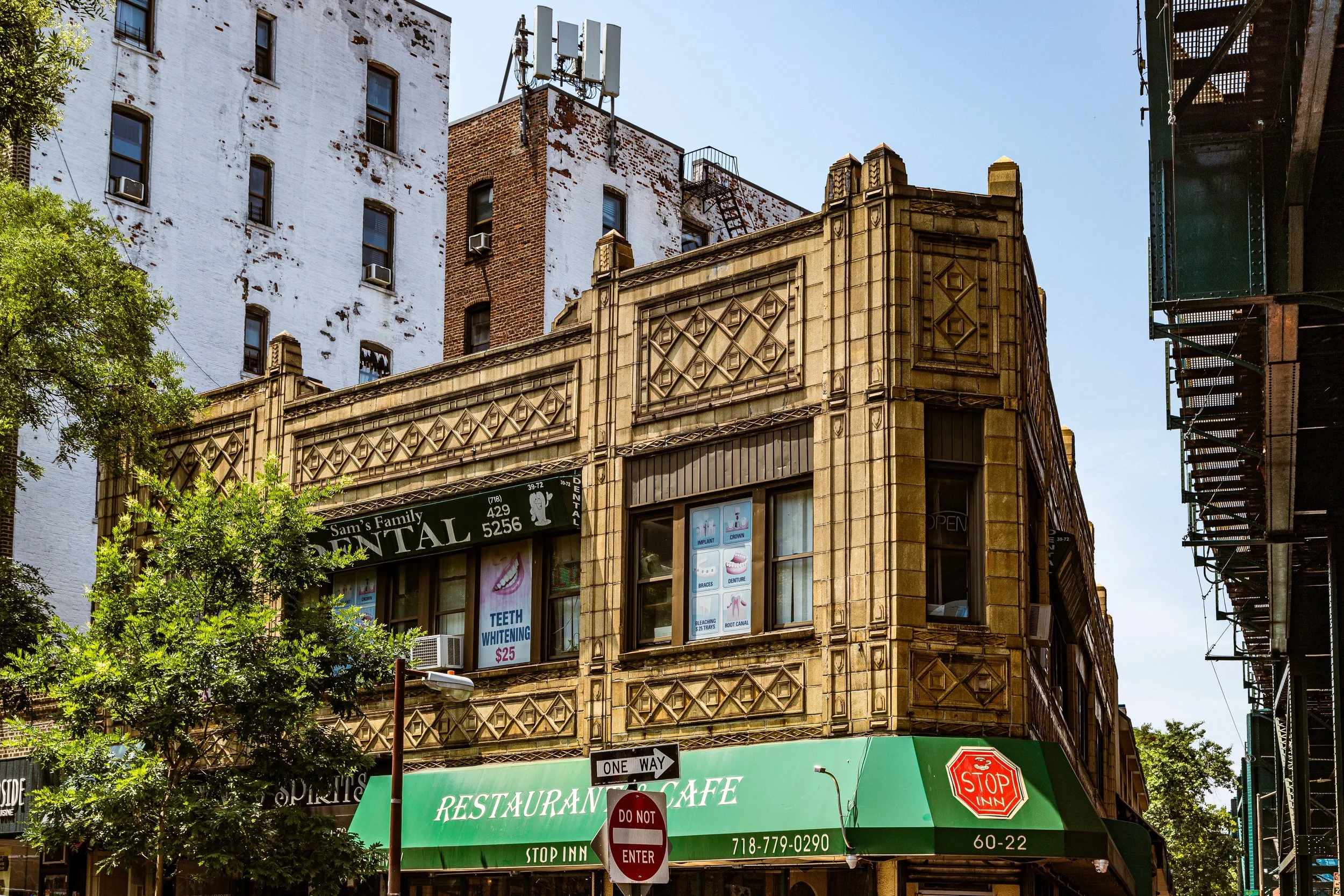
The neighborhood’s physical plan emerged from this era: Woodside Avenue and Roosevelt Avenue became main thoroughfares, while cross streets such as 51st, 55th, and 58th filled with homes featuring front porches, gabled roofs, and small gardens. Churches like St. Sebastian Roman Catholic Church (est. 1896), still a community cornerstone, and St. Paul’s Episcopal anchored local identity. Small businesses—bakeries, groceries, and taverns—clustered around the 61st Street–Woodside station, where the elevated train and LIRR intersect.
By the early 20th century, Woodside was part of a rapidly urbanizing western Queens. The construction of the Queensboro Bridge (1909) and the BQE (1940s) made it both accessible and bisected—physically tied to the metropolis yet separated from its quieter past.
Mid-20th Century: The Irish Enclave and Suburban Aspirations
From the 1930s through the 1960s, Woodside became one of the most recognizable Irish-American neighborhoods in New York City. Alongside nearby Sunnyside, it attracted waves of Irish immigrants seeking affordable housing and close-knit community life. Irish pubs, social clubs, and parish schools flourished; St. Sebastian’s Parish grew into one of the largest in the diocese, and annual events like St. Patrick’s Day parades became neighborhood traditions.
During this period, Woodside’s housing stock stabilized. Many of the prewar frame homes were supplemented by brick rowhouses, Art Deco apartment buildings, and garden-style co-ops such as the Stratford Hall and Lincoln Apartments. Middle-class families viewed the area as a bridge between city and suburb—accessible by subway to Manhattan yet quiet enough for backyard gardens.
The intersection of Roosevelt Avenue and 61st Street, shared with the LIRR, became a vibrant commercial and transit hub, while Queens Boulevard evolved into the area’s major thoroughfare. In the postwar years, the community maintained its reputation as clean, safe, and strongly familial—its Irish pubs, diners, and grocers serving as fixtures of neighborhood continuity.
Woodhaven Video Coming Soon
Late 20th Century: Diversity and Urban Vitality
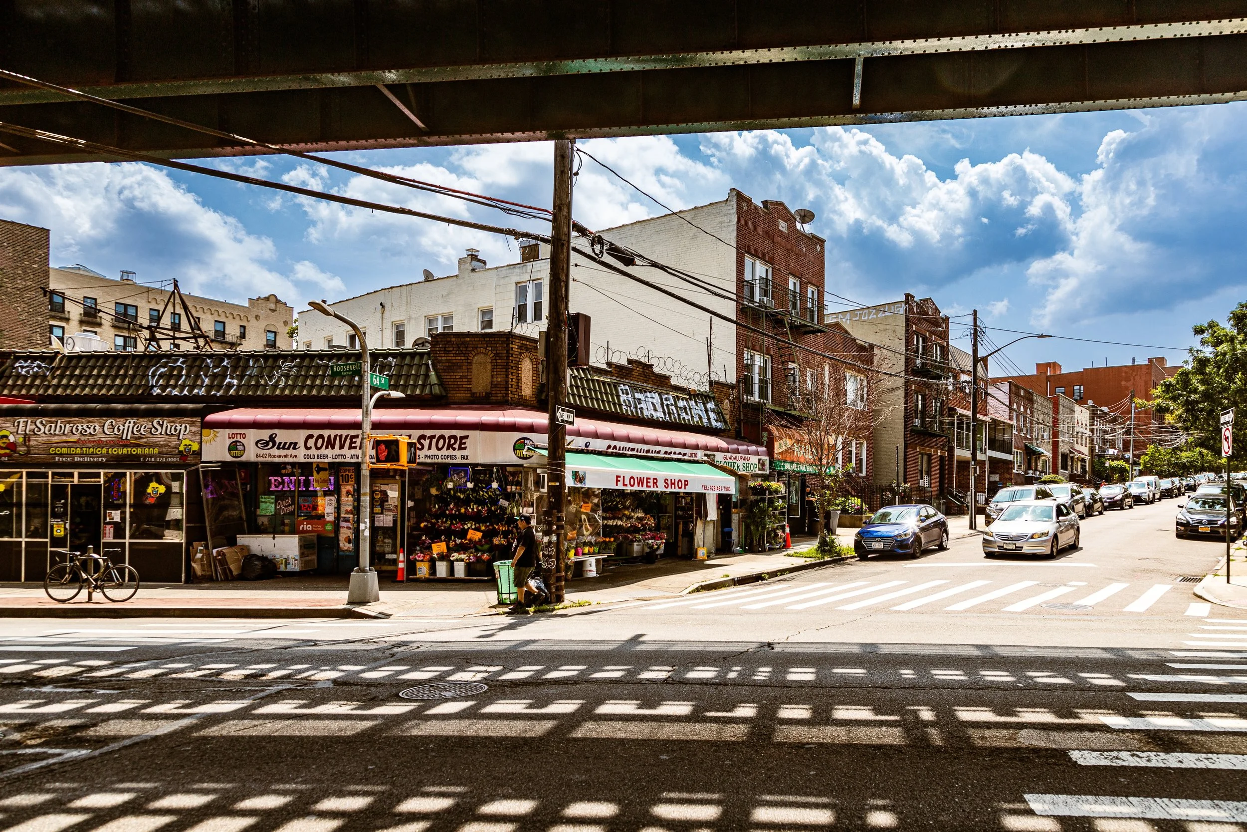
By the 1970s and 1980s, immigration patterns reshaped Woodside profoundly. New arrivals from Latin America (especially Colombia and Ecuador), East Asia (notably the Philippines, Korea, and China), and South Asia transformed the cultural landscape. Former Irish taverns became Filipino bakeries, Thai restaurants, and Latin bodegas; English and Gaelic mingled with Spanish, Tagalog, and Korean on storefronts and street corners.
This influx brought new vitality to Roosevelt Avenue, which by the 1990s had become one of New York City’s most dynamic and polyglot corridors. The neighborhood’s housing stock remained largely intact, its affordability attracting students, artists, and working-class families priced out of Manhattan and Brooklyn. Civic organizations and ethnic associations flourished, fostering dialogue and mutual support among communities.
Despite growing diversity, the Irish presence endured through cultural institutions like Donovan’s Pub (est. 1966) and organizations such as the Sunnyside–Woodside St. Pat’s for All Parade, which celebrates inclusion and multiculturalism.
21st Century: A Microcosm of Queens
In the 21st century, Woodside stands as one of Queens’ most diverse, transit-rich, and resilient neighborhoods. With residents from more than 60 national backgrounds, it epitomizes the borough’s global identity. Roosevelt Avenue hums with food carts and restaurants serving everything from Nepali momo dumplings to Colombian arepas. The elevated 7 train continues to define the area’s soundscape and spirit—its steel structure a unifying landmark across generations.
Residentially, Woodside balances old and new. Prewar homes and walk-ups coexist with new condominiums and mixed-use developments, particularly along Queens Boulevard and near the 61st Street transit hub. Local civic groups remain active in advocating for traffic safety, affordable housing, and the preservation of neighborhood character amid ongoing gentrification pressures.
Parks and public spaces, including the Big Bush Park renovation and tree-lined segments of Skillman Avenue, reinforce the community’s livability, while its connectivity—via subway, bus, LIRR, and expressway—makes it one of the city’s most accessible enclaves.
Woodside Photo Gallery
Spirit and Legacy
The spirit of Woodside lies in its layers of belonging—from its 19th-century roots as a wooded hamlet to its 20th-century identity as an Irish-American stronghold, and now as a thriving nexus of global migration. It remains a place where newcomers find footing, longtimers hold memory, and the elevated train binds generations in shared experience.
New York City
Use this custom Google map to explore where every neighborhood in all five boroughs of New York City is located.
The Five Boroughs
One of New York City’s unique qualities is its organization in to 5 boroughs: Manhattan, Brooklyn, Queens, The Bronx, and Staten Island. These boroughs are part pragmatic administrative districts, and part vestiges of the region’s past. Each borough is an entire county in New York State - in fact, Brooklyn is, officially, Kings County, while Staten Island is, officially Richmond County. But that’s not the whole story …
Initially, New York City was located on the southern tip of Manhattan (now the Financial District) that was once the Dutch colony of New Amsterdam. Across the East River, another city was rising: Brooklyn. In time, the city planners realized that unification between the rapidly rising cities would create commercial and industrial opportunities - through streamlined administration of the region.
So powerful was the pull of unification between New York and Brooklyn that three more counties were pulled into the unification: The Bronx, Queens, and Staten Island. And on January 1, 1898, the City of New York unified two cities and three counties into one Greater City of New York - containing the five boroughs we know today.
But because each borough developed differently and distinctly until unification, their neighborhoods likewise uniquely developed. Today, there are nearly 390 neighborhoods, each with their own histories, cultures, cuisines, and personalities - and each with residents who are fiercely proud of their corner of The Big Apple.


