BELLEROSE
Queens
Geographic Setting
Bounded by Little Neck Parkway to the east, Jericho Turnpike to the south, a western perimeter tracing Gettysburg Street north to Braddock Avenue, continuing along Moline Street, 235th Court, Hillside Avenue, and Winchester Boulevard, and enclosed to the north by the Grand Central Parkway, Bellerose sits at the far eastern edge of Queens—a tranquil garden suburb marking the threshold between New York City and Nassau County. The neighborhood occupies the western half of a twin community, the other half lying just beyond the city line in Bellerose Village, Nassau County. Together, they form one of the most seamless urban–suburban transitions in the five boroughs: a landscape of single-family homes, manicured lawns, and leafy blocks where the dense grid of Queens gives way to Long Island’s open rhythm.
The terrain slopes gently southward from the Grand Central Parkway toward Jericho Turnpike, with Hillside Avenue and Braddock Avenue serving as the main east–west arteries. Little Neck Parkway and Winchester Boulevard frame the community’s long axis, while interior streets such as 86th Avenue, 87th Drive, and 88th Road retain the calm, curving patterns characteristic of early suburban planning. The Cross Island Parkway, running just to the north, provides swift access to the Long Island Expressway, while the Floral Park LIRR Station a few blocks east connects residents directly to Manhattan. Despite its accessibility, Bellerose maintains a distinct, village-like calm: quiet sidewalks, front gardens, and a skyline of trees.
Etymology and Origins
The name “Bellerose” was coined in the early 20th century by Helen Marsh, the wife of landscape developer Edward P. Raynor, who founded Bellerose Village in 1909 on adjacent Nassau County farmland. Inspired by the pastoral imagery of “belle” (beautiful) and “rose,” she sought a name that conveyed charm and refinement for the model suburb her husband envisioned. When development expanded westward into Queens in the 1910s and 1920s, the name naturally carried across the city line, defining the contiguous neighborhood we know today.
Before subdivision, this area formed part of the Town of Hempstead’s rural hinterlands—tracts of farmland, orchards, and meadows cultivated by Dutch and English settlers since the 17th century. The region’s sandy loam and proximity to Jamaica made it ideal for truck farming well into the 19th century, when improved transit lines began to shift its destiny from agricultural to residential.
The Neighborhood
Early 20th Century: The Birth of a Model Suburb
The development of Bellerose coincided with New York City’s great suburban expansion in the early 1900s. The arrival of the Long Island Rail Road in nearby Floral Park and the paving of Jericho Turnpike transformed the once-rural crossroads into a commuter hub. In 1910, promotional materials heralded Bellerose as “the garden suburb of Greater New York,” offering detached homes, landscaped streets, and fresh air within a short train ride of Manhattan.
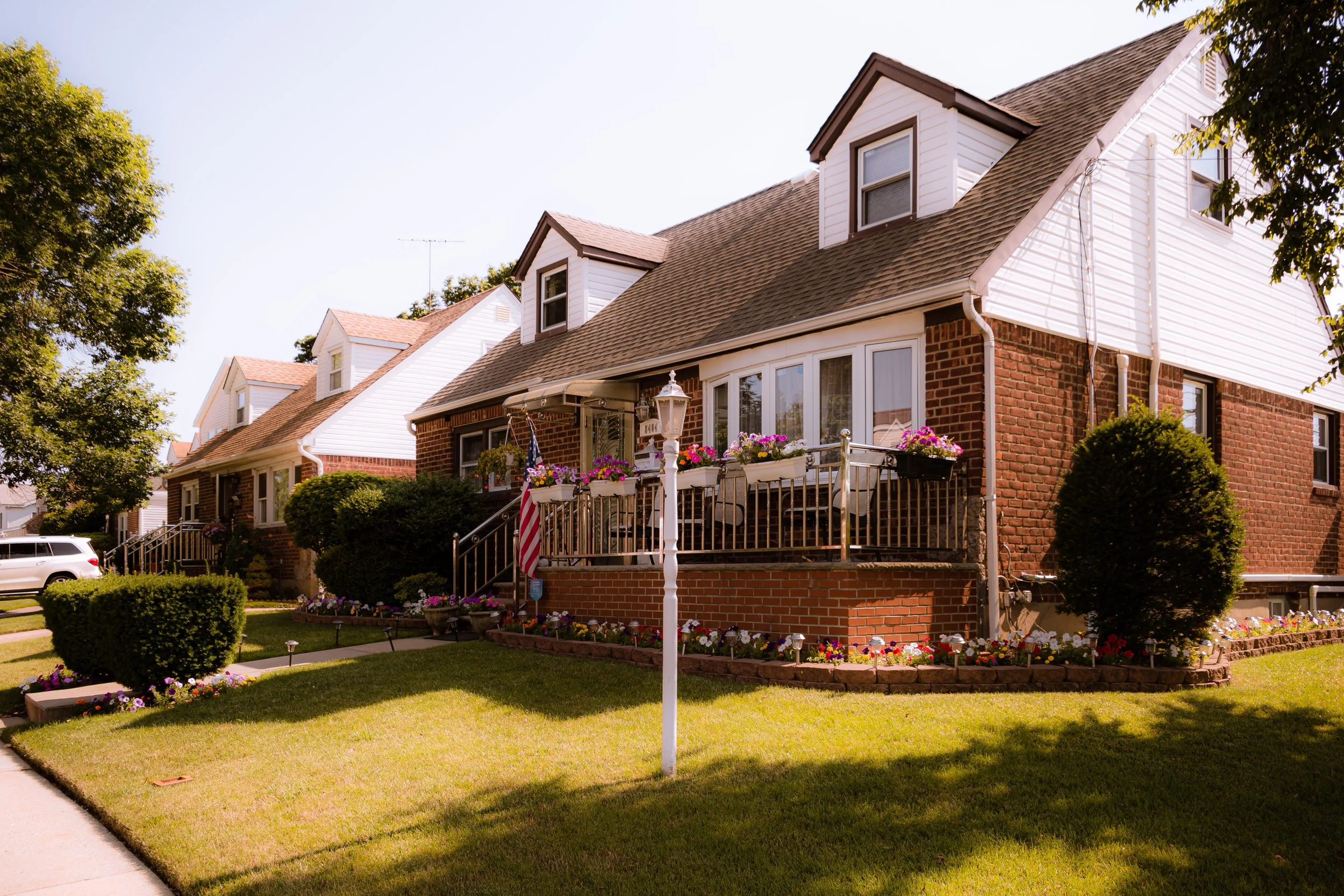
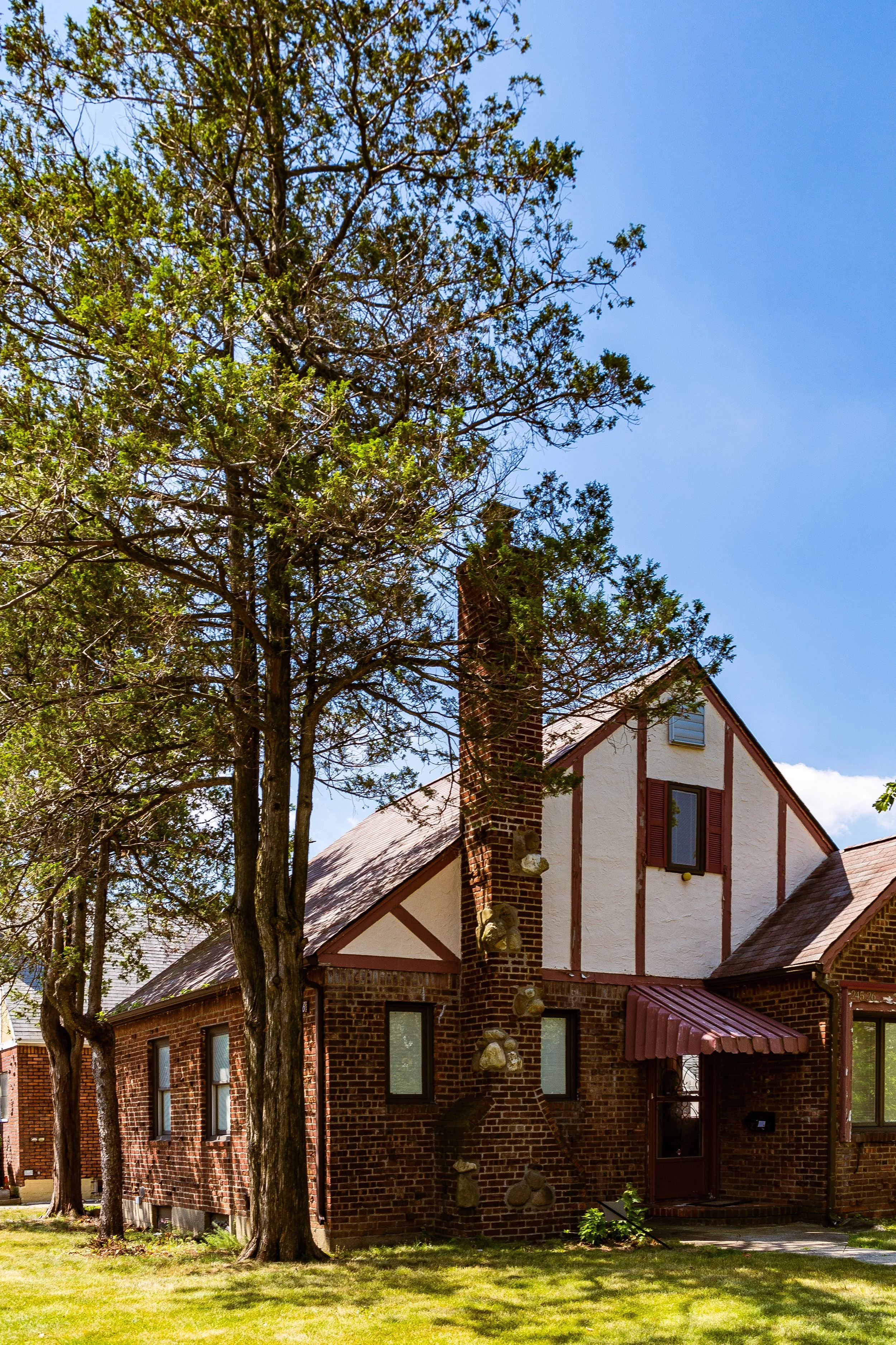
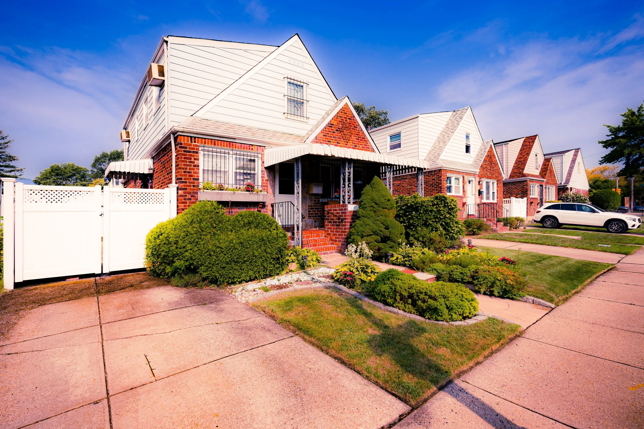
By the 1920s, Bellerose’s Queens section was formally mapped and integrated into the borough’s grid under the city’s zoning reforms. Builders erected neat rows of Tudor and Colonial Revival homes, many featuring gables, porches, and decorative brickwork. Unlike the dense apartment districts farther west, Bellerose was conceived as an explicitly residential enclave: each lot with a front lawn, backyard, and driveway. The Bellerose Civic Association, formed early in its development, set a tone of local self-governance that endures to this day.
Interwar and Mid-Century: Suburban Maturity and Civic Identity
Between the 1930s and 1950s, Bellerose matured into one of Queens’ most cohesive communities. The construction of the Grand Central Parkway (1936) and the later Cross Island Parkway (1939–40) linked it efficiently to both Manhattan and Long Island, but also reinforced its role as a green, insulated pocket between urban and suburban life. The neighborhood’s street grid, anchored by Braddock Avenue, Hillside Avenue, and Winchester Boulevard, filled in with sturdy one- and two-family homes that defined the mid-century ideal of attainable homeownership.
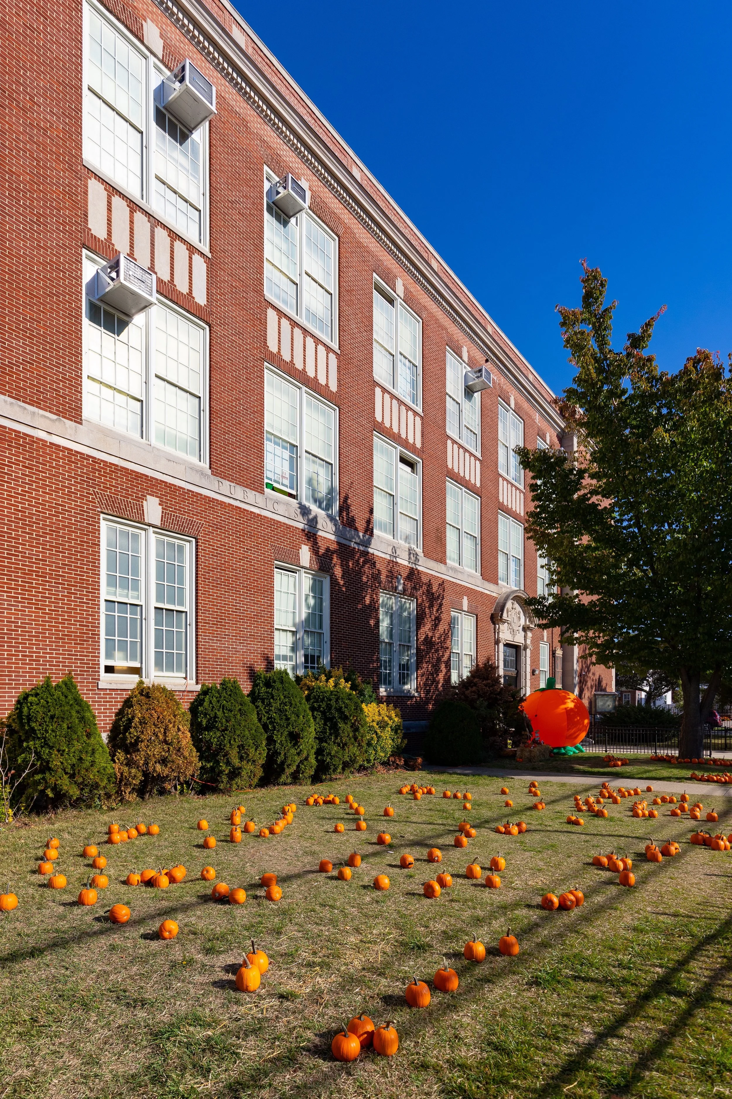
During this period, Bellerose developed a reputation for stability, civic pride, and family life. Local institutions—P.S. 133, St. Gregory the Great Church and School, and the Bellerose Jewish Center—anchored the social fabric. Many residents worked in city service professions or commuted via the LIRR to Manhattan offices, while others found employment in the growing suburban commercial corridors along Jericho and Hillside Avenues.
Tree planting initiatives and uniform building restrictions preserved the area’s visual harmony, distinguishing Bellerose from neighboring Queens Village to the west and the denser sections of Jamaica beyond. Its close-knit blocks and local associations fostered a quiet suburban culture that has remained remarkably consistent for nearly a century.
Bellerose Video Coming Soon
Late 20th Century: Preservation Through Change
By the 1960s and 1970s, Bellerose had fully transitioned from a young suburb to an established community. The neighborhood’s tidy architecture, low density, and strong civic traditions shielded it from many of the disruptions that reshaped other parts of Queens during these decades. While nearby Queens Village and Cambria Heights diversified rapidly, Bellerose remained largely middle-class, anchored by homeownership and intergenerational families.
As the city’s demographics evolved, so too did Bellerose’s. New waves of residents—Caribbean, South Asian, Greek, and Irish—joined the longstanding European-American population, contributing to a cultural mosaic while sustaining the neighborhood’s tradition of care and stability. The Bellerose Commonwealth Civic Association and Bellerose Hillside Civic Association emerged as guardians of local quality of life, advocating for zoning integrity, school funding, and traffic safety amid the pressures of urban expansion.
21st Century: Community in Balance
In the new millennium, Bellerose continues to exemplify the enduring success of New York’s early suburban vision. Its leafy streets and well-maintained homes attract families seeking space and community within the city limits. Many of its original Tudor and Colonial houses remain intact, their façades restored and their front gardens tended with pride. Streets like 86th Avenue and 237th Street preserve the neighborhood’s early-20th-century rhythm, where American flags wave above stoops and conversations unfold along evening sidewalks.
The area’s demographic richness has deepened: Indian, Pakistani, Filipino, and Caribbean-American families now form a significant share of residents, bringing new cultural vibrancy while embracing the neighborhood’s quiet traditions. Restaurants and small businesses along Hillside Avenue reflect this diversity, offering cuisines and shops from every continent, yet the streetscape remains distinctly residential.
Bellerose’s proximity to major parkways and Long Island’s open landscapes continues to define its identity. To the north, the Grand Central Parkway’s greenbelt buffers it from the bustle of the city; to the south, Jericho Turnpike connects it seamlessly to Nassau’s commercial corridors. The sense of “edge”—between urban and suburban, historic and contemporary—remains its defining quality.
Bellerose Photo Gallery
Spirit and Legacy
Bellerose endures as a living symbol of New York’s suburban promise: a neighborhood where order, greenery, and community coexist within sight of the city’s skyline. Its tree-shaded streets and century-old houses speak to the aspirations of its founders—to build a “beautiful rose” of a neighborhood that would grow with grace.
Through wars, migration, and modernization, that vision has held. The air here still carries the faint scent of gardens, the sound of trains from Floral Park, and the steady heartbeat of families who have made Bellerose home for generations.
New York City
Use this custom Google map to explore where every neighborhood in all five boroughs of New York City is located.
The Five Boroughs
One of New York City’s unique qualities is its organization in to 5 boroughs: Manhattan, Brooklyn, Queens, The Bronx, and Staten Island. These boroughs are part pragmatic administrative districts, and part vestiges of the region’s past. Each borough is an entire county in New York State - in fact, Brooklyn is, officially, Kings County, while Staten Island is, officially Richmond County. But that’s not the whole story …
Initially, New York City was located on the southern tip of Manhattan (now the Financial District) that was once the Dutch colony of New Amsterdam. Across the East River, another city was rising: Brooklyn. In time, the city planners realized that unification between the rapidly rising cities would create commercial and industrial opportunities - through streamlined administration of the region.
So powerful was the pull of unification between New York and Brooklyn that three more counties were pulled into the unification: The Bronx, Queens, and Staten Island. And on January 1, 1898, the City of New York unified two cities and three counties into one Greater City of New York - containing the five boroughs we know today.
But because each borough developed differently and distinctly until unification, their neighborhoods likewise uniquely developed. Today, there are nearly 390 neighborhoods, each with their own histories, cultures, cuisines, and personalities - and each with residents who are fiercely proud of their corner of The Big Apple.


