
THE STREETS OF NEW YORK
The streets of New York form the living framework of the city — a network of energy and intention carved through centuries of movement. They are the city’s arteries, drawing millions through their corridors each day; a language of pavement and pattern that speaks of order and chaos in equal measure.
From the colonial angles of lower Manhattan to the unwavering grid of Midtown, from the winding streets of Brooklyn’s waterfront to the broad boulevards of the Bronx, each stretch of asphalt tells its own story. These are the spaces where commerce and community converge, where light and shadow divide the hours, and where the pulse of the city is most immediate.
Streets of New York captures that living geometry — the ceaseless choreography of motion that defines how New Yorkers move, meet, and make their lives within the grid. To walk its streets is to trace the city’s heartbeat in real time.
The Streets:
-
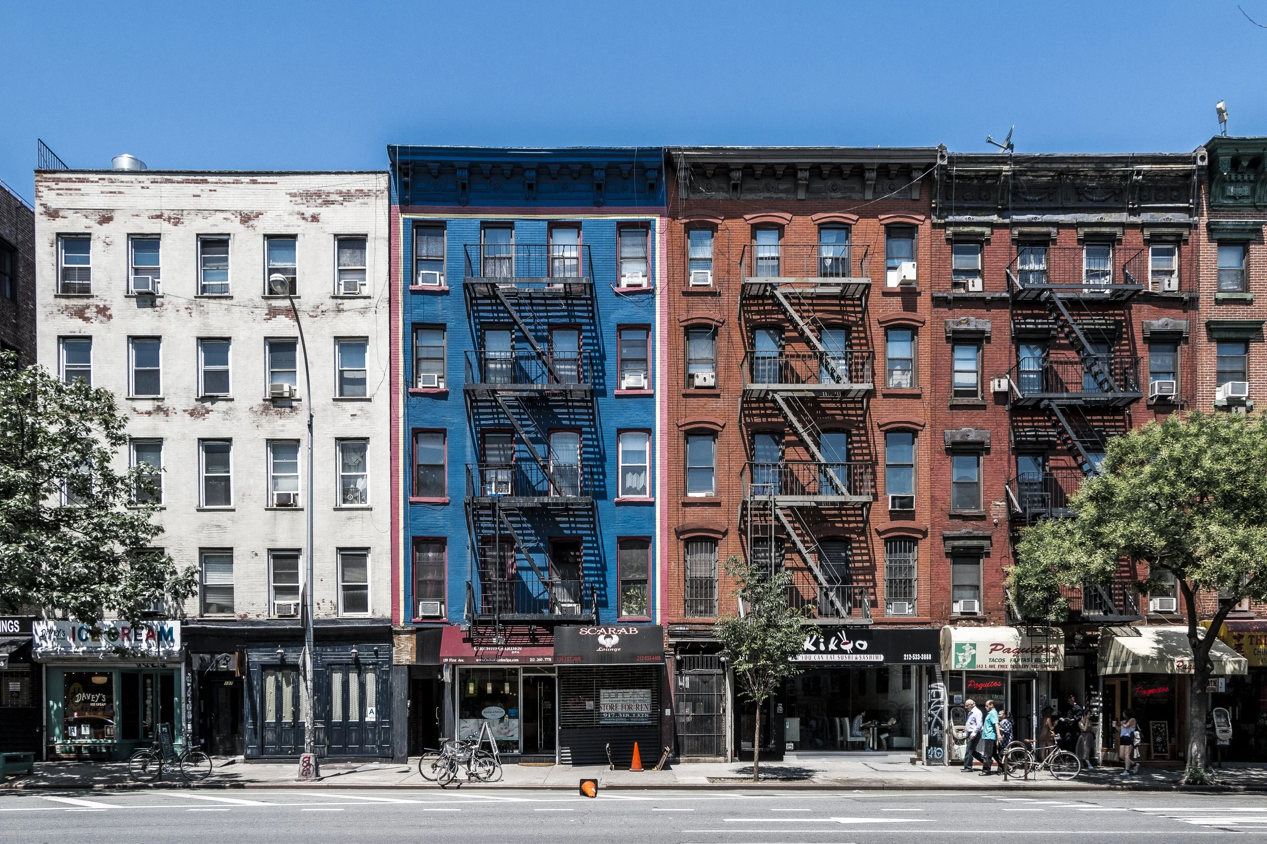
1st Avenue - Manhattan
First Avenue runs the full length of Manhattan’s East Side, a vital north–south artery stretching from Houston Street in the East Village northward through Midtown East, the Upper East Side, and East Harlem, before ending at the Harlem River Drive near 127th Street.
-

2nd Avenue - Manhattan
Second Avenue runs north–south along Manhattan’s East Side, stretching from Houston Street in the East Village to Harlem River Drive at 128th Street, tracing a near-continuous line through some of the island’s most storied neighborhoods: the East Village, Kips Bay, Murray Hill, Turtle Bay, Midtown East, the Upper East Side, and East Harlem.
-

3rd Avenue - Manhattan
Third Avenue is one of Manhattan’s longest and most emblematic north–south arteries, extending from Cooper Square at Astor Place in the East Village to the Harlem River at 129th Street, tracing the eastern spine of the island through nearly every major phase of its development.
-
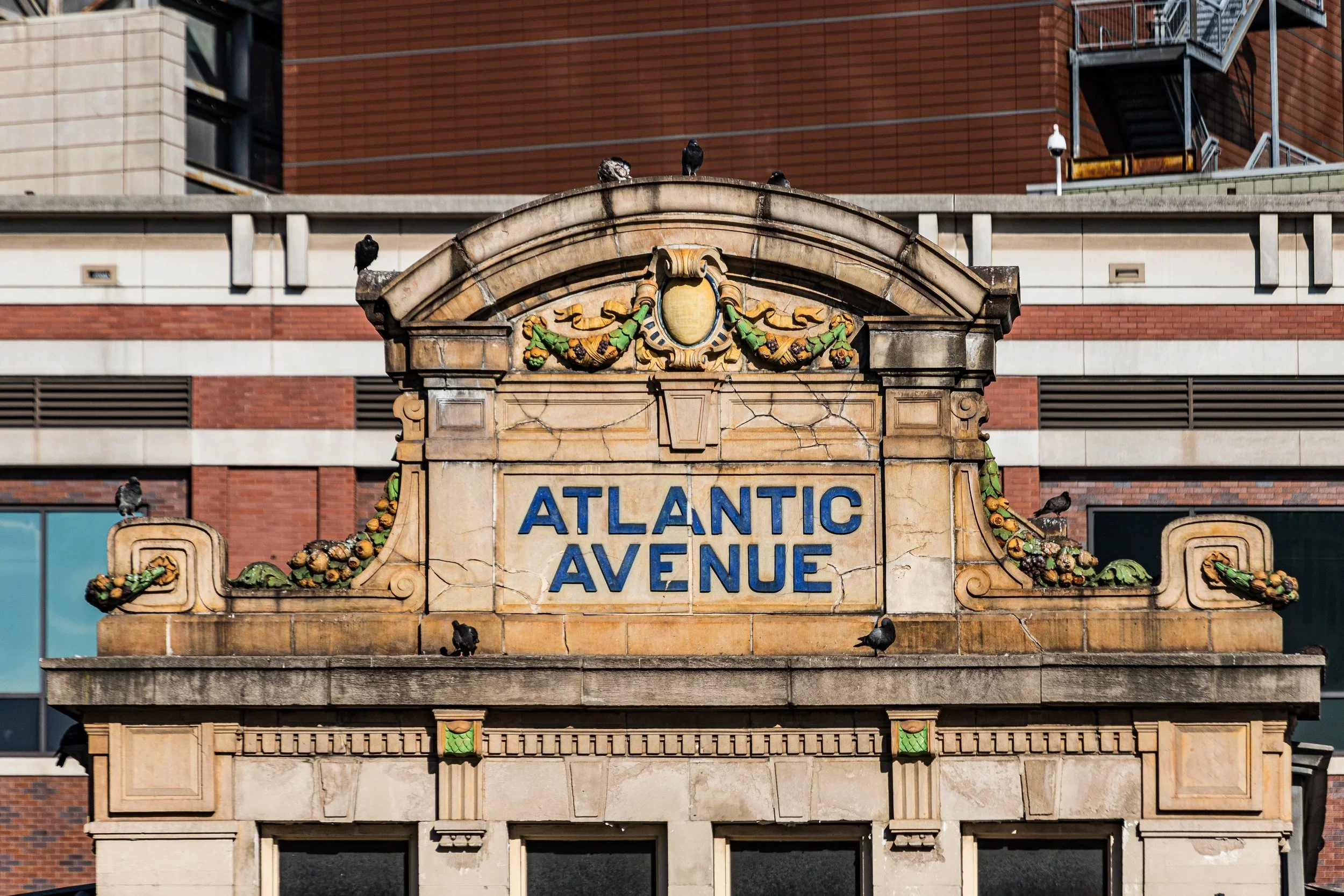
Atlantic Avenue - Brooklyn-Queens
Description goes hereAtlantic Avenue is one of New York City’s oldest and most storied thoroughfares—a 10-mile artery that cuts a straight and symbolic line across Brooklyn and Queens, from the Brooklyn waterfront at the East River to the Van Wyck Expressway near Jamaica, where it continues eastward toward Long Island.
-
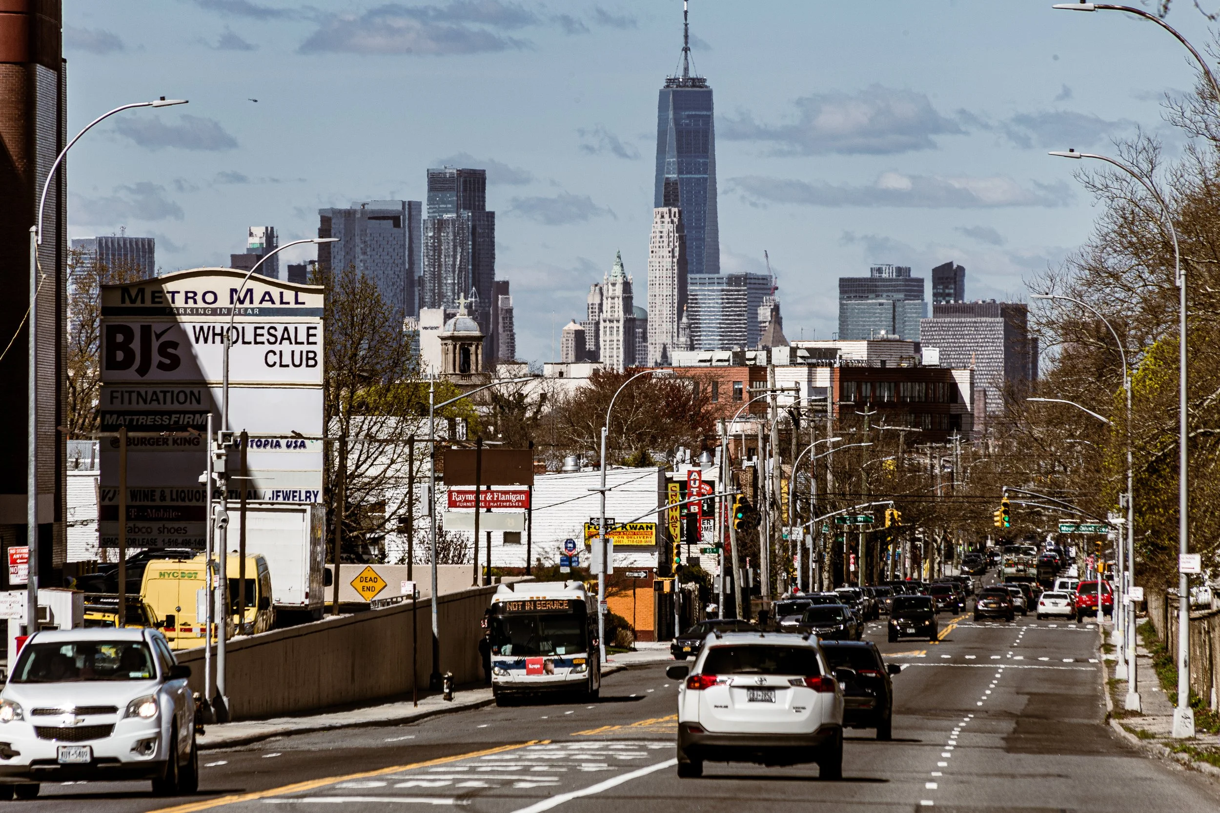
Metropolitan Avenue - Brooklyn-Queens
Atlantic Avenue is one of New York City’s oldest and most storied thoroughfares—a 10-mile artery that cuts a straight and symbolic line across Brooklyn and Queens, from the Brooklyn waterfront at the East River to the Van Wyck Expressway near Jamaica, where it continues eastward toward Long Island.
-
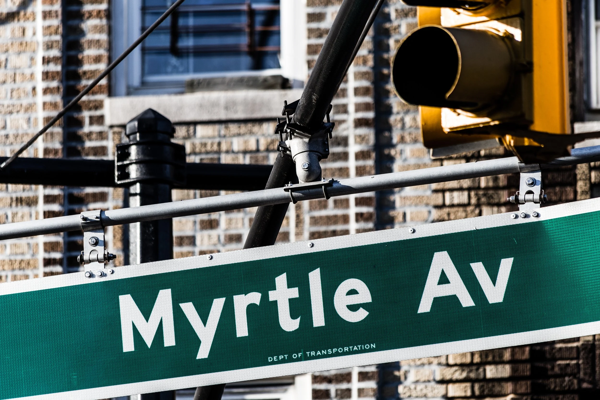
Myrtle Avenue - Brooklyn & Queens
Myrtle Avenue runs through the heart of Brooklyn and western Queens—an east–west spine nearly 8 miles long, from the Brooklyn waterfront in DUMBO to Jamaica Avenue in Richmond Hill. Beginning near Jay Street and Flatbush Avenue Extension, it travels eastward through Fort Greene, Clinton Hill, Bedford-Stuyvesant, Bushwick, and Ridgewood, before crossing into Glendale and Richmond Hill, Queens.
CityChroniclesNYC
-
The Streets
The streets of New York form the living framework of the city — a network of energy and intention carved through centuries of movement. They are the city’s arteries, drawing millions through their corridors each day; a language of pavement and pattern that speaks of order and chaos in equal measure.
-
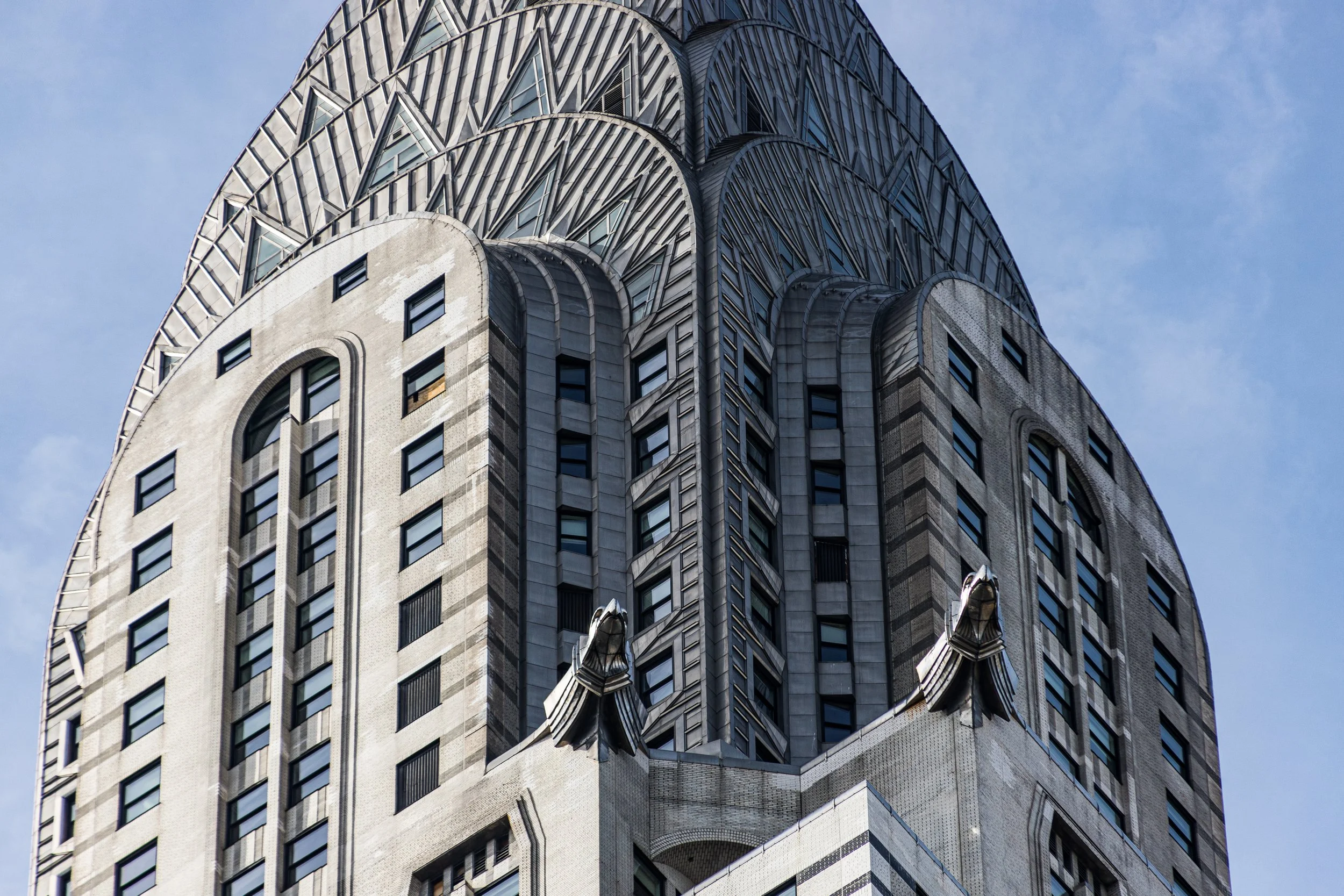
The Landmarks
The landmarks of New York are its great signatures — the visible testament to ambition and endurance written across stone, steel, and sky. From the Statue of Liberty’s raised torch to the Gothic crown of the Woolworth Building, from Grand Central’s constellations to the towering planes of the Empire State, each landmark embodies a chapter of the city’s identity.
-
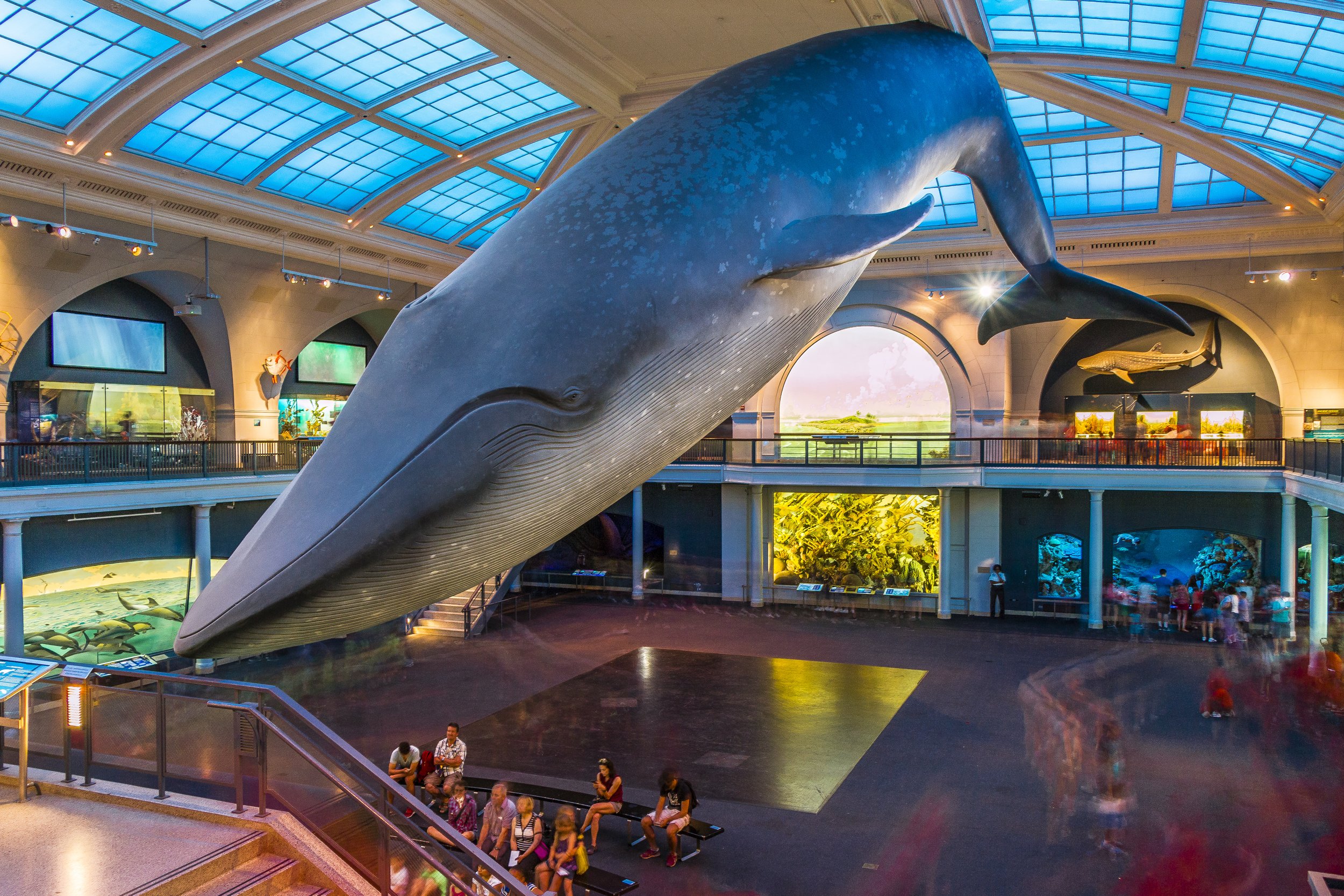
The Exhibitions
Few cities have turned creativity into civic identity quite like New York. From the marble halls of The Met and the Cloisters to the experimental pavilions of MoMA PS1, from the sculptural quiet of Little Island to the open canvases of its murals and parks, the city exists as a gallery in perpetual renewal.
-
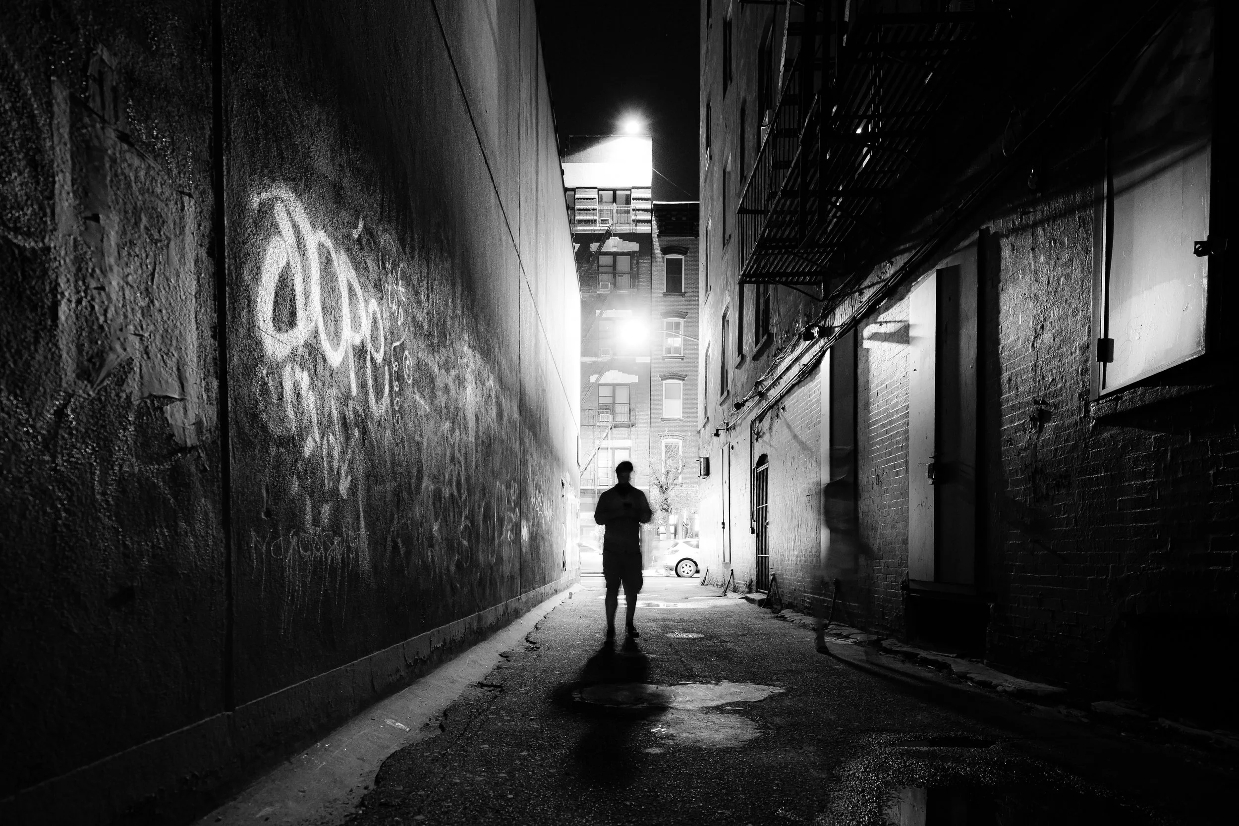
The Visions
There are as many New Yorks as there are moments of light. Seen through rain or reflection, in twilight haze or midnight flare, the city remakes itself in every frame. Visions of New York captures those transformations — the fleeting alignments of architecture, weather, and mood that define how the city feels.
-
The Explorations
Every photograph begins with a walk — and every walk through New York is a journey through both city and self. Explorations of New York is the ongoing record of those days: a chronicle of routes taken, bridges crossed, seasons observed, and stories found at street level.
-
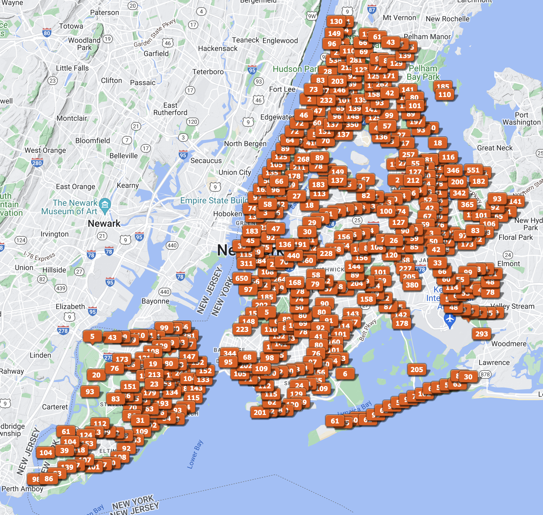
The Cartographies
Every act of mapping is an act of understanding. Cartographies of New York gathers the city’s form as both geography and imagination — a portrait drawn in lines, borders, and waterways. These maps are not mere diagrams; they are interpretations of space, attempts to make visible the patterns beneath the metropolis.
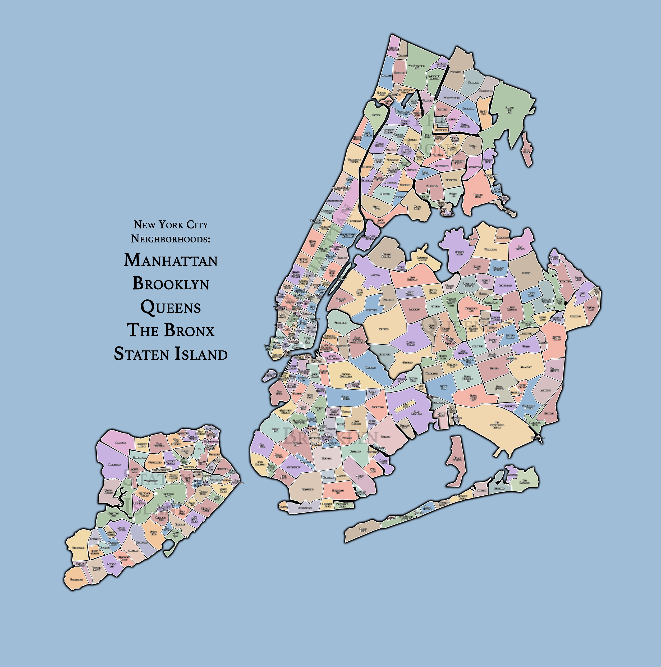
New York City
Use this custom Google map to explore where every neighborhood in all five boroughs of New York City is located.
The Five Boroughs
One of New York City’s unique qualities is its organization in to 5 boroughs: Manhattan, Brooklyn, Queens, The Bronx, and Staten Island. These boroughs are part pragmatic administrative districts, and part vestiges of the region’s past. Each borough is an entire county in New York State - in fact, Brooklyn is, officially, Kings County, while Staten Island is, officially Richmond County. But that’s not the whole story …
Initially, New York City was located on the southern tip of Manhattan (now the Financial District) that was once the Dutch colony of New Amsterdam. Across the East River, another city was rising: Brooklyn. In time, the city planners realized that unification between the rapidly rising cities would create commercial and industrial opportunities - through streamlined administration of the region.
So powerful was the pull of unification between New York and Brooklyn that three more counties were pulled into the unification: The Bronx, Queens, and Staten Island. And on January 1, 1898, the City of New York unified two cities and three counties into one Greater City of New York - containing the five boroughs we know today.
But because each borough developed differently and distinctly until unification, their neighborhoods likewise uniquely developed. Today, there are nearly 390 neighborhoods, each with their own histories, cultures, cuisines, and personalities - and each with residents who are fiercely proud of their corner of The Big Apple.
