
LATOURETTE PARK
Staten Island
Geographic Setting
LaTourette Park, also known as LaTourette Park and Golf Course, spans over 800 acres in the geographical heart of Staten Island, forming one of the central anchors of the Staten Island Greenbelt. The park is bounded roughly by Richmond Avenue to the west, Rockland Avenue to the north, Richmond Hill Road to the east, and Forest Hill Road and Richmond Road to the south. Nestled between the neighborhoods of Willowbrook, Heartland Village, Lighthouse Hill, and New Springville, the park lies within a landscape of rolling hills, wooded ravines, and open meadows that have defined Staten Island’s interior for centuries.
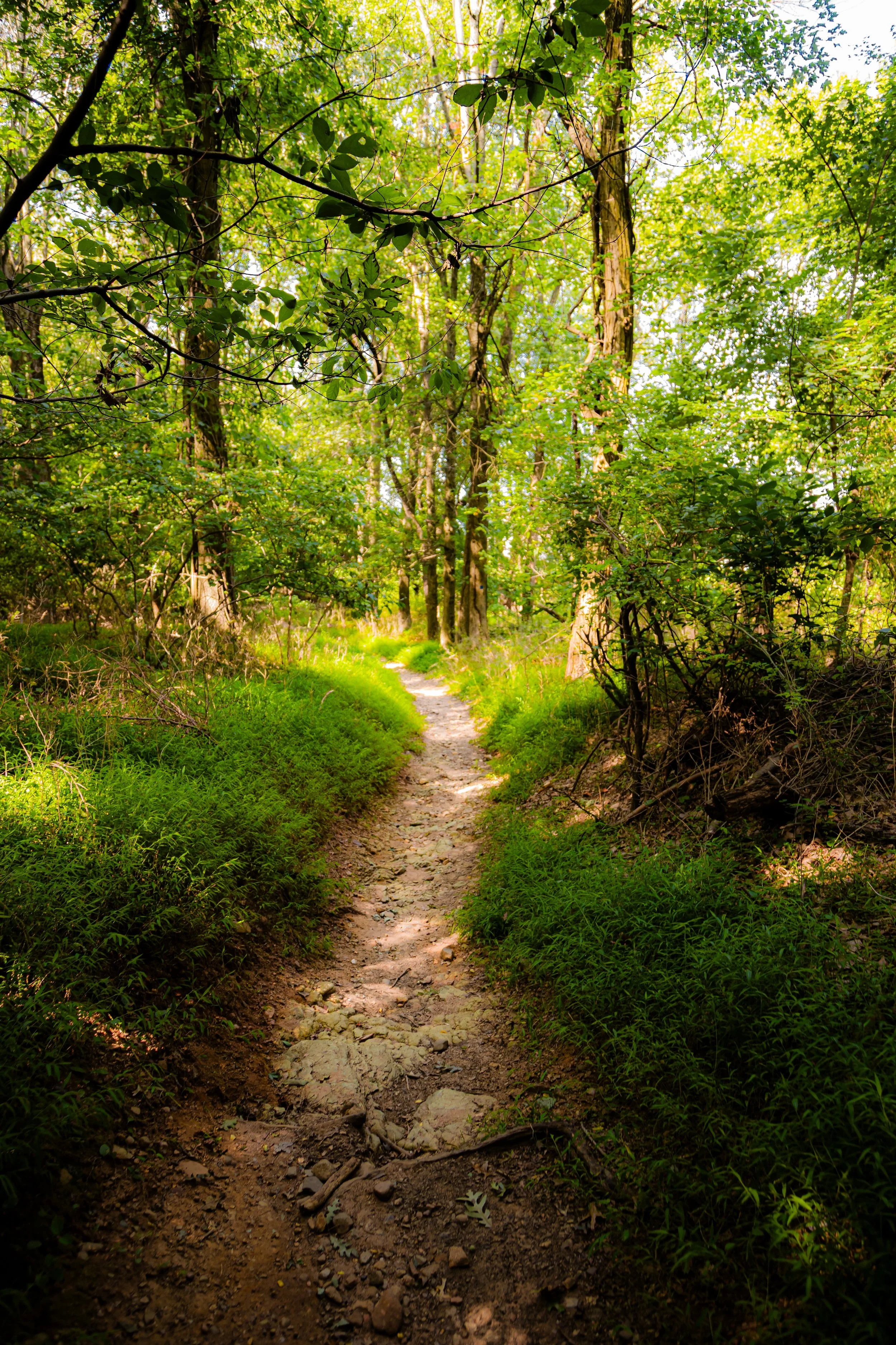
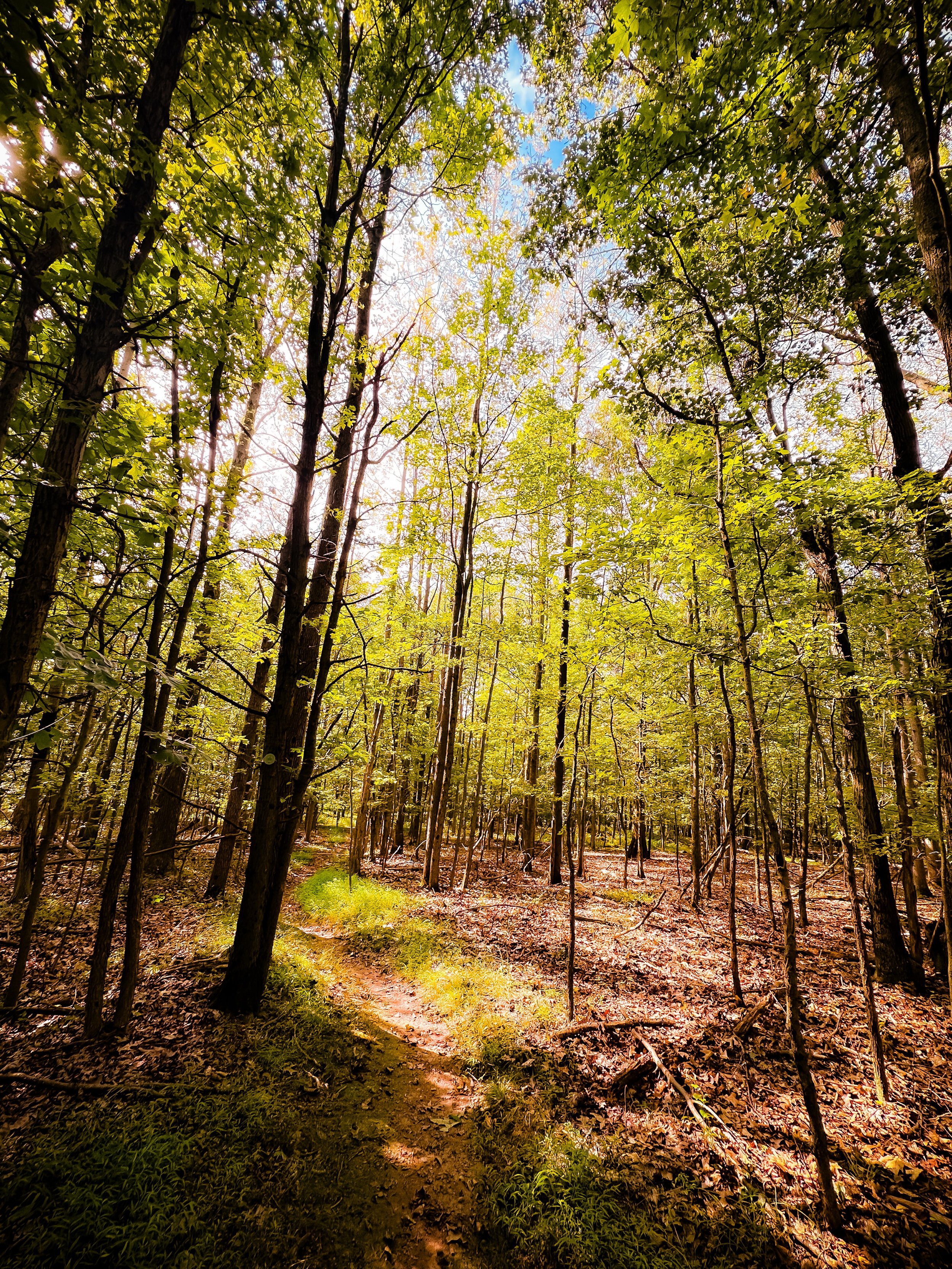
Its terrain rises and falls with glacial contours, blending dense forest canopies, freshwater streams, and wide grassy clearings. At its heart stands the historic LaTourette House, an 1830s stone farmhouse that now serves as the clubhouse for the public golf course—a pastoral centerpiece surrounded by one of New York City’s most ecologically diverse parklands. Together, the golf course, woodland trails, and restored wetlands form a living synthesis of history, recreation, and conservation—a place where urban life gives way to the rhythms of the countryside.
Etymology
The park’s name honors the LaTourette family, French Huguenot settlers who arrived on Staten Island in the late 17th century and farmed the area for generations. Their estate, established in the early 1800s, once encompassed much of the land that now forms the park. The family name, derived from the French “la tourette” (meaning “small tower” or “little lookout”), fittingly evokes the site’s high, scenic ridges and commanding vistas.
When the City of New York acquired the property in the 1920s, the name LaTourette was preserved to commemorate the family’s agricultural heritage and their enduring influence on Staten Island’s rural identity. Today, it remains a rare example of a public park that retains both the name and footprint of a colonial-era farm estate.
The Neighborhood
Origins through the 19th Century: From Farmland to Estate
The land that became LaTourette Park began as part of the colonial agricultural patchwork that defined Staten Island’s central spine. Through the 18th and early 19th centuries, the LaTourette family farmed its rolling acres, cultivating wheat, corn, and hay, and raising livestock amid the meadows and forests. The estate’s centerpiece was the LaTourette House, built around 1836 by David and Ann LaTourette—a stately Greek Revival farmhouse constructed of native fieldstone.
The surrounding property reflected a self-sustaining agrarian world typical of Staten Island’s pre-industrial past. Family members tended orchards, operated sawmills along Richmond Creek, and sold produce to nearby communities such as Richmondtown and New Springville. The farm’s elevated location provided sweeping views across the island to the harbor and bay, earning it the reputation of one of Staten Island’s most picturesque estates.
By the late 19th century, as Staten Island’s population began to grow, the LaTourette farm remained a vestige of pastoral continuity—an emblem of the borough’s deep agricultural roots even as suburbanization advanced around it. The family’s long stewardship left an indelible mark on the landscape, preserving the open fields and woodland ridges that would later become the park’s defining features.
Early 20th Century: Park Creation and the City Beautiful Era
The transition from private farmland to public parkland occurred in 1928, when the City of New York purchased the LaTourette estate as part of a broader plan to expand Staten Island’s park system. The acquisition was championed by the Staten Island Chamber of Commerce and city officials who recognized the land’s potential for recreation and scenic preservation. The city’s intention was twofold: to create a municipal golf course that would rival those in the Bronx and Queens, and to safeguard Staten Island’s remaining open spaces amid rapid urban expansion.
By the early 1930s, the LaTourette Golf Course was constructed under the supervision of the New York City Department of Parks, with design input reflecting the rustic aesthetics of the era’s City Beautiful movement. The old farmhouse was repurposed as the clubhouse, while the rolling fields and meadows were sculpted into fairways that followed the land’s natural contours. The result was a course praised for its pastoral charm and integration with the surrounding landscape—more rural refuge than urban facility.
During the 1930s and 1940s, city planners, including Robert Moses, envisioned the area as part of a larger green network connecting Staten Island’s hills and waterways. This vision would later materialize as the Greenbelt, a continuous belt of preserved open space that included LaTourette, High Rock, Willowbrook, and Clove Lakes Parks. From its inception, LaTourette stood at the heart of that system—both geographically and symbolically.
Latourette Park Video Coming Soon
Mid–Late 20th Century: The Greenbelt and Environmental Awakening
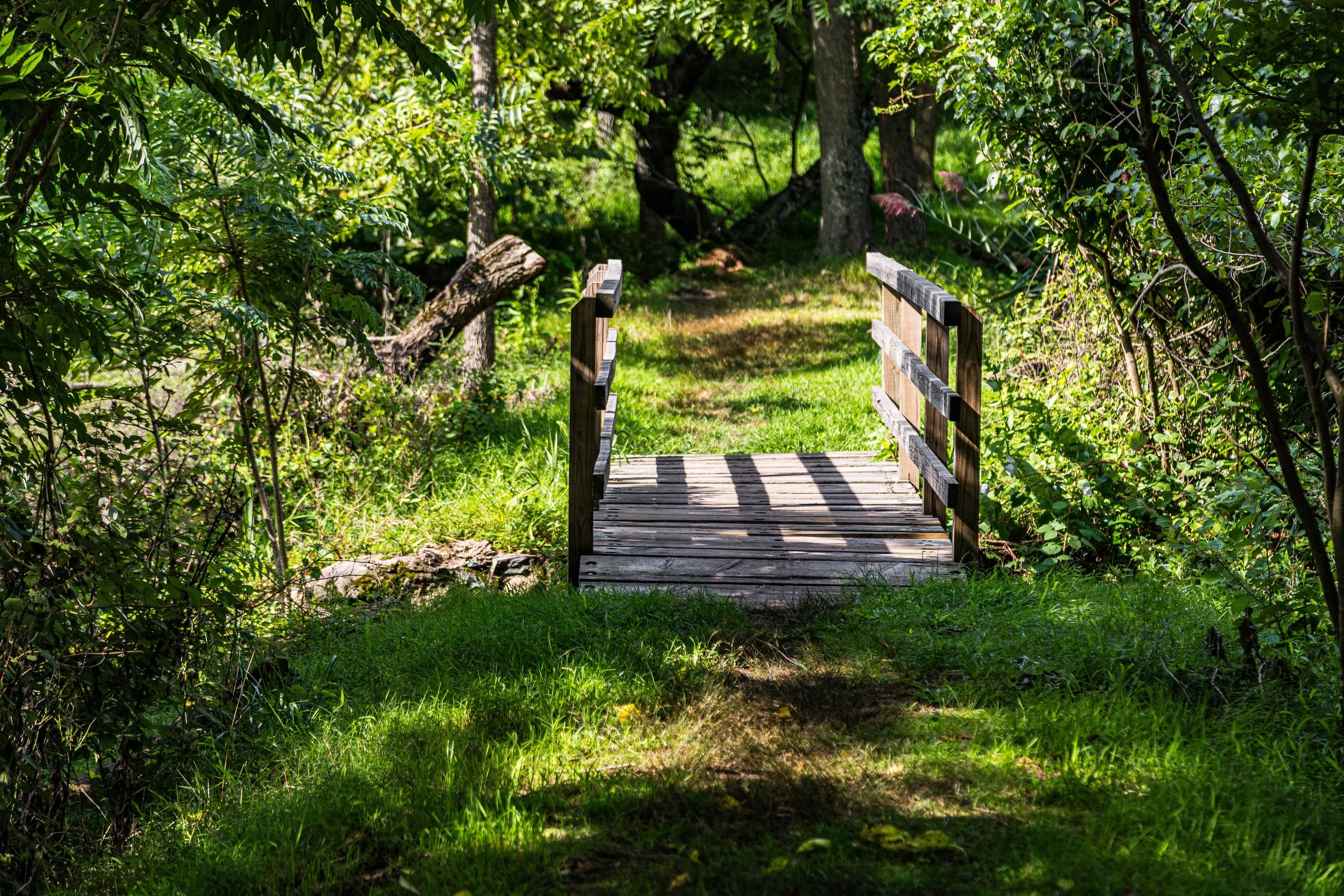
The mid-20th century saw LaTourette Park evolve into a dual-purpose landscape—part recreational complex, part conservation area. While the golf course remained popular with Staten Islanders, much of the park’s perimeter remained undeveloped forest, protecting vital watersheds feeding Richmond Creek and New Creek.
In the 1960s, as Staten Island experienced rapid suburbanization following the opening of the Verrazzano-Narrows Bridge, local conservationists grew concerned that the island’s interior green spaces would vanish. Their advocacy culminated in the creation of the Staten Island Greenbelt in the 1980s, a visionary project uniting LaTourette Park with neighboring natural areas under a shared mandate of preservation and recreation. LaTourette became both the geographic and ecological nucleus of this system—a place where woodland, meadow, and wetland converged in balance.
The park’s historic house, listed on the National Register of Historic Places in 1982, was restored to preserve its architectural integrity. Meanwhile, new trails were opened, linking LaTourette’s meadows to the Blue Trail, White Trail, and Yellow Trail systems that wind through the Greenbelt. These pathways connected generations of hikers, cyclists, and naturalists to the island’s interior, transforming LaTourette into a gateway for exploration and environmental education.
By the 1970s and 1980s, the park had become a beloved site for community events, nature walks, and the annual Greenbelt Pumpkin Festival, blending its historic identity with contemporary civic life. Through all this, the golf course remained in continuous operation—its greens framed by forest and history alike.
21st Century: Preservation, Recreation, and Ecology
In the 21st century, LaTourette Park remains a cornerstone of Staten Island’s environmental and cultural landscape. Managed collaboratively by the New York City Department of Parks & Recreation and the Greenbelt Conservancy, the park embodies the city’s ongoing commitment to sustainable land management and historic preservation.
Its diverse habitats now support a thriving array of wildlife: deer, foxes, red-tailed hawks, owls, and countless bird species frequent the woodlands and meadows. Seasonal blooms of goldenrod, milkweed, and wild asters fill the fields with color, while wetlands along Richmond Creek provide natural flood control and habitat for amphibians and waterfowl.
The LaTourette House, still functioning as the golf clubhouse, anchors the park’s historic identity, its fieldstone façade standing as a tangible link to Staten Island’s agrarian past. Modern additions—a pro shop, trailside signage, and interpretive programs—enhance the visitor experience while preserving the estate’s original charm.
In recent years, restoration projects have improved trail connectivity to neighboring sites such as Willowbrook Park, High Rock Park, and Blood Root Valley, allowing for uninterrupted journeys through the island’s interior wilderness. Educational initiatives, led by the Greenbelt Environmental Education Center, introduce students and visitors to the park’s ecology and history, reinforcing its role as both a recreational destination and living classroom.
Latourette Park Photo Gallery
Spirit and Legacy
The spirit of LaTourette Park is one of stewardship—of a land tended, preserved, and passed forward through generations. From its beginnings as a working farm to its present form as part of New York City’s largest continuous greenbelt, it embodies the enduring relationship between people and place.
Its legacy is written in both stone and soil: in the weathered farmhouse that recalls the labor of early settlers, in the fairways that flow like meadows, and in the forests that now reclaim what cultivation once tamed. Few parks in New York so completely integrate history, recreation, and natural beauty.
New York City
Use this custom Google map to explore where every neighborhood in all five boroughs of New York City is located.
The Five Boroughs
One of New York City’s unique qualities is its organization in to 5 boroughs: Manhattan, Brooklyn, Queens, The Bronx, and Staten Island. These boroughs are part pragmatic administrative districts, and part vestiges of the region’s past. Each borough is an entire county in New York State - in fact, Brooklyn is, officially, Kings County, while Staten Island is, officially Richmond County. But that’s not the whole story …
Initially, New York City was located on the southern tip of Manhattan (now the Financial District) that was once the Dutch colony of New Amsterdam. Across the East River, another city was rising: Brooklyn. In time, the city planners realized that unification between the rapidly rising cities would create commercial and industrial opportunities - through streamlined administration of the region.
So powerful was the pull of unification between New York and Brooklyn that three more counties were pulled into the unification: The Bronx, Queens, and Staten Island. And on January 1, 1898, the City of New York unified two cities and three counties into one Greater City of New York - containing the five boroughs we know today.
But because each borough developed differently and distinctly until unification, their neighborhoods likewise uniquely developed. Today, there are nearly 390 neighborhoods, each with their own histories, cultures, cuisines, and personalities - and each with residents who are fiercely proud of their corner of The Big Apple.


