SCHUYLERVILLE
The Bronx
Geographic Setting
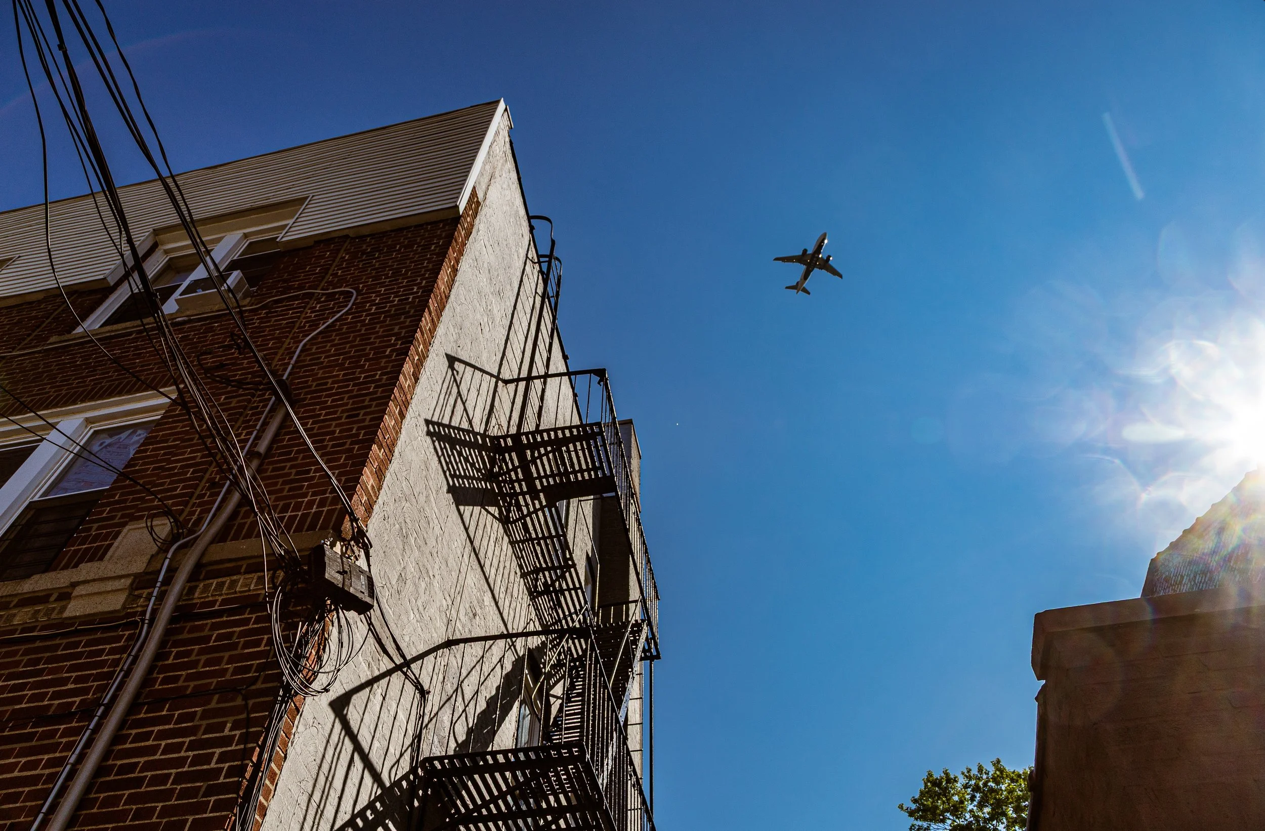
Bounded by Middletown Road to the north, the Bruckner Expressway to the east and southeast, and Westchester Creek to the west, Schuylerville occupies a compact but distinctive pocket in the East Bronx—an enclave that bridges the dense residential grid of Pelham Bay and Westchester Square with the water’s edge along Westchester Creek. The neighborhood sits on gentle, low-lying terrain just inland from the tidal estuaries that once defined much of the southeastern Bronx coastline, and its layout—tight-knit blocks of brick homes and narrow cross streets—reflects both its working-class origins and its enduring sense of stability.
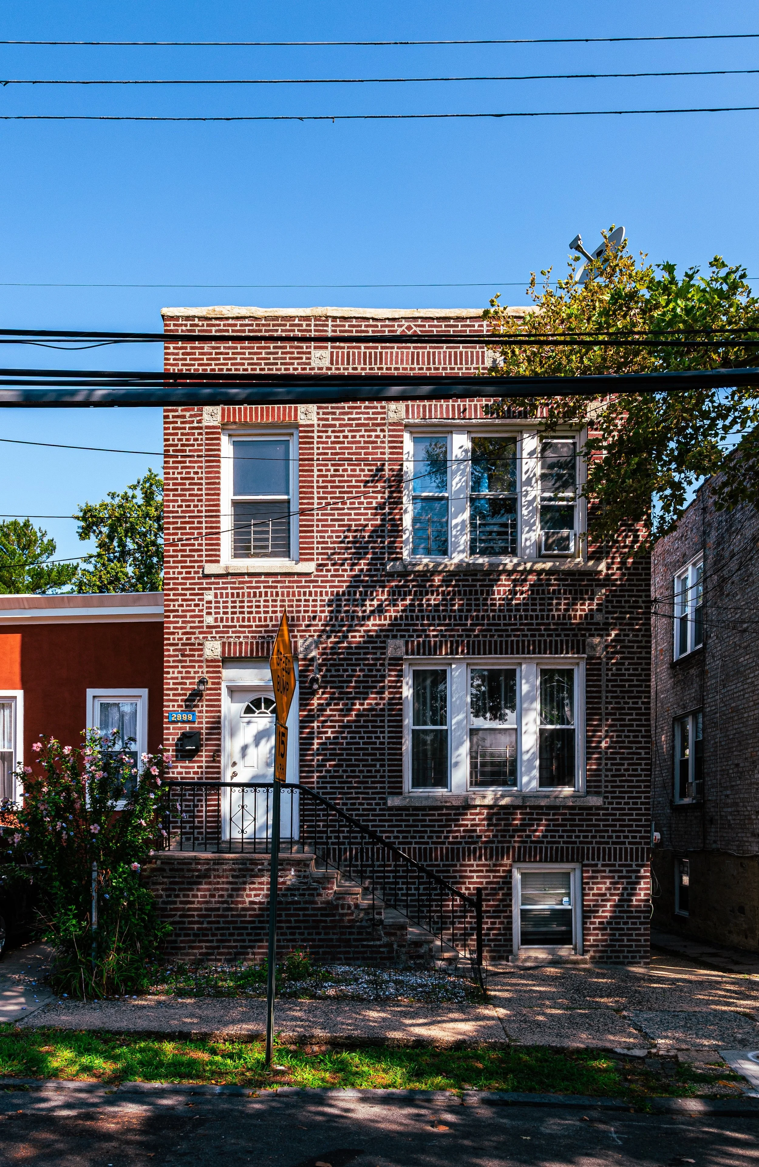
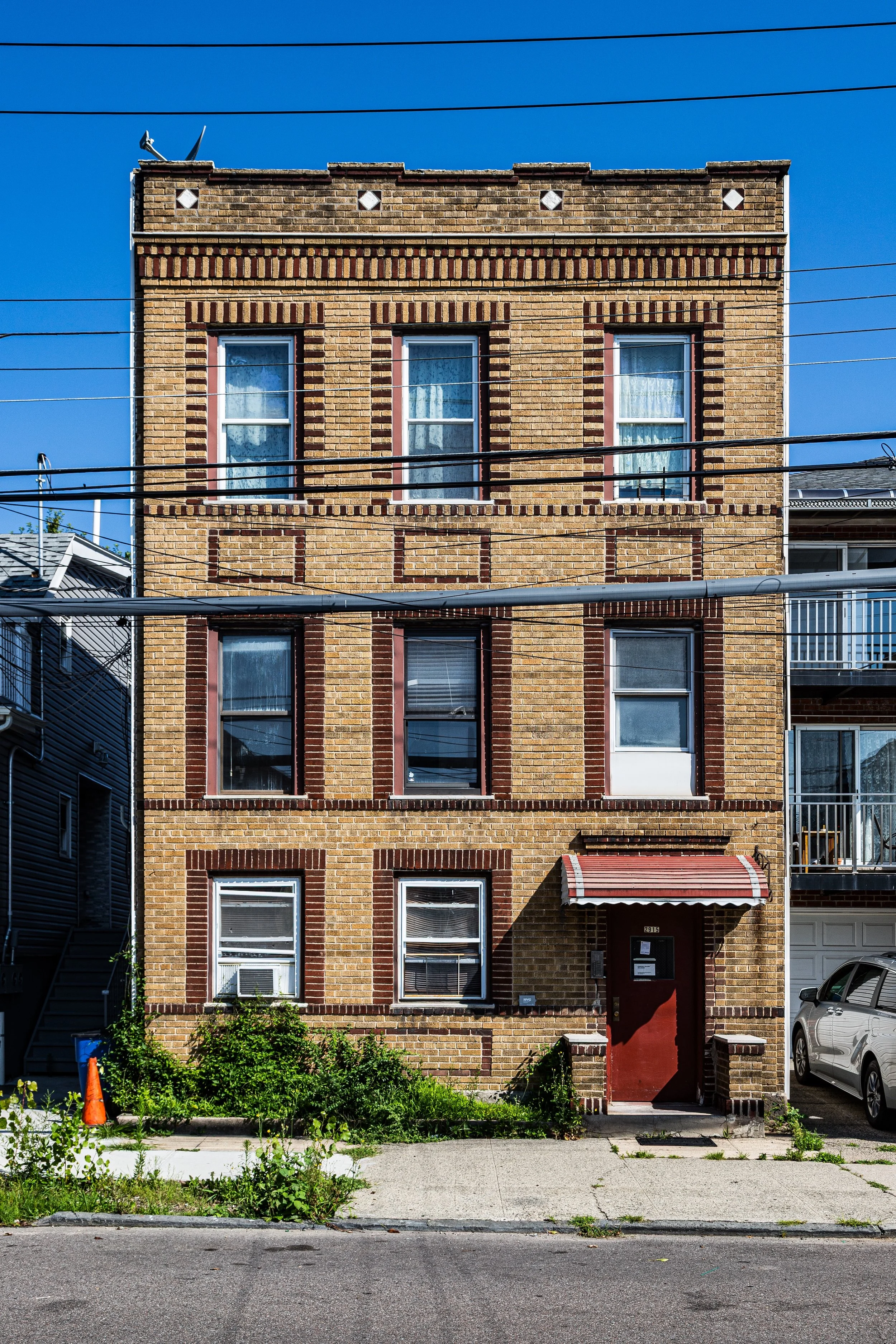
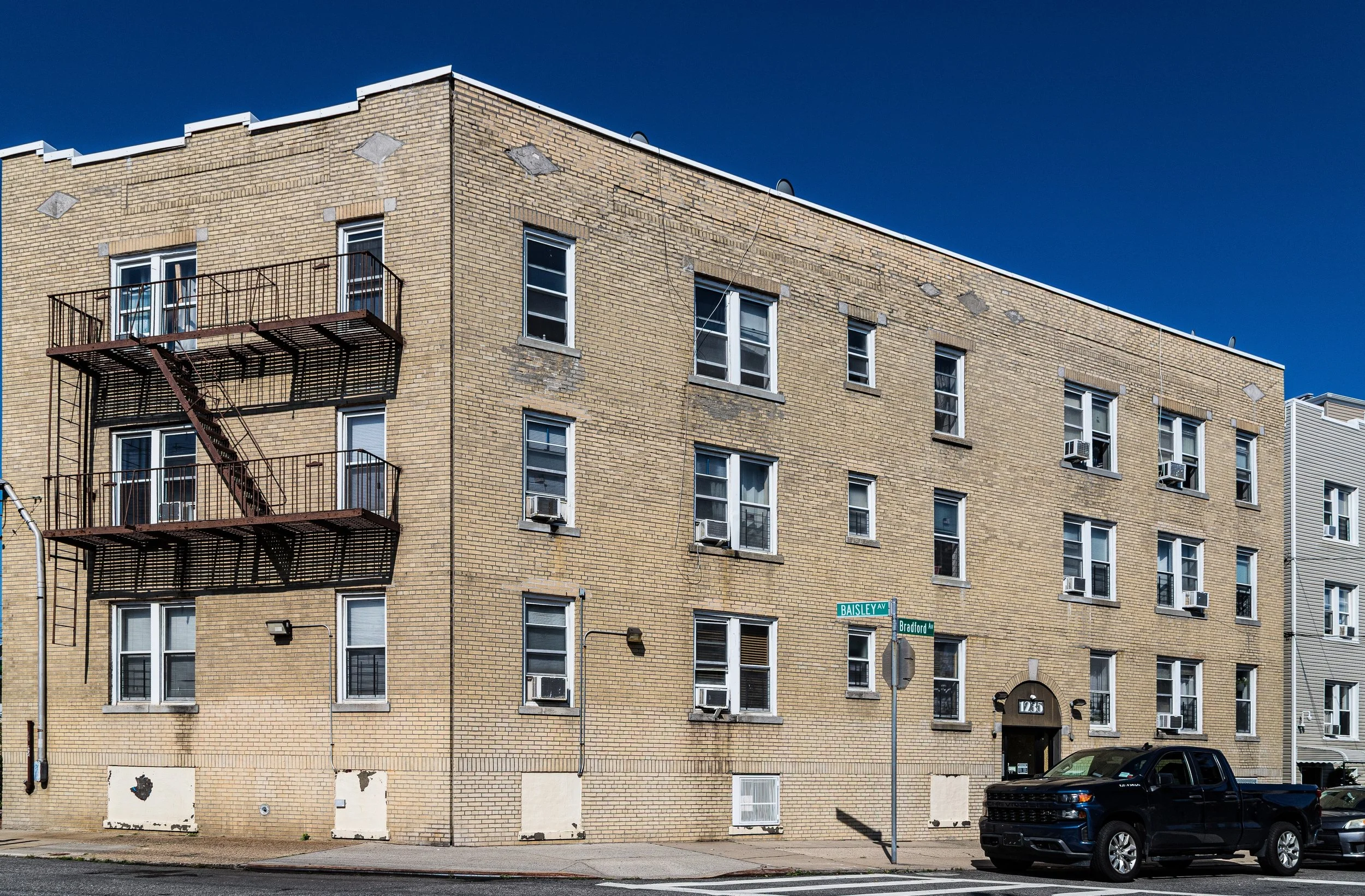
Schuylerville’s primary thoroughfares—Buhre Avenue, Robbins Avenue, and Philip Avenue—connect its residential core to the commercial life of Westchester Avenue and Middletown Road, while the Bruckner Expressway and Crosby Avenue form its major arterial boundaries. Architecturally, the neighborhood is dominated by 1920s–1950s rowhouses, semi-attached two-family homes, and modest apartment houses, many with small front gardens and porches that testify to its early suburban ambitions. The proximity of Westchester Creek, once lined with boatyards and docks, lends a subtle maritime atmosphere, while the presence of Schuylerville Park, St. Raymond’s Cemetery, and the Throgs Neck shopping corridor to the east reinforces the area’s blend of residential calm and urban accessibility.
Though surrounded by major highways and bustling commercial zones, Schuylerville retains a small-town texture—quiet, close-knit, and self-sustaining—rooted in generations of families who have called this bend of the Bronx home for more than a century.
Etymology
The name “Schuylerville” dates to the early 20th century and honors the Schuyler family, one of the Bronx’s most prominent colonial landowning dynasties. Descended from Philip Pieterse Schuyler, a 17th-century Dutch settler and fur trader, the Schuylers established extensive estates throughout what was then the Town of Westchester. Their holdings along Westchester Creek, known as “The Schuyler Patent,” encompassed much of the land that would later become Schuylerville, Throgs Neck, and the surrounding area.
By naming the neighborhood “Schuylerville,” early developers sought to evoke a sense of history and prestige—connecting the newly platted residential district to the colonial lineage of one of New York’s founding families. The Schuyler family’s riverside manor, long vanished but once located near the mouth of Westchester Creek, remains a symbolic touchstone for the area’s identity, linking its modern homes and tidy blocks to the city’s earliest era of European settlement.
The Neighborhood
Origins through the 19th Century
In the 18th and 19th centuries, the land that would become Schuylerville formed part of a network of farms and estates lining Westchester Creek, a tidal inlet that served as a commercial artery between the East River and the inland settlements of Westchester. The Schuyler family, followed by subsequent generations of local farmers and shipwrights, utilized the creek’s sheltered waters for milling, shellfishing, and small-scale shipping. The area remained pastoral for much of the century, its landscape defined by open meadows, orchards, and scattered homesteads along what would later become Buhre Avenue and Middletown Road.
The annexation of the eastern Bronx in 1895 marked the beginning of its transformation. Improved infrastructure—particularly the extension of Westchester Avenue, new bridges across the creek, and the expansion of the Interborough Rapid Transit (IRT) line—brought development pressure to the once-isolated farmland. By the dawn of the 20th century, the Schuyler family’s former holdings were subdivided and sold to developers eager to create suburban-style housing tracts for New Yorkers seeking affordable ownership outside Manhattan.
Early 20th Century: A Suburban Ideal
Between 1910 and 1940, Schuylerville emerged as a planned residential enclave within the expanding Bronx. Its builders marketed it as a “modern village near the bay”—a peaceful alternative to the crowded city core. Streets were laid out in a fine grid, and the neighborhood filled quickly with brick two-family houses, bungalows, and low-rise apartment buildings, many still standing today.
The construction of the Pelham Bay IRT line (6 train), with nearby stations at Westchester Square and Buhre Avenue, made daily commuting practical, while the new Bruckner Boulevard provided automotive access to Manhattan. Churches such as St. Raymond’s Parish, founded in the late 19th century, served as community anchors for the predominantly Italian-American and Irish-American families who settled here during the interwar years.
Local businesses—bakeries, butcher shops, and hardware stores—lined Middletown Road and Westchester Avenue, creating a self-contained economy where nearly everything a resident needed could be found within a few blocks. The neighborhood’s modest homes, many with private yards and porches, embodied the promise of the middle-class Bronx: ownership, order, and proximity to both parkland and the waterfront.
Schuylerville Video Coming Soon
Mid–Late 20th Century: Continuity Amid Change
The postwar decades reinforced Schuylerville’s reputation as a stable, middle-class enclave. Returning veterans in the 1940s and 1950s found affordable homes here, and the neighborhood maintained one of the Bronx’s highest rates of homeownership. The construction of the Bruckner Expressway (1961–72) reshaped its eastern edge, physically separating Schuylerville from neighboring Throgs Neck but also insulating it from heavier industrial traffic.
Throughout the 1960s–1980s, as many Bronx districts faced arson and disinvestment, Schuylerville remained largely intact. Its strong social institutions—particularly St. Raymond’s Church, Villa Maria Academy, and the numerous civic clubs and block associations—anchored the community through turbulent decades. The population diversified gradually, as new Puerto Rican, Irish, and Jewish families joined long-established Italian households.
Even as the nearby Westchester Creek grew more industrialized, efforts by local groups kept the surrounding residential streets clean and orderly. By the 1990s, as citywide investment returned to the Bronx, Schuylerville’s property values rose steadily, reflecting its enduring appeal as a quiet, homeowner-driven neighborhood.
21st Century: Resilience, Renewal, and Neighborhood Pride
In the 21st century, Schuylerville has entered a period of renewal while preserving its historic identity. The neighborhood remains predominantly low-rise and residential, with recent infill construction complementing the existing stock of midcentury homes. New families—Albanian, Dominican, South Asian, and African-American—have joined the community, bringing fresh energy to its long-established institutions while maintaining its character of mutual respect and neighborliness.
The Bruckner Plaza and nearby Crosby Avenue corridors provide shopping and dining options, while ongoing efforts to restore sections of the Westchester Creek shoreline have reawakened awareness of the neighborhood’s maritime heritage. The 6 train continues to link residents to Manhattan within forty minutes, preserving the very commuter convenience that first gave rise to the community a century ago.
Community events, block beautification projects, and active civic organizations underscore the district’s deep local pride. Despite its proximity to major highways, Schuylerville retains an atmosphere of quiet order—a Bronx neighborhood that still feels like a small town.
Schuylerville Photo Gallery
Spirit and Legacy
The spirit of Schuylerville rests in its constancy and care. Generations have maintained its modest homes and leafy blocks with pride, nurturing a sense of belonging that transcends time and demographic change. Here, the Bronx’s history of ambition and adaptation is distilled into everyday life: a blend of tradition, diversity, and hard-earned stability.
New York City
Use this custom Google map to explore where every neighborhood in all five boroughs of New York City is located.
The Five Boroughs
One of New York City’s unique qualities is its organization in to 5 boroughs: Manhattan, Brooklyn, Queens, The Bronx, and Staten Island. These boroughs are part pragmatic administrative districts, and part vestiges of the region’s past. Each borough is an entire county in New York State - in fact, Brooklyn is, officially, Kings County, while Staten Island is, officially Richmond County. But that’s not the whole story …
Initially, New York City was located on the southern tip of Manhattan (now the Financial District) that was once the Dutch colony of New Amsterdam. Across the East River, another city was rising: Brooklyn. In time, the city planners realized that unification between the rapidly rising cities would create commercial and industrial opportunities - through streamlined administration of the region.
So powerful was the pull of unification between New York and Brooklyn that three more counties were pulled into the unification: The Bronx, Queens, and Staten Island. And on January 1, 1898, the City of New York unified two cities and three counties into one Greater City of New York - containing the five boroughs we know today.
But because each borough developed differently and distinctly until unification, their neighborhoods likewise uniquely developed. Today, there are nearly 390 neighborhoods, each with their own histories, cultures, cuisines, and personalities - and each with residents who are fiercely proud of their corner of The Big Apple.


