BATH BEACH
Brooklyn
Geographic Setting
Bounded by Gravesend Bay to the south and 86th Street to the north, and extending from Bay Parkway westward to Bay 8th Street and 14th Avenue, Bath Beach occupies a serene coastal swath of southwestern Brooklyn—a neighborhood defined by its broad horizons, maritime breezes, and quiet residential rhythm. Nestled between Bensonhurst to the northeast and Dyker Beach Park to the west, Bath Beach sits at the meeting point of land and sea, where the grid of Brooklyn meets the open water of Lower New York Bay.
The shoreline—once a popular bathing resort and now lined by the Shore Parkway and the Belt Parkway Promenade—offers sweeping views toward Staten Island and the Verrazzano-Narrows Bridge, whose western arch anchors the skyline. Inland, a pattern of low-rise homes, brick rowhouses, and small apartment buildings gives Bath Beach a village-like scale. Cropsey Avenue, Bath Avenue, and Bay 16th–20th Streets form its internal arteries, carrying the neighborhood’s unhurried pulse through tree-lined streets that still evoke traces of its seaside origins.
Etymology and Origins
The name “Bath Beach” dates to the mid-19th century and reflects the Victorian fascination with seaside leisure. The term “Bath” was borrowed from the famed English spa town of Bath, Somerset, signaling refinement and recreation. Local developer B. J. Osborne, who purchased farmland here in the 1850s, sought to establish a genteel seaside colony—complete with bathing facilities and villas—along the shores of Gravesend Bay.
The area’s earliest history, however, predates this resort vision. It was originally part of the Town of New Utrecht, settled in the 1650s by Dutch farmers who cultivated its fertile shoreline meadows. By the early 1800s, it formed part of the Benson and Cropsey estates, whose names remain embedded in the local street grid. The arrival of the Brooklyn, Bath and Coney Island Railroad (1862)—one of the borough’s first passenger lines—gave the district both its name and its future, connecting the tranquil bayfront to the growing metropolis.
The Neighborhood
19th Century: Seaside Resort and Suburban Promise
In the 1860s–1880s, Bath Beach emerged as a fashionable summer destination for middle-class New Yorkers seeking coastal air without the crowds of Coney Island. Developers built wooden hotels, cottages, and bathhouses along the shore, accessible by rail and carriage from the Brooklyn ferry terminals. The Bath Beach Hotel, with its long piazzas overlooking the bay, became the centerpiece of this resort colony, attracting visitors who strolled the shore and dined on seafood hauled directly from nearby docks.
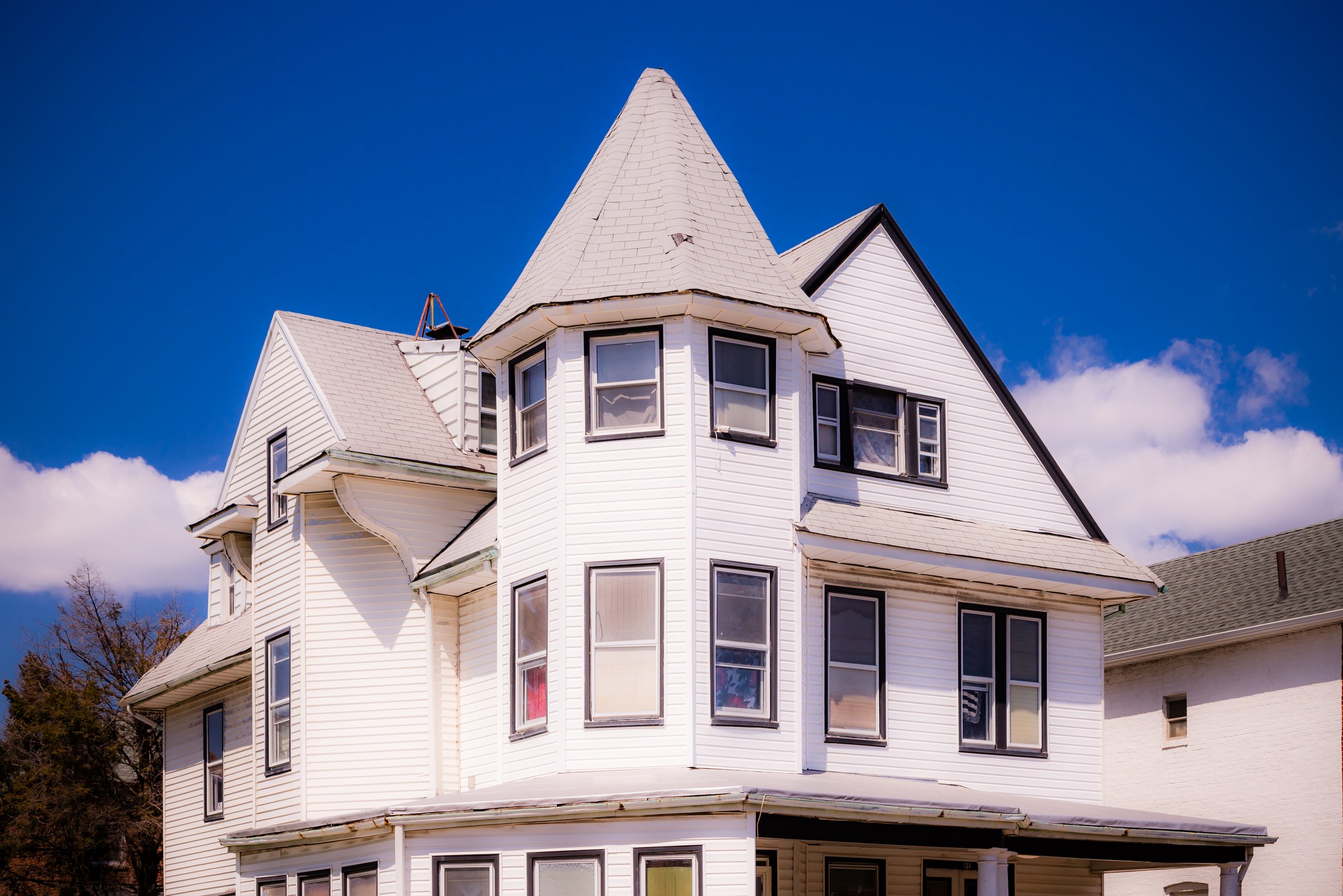
The neighborhood’s layout followed a grid of generous avenues—Bath Avenue, Cropsey Avenue, and Bay 16th–22nd Streets—that still define its structure today. Early advertisements promoted “a healthful retreat by the sea” where one might “bathe, boat, and breathe the salt air within sight of the Narrows.” Villas and small summer homes dotted the landscape, many later converted into year-round residences as the city expanded southward.
By the 1890s, Bath Beach was being absorbed into Greater Brooklyn’s growing suburban fabric. With the consolidation of Brooklyn into New York City in 1898, the area lost its resort exclusivity but gained the infrastructure—paved streets, sewers, trolleys—that would enable its transformation into a permanent neighborhood.
Early 20th Century: Immigrant Settlement and Domestic Stability
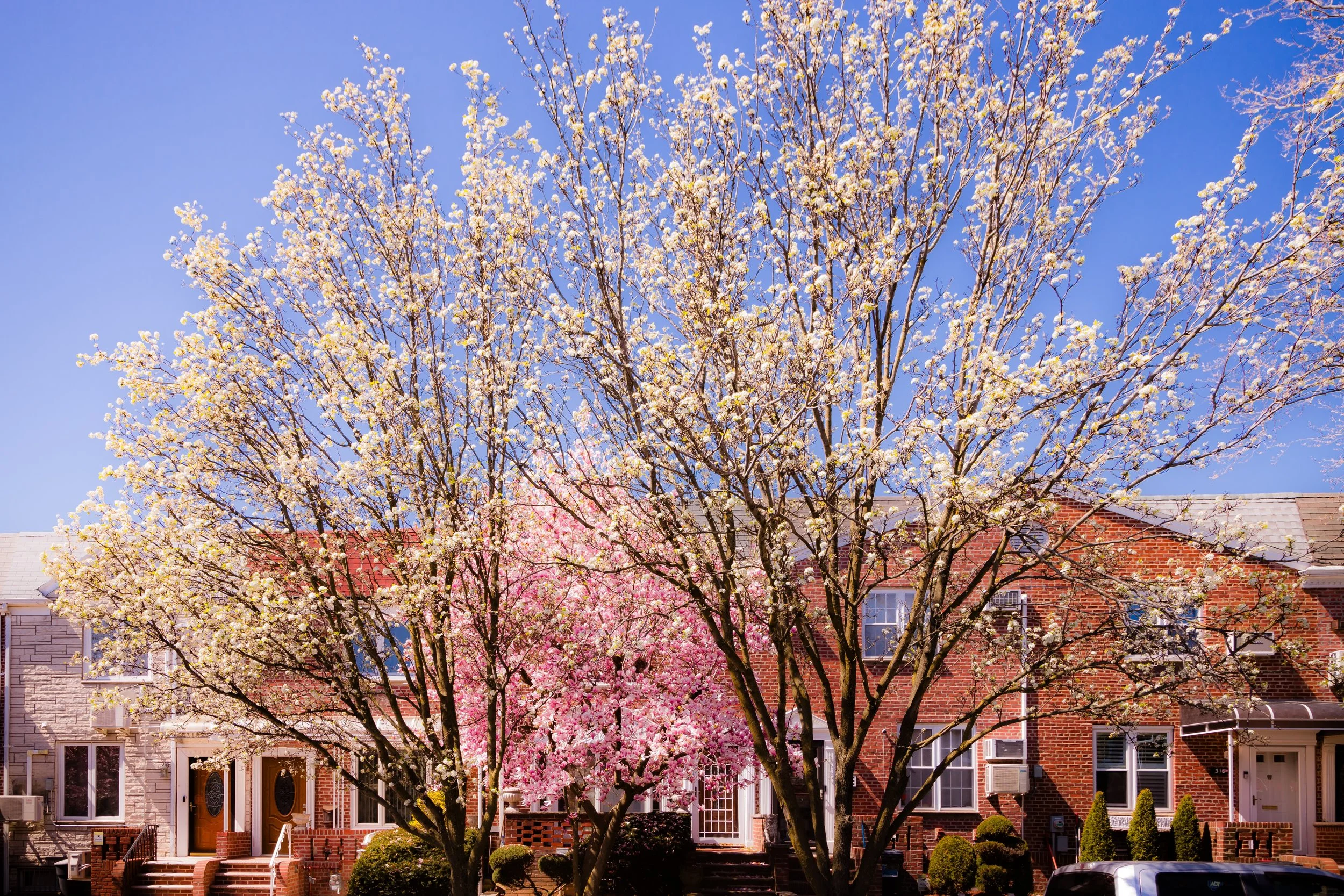
The first decades of the 20th century saw Bath Beach shift decisively from resort to residential enclave. Italian immigrants from Bensonhurst and Bay Ridge began settling here, joined by Jewish families relocating from Lower Manhattan and Brownsville. The neighborhood’s modest rowhouses, attached brick homes, and small apartment buildings reflected the aspirations of these new arrivals: ownership, stability, and proximity to both city and sea.
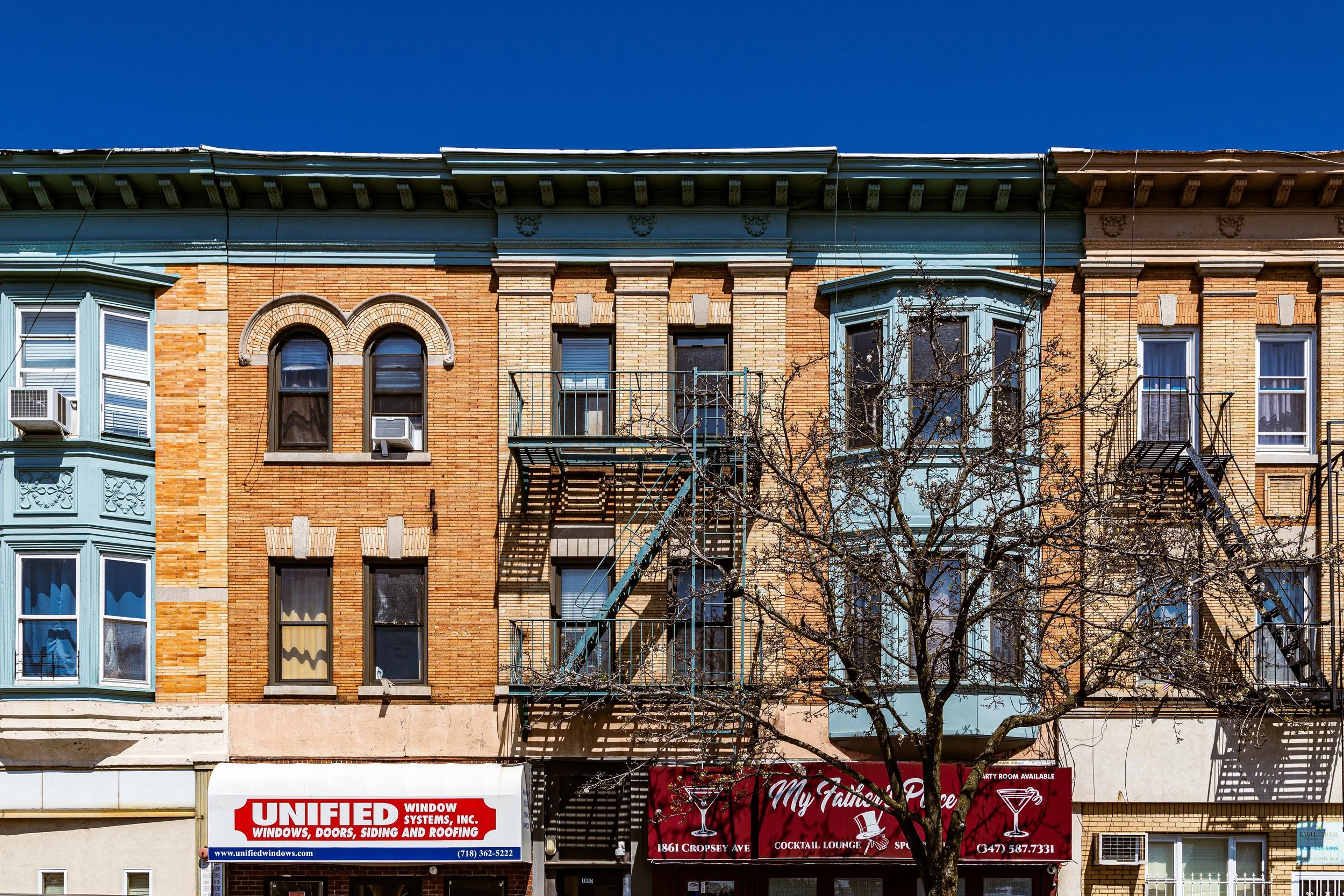
The BMT West End Line (D train), running along New Utrecht Avenue, and the Bensonhurst trolley lines provided convenient access to employment centers, while Bath Beach retained a self-contained, small-town atmosphere. Churches such as St. Finbar’s Roman Catholic Church (est. 1880s) and synagogues like Temple Beth El anchored community life. Corner grocers, barbers, and bakeries—often run by families for generations—lined Bath Avenue and 86th Street, fostering a deeply local economy.
During the 1930s, construction of the Belt Parkway and its accompanying Shore Parkway Promenade permanently altered the waterfront. Though the open beach gave way to highway embankments, the new promenade offered public access and panoramic views, preserving the district’s maritime spirit even as its shoreline became more urbanized.

Bath Beach Photographic Video
Mid–Late 20th Century: Continuity Through Change
Through the 1950s–1980s, Bath Beach remained a remarkably stable, middle-class enclave—one of Brooklyn’s quiet success stories. Postwar prosperity brought new apartment buildings along Bay Parkway and Cropsey Avenue, while many of the original 1920s homes were renovated by second-generation Italian-American families. Despite citywide demographic shifts, Bath Beach retained a neighborly, almost suburban identity—its rhythms marked by block parties, school parades, and church festivals.
The Verrazzano-Narrows Bridge (opened 1964) transformed the horizon and linked Brooklyn to Staten Island, increasing traffic along the Belt Parkway but also opening new economic connections. In later decades, new waves of immigration—Chinese, Russian, Turkish, and Latino families—reshaped Bath Beach’s cultural landscape without erasing its social fabric. By the 1990s, Chinese and Uzbek bakeries joined Italian delis, and storefronts displayed signs in multiple languages—a vivid reflection of Brooklyn’s new cosmopolitanism rooted in old stability.
Local landmarks such as Shore Parkway Park, St. Finbar’s, and the playgrounds along Bay 20th Street continued to define daily life, maintaining a neighborhood rhythm where generations coexist and greet one another by name.
21st Century: Waterfront Renewal and Cultural Mosaic
Today, Bath Beach stands as one of Brooklyn’s most quietly diverse neighborhoods. Along 86th Street, small businesses thrive—dumpling houses beside pizzerias, Orthodox bakeries near halal cafés—illustrating the coexistence that defines southern Brooklyn’s civic character. Residential streets remain low-rise and leafy, with well-kept stoops, brickwork mosaics, and flags representing every heritage under the sun.
The Belt Parkway Promenade, now part of the Shore Parkway Greenway, has become a favored route for cyclists and evening walkers, linking Bath Beach to Bensonhurst Park, Dyker Beach Park, and beyond. Community initiatives have restored access to the bay, planting new trees and benches that reawaken the area’s original seaside purpose. The hum of the D train and the scent of salt air together form the neighborhood’s enduring soundtrack—a reminder that even within the vast metropolis, a coastal village endures.
Bath Beach Photo Gallery
Spirit and Legacy
Bath Beach’s legacy is one of endurance and quiet adaptation. From seaside villas to working-class homes, from Italian feasts to Lunar New Year parades, it has absorbed change with grace, preserving its essential modesty and warmth. Unlike trendier parts of the borough, Bath Beach has never sought to reinvent itself; it simply continues—resilient, familiar, deeply local.
New York City
Use this custom Google map to explore where every neighborhood in all five boroughs of New York City is located.
The Five Boroughs
One of New York City’s unique qualities is its organization in to 5 boroughs: Manhattan, Brooklyn, Queens, The Bronx, and Staten Island. These boroughs are part pragmatic administrative districts, and part vestiges of the region’s past. Each borough is an entire county in New York State - in fact, Brooklyn is, officially, Kings County, while Staten Island is, officially Richmond County. But that’s not the whole story …
Initially, New York City was located on the southern tip of Manhattan (now the Financial District) that was once the Dutch colony of New Amsterdam. Across the East River, another city was rising: Brooklyn. In time, the city planners realized that unification between the rapidly rising cities would create commercial and industrial opportunities - through streamlined administration of the region.
So powerful was the pull of unification between New York and Brooklyn that three more counties were pulled into the unification: The Bronx, Queens, and Staten Island. And on January 1, 1898, the City of New York unified two cities and three counties into one Greater City of New York - containing the five boroughs we know today.
But because each borough developed differently and distinctly until unification, their neighborhoods likewise uniquely developed. Today, there are nearly 390 neighborhoods, each with their own histories, cultures, cuisines, and personalities - and each with residents who are fiercely proud of their corner of The Big Apple.


