LOS SURES - SOUTHSIDE WILLIAMSBURG
Brooklyn
Geographic Setting
Bounded roughly by Grand Street to the north, Union Avenue to the east, Broadway and Division Avenue to the south, and the East River waterfront to the west, Los Sures—literally “the Southside”—forms the historic heart of South Williamsburg, a neighborhood long defined by resilience, reinvention, and community struggle. Once a center of industry and working-class tenements overlooking the river’s docks, Los Sures has evolved into one of Brooklyn’s most symbolically charged landscapes: a microcosm of New York’s shifting urban tides—industrial decline, immigration, disinvestment, activism, and gentrification—all within a few square blocks.
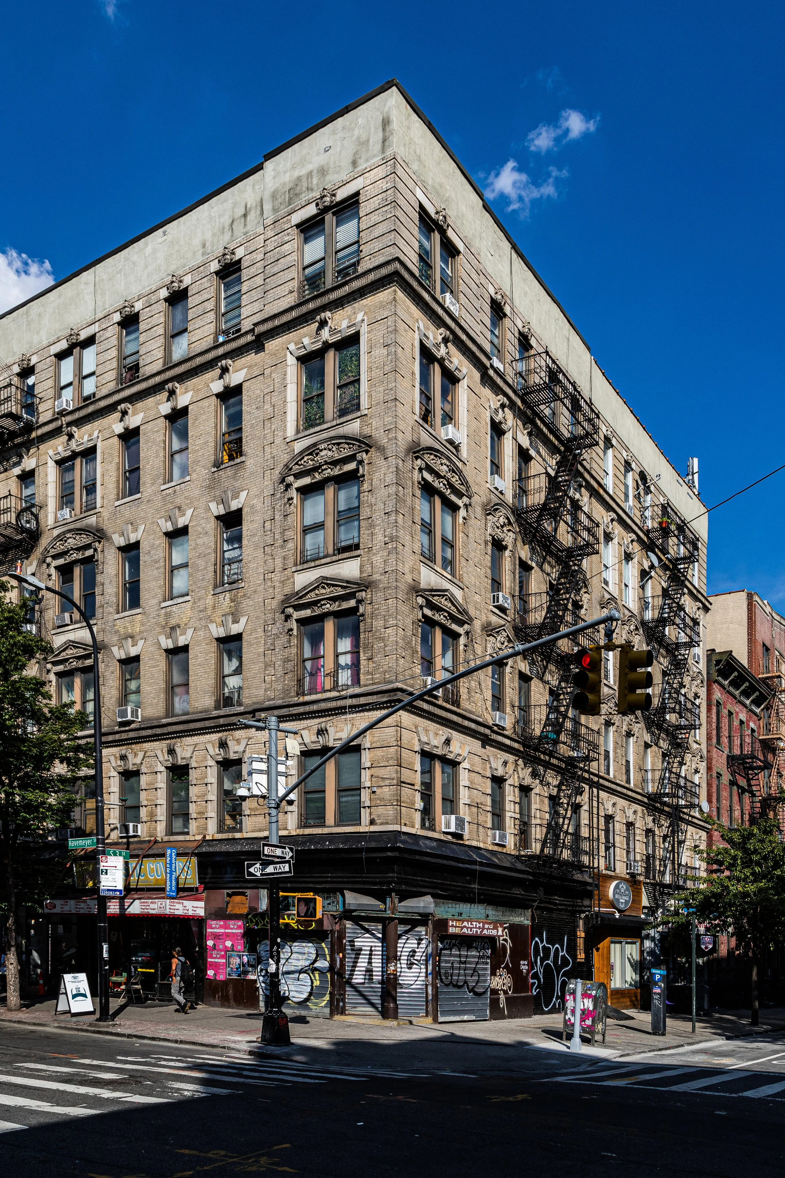
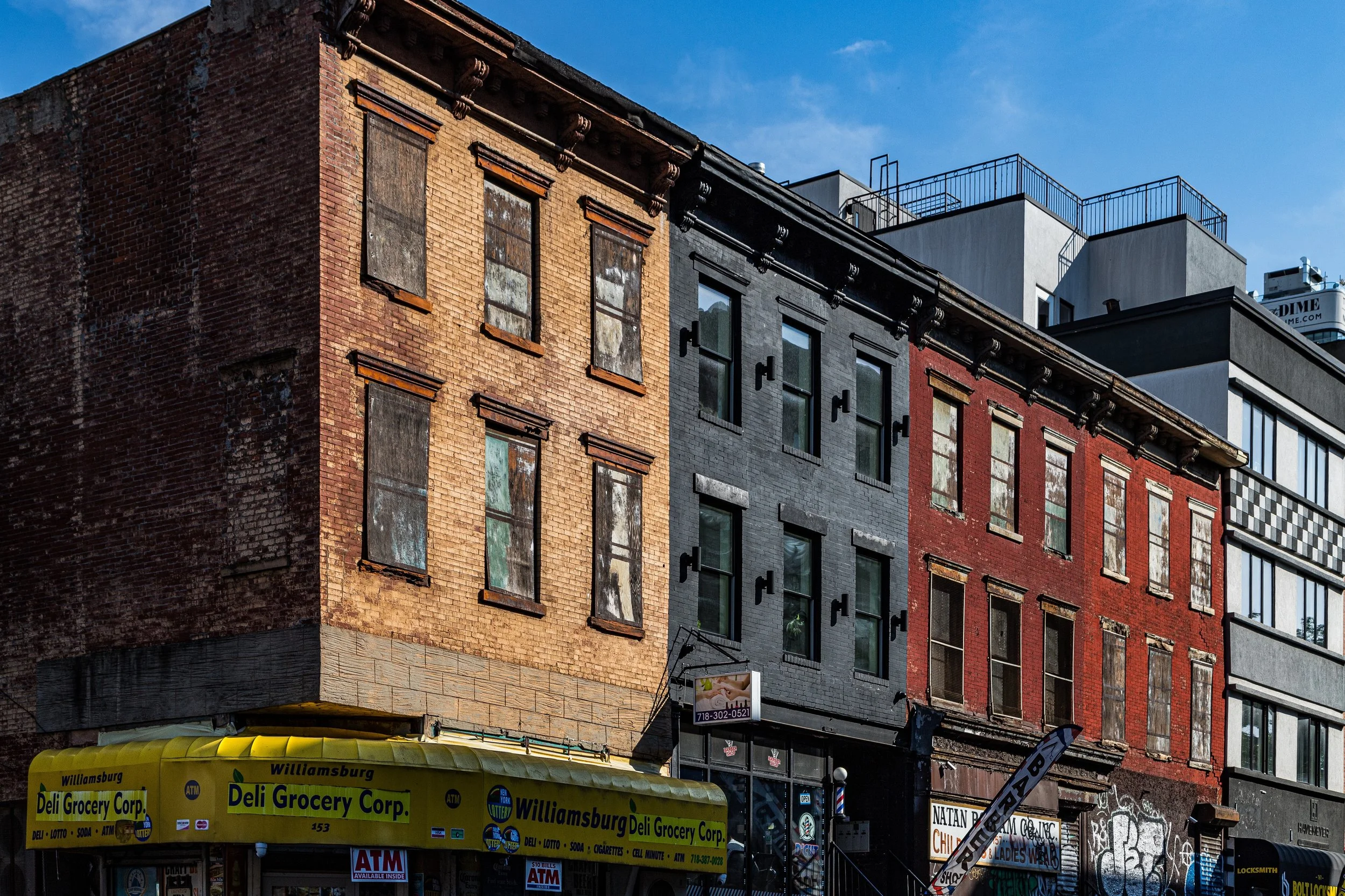
The geography of Los Sures is both intimate and industrial. Narrow side streets like South 2nd through South 5th Streets, Havemeyer, Roebling, and Driggs Avenues are lined with 19th-century brick tenements and converted warehouses, their façades bearing the patina of a century’s labor and life. Along the waterfront, former sugar refineries and shipping terminals—once dominated by the Domino Sugar complex—have given way to glass towers and new parks, where the Manhattan skyline stretches across the East River. Yet within the grid east of Kent Avenue, the older fabric endures: bodega awnings in Spanish and English, murals honoring local heroes, and generations of families who call Los Sures home.
Etymology and Origins
The name Los Sures (Spanish for “The Souths”) emerged organically in the 1970s, coined by the area’s Puerto Rican and Dominican residents to describe the southern portion of Williamsburg that had become their cultural stronghold. In earlier centuries, the land was marshy farmland belonging to the Dutch village of Boswijck (Bushwick), later subdivided into industrial lots during Brooklyn’s 19th-century expansion.
By the mid-1800s, Williamsburg—then an independent city before its annexation by Brooklyn—was booming. The Southside became home to German, Polish, Italian, and Jewish immigrants who worked in the shipyards, sugar refineries, breweries, and metalworks that lined the waterfront. The Havemeyer & Elder Sugar Refinery (later Domino Sugar) employed thousands and stood as one of the largest sugar producers in the world, while Wythe Avenue and Kent Avenue bustled with warehouses and rail sidings.
The neighborhood’s tenement blocks were dense and hardworking, their proximity to the factories shaping a rhythm of life centered on labor, family, and faith. Churches such as Our Lady of Mount Carmel (1887) and synagogues like Congregation Beth Jacob Anshe Leib reflected the area’s European immigrant roots, while the hum of trolley lines connected Los Sures to the rest of Brooklyn.
The Neighborhood
19th Century: The Industrial Waterfront
The mid-1800s saw the Southside transform into one of the most productive industrial zones in the world. The skyline was dominated by the Domino Sugar Refinery, which by 1882 was the largest sugar refinery on earth. The neighborhood was a chaotic, productive engine of the "Five Black Arts," where the scent of boiling molasses mingled with the smoke of glassworks and iron foundries.
Grand tenements and elegant cast-iron buildings rose along Broadway, which served as Brooklyn’s "Second Downtown," complete with opulent banks, theaters, and department stores. By the time the Williamsburg Bridge opened in 1903, the neighborhood was no longer a quiet suburb; it was a dense, vertical city of workers, connected to Manhattan by a span that would soon bring a new wave of residents fleeing the overcrowded tenements of the East Side.
Early 20th Century: A Gateway for Immigrants
The completion of the bridge triggered a massive demographic shift. Tens of thousands of Jewish immigrants crossed from Manhattan, establishing the Southside as a center of religious and social life. Synagogues and community centers lined the streets between the bridge and Division Avenue. Following World War II, a new chapter began as the Latino community, primarily from Puerto Rico, moved into the area’s walk-up tenements and low-rise apartments.
By the 1950s, the neighborhood had become Los Sures. This era saw the birth of vital grassroots organizations, such as Southside United HDFC, formed to protect residents from displacement and neglect. The neighborhood became a bastion of community activism, where the struggle for housing rights and social services forged a resilient, tight-knit identity that exists to this day.
Los Sures (Southside Williamsburg) Video Coming Soon
Mid-Century Character and the Bridge’s Shadow
Mid-century Los Sures was defined by the looming presence of the Williamsburg Bridge and the construction of the Brooklyn-Queens Expressway (BQE), which sliced through the neighborhood’s eastern edge. While these projects physically divided the community, they also reinforced its insular, protective culture. Life centered around the parish of Epiphany Roman Catholic Church and the storefront bodegas where neighbors gathered to discuss local politics over strong coffee.
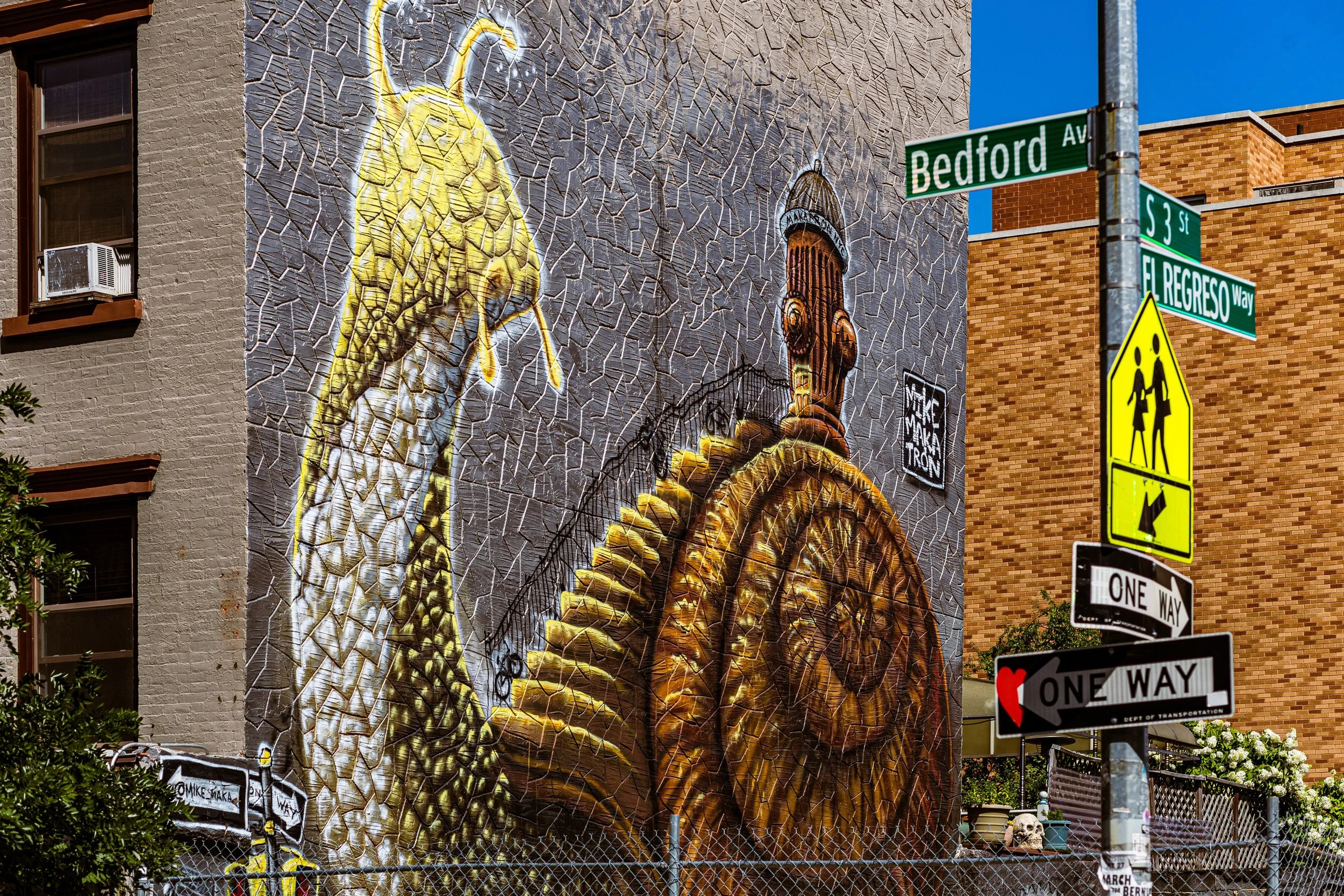
Despite the economic hardships that hit New York City in the 1970s, Los Sures maintained a fierce sense of place. Murals began to decorate the brick walls, celebrating Caribbean heritage and the neighborhood’s activist spirit. The "Southside" was not just a geographic designation; it was a badge of pride for the "Sures" who stayed when others fled.
Late 20th Century to Present: The Changing Waterfront
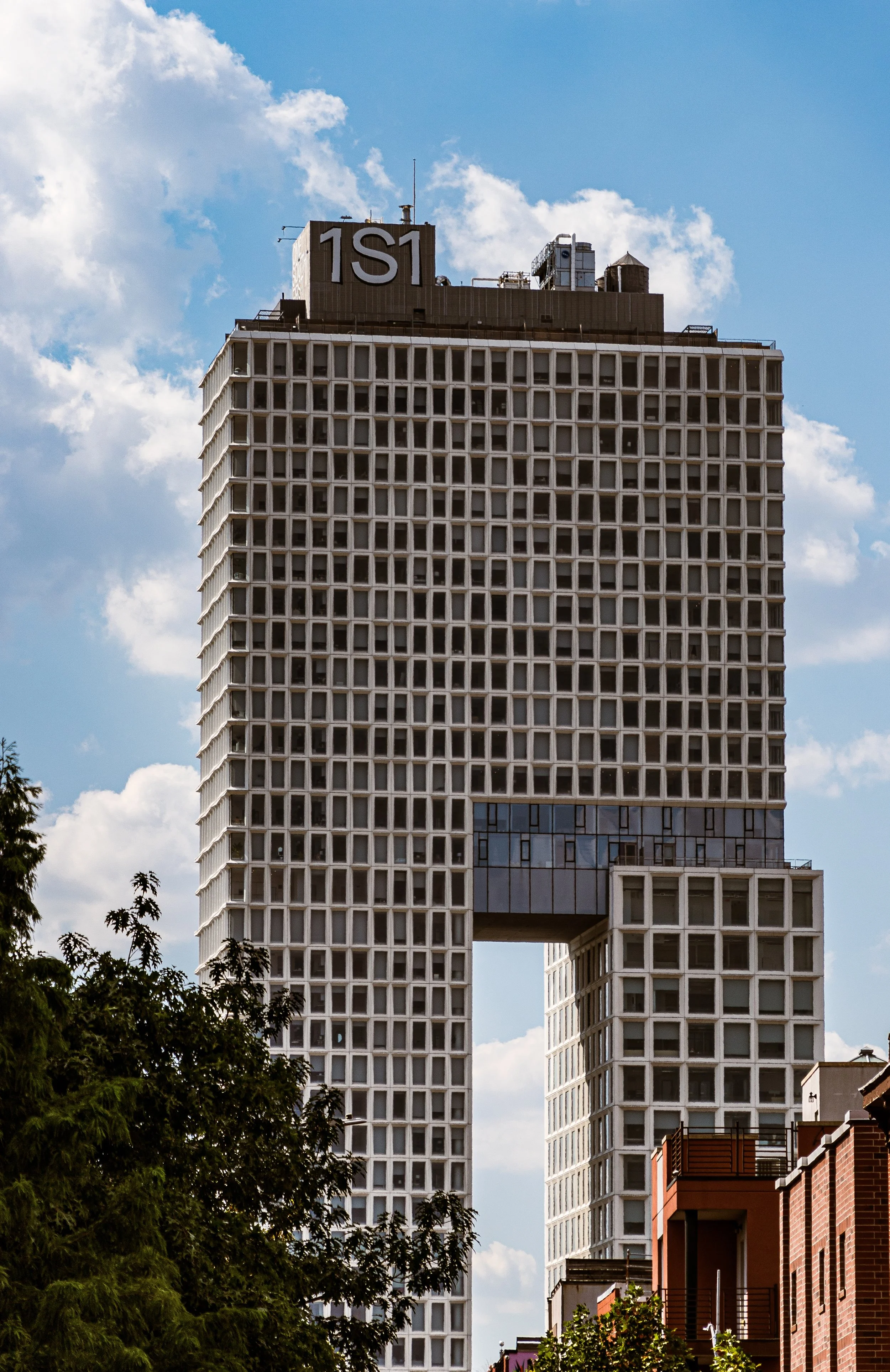
The turn of the 21st century brought a seismic shift as the industrial waterfront was rezoned for residential use. The iconic Domino Sugar Refinery was decommissioned and reimagined as a centerpiece for a high-tech office and park complex. This "New Williamsburg" of luxury glass towers and artisanal coffee shops began to press inward from the river, creating a stark contrast with the historic, low-slung blocks of the interior.
Today, Los Sures exists as a fascinating, often tension-filled mosaic. Along Havemeyer and South 4th Streets, traditional botanicas and family-run diners sit alongside minimalist galleries and upscale cocktail bars. The neighborhood is a site of constant negotiation between its storied Latino heritage and its status as one of the most desirable real estate markets in the city.
Los Sures (Southside Williamsburg) Photo Gallery
Architecture and Atmosphere
The architecture of Los Sures is a rugged blend of the industrial and the domestic. You’ll find grand, ornate bank buildings on Broadway, sturdy brick tenements with intricate fire escapes, and the looming, iconic brickwork of the sugar refinery. The atmosphere is cinematically "Old New York"—the roar of the J train overhead, the smell of roasted chicken and plantains, and the sight of older residents playing dominoes on the sidewalk as young professionals hurry toward the ferry.
Spirit and Legacy
Los Sures remains a study in endurance. Its legacy is one of community-led survival—a neighborhood that fought for its right to exist in the face of urban renewal and neglect. It is a place where the "Sures" identity remains a powerful counter-narrative to the rapid gentrification surrounding it.
On a summer afternoon, when the spray from a fire hydrant cools a side street and the sound of salsa music competes with the rumble of the bridge, Los Sures feels like the soul of Brooklyn. Standing at Domino Park, looking back from the manicured lawns toward the gritty, storied blocks of the Southside, one sees the neighborhood’s true triumph: it is a place that refuses to be forgotten, standing firm at the crossroads of Brooklyn’s past and its future.
New York City
Use this custom Google map to explore where every neighborhood in all five boroughs of New York City is located.
The Five Boroughs
One of New York City’s unique qualities is its organization in to 5 boroughs: Manhattan, Brooklyn, Queens, The Bronx, and Staten Island. These boroughs are part pragmatic administrative districts, and part vestiges of the region’s past. Each borough is an entire county in New York State - in fact, Brooklyn is, officially, Kings County, while Staten Island is, officially Richmond County. But that’s not the whole story …
Initially, New York City was located on the southern tip of Manhattan (now the Financial District) that was once the Dutch colony of New Amsterdam. Across the East River, another city was rising: Brooklyn. In time, the city planners realized that unification between the rapidly rising cities would create commercial and industrial opportunities - through streamlined administration of the region.
So powerful was the pull of unification between New York and Brooklyn that three more counties were pulled into the unification: The Bronx, Queens, and Staten Island. And on January 1, 1898, the City of New York unified two cities and three counties into one Greater City of New York - containing the five boroughs we know today.
But because each borough developed differently and distinctly until unification, their neighborhoods likewise uniquely developed. Today, there are nearly 390 neighborhoods, each with their own histories, cultures, cuisines, and personalities - and each with residents who are fiercely proud of their corner of The Big Apple.


