
NEW HYDE PARK
Queens
Geographic Setting
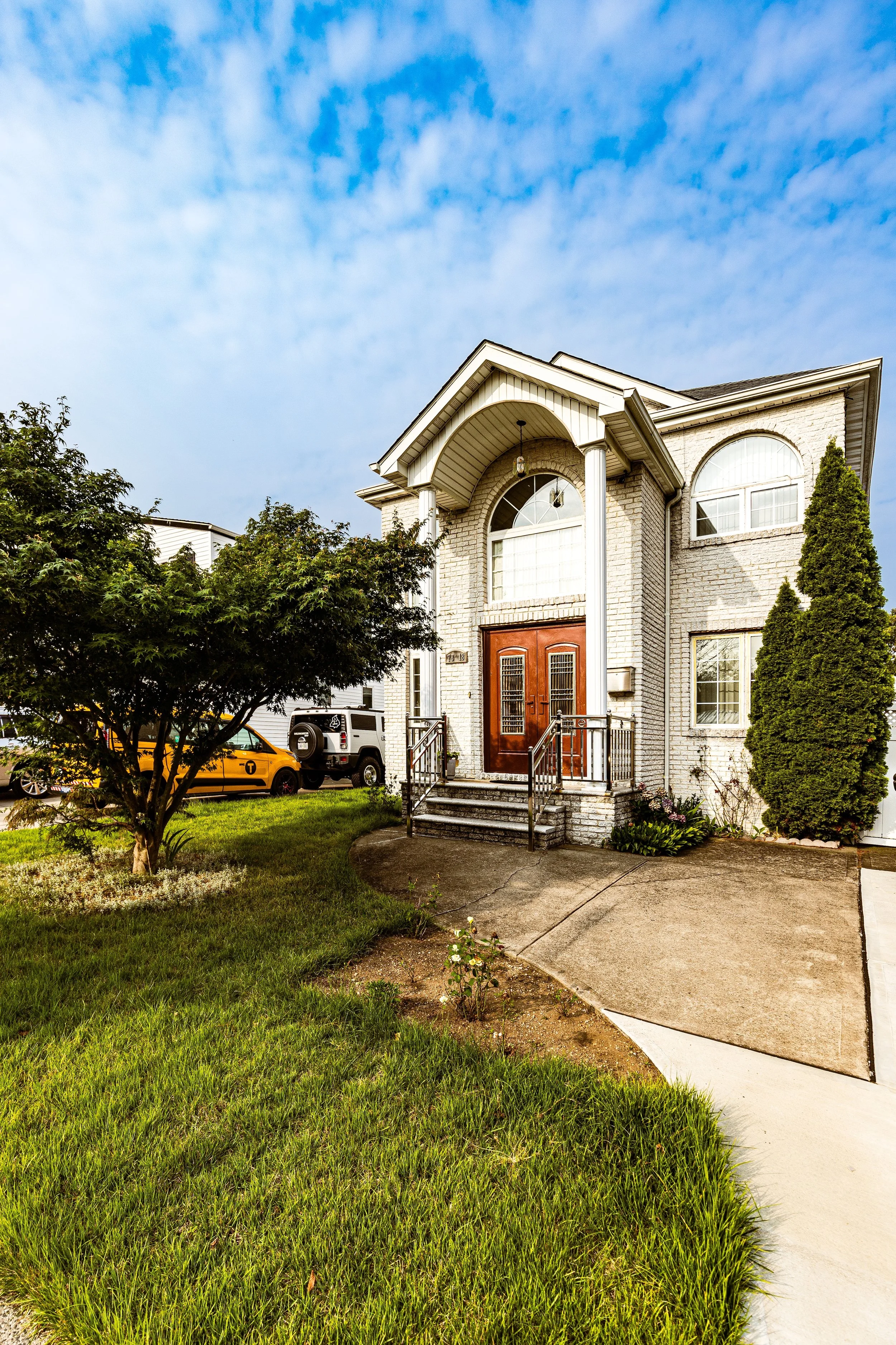
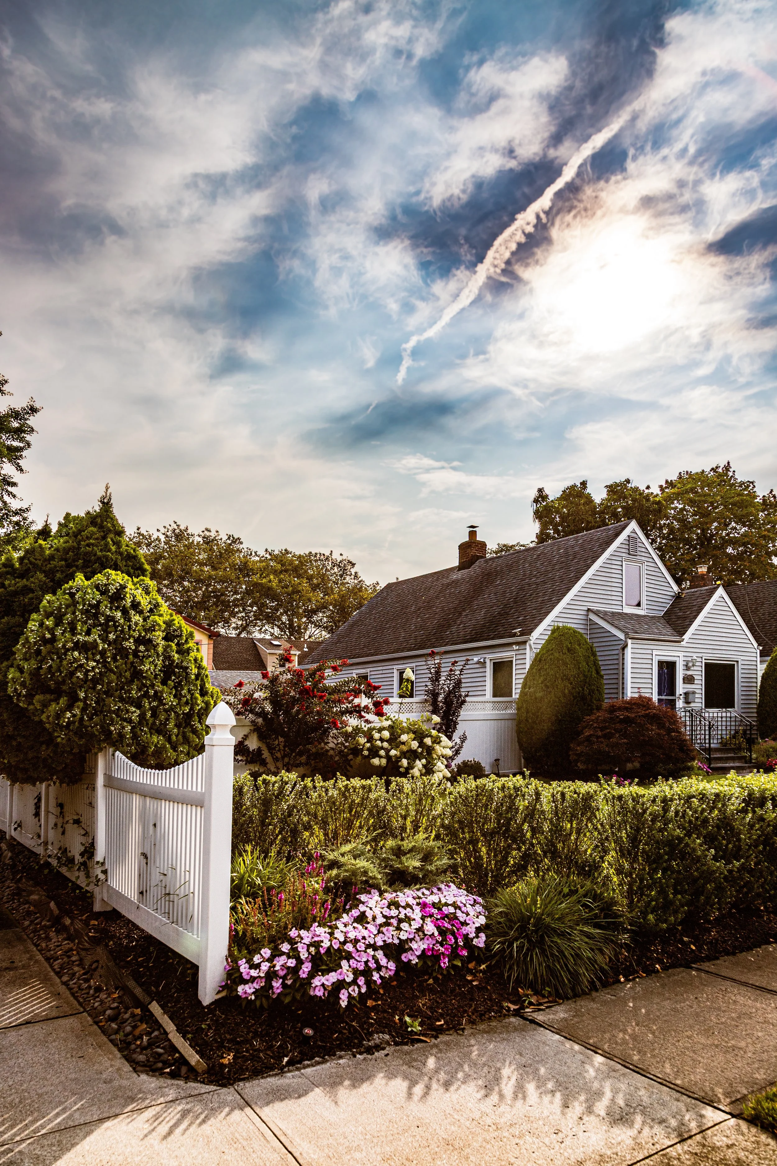
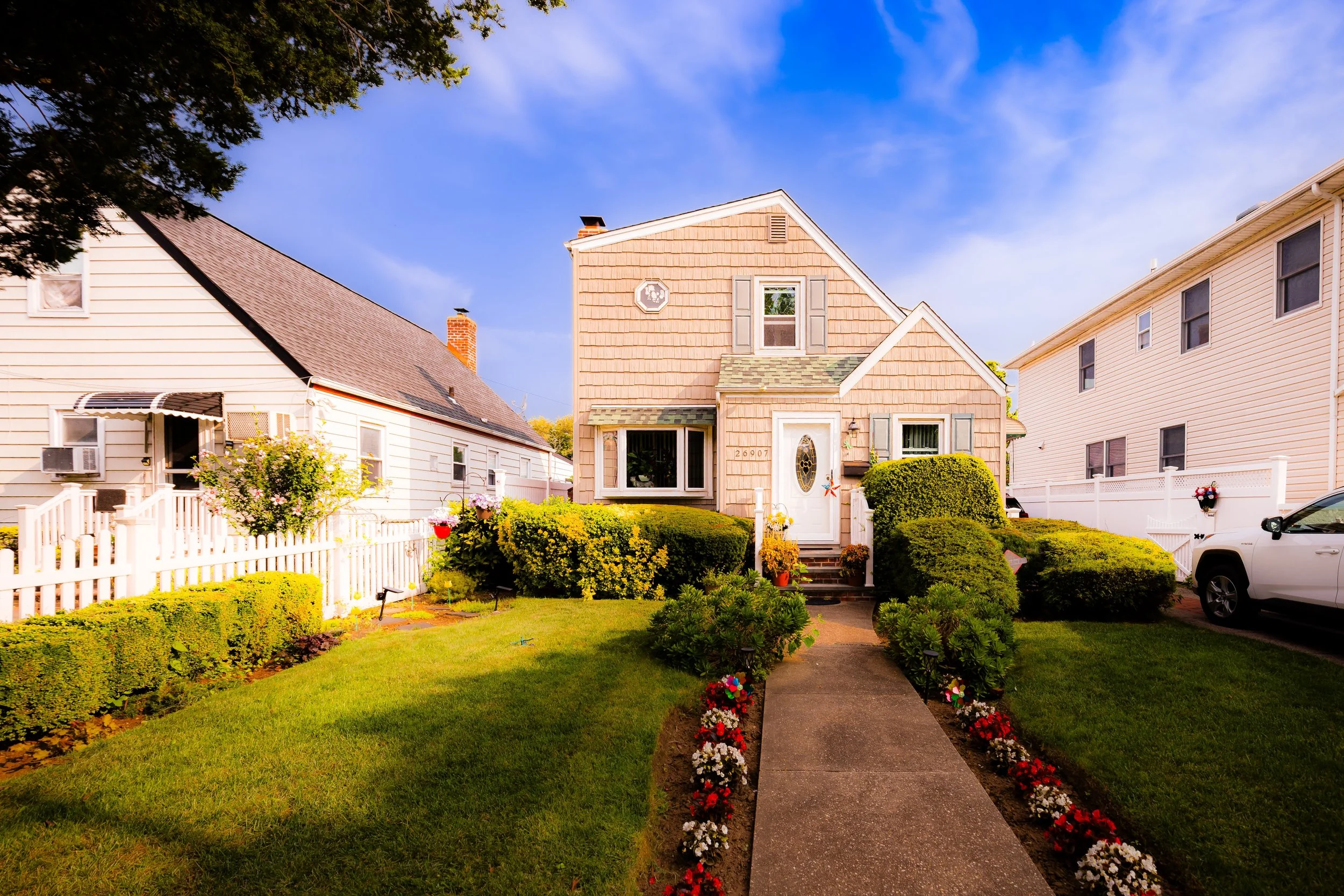
Bounded by 268th Street to the west, the sprawling Northwell Health/Long Island Jewish (LIJ) Medical Center campus to the north, and the Nassau County line to the east, New Hyde Park marks the easternmost edge of Queens—where New York City’s urban grid yields to the garden suburbs of Long Island. This small, residential enclave forms a seamless border with the village of New Hyde Park across the county line, yet within city limits it retains a distinct Queens identity: a quiet, tree-lined community defined by tidy single-family homes, brick colonials, and Cape Cod–style houses built during the mid-20th century suburban expansion.
The neighborhood’s geography slopes gently southward from the wooded ridge surrounding Northwell LIJ, whose hospital towers and medical school dominate the northern horizon. To the east and west, the grid pattern reflects its dual heritage: Queens-style numbering transitioning to the named avenues of Nassau County. Major thoroughfares such as Union Turnpike, Hillside Avenue, and Lakeville Road connect residents to surrounding commercial centers while maintaining a suburban sense of calm. Within its borders, streets such as Winchester Boulevard, Little Neck Parkway, and 268th Street define the community’s framework, while pocket parks and shaded lawns provide a buffer from the bustle of nearby highways.
New Hyde Park’s character is resolutely residential—low-rise, family-oriented, and marked by an ethos of stability and care. Though the boundaries between city and suburb blur here, the neighborhood remains distinctly part of Queens’ fabric: diverse, cohesive, and quietly prosperous.
Etymology and Origins
The name “New Hyde Park” dates back to the 17th century and refers to the Hyde family, early English settlers who established a large estate—“Hyde Park”—in what is now western Nassau County. The “New” prefix distinguished later developments on adjoining land to the west, within what became Queens. For much of its history, this area was farmland and meadow, forming part of the Town of Hempstead’s outlying agricultural lands before the city’s consolidation in 1898 brought the Queens portion under New York jurisdiction.
Throughout the 18th and 19th centuries, the region’s identity was defined by its rural landscapes—orchards, dairy farms, and small inns that lined the turnpikes connecting Jamaica, Floral Park, and Mineola. The arrival of the Long Island Rail Road (LIRR) in the mid-1800s spurred gradual growth, with New Hyde Park Station (just east of the city line) serving as a lifeline for commuters and goods. Yet development within the Queens section remained sparse until after World War II, when housing demand transformed the area from farmland to suburban neighborhood.
The Neighborhood
19th Century: From Farmsteads to Railroad Hamlet
When the Long Island Rail Road reached this area in the mid-19th century, the surrounding farms gained new access to city markets. A small depot community formed around the New Hyde Park station (now in Nassau), with general stores, blacksmiths, and inns serving local residents. In the Queens portion, however, the landscape remained almost entirely agricultural—rows of potatoes, corn, and wheat stretching toward Lake Success.
The creation of Union Turnpike and improvements to Little Neck Parkway in the late 1800s enhanced east–west travel and set the stage for suburbanization. Yet through the early 1900s, Queens’ westernmost fields remained sparsely populated, dotted with farmhouses and small dairies. Only after World War II did the area transform into the residential neighborhood recognizable today.
Mid-20th Century: The Suburban Frontier
Following the Second World War, the Queens section of New Hyde Park was rapidly developed with detached Cape Cod, ranch, and Colonial Revival houses built for veterans and middle-income families seeking suburban tranquility within the city. These homes—modest in size but surrounded by lawns and driveways—reflected the postwar dream of ownership and stability. Streets such as Commonwealth Boulevard, 252nd Street, and 76th Avenue became emblematic of Queens’ midcentury expansion. Churches, synagogues, and civic groups soon followed, including Our Lady of the Snows Parish (founded 1948) and the Glen Oaks Jewish Center, both serving as vital social and spiritual anchors.
The decades following World War II were transformative for New Hyde Park. Returning veterans and city families seeking affordable, suburban-style homes found the area’s open tracts ideal for development. Between 1946 and 1960, builders erected hundreds of brick colonials, Cape Cods, and split-level homes, following a pattern similar to nearby Bellerose Manor and Glen Oaks. The houses were modest but well-built, featuring lawns, driveways, and detached garages—symbols of middle-class upward mobility during the postwar boom.
The construction of the Long Island Expressway (LIE) and the Grand Central Parkway enhanced accessibility, linking New Hyde Park to Manhattan and the broader Long Island corridor. Meanwhile, the establishment and expansion of Long Island Jewish Hospital (founded 1954)—later the nucleus of the Northwell Health system—transformed the northern boundary into one of the region’s major medical and employment centers. The hospital’s presence attracted medical professionals, researchers, and healthcare workers to the neighborhood, many of whom settled in the surrounding homes.
Civic life during these years revolved around local schools, churches, and civic associations. Institutions such as P.S. 186 Castlewood School, Notre Dame Parish, and the New Hyde Park Civic Council fostered a tight-knit sense of community. Tree planting campaigns and block associations preserved the neighborhood’s suburban aesthetics, while zoning restrictions limited commercial encroachment.
New Hyde Park Video Coming Soon
Late 20th Century: Stability, Diversity, and Suburban Continuity
From the 1970s through the 1990s, New Hyde Park remained one of Queens’ most stable, middle-class neighborhoods, even as much of New York City experienced periods of turbulence. Its residents—initially dominated by Italian-, Irish-, and Jewish-American families—gradually diversified with the arrival of South Asian, Korean, and Chinese-American homeowners, drawn by strong schools, safety, and proximity to both city and suburban amenities.
Despite demographic change, the neighborhood’s character shifted little: lawns remained trimmed, homes well-kept, and civic pride intact. The Union Turnpike corridor developed into a modest commercial strip of family-owned businesses, small restaurants, and professional offices. Many residents worked in education, healthcare, and city services, reinforcing a culture of stability and self-reliance.
Community organizations continued to play a vital role. The North Bellerose Civic Association and New Hyde Park Civic Council organized neighborhood cleanups, holiday decorations, and advocacy for traffic safety and zoning preservation. The neighborhood’s proximity to major parks—Alley Pond Park to the northwest and Creedmoor’s green buffer to the west—ensured access to open space, a rarity within city limits.
21st Century: Modernization and Quiet Prosperity
In the 21st century, New Hyde Park has become a model of multicultural suburban coexistence within New York City. Its population now includes Indian, Bangladeshi, Filipino, and East Asian families alongside long-established residents, creating one of the most ethnically diverse yet harmonious communities in eastern Queens. The area’s churches and temples—ranging from St. Gregory the Great Church to Hindu Mandirs and Korean Christian congregations—reflect this pluralism.
Housing modernization has accompanied demographic change. Many older postwar homes have been renovated or expanded, often blending traditional colonial designs with contemporary features. While the overall density has increased slightly, the neighborhood retains its low-rise, green, and residential identity.
The Northwell Health complex, now one of the largest employers in the state, continues to shape local life, bringing new professionals and steady economic vitality. Meanwhile, public infrastructure investments—road resurfacing, tree replanting, and school improvements—have kept the area vibrant and livable. Despite rising property values, New Hyde Park remains relatively affordable compared to Nassau County just across the line, making it a sought-after address for middle-class families seeking stability and access.
New Hyde Park Photo Gallery
Spirit and Legacy
New Hyde Park’s spirit is one of quiet endurance and civic pride. Born from farmland and forged in the optimism of the postwar era, it embodies the enduring suburban ideal within the boundaries of New York City: homeownership, greenery, good schools, and neighborly connection. Its evolution—from colonial farmland to postwar suburb to diverse 21st-century enclave—mirrors the broader American story of migration, adaptation, and belonging.
New York City
Use this custom Google map to explore where every neighborhood in all five boroughs of New York City is located.
The Five Boroughs
One of New York City’s unique qualities is its organization in to 5 boroughs: Manhattan, Brooklyn, Queens, The Bronx, and Staten Island. These boroughs are part pragmatic administrative districts, and part vestiges of the region’s past. Each borough is an entire county in New York State - in fact, Brooklyn is, officially, Kings County, while Staten Island is, officially Richmond County. But that’s not the whole story …
Initially, New York City was located on the southern tip of Manhattan (now the Financial District) that was once the Dutch colony of New Amsterdam. Across the East River, another city was rising: Brooklyn. In time, the city planners realized that unification between the rapidly rising cities would create commercial and industrial opportunities - through streamlined administration of the region.
So powerful was the pull of unification between New York and Brooklyn that three more counties were pulled into the unification: The Bronx, Queens, and Staten Island. And on January 1, 1898, the City of New York unified two cities and three counties into one Greater City of New York - containing the five boroughs we know today.
But because each borough developed differently and distinctly until unification, their neighborhoods likewise uniquely developed. Today, there are nearly 390 neighborhoods, each with their own histories, cultures, cuisines, and personalities - and each with residents who are fiercely proud of their corner of The Big Apple.


