ROOSEVELT ISLAND
Manhattan
Geographic Setting
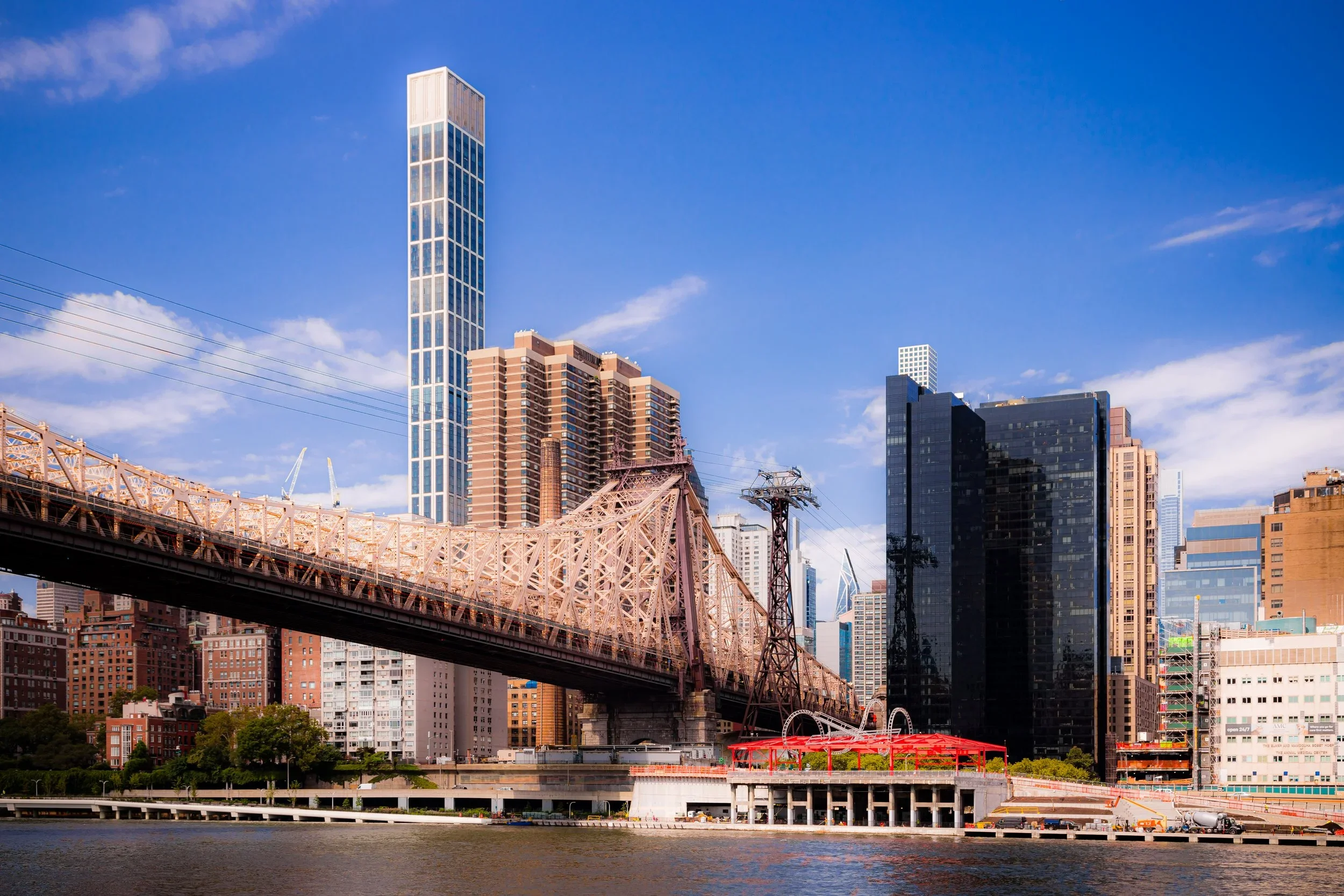
Stretching two miles long and just 800 feet wide, Roosevelt Island lies midstream in the East River, between East 46th Street and East 85th Street, opposite the Manhattan neighborhoods of Midtown East, Lenox Hill, and Yorkville, and the Queens shorelines of Long Island City and Astoria. The island’s geography is both intimate and monumental—its linear form framed by bridges and water, its skyline dwarfed yet dignified by the towers of Manhattan rising just across the channel.
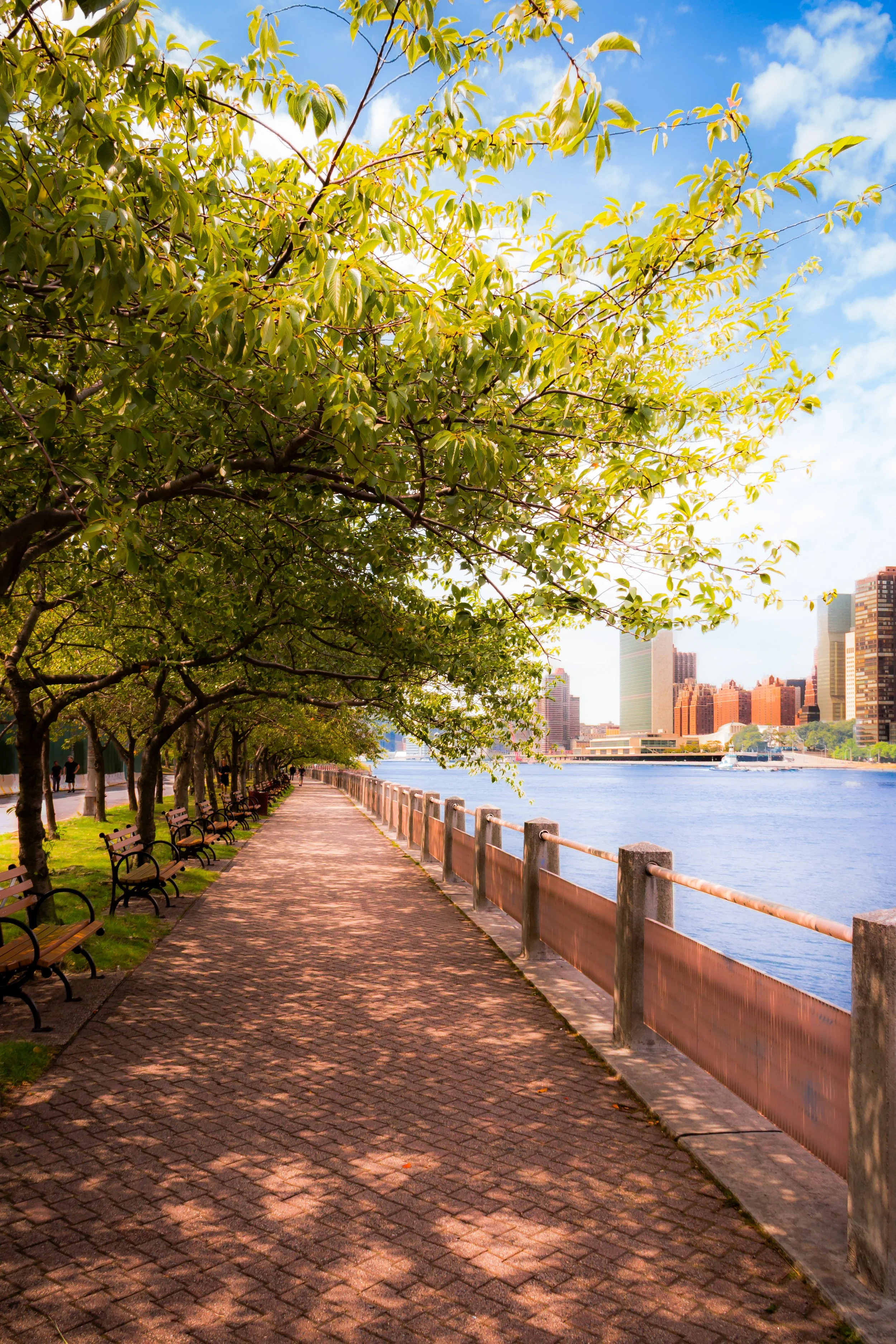
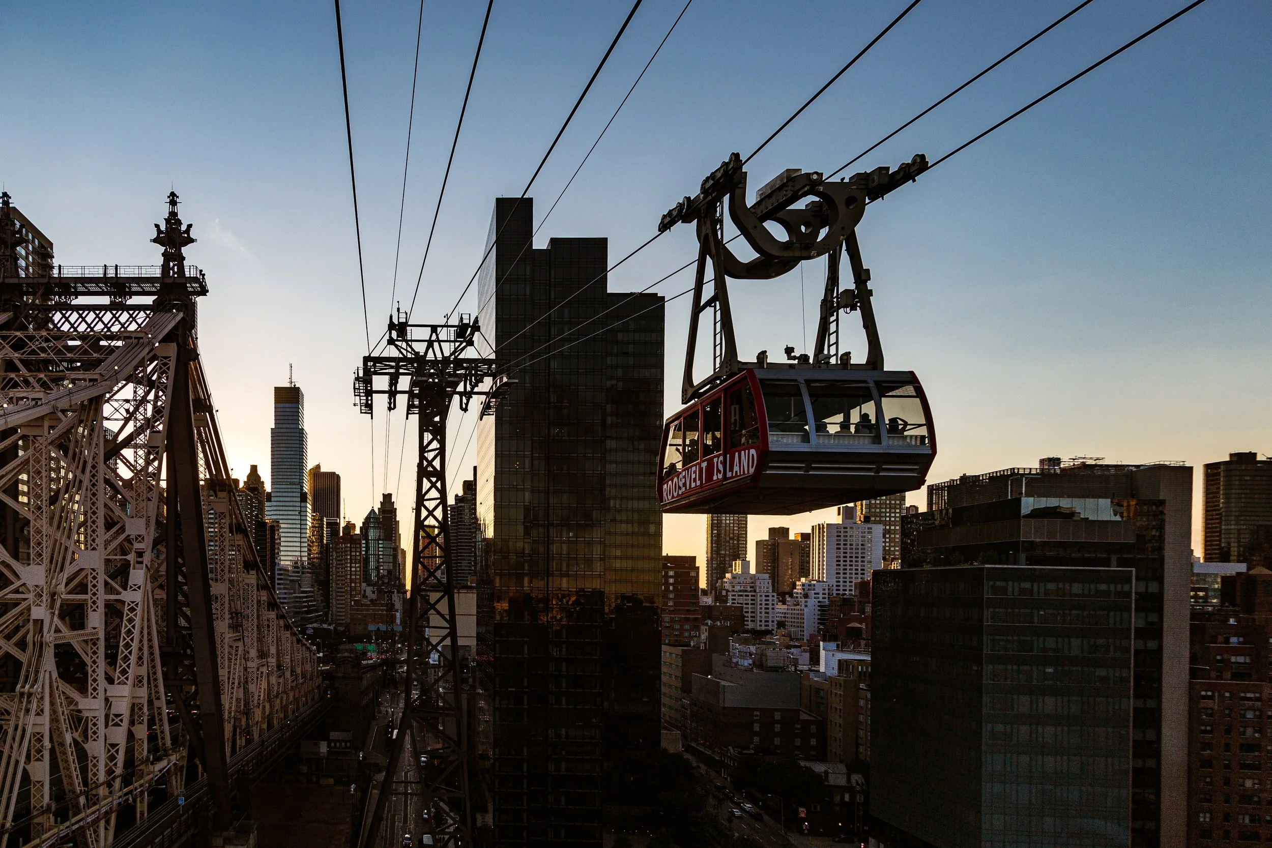
Roosevelt Island Bridge, linking the island to Queens at 36th Avenue, provides its primary vehicular access, while the Roosevelt Island Tramway, suspended over the East River since 1976, connects directly to East 60th Street in Manhattan. The F Train, which stops deep beneath the island, provides a second lifeline. Along the island’s western promenade, the Manhattan skyline unfolds like a mural—UN Headquarters to the south, Midtown’s towers in the center, and Harlem’s bluffs to the north. To the east, the quieter Queens shore offers a sense of distance rare within New York’s boundaries. The effect is paradoxical: Roosevelt Island feels central yet apart, modern yet deeply historical—a narrow ribbon where the city’s past and future coexist in one long view.
Etymology and Origins
Originally known to the Lenape as Minnehanonck, the island was later named Blackwell’s Island after Robert Blackwell, who inherited it in 1686 from his stepfather, Captain John Manning, an English colonial officer who had been granted the land in the 1660s. The Blackwell family farmed the island for over a century, their homestead (built 1796) still standing today as one of New York’s oldest houses.
In 1828, the City of New York purchased the island for institutional use, and it became synonymous with incarceration, illness, and reform. For much of the 19th century, “Blackwell’s Island” was a name spoken with dread—it was home to prisons, workhouses, almshouses, and hospitals that isolated the city’s poor, sick, and condemned. In 1921, the island was renamed Welfare Island, reflecting its dominant role in the city’s charitable system; and in 1973, after its redevelopment as a residential community, it was renamed Roosevelt Island in honor of Franklin D. Roosevelt, symbolizing rebirth from confinement to community.
The Neighborhood
19th Century: Isolation and the Age of Reform
Blackwell’s Island was central to the 19th-century vision of public health and social reform through isolation. Beginning in the 1830s, the city constructed an array of institutions meant to remove the destitute and diseased from Manhattan’s teeming tenements. Among these were the Penitentiary (1832), the Lunatic Asylum (1839), the Almshouse (1840s), the Charity Hospital (1856), and the Smallpox Hospital (1856)—each a formidable stone edifice facing the water, each designed to embody both compassion and control.
The asylum, with its domed rotunda designed by Alexander Jackson Davis, was immortalized by journalist Nellie Bly, whose exposé Ten Days in a Mad-House (1887) revealed the abuses endured by female patients and helped spark reforms in mental health care. The Smallpox Hospital, a Gothic Revival masterpiece by James Renwick Jr. (architect of St. Patrick’s Cathedral), treated contagious patients in isolation until the 1870s; its ivy-clad ruins remain one of New York’s most haunting landmarks.
The island’s population—patients, prisoners, and the poor—was served by ferries from Manhattan and by the Blackwell’s Island Bridge (now Queensboro Bridge, opened 1909), which loomed overhead but offered no direct access for decades. By century’s end, Blackwell’s Island symbolized both the humanitarian ambition and the moral hypocrisy of the Victorian city: a place intended for healing but often marked by neglect.
Early 20th Century: Transition and Public Works
In the early 1900s, reformers sought to modernize and humanize Welfare Island’s institutions. Many of the old asylums were relocated to larger campuses on the mainland, replaced by hospitals serving chronic and infectious diseases. Goldwater Memorial Hospital (opened 1939) and Coler Hospital (opened 1952, later merged as Coler-Goldwater Specialty Hospital) represented this new era of medical modernism—clean-lined, humane, and surrounded by greenery.
The completion of the Queensboro Bridge (1909) and the Roosevelt Island Bridge (1955) improved access but did little to integrate the island into city life. It remained a medical outpost—a world apart. In 1921, the name “Welfare Island” was officially adopted to shed the stigma of Blackwell’s past, though the association with hardship endured. A more profound transformation would wait until the city’s postwar housing experiments reshaped its purpose entirely.
Roosevelt Island Photographic Tour
Mid-20th Century: Visionary Redevelopment
The 1960s brought a new conception for the island’s future. With the city’s population booming and its housing stock strained, planners saw Welfare Island as an opportunity to build a model urban community. In 1968, the New York State Urban Development Corporation (UDC), under Governor Nelson Rockefeller, commissioned architects Philip Johnson and John Burgee to design a new residential town.
Renamed Roosevelt Island in 1973, the redevelopment emphasized accessibility, affordability, and progressive design. The plan created a linear community stretching north–south, with pedestrian promenades replacing cars and a mix of mid-rise brick apartment buildings designed for light and air. The opening of the Roosevelt Island Tramway (1976) gave the neighborhood an iconic link to Manhattan—a futuristic gesture that became a cultural landmark. The F Train station (1989) later integrated the island into the subway network, ensuring its permanence as a living neighborhood rather than an isolated experiment.
Roosevelt Island thus became a midcentury utopia realized—public housing and parkland in harmony, overlooking the city yet apart from its chaos.
Late 20th–21st Century: Renewal, Education, and Design Legacy
By the late 20th century, Roosevelt Island matured into one of New York’s most distinctive residential enclaves. Its population diversified, drawn by affordable rents, river views, and a strong sense of community. Landmark preservation gained traction: the Renwick Smallpox Hospital Ruin was stabilized and illuminated; the Blackwell House restored; and historic bridges and piers maintained as living heritage.
The 21st century ushered in a new chapter of innovation. The southern tip of the island was transformed into the Franklin D. Roosevelt Four Freedoms Park (dedicated 2012), a monumental granite landscape designed by Louis Kahn, whose austere geometry and open vistas frame the United Nations across the river. Further north, the Cornell Tech Campus, opened in 2017, brought an era of educational and technological renewal—a modern acropolis of glass and gardens set against the island’s historic stone foundations.
Today, Roosevelt Island balances its roles as neighborhood, campus, and park. New housing, sustainable design initiatives, and cultural programming have integrated it fully into the city’s social and architectural life while preserving its tranquil, almost European rhythm.
Roosevelt Island Photo Gallery
Spirit and Legacy
Roosevelt Island’s legacy is one of transformation through redefinition. Once synonymous with suffering and seclusion, it now represents resilience, design, and civic imagination. Its narrow shape tells a long story of New York’s evolving conscience—from 19th-century moral isolationism to 20th-century utopian modernism and 21st-century innovation.
New York City
Use this custom Google map to explore where every neighborhood in all five boroughs of New York City is located.
The Five Boroughs
One of New York City’s unique qualities is its organization in to 5 boroughs: Manhattan, Brooklyn, Queens, The Bronx, and Staten Island. These boroughs are part pragmatic administrative districts, and part vestiges of the region’s past. Each borough is an entire county in New York State - in fact, Brooklyn is, officially, Kings County, while Staten Island is, officially Richmond County. But that’s not the whole story …
Initially, New York City was located on the southern tip of Manhattan (now the Financial District) that was once the Dutch colony of New Amsterdam. Across the East River, another city was rising: Brooklyn. In time, the city planners realized that unification between the rapidly rising cities would create commercial and industrial opportunities - through streamlined administration of the region.
So powerful was the pull of unification between New York and Brooklyn that three more counties were pulled into the unification: The Bronx, Queens, and Staten Island. And on January 1, 1898, the City of New York unified two cities and three counties into one Greater City of New York - containing the five boroughs we know today.
But because each borough developed differently and distinctly until unification, their neighborhoods likewise uniquely developed. Today, there are nearly 390 neighborhoods, each with their own histories, cultures, cuisines, and personalities - and each with residents who are fiercely proud of their corner of The Big Apple.


