MEIER’S CORNERS
Staten Island
Geographic Setting
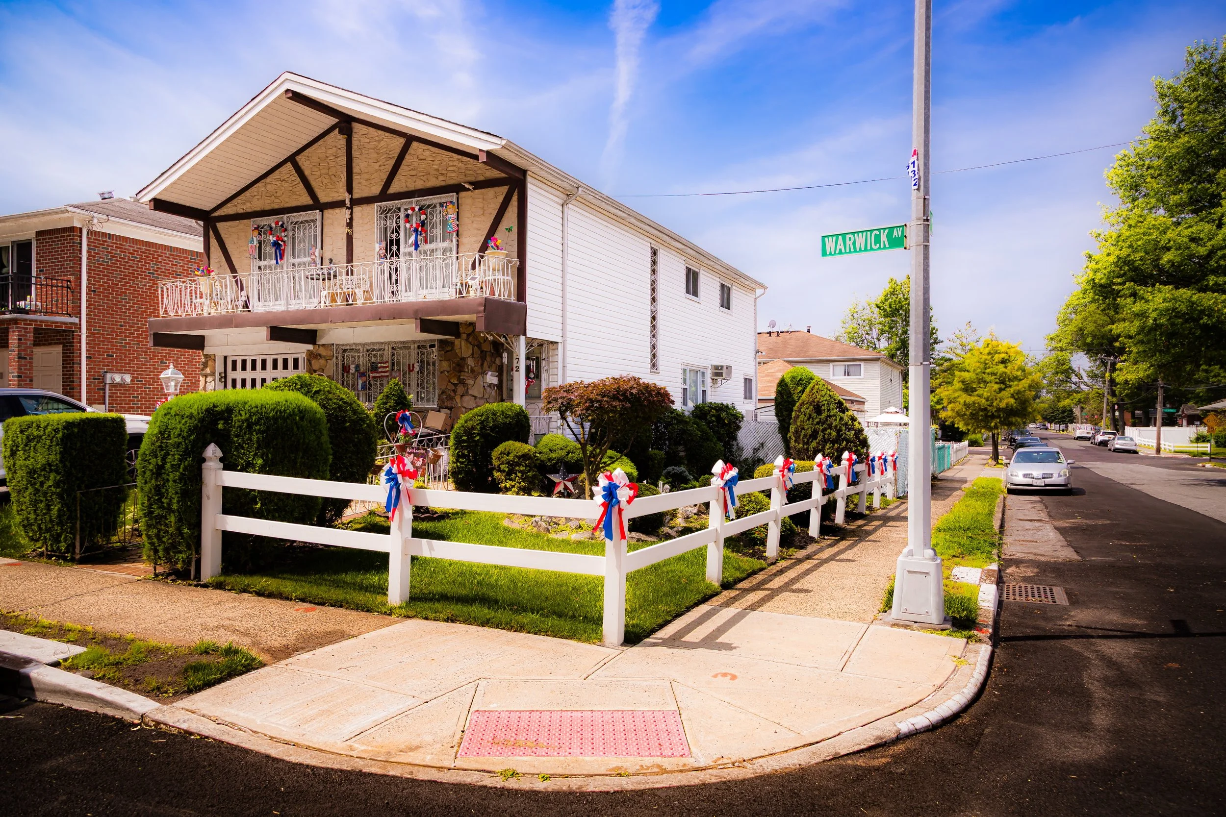
Bounded by the Staten Island Expressway to the south, Victory Boulevard to the north, and Lester and Gower Streets to the east, Meiers Corners occupies a compact but historically significant section of Staten Island’s North-Central corridor. It lies at the confluence of Victory Boulevard, Bradley Avenue, and Watchogue Road—a crossroads that has long served as one of the island’s key inland junctions. The neighborhood sits on gently rolling terrain between the low ridges of Westerleigh to the north and Willowbrook and Manor Heights to the south, with tree-lined residential blocks radiating outward from its bustling commercial heart along Victory Boulevard.
The area’s geography reflects both accessibility and transition: close to the Staten Island Expressway for commuters yet buffered by parkland and greenbelts that lend it a suburban calm. Meiers Corners functions as a natural gateway between the island’s older North Shore neighborhoods and the more modern developments of Mid-Island—an enduring meeting point that has shaped its identity for nearly two centuries.
Etymology
Meiers Corners takes its name from Frederick Meier, a 19th-century German immigrant who operated a general store and tavern at the intersection of Victory Boulevard and Bradley Avenue in the mid-1800s. The spot became widely known as “Meier’s Corner,” a popular stagecoach and wagon stop on the route between Port Richmond and New Dorp. Over time, the possessive apostrophe was dropped, but the name endured—preserving both the memory of its proprietor and the role his establishment played in Staten Island’s early transportation network.
Like many Staten Island neighborhood names, “Meiers Corners” reflects its origin as a literal crossroads—a place where trade, travel, and community converged. It remains one of the few Staten Island neighborhoods whose name directly references its founder and its original function, standing as a linguistic echo of the island’s rural past.
The Neighborhood
Origins through the 19th Century
In the early 19th century, Meiers Corners was part of the Town of Castleton, then a patchwork of farmland, forests, and small settlements. Victory Boulevard, originally known as Richmond Turnpike, was built in 1816 by Daniel D. Tompkins, New York’s governor and later U.S. Vice President, as a toll road connecting the ferry landing at Tompkinsville with the island’s western shore. The road quickly became Staten Island’s main inland artery, drawing inns, taverns, and farms to its route.
Frederick Meier’s establishment, built around the 1850s, stood at the crossroads of this turnpike and Bradley Avenue, serving as both social hub and waypoint for travelers and farmers transporting goods. The intersection gained prominence as a regional center of trade and conversation, with blacksmith shops, stables, and general stores clustering nearby.
By the late 19th century, Meiers Corners had evolved into a modest hamlet surrounded by dairy farms and orchards. The nearby Silver Lake Reservoir and Clove Lakes Park offered recreational destinations, while the neighborhood’s central location made it a convenient midpoint between Staten Island’s North Shore port communities and its rural South Shore villages. Even before suburbanization, Meiers Corners was recognized as one of the island’s most active inland crossroads.
Early 20th Century: From Crossroads to Community
The turn of the 20th century brought gradual suburbanization to Meiers Corners, spurred by the paving of Victory Boulevard and the growing use of automobiles. The old rural character gave way to residential development as Staten Island’s population increased. Modest single-family houses and small apartment buildings began to line the side streets, while local shops, bakeries, and service businesses established themselves along Victory Boulevard.
During this era, the neighborhood’s proximity to the Clove Lakes and Willowbrook parklands made it attractive to families seeking a quieter environment within commuting distance of Manhattan. Public transportation expanded, with trolley and bus lines connecting Meiers Corners to St. George and the ferry. Churches and schools soon followed, reinforcing its transition from rural junction to residential district.
By the 1930s, Meiers Corners had emerged as a fully formed neighborhood—an unassuming yet vital part of Staten Island’s mid-island corridor, defined by its accessibility, stability, and community spirit.
Meier’s Corners Video Coming Soon
Mid–Late 20th Century: Expressways and Suburban Growth
The post–World War II decades transformed Staten Island, and Meiers Corners stood at the heart of that transformation. The construction of the Staten Island Expressway (completed in 1964) brought major infrastructure to the neighborhood’s southern edge, improving accessibility while altering its landscape. Though some older structures were lost to road expansion, Meiers Corners retained its residential core and small-town feel.
The completion of the Verrazzano-Narrows Bridge that same year sparked a population boom, with new housing developments rising across the mid-island region. Meiers Corners benefited from its central location, becoming a commuter hub with quick routes to both Brooklyn and New Jersey. Victory Boulevard evolved into a thriving commercial corridor, home to grocery stores, diners, and small professional offices that served the growing suburban population.
Despite modernization, vestiges of the past endured: the original street grid remained largely intact, and a few 19th-century homes survived along the main avenues. Civic associations worked to maintain the neighborhood’s cleanliness and safety, while schools and parks reinforced its reputation as a stable, family-friendly community. By the late 20th century, Meiers Corners had become one of Staten Island’s most recognizable mid-island neighborhoods—a practical, well-situated district that combined accessibility with a sense of continuity.
21st Century: A Neighborhood at the Crossroads
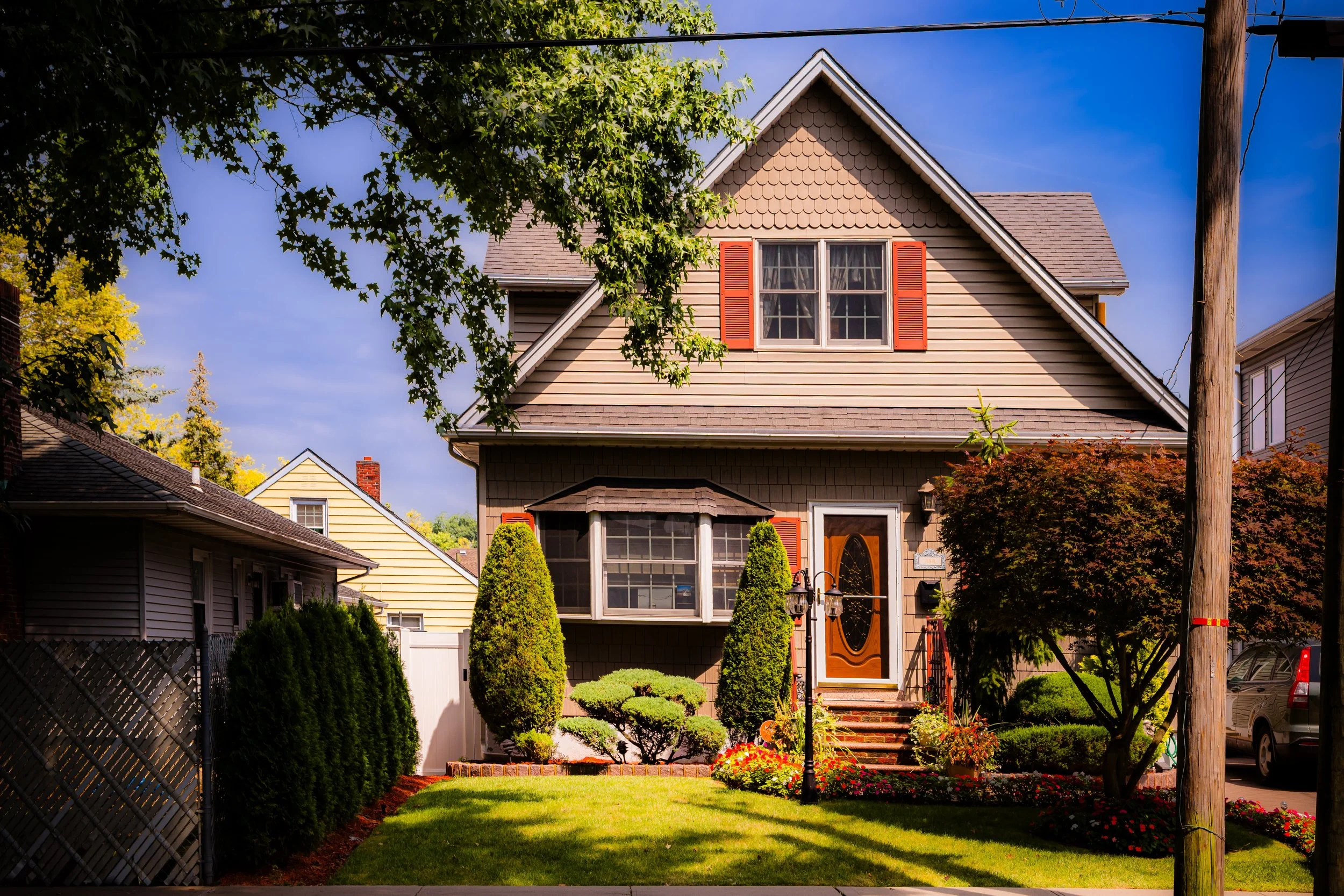
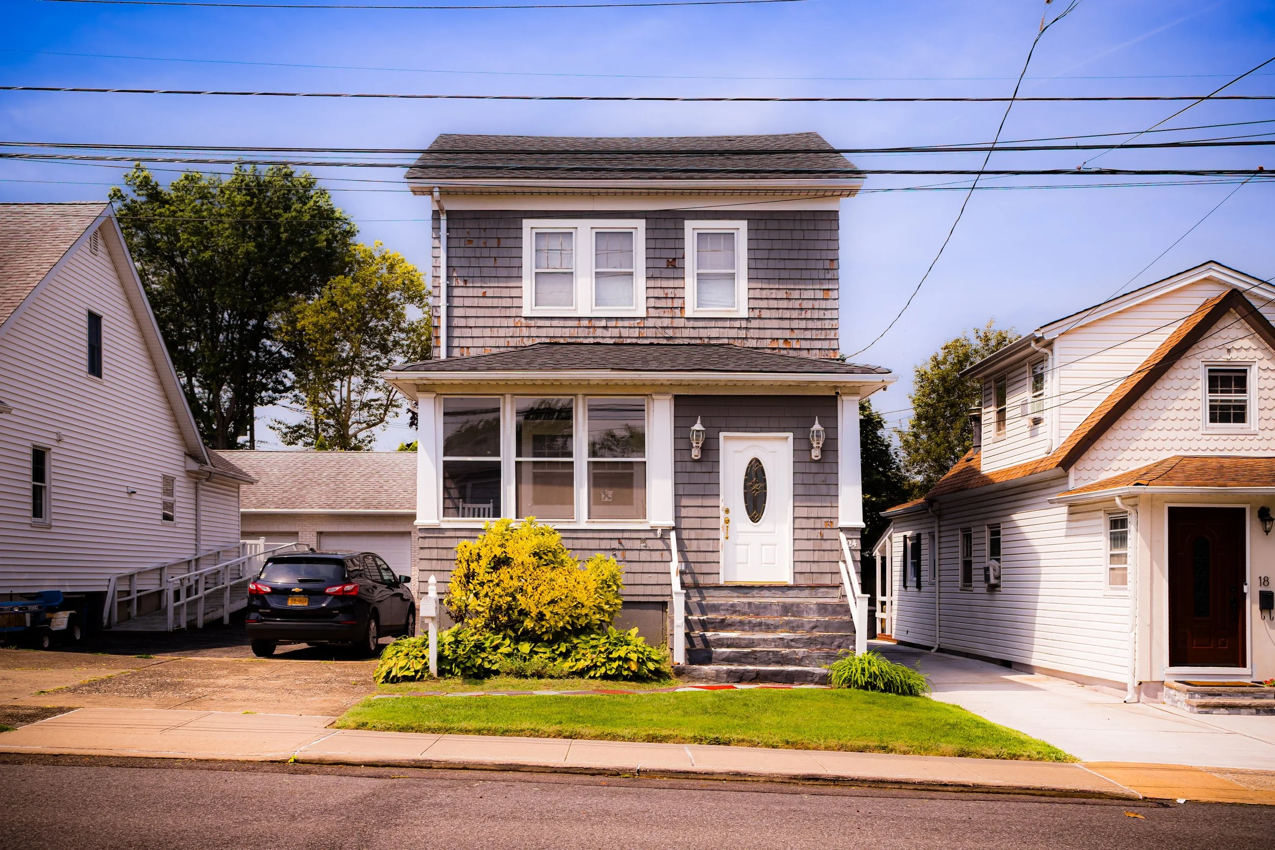
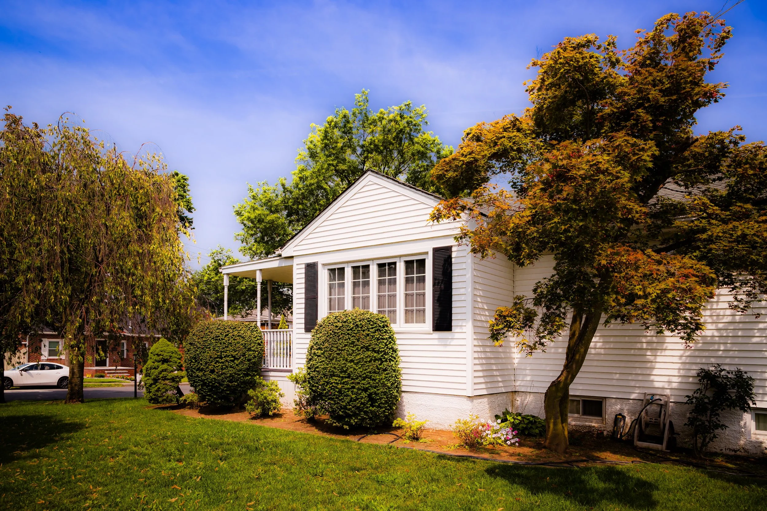
In the 21st century, Meiers Corners remains a vital link in Staten Island’s geographic and civic landscape. Its location—between the Staten Island Expressway and Victory Boulevard—positions it at the center of the island’s daily movement. The area’s housing stock reflects its layered history: early 20th-century homes stand beside postwar colonials and newer multi-family constructions. The mix of architectural styles mirrors the mix of its people—a diverse, middle-class community of long-established families and newcomers alike.
Victory Boulevard continues to serve as the neighborhood’s main artery, hosting an array of restaurants, cafés, and small businesses that reflect Staten Island’s evolving demographics. The area’s proximity to Clove Lakes Park, Willowbrook Park, and the College of Staten Island ensures a steady rhythm of recreation and education, while nearby institutions such as Susan E. Wagner High School strengthen the neighborhood’s social fabric.
Even as traffic and commercial pressures increase, Meiers Corners has retained its suburban equilibrium through active civic engagement. Community boards and neighborhood associations work to manage development and maintain the character of side streets where families tend gardens and greet neighbors across driveways. The name Meiers Corners still conjures a sense of place—a reminder of the days when Staten Island’s life revolved around the meeting of roads and the faces that gathered there.
Meier’s Corner Photo Gallery
Spirit and Legacy
The spirit of Meiers Corners is one of continuity—a community built around connection, where roads, lives, and generations intersect. From a 19th-century tavern stop to a 21st-century residential hub, it has evolved without losing its essential role as Staten Island’s meeting ground. The hum of cars on Victory Boulevard echoes the wagon wheels of the old Richmond Turnpike, and the modest homes that line its shaded streets speak to enduring values of family, work, and belonging.
Its legacy lies in its name and its nature: a neighborhood born of movement that became a place of stability. Meiers Corners embodies Staten Island’s story in miniature—a crossroads of history and modernity, commerce and community.
New York City
Use this custom Google map to explore where every neighborhood in all five boroughs of New York City is located.
The Five Boroughs
One of New York City’s unique qualities is its organization in to 5 boroughs: Manhattan, Brooklyn, Queens, The Bronx, and Staten Island. These boroughs are part pragmatic administrative districts, and part vestiges of the region’s past. Each borough is an entire county in New York State - in fact, Brooklyn is, officially, Kings County, while Staten Island is, officially Richmond County. But that’s not the whole story …
Initially, New York City was located on the southern tip of Manhattan (now the Financial District) that was once the Dutch colony of New Amsterdam. Across the East River, another city was rising: Brooklyn. In time, the city planners realized that unification between the rapidly rising cities would create commercial and industrial opportunities - through streamlined administration of the region.
So powerful was the pull of unification between New York and Brooklyn that three more counties were pulled into the unification: The Bronx, Queens, and Staten Island. And on January 1, 1898, the City of New York unified two cities and three counties into one Greater City of New York - containing the five boroughs we know today.
But because each borough developed differently and distinctly until unification, their neighborhoods likewise uniquely developed. Today, there are nearly 390 neighborhoods, each with their own histories, cultures, cuisines, and personalities - and each with residents who are fiercely proud of their corner of The Big Apple.


