
BAY TERRACE
Staten Island
Geographic Setting
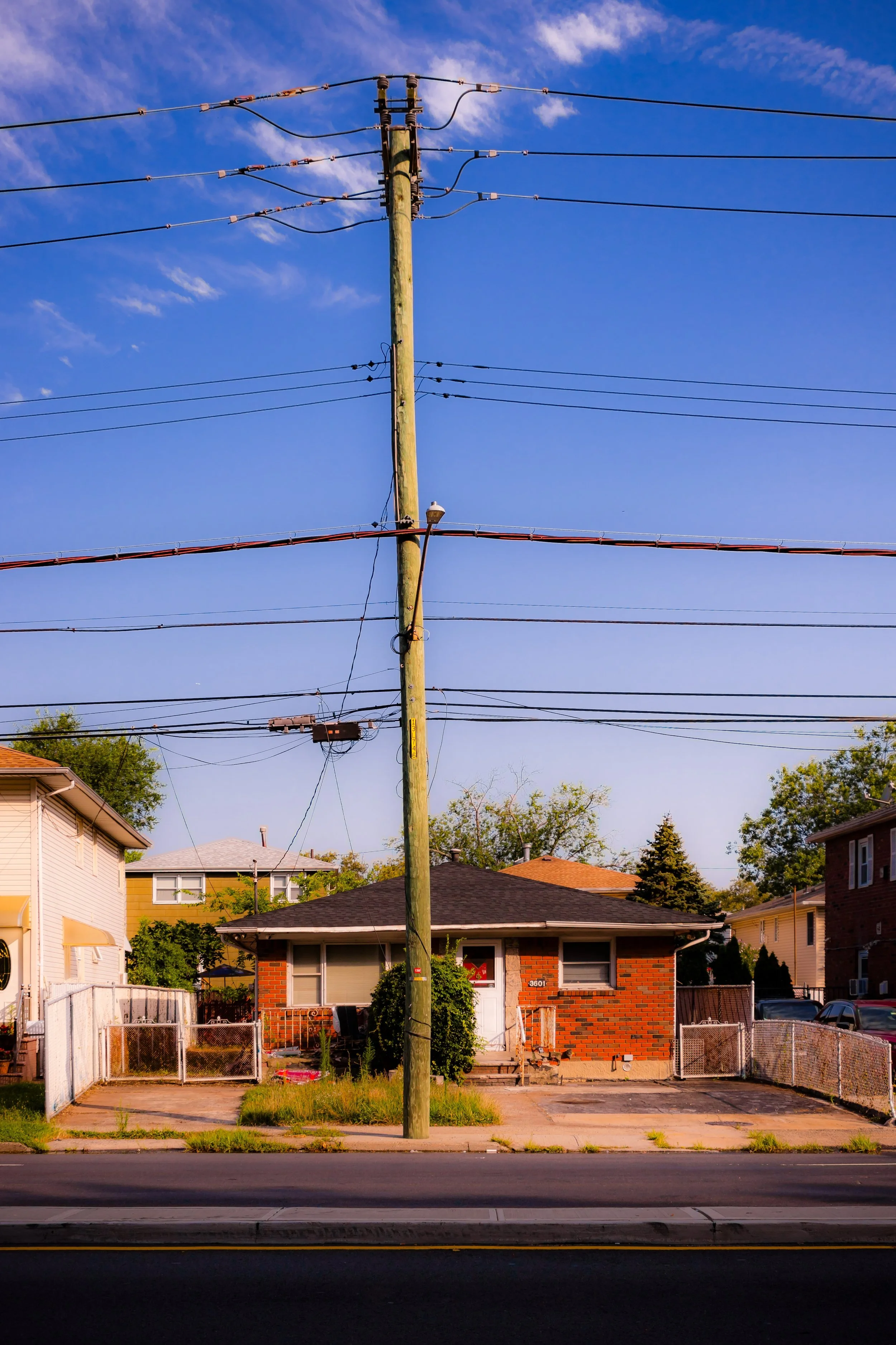
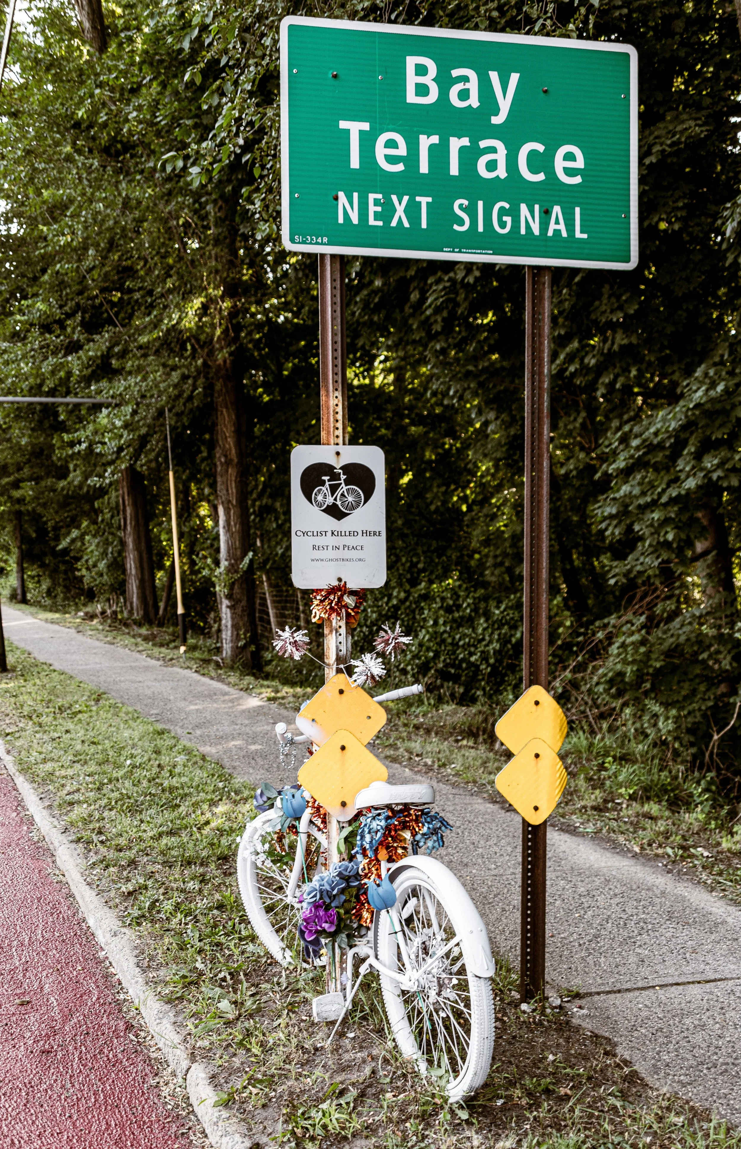
Bounded by Hylan Boulevard to the southeast, Keegans Lane to the southwest, Amboy Road to the northwest, and Currie Avenue to the east, Bay Terrace occupies a tranquil and well-kept stretch of Staten Island’s South Shore. Situated between Great Kills to the west and Oakwood to the northeast, the neighborhood lies on gently rolling land that slopes toward the Lower New York Bay. Its tree-lined streets, manicured lawns, and tidy mid-century homes reflect the suburban ideal that took shape here in the decades following World War II.
The neighborhood’s layout follows a curving grid that diverges from the island’s older colonial roadways, suggesting its postwar origins. Hylan Boulevard, one of Staten Island’s major arteries, defines Bay Terrace’s southeastern edge, connecting residents north toward the Verrazzano Bridge and south toward Eltingville and Tottenville. Amboy Road, its historic counterpart, borders the neighborhood on the opposite side and offers a window into Staten Island’s older rural past. Between them lies a compact but distinctly cohesive community—a calm residential pocket framed by local schools, small shopping centers, and stretches of preserved greenery. The Bay Terrace station on the Staten Island Railway provides direct commuter access to St. George, giving this neighborhood a rare blend of seclusion and connectivity.
Etymology
The name Bay Terrace was coined in the early 1950s by developers seeking to market the new suburban community rising between Great Kills and Oakwood. “Bay” honored its nearness to the Lower New York Bay, whose breezes define the local climate, while “Terrace” evoked a sense of elevation, order, and refined domesticity—fitting for a planned subdivision of ranches, split-levels, and colonials. Unlike older Staten Island names rooted in family estates or colonial holdings, Bay Terrace was a product of modern suburbia—an aspirational name designed to attract postwar families seeking quiet, safety, and a sense of community.
The title endured because it fit. Over time, “Bay Terrace” came to signify not just a real-estate venture but a genuine neighborhood identity: solidly middle-class, family-oriented, and proud of its modest but distinctive setting between the bay and the hills.
The Neighborhood
Origins through the 19th Century
Before the rise of Bay Terrace, this land was part of a broad patchwork of farms and woodlots that defined the South Shore. During the 18th and 19th centuries, the area lay on the rural periphery of Richmond County, crisscrossed by farm lanes and small creeks that drained into Great Kills Harbor. The nearby settlements of Great Kills and Oakwood—then known as Giffords and Richmond Valley Plains—were established communities with churches, mills, and ferry access.
The land between them remained largely agricultural, with family farms cultivating vegetables, grains, and orchards for the growing markets of New York City. The arrival of the Staten Island Railway (1860) changed the area’s prospects, offering a direct connection to the ferry at St. George and encouraging the first modest wave of suburban subdivision. However, this corner of the island developed slowly; its distance from industrial centers and lack of major roads preserved its rural quiet well into the 20th century. On maps of the 1890s, the future Bay Terrace appeared as little more than a handful of houses along Amboy Road and Keegans Lane, surrounded by open meadows.
Early 20th Century: Farms to Suburbia
At the dawn of the 20th century, the area remained pastoral, defined by family farms, wood lots, and scattered summer cottages. The expansion of Hylan Boulevard in the 1920s improved access, but Bay Terrace remained sparsely settled. Local residents could still hear the ringing of church bells from Great Kills and see the smoke of Staten Island Rapid Transit trains in the distance.
It was the postwar housing boom that finally transformed this landscape. In the 1940s and early 1950s, with returning veterans and young families seeking affordable homes, developers purchased large tracts of farmland and began constructing rows of detached houses. The newly platted streets—such as Spratt Avenue, Justin Avenue, and Bay Terrace Avenue—introduced a suburban order to what had long been countryside. Small parks and playgrounds were integrated into the design, and the first elementary school soon followed. Unlike many of Staten Island’s older neighborhoods, Bay Terrace was conceived as a self-contained community from the start: residential, peaceful, and neatly planned.
Bay Terrace Video Coming Soon
Mid–Late 20th Century: A Postwar Suburban Ideal
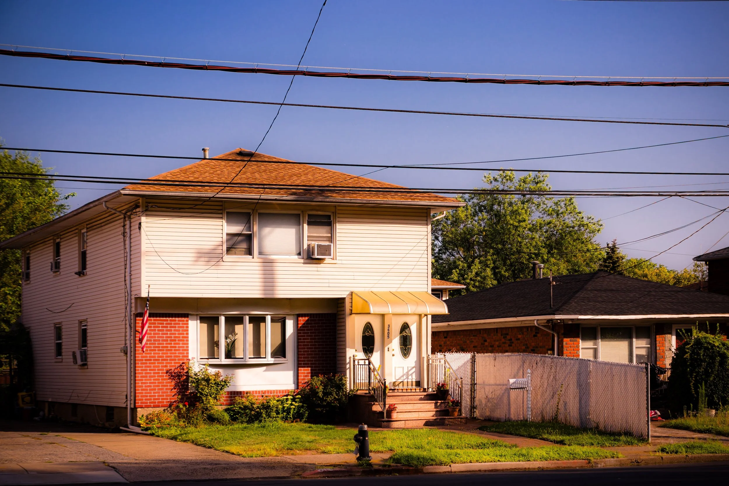
The decades following World War II marked Bay Terrace’s defining era. As the Verrazzano-Narrows Bridge opened in 1964, connecting Staten Island to Brooklyn, new waves of residents arrived—many relocating from Brooklyn or Queens in search of more space and greenery. The suburban dream was fully realized here: single-family homes with driveways and yards, local schools, and neighborhood shopping strips along Hylan Boulevard.
The Bay Terrace Shopping Center, with its grocery, bakery, and pharmacy, became a local landmark, serving generations of residents. Churches and civic organizations reinforced community life, while playgrounds and cul-de-sacs offered safe spaces for children. The neighborhood’s modest scale distinguished it from nearby commercial districts; it was residential by design, a haven of quiet amid the South Shore’s growing traffic.
By the 1970s and 1980s, Bay Terrace represented the quintessential Staten Island middle-class community—steady, family-oriented, and bound by neighborhood pride. The Staten Island Railway station at Bay Terrace, part of the original SIRT line, remained a vital lifeline, offering direct access to the ferry while preserving the area’s commuter convenience. The surrounding woodlands gradually gave way to newer homes, but careful zoning preserved the neighborhood’s suburban feel.
21st Century: Continuity and Renewal
In the 21st century, Bay Terrace continues to embody the postwar promise of Staten Island living: accessible yet insulated, suburban yet distinctly New York. The neighborhood remains primarily residential, with single-family homes maintained with evident care and pride. Generational continuity is strong—many families who settled here in the mid-20th century still have descendants in the area.
While the commercial strip along Hylan Boulevard has modernized, adding chain stores and cafés, it retains a local rhythm shaped by small business owners and long-standing community ties. The Bay Terrace Civic Association and neighborhood groups advocate for infrastructure improvements and environmental stewardship, particularly concerning drainage and coastal storm resilience. Proximity to the Bluebelt wetlands system, part of Staten Island’s innovative stormwater management network, reinforces the area’s ongoing relationship with nature.
The Bay Terrace station remains a quiet but indispensable commuter hub, while nearby schools and parks sustain the neighborhood’s family focus. Although traffic along Hylan Boulevard has intensified, within the interior streets life continues at a gentler pace—children biking on tree-shaded lanes, neighbors chatting over fences, and the faint scent of sea air drifting in from the bay.
Bay Terrace Photo Gallery
Spirit and Legacy
The spirit of Bay Terrace lies in its constancy. Born of postwar optimism and nurtured by decades of community care, it remains one of Staten Island’s most balanced neighborhoods—a place that offers suburban peace without isolation, tradition without stagnation. Its landscape, once farmland and open meadow, now bears the imprint of generations who built lives here through steadiness rather than spectacle.
Bay Terrace’s legacy is not measured in monuments but in everyday continuity—the quiet hum of a train pulling into the station at dusk, the glow of porch lights along tree-lined streets, the shared rhythm of civic life. It stands as a living emblem of Staten Island’s transformation from rural outskirts to residential borough: modest, enduring, and profoundly local.
New York City
Use this custom Google map to explore where every neighborhood in all five boroughs of New York City is located.
The Five Boroughs
One of New York City’s unique qualities is its organization in to 5 boroughs: Manhattan, Brooklyn, Queens, The Bronx, and Staten Island. These boroughs are part pragmatic administrative districts, and part vestiges of the region’s past. Each borough is an entire county in New York State - in fact, Brooklyn is, officially, Kings County, while Staten Island is, officially Richmond County. But that’s not the whole story …
Initially, New York City was located on the southern tip of Manhattan (now the Financial District) that was once the Dutch colony of New Amsterdam. Across the East River, another city was rising: Brooklyn. In time, the city planners realized that unification between the rapidly rising cities would create commercial and industrial opportunities - through streamlined administration of the region.
So powerful was the pull of unification between New York and Brooklyn that three more counties were pulled into the unification: The Bronx, Queens, and Staten Island. And on January 1, 1898, the City of New York unified two cities and three counties into one Greater City of New York - containing the five boroughs we know today.
But because each borough developed differently and distinctly until unification, their neighborhoods likewise uniquely developed. Today, there are nearly 390 neighborhoods, each with their own histories, cultures, cuisines, and personalities - and each with residents who are fiercely proud of their corner of The Big Apple.


