PELHAM BAY
The Bronx
Geographic Setting
Bounded by Middletown Road to the south, Water Place to the southwest, Eastchester Road to the west, and the Bronx and Pelham Parkway to the north, Pelham Bay occupies a key position in the northeastern Bronx, bridging the densely built mid-Bronx neighborhoods and the open parklands that lead toward the coast. Though often conflated with nearby Pelham Bay Park, the residential neighborhood of Pelham Bay is distinct—a thriving, middle-class enclave whose streets form a neat grid framed by broad boulevards, corner bakeries, and tidy brick homes.
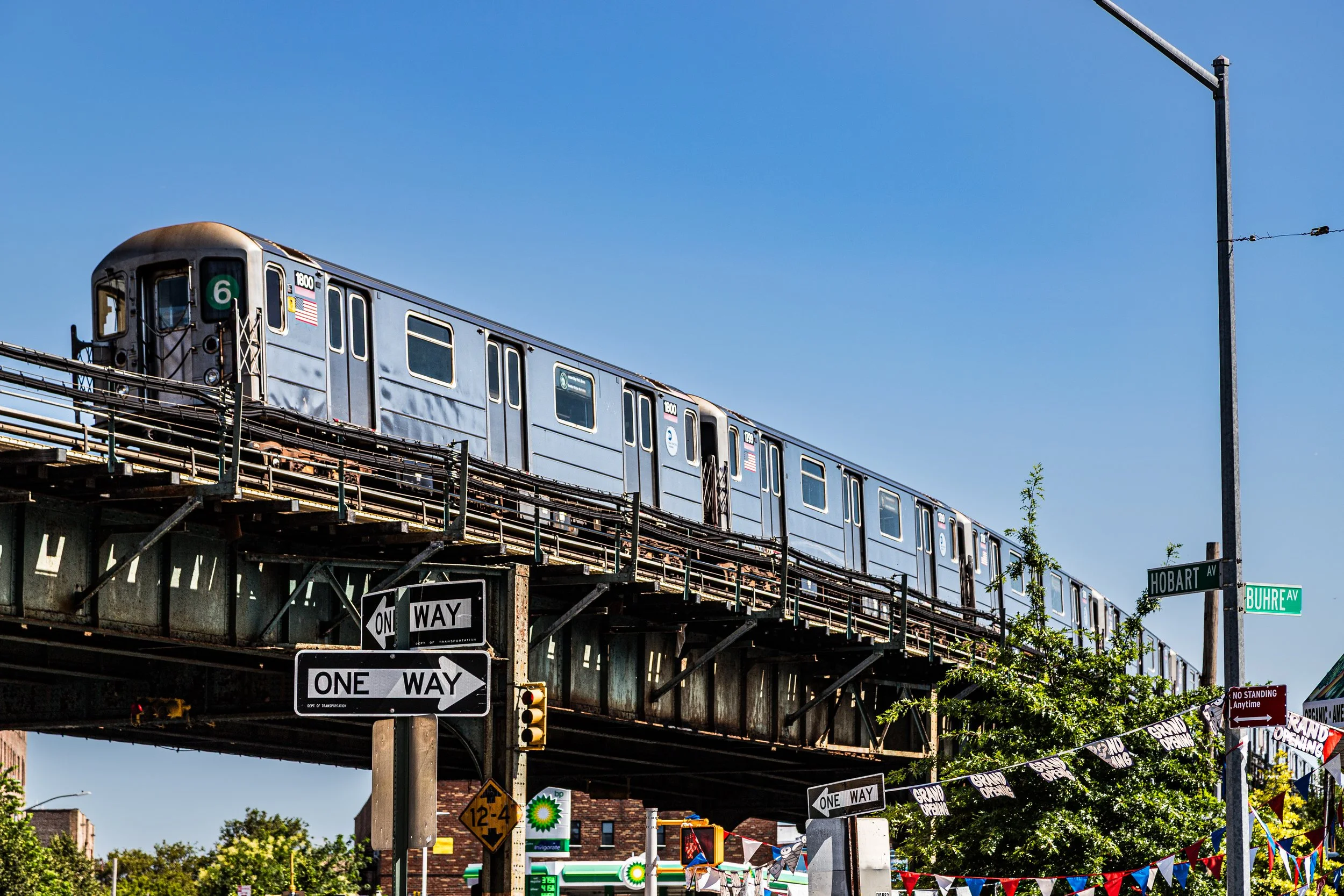
The neighborhood’s physical character reflects its transitional geography. To the north lies the expansive greenery of Pelham Bay Park, New York City’s largest public park; to the west, Eastchester Road and the Bronx–Pelham Parkway serve as vital arteries linking the community to Morris Park, Williamsbridge, and Co-op City. Within its boundaries, Buhre Avenue, Jarvis Avenue, and Westchester Avenue form the neighborhood’s main spines, while tree-lined side streets are lined with single-family homes, small apartment buildings, and two-story rowhouses from the mid-20th century. The Pelham Bay station (6 train)—its elevated tracks arching above Westchester Avenue—anchors the neighborhood’s commercial heart and connects it directly to Manhattan.
Despite its proximity to major highways and transit corridors, Pelham Bay retains a distinct small-town atmosphere, shaped by generations of homeowners, tight-knit families, and a shared pride in a neighborhood that balances city living with suburban tranquility.
Etymology
The name “Pelham Bay” traces its origin to Thomas Pell, an English physician and merchant who purchased a vast tract of land from the local Siwanoy people in 1654, naming it Pelham Manor after his ancestral home in England. The “Bay” in the modern name refers to the tidal inlet east of today’s neighborhood—Pelham Bay, the sheltered waterway along the western edge of City Island and Orchard Beach.
Though the residential district of Pelham Bay lies inland from the bay itself, its name preserves that colonial connection, evoking both geography and heritage. When the neighborhood developed in the early 20th century, developers deliberately adopted the name to lend prestige and continuity to the area—an echo of the colonial manor that once stretched from the Bronx to modern-day Westchester County.
The Neighborhood
Origins through the 19th Century
For centuries, the land that would become Pelham Bay lay within the agricultural estates of Pelham Manor, comprising rolling meadows, woodlots, and marshland near the Hutchinson and Bronx Rivers. Throughout the 18th and early 19th centuries, the area remained rural, dotted with farms supplying produce to the markets of lower Manhattan. The opening of Pelham Bridge (1815) and Westchester Turnpike (later East Tremont Avenue) connected these coastal tracts to city commerce, but residential development was minimal until annexation.
When the City of New York annexed the eastern Bronx in 1895, the area was subdivided for future growth. The creation of Pelham Bay Park (1888), championed by landscape advocate John Mullaly, permanently preserved the northern portion of the old manor lands, while the remaining parcels along Middletown Road and Westchester Avenue were gradually surveyed for residential use.
By the late 19th century, small clusters of homes and resorts appeared near Pelham Bay Station (then part of the old Harlem River Branch), serving summer visitors en route to City Island and Orchard Beach. The neighborhood’s transformation from farmland to suburb, however, awaited the coming of the subway.
Early 20th Century: Transit and Transformation
The decisive catalyst for Pelham Bay’s urbanization came with the extension of the IRT Pelham Line (6 train) in 1920. The elevated line’s terminus at Pelham Bay Park Station opened the eastern Bronx to thousands of new residents, transforming vacant fields into a bustling residential district. Developers quickly filled the area with brick two-family homes, small apartment buildings, and corner storefronts, creating a planned but organic neighborhood that reflected the working- and middle-class aspirations of its new residents—largely Italian, Irish, and Jewish families relocating from Manhattan.
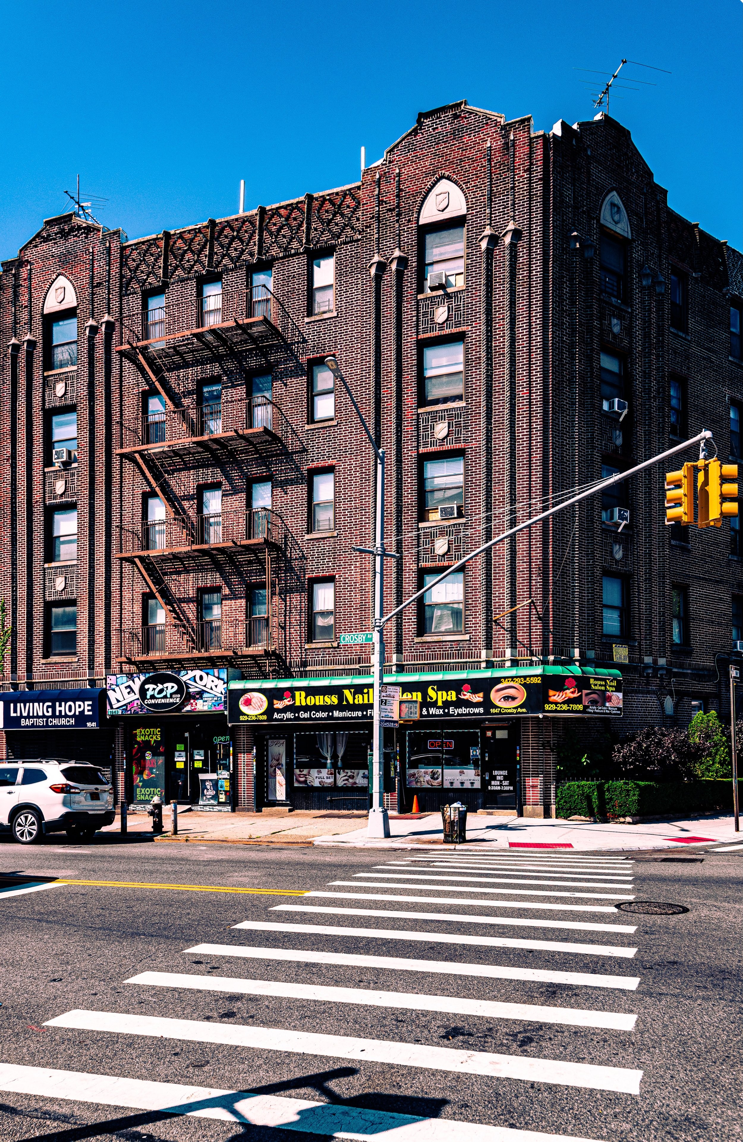
The architecture of this era endures: narrow front gardens, terra-cotta cornices, and modest decorative flourishes that lend the neighborhood its intimate human scale. Churches such as Our Lady of the Assumption (est. 1920s) and St. Theresa’s (est. 1927) became centers of community life, while local businesses along Westchester Avenue—bakeries, butchers, and tailor shops—provided both commerce and connection.
The neighborhood’s proximity to Pelham Bay Park offered residents immediate access to nature. Families spent weekends at Orchard Beach, built by Robert Moses in the 1930s, or enjoyed the park’s trails and bridle paths, blending urban convenience with coastal recreation in a way few other Bronx districts could match.
Pelham Bay Video Coming Soon
Mid–Late 20th Century: Suburban Continuity and Cultural Cohesion
In the postwar years, Pelham Bay solidified its reputation as one of the Bronx’s most stable, family-oriented neighborhoods. Returning veterans of World War II found affordable housing here, and a strong tradition of homeownership took root. The construction of the Hutchinson River Parkway (1937) and later the Bruckner Expressway improved automobile access while reinforcing the area’s distinct identity as the Bronx’s northeastern residential heart.
Throughout the 1950s–1970s, Pelham Bay remained predominantly Italian-American, with tight-knit families maintaining long-term residency and strong civic organizations. Social life revolved around parish halls, neighborhood associations, and family-run restaurants. Even as much of the South Bronx faced arson, depopulation, and economic decline, Pelham Bay remained resilient—protected by its strong homeowner base, active community boards, and distance from industrial zones.
By the 1980s and 1990s, new waves of residents—including Puerto Rican, Irish-American, and later Albanian, Greek, and Latino families—added to the neighborhood’s diversity while maintaining its essential character: safe, clean, and community-driven. Pelham Bay Park, Pelham Parkway, and Orchard Beach continued to serve as shared outdoor gathering grounds for generations of Bronxites.
21st Century: A Living Link Between City and Parkland
In the 21st century, Pelham Bay has evolved into one of the Bronx’s most desirable and civically active neighborhoods. Its population has become increasingly multicultural—Italian, Dominican, Albanian, Filipino, and Puerto Rican communities coexist peacefully along quiet residential streets and vibrant commercial corridors. The Pelham Bay Merchants Association and Community Board 10 oversee beautification projects, traffic improvements, and park conservation efforts, ensuring the neighborhood’s steady vitality.
The Buhre Avenue and Middletown Road subway stations—both renovated in the 2010s—anchor thriving retail zones filled with pizzerias, Latin cafés, and small shops. The proximity of Jacobi Medical Center, Einstein College of Medicine, and Pelham Bay Park lends both economic stability and access to essential services.
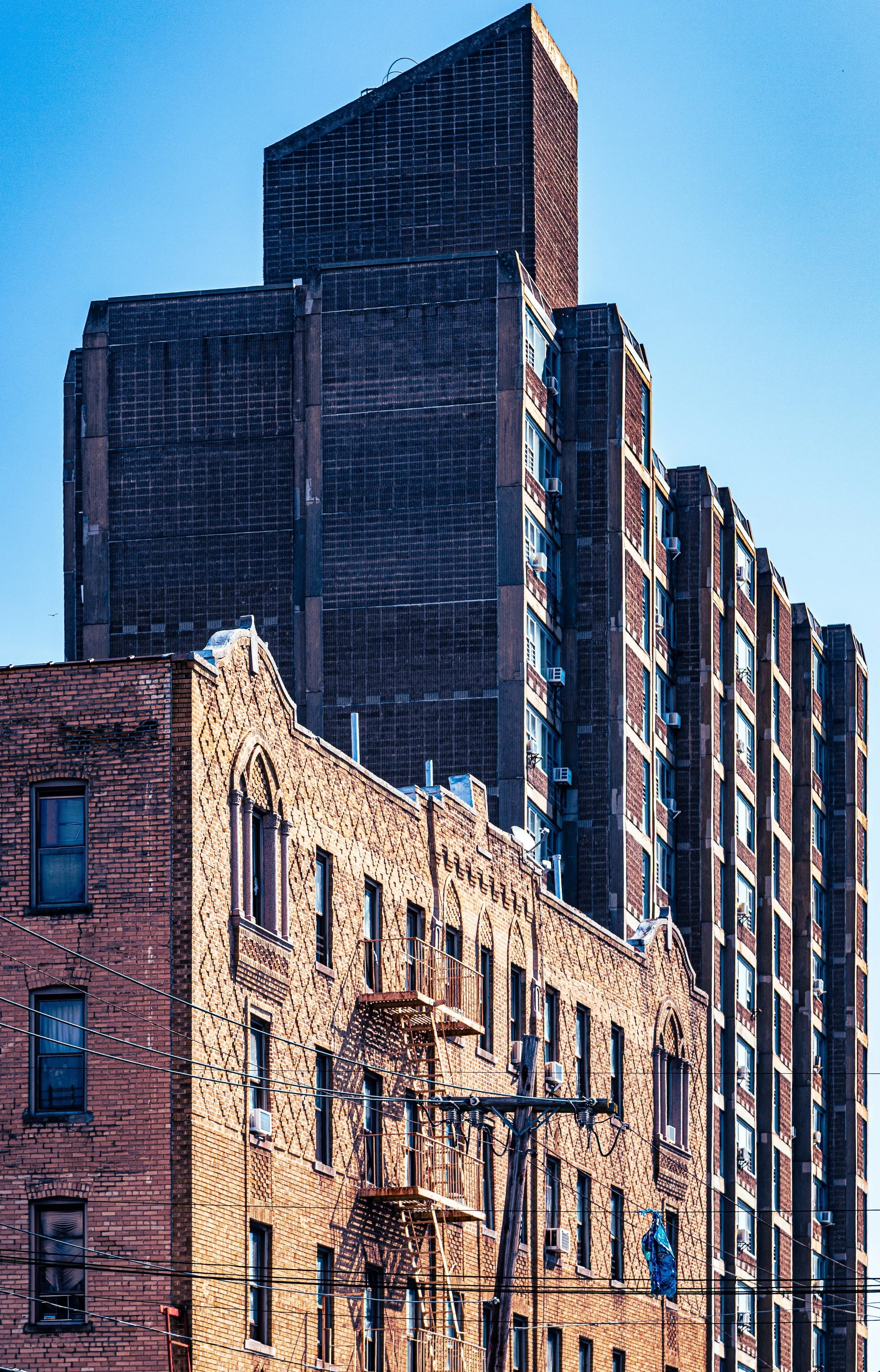
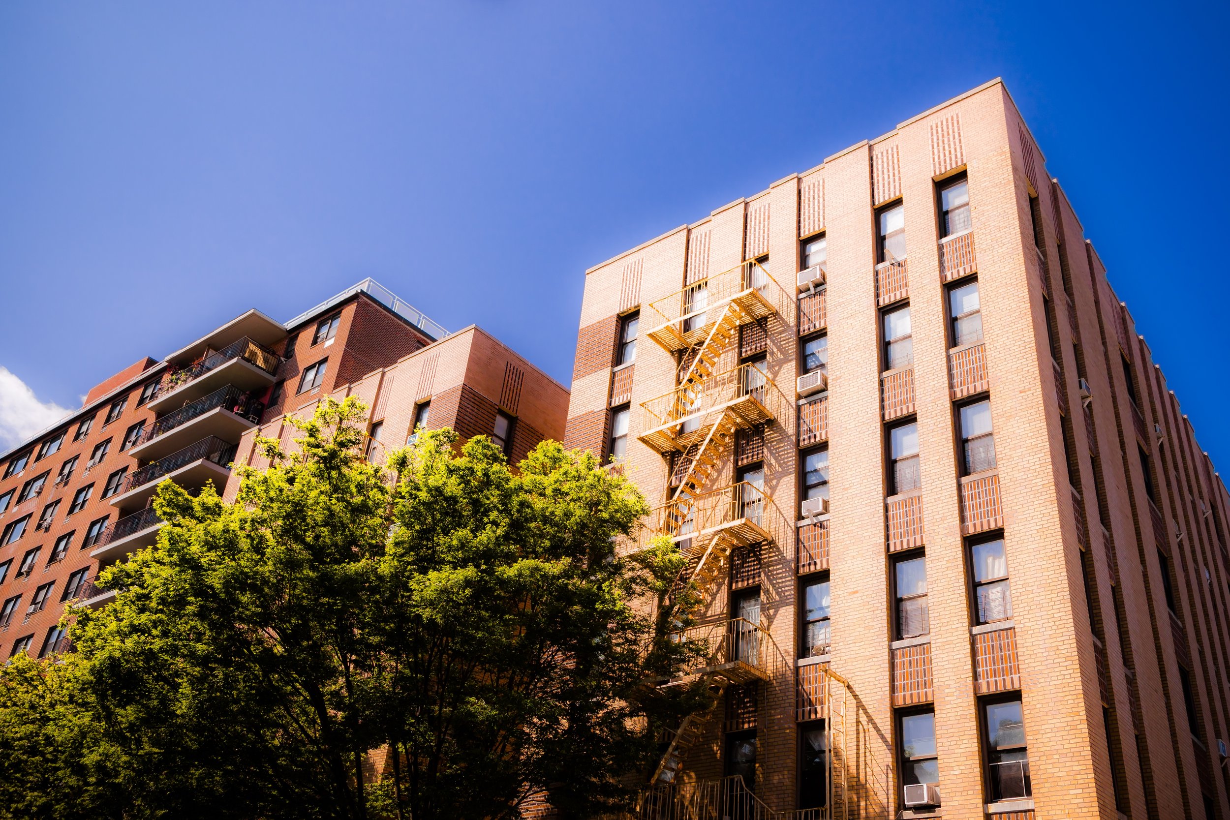
Architectural renewal has also arrived: older two-family homes are being restored with care, while new low-rise condominiums blend into the streetscape. The neighborhood’s green perimeters—Pelham Parkway’s tree-lined median and the open fields of Pelham Bay Park—still provide the sense of openness and air that inspired its early settlers.
Pelham Bay Photo Gallery
Spirit and Legacy
The spirit of Pelham Bay is one of balance—between past and present, city and nature, tradition and renewal. It is a neighborhood that thrives on continuity: generations walking the same blocks, attending the same churches, and celebrating the same summer nights along the parkway. Its enduring appeal lies not in spectacle but in steadiness—a model of Bronx neighborhood life sustained by pride of place.
New York City
Use this custom Google map to explore where every neighborhood in all five boroughs of New York City is located.
The Five Boroughs
One of New York City’s unique qualities is its organization in to 5 boroughs: Manhattan, Brooklyn, Queens, The Bronx, and Staten Island. These boroughs are part pragmatic administrative districts, and part vestiges of the region’s past. Each borough is an entire county in New York State - in fact, Brooklyn is, officially, Kings County, while Staten Island is, officially Richmond County. But that’s not the whole story …
Initially, New York City was located on the southern tip of Manhattan (now the Financial District) that was once the Dutch colony of New Amsterdam. Across the East River, another city was rising: Brooklyn. In time, the city planners realized that unification between the rapidly rising cities would create commercial and industrial opportunities - through streamlined administration of the region.
So powerful was the pull of unification between New York and Brooklyn that three more counties were pulled into the unification: The Bronx, Queens, and Staten Island. And on January 1, 1898, the City of New York unified two cities and three counties into one Greater City of New York - containing the five boroughs we know today.
But because each borough developed differently and distinctly until unification, their neighborhoods likewise uniquely developed. Today, there are nearly 390 neighborhoods, each with their own histories, cultures, cuisines, and personalities - and each with residents who are fiercely proud of their corner of The Big Apple.


