NEW DORP
Staten Island
Geographic Setting
Bounded by Bancroft Avenue to the northeast, Hylan Boulevard to the southeast, Tysens Lane to the southwest, and Richmond Road to the northwest, New Dorp lies at the heart of Staten Island’s East Shore—one of its oldest, most historically layered, and culturally emblematic neighborhoods. Nestled between Grant City and Oakwood, New Dorp stretches inland from the coastal plain toward the island’s central highlands, with its residential grid giving way to the wooded rise of Richmond Road, one of Staten Island’s oldest colonial thoroughfares.
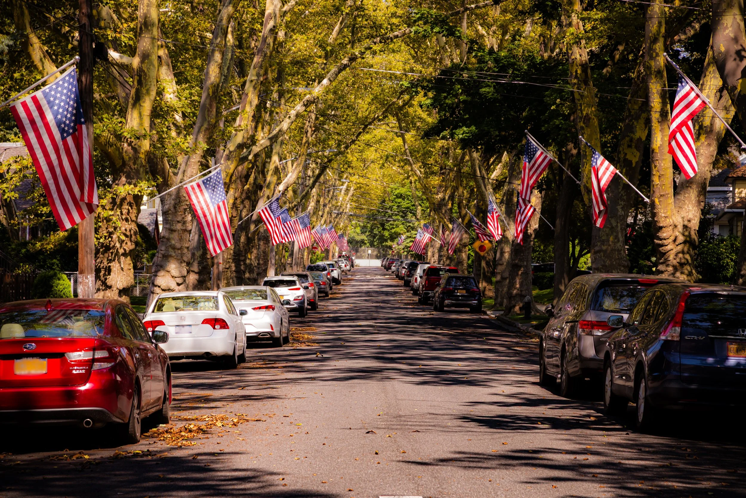
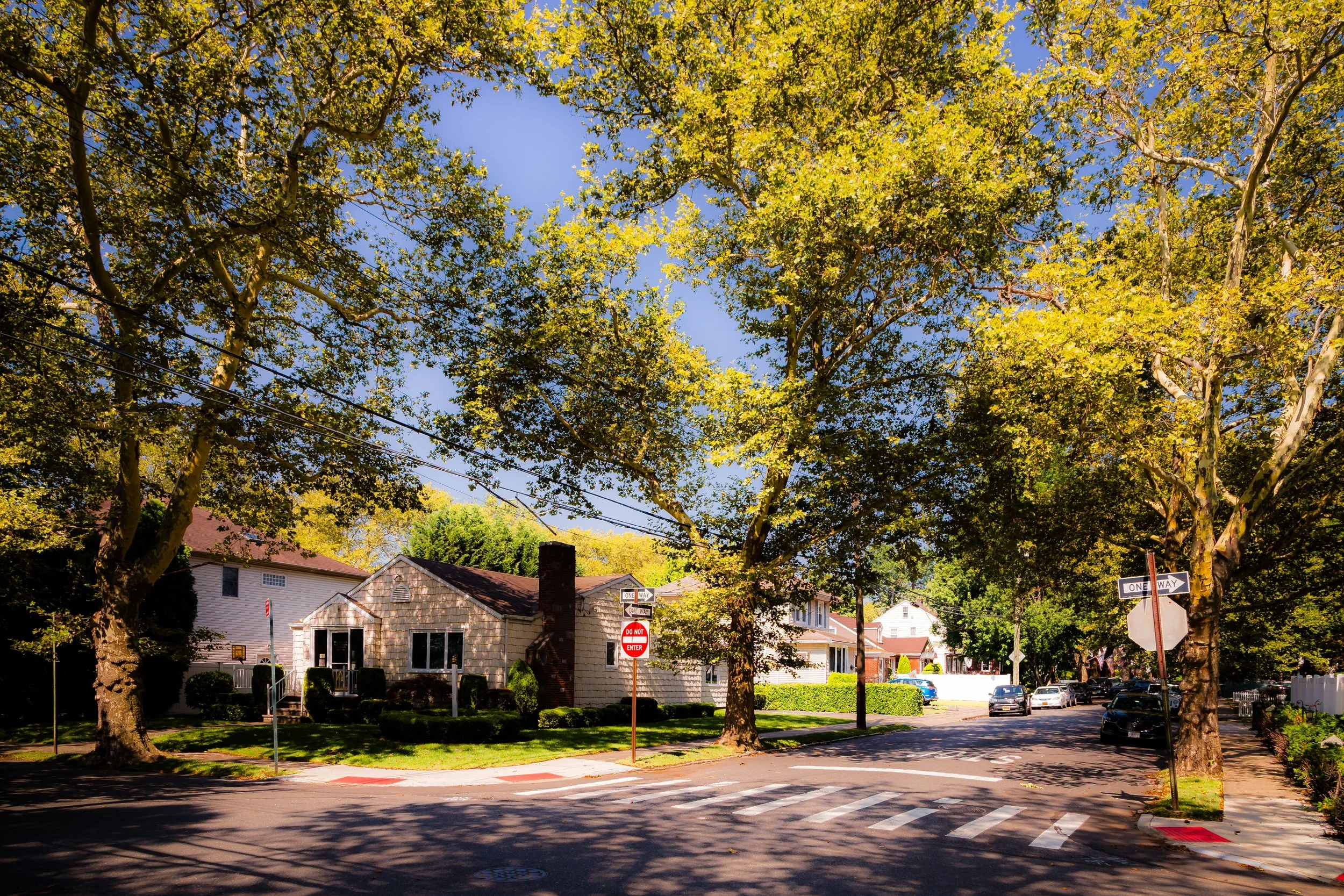
The landscape reflects a balance between suburban calm and urban convenience. New Dorp Lane, the neighborhood’s commercial spine, bisects the community from Richmond Road to Hylan Boulevard, lined with family-owned shops, cafés, and historic churches. To the southeast, tree-lined streets lead toward the shore and the recreational fields of Miller Field, while the inland reaches approach the greenbelt slopes near LaTourette Park. This spatial duality—land meeting water, old meeting new—defines New Dorp’s enduring identity as both a historic village and a modern neighborhood at the center of Staten Island life.
Etymology
The name New Dorp derives from the Dutch word dorp, meaning “village,” reflecting Staten Island’s early colonial heritage under New Netherland. The term Nieuw Dorp—literally “New Village”—was adopted in the late 17th century to distinguish the settlement from the older “Oude Dorp” (Old Village), located just to the northeast along the present-day South Beach shoreline. As English influence supplanted Dutch rule, the name Anglicized into “New Dorp,” a rare survival of Dutch linguistic roots in the city’s geography.
The name embodies both continuity and renewal: the second village of Staten Island’s early settlers, founded on cleared farmland and marshland as the population expanded inland from the coast. Over centuries, it has remained a living link to the island’s Dutch origins and agrarian past, even as it evolved into one of New York City’s quintessential suburban communities.
The Neighborhood
Origins through the 19th Century
New Dorp traces its history to the 1670s, when Dutch and French Huguenot settlers established farms on land previously inhabited by the Lenape people. Granted under the English colonial governor Sir Edmund Andros, the tract became part of the Southfield township and soon grew into a self-sufficient agricultural community. Early settlers included families whose names still echo in Staten Island history—the Vanderbilts, Simonsons, Brittons, and Croakers—many of whom operated farms, mills, and blacksmith shops along Richmond Road.
By the 18th century, New Dorp had become a thriving inland hamlet marked by its central crossroads at what is now New Dorp Lane and Richmond Road. The area’s fertile soil supported grain and livestock farming, while its proximity to the bay encouraged coastal trade. During the American Revolution, New Dorp became a strategic location, occupied by British forces due to its open fields and commanding position between the shore and the island’s central ridge.
After independence, the community entered a new era of prosperity. By the early 19th century, the establishment of the New Dorp Moravian Church (1763)—whose cemetery holds the remains of Cornelius Vanderbilt—anchored local religious and civic life. Richmond Road became a major artery linking the island’s villages, and stagecoaches carried passengers between New Dorp and the St. George Ferry. As the century progressed, wealthy New Yorkers began building country estates on the nearby hills, while local farms continued to define the area’s landscape.
Early 20th Century: A Suburban Village Emerges
The early 20th century brought transformation to New Dorp as Staten Island shifted from rural township to urban borough. The arrival of the Staten Island Railway (1860), with a station at New Dorp Lane, connected the neighborhood directly to St. George and Manhattan ferries, stimulating suburban growth. By the 1910s and 1920s, developers began subdividing farmland into residential blocks, advertising New Dorp as a modern “village by the sea.”
The construction of Hylan Boulevard in the 1920s cemented its status as a central East Shore corridor, while new schools, churches, and civic buildings reinforced community life. The Vanderbilt family, whose estate dominated the area for more than a century, donated portions of their land for public use, including what would become Miller Field—originally a U.S. Army Air Corps station established in 1919, later a recreational complex under the National Park Service’s Gateway National Recreation Area.
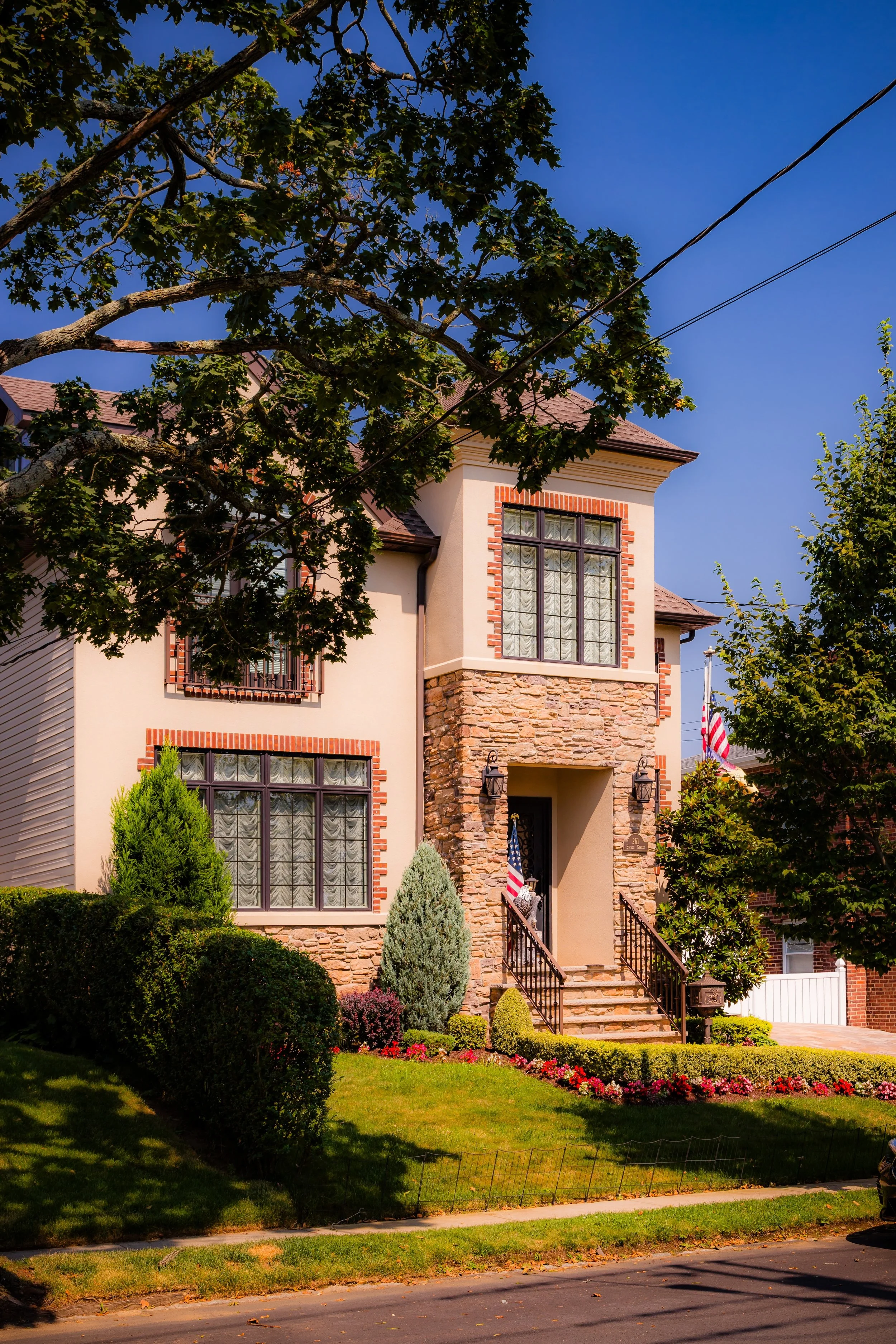
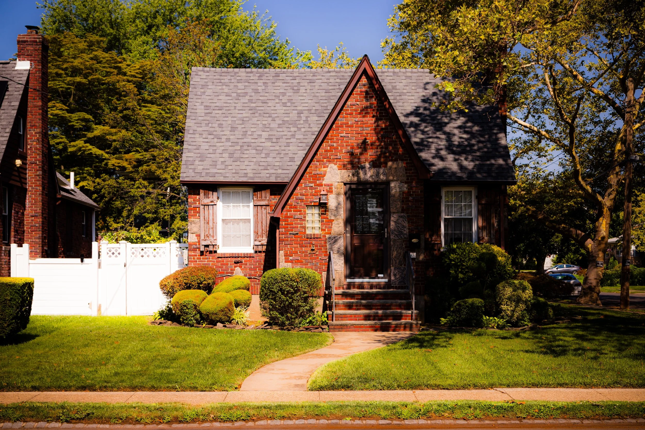
Through these decades, New Dorp retained a balance of urban accessibility and village intimacy. Its main street—New Dorp Lane—grew into one of Staten Island’s most recognizable commercial districts, its mix of shops, bakeries, and restaurants earning it the nickname “the Main Street of the East Shore.” Architecturally, the area blended Colonial Revival homes, bungalows, and row houses, giving the neighborhood its characteristic diversity of scale and style.
New Dorp Video Coming Soon
Mid–Late 20th Century: Postwar Growth and Cultural Vitality
The post–World War II era brought rapid suburban expansion to Staten Island, and New Dorp stood at its epicenter. Returning veterans and their families flocked to the area’s newly built single-family homes, drawn by affordable land and proximity to the shoreline. The construction of the Verrazzano-Narrows Bridge (1964) accelerated this growth, transforming Staten Island into the “borough of homeowners.”
By the 1960s and 1970s, New Dorp had matured into a bustling, self-contained community. New Dorp High School (1937) became a borough-wide institution, producing generations of Staten Islanders, while civic organizations such as the New Dorp Central Civic Association advocated for preservation and quality of life. Commercial life flourished along New Dorp Lane and Hylan Boulevard, where family-run businesses coexisted with growing retail chains.
The surrounding landscape, however, continued to change. The once-rural fringes near Tysens Lane and Bancroft Avenue filled with homes, and much of the Vanderbilt estate gave way to modern developments. Yet elements of the past endured: the Moravian Church, Vanderbilt Mausoleum, and colonial-era street grid stood as enduring reminders of New Dorp’s deep historical roots. Through these transitions, the neighborhood preserved its identity as both heartland and haven—an archetype of Staten Island’s suburban ideal.
21st Century: Tradition, Diversity, and Resilience
In the 21st century, New Dorp remains one of Staten Island’s most vital and multifaceted communities. Its population reflects the borough’s growing diversity, with longtime Italian-American families living alongside newcomers from Eastern Europe, Latin America, and South Asia. This cultural mix has invigorated local commerce and community life, with new restaurants, cafés, and markets joining the century-old businesses that line New Dorp Lane.
The neighborhood’s walkable character, transit access, and proximity to the shoreline make it a hub of East Shore life. The New Dorp SIR station continues to connect residents to the ferry and beyond, while the boardwalks and fields of Miller Field provide recreation and open space. The area has also shown remarkable resilience in the face of coastal challenges—most notably in the aftermath of Hurricane Sandy (2012), when flooding along the lower streets prompted new investment in coastal protection and stormwater management.
Today, New Dorp stands as both a historical and cultural bridge: a community that honors its 17th-century origins while embracing the realities and richness of 21st-century urban life. Its civic groups, schools, and churches remain pillars of local engagement, ensuring that the neighborhood’s growth continues to reflect its long tradition of self-reliance and pride.
New Dorp Photo Gallery
Spirit and Legacy
The spirit of New Dorp lies in continuity—a living dialogue between past and present, between the colonial village and the modern suburb. Few neighborhoods in New York City encapsulate such a span of history in such a concentrated space: from Dutch settlers and Vanderbilt magnates to commuters and shopkeepers who keep the main street alive.
Its legacy is one of endurance and adaptation. The old Moravian graveyard and the sleek storefronts of New Dorp Lane belong to the same story—a story of people who built, rebuilt, and renewed across centuries. The neighborhood’s name, meaning simply “new village,” remains fitting even today: each generation has made it new again.
New York City
Use this custom Google map to explore where every neighborhood in all five boroughs of New York City is located.
The Five Boroughs
One of New York City’s unique qualities is its organization in to 5 boroughs: Manhattan, Brooklyn, Queens, The Bronx, and Staten Island. These boroughs are part pragmatic administrative districts, and part vestiges of the region’s past. Each borough is an entire county in New York State - in fact, Brooklyn is, officially, Kings County, while Staten Island is, officially Richmond County. But that’s not the whole story …
Initially, New York City was located on the southern tip of Manhattan (now the Financial District) that was once the Dutch colony of New Amsterdam. Across the East River, another city was rising: Brooklyn. In time, the city planners realized that unification between the rapidly rising cities would create commercial and industrial opportunities - through streamlined administration of the region.
So powerful was the pull of unification between New York and Brooklyn that three more counties were pulled into the unification: The Bronx, Queens, and Staten Island. And on January 1, 1898, the City of New York unified two cities and three counties into one Greater City of New York - containing the five boroughs we know today.
But because each borough developed differently and distinctly until unification, their neighborhoods likewise uniquely developed. Today, there are nearly 390 neighborhoods, each with their own histories, cultures, cuisines, and personalities - and each with residents who are fiercely proud of their corner of The Big Apple.


