BRIARWOOD
Queens
Geographic Setting
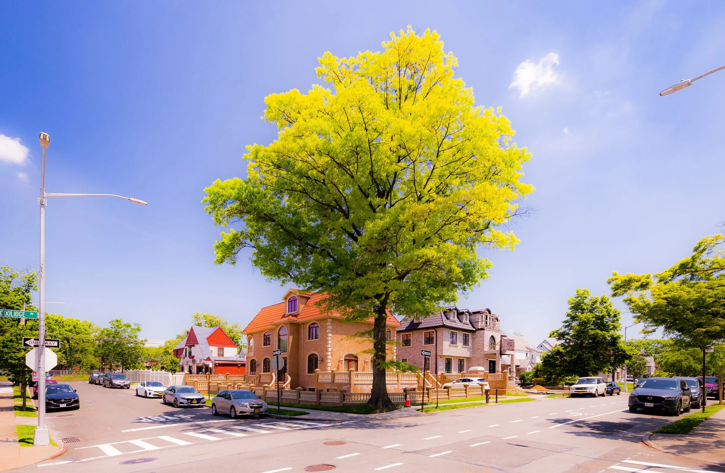
Bounded by Hillside Avenue to the south, the Van Wyck Expressway to the east, Union Turnpike to the north, and Parsons Boulevard to the west, Briarwood lies at the geographic center of Queens—a modest yet characterful neighborhood defined by tree-lined streets, prewar apartment houses, and mid-century homes. Its gently sloping terrain rises from the lowlands near the expressway toward Main Street and Queens Boulevard, forming a residential pocket between the larger districts of Jamaica Hills and Kew Gardens Hills.
Despite its centrality, Briarwood maintains a distinctly tranquil atmosphere. Queens Boulevard and Hillside Avenue frame its busy edges, while interior streets such as Manton Street, 84th Drive, and 136th Street preserve the calm of garden suburb design. The Briarwood–Van Wyck Boulevard subway station (E and F trains) connects the neighborhood directly to Manhattan and Long Island City, while the Grand Central Parkway and Van Wyck Expressway provide vehicular access across the borough. Pockets of green—Maple Grove Cemetery to the northwest and Captain Tilly Park just beyond Parsons—give the area an enduring sense of balance between city and sanctuary.
Etymology and Origins
The name “Briarwood” dates to the early 20th century and reflects the real estate romanticism of its founding. Developer Clarence Stein and the Briarwood Land Company, active around 1905–1910, sought to market this portion of the former Flushing–Jamaica farmland as a suburban retreat “where the city’s pace gives way to the peace of trees.” The word “briarwood” evoked rustic gentility—an allusion to wild roses and English gardens—aimed at middle-class professionals seeking quiet and greenery within commuting distance of Manhattan.
Before its development, the area was part of the colonial-era Town of Jamaica, with farmsteads stretching north toward Flushing Meadows and south toward Jamaica Village. The coming of the Queens Boulevard trolley and later the IND Subway (completed to Jamaica in 1937) turned what had been rural acreage into prime residential land, reshaping the borough’s center into an accessible commuter hub.
The Neighborhood
Early 20th Century: Planned Suburb and Interwar Growth
Briarwood’s transformation began in earnest in the 1920s, when the extension of Union Turnpike and Queens Boulevard created the transportation framework that still defines the area today. The Briarwood Land Company subdivided farmland into a grid of curving residential blocks, lined with newly planted elms and maples. Early promotional literature described the area as “the garden of Queens,” emphasizing its elevation, clean air, and proximity to both Forest Park and Jamaica Hills.
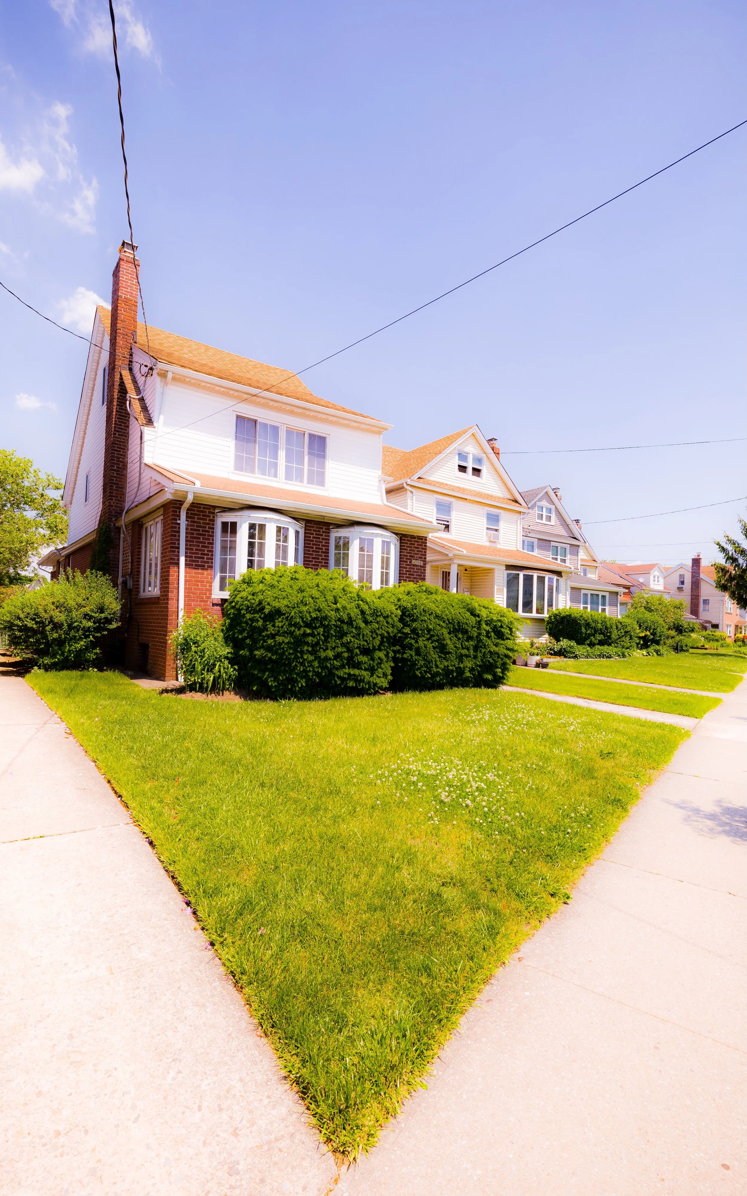
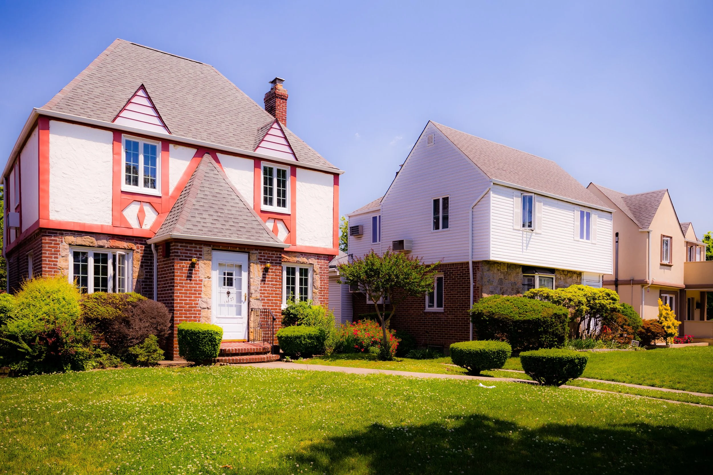
The first homes—Tudor Revival, Colonial, and Mediterranean in style—were built for teachers, civil servants, and small business owners. By the mid-1930s, small apartment houses and two-story brick garden complexes joined the landscape, creating a mix of single- and multi-family housing that remains characteristic today. The neighborhood’s architectural unity—brick façades, slate roofs, and narrow setbacks—gave it a cohesive charm that differentiated it from denser nearby districts.
Mid-20th Century: Suburban Ideal in the Heart of Queens
By the 1940s and 1950s, Briarwood had become one of Queens’ most stable, middle-class neighborhoods. The completion of the Grand Central Parkway (1936) and Van Wyck Expressway (1950s) improved accessibility while physically enclosing the area within a ring of major thoroughfares, reinforcing its sense of separateness. This infrastructure, while noisy at the margins, gave Briarwood a clear geographic identity—an island of calm bordered by motion.
The neighborhood’s population at mid-century was a microcosm of upwardly mobile New York: Irish, Italian, and Jewish families formed the early core, later joined by Greek and Caribbean residents. Civic associations and parent-teacher groups flourished, maintaining a strong local identity even as commercial corridors grew along Hillside and Queens Boulevards. Churches such as St. Demetrios Greek Orthodox Church and schools including P.S. 117 and J.H.S. 217 became neighborhood anchors.
Briarwood’s appeal lay in its scale: low-rise apartment buildings surrounded by greenery, accessible yet sheltered. Small corner stores, bakeries, and luncheonettes created a self-contained atmosphere that continues today. The opening of the Briarwood–Van Wyck subway station in 1937 (originally named “Briarwood–Sutphin Boulevard”) further cemented the area’s identity as a true commuter suburb within city limits.
Briarwood Photographic Video
Late 20th Century: Continuity Through Change
From the 1960s through the 1980s, Briarwood experienced gradual demographic change but remained solidly residential. The construction of the Van Wyck Expressway had displaced a small section of housing along its eastern boundary, yet the neighborhood’s core endured intact. Many families who had arrived in the interwar years remained, even as younger generations moved outward to Long Island.
New immigrant populations—particularly from South Asia, the Caribbean, and Latin America—brought fresh energy to Hillside Avenue’s commercial life, transforming it into a vibrant corridor of markets, restaurants, and specialty shops. Apartment buildings near Queens Boulevard diversified further, housing professionals, retirees, and students drawn by the area’s affordability and transit convenience.
Despite these shifts, Briarwood retained a strong sense of place. The Briarwood Community Association, active since the mid-century, championed zoning protections to prevent overdevelopment and lobbied for beautification projects, park improvements, and noise abatement from nearby expressways. The result was a neighborhood that managed to evolve demographically while preserving its essential physical and civic form.
21st Century: Diversity, Transit, and Neighborhood Pride
In the 2000s and 2010s, Briarwood quietly thrived amid the rapid transformation of central Queens. Its population grew more diverse, reflecting the borough’s global mosaic: Bangladeshi, Indian, Latin American, Filipino, and African-American residents joined longstanding European-American families, creating a richly multicultural community. The E and F trains, major highways, and nearby JFK Airport make it one of the most transit-connected neighborhoods in the borough, yet its residential core remains low-key and leafy.
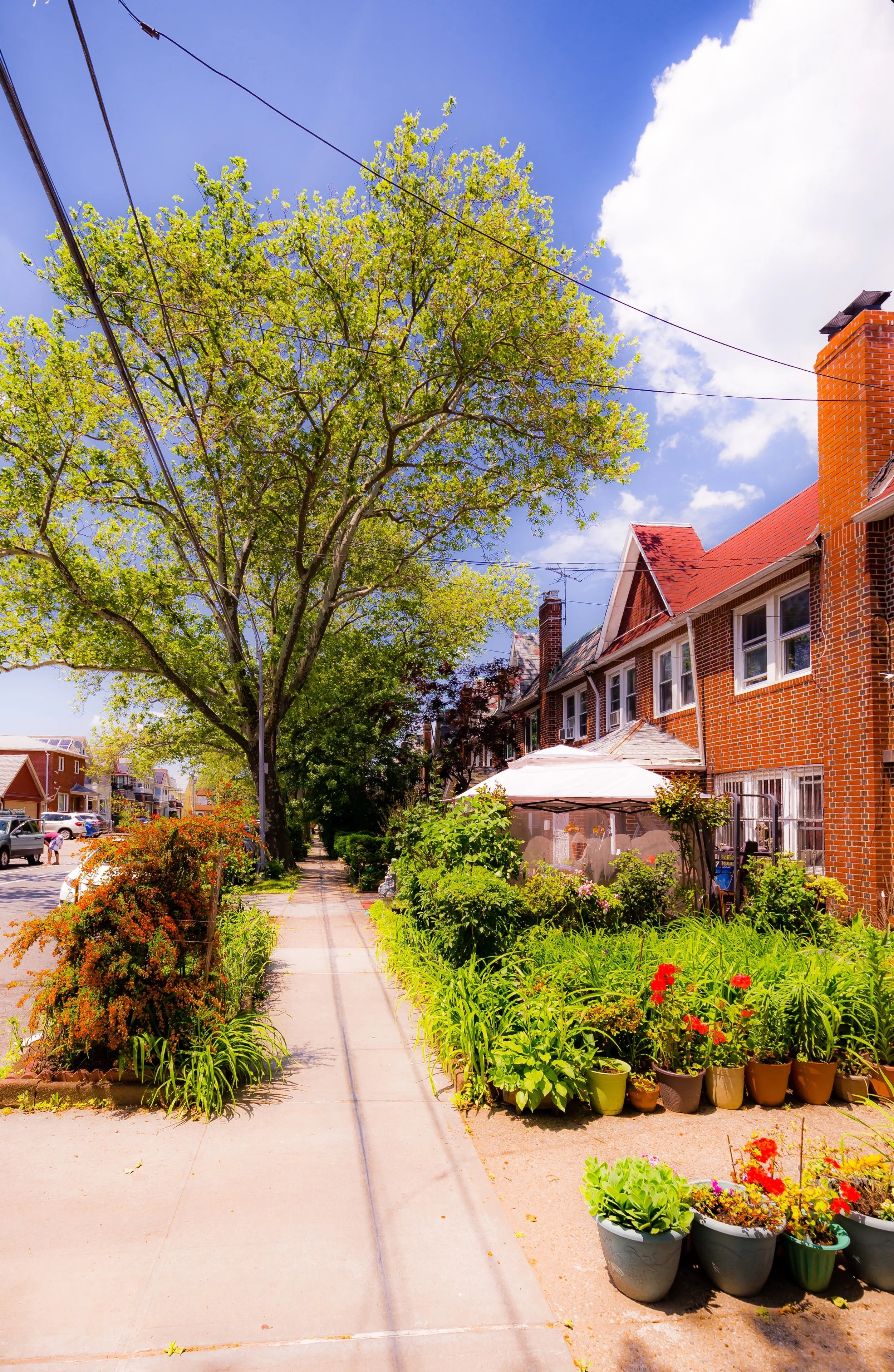
The renovation of the Briarwood subway station (completed in 2014) revitalized the neighborhood’s gateway, while small businesses and eateries continue to animate Hillside Avenue and Queens Boulevard. Meanwhile, quiet side streets like Manton Street and 136th Street retain their interwar charm—brick facades, stoops lined with flowerpots, and children’s bicycles leaning against iron fences.
Today, Briarwood stands as one of Queens’ most balanced neighborhoods: diverse yet cohesive, central yet calm. Its modest skyline, abundant trees, and strong transit links make it both a refuge and a crossroads—a neighborhood where the old suburban vision and the global city meet comfortably.
Briarwood Photo Gallery
Spirit and Legacy
Briarwood’s legacy lies in its name: a place of natural grace and enduring beauty, cultivated within the bounds of the metropolis. It is a neighborhood that has quietly fulfilled the early 20th-century promise of “urban serenity”—a community shaped not by spectacle but by steadiness.
New York City
Use this custom Google map to explore where every neighborhood in all five boroughs of New York City is located.
The Five Boroughs
One of New York City’s unique qualities is its organization in to 5 boroughs: Manhattan, Brooklyn, Queens, The Bronx, and Staten Island. These boroughs are part pragmatic administrative districts, and part vestiges of the region’s past. Each borough is an entire county in New York State - in fact, Brooklyn is, officially, Kings County, while Staten Island is, officially Richmond County. But that’s not the whole story …
Initially, New York City was located on the southern tip of Manhattan (now the Financial District) that was once the Dutch colony of New Amsterdam. Across the East River, another city was rising: Brooklyn. In time, the city planners realized that unification between the rapidly rising cities would create commercial and industrial opportunities - through streamlined administration of the region.
So powerful was the pull of unification between New York and Brooklyn that three more counties were pulled into the unification: The Bronx, Queens, and Staten Island. And on January 1, 1898, the City of New York unified two cities and three counties into one Greater City of New York - containing the five boroughs we know today.
But because each borough developed differently and distinctly until unification, their neighborhoods likewise uniquely developed. Today, there are nearly 390 neighborhoods, each with their own histories, cultures, cuisines, and personalities - and each with residents who are fiercely proud of their corner of The Big Apple.


