JAMAICA ESTATES
Queens
Geographic Setting
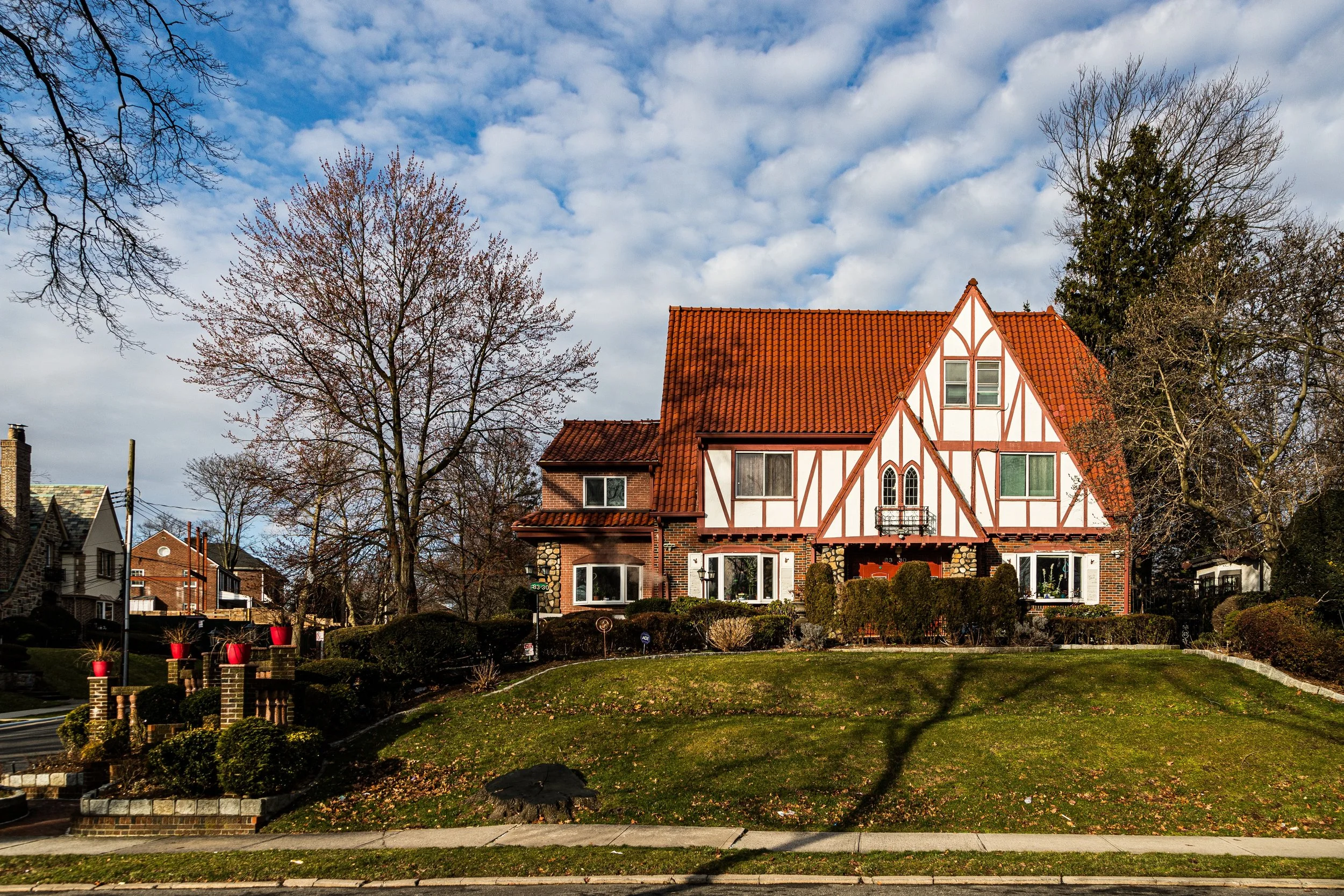
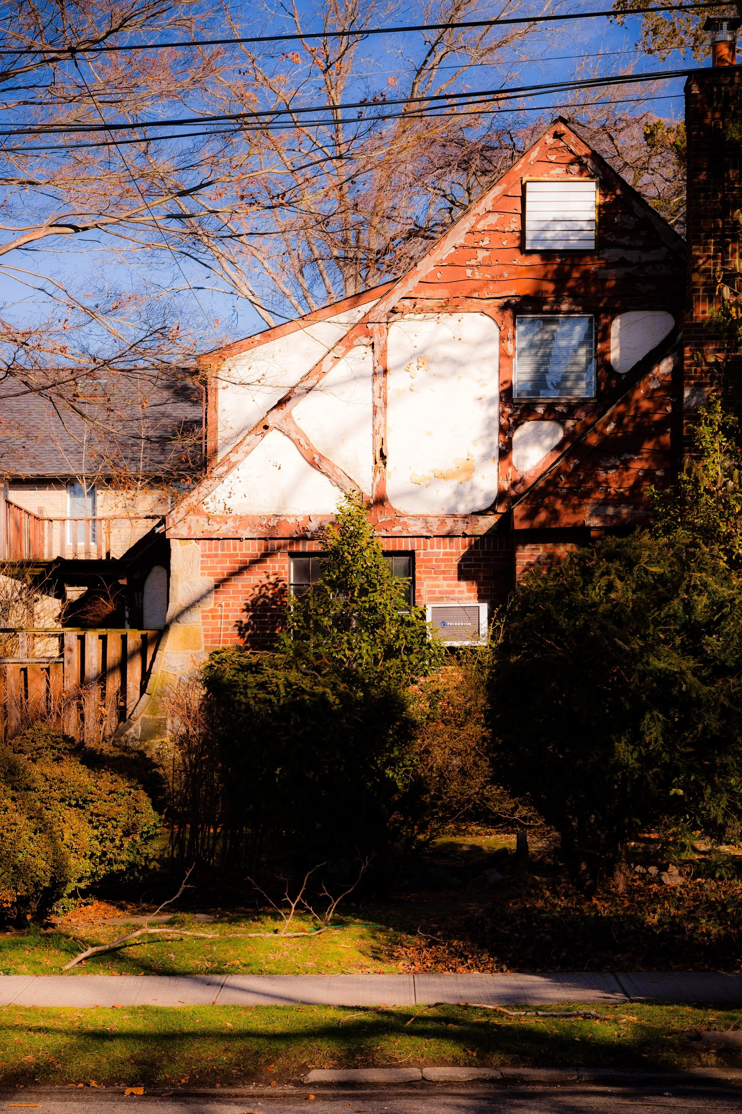
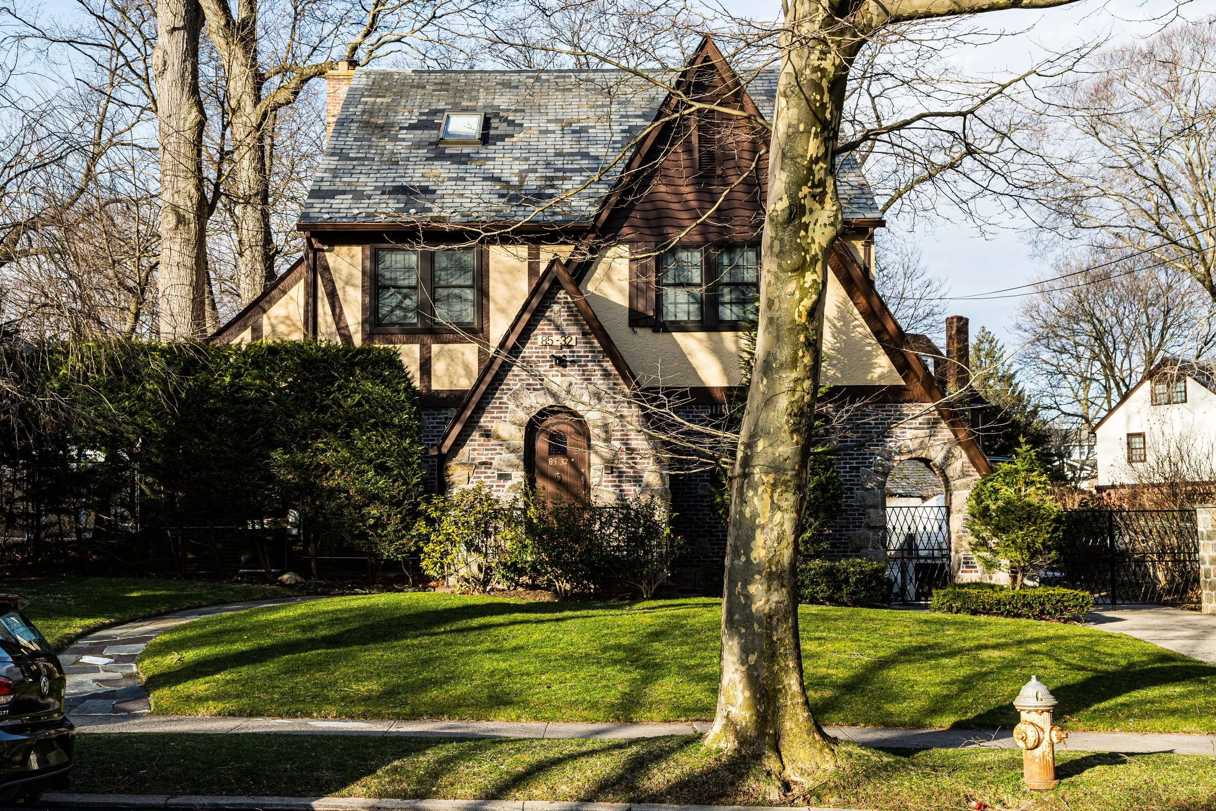
Tucked into the rolling hills of central Queens, Jamaica Estates occupies one of the borough’s most distinctive and verdant residential enclaves. It is bounded by Union Turnpike to the north, Hillside Avenue to the south, Homelawn and 170th Streets to the west, and 188th Street to the east—nestled between Holliswood and Fresh Meadows, just east of St. John’s University. Rising along the glacial ridge that divides northern and southern Queens, its topography of curving roads, shaded lanes, and elevated lots sets it apart from the surrounding grid of streets.
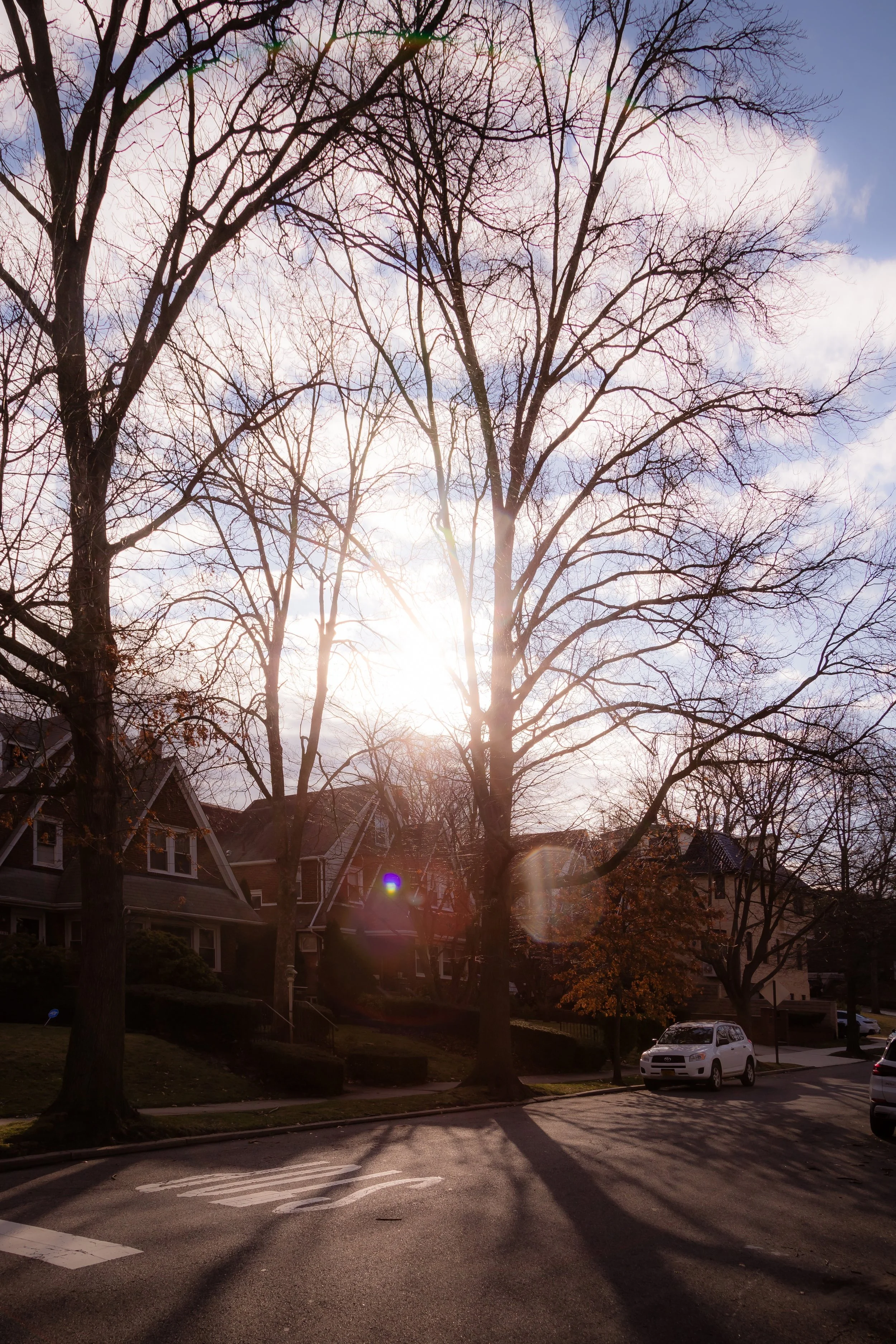
The neighborhood’s layout is deliberately pastoral: streets such as Dalton Street, Avon Road, Midland Parkway, and Edgerton Boulevard wind among mature trees and spacious detached homes. Midland Parkway, lined with stately lamp posts and landscaped medians, serves as the community’s ceremonial boulevard—its gentle curves culminating in the small commercial triangle near Hillside Avenue that functions as the neighborhood’s gateway. Despite proximity to major highways and the F train at 169th Street, Jamaica Estates remains a world apart: leafy, tranquil, and almost suburban in spirit.
Etymology and Origins
The name “Jamaica Estates” was coined in 1907 by the Jamaica Estates Corporation, founded by brothers Frederick and Edwin W. Johnson, developers who envisioned a model suburban community for professionals seeking country living within New York City. “Jamaica” reflected the area’s historic ties to the larger township dating back to the 17th century, while “Estates” signaled the corporation’s intention to market the district as an exclusive residential park.
Prior to development, the land—nearly 500 acres—consisted of farms, woodlots, and meadows. Its elevation and natural contours offered drainage, views, and breezes unmatched elsewhere in Queens. The Johnsons, influenced by the Garden City Movement and contemporary suburban design in Westchester and Long Island, saw in these hills the potential for a planned enclave of elegance and restraint.
The Neighborhood
Early 20th Century: The Making of a Suburban Park
Development began in 1908, guided by a master plan that rejected the city’s rectilinear grid in favor of winding roads that followed the terrain. The Jamaica Estates Corporation imposed strict architectural and landscaping covenants: all houses were to be detached, built of brick, stone, or stucco, and set back from the street with lawns and trees. Overhead wires were banned, sidewalks bordered by uniform shade trees, and every lot required landscaping.
By the 1920s, the neighborhood was fully taking shape. Early homes reflected a range of styles popular among the upper middle class—Tudor Revival, Colonial, Mediterranean, and Arts & Crafts—designed by prominent architects such as Henry A. Macomb and Robert Tappan. The Jamaica Estates Golf Club and the stately Jamaica Estates Guardhouse (still standing on Midland Parkway) underscored its identity as a planned community of refinement. Advertisements of the era described it as “the most beautiful residential park in Greater New York.”
Its residents were professionals, merchants, and civil servants drawn by its tranquility and proximity to downtown Jamaica’s shopping and rail links. The creation of Union Turnpike in the 1930s and the later construction of the Grand Central Parkway improved access while preserving the district’s serenity.
Mid-20th Century: Prestige and Continuity
During the 1940s–1960s, Jamaica Estates reached full maturity as one of Queens’ most desirable residential districts. Larger homes were built on remaining lots, particularly along Midland Parkway, while older structures were carefully maintained. The neighborhood’s religious and civic institutions flourished: the Jamaica Estates–Holliswood–South Bayside Jewish Center, the Church of the Immaculate Conception, and local civic associations organized social events, parades, and beautification projects.
Despite the urbanization of nearby Jamaica and Hollis, Jamaica Estates remained almost suburban in appearance and feel. Strict zoning protected its single-family character, and the Jamaica Estates Association, formed in 1929, became one of the city’s most effective civic bodies—enforcing maintenance standards, opposing commercial encroachment, and preserving its leafy atmosphere. Its residents included judges, doctors, educators, and city officials—a reflection of the neighborhood’s continued prestige.
Jamaica Estates Photographic Video
Late 20th–21st Century: Diversity and Preservation
As Queens became increasingly multicultural in the late 20th century, Jamaica Estates evolved without losing its identity. By the 1980s and 1990s, new homeowners of South Asian, Caribbean, and Eastern European descent joined long-established Jewish and Italian families, maintaining the neighborhood’s tradition of stability and pride. Property values remained among the highest in the borough.
While some older houses were replaced by larger modern constructions, civic leaders ensured that new development adhered to zoning that preserved low density and generous setbacks. The Midland Parkway median, now adorned with seasonal plantings, continues to symbolize the area’s aesthetic unity. Nearby St. John’s University provides cultural and academic connection, while residents enjoy direct access to Cunningham Park and Grand Central Parkway without sacrificing tranquility.
In recent years, efforts by the Jamaica Estates Association have emphasized environmental stewardship—tree preservation, stormwater management, and sidewalk restoration—ensuring that the neighborhood’s defining greenery remains intact for future generations.
Jamaica Estates Photo Gallery
Spirit and Legacy
Jamaica Estates remains one of the finest examples of early 20th-century suburban planning within New York City—a living synthesis of landscape design, architecture, and civic pride. Its winding streets and stone gateposts speak to an era when neighborhoods were conceived as complete aesthetic environments. Yet beyond its physical beauty lies a deeper continuity: a shared ethos of care, civility, and belonging that transcends generations.
At dusk, as the lamps along Midland Parkway flicker on beneath towering oaks and the city’s skyline glimmers faintly to the west, Jamaica Estates feels both timeless and distinctly modern—a sanctuary built on foresight and preserved through devotion. In its graceful streets and steadfast community, one finds a rare urban ideal fulfilled: harmony between nature, architecture, and the enduring human desire for home.
New York City
Use this custom Google map to explore where every neighborhood in all five boroughs of New York City is located.
The Five Boroughs
One of New York City’s unique qualities is its organization in to 5 boroughs: Manhattan, Brooklyn, Queens, The Bronx, and Staten Island. These boroughs are part pragmatic administrative districts, and part vestiges of the region’s past. Each borough is an entire county in New York State - in fact, Brooklyn is, officially, Kings County, while Staten Island is, officially Richmond County. But that’s not the whole story …
Initially, New York City was located on the southern tip of Manhattan (now the Financial District) that was once the Dutch colony of New Amsterdam. Across the East River, another city was rising: Brooklyn. In time, the city planners realized that unification between the rapidly rising cities would create commercial and industrial opportunities - through streamlined administration of the region.
So powerful was the pull of unification between New York and Brooklyn that three more counties were pulled into the unification: The Bronx, Queens, and Staten Island. And on January 1, 1898, the City of New York unified two cities and three counties into one Greater City of New York - containing the five boroughs we know today.
But because each borough developed differently and distinctly until unification, their neighborhoods likewise uniquely developed. Today, there are nearly 390 neighborhoods, each with their own histories, cultures, cuisines, and personalities - and each with residents who are fiercely proud of their corner of The Big Apple.


