TWO BRIDGES
Manhattan
Geographic Setting
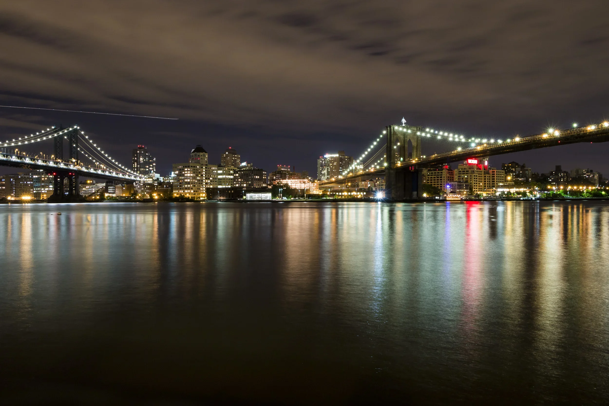
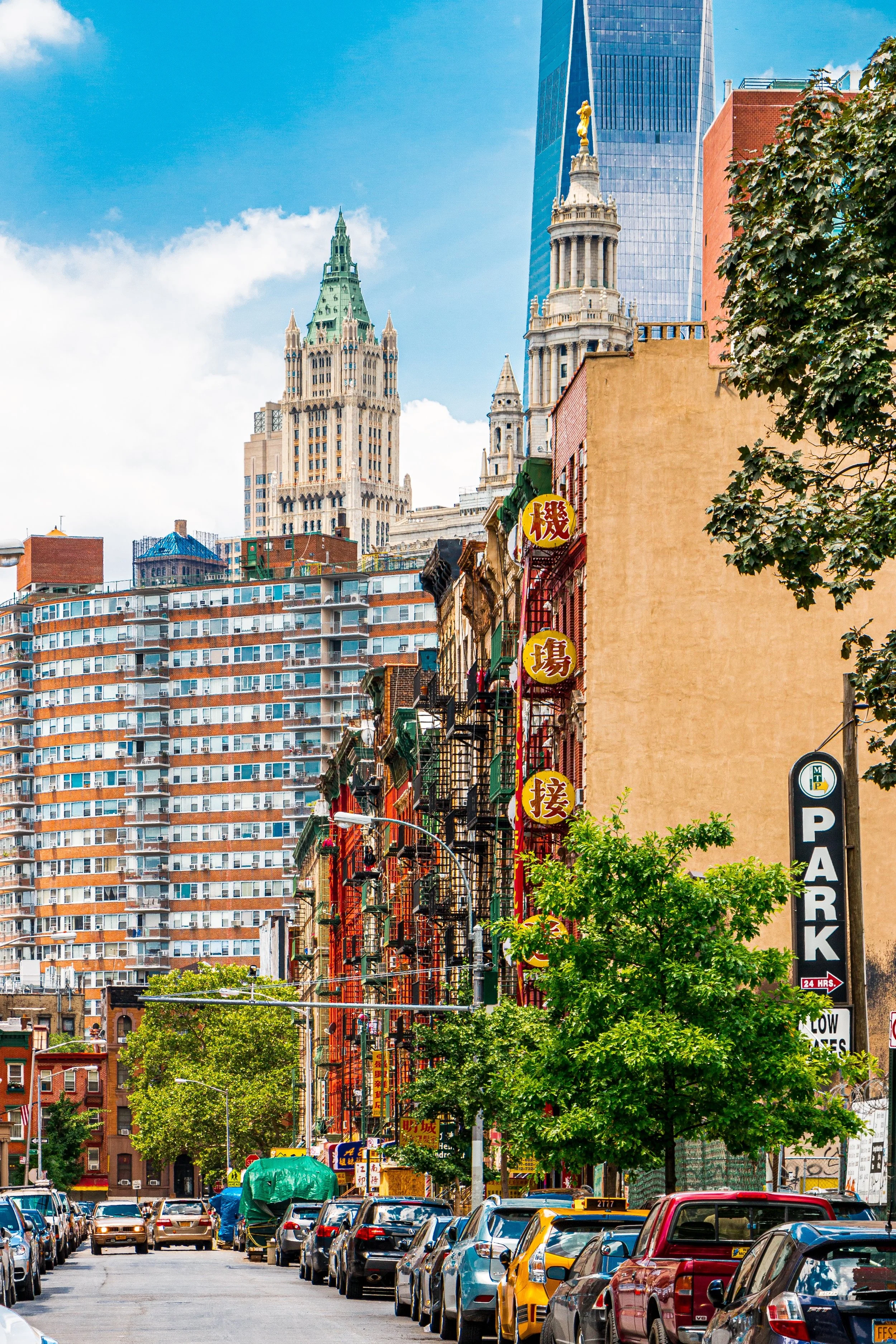
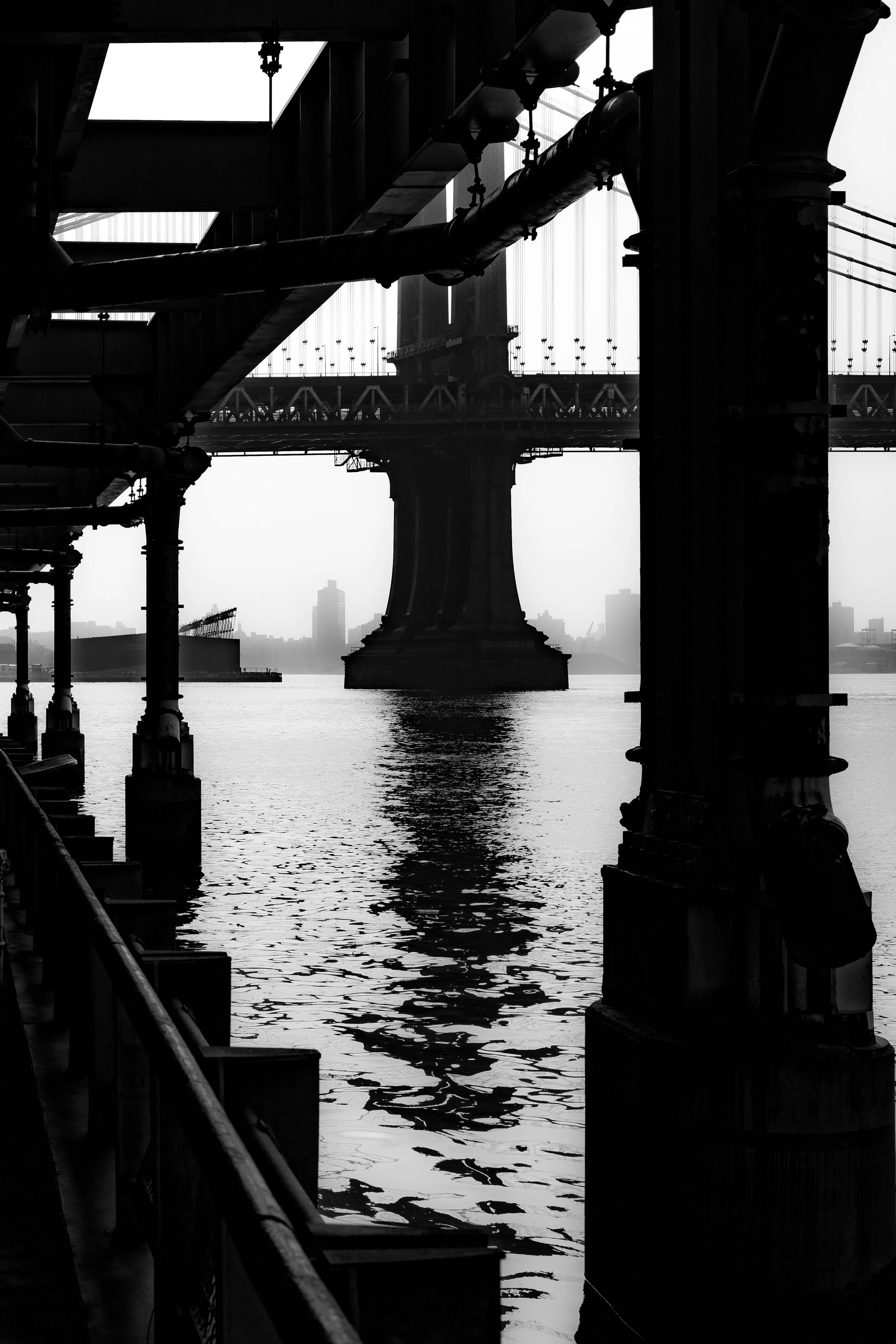
Bounded by the Brooklyn Bridge to the north and the East River to the east, and running south and west along St. James Place, East Broadway, and Montgomery Street, Two Bridges occupies the waterfront crescent between the bases of the Brooklyn and Manhattan Bridges. Tucked between the Lower East Side to the north and Chinatown to the west, the neighborhood forms one of Lower Manhattan’s most historically layered and socially diverse enclaves—a low-rise pocket where 19th-century tenements, mid-20th-century housing towers, and the massive steel spans of two iconic bridges coexist within a single vista.
The geography defines its name and its soul: a neighborhood suspended between two crossings, bounded by infrastructure yet enriched by the flow of the river and the movement of generations. Along the East River esplanade, fishermen, cyclists, and elders gather beneath the shadows of the bridges; inland, Cherry Street, Water Street, and Madison Street trace the old shoreline, lined with a mosaic of public housing complexes, immigrant groceries, and vestiges of the maritime city that once was.
Etymology and Origins
The name “Two Bridges” is a modern description of geography rather than an official designation, deriving from the neighborhood’s position between the Brooklyn Bridge (completed 1883) and the Manhattan Bridge (completed 1909). Yet its roots extend much deeper—into the colonial waterfront that once defined New York’s earliest identity. In the 18th and early 19th centuries, this stretch of riverfront was part of the Catherine Slip and Rutgers Farm districts, dotted with shipyards, ropewalks, and warehouses that serviced the East River’s teeming harbor.
The name “Two Bridges” came into common use in the mid-20th century, as planners and residents sought to describe the distinct community that had emerged between the two bridge approaches—an area neither fully Lower East Side nor fully Chinatown, but a hybrid of both. Over time, “Two Bridges” came to signify not only a location, but a spirit of continuity across cultures, classes, and centuries.
The Neighborhood
18th–19th Centuries: Maritime Foundations and Immigrant Arrival
The Two Bridges area originated as shoreline farmland belonging to the Rutgers family, prominent Dutch landowners whose estate stretched across what is now the Lower East Side. As the city expanded northward in the late 1700s, the Rutgers family subdivided and sold parcels along the riverfront for industrial and maritime use. Shipyards, breweries, and sugar refineries flourished near Catherine Slip and James Slip, while docks along Cherry Street hosted merchant ships and ferries crossing to Brooklyn.
By the early 19th century, the area had become a densely populated immigrant quarter. Irish, German, and later Jewish families crowded into narrow tenement blocks near Madison, Market, and Monroe Streets. Conditions were harsh: poor sanitation and repeated outbreaks of cholera and yellow fever led reformers like Jacob Riis to photograph the area for his seminal work How the Other Half Lives (1890). Despite hardship, community institutions took root—churches, schools, and settlement houses such as the Catherine Street Settlement (1890s) offered education and social aid to newcomers.
The construction of the Brooklyn Bridge (1870–1883) transformed the landscape dramatically, carving new roadways through old blocks and displacing hundreds of residents. The subsequent Manhattan Bridge (1901–1909) intensified the disruption, its stone anchorage rising over Cherry and Monroe Streets. Yet amid upheaval, the neighborhood persisted, its tenements filling again with waves of Eastern European Jews, Italians, and later, Chinese immigrants seeking proximity to the garment trades and waterfront jobs.
Early–Mid 20th Century: Public Housing and Urban Transformation
By the 1930s, Two Bridges reflected both the diversity and the decline of New York’s old waterfront neighborhoods. The Depression-era Works Progress Administration (WPA) documented its crumbling docks and overcrowded tenements, scenes emblematic of the city’s need for renewal. Urban reform arrived after World War II, reshaping the district through one of the most ambitious public housing programs in American history.
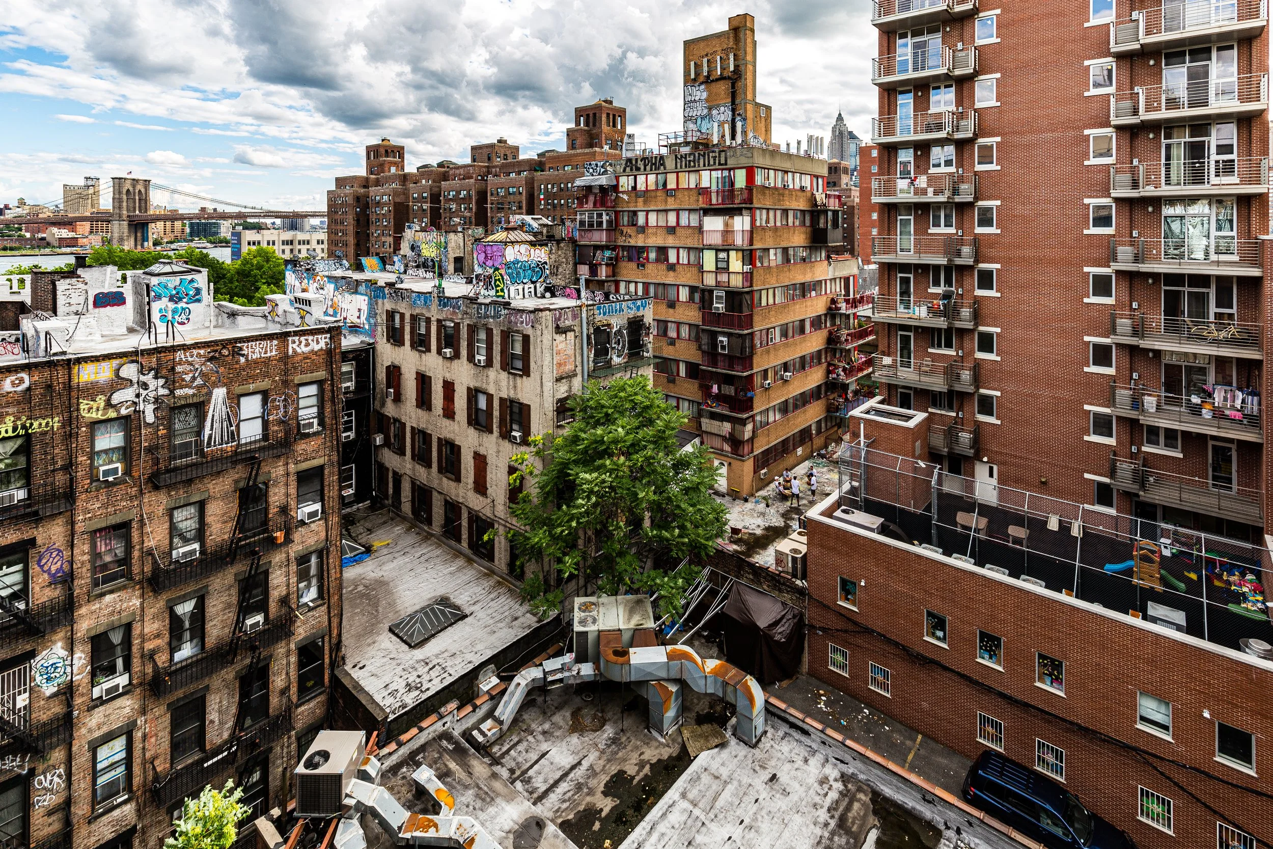
The Two Bridges Urban Renewal Plan (1949–1960s) replaced vast swaths of 19th-century housing with high-rise developments designed by the New York City Housing Authority (NYCHA). Complexes such as the Smith Houses (1953), LaGuardia Houses (1957), and Rutgers Houses (1965) redefined the neighborhood’s skyline with red-brick towers set amid landscaped courtyards. These developments, while controversial for their displacement of long-standing communities, provided thousands of low-income families with modern housing, plumbing, and open space.
At the same time, remnants of the old waterfront industry vanished. The piers along the East River fell into disuse, and the elevated FDR Drive (built 1930s–1940s) sealed off the shoreline from the inland streets. Two Bridges entered a quieter phase—isolated but cohesive, sustained by its residential core and cultural continuity.
Two Bridges Photographic Tour
Late 20th Century: Resilience, Immigration, and Community Identity
During the 1970s and 1980s, as much of Lower Manhattan grappled with economic decline, Two Bridges remained one of the city’s most stable working-class neighborhoods. Its population shifted as Chinese and later Fujianese immigrants expanded eastward from Chinatown, joining long-established Puerto Rican, Dominican, and African American residents in a complex mosaic of cultures. Community organizations such as the Two Bridges Neighborhood Council (founded 1955) played an essential role in preserving affordability and supporting social programs, after-school initiatives, and local arts.
In these decades, Two Bridges became known less for its proximity to the bridges than for its tight-knit, intergenerational fabric. Narrow courtyards between NYCHA towers became communal spaces where children played beneath laundry lines; corner delis sold both dumplings and plantains; churches like St. James Roman Catholic and temples like the Mahayana Buddhist Temple reflected overlapping spiritual traditions.
At the same time, artists and photographers—drawn by cheap rents and waterfront light—documented the neighborhood’s authenticity. The South Street Seaport revival to the south and the Chinatown expansion to the west brought visibility, but also the first glimmers of gentrification.
21st Century: Waterfront Redevelopment and Preservation Battles
The 21st century has brought both opportunity and challenge to Two Bridges. The East River Esplanade, expanded in the 2010s, reconnected the community to the waterfront through landscaped paths, seating areas, and playgrounds beneath the bridges. Yet rapid real estate speculation has placed new pressures on the district’s low-rise, affordable character.
Proposals for luxury towers along Cherry Street, South Street, and Clinton Street have drawn fierce opposition from residents, housing advocates, and preservationists who argue that such developments threaten to overwhelm the area’s human scale and cultural heritage. Legal challenges mounted by the Two Bridges Neighborhood Council and allied groups have sought to preserve zoning protections and resist displacement.
Amid these tensions, the neighborhood’s community life remains strong. Festivals along Madison Street, the smells of Fujianese bakeries and Dominican bodegas, and the laughter of children playing near the Cherry Playground testify to the endurance of local identity. Beneath the thundering bridges, Two Bridges endures as a microcosm of New York’s most essential struggle—the balance between renewal and remembrance.
Two Bridges Photo Gallery
Spirit and Legacy
Two Bridges stands as one of Manhattan’s last authentic riverfront neighborhoods, a place where the city’s oldest currents—immigration, adaptation, solidarity—still flow in daily life. Its physical frame, hemmed in by monumental infrastructure, has paradoxically preserved its sense of community: generations connected by stoops, parks, and shared history.
New York City
Use this custom Google map to explore where every neighborhood in all five boroughs of New York City is located.
The Five Boroughs
One of New York City’s unique qualities is its organization in to 5 boroughs: Manhattan, Brooklyn, Queens, The Bronx, and Staten Island. These boroughs are part pragmatic administrative districts, and part vestiges of the region’s past. Each borough is an entire county in New York State - in fact, Brooklyn is, officially, Kings County, while Staten Island is, officially Richmond County. But that’s not the whole story …
Initially, New York City was located on the southern tip of Manhattan (now the Financial District) that was once the Dutch colony of New Amsterdam. Across the East River, another city was rising: Brooklyn. In time, the city planners realized that unification between the rapidly rising cities would create commercial and industrial opportunities - through streamlined administration of the region.
So powerful was the pull of unification between New York and Brooklyn that three more counties were pulled into the unification: The Bronx, Queens, and Staten Island. And on January 1, 1898, the City of New York unified two cities and three counties into one Greater City of New York - containing the five boroughs we know today.
But because each borough developed differently and distinctly until unification, their neighborhoods likewise uniquely developed. Today, there are nearly 390 neighborhoods, each with their own histories, cultures, cuisines, and personalities - and each with residents who are fiercely proud of their corner of The Big Apple.


