WOODROW
Staten Island
Geographic Setting
Bounded by Drumgoole Road and the Korean War Veterans Parkway to the south, Lenevar and Maguire Avenues to the west, Mason Boulevard to the north, and Marcy Avenue to the east, Woodrow lies in Staten Island’s southwestern interior between Huguenot to the east, Rossville to the north, and Sandy Ground to the west. The neighborhood occupies a quiet, largely residential expanse characterized by wide tree-lined streets, low-density housing, and the green corridors that form part of Staten Island’s South Shore belt of suburban communities.
Woodrow’s landscape rises gently from the wetlands near Arden Heights Woods toward the uplands of the Greenbelt’s western edges, where new homes intermingle with older farmsteads and postwar developments. Though connected to the borough’s modern expressway system, Woodrow retains an almost rural calm—its cul-de-sacs, community parks, and consistent greenery preserving the atmosphere of a self-contained village. The area’s geography, once a patchwork of woodlots and open fields, continues to reflect its name: a district born of woodlands and wide, open sky.
Etymology
The name Woodrow dates back to the mid-19th century and is rooted in both its landscape and local history. “Woodrow” is believed to derive from the Old English wudu (wood) and raw (row), meaning “a row of houses near the woods” or “a settlement along the trees.” The name was formally applied when the community established its post office in 1882, distinguishing it from neighboring Huguenot and Rossville.
Some local historians have suggested that the name may have been influenced by Woodrow Road, one of Staten Island’s early east–west connectors, which itself referenced the area’s heavy forestation. Regardless of origin, the name evokes both place and personality—simple, pastoral, and enduringly appropriate for a neighborhood where forested tracts still frame the edges of suburban life.
The Neighborhood
Origins through the 19th Century: A Rural Hamlet Emerges
Long before suburban streets and expressways, Woodrow was a quiet rural outpost in the broader township of Westfield, which covered much of Staten Island’s South Shore. Through the 18th and 19th centuries, the area was defined by farmland, woodlots, and small family homesteads, many owned by descendants of the island’s earliest English and Dutch settlers.
The region’s fertile soils supported truck farming and dairying, while nearby tidal creeks fed the island’s growing shellfish and oystering industries. Woodrow Road, an early farm lane linking Richmondtown to the southern shore, provided a vital artery through which goods were hauled toward Prince’s Bay and Tottenville.
By the mid-1800s, a modest hamlet had coalesced around the intersection of Woodrow Road and Bloomingdale Road, marked by a schoolhouse, a general store, and several farmsteads. The area’s quiet, wooded surroundings appealed to those seeking a self-sufficient rural life apart from the busier harbor communities to the north.
Religious life was central to early Woodrow. The Woodrow United Methodist Church, established in 1842, became a cornerstone of community identity and remains among the oldest continuously active congregations on Staten Island. The church’s modest white clapboard structure and adjoining cemetery encapsulate the simplicity and endurance of Woodrow’s early years—a reminder of a time when faith, family, and the land were inseparable.
Early 20th Century: The Country Within the City
At the turn of the 20th century, Woodrow remained one of Staten Island’s most bucolic enclaves. Despite the borough’s 1898 consolidation into New York City, the area’s rural character persisted, with unpaved roads, open meadows, and dense stands of oak and maple. The construction of new roads gradually improved access, but Woodrow developed slowly compared to its eastern neighbors.
Electric trolleys reached nearby Huguenot and Rossville by the 1910s, but the absence of direct rail service kept Woodrow’s population sparse. Small-scale farms and greenhouses flourished, producing vegetables, flowers, and dairy products for markets in Richmondtown and along Amboy Road. During this era, the community’s few civic structures—a post office, school, and firehouse—anchored local life.
Residents often described Woodrow as “the country within the city,” a phrase that would remain apt for decades. Even as automobiles arrived and the Staten Island Rapid Transit expanded its reach, Woodrow’s isolation preserved its tranquility and sense of self-containment. Families here knew their neighbors by name, and the rhythms of life—church picnics, crop harvests, and volunteer fire drills—reflected a continuity more typical of 19th-century hamlets than modern urban districts.
Woodrow Video Coming Soon
Mid–Late 20th Century: Suburbanization and Transformation
The postwar decades reshaped Staten Island, and Woodrow was no exception. The construction of the Verrazzano-Narrows Bridge (1964) and the West Shore and Korean War Veterans Parkways transformed travel and development across the South Shore. Woodrow’s once-remote farmlands became prime sites for suburban expansion, and new residential subdivisions began to emerge through the 1960s and 1970s.
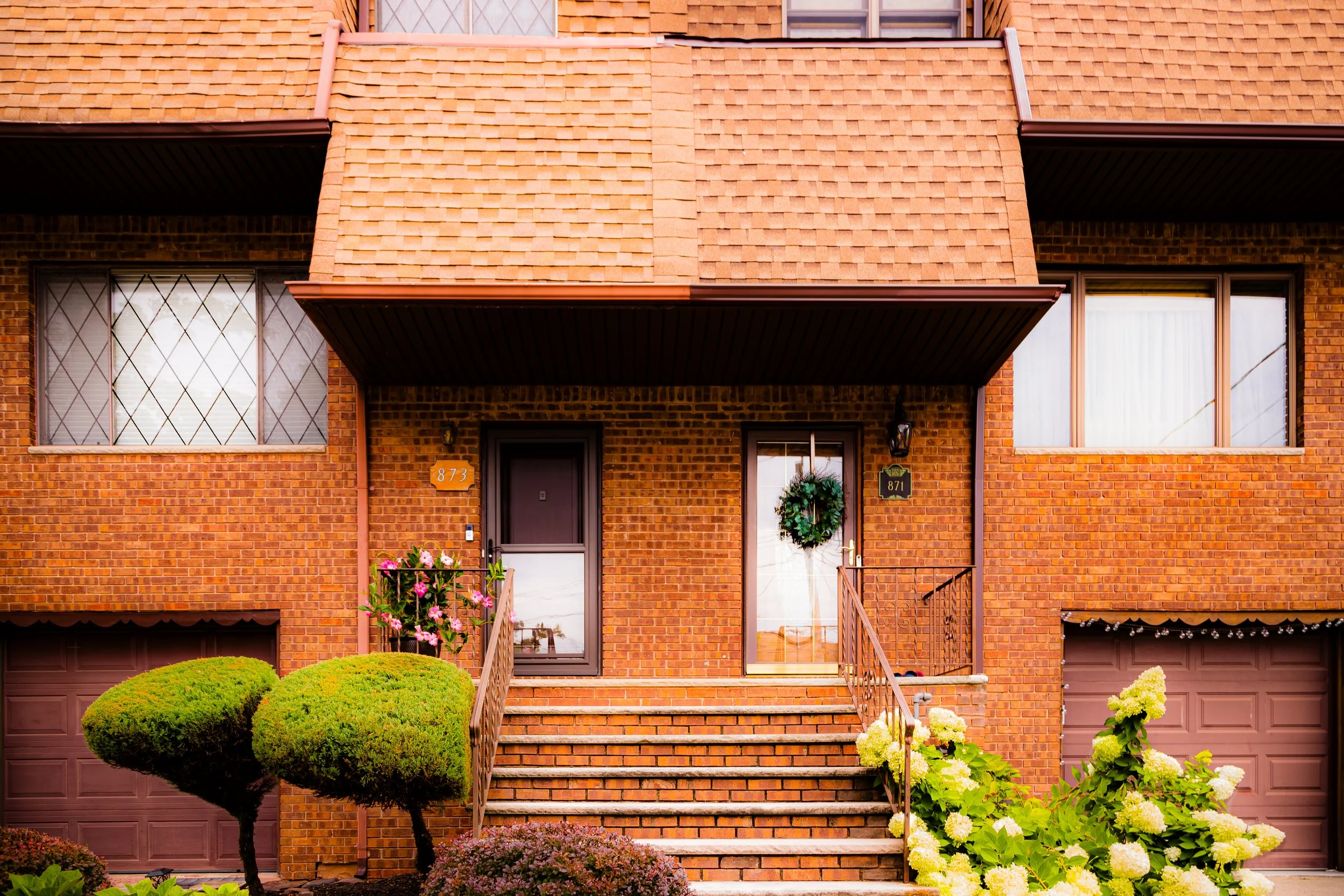
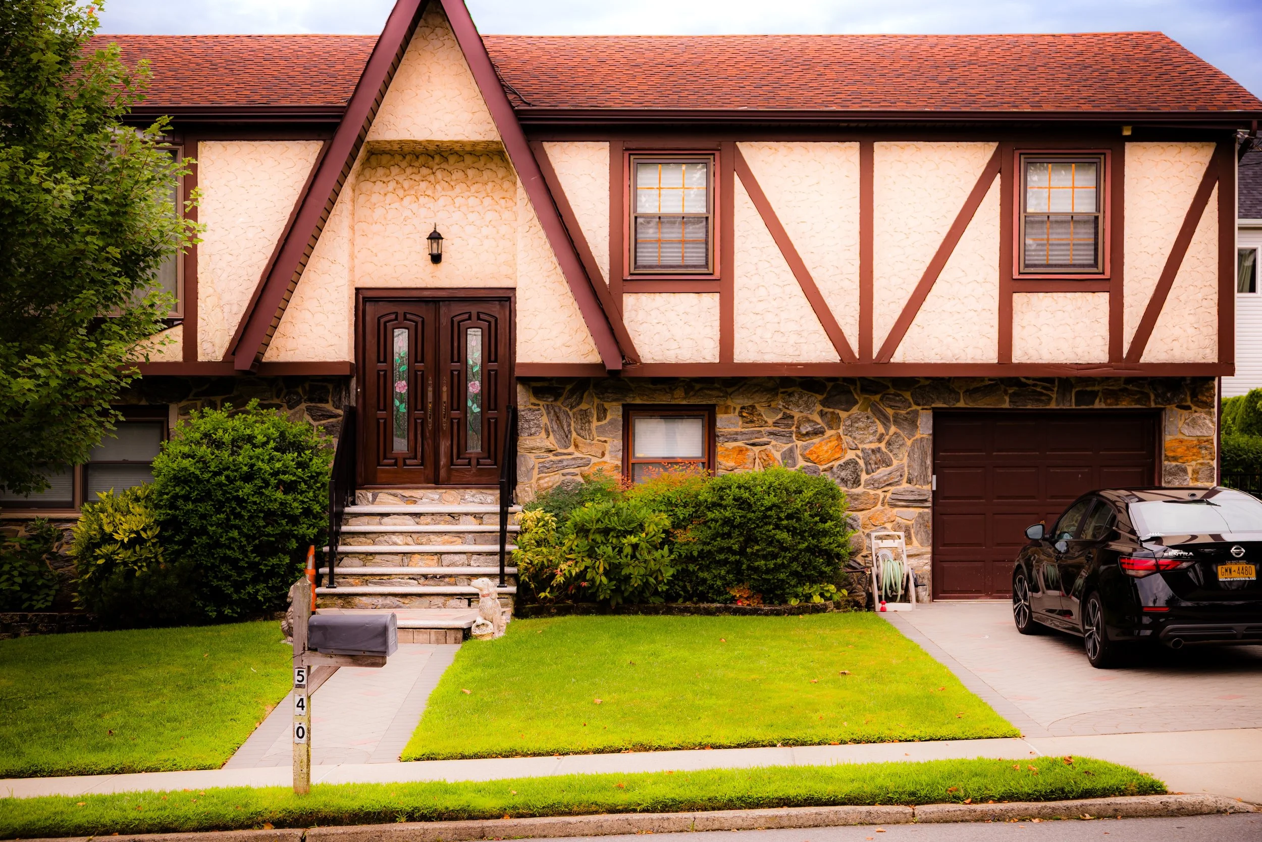
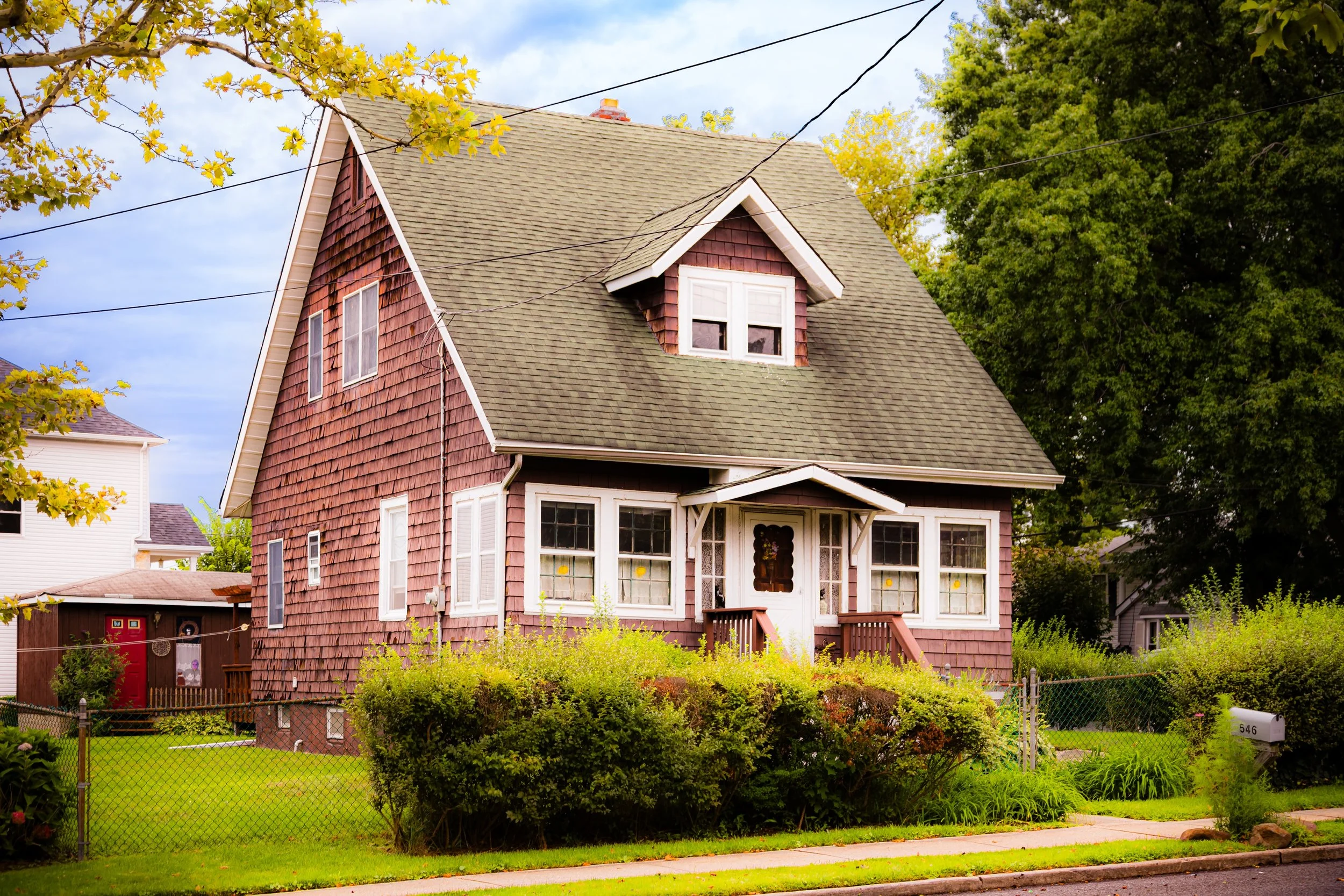
Unlike some denser developments in Arden Heights or Annadale, Woodrow’s growth was measured, guided by its topography and existing road network. Developers laid out quiet cul-de-sacs, broad lawns, and single-family homes, maintaining the area’s open feel even as population increased. Many of the homes reflected the architecture of their time—brick ranches, split-levels, and Colonials—set against backdrops of preserved woodland.
Community institutions also evolved. The old Methodist church remained active, while new schools and recreational spaces served the growing population. Civic associations emerged to advocate for traffic control, green preservation, and responsible zoning, ensuring that the neighborhood’s scale and serenity were not lost amid rapid suburbanization.
By the 1980s, Woodrow had become emblematic of Staten Island’s suburban ideal: affordable yet quiet, family-oriented yet close to major roads. Its proximity to the West Shore Expressway, Arden Avenue, and Huguenot Avenue made it accessible while preserving its sense of distance from the island’s busier corridors.
21st Century: A Suburban Hamlet with Deep Roots
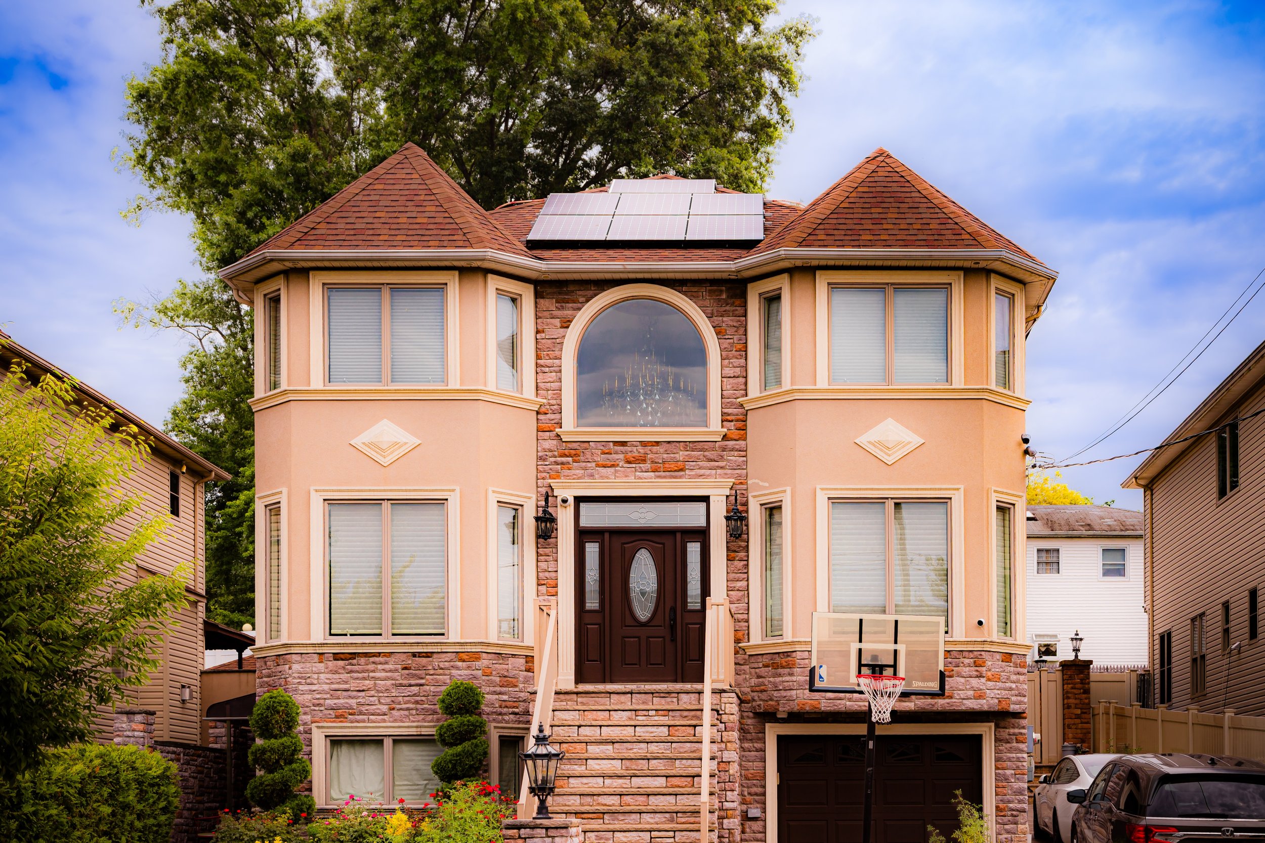
In the 21st century, Woodrow continues to reflect the balance between growth and preservation that defines much of Staten Island’s South Shore. The neighborhood’s streets remain lined with tidy homes and shade trees, interspersed with small parks and green buffers that trace the legacy of its woodlands. While nearby areas such as Rossville and Charleston have seen substantial commercial development, Woodrow has retained a primarily residential character.
New generations of families—drawn by its strong schools, low density, and proximity to both Freshkills Park and Blue Heron Park—have brought quiet vitality to the area. Small-scale construction has filled in remaining lots, but much of Woodrow’s physical and social landscape remains recognizable to those who knew it decades ago.
Community life centers on long-standing institutions: the Woodrow United Methodist Church, neighborhood associations, and local schools. Seasonal events and civic activities maintain the continuity that has long defined the neighborhood’s identity.
Nature remains close at hand. To the north, the reclaimed wetlands of Freshkills Park offer trails and wildlife habitats, while to the south and east, wooded tracts and greenbelts preserve glimpses of the pre-urban island. For many residents, this balance—between connection and seclusion, past and present—is the essence of living in Woodrow.
Woodrow Photo Gallery
Spirit and Legacy
The spirit of Woodrow lies in its steadfastness. From its origins as a rural crossroads to its evolution as a suburban enclave, it has remained a place where quiet endurance defines community life. The echoes of its past—the church bells, the farm lanes, the whisper of trees in the evening wind—still resonate amid the cul-de-sacs and parkways of the modern city.
Its legacy is one of constancy and care: of a neighborhood that has managed to grow without losing its soul. Where once farmers plowed and preachers built a moral outpost, families now tend gardens and watch the sunset over streets that bear the same rhythms of peace and belonging.
New York City
Use this custom Google map to explore where every neighborhood in all five boroughs of New York City is located.
The Five Boroughs
One of New York City’s unique qualities is its organization in to 5 boroughs: Manhattan, Brooklyn, Queens, The Bronx, and Staten Island. These boroughs are part pragmatic administrative districts, and part vestiges of the region’s past. Each borough is an entire county in New York State - in fact, Brooklyn is, officially, Kings County, while Staten Island is, officially Richmond County. But that’s not the whole story …
Initially, New York City was located on the southern tip of Manhattan (now the Financial District) that was once the Dutch colony of New Amsterdam. Across the East River, another city was rising: Brooklyn. In time, the city planners realized that unification between the rapidly rising cities would create commercial and industrial opportunities - through streamlined administration of the region.
So powerful was the pull of unification between New York and Brooklyn that three more counties were pulled into the unification: The Bronx, Queens, and Staten Island. And on January 1, 1898, the City of New York unified two cities and three counties into one Greater City of New York - containing the five boroughs we know today.
But because each borough developed differently and distinctly until unification, their neighborhoods likewise uniquely developed. Today, there are nearly 390 neighborhoods, each with their own histories, cultures, cuisines, and personalities - and each with residents who are fiercely proud of their corner of The Big Apple.


