CASTLE HILL
The Bronx
Geographic Setting
Bounded by White Plains Road to the west, Lafayette Avenue to the north, and Westchester Creek to the south and east, Castle Hill occupies a peninsula-like rise in the southeastern Bronx—a neighborhood defined by both elevation and shoreline. The area slopes gently down from its namesake hilltop toward the tidal waters of Westchester Creek, which meander around its southern and eastern edges before opening into Pugsley Creek and the East River beyond. Its landscape is threaded by a mix of residential streets—Castle Hill Avenue, Zerega Avenue, Pugsley Avenue, and Havemeyer Avenue—that climb and descend through blocks of low-rise homes, apartment houses, and community spaces.
Castle Hill Avenue, running north–south through the neighborhood’s core, remains its commercial and social spine, lined with storefronts, restaurants, and churches that give the district its distinct rhythm. To the east, Pugsley Creek Park and Castle Hill Point form the green, watery edge of the community, offering glimpses of boats, herons, and the Bronx’s maritime past. To the north, Lafayette Avenue connects Castle Hill to Soundview, while White Plains Road defines its boundary with Parkchester and the wider borough. The elevated 6 train, running parallel just to the west, gives Castle Hill residents direct access to Manhattan while preserving the neighborhood’s residential calm—a balance between mobility and rootedness that defines life here.
Etymology
The name “Castle Hill” dates to the 18th century, derived from a modest estate once situated on a prominent rise overlooking Westchester Creek. Early maps and land records refer to the area as “Castle Hill Neck,” a description likely inspired by the topography—a rounded hill resembling an island fortress rising above the surrounding tidal flats. The “castle” itself was not a fortified structure but a large country house belonging to the Pell and later the Zerega families, whose holdings once dominated this southeastern corner of the Bronx.
By the late 19th century, “Castle Hill” had entered common use to describe both the hilltop estate and the surrounding settlement. Its name survived as the estates gave way to grid-planned streets, its imagery shifting from aristocratic to civic: a community grounded in elevation, endurance, and perspective.
The Neighborhood
Origins through the 19th Century
Before its urbanization, Castle Hill was part of the Town of Westchester, settled in the 17th century by English colonists following the Pell Purchase (1654) from the Siwanoy people. The peninsula’s tidal creeks and upland meadows provided ideal conditions for farming, shellfishing, and milling. During the Revolutionary War, the area’s high ground was used as a lookout point by both British and American forces due to its sweeping views of the East River approaches.
Through the 18th and 19th centuries, the land remained largely agrarian, dotted with estates and small farms. Notable among them was the property of Anthony Zerega, a biscuit manufacturer whose family operated the “Zerega’s” pasta company—a local industry that lent its name to Zerega Avenue, one of the area’s principal north–south roads. The completion of Westchester Creek’s drawbridges and the early industrial wharves along its banks in the mid-19th century marked the first steps toward modernization, yet Castle Hill retained its pastoral isolation well into the early 1900s.
Early 20th Century: From Estates to Neighborhood
The early 20th century brought the transformation of Castle Hill from farmland to a structured residential district. The annexation of Westchester to New York City (1895), followed by the extension of city services—sewers, paved streets, and streetcars—opened the area to working- and middle-class development. By the 1920s, modest one- and two-family homes and walk-up apartments began to fill the gridded landscape between Lafayette Avenue and Pugsley Creek.
The completion of the Interborough Rapid Transit (IRT) Pelham Line (6 train) in 1920 further catalyzed growth, giving residents rapid access to Manhattan while retaining the suburban quiet that attracted them. Immigrant families—Italian, Irish, and Jewish—were among the first to settle here, establishing churches such as Our Lady of the Assumption (1928), small synagogues, and social clubs. The area’s mix of housing, including cooperative apartments along Castle Hill Avenue, reflected the era’s optimism in city planning: a belief that light, air, and stability could be achieved through thoughtful urban design.
By the 1930s and 1940s, Castle Hill had solidified its identity as a middle-income neighborhood with a local shopping corridor, nearby schools, and recreational access to the waterfront. Its gently rolling streets, framed by trees and bay views, earned it a reputation as one of the Bronx’s more peaceful enclaves.
Castle Hill Video Coming Soon
Mid–Late 20th Century: Public Housing, Change, and Resilience
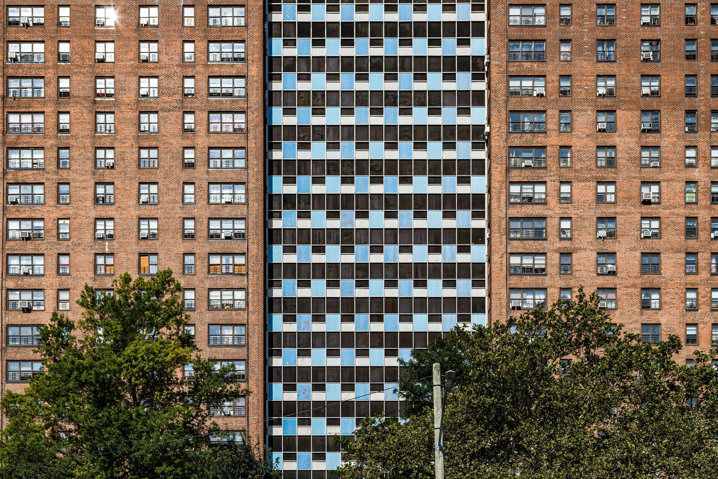
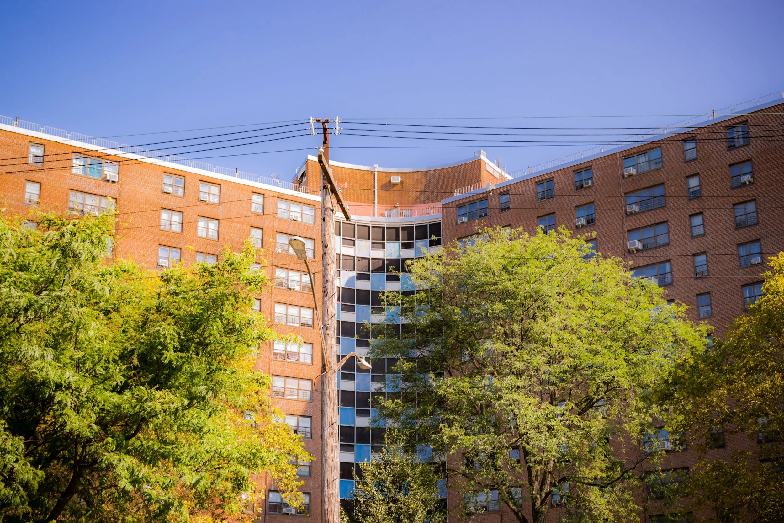
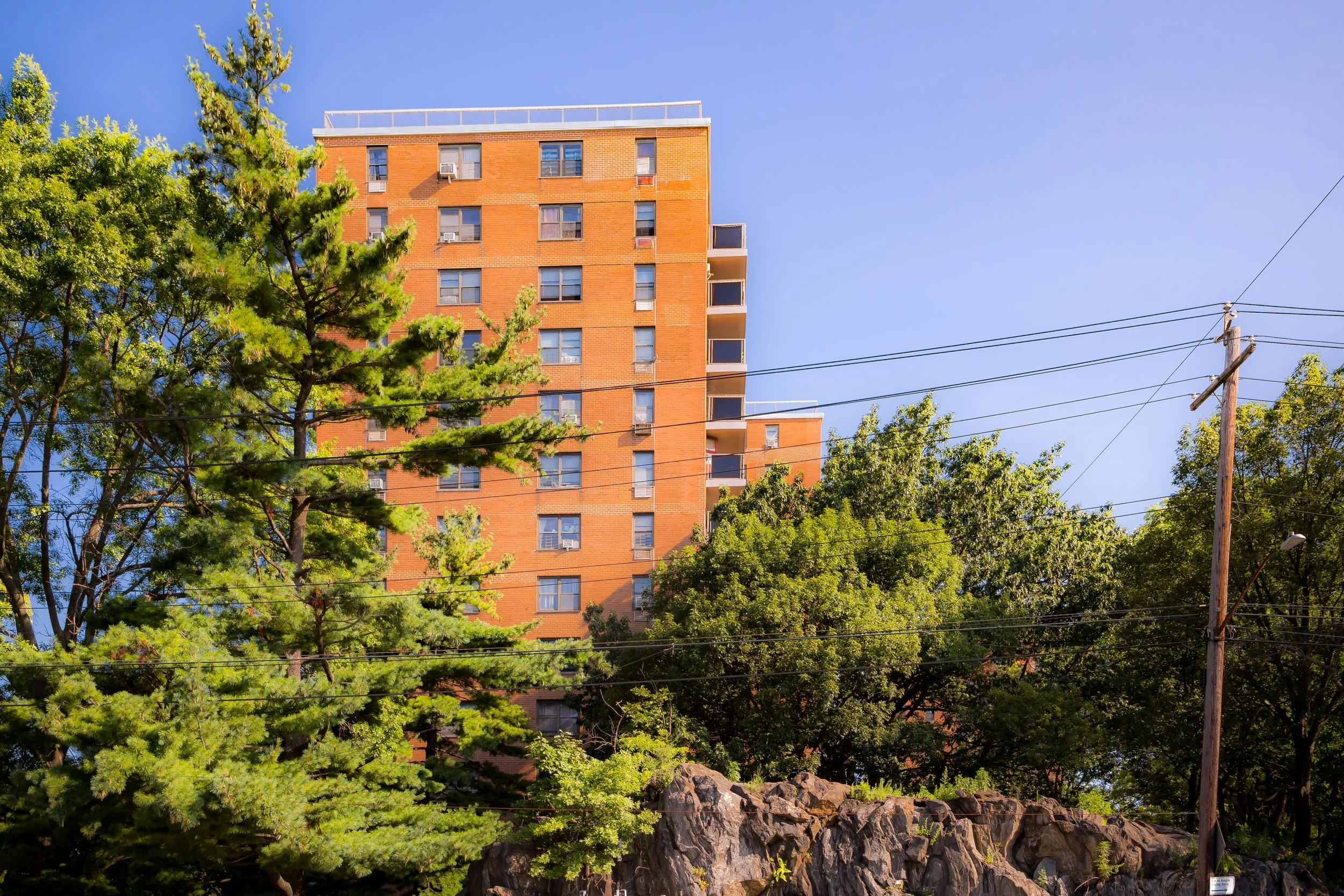
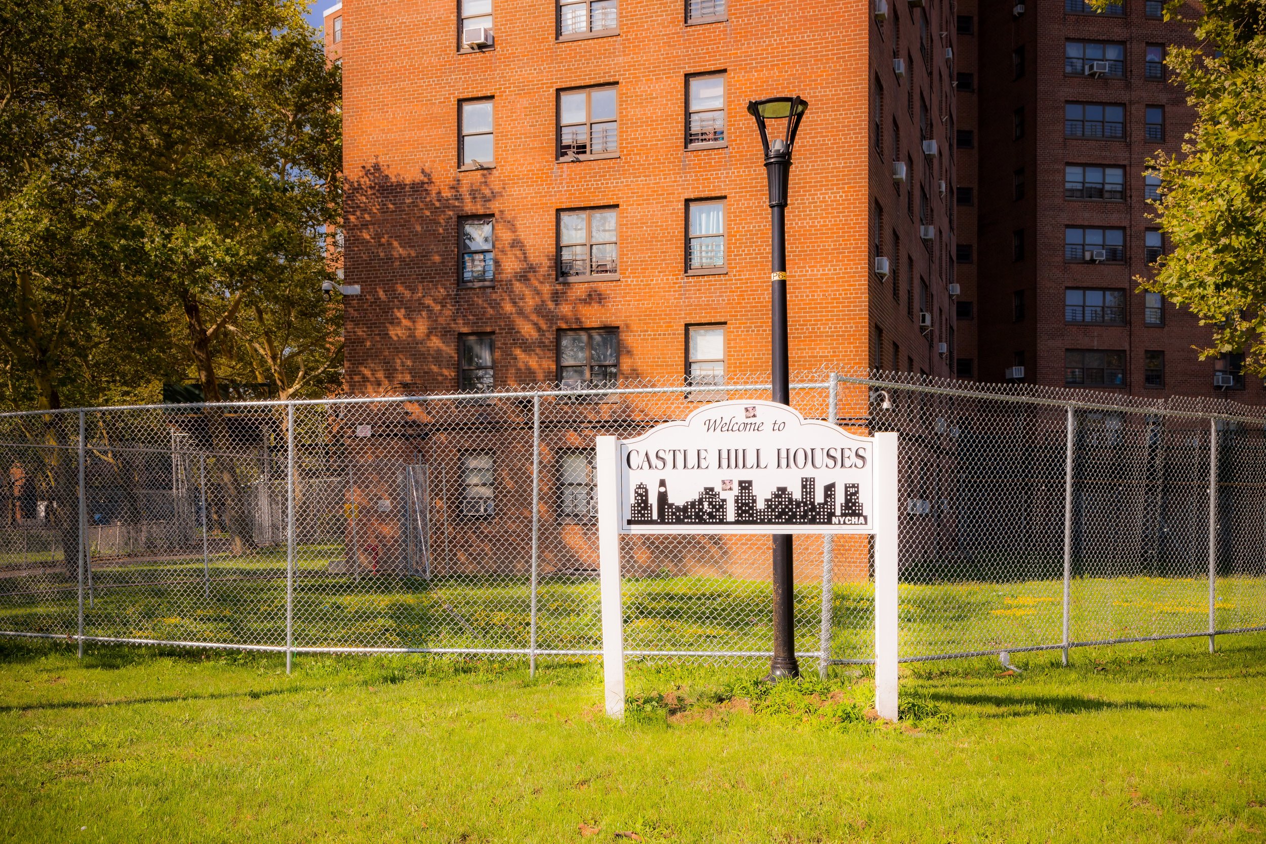
The postwar decades brought dramatic change. In 1959, the New York City Housing Authority completed the Castle Hill Houses, a 1,600-unit public housing complex occupying nearly 40 acres near Pugsley Avenue and Castle Hill Avenue. Designed in the modernist “tower-in-the-park” style, the development aimed to provide affordable, hygienic housing but also transformed the neighborhood’s social fabric.
During the 1960s and 1970s, waves of Puerto Rican, African-American, and later Caribbean families arrived, while many older white residents moved to the suburbs. The city’s fiscal crisis, disinvestment, and rising unemployment challenged community stability, yet Castle Hill remained more cohesive than many nearby districts. Churches, tenant associations, and block organizations—such as the Castle Hill Community Center and the Bronx River Neighborhood Preservation Council—helped sustain public morale.
Despite the hardships of the era, Castle Hill retained a strong sense of neighborhood identity. Local businesses on Castle Hill Avenue continued to serve residents; youth programs and summer festivals created continuity; and the waterfront, though increasingly industrial, remained a symbolic horizon for renewal.
21st Century: Waterfront Revival and Community Renewal
In the 21st century, Castle Hill has entered a period of reinvestment and revitalization. The neighborhood’s population—now an intricate mosaic of Latino, African-American, West African, and South Asian families—reflects the Bronx’s evolving diversity. Major renovations of the Castle Hill Houses have improved living conditions, while new affordable housing developments along Zerega Avenue and Lacombe Avenue have modernized the area’s housing stock.
At the same time, the city’s focus on waterfront restoration has reconnected Castle Hill to its maritime roots. Castle Hill Point, once a neglected shoreline, was transformed into a public waterfront park featuring fishing piers, kayak launches, and panoramic views of the Throgs Neck and Whitestone Bridges. Nearby, Pugsley Creek Park and the Hutchinson River Greenway have restored wetlands and created new trails, allowing residents to engage with landscapes that had been inaccessible for decades.
The commercial spine along Castle Hill Avenue remains lively—anchored by small restaurants, bodegas, and community hubs that embody the neighborhood’s independent spirit. The area’s blend of dense housing, local enterprise, and scenic waterfront now attracts a new generation of families seeking affordability and connection.
Castle Hill Photo Gallery
Spirit and Legacy
The spirit of Castle Hill is one of balance: between height and harbor, past and present, challenge and endurance. It has weathered the tides of the Bronx’s history—from colonial farmland to immigrant suburb, from public-housing crucible to 21st-century renewal—without losing its grounded sense of community.
For residents, the hill still carries symbolic weight: a place to rise above hardship, to see farther, to belong. On summer evenings, children play along Lacombe Avenue, the scent of saltwater drifting from the creek, while families gather on benches at Castle Hill Point to watch the sun set over the East River. From that vantage—the same high ground once used as a lookout centuries ago—Castle Hill stands as a testament to the Bronx’s enduring capacity to evolve, rebuild, and look forward without forgetting where it began.
New York City
Use this custom Google map to explore where every neighborhood in all five boroughs of New York City is located.
The Five Boroughs
One of New York City’s unique qualities is its organization in to 5 boroughs: Manhattan, Brooklyn, Queens, The Bronx, and Staten Island. These boroughs are part pragmatic administrative districts, and part vestiges of the region’s past. Each borough is an entire county in New York State - in fact, Brooklyn is, officially, Kings County, while Staten Island is, officially Richmond County. But that’s not the whole story …
Initially, New York City was located on the southern tip of Manhattan (now the Financial District) that was once the Dutch colony of New Amsterdam. Across the East River, another city was rising: Brooklyn. In time, the city planners realized that unification between the rapidly rising cities would create commercial and industrial opportunities - through streamlined administration of the region.
So powerful was the pull of unification between New York and Brooklyn that three more counties were pulled into the unification: The Bronx, Queens, and Staten Island. And on January 1, 1898, the City of New York unified two cities and three counties into one Greater City of New York - containing the five boroughs we know today.
But because each borough developed differently and distinctly until unification, their neighborhoods likewise uniquely developed. Today, there are nearly 390 neighborhoods, each with their own histories, cultures, cuisines, and personalities - and each with residents who are fiercely proud of their corner of The Big Apple.


