CIVIC CENTER
Manhattan
Geographic Setting
The Civic Center of Manhattan occupies a compact but monumental district in Lower Manhattan, bounded roughly by White Street and Worth Street to the north, Ann Street to the south, Broadway to the west, and Pearl Street and St. James Place to the east. Within these few blocks lies the administrative heart of New York City—the nexus of its courts, civic institutions, and government offices. The area’s dense cluster of Beaux-Arts and Art Deco towers forms a striking ensemble rising just east of City Hall Park, adjacent to Chinatown and the Financial District.
Its geography follows the contours of the original colonial shoreline, once defined by the Collect Pond, a freshwater lake that served the early city but was drained and filled in the early 19th century. Beneath today’s civic buildings lie its remnants—soft ground layered with centuries of engineering. The district’s narrow streets, widened in places to accommodate courthouses and plazas, frame one of the most architecturally unified civic cores in America: a city within the city, where marble, limestone, and granite announce the authority of government amid the motion of downtown life.
Etymology and Origins
The term “Civic Center” gained currency in the early 20th century, when planners sought to formalize Lower Manhattan’s government precinct as a coherent district. Yet its roots trace to the city’s earliest days. The land was once part of the Common Lands of New Amsterdam, used for grazing cattle and collecting fresh water from the Collect Pond. By the late 18th century, the pond had become polluted by nearby tanneries and industries; its drainage in 1811 created the level ground upon which the city’s future administrative core would rise.
The nearby City Hall, completed in 1812 and designed by Joseph-François Mangin and John McComb Jr., marked the beginning of the area’s civic identity. Its elegant Federal-style façade, oriented toward the growing city to the north, symbolized the young republic’s ideals of democracy and order. Over the next century, the blocks surrounding City Hall would be transformed from a patchwork of small streets and tenements into the monumental landscape of courts and government offices we know today.
The Neighborhood
19th Century: From Collect Pond to City Hall Park
In the early 1800s, the filling of the Collect Pond allowed for expansion of the city grid northward from Wall Street. Streets such as Centre, Elm (now Lafayette), and Worth emerged atop unstable fill, lined initially with boardinghouses and small factories. The Tombs Prison, opened in 1838 at Centre and Franklin Streets, became infamous both for its Egyptian Revival architecture and for the fetid conditions resulting from the boggy ground beneath.
By mid-century, the area had gained a dual character: civic order around City Hall, and urban disorder just beyond it. Yet reformers and city officials envisioned a grand civic precinct that would rival those of Paris and Washington. The transformation began in the 1870s–1890s, with the construction of The Tweed Courthouse (officially the Old New York County Courthouse), Surrogate’s Court, and the expansion of City Hall Park. These projects, though mired in political scandal under Boss Tweed, ultimately established the monumental vocabulary—granite, domes, and classical porticoes—that would define the Civic Center’s future.
By the century’s end, the district’s western edge along Broadway had also become a corridor of press and government buildings. The proximity of Newspaper Row, centered on Park Row and Printing House Square, linked civic life to journalism and public opinion, creating an early ecosystem of governance and media that defined modern New York politics.
Early 20th Century: Monumentality and Municipal Ambition
The early 20th century marked the apotheosis of the Civic Center’s design. The consolidation of Greater New York in 1898 required new administrative headquarters to serve the five-borough metropolis. The result was a wave of monumental construction between 1900 and 1936 that gave the area its present skyline.
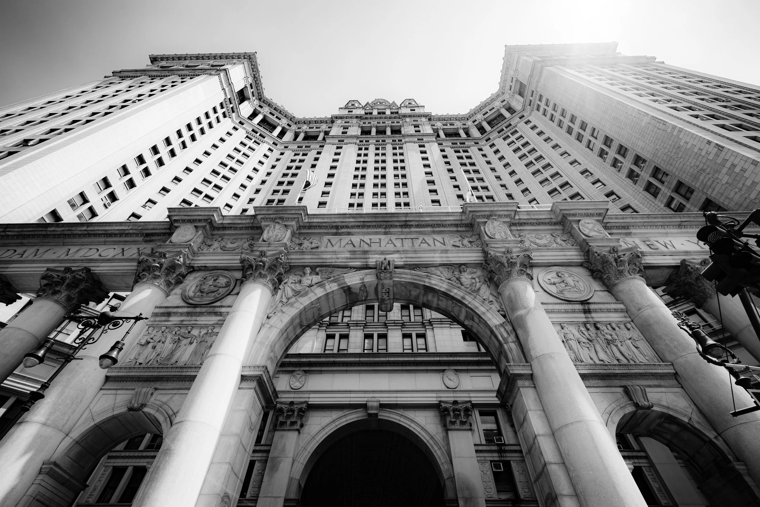
Foremost among these was the Manhattan Municipal Building (completed 1914), designed by McKim, Mead & White—a colossal Beaux-Arts structure spanning Chambers Street with its iconic “Civic Fame” statue crowning the tower. Rising 580 feet, it symbolized both the unity and the scale of modern New York governance. Nearby, Woolworth Building (1913), though privately built, complemented this civic cluster with its Gothic spire—proof that commerce and government shared the same architectural grandeur.
The U.S. Courthouse (1936) by Cass Gilbert, the Surrogate’s Courthouse (1907) by John R. Thomas, and the New York City Police Headquarters (1909) further established the area as the judicial and administrative core of the metropolis. The Brooklyn Bridge, whose Manhattan anchorage begins just to the east at Park Row, reinforced the district’s role as the physical and symbolic gateway between boroughs.
Civic Center Photographic Video
Mid–Late 20th Century: Bureaucracy, Decline, and Renewal
By mid-century, the Civic Center had grown dense with municipal and federal offices. Modernist additions such as the Foley Square federal complex (completed in stages from the 1930s through the 1960s) introduced streamlined geometry amid Beaux-Arts splendor. The area’s reputation as the seat of justice deepened with the opening of the State Supreme Court Building (1927) and later the Thurgood Marshall United States Courthouse.
Yet as Lower Manhattan changed, so too did the district’s surroundings. The once-residential enclaves of Five Points and Chinatown to the east pressed against the Civic Center’s borders, creating a unique juxtaposition of immigrant neighborhoods and governmental authority. In the 1970s–1980s, as city government faced fiscal crisis and population decline, the area grew quieter after office hours—its grand plazas often windswept and empty.
Renewal came gradually. The restoration of the Tweed Courthouse, completed in 2001, returned one of the city’s oldest civic landmarks to active use. Streets once closed to traffic were reopened as pedestrian corridors linking the courts, parks, and waterfront. The 9/11 attacks a few blocks south deepened the district’s symbolic role, as City Hall and its agencies helped lead the city’s recovery.
21st Century: Government, Heritage, and the Urban Commons
Today, the Civic Center remains the nerve center of municipal and judicial life in New York. The cluster of courthouses around Foley Square houses the city’s Supreme, Criminal, and Civil Courts, as well as federal and appellate tribunals. The Municipal Building continues to serve as headquarters for agencies ranging from City Planning to Records and Information Services, while City Hall, still functioning after more than two centuries, anchors the ensemble both physically and symbolically.
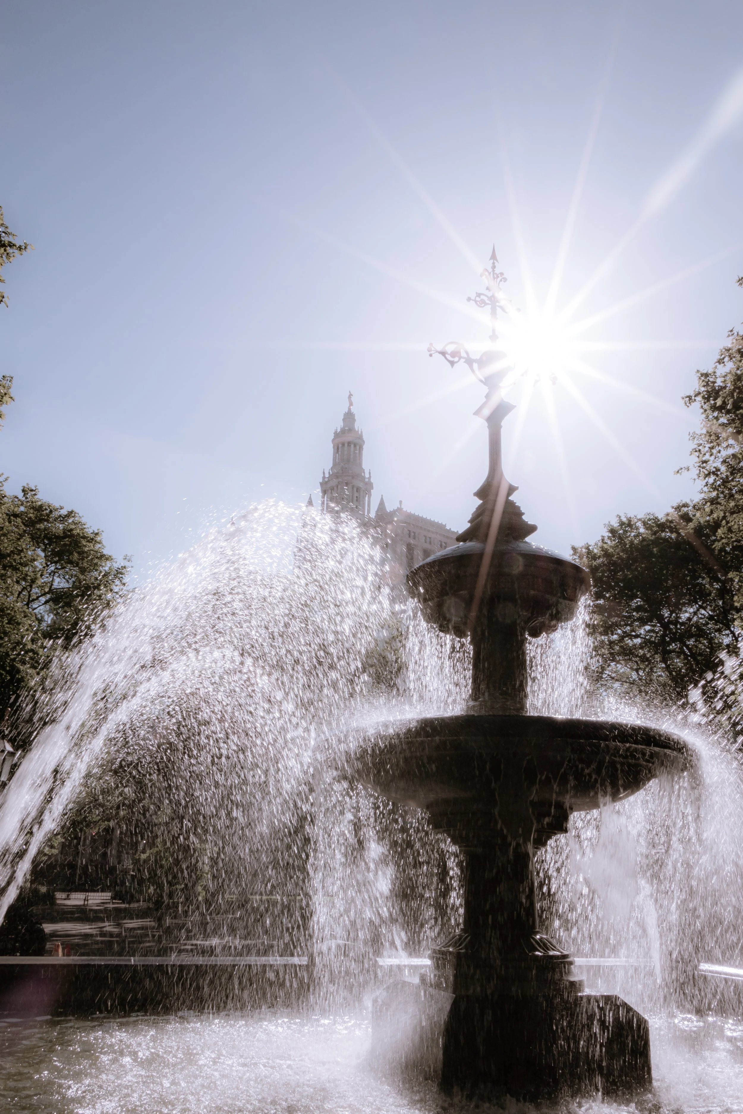
The area’s public spaces—City Hall Park, Collect Pond Park, and the restored Foley Square Plaza—have become vital urban commons, linking the bureaucratic core to the surrounding communities of Tribeca, Chinatown, and the Financial District. Modern architectural interventions—such as the New York State Office Building at 80 Centre Street and the Manhattan Detention Complex—sit beside restorations of historic structures, illustrating the ongoing balance between function and heritage.
Pedestrianization, security redesign, and cultural programming have softened what was once a strictly administrative zone into a living civic campus. The sound of protesters’ chants on Centre Street, the quiet of lunchtime crowds in City Hall Park, and the steady hum of government traffic together sustain the district’s dual nature: solemn yet alive, monumental yet human-scaled.
Civi Center Photo Gallery
Spirit and Legacy
The Civic Center’s legacy is governance made visible. Within its few city blocks, architecture speaks the language of democracy—arches for openness, columns for order, domes for unity. From the days of the Collect Pond to the gleaming Municipal Building, this ground has evolved from wilderness to city, from corruption to reform, from bureaucracy to public space.
New York City
Use this custom Google map to explore where every neighborhood in all five boroughs of New York City is located.
The Five Boroughs
One of New York City’s unique qualities is its organization in to 5 boroughs: Manhattan, Brooklyn, Queens, The Bronx, and Staten Island. These boroughs are part pragmatic administrative districts, and part vestiges of the region’s past. Each borough is an entire county in New York State - in fact, Brooklyn is, officially, Kings County, while Staten Island is, officially Richmond County. But that’s not the whole story …
Initially, New York City was located on the southern tip of Manhattan (now the Financial District) that was once the Dutch colony of New Amsterdam. Across the East River, another city was rising: Brooklyn. In time, the city planners realized that unification between the rapidly rising cities would create commercial and industrial opportunities - through streamlined administration of the region.
So powerful was the pull of unification between New York and Brooklyn that three more counties were pulled into the unification: The Bronx, Queens, and Staten Island. And on January 1, 1898, the City of New York unified two cities and three counties into one Greater City of New York - containing the five boroughs we know today.
But because each borough developed differently and distinctly until unification, their neighborhoods likewise uniquely developed. Today, there are nearly 390 neighborhoods, each with their own histories, cultures, cuisines, and personalities - and each with residents who are fiercely proud of their corner of The Big Apple.


