
BAYSIDE HILLS
Queens
Geographic Setting
Bounded to the south by the Long Island Expressway (I-495), to the west by Francis Lewis Boulevard, to the north by 48th Avenue, and to the east by Springfield Boulevard, Bayside Hills forms a distinct residential enclave within the greater Bayside area of northeastern Queens. Perched slightly above the surrounding terrain on the northern slope of the Oakland Gardens rise, the neighborhood combines suburban elegance with classic Queens density—broad, leafy blocks of single-family homes laid out along gently curving streets that catch the sound of wind through maples and oaks.
The grid of 216th Street, 217th Street, and 48th Avenue defines the heart of Bayside Hills, while Horace Harding Expressway and Francis Lewis Boulevard serve as its principal southern and western corridors. The neighborhood’s internal rhythm is quiet and residential, with front lawns, hedges, and driveways maintaining a sense of openness rare within the city. Despite its proximity to major highways, Bayside Hills feels insulated: a neighborhood designed for calm continuity, bracketed by tree canopy and neighborhood pride. Nearby parks—Alley Pond Park to the east and Clearview Park to the north—enhance the area’s lush, suburban character and provide residents with abundant open space within walking distance.
Etymology and Origins
The name “Bayside Hills” emerged in the early 20th century during Queens’ great wave of suburban expansion, drawing from its geographic position on elevated ground above the larger Bayside area to the north. The “Hills” suffix, then fashionable among developers, suggested prestige, stability, and a landscaped environment modeled after the successful “garden suburb” ideal of nearby Forest Hills Gardens. The neighborhood was conceived in the 1920s by the Bayside Hills Improvement Company, which marketed its streets as a “modern residential park” complete with uniform setbacks, paved sidewalks, and underground utilities—an advanced amenity package for its day.
Before its subdivision, the area formed part of the historic Town of Flushing’s farmlands, later annexed into New York City in 1898. The rolling terrain—once meadows and small woodlots—belonged to local families of Dutch and English descent who cultivated the fertile glacial soil of northern Queens. With the advent of automobile travel and the completion of the Queensboro Bridge (1909), this formerly rural landscape was recast as an accessible suburban frontier for middle- and upper-middle-class families seeking green space and quiet within commuting distance of Manhattan.
The Neighborhood
1920s–1930s: Planned Suburban Development
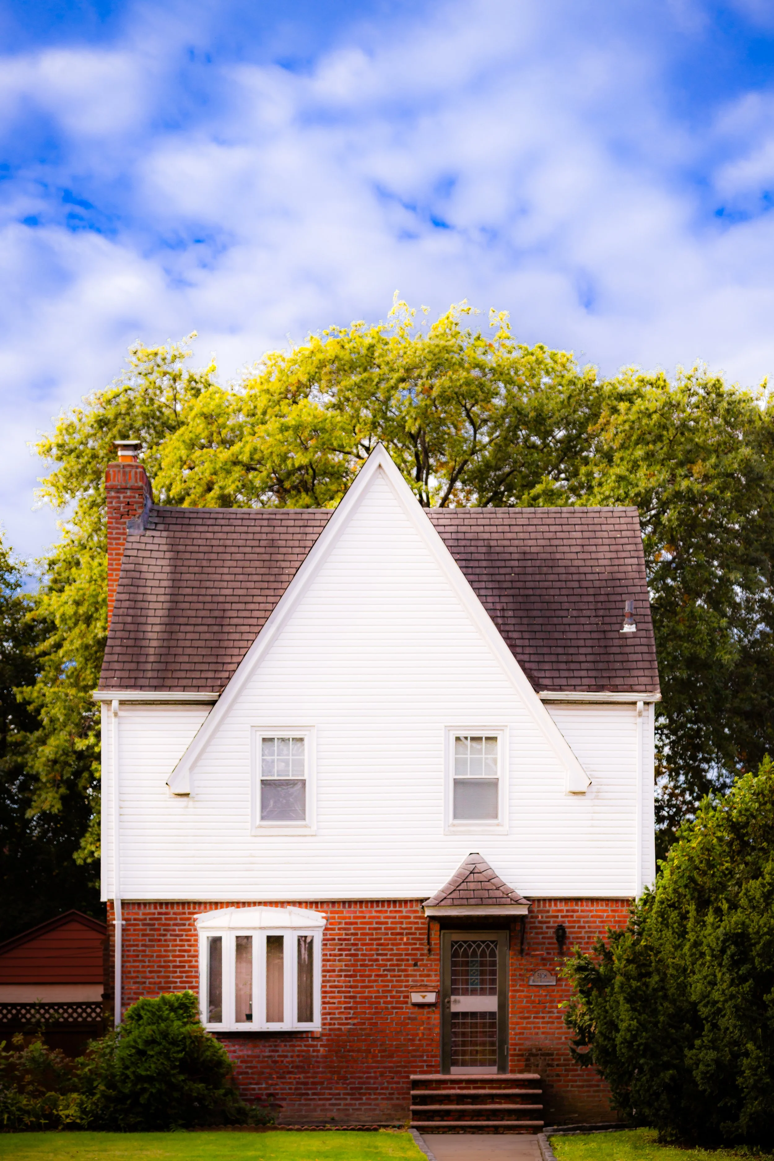
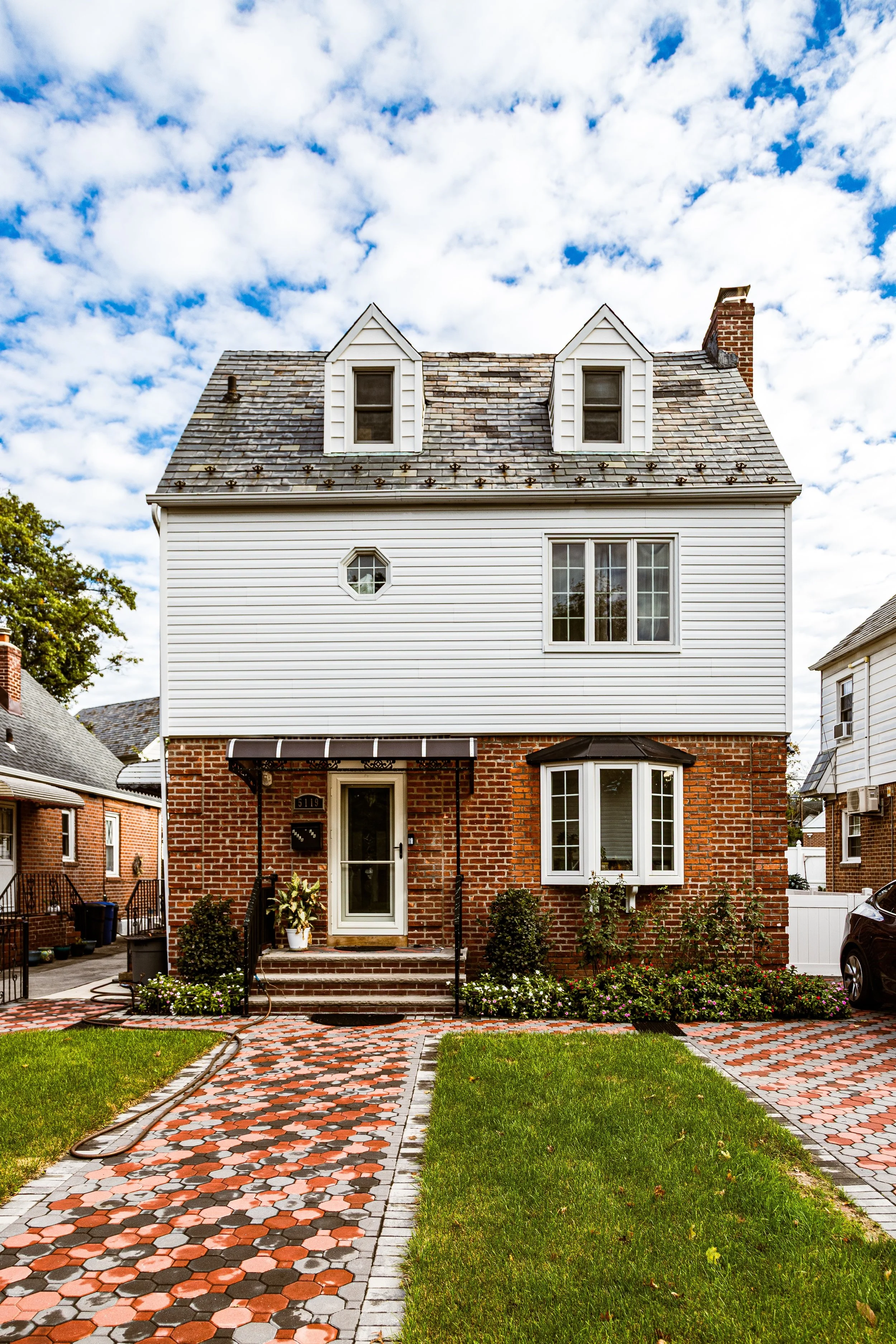
The interwar decades defined Bayside Hills’ architectural and social identity. By the late 1920s, the Bayside Hills Improvement Company, under the guidance of developer Benjamin Winter, laid out a grid of streets distinguished by broad roadways, landscaped traffic islands, and a meticulous zoning plan that prohibited commercial intrusion. Construction of detached brick and stucco Tudor, Colonial, and Mediterranean-style homes began in earnest between 1927 and 1935, many featuring slate roofs, leaded-glass windows, and decorative stonework.
Marketing brochures of the time heralded Bayside Hills as “the residential crown of Bayside—where city and country meet,” emphasizing its proximity to both the Long Island Rail Road’s Bayside Station and the expanding network of parkways then transforming the borough. The inclusion of underground electrical lines, ornamental streetlights, and curved corner plots reflected early 20th-century urban design ideals that prioritized aesthetics as much as function.
Civic infrastructure followed closely: churches, schools, and the Bayside Hills Civic Association, founded in 1938, became central pillars of local life. The association would grow into one of the oldest and most influential community organizations in Queens, instrumental in preserving the neighborhood’s residential zoning and aesthetic standards for nearly a century.
Mid–20th Century: Maturity and Postwar Prosperity
By the 1940s and 1950s, Bayside Hills had achieved full build-out, its leafy streets representing the archetype of postwar suburban success. The area’s population, largely professional and middle-class, was anchored by families of Irish, Italian, and Jewish descent who had moved from denser borough neighborhoods seeking stability and homeownership. The opening of the Long Island Expressway in the 1950s, running just south of the neighborhood, enhanced mobility while reinforcing Bayside Hills’ position as a commuter haven.
Despite its proximity to major roadways, Bayside Hills retained its tranquil identity. Strict single-family zoning discouraged overdevelopment, while local schools such as P.S. 203 Oakland Gardens and J.H.S. 74 Nathaniel Hawthorne served successive generations. The Bayside Hills Civic Association became the community’s guardian, lobbying against high-rise construction and preserving the distinctive “garden suburb” streetscape that continues to define the area today.
Bayside Hills Video Coming Soon
Late 20th Century: Preservation and Adaptation
During the 1970s and 1980s, Bayside Hills remained one of Queens’ most stable neighborhoods. Even as much of the borough diversified and densified, this enclave retained its architectural integrity and small-town feel. The civic association organized beautification drives, tree-planting initiatives, and the annual lighting of the Bayside Hills Mall triangle, a landscaped traffic circle that became a symbol of community pride.
The 1980s also saw growing ethnic diversity, as Asian-American and Latin American families joined long-established residents, enriching the neighborhood’s cultural life while preserving its quiet tone. The strong emphasis on civic involvement ensured that zoning protections remained intact, warding off speculative redevelopment. The Francis Lewis Boulevard corridor to the west evolved into a modest commercial strip of family-owned restaurants and shops, providing convenience without compromising the district’s predominantly residential nature.
21st Century: Timeless Enclave in a Changing City
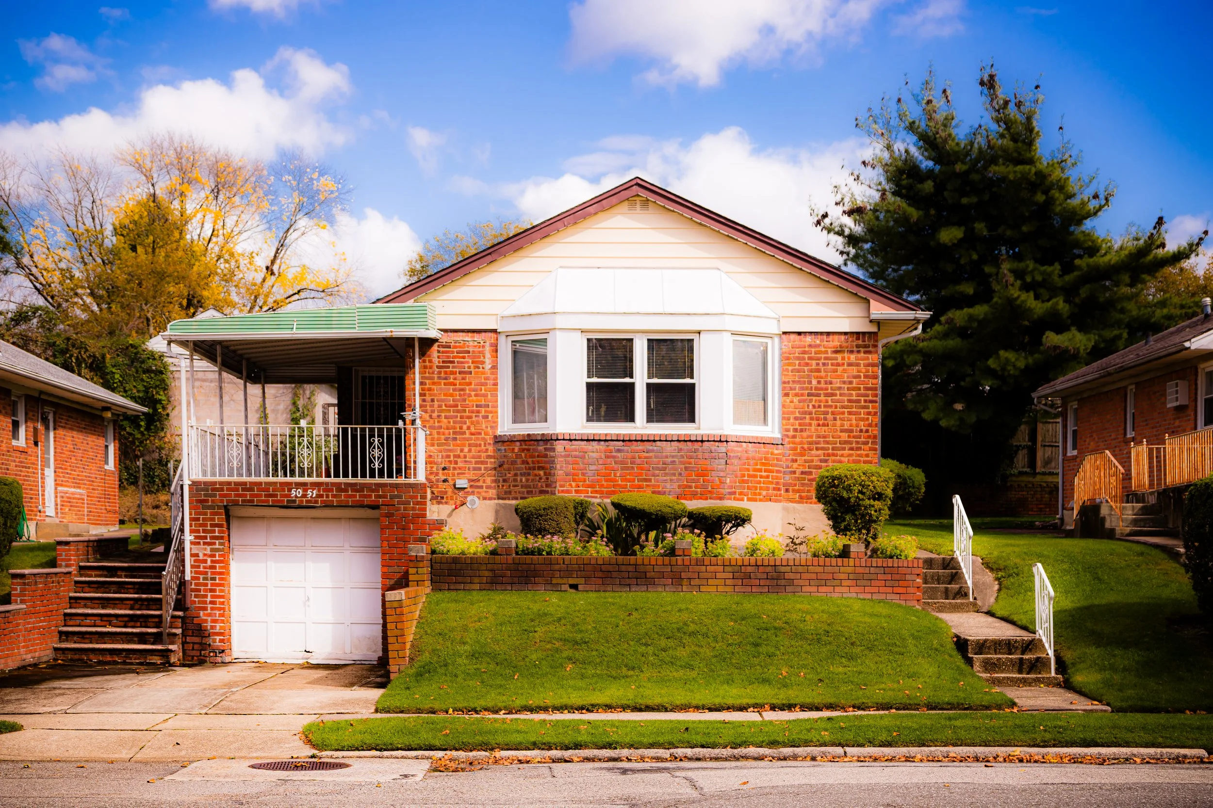
In the new millennium, Bayside Hills stands as a model of continuity within an ever-changing city. The single-family homes, many lovingly restored, remain the neighborhood’s defining feature. Red-brick Colonials, Tudors with half-timbered façades, and Mediterranean villas with arched entryways line streets shaded by mature trees planted nearly a century ago. Modern renovations blend carefully with original design, preserving the cohesive streetscape envisioned by the 1920s planners.
While nearby Bayside, Auburndale, and Oakland Gardens have absorbed denser development, Bayside Hills remains resolutely low-rise. Its residents—representing a mosaic of backgrounds—continue to share a collective commitment to preservation, education, and civic order. The Bayside Hills Civic Association maintains its role as a community steward, coordinating neighborhood cleanups, traffic safety programs, and preservation advocacy.
Access to major routes like the Long Island Expressway, Clearview Expressway, and Francis Lewis Boulevard allows easy connectivity, yet the neighborhood’s internal calm persists. Its parks, including nearby Alley Pond Park and Captain Dermody Triangle, offer green relief and continuity with the natural landscape that first drew settlers to these rolling hills.
Bayside Hills Photo Gallery
Spirit and Legacy
Bayside Hills represents the enduring promise of New York’s early suburban dream: order, greenery, and belonging within reach of the metropolis. From its meticulously planned interwar origins to its present-day tranquility, the neighborhood has exemplified stability through design and civic vigilance. Its legacy is one of care—streetscapes maintained with pride, traditions carried forward by generations, and a built environment that continues to embody the harmony between architecture and landscape envisioned nearly a century ago.
New York City
Use this custom Google map to explore where every neighborhood in all five boroughs of New York City is located.
The Five Boroughs
One of New York City’s unique qualities is its organization in to 5 boroughs: Manhattan, Brooklyn, Queens, The Bronx, and Staten Island. These boroughs are part pragmatic administrative districts, and part vestiges of the region’s past. Each borough is an entire county in New York State - in fact, Brooklyn is, officially, Kings County, while Staten Island is, officially Richmond County. But that’s not the whole story …
Initially, New York City was located on the southern tip of Manhattan (now the Financial District) that was once the Dutch colony of New Amsterdam. Across the East River, another city was rising: Brooklyn. In time, the city planners realized that unification between the rapidly rising cities would create commercial and industrial opportunities - through streamlined administration of the region.
So powerful was the pull of unification between New York and Brooklyn that three more counties were pulled into the unification: The Bronx, Queens, and Staten Island. And on January 1, 1898, the City of New York unified two cities and three counties into one Greater City of New York - containing the five boroughs we know today.
But because each borough developed differently and distinctly until unification, their neighborhoods likewise uniquely developed. Today, there are nearly 390 neighborhoods, each with their own histories, cultures, cuisines, and personalities - and each with residents who are fiercely proud of their corner of The Big Apple.


