ST. ALBANS
Queens
Geographic Setting
Bounded by Francis Lewis Boulevard to the east, Springfield Boulevard to the southeast, 120th and 121st Avenues to the south, and Merrick Boulevard to the west, St. Albans occupies a proud and historically rich section of southeastern Queens. Nestled between Cambria Heights, Springfield Gardens, and Hollis, the neighborhood forms part of Queens’ great belt of tree-lined, single-family residential communities—places defined by quiet streets, deep-rooted civic pride, and a legacy of homeownership that stretches back nearly a century.
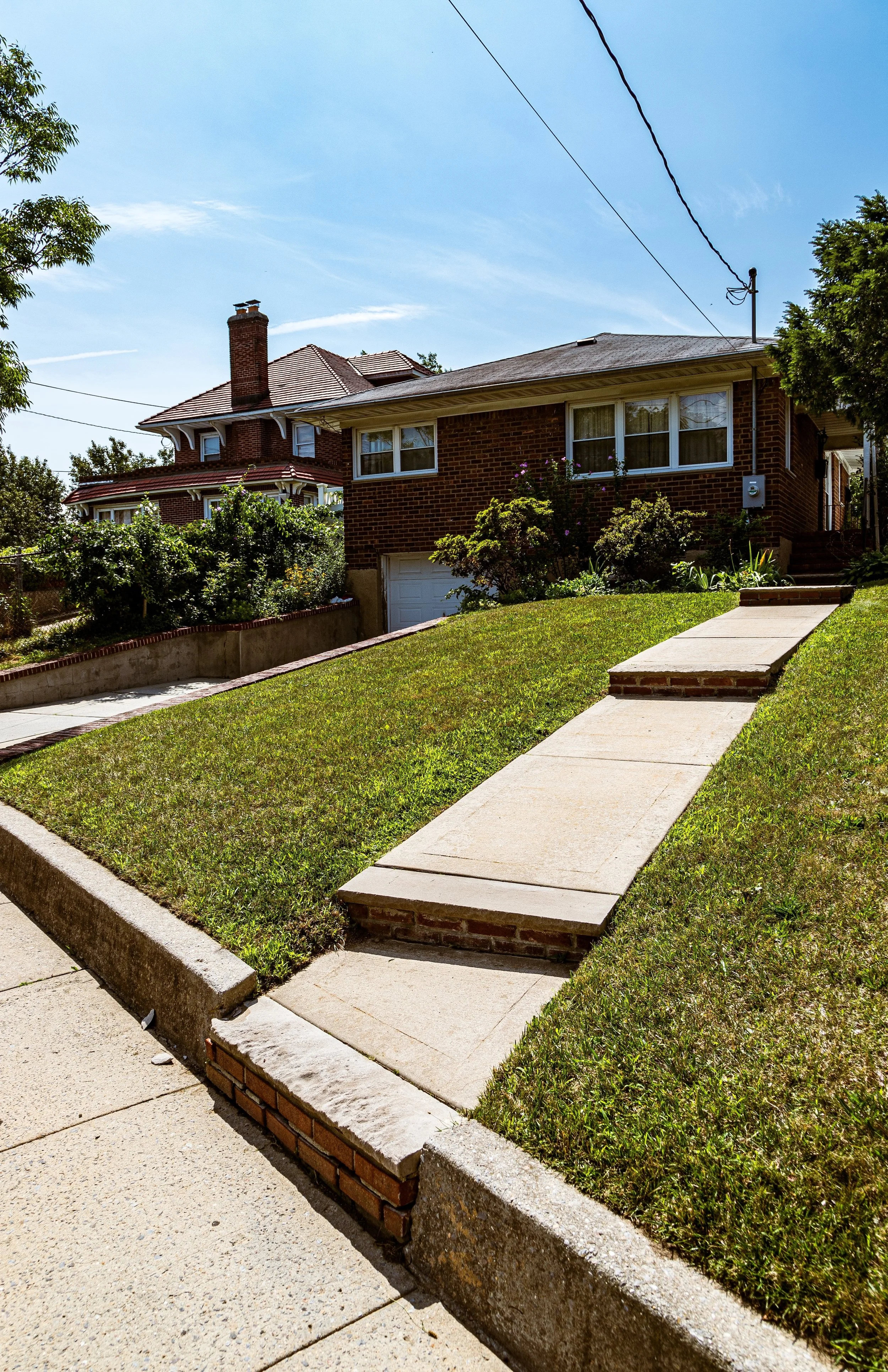
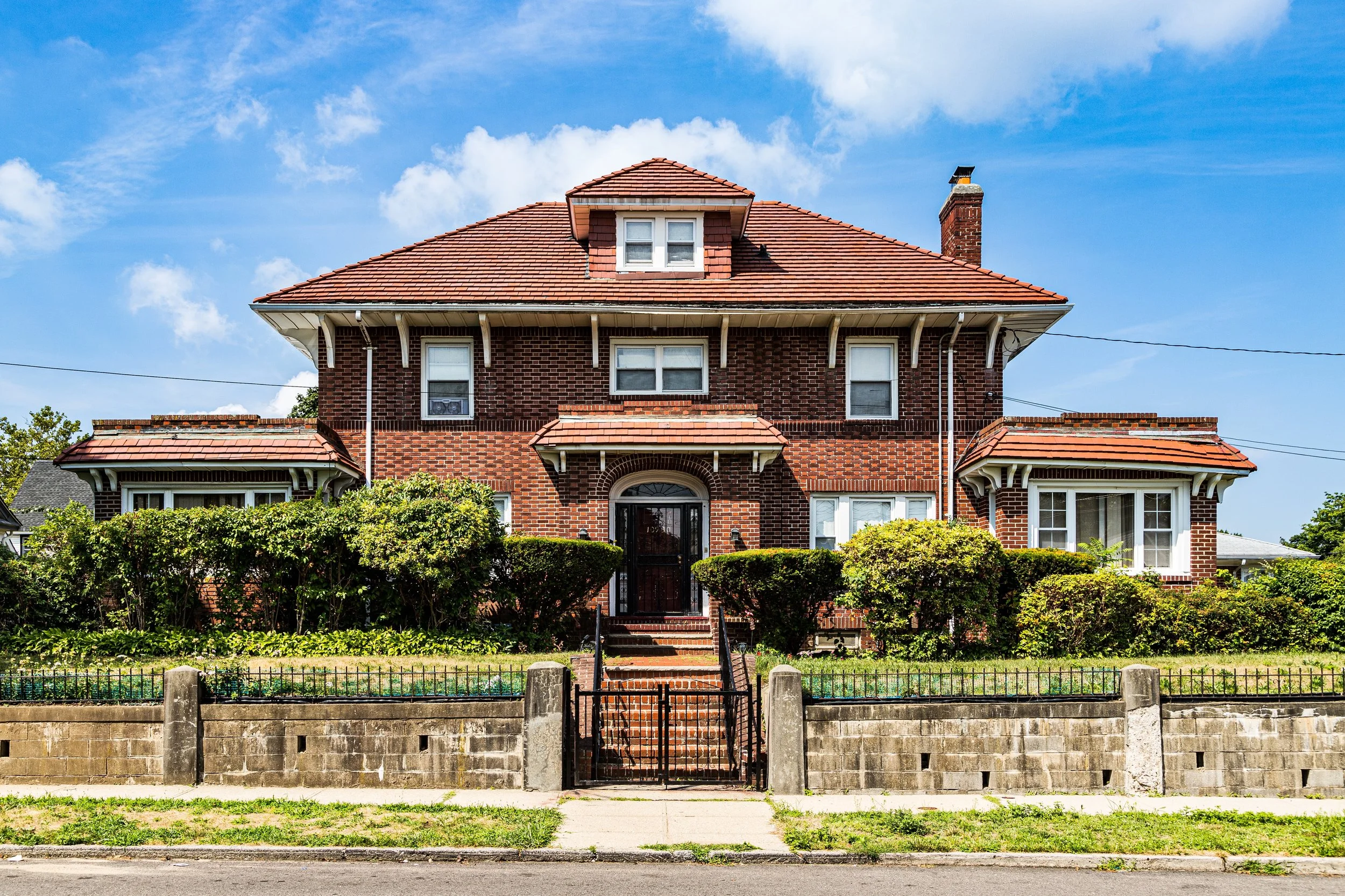
The neighborhood’s grid radiates outward from Linden Boulevard and Merrick Boulevard, its two principal thoroughfares. Homes here—predominantly detached Colonials, Tudors, Capes, and brick two-families—sit on tidy lots with driveways, porches, and manicured lawns. Churches, parks, and schools anchor its blocks, while small clusters of shops along Farmers Boulevard, Linden Boulevard, and Merrick Boulevard serve the community’s daily needs. To the south, the gentle topography dips toward Springfield Gardens, while to the north, Addisleigh Park—a nationally recognized historic district—forms the architectural and cultural heart of St. Albans’ story.
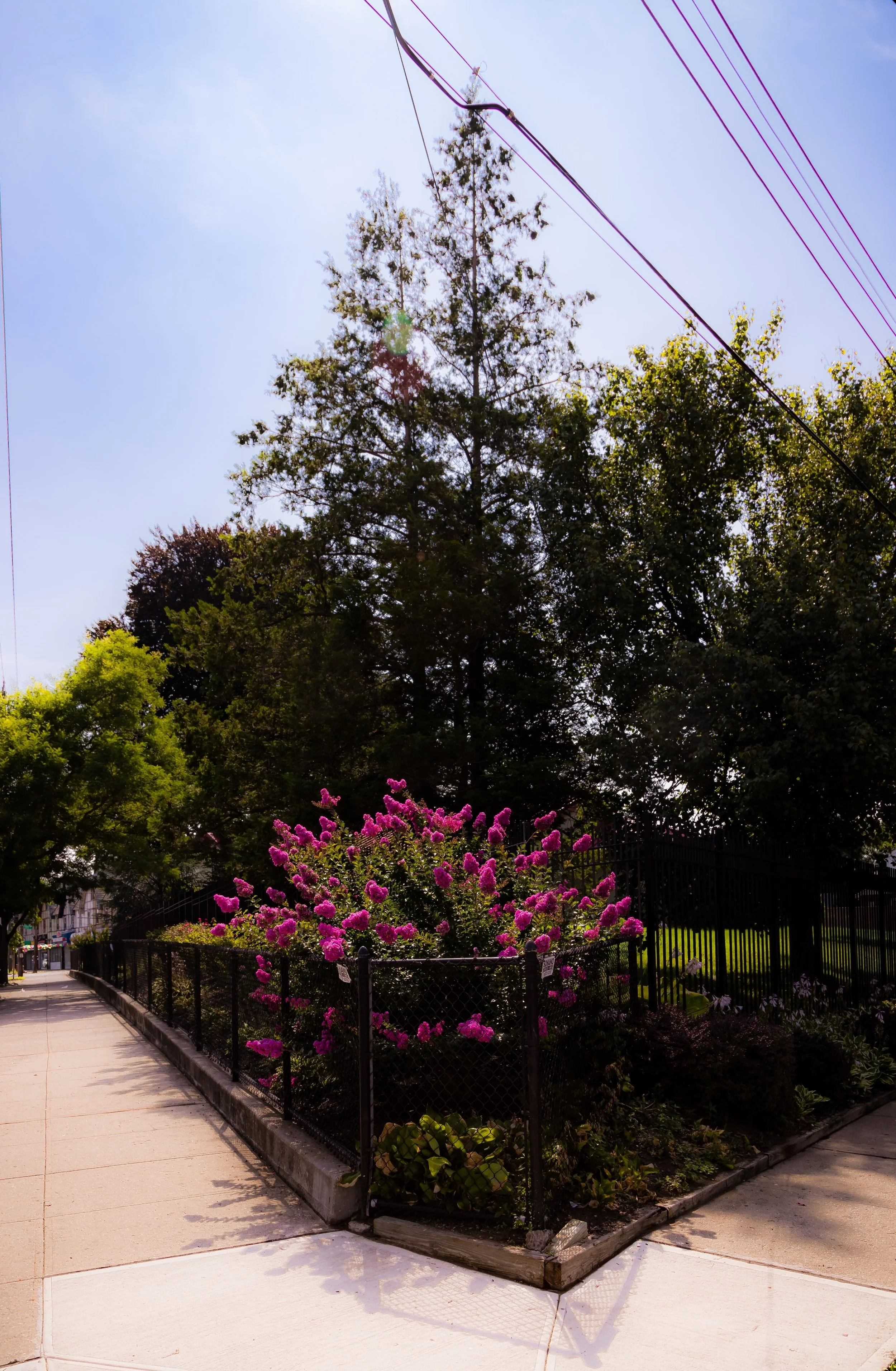
The neighborhood’s atmosphere remains unmistakably suburban, despite its location within New York City: wide streets, front yards, and a sense of rooted permanence define its rhythm.
Etymology and Origins
The name “St. Albans” was chosen by developers in the late 19th century, drawing inspiration from the ancient English cathedral city of the same name. The title was likely selected for its connotations of refinement and pastoral calm—a reflection of the suburban ideals driving Queens’ transformation at the turn of the century.
Before suburban development, the area was largely farmland and meadow, part of the Town of Jamaica. The land was owned by families such as the Remsens, Fosters, and Wards, whose large estates and orchards characterized what was then known simply as “Springfield” or “Jamaica Plains.” In the 1890s, the LIRR’s Springfield Branch (later the Montauk Division) added a local stop named St. Albans, formalizing the community’s identity.
By the early 20th century, the area was marketed as a suburban retreat for middle-class families, with modest lots and modern conveniences. Its early growth coincided with the expansion of the Queens street grid and the paving of Merrick Road (now Merrick Boulevard), transforming former farmland into a cohesive residential district connected to Jamaica’s commercial core.
The Neighborhood
Early–Mid 20th Century: Suburban Growth and Cultural Flourishing
From the 1910s through the 1940s, St. Albans developed rapidly, becoming one of Queens’ most attractive residential neighborhoods for upwardly mobile families. Developers built rows of wood-frame houses, brick colonials, and two-family homes that embodied the American suburban ideal—quiet streets, private yards, and accessible transit via the Long Island Rail Road.
During this era, Addisleigh Park, a section of St. Albans bounded by Linden Boulevard, Francis Lewis Boulevard, Sayres Avenue, and Merrick Boulevard, emerged as one of New York City’s most distinguished suburban enclaves. Initially restricted by racially exclusive covenants, the community transformed in the 1930s and 1940s when prominent African-American families began purchasing homes despite discrimination. A landmark legal case—Silsdorf v. City of New York (1948)—struck down the restrictive covenants, securing Addisleigh Park’s integration and establishing it as a model for fair housing nationwide.
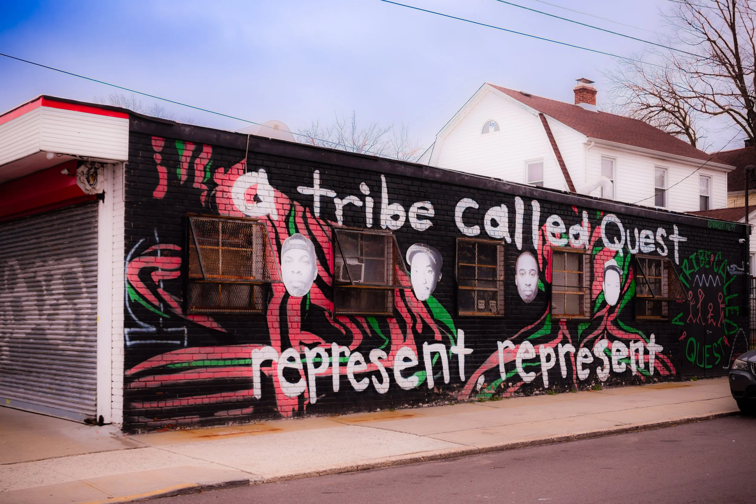
The neighborhood’s elegant homes and leafy streets soon attracted an extraordinary generation of Black professionals, artists, and musicians, transforming St. Albans into what journalists dubbed “The Harlem of the Suburbs.” Among its residents were Count Basie, Lena Horne, Fats Waller, Ella Fitzgerald, Illinois Jacquet, John Coltrane, and James Brown, who all found in St. Albans a place of dignity, safety, and space to live and create.
Mid–Late 20th Century: Stability, Pride, and the Middle-Class Dream
By the 1950s and 1960s, St. Albans had fully matured as a Black middle-class stronghold—a community of teachers, postal workers, small business owners, and city employees who maintained their homes with care and built institutions that anchored civic life. Churches such as Allen A.M.E. Cathedral, St. Catherine of Sienna Roman Catholic Church, and St. Albans Congregational Church became spiritual and social centers, hosting community events, youth programs, and civil rights meetings.
The neighborhood’s schools—P.S. 36, P.S. 118, and Andrew Jackson High School—produced generations of professionals, artists, and athletes. Parks and playgrounds dotted the area, providing green relief and gathering spaces for families. Roy Wilkins Park, created in the 1970s on the site of the former St. Albans Naval Hospital, became the neighborhood’s civic and recreational centerpiece, featuring sports fields, cultural festivals, and the Black Spectrum Theatre, a cornerstone of African-American performing arts in Queens.
Throughout the city’s turbulent 1970s, St. Albans remained remarkably stable. High rates of homeownership, strong churches, and long-standing neighborhood associations insulated it from the urban decline seen elsewhere. The lawns were tended, the houses painted, and block parties continued—symbols of enduring community pride.
St. Albans Photographic Video
Late 20th – 21st Century: Renewal, Diversity, and Legacy
In the 1980s and 1990s, St. Albans’ cultural and civic identity deepened as a new wave of Caribbean-American residents joined the established African-American community. Immigrants from Jamaica, Trinidad and Tobago, Barbados, and Haiti brought new energy, music, and cuisine to the area, reinforcing its reputation as one of Queens’ most vibrant yet grounded neighborhoods.
While neighboring communities experienced rapid redevelopment, St. Albans held fast to its low-rise, residential character. The majority of homes remain single- or two-family, with tree canopies shading sidewalks and gardens bursting with color each summer. Local businesses—beauty salons, bakeries, Caribbean restaurants, and home improvement stores—line Merrick Boulevard and Farmers Boulevard, serving both daily life and cultural tradition.
Roy Wilkins Park continues to serve as the symbolic heart of the neighborhood, hosting major community events including Juneteenth celebrations, Caribbean carnivals, and youth sports leagues. Meanwhile, Addisleigh Park was listed on the National Register of Historic Places in 2011, ensuring the preservation of its architectural and cultural heritage.
Today, St. Albans stands as a beacon of Black and Caribbean homeownership, civic engagement, and cultural memory. Though challenges such as property taxes, airport noise, and aging infrastructure persist, the community’s spirit remains unshaken—rooted in resilience and pride.
St. Albans Photo Gallery
Spirit and Legacy
The spirit of St. Albans is one of achievement, dignity, and belonging. From its early suburban roots to its evolution as a hub of African-American culture and middle-class stability, it has embodied the promise of Queens: space, opportunity, and self-determination.
New York City
Use this custom Google map to explore where every neighborhood in all five boroughs of New York City is located.
The Five Boroughs
One of New York City’s unique qualities is its organization in to 5 boroughs: Manhattan, Brooklyn, Queens, The Bronx, and Staten Island. These boroughs are part pragmatic administrative districts, and part vestiges of the region’s past. Each borough is an entire county in New York State - in fact, Brooklyn is, officially, Kings County, while Staten Island is, officially Richmond County. But that’s not the whole story …
Initially, New York City was located on the southern tip of Manhattan (now the Financial District) that was once the Dutch colony of New Amsterdam. Across the East River, another city was rising: Brooklyn. In time, the city planners realized that unification between the rapidly rising cities would create commercial and industrial opportunities - through streamlined administration of the region.
So powerful was the pull of unification between New York and Brooklyn that three more counties were pulled into the unification: The Bronx, Queens, and Staten Island. And on January 1, 1898, the City of New York unified two cities and three counties into one Greater City of New York - containing the five boroughs we know today.
But because each borough developed differently and distinctly until unification, their neighborhoods likewise uniquely developed. Today, there are nearly 390 neighborhoods, each with their own histories, cultures, cuisines, and personalities - and each with residents who are fiercely proud of their corner of The Big Apple.


