Geographic Setting
Straddling the Queens–Brooklyn border between South Ozone Park and East New York, and roughly bounded by Linden Boulevard to the north, South Conduit Avenue to the south, Ruby Street to the east, and Vandalia Avenue to the west, The Hole occupies one of New York City’s most unusual and haunting landscapes—a low-lying hollow carved from the city grid, where streets sink as much as 30 feet below surrounding neighborhoods. Lying within the old floodplain of Jamaica Creek, The Hole sits quite literally below sea level, giving it both its name and its defining isolation.
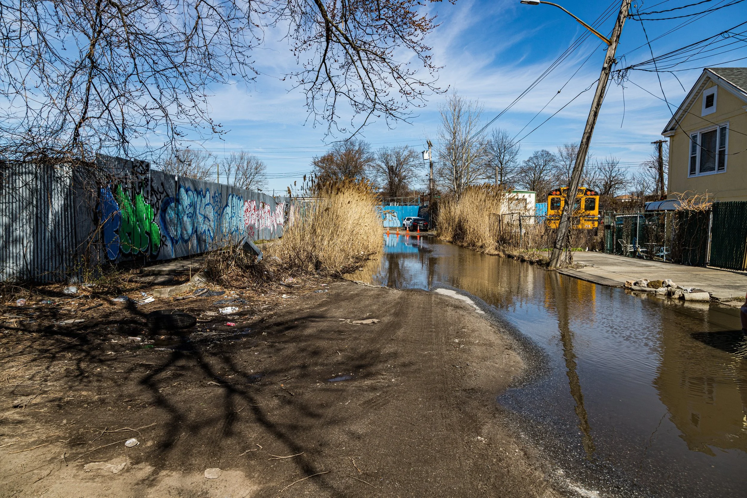
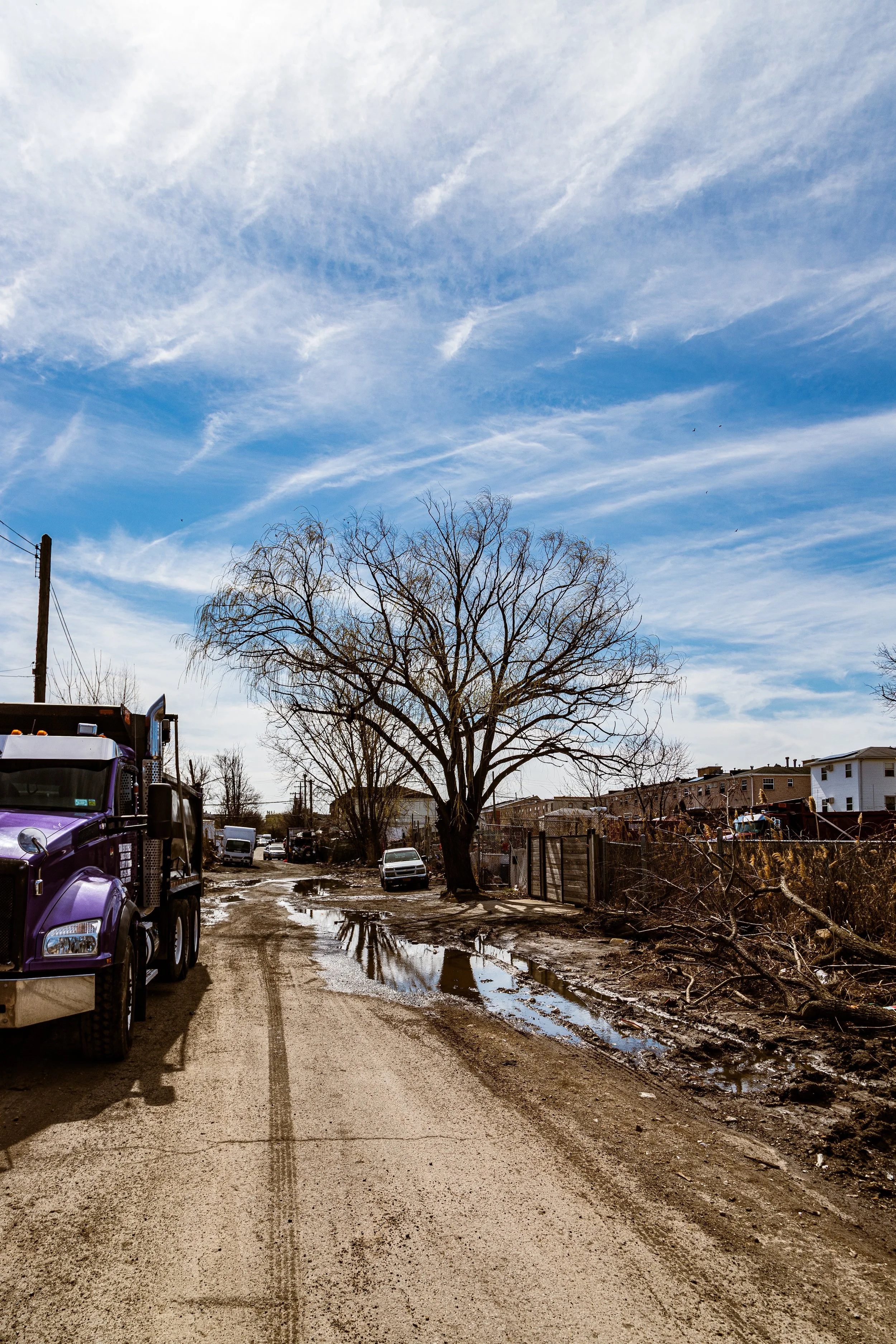
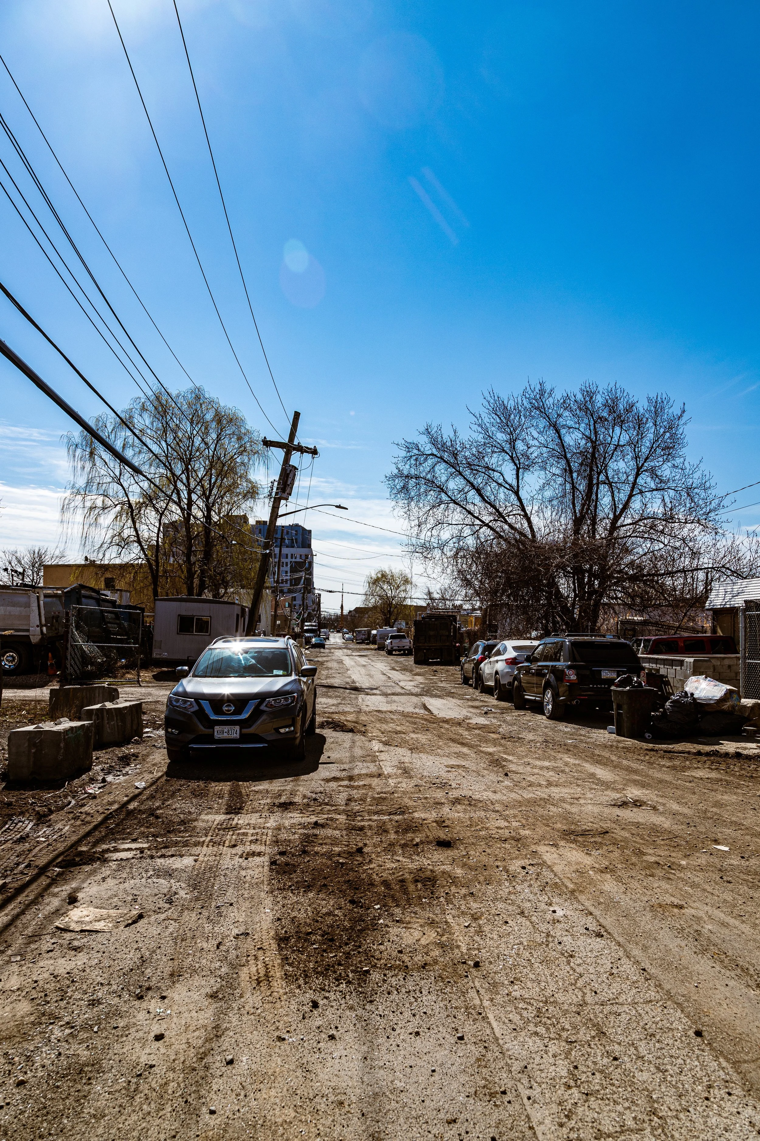
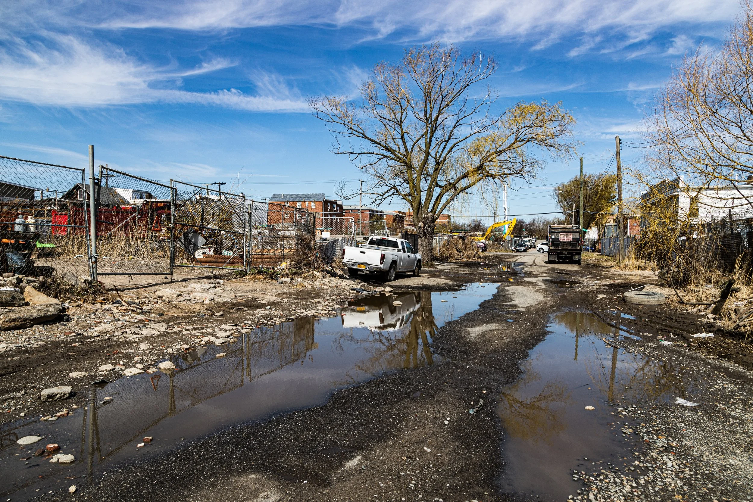
The area is a patchwork of vacant lots, marshy ground, low-built houses, and industrial yards, bounded by the elevated Belt Parkway and Conduit Avenue’s traffic roar. The streets—Cohancy Street, Lincoln Avenue, Montauk Avenue, and Linden Boulevard—descend abruptly from higher terrain, creating an eerie sense of disconnection. Pockets of homes, many small and single-story, cluster along unpaved or poorly maintained blocks. During heavy rains, standing water often collects for days, lending the neighborhood a stagnant, rural quality unlike anywhere else in New York City.
Though technically divided between the boroughs of Brooklyn (East New York) and Queens (South Ozone Park), The Hole feels like neither—a liminal zone, half-forgotten by urban planning and half-preserved by its own strange geography.
Etymology and Origins
The name “The Hole” is both literal and local. The area sits in a natural depression formed by glacial erosion and historic streambeds that once drained toward Jamaica Bay. Before urbanization, the site was a low, marshy meadow used for grazing livestock and hunting. Early maps from the 19th century show the area as part of the “Old Town of Jamaica” wetlands, considered unsuitable for farming or construction due to frequent flooding.
When the surrounding neighborhoods of East New York, Ozone Park, and Lindenwood were developed in the early 20th century, city engineers raised their streets by several feet to meet new drainage and sewer lines. The Hole, lying just beyond the grade, was never properly filled or integrated into the municipal infrastructure grid. As a result, it remained a sunken enclave, without sewers or storm drains—a physical and bureaucratic anomaly.
Over time, residents began referring to it simply as “the Hole,” a name that entered official parlance through decades of press coverage and municipal reports.
The Neighborhood
Early–Mid 20th Century: The City’s Edge
During the early 1900s, The Hole lay on the fringes of farmland and marsh, surrounded by the developing neighborhoods of East New York, Cypress Hills, and Ozone Park. Its isolation made it a haven for those seeking space outside the city’s rigid order: stable owners, small-scale farmers, and working families who built homes from salvaged materials. Throughout the early 20th century, The Hole developed sporadically, with scattered housing constructed on cheap, flood-prone land.
Many of the early homes were one-story bungalows or converted garages, built without basements or proper foundations to avoid flooding. Lacking sewer connections, residents relied on septic tanks and wells, while roads remained unpaved or prone to collapse. The area’s unpaved streets and lack of drainage infrastructure meant residents often contended with standing water and mud, especially after heavy rain.
By the 1940s and 1950s, as surrounding neighborhoods urbanized with paved streets, brick rowhouses, and public utilities, The Hole stood apart—a pocket of semi-rural life in the middle of the city. Residents raised chickens, repaired cars in front yards, and used wooden planks to cross flooded intersections. The city largely ignored the area in zoning and maintenance plans, leaving it physically and symbolically below the map’s concern.
This neglect created a unique culture of self-reliance and seclusion. For much of the 20th century, The Hole’s residents—many from working-class Black, Italian-American, and later Caribbean families—formed tight community bonds, sharing resources and defending their patch of land from outsiders and developers alike.
Mid–Late 20th Century: Margins and Myths
By the 1950s, as nearby South Ozone Park and Lindenwood developed into stable suburban neighborhoods, The Hole remained suspended between eras—still rural in spirit, yet encircled by urban sprawl. The extension of the Belt Parkway and the growth of Idlewild (JFK) Airport brought noise and proximity to industry, but little in the way of infrastructure improvement. Streets remained unpaved, city water and sewer systems were minimal, and flooding persisted as a defining feature.
In this isolation, legend and lore began to gather. By the 1970s and 1980s, The Hole’s reputation had drifted into the city’s mythology—portrayed alternately as a forgotten “no man’s land,” a hideout for horse trainers and offbeat characters, and, at times, a dumping ground for mob-related crimes. While some of this notoriety was exaggerated by tabloids, it added to the area’s mystique as New York’s “lost neighborhood.”
By this time, The Hole had entered local folklore as one of New York’s strangest—and roughest—neighborhoods. Persistent flooding, abandoned lots, and isolation contributed to its reputation as a lawless backwater. It was here that city workers and journalists occasionally discovered abandoned cars, animal remains, and even mob burial sites, fueling sensational headlines.
The most infamous of these came in 1981, when police uncovered a series of mafia-linked graves—victims of the Gambino crime family, allegedly disposed of in the area’s desolate lots. The Hole’s remote geography, just out of sight of traffic but minutes from major highways, made it an ideal dumping ground during New York’s mob era.
Despite this notoriety, a small but stable community persisted. Longtime residents described the area as quiet and close-knit, if perilous in wet weather. “We’re the forgotten ones,” one resident told reporters in the 1990s, “but it’s home.” The landscape—pocked with reeds, fences, and rusting cars—gave the area an almost rural southern feel, earning it the nickname “the swamp neighborhood.”
Despite hardship, families continued to live there, joined by new arrivals seeking affordable shelter and independence. The community’s resilience—its ability to endure amid neglect—became both its challenge and its badge of honor.
The Hole Photographic Video
21st Century: Recognition and Renewal at the Fringe
In the 21st century, The Hole has begun to receive long-overdue municipal attention. Chronic flooding and infrastructural decay—exacerbated by rising sea levels and heavy storms—finally pushed the city to act. In 2015, the New York City Department of Environmental Protection (DEP) and Department of Design and Construction (DDC) initiated studies to address stormwater management, raising street levels, and connecting homes to sewer and water mains for the first time.
While full remediation remains ongoing, sections of The Hole have seen partial elevation and reconstruction. New curbs, drainage systems, and roadbeds have been installed along key blocks such as Cohancy Street and Pitkin Avenue, signaling a gradual reintegration of the area into the city’s infrastructure network. Environmental advocacy groups have also pushed for ecological restoration, emphasizing the area’s historical role in the Jamaica Bay watershed.
Despite these efforts, The Hole retains its distinctive atmosphere—a rural pocket in the metropolis, where roosters crow, stormwater ponds gleam under streetlights, and the skyline of East New York looms like another world just beyond the ridge. For many residents, the neighborhood’s isolation remains both its curse and its charm: “It’s quiet here,” one longtimer told The New York Times in 2022, “and we like it that way—even if we have to wear boots after the rain.”
The Hole Photo Gallery
Spirit and Legacy
The Hole’s spirit is defined by endurance at the margins. It is a place that defies the city’s logic—built too low, too wet, and too forgotten to fit neatly within New York’s modern grid. Yet it has persisted for generations, its residents shaping a life amid adversity and neglect.
In many ways, The Hole stands as a living reminder of New York’s uneven history of development: the costs of progress measured in who gets left behind. Its muddy lots and sagging porches tell a story of survival, ingenuity, and the stubborn will to call home what others would abandon.
New York City
Use this custom Google map to explore where every neighborhood in all five boroughs of New York City is located.
The Five Boroughs
One of New York City’s unique qualities is its organization in to 5 boroughs: Manhattan, Brooklyn, Queens, The Bronx, and Staten Island. These boroughs are part pragmatic administrative districts, and part vestiges of the region’s past. Each borough is an entire county in New York State - in fact, Brooklyn is, officially, Kings County, while Staten Island is, officially Richmond County. But that’s not the whole story …
Initially, New York City was located on the southern tip of Manhattan (now the Financial District) that was once the Dutch colony of New Amsterdam. Across the East River, another city was rising: Brooklyn. In time, the city planners realized that unification between the rapidly rising cities would create commercial and industrial opportunities - through streamlined administration of the region.
So powerful was the pull of unification between New York and Brooklyn that three more counties were pulled into the unification: The Bronx, Queens, and Staten Island. And on January 1, 1898, the City of New York unified two cities and three counties into one Greater City of New York - containing the five boroughs we know today.
But because each borough developed differently and distinctly until unification, their neighborhoods likewise uniquely developed. Today, there are nearly 390 neighborhoods, each with their own histories, cultures, cuisines, and personalities - and each with residents who are fiercely proud of their corner of The Big Apple.


