DAHILL
Brooklyn
Geographic Setting
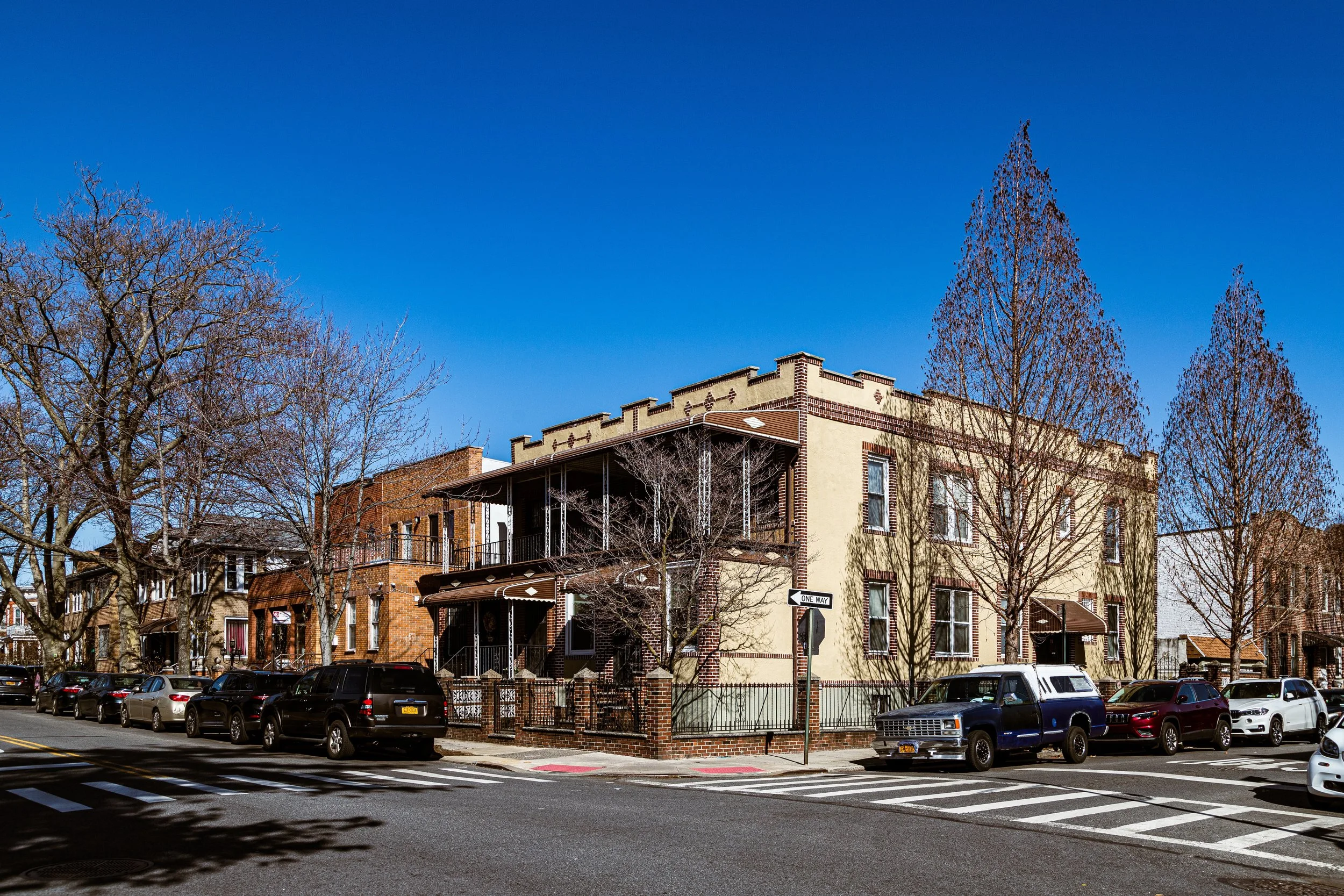
Tucked into a small triangular pocket bounded by Martense Lane, Fort Hamilton Parkway, and Dahill Road, the micro-neighborhood of Dahill occupies one of Brooklyn’s most quietly distinctive corners—a wedge of residential calm set between Borough Park, Kensington, and Mapleton. Though only a few blocks in size, Dahill is emblematic of the fine-grained patchwork that defines southern Brooklyn: a district shaped by the evolution of streets older than the grid itself, where historic farm lanes bend through the otherwise rigid geometry of the modern city. Its namesake thoroughfare, Dahill Road, curves gracefully through the triangle, marking a subtle rise in the landscape that once formed the western fringe of Flatbush’s 19th-century farmland.
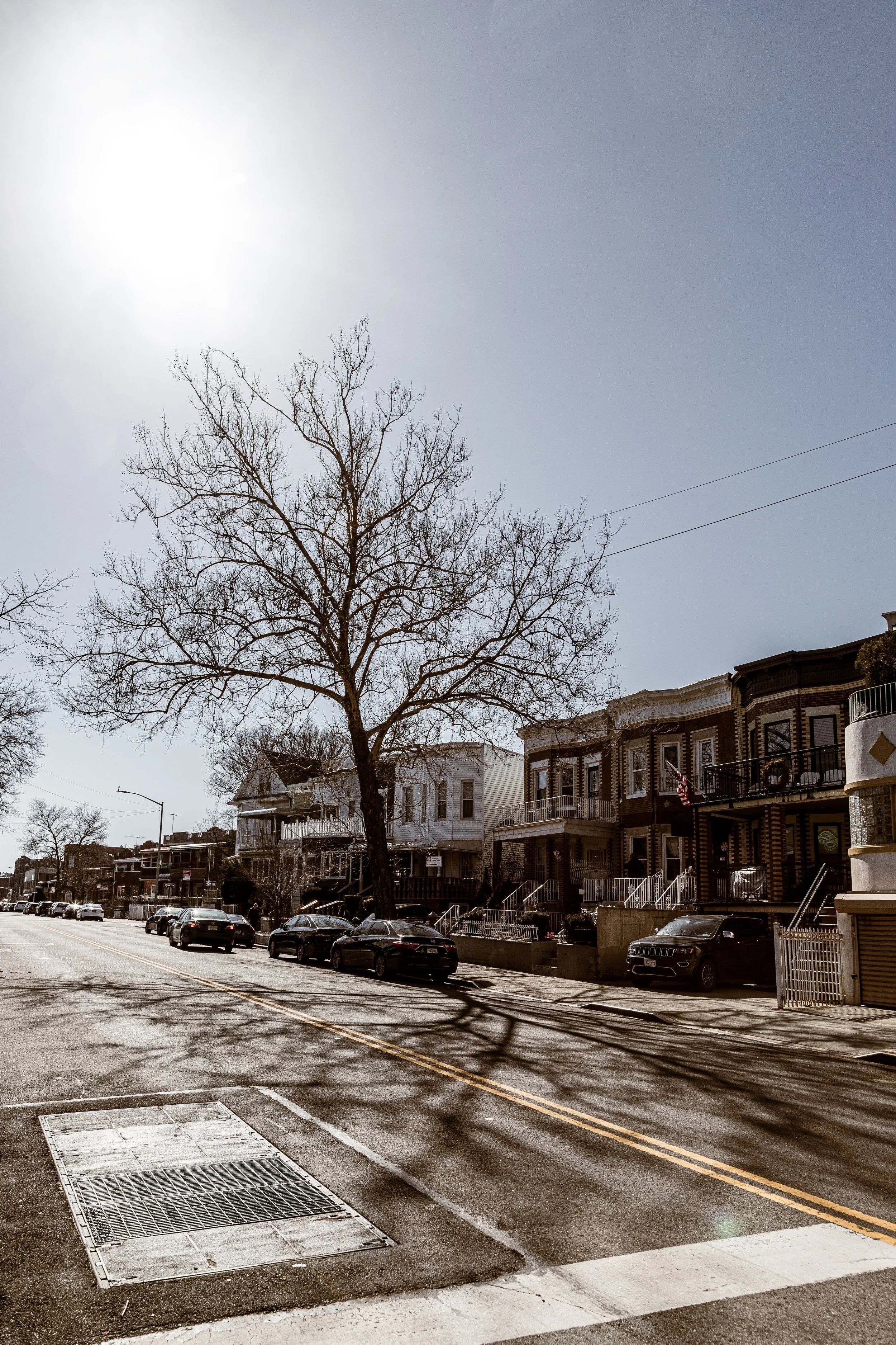
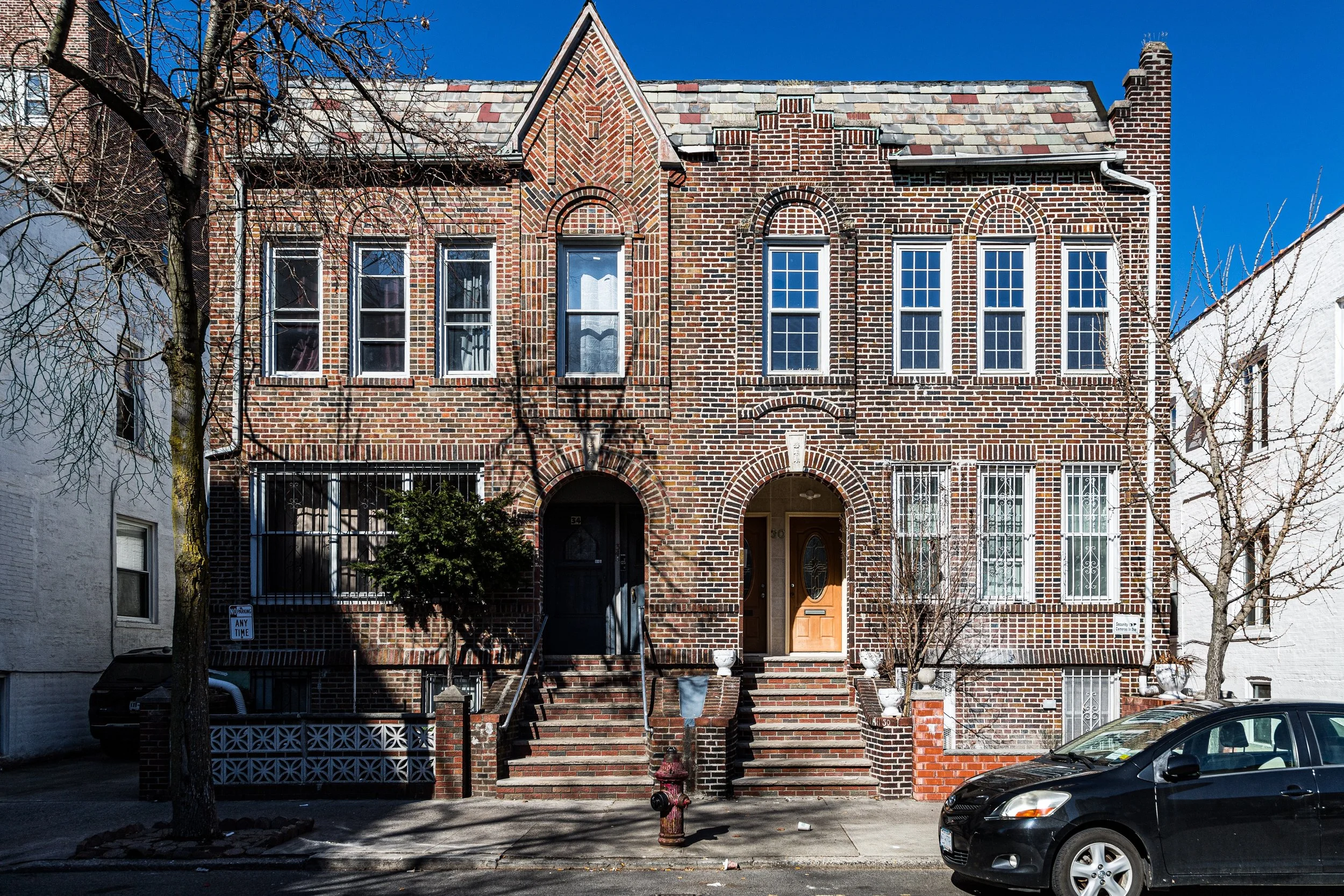
Dahill’s built environment is intimate and varied. Tree-lined blocks feature prewar brick rowhouses, semi-detached homes with front gardens, and low-rise apartment buildings dating largely from the 1920s–1940s, their façades ornamented with limestone lintels and decorative brickwork. The proximity of McDonald Avenue and the F and G subway lines keeps the area well connected, while Fort Hamilton Parkway provides a commercial corridor of small bakeries, kosher delis, and corner stores that reflect the district’s layered cultural heritage. Despite its tiny footprint, Dahill possesses a strong sense of neighborhood identity—defined less by borders than by continuity, community, and the enduring curve of its streets.
Etymology and Origins
The name Dahill likely commemorates the Dahill family, early landowners and developers in this section of Flatbush during the late 19th century, when the rural lanes of Dutch-era farms began giving way to new suburban streets. Dahill Road itself predates much of the surrounding grid, tracing an older property boundary that wound through meadows and orchards. Martense Lane, running diagonally along the neighborhood’s southern edge, preserves the name of the Martense family, among Flatbush’s earliest Dutch settlers in the 1600s, whose homesteads once stood nearby.
Before urbanization, this triangle was farmland dotted with windmills and outbuildings belonging to Dutch and later English families who cultivated the fertile soil between the villages of Flatbush and New Utrecht. The coming of Fort Hamilton Parkway in the mid-1800s and the extension of streetcar lines toward Coney Island transformed the area’s destiny, connecting it to Brooklyn’s expanding network of residential suburbs.
The Neighborhood
19th Century: From Farmland to Suburban Outpost
During the 1870s–1890s, as Brooklyn’s population exploded and the consolidation with New York City (1898) approached, developers subdivided former farms into modest housing tracts. Dahill’s triangular parcel—bordered by Martense Lane’s old farm route and the newly graded Fort Hamilton Parkway—was one of the smallest yet most distinct of these developments. Early houses were wood-frame cottages and two-family homes, built for clerks, craftsmen, and small shopkeepers who sought space and light within commuting distance of downtown Brooklyn.
Advertisements of the period marketed the area as part of “South Flatbush”, praising its pure air and “parkway access.” The nearby Prospect Park extension and the establishment of Greenwood Cemetery to the north added to its appeal. Although never grand, Dahill was comfortable—a working- and middle-class refuge amid the city’s expanding urban fabric.
Early–Mid 20th Century: Immigrant Neighborhood in Bloom
In the early 1900s, the completion of the Culver elevated line (later the F and G trains) and the paving of Fort Hamilton Parkway brought a second wave of development. Rows of brick and limestone houses replaced older wood structures, while small apartment buildings appeared along Dahill Road. The neighborhood’s population diversified: Jewish, Italian, and Irish families arrived first, followed by Syrian and Lebanese immigrants in the 1920s.
By mid-century, Dahill had become a microcosm of Brooklyn’s multiethnic life. Corner groceries, kosher butcher shops, and soda fountains served residents who knew one another by name. The area’s compact size and its position between the larger communities of Borough Park and Kensington gave it a dual identity—part of both, yet distinct. Children attended nearby public schools such as P.S. 230, and the sound of trolley bells along Fort Hamilton Parkway marked the rhythm of daily life.
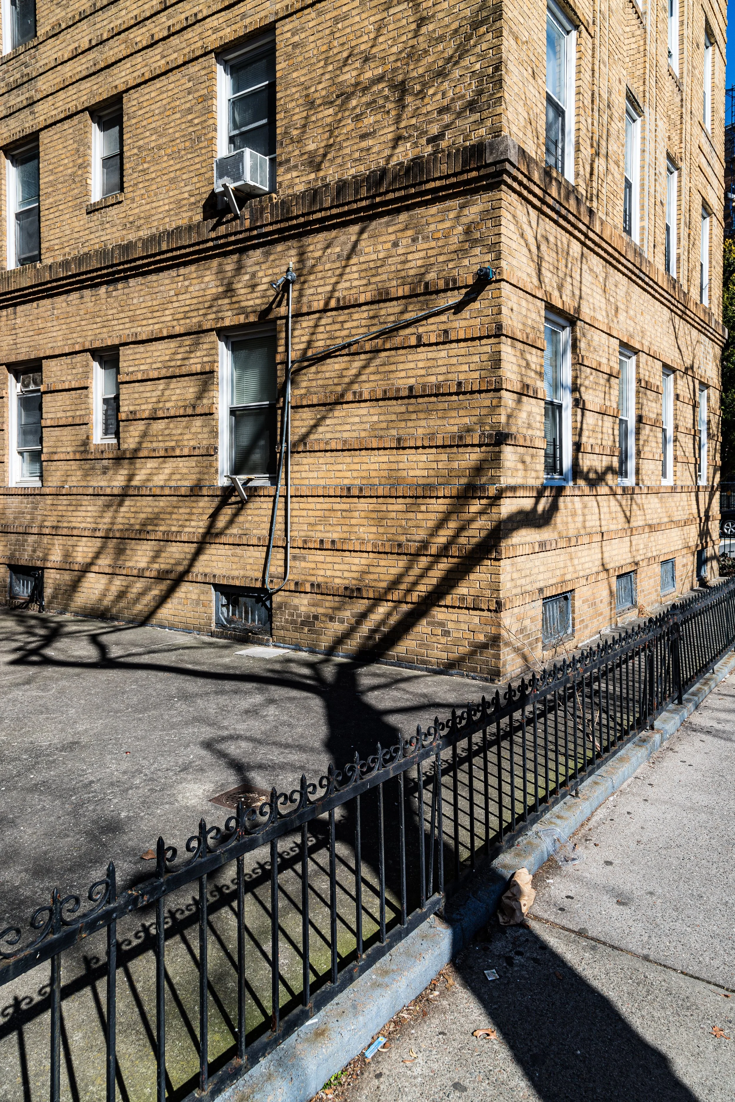
After World War II, the neighborhood saw the arrival of new Eastern European and Sephardic Jewish families, drawn by affordable housing and proximity to Borough Park’s synagogues and community institutions. Apartment buildings such as those along Dahill Road between 37th and 40th Streets reflected postwar optimism—solid, practical, and built to last.
Dahill Photographic Video
Late 20th Century: Continuity through Change
The 1960s–1980s brought shifts typical of Brooklyn’s outer neighborhoods: demographic change, economic uncertainty, and periodic renewal. While nearby sections of Borough Park became increasingly Orthodox Jewish, Dahill remained more mixed, home to Jewish, Hispanic, South Asian, and Middle Eastern residents. The Syrian-Jewish community, in particular, maintained a visible presence along Dahill Road, establishing small synagogues and community centers within walking distance.
Despite urban challenges elsewhere in Brooklyn, Dahill avoided widespread decline. Its modest scale and homeownership base provided stability, while the active presence of religious congregations, civic associations, and small landlords kept its streets well maintained. The triangle’s relative isolation—bounded by two major parkways—contributed to its quiet, self-contained character.
21st Century: A Hidden Enclave Endures
In the 21st century, Dahill remains one of Brooklyn’s lesser-known but most enduring enclaves. The streets retain a 20th-century rhythm: stoops swept clean, children playing on sidewalks, elderly residents chatting near corner stores. New generations of Syrian-Jewish, Pakistani, Bangladeshi, and Eastern European families share the same blocks once settled by Italians and Irish, reflecting the borough’s perpetual cycle of renewal.
While development pressures have reshaped parts of Kensington and Borough Park, Dahill’s small, irregular parcel and its patchwork of co-ops, rentals, and private houses have largely preserved its intimate scale. On Fort Hamilton Parkway, halal markets and kosher bakeries operate side by side; along Dahill Road, apartment courtyards bloom with rose bushes and grapevines. The Dahill Triangle Park, a tiny green space near the neighborhood’s center, stands as a symbol of the community’s compact charm and its name made literal—a triangle within a triangle.
Dahill Photo Gallery
Spirit and Legacy
Dahill’s legacy is one of persistence in miniature—a neighborhood that, though scarcely a dozen blocks, embodies the quiet continuity of Brooklyn’s residential heart. Its curving roads and diagonals preserve traces of the borough’s agrarian past; its buildings, the aspirations of immigrant families who sought both proximity and peace.
New York City
Use this custom Google map to explore where every neighborhood in all five boroughs of New York City is located.
The Five Boroughs
One of New York City’s unique qualities is its organization in to 5 boroughs: Manhattan, Brooklyn, Queens, The Bronx, and Staten Island. These boroughs are part pragmatic administrative districts, and part vestiges of the region’s past. Each borough is an entire county in New York State - in fact, Brooklyn is, officially, Kings County, while Staten Island is, officially Richmond County. But that’s not the whole story …
Initially, New York City was located on the southern tip of Manhattan (now the Financial District) that was once the Dutch colony of New Amsterdam. Across the East River, another city was rising: Brooklyn. In time, the city planners realized that unification between the rapidly rising cities would create commercial and industrial opportunities - through streamlined administration of the region.
So powerful was the pull of unification between New York and Brooklyn that three more counties were pulled into the unification: The Bronx, Queens, and Staten Island. And on January 1, 1898, the City of New York unified two cities and three counties into one Greater City of New York - containing the five boroughs we know today.
But because each borough developed differently and distinctly until unification, their neighborhoods likewise uniquely developed. Today, there are nearly 390 neighborhoods, each with their own histories, cultures, cuisines, and personalities - and each with residents who are fiercely proud of their corner of The Big Apple.


