
CYPRESS HILLS
Brooklyn
Geographic Setting
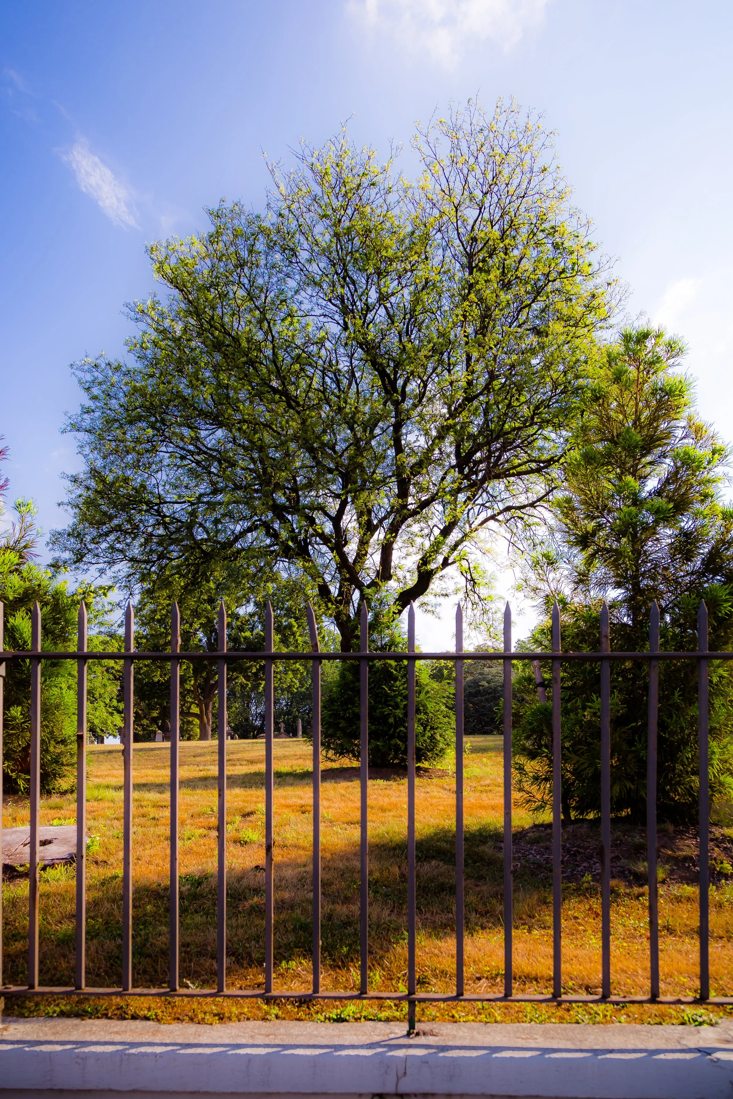
Bounded by Atlantic Avenue to the south, Broadway Junction to the west, Jamaica Avenue and the Cypress Hills Cemetery to the north, and the Queens line to the east, Cypress Hills occupies the far northeastern corner of Brooklyn—a ridge-top neighborhood where the city’s grid gives way to rolling ground, panoramic skies, and the quiet threshold of the borough’s borderlands. Set high above East New York and adjacent to Highland Park, it is one of Brooklyn’s most geographically distinct enclaves, its streets climbing and curving with the contours of the terminal moraine that once defined the ancient edge of Long Island’s glacial plain.
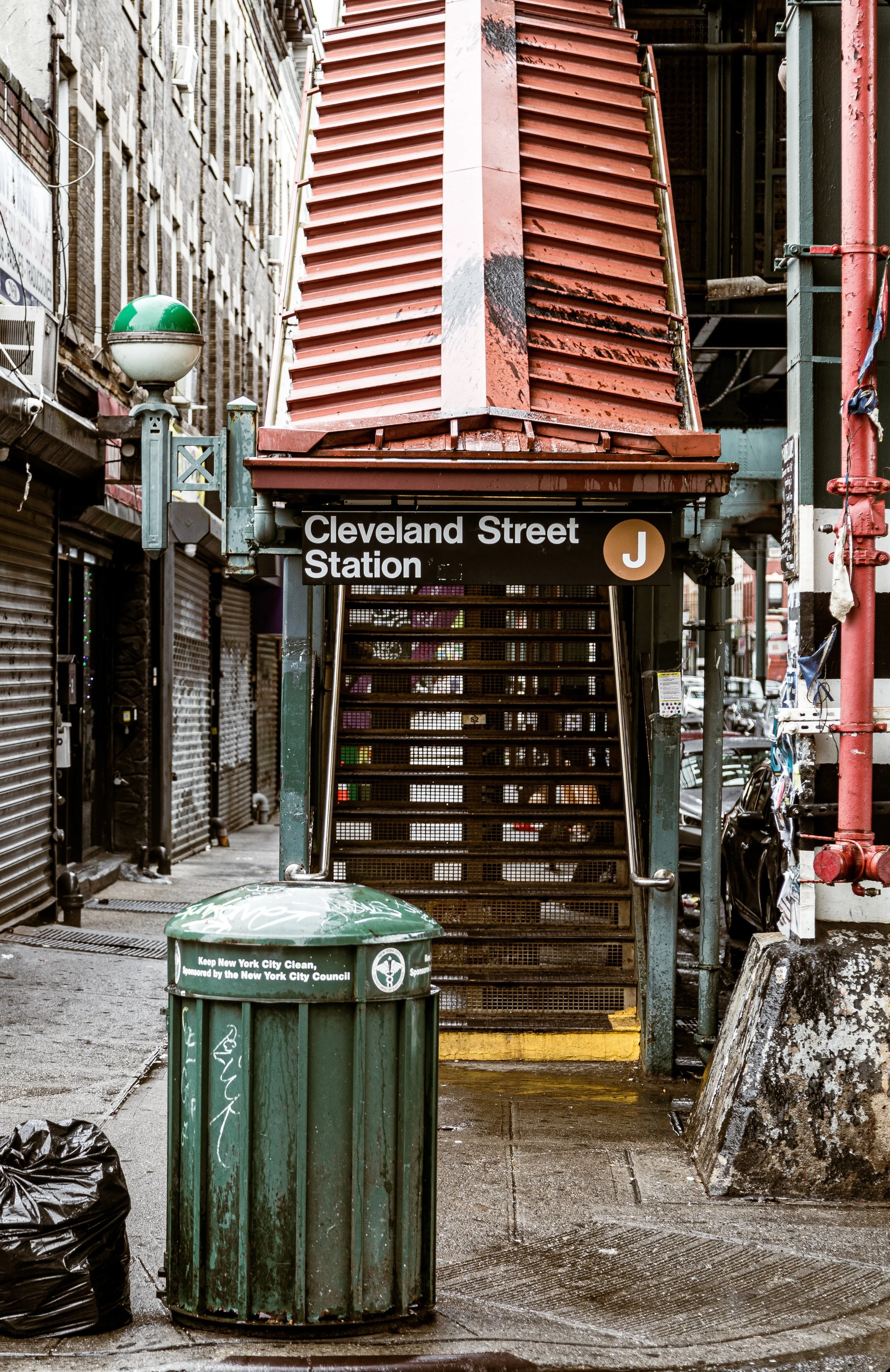
Cypress Hills is a neighborhood of houses, not towers—tree-lined blocks of wood-frame and brick rowhouses, late-19th-century two-family homes, and compact apartment buildings interspersed with churches, schools, and small businesses. Its eastern edge overlooks the verdant expanse of Cypress Hills Cemetery and Forest Park, while Atlantic Avenue and Fulton Street serve as its southern and central arteries. The elevated J and Z trains, running along Jamaica Avenue, link the community to the heart of Brooklyn and Lower Manhattan. Beneath its modest exterior lies a history of urban ambition, working-class perseverance, and steady reinvention stretching back more than 150 years.
Etymology and Origins
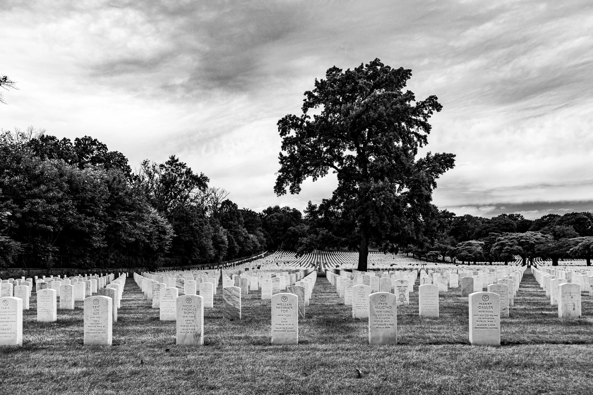
The name Cypress Hills dates to the mid-19th century, drawn from the tall cypress trees that once grew across its slopes and the establishment of the Cypress Hills Cemetery (1848), one of New York’s earliest and most beautiful rural cemeteries. The cemetery’s rolling terrain and sweeping views inspired the same romantic landscape ideals that shaped Green-Wood Cemetery and Prospect Park. The surrounding hills, part of the terminal moraine left by the Wisconsin Glacier, offered a cooler, breezier climate than the lowlands of East New York—a feature that made the area desirable for settlement as Brooklyn expanded eastward.
Before the grid and the railroad, this region was rural Flatbush and Jamaica farmland, owned by Dutch and English families whose homesteads dotted the ridge. Its transformation into a residential district began in earnest in the 1870s–1880s, when improved transit and the rise of new industries along Atlantic Avenue drew both developers and immigrants seeking affordable housing just beyond the city’s core.
The Neighborhood
19th Century: A Ridge-Top Village on the City’s Edge
By the 1880s, Cypress Hills had emerged as a distinct neighborhood of tidy streets, small wood-frame houses, and corner stores. Developers advertised it as a “healthy suburban retreat” accessible by the Long Island Rail Road and later the Fulton Street Elevated Railway (1888). Immigrants—particularly German, Irish, and Italian families—settled here, attracted by low-cost lots and proximity to jobs in East New York’s factories and breweries.
Jamaica Avenue became the main commercial corridor, lined with bakeries, hardware shops, and tailor stores. Churches and parochial schools—such as St. Rita’s Roman Catholic Church (1899) and Blessed Sacrament Church (1897)—anchored the growing community, while the Cypress Hills Cemetery provided both employment and a contemplative landscape that lent the area an almost pastoral calm.
Architecturally, the neighborhood reflected its transitional character: wood-frame rowhouses with peaked roofs, bay windows, and small porches mixed with modest brick and limestone townhouses built in the 1890s–1910s. The elevated trains, though noisy, brought vitality; the platforms offered expansive views toward the ocean and Manhattan’s skyline. By the turn of the century, Cypress Hills had become a model of the workingman’s suburb—a place of dignity, thrift, and family life on the edge of the metropolis.
Early–Mid 20th Century: Working-Class Stability
In the first half of the 20th century, Cypress Hills retained its strong working-class character. Many residents worked in manufacturing and transport industries clustered along Atlantic Avenue, the East New York freight yards, and nearby Highland Park. Rowhouses were well maintained, with front stoops, flower boxes, and pocket gardens.
The Cypress Hills Houses, one of the city’s earliest public housing developments, opened in 1955, introducing modern apartments for returning veterans and working families. Schools, community centers, and playgrounds fostered a close-knit social life. The area’s ethnic composition evolved as Jewish and Italian families gave way to Puerto Rican and later Dominican, African American, and Caribbean newcomers, who brought new languages, music, and cuisines. Despite modest means, Cypress Hills remained relatively stable, avoiding the steep decline that struck neighboring East New York in the 1960s–1970s.
The neighborhood’s small scale—its mix of one- and two-family homes—helped preserve a sense of ownership and care. Block associations organized cleanups and summer festivals, while local businesses along Fulton and Crescent Streets remained family-run. Churches and schools adapted to changing congregations, maintaining continuity amid demographic turnover.
Cypress Hills Photographic Video
Late 20th Century: Decline and Determination
The 1970s–1980s tested Cypress Hills, as New York’s fiscal crisis, disinvestment, and rising crime reached its periphery. Vacant houses, neglected lots, and declining city services challenged residents’ resilience. Yet unlike many parts of East New York, Cypress Hills saw a groundswell of grassroots activism that ultimately reversed its fortunes.
In 1983, local residents founded the Cypress Hills Local Development Corporation (CHLDC)—a nonprofit that became a national model for community-led revitalization. The organization rehabilitated abandoned housing, developed affordable apartments, supported small businesses, and launched youth and environmental programs. Their efforts, combined with those of local churches and schools, stabilized property values and restored civic pride.
The neighborhood’s cultural fabric deepened with the arrival of Dominican, Ecuadorian, Mexican, and West Indian immigrants, who revitalized storefronts and established new restaurants, bodegas, and community groups. The sounds of salsa, bachata, and merengue began to fill Jamaica Avenue, and annual parades and street fairs reflected the neighborhood’s shifting yet cohesive identity.
21st Century: A Neighborhood Reclaimed
Today, Cypress Hills stands as one of Brooklyn’s quiet success stories—still working-class, still diverse, but steadily improving through decades of community persistence. Its housing stock, once imperiled, is now a point of pride: carefully maintained rowhouses and restored two-family homes line Euclid Avenue, Hemlock Street, and Lincoln Avenue, while new affordable housing developments coexist with older structures.
The Cypress Hills Local Development Corporation continues to anchor neighborhood progress, spearheading sustainable initiatives like the Cypress Hills Verde environmental plan and the Fulton Street Gateway revitalization. Highland Park and the Ridgewood Reservoir, on the northern edge, have been restored as ecological sanctuaries, offering panoramic views of the city skyline amid woodlands and wetlands.
Transit access remains one of the neighborhood’s defining strengths: the J, Z, and C trains, along with bus and bike routes, connect residents easily to Downtown Brooklyn and Queens. Yet Cypress Hills retains a semi-suburban tranquility rare in New York—quiet blocks, backyard gardens, and the sound of church bells or children playing echoing against the hill.
Its population today is a tapestry of Latino, African American, Caribbean, and South Asian families, joined by a younger generation of artists and professionals who value its affordability and authenticity. Through reinvestment and civic stewardship, Cypress Hills has managed to evolve without erasing its soul.
Cypress Hills Photo Gallery
Spirit and Legacy
Cypress Hills’ legacy is one of endurance at the margins—a neighborhood that has remained both humble and proud, grounded in the labor and faith of its people. Its hills have witnessed the transformation of Brooklyn from farmland to factory borough to global city, yet its streets still reflect the cadence of everyday life: homeowners tending stoops, small businesses thriving under the elevated tracks, and children walking to school beneath the shade of century-old trees.
New York City
Use this custom Google map to explore where every neighborhood in all five boroughs of New York City is located.
The Five Boroughs
One of New York City’s unique qualities is its organization in to 5 boroughs: Manhattan, Brooklyn, Queens, The Bronx, and Staten Island. These boroughs are part pragmatic administrative districts, and part vestiges of the region’s past. Each borough is an entire county in New York State - in fact, Brooklyn is, officially, Kings County, while Staten Island is, officially Richmond County. But that’s not the whole story …
Initially, New York City was located on the southern tip of Manhattan (now the Financial District) that was once the Dutch colony of New Amsterdam. Across the East River, another city was rising: Brooklyn. In time, the city planners realized that unification between the rapidly rising cities would create commercial and industrial opportunities - through streamlined administration of the region.
So powerful was the pull of unification between New York and Brooklyn that three more counties were pulled into the unification: The Bronx, Queens, and Staten Island. And on January 1, 1898, the City of New York unified two cities and three counties into one Greater City of New York - containing the five boroughs we know today.
But because each borough developed differently and distinctly until unification, their neighborhoods likewise uniquely developed. Today, there are nearly 390 neighborhoods, each with their own histories, cultures, cuisines, and personalities - and each with residents who are fiercely proud of their corner of The Big Apple.


