ALPHABET VILLAGE
Manhattan
Geographic Setting
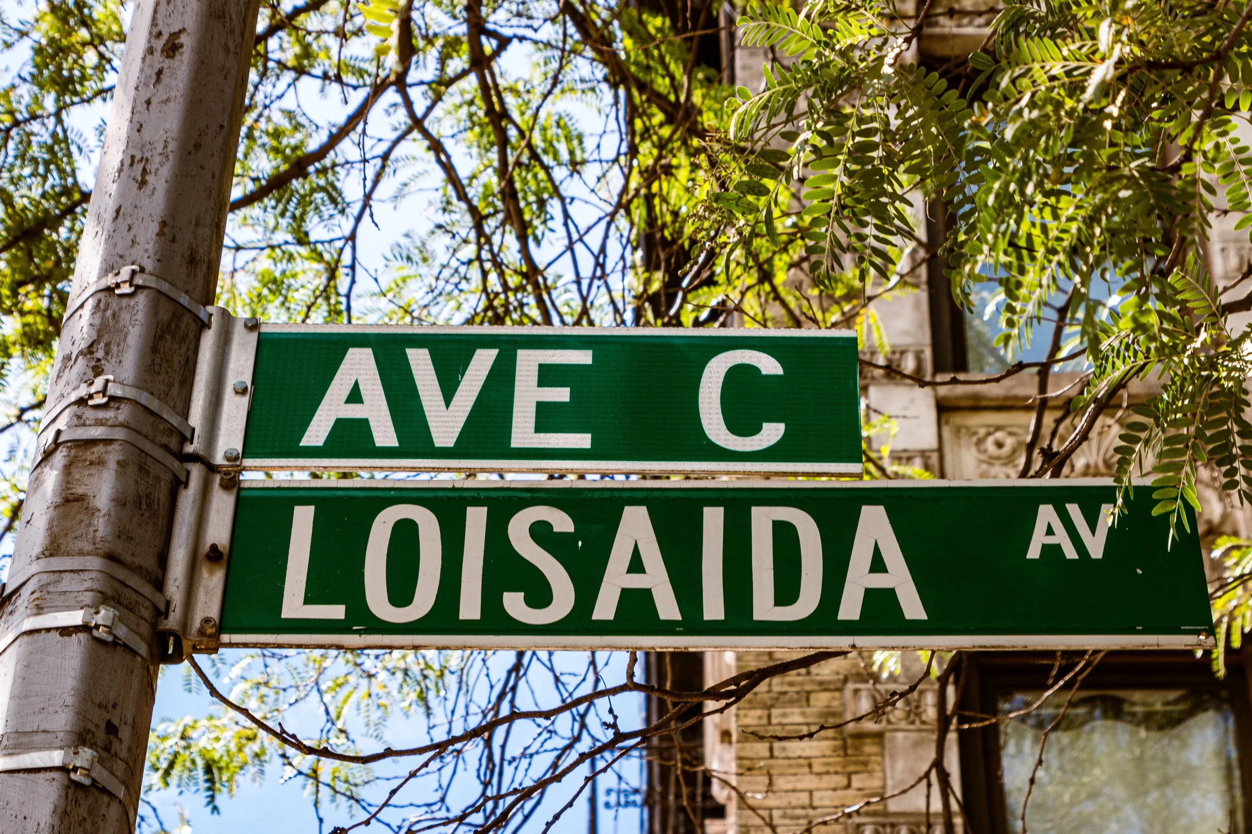
Tucked between Avenue A and the East River, and stretching roughly from Houston Street north to 14th Street, Alphabet City occupies the easternmost portion of the East Village — a neighborhood both mythic and mutable, long defined by rebellion, creativity, and survival. Its name comes directly from its grid: Avenues A, B, C, and D, the only lettered avenues in Manhattan. Together they trace a slender edge of the island that has evolved from tidal marsh to tenement district to one of New York’s most storied enclaves of art, activism, and endurance.
Etymology and Origins
At first glance, the name “Alphabet Village” may seem unfamiliar — or even mistaken — to visitors who know this area as “Alphabet City.” The distinction is deliberate. Here, “Alphabet Village” is used as a way of honoring the neighborhood’s well-known “Alphabet” identity while also acknowledging its longstanding historical and cultural relationship to the East Village and the broader family of Manhattan’s “villages.”
The name “Alphabet City” is both geographic and cultural in origin. When the Commissioners’ Plan of 1811 imposed Manhattan’s numbered street grid, the island’s narrowing eastern edge left insufficient room for additional full-length numbered avenues east of First Avenue. In response, four shorter avenues — A, B, C, and D — were laid out along the East River side of the grid. From this distinctive lettering came the neighborhood’s best-known modern name.
Yet the meaning of “Alphabet City” has never been purely cartographic. Over time, the name became tied to specific chapters in the area’s history — especially the hardship, disinvestment, and fierce countercultural identity of the late 20th century. For some, it remains a badge of resilience and individuality; for others, it is a term shaped by real-estate branding, media shorthand, or a difficult era they would rather not see define the neighborhood’s full story. In parallel, the area has also long been understood as part of the broader East Village, creating an enduring tension between overlapping names and identities.
The use of “Alphabet Village” reflects an effort to honor multiple histories at once. It preserves the unmistakable reference to the lettered avenues and the neighborhood’s proud “Alphabet” legacy, while also acknowledging its longstanding relationship to the East Village and the wider constellation of Manhattan’s “villages.” It also marks the eastern end of a notable sequence of village identities across Lower Manhattan — West Village, Greenwich Village, East Village, and Alphabet Village. In this sense, the name signals continuity rather than erasure: a way of recognizing the past while allowing the neighborhood’s identity to continue evolving in the 21st century.
Before any of these names existed, the area formed part of a low-lying landscape of marshes, inlets, and shoreline edges associated with the Stuyvesant lands, including the 17th-century farm of Peter Stuyvesant, the last Dutch director-general of New Netherland. Much of this terrain was gradually filled, graded, and built upon through the 18th and 19th centuries, transforming waterfront margins and agricultural holdings into the dense urban blocks that would later give rise to one of Manhattan’s most distinct neighborhood identities.
The Neighborhood
19th Century: Tenement Rows and Immigrant Crowds
Alphabet City’s transformation began in the 1820s and 1830s, when New York’s population surged and housing demand skyrocketed. Developers erected brick rowhouses along the newly mapped avenues, soon followed by five- and six-story tenements that packed families into narrow lots. By mid-century, the area had become one of the city’s great immigrant quarters — home to Germans, Poles, Russians, Czechs, and Ukrainians, collectively giving rise to the nickname “Little Germany,” or Kleindeutschland.
The cultural center of this community stretched along Avenue B and East 6th through 10th Streets, lined with beer gardens, bakeries, and music halls. The Deutsch-Amerikanische Schützen Gesellschaft (German-American Shooting Society) and the St. Mark’s Evangelical Lutheran Church embodied a strong sense of social life and solidarity. Tragedy struck in 1904 when the General Slocum steamship disaster, which claimed over 1,000 lives — mostly from Kleindeutschland families — shattered the community. Many survivors moved uptown, and the neighborhood’s ethnic composition shifted again.
By the early 20th century, Eastern European Jews, Ukrainians, and Puerto Ricans became the dominant groups. Synagogues, social clubs, and bodegas replaced the beer halls, and the soundscape of the streets shifted from accordion to salsa. Alphabet City’s resilience lay in its ability to absorb each wave of newcomers while maintaining a fierce local identity.
Early 20th Century: Density and Diversity
Throughout the early 1900s, Alphabet City remained densely populated but culturally vibrant. Street markets thrived along Avenues C and D, while the nearby Tompkins Square Park, opened in 1834, served as the district’s communal heart — alternately a playground, a rally ground, and a stage for protest. The park’s bandstand echoed with immigrant songs and labor speeches, and its elm-shaded paths became a microcosm of New York’s social ferment.
Life here was difficult but communal. Families crowded into railroad flats, children played stickball in the gutters, and the scent of fresh bread, pickled herring, and roasting coffee mingled in the air. The tenements were rough, but so were their residents — proud, industrious, and bound by kinship networks that extended across the Lower East Side.
Mid-20th Century: Decline and Defiance
By the 1950s, however, deindustrialization and disinvestment began to erode Alphabet City’s fabric. Manufacturing jobs disappeared, and landlords abandoned buildings. Fires, crime, and poverty became endemic. The construction of the FDR Drive in the 1940s physically walled off the neighborhood from the East River, severing the community from its historic waterfront.
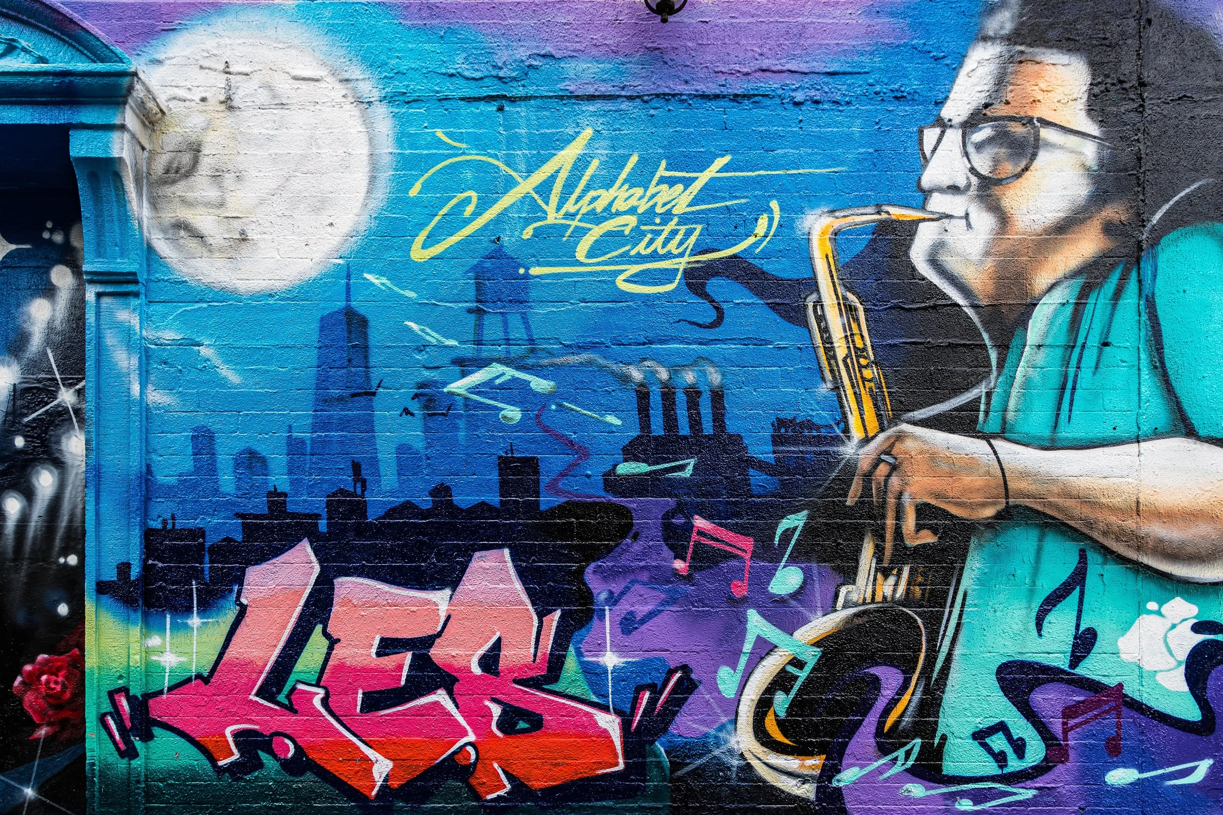
In the 1960s and 1970s, the area became one of Manhattan’s poorest but most artistically fertile quarters. Amid disrepair and neglect, creativity took root. Immigrants from Puerto Rico, the Dominican Republic, and Central America gave the neighborhood its enduring Nuyorican character — blending New York and Puerto Rican identity in poetry, music, and street art. The Nuyorican Poets Café, founded on East 3rd Street in 1973, became an epicenter of spoken word and cultural resistance.
Simultaneously, artists and musicians — drawn by cheap rents and freedom — began transforming abandoned buildings into studios and performance spaces. Punk, graffiti, and experimental art collided in a raw urban crucible. CBGB, A7, and Pyramid Club defined the local music scene, while squatter collectives and community gardens turned ruin into renewal.

Alphabet Village Photograph Video
Late 20th Century: Rebellion Becomes Renaissance
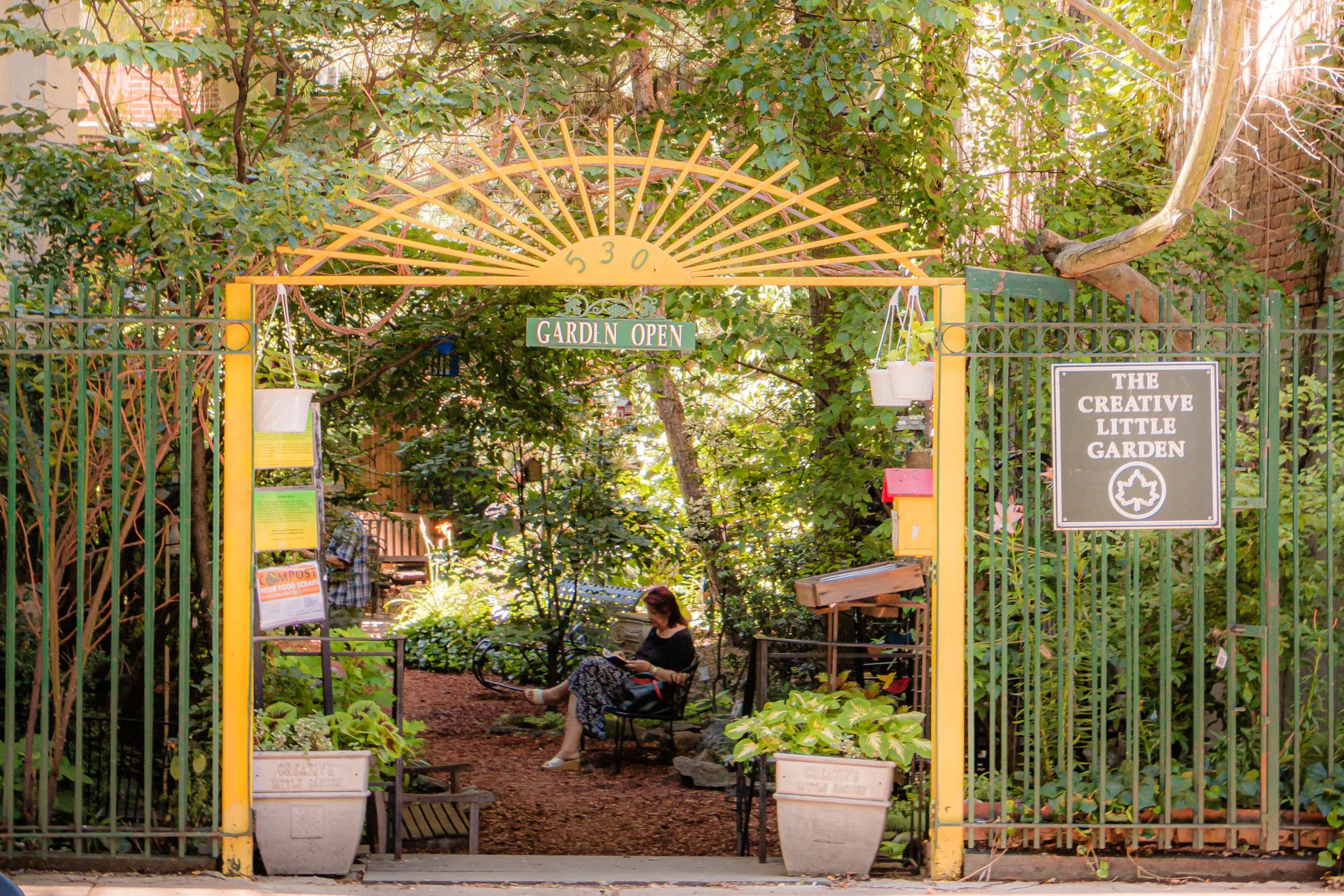
By the 1980s, Alphabet City embodied both the peril and promise of downtown New York. It was dangerous — with open-air drug markets on Avenues B and D — but also dazzlingly creative. Murals bloomed on crumbling walls; poets read by candlelight in abandoned churches. Activists reclaimed vacant lots as community gardens, creating the first wave of green oases that still dot the neighborhood today.
The area’s countercultural energy drew global attention, but also set the stage for gentrification. By the 1990s, artists gave way to entrepreneurs; tenements turned into co-ops; and the once-neglected avenues began to fill with cafés, boutiques, and bars. The name “Alphabet City,” once shorthand for danger and defiance, became a brand — a paradox that both celebrated and commodified its past.
21st Century: Memory, Music, and Renewal
Today, Alphabet City stands transformed yet still defiantly individual. It remains one of Manhattan’s most ethnically diverse districts — a mosaic of Latino, Ukrainian, Polish, Jewish, and creative communities — but its edges are softened by affluence. The community gardens founded by activists in the 1970s now flourish as city-protected sanctuaries. Tompkins Square Park, once the scene of riots and rallies, is today a vibrant commons of dogs, music, and families.
Historic landmarks such as St. Nicholas of Myra Church and St. Brigid’s on Avenue B survive beside modern towers, their stained glass casting color onto the sidewalks. The sounds of punk and salsa have given way to jazz, indie rock, and street festivals that echo the district’s eclectic heritage.
Alphabet Village Photo Prints
Architecture and Atmosphere
Architecturally, Alphabet City retains a patchwork of 19th-century tenements, Greek Revival rowhouses, and converted warehouses. Fire escapes zigzag across façades like iron lace; murals and graffiti add bursts of color to old brick. Avenue C’s tenements still bear faded signage for delis and laundries, while new cafés and bars hum beneath cornices a century old.
The atmosphere is vivid, layered, and intimate. The streets are narrower than elsewhere in Manhattan, and the sunlight slants differently — filtered through trees, murals, and memory. Walk down Avenue B at dusk and you still feel the neighborhood’s heartbeat: the echo of a conga drum, the hum of voices spilling from a café, the faint scent of coffee and asphalt after rain.
Spirit and Legacy
Alphabet City’s legacy is one of transformation through persistence. From its 19th-century immigrant roots to its 20th-century bohemia, it has continually reinvented itself without erasing its defiant soul. It remains the city’s great laboratory of reinvention — a place where hardship bred art, and where survival itself became a form of creativity.
New York City
Use this custom Google map to explore where every neighborhood in all five boroughs of New York City is located.
The Five Boroughs
One of New York City’s unique qualities is its organization in to 5 boroughs: Manhattan, Brooklyn, Queens, The Bronx, and Staten Island. These boroughs are part pragmatic administrative districts, and part vestiges of the region’s past. Each borough is an entire county in New York State - in fact, Brooklyn is, officially, Kings County, while Staten Island is, officially Richmond County. But that’s not the whole story …
Initially, New York City was located on the southern tip of Manhattan (now the Financial District) that was once the Dutch colony of New Amsterdam. Across the East River, another city was rising: Brooklyn. In time, the city planners realized that unification between the rapidly rising cities would create commercial and industrial opportunities - through streamlined administration of the region.
So powerful was the pull of unification between New York and Brooklyn that three more counties were pulled into the unification: The Bronx, Queens, and Staten Island. And on January 1, 1898, the City of New York unified two cities and three counties into one Greater City of New York - containing the five boroughs we know today.
But because each borough developed differently and distinctly until unification, their neighborhoods likewise uniquely developed. Today, there are nearly 390 neighborhoods, each with their own histories, cultures, cuisines, and personalities - and each with residents who are fiercely proud of their corner of The Big Apple.


