
NEW LOTS
Brooklyn
Geographic Setting
Bounded by Linden Boulevard to the south, Pennsylvania Avenue to the west, New Lots Avenue and Dumont Avenue to the north, and Fountain Avenue to the east, New Lots lies in the easternmost reaches of Brooklyn, forming part of the larger East New York district. Flat and expansive, its streets stretch across the remnants of 18th- and 19th-century farmland, now overlaid with 20th-century brick rowhouses, public housing developments, small industrial buildings, and patches of community green space. Despite its dense urbanity, the neighborhood retains a visible sense of its layered history—rural beginnings, industrial promise, urban struggle, and ongoing renewal.
New Lots occupies a transitional zone between the solid grid of central Brooklyn and the open marshlands that once extended toward Jamaica Bay. The major arteries—Linden Boulevard, New Lots Avenue, and Pennsylvania Avenue—form its structural spine, linking it to Brownsville to the west and Spring Creek and East New York Gateway to the east. The 3 train terminates at New Lots Avenue station, a symbolic eastern gateway of the city’s transit network. Amid the steady flow of buses, storefront churches, and corner shops, New Lots retains a distinctly local cadence—one shaped by community resilience and the enduring spirit of its residents.
Etymology and Origins
The name New Lots dates to the 17th and 18th centuries, when Dutch farmers from nearby Flatbush and Flatlands began subdividing additional tracts of arable land—hence “new lots”—beyond the original settlements of Kings County. These “new lots” were carved from low-lying meadows and salt marshes along Jamaica Bay, forming the eastern extension of Flatbush’s farmland.
By 1670, the area was known officially as Nieuw Lots, part of the Town of Flatbush. The first homesteads and small farms appeared along the sandy ridge that later became New Lots Road (today’s New Lots Avenue). In 1820, as settlement spread eastward, local farmers petitioned to form a separate administrative district, and the Town of New Lots was established—Brooklyn’s youngest of the original six towns (the others being Flatlands, Flatbush, Gravesend, Bushwick, and New Utrecht).
The town’s boundaries extended roughly from present-day Pennsylvania Avenue eastward to the Queens line and from Jamaica Bay northward to Atlantic Avenue. It remained largely rural—fields of hay, corn, and potatoes interspersed with Dutch homesteads and wooden barns.
The Neighborhood
19th Century: From Farmland to Suburb of East New York
The mid-19th century brought transformation. In 1852, developer John Pitkin, founder of nearby East New York, envisioned the region as a “new city on the hill,” with broad streets and ferry connections to Manhattan. Although Pitkin’s venture faltered financially, his grid plan and speculative subdivisions laid the groundwork for future development.
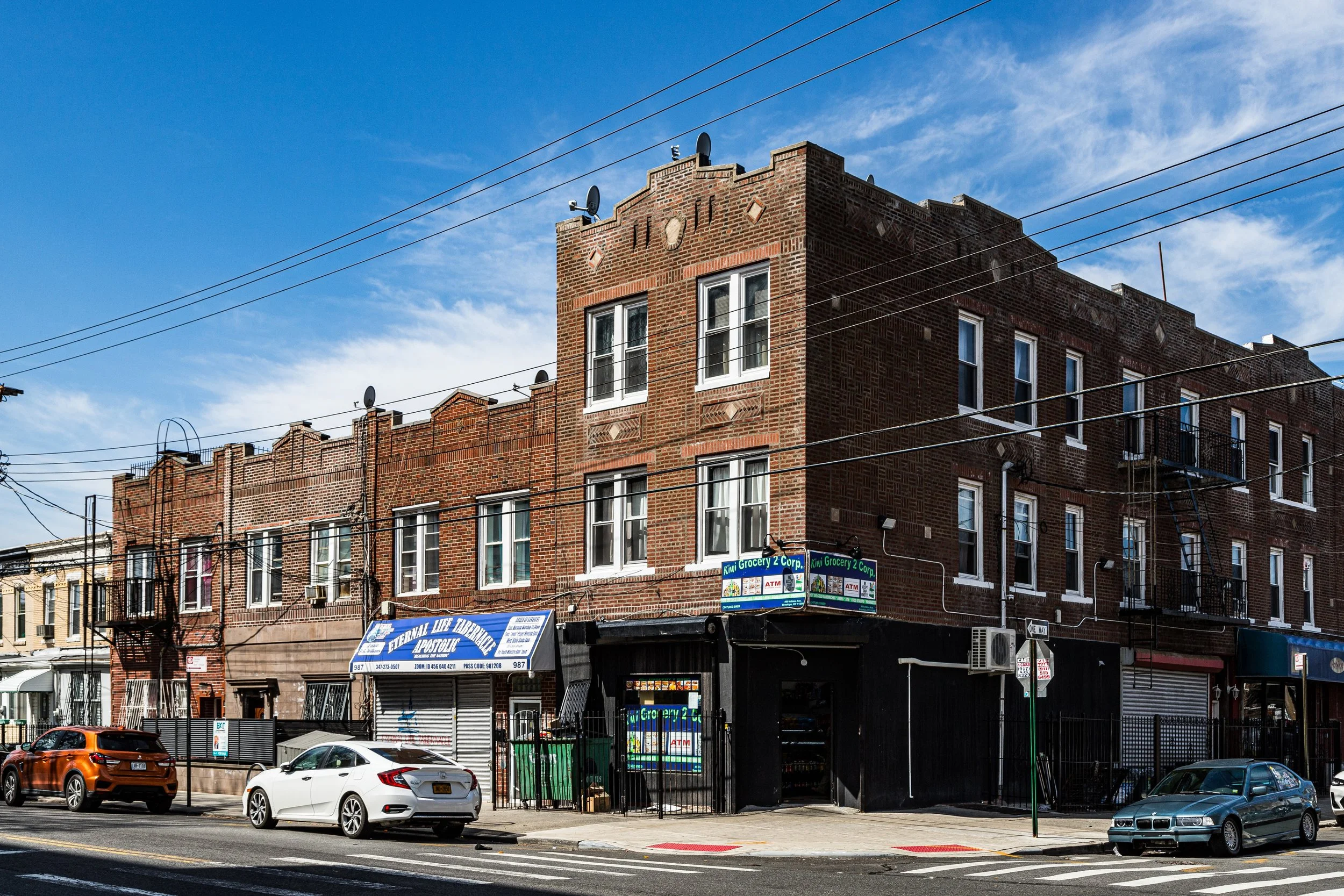
By the 1870s, New Lots’ farmland began yielding to small-scale residential and industrial growth as Brooklyn expanded eastward. The arrival of the Long Island Rail Road’s Bay Ridge Branch and later the elevated lines brought accessibility. Streets such as Pennsylvania Avenue, New Lots Avenue, and Shepherd Avenue became commercial corridors serving factory workers, farmers, and new immigrants.
When Brooklyn consolidated with New York City in 1898, the former Town of New Lots was absorbed into the borough’s East New York section. Paved roads, sewer lines, and street grids replaced the last of the farmlands. The old New Lots Dutch Reformed Church, founded in 1824 at New Lots and Schenck Avenues, survived as a reminder of the community’s rural past—the small church and its adjoining cemetery still stand today, the oldest continuous congregation in East New York.
Early–Mid 20th Century: Industry, Immigration, and Housing Expansion
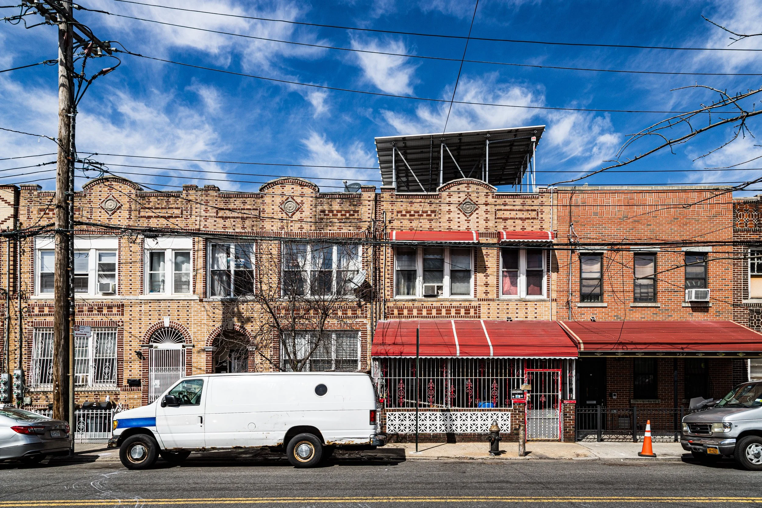
By the 1920s–1930s, New Lots had evolved into a dense, working-class district. Rows of brick two-family houses and small apartment buildings filled the former meadows, while nearby industrial zones along Linden Boulevard and Pennsylvania Avenue provided employment in manufacturing and distribution. Immigrant families—Italian, Jewish, Irish, and later Caribbean—formed a diverse social fabric anchored by schools, churches, and local businesses.
The extension of the IRT subway line to New Lots Avenue (opened 1922) transformed the area into a viable residential community for city workers, connecting it to Downtown Brooklyn and Manhattan. However, as industry shifted and economic patterns changed, the neighborhood’s fortunes became tied to broader urban forces.
In the 1940s–1960s, large-scale public housing projects were built to accommodate the postwar population boom. Developments such as the Pink Houses (1959), Fiorentino Plaza, and Unity Plaza reshaped much of the landscape, replacing older housing stock with modernist brick towers and open courtyards. These projects, though designed with optimism, coincided with disinvestment and job loss across Brooklyn, setting the stage for decades of economic struggle.
New Lots Photographic Video
Late 20th Century: Decline and Resilience
The 1970s–1990s brought severe challenges. Deindustrialization, redlining, and public neglect left much of East New York—including New Lots—struggling with poverty and crime. Many small businesses closed, and vacant lots multiplied along Linden Boulevard and Fountain Avenue. Yet amid hardship, community resilience took root.
Local churches and block associations—such as St. Paul Community Baptist Church, New Lots Family Center, and the United Community Centers (UCC)—became vital sources of social support and activism. Community gardens blossomed on abandoned lots, and youth programs sought to reclaim neighborhood pride. The East New York Farms! Initiative, launched in the 1990s, restored the area’s agricultural legacy by turning vacant land into productive urban farms.
Throughout these years, New Lots’ residents—predominantly African American, Afro-Caribbean, and Latinx—built a strong network of cultural identity and mutual aid. Street murals, neighborhood festivals, and oral history projects preserved community memory even as the city at large looked away.
21st Century: Renewal and Continuity
In the 21st century, New Lots stands at the intersection of renewal and endurance. Long considered a symbol of urban decline, it has in recent decades become a focus of investment and revitalization. The Gateway Center Mall (opened 2002, expanded 2014) near Spring Creek has brought new retail and employment opportunities, while infrastructure improvements along Linden Boulevard and Pennsylvania Avenue have modernized transit and pedestrian corridors.
Yet New Lots’ defining character remains rooted in its people and their sense of continuity. The New Lots Library, community farms, and restored New Lots Reformed Church anchor a growing effort to balance development with heritage. Affordable housing initiatives, new schools, and small business incubators have begun reshaping the landscape once again.
The neighborhood’s proximity to vast green spaces—the Fresh Creek Nature Preserve, Shirley Chisholm State Park, and the Gateway National Recreation Area—links its residents to an environmental legacy that stretches back to the salt marshes of the colonial era.
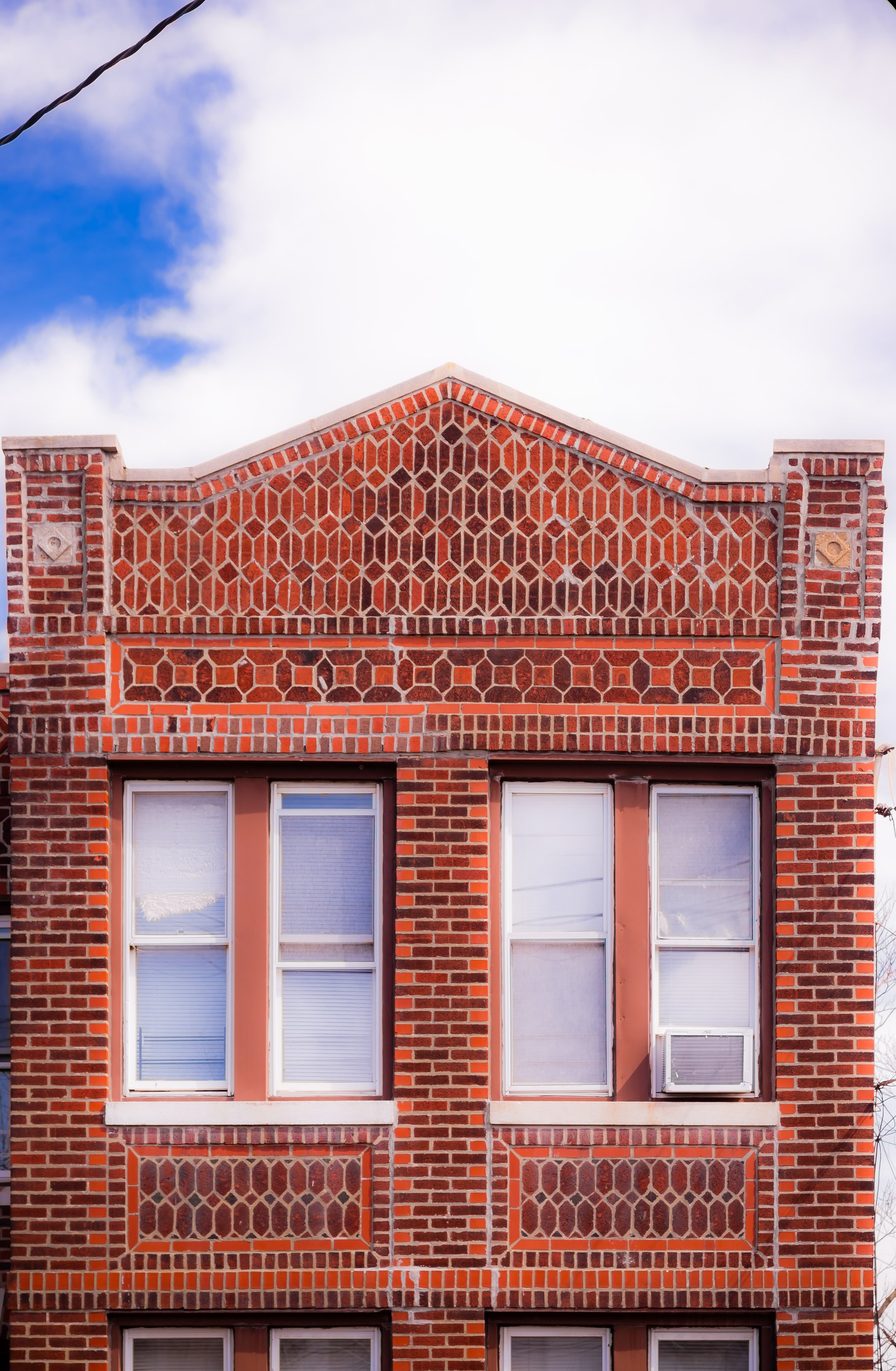
Architecturally, New Lots remains a study in contrasts: prewar rowhouses beside modern apartment blocks, 1960s public housing beside new townhomes. The grid endures, the avenues hum with commerce, and the sound of the elevated train remains the neighborhood’s constant refrain.
New Lots Photo Gallery
Spirit and Legacy
The spirit of New Lots is one of endurance and reinvention. From Dutch farms to subway suburbs, from disinvestment to community renewal, it has continually adapted to the city’s shifting tides. Its story mirrors that of Brooklyn itself: born of land reclamation, reshaped by immigration and industry, tested by adversity, and sustained by collective will.
New York City
Use this custom Google map to explore where every neighborhood in all five boroughs of New York City is located.
The Five Boroughs
One of New York City’s unique qualities is its organization in to 5 boroughs: Manhattan, Brooklyn, Queens, The Bronx, and Staten Island. These boroughs are part pragmatic administrative districts, and part vestiges of the region’s past. Each borough is an entire county in New York State - in fact, Brooklyn is, officially, Kings County, while Staten Island is, officially Richmond County. But that’s not the whole story …
Initially, New York City was located on the southern tip of Manhattan (now the Financial District) that was once the Dutch colony of New Amsterdam. Across the East River, another city was rising: Brooklyn. In time, the city planners realized that unification between the rapidly rising cities would create commercial and industrial opportunities - through streamlined administration of the region.
So powerful was the pull of unification between New York and Brooklyn that three more counties were pulled into the unification: The Bronx, Queens, and Staten Island. And on January 1, 1898, the City of New York unified two cities and three counties into one Greater City of New York - containing the five boroughs we know today.
But because each borough developed differently and distinctly until unification, their neighborhoods likewise uniquely developed. Today, there are nearly 390 neighborhoods, each with their own histories, cultures, cuisines, and personalities - and each with residents who are fiercely proud of their corner of The Big Apple.


