
BUSHWICK
Brooklyn
Geographic Setting
Bounded by Broadway to the west, Flushing Avenue to the north (including the Bushwick Houses), the Queens line to the east, and the Jackie Robinson Parkway to the southeast—running northwest along Bushwick Avenue to Conway Street—Bushwick occupies a broad sweep of north-central Brooklyn, bridging the old industrial waterfront of East Williamsburg and the leafy residential slopes of Ridgewood. Once farmland and forest, later a powerhouse of German-American brewing, and in the 20th century a crucible of both hardship and renewal, Bushwick has long embodied the cycles of labor, migration, and reinvention that define New York itself.
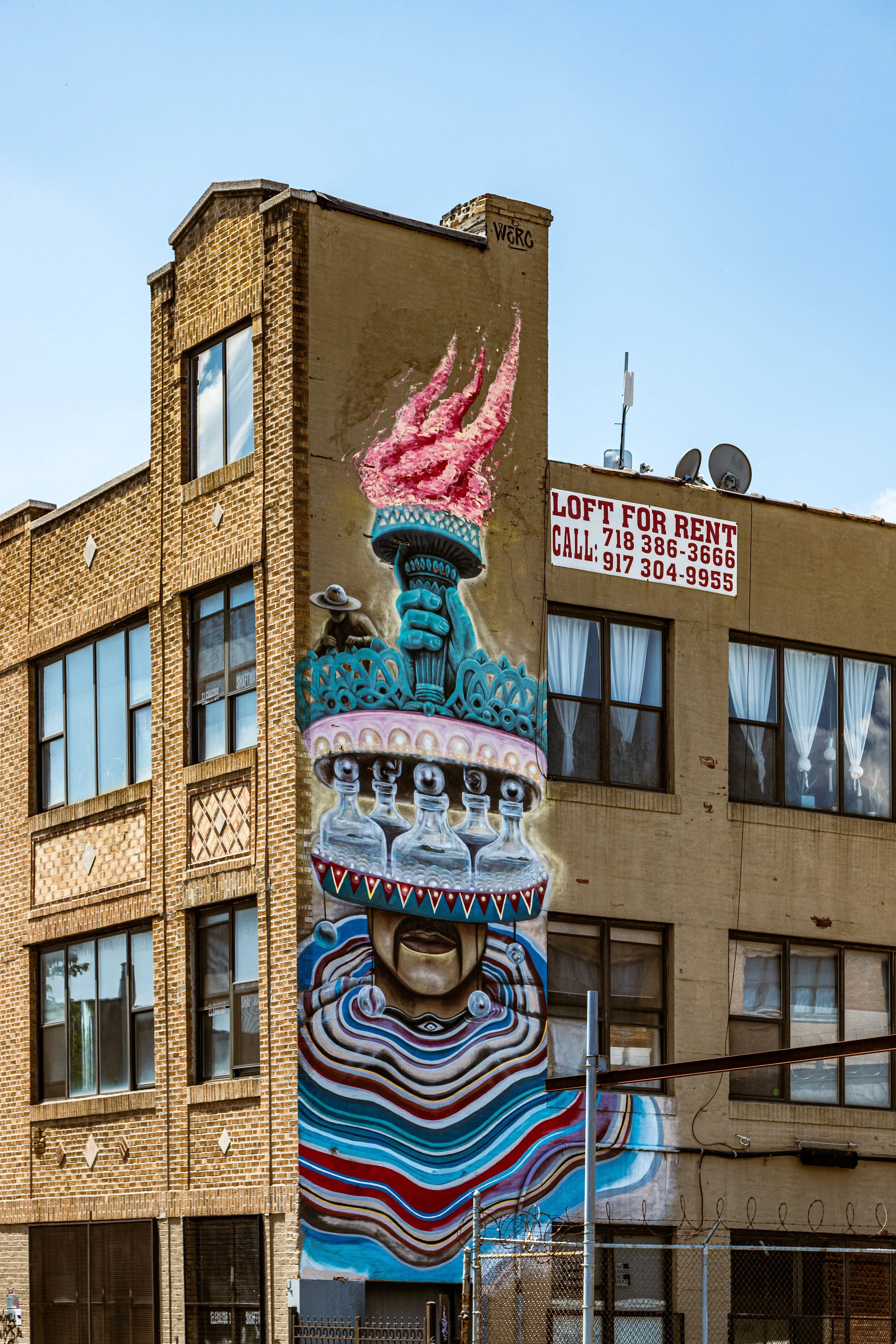
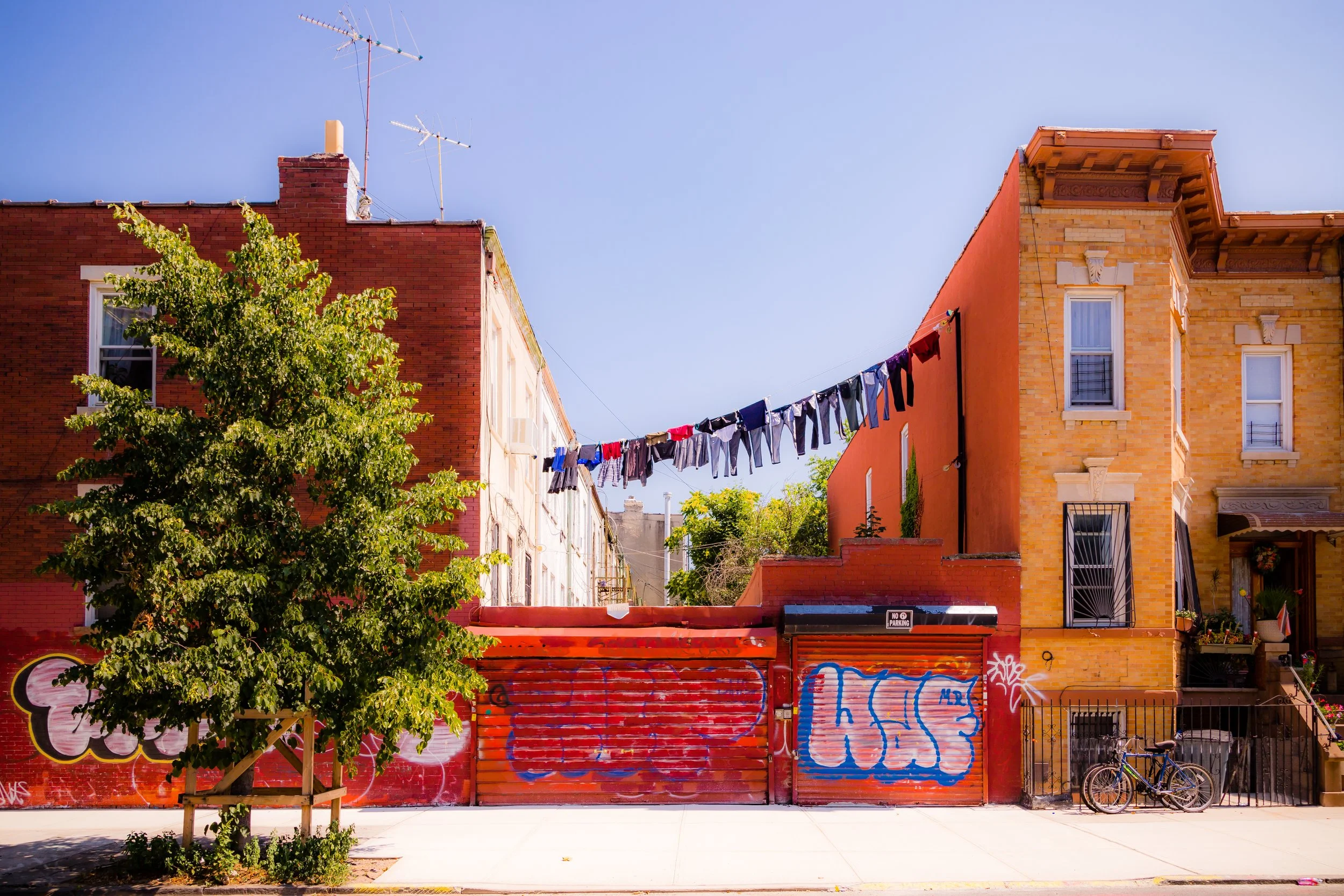
The neighborhood is a dense tapestry of brick rowhouses, former factory buildings, and church spires rising above low industrial roofs. Bushwick Avenue, its namesake boulevard, remains the historic spine: broad, dignified, and lined with grand 19th-century architecture—churches, schools, and banks that recall a period of prosperity and civic pride. Crossing the district diagonally, Myrtle Avenue, Knickerbocker Avenue, and Broadway hum with commerce, transit, and street life. Alongside them, 21st-century creativity has transformed old breweries and textile mills into art studios, cafes, and performance spaces, while murals by the Bushwick Collective have turned the neighborhood itself into a living gallery.
Etymology and Origins
The name Bushwick originates from the Dutch “Boswijck,” meaning “little town in the woods,” bestowed by Governor Peter Stuyvesant in 1661 upon one of Brooklyn’s original six towns. The early Dutch and German settlers farmed fertile fields along the ridge now traced by Bushwick Avenue, raising grain, vegetables, and hops that supplied both local markets and Manhattan’s taverns. The area remained agricultural for nearly two centuries, its landscape dotted with mills, orchards, and family homesteads connected by country lanes like Flushing Avenue and Broadway, which began as colonial roads leading to the East River ferries.
The coming of industry—and the railroad—would transform the rural “town in the woods” into a true city district. By the mid-19th century, Bushwick’s farms gave way to breweries, foundries, and tenement blocks, as immigrants from Germany, Poland, and Bohemia brought with them both labor and expertise.
The Neighborhood
19th Century: From Farmland to Brewery Capital
The 1850s–1890s marked Bushwick’s great industrial flowering. German brewers, drawn by ample water from the Ridgewood aquifer and proximity to rail lines and shipping docks, established dozens of breweries and malt houses. Legendary firms such as Rheingold, Schlitz, Hittleman, and Vaterland rose along Meserole, Melrose, and Forbell Streets, forming what locals called “Brewer’s Row.” The neighborhood’s subterranean vaults—brick-lined cellars built to keep beer cool before refrigeration—still run beneath parts of George Street and Forrest Street today.
Prosperity followed. Bushwick Avenue became a showcase boulevard, lined with ornate mansions, high-steepled churches like St. Barbara’s Roman Catholic (1910), and civic institutions such as All Saints Church (1893). Nearby streets filled with well-crafted brownstones and three-story brick rowhouses for the tradesmen and artisans who staffed the breweries, ironworks, and carriage shops.
Though working-class, Bushwick was orderly and proud—its German population celebrated Schützenfest parades, beer gardens, and choral societies. By the time of Brooklyn’s consolidation into New York City in 1898, Bushwick had become one of the borough’s most solidly built and culturally cohesive districts.
Early–Mid 20th Century: Immigration, Industry, and Transition
The early 1900s brought new immigrants—Italians, Jews, Irish, and later Puerto Ricans—who filled Bushwick’s sturdy housing stock as the German families moved outward to Ridgewood and Long Island. Brewing and manufacturing continued to anchor the local economy, but the twin blows of Prohibition (1920–1933) and the Great Depression changed everything. Many breweries closed permanently, and the district’s once-thriving industrial corridors began to wane.
During the 1940s–1950s, Bushwick absorbed large numbers of working-class families from Williamsburg, Harlem, and the Bronx, drawn by affordable rents and proximity to factory work. New York City constructed the Bushwick Houses (1956) along Flushing Avenue as part of its ambitious public housing expansion. But as industry declined citywide and white flight accelerated, Bushwick’s infrastructure deteriorated. Buildings fell into neglect, and by the 1960s, the area—once a model of stable urban working-class life—struggled with disinvestment, overcrowding, and unemployment.
The nadir came in July 1977, when a citywide blackout triggered looting and arson that gutted dozens of blocks around Broadway, Knickerbocker Avenue, and Bushwick Avenue. The fires left entire streetscapes in ruin, accelerating a collapse that would take decades to reverse. Yet even amid destruction, residents—largely Puerto Rican and Dominican families by this time—organized tenant groups, churches, and youth coalitions to reclaim their streets.

Bushwick Photographic Video
Late 20th Century: Community Rebuilding and Cultural Survival
The 1980s–1990s were years of slow, grassroots recovery. Civic groups like the Ridgewood-Bushwick Senior Citizens Council (RBSCC), the Hope Gardens development, and community activists such as Father John Powis led efforts to rehabilitate housing, plant gardens, and reestablish safety and pride. Block associations reclaimed abandoned lots, and churches became lifelines. Maria Hernandez Park—named after a local activist murdered for her anti-drug efforts—was renovated into the neighborhood’s green heart.
Despite persistent poverty, Bushwick in these decades built the foundations for renewal. The infusion of Latino culture—music, murals, food, and family—gave the neighborhood its new identity. Salsa and merengue echoed down Knickerbocker Avenue, while bodegas and botanicas replaced old delis and taverns.
At the same time, early artists and photographers began moving into the area’s vacant industrial lofts, drawn by low rents and generous space. Their presence hinted at the transformation to come, though few could yet imagine its speed or scale.
21st Century: Reinvention, Art, and Displacement
In the new millennium, Bushwick became a global byword for urban reinvention. As neighboring Williamsburg gentrified, artists, musicians, and entrepreneurs migrated east, converting warehouses into galleries and live-work spaces. Streets once silent after dark came alive with music, markets, and mural festivals—the most famous being the Bushwick Collective, founded in 2011, which transformed the area’s industrial facades into an outdoor museum of contemporary street art.
Yet prosperity brought tension. Rising rents and speculative development displaced many long-time Latino residents, who saw their community’s fabric strained by rapid change. Old factories on Troutman, Jefferson, and Wyckoff Streets gave way to glass apartments and nightlife venues. City rezoning debates in the 2010s revealed deep divides over who would benefit from Bushwick’s rebirth—and who would be priced out of it.
Still, Bushwick remains a place of contrast and coexistence: taco trucks beside craft breweries, Pentecostal storefront churches beside art galleries, 19th-century brick breweries beside 21st-century co-working spaces. Local initiatives such as Make the Road New York, Bushwick Ayuda Mutua, and Sure We Can fight to preserve affordability and dignity amid flux, ensuring the neighborhood’s transformation remains inclusive rather than erasing its past.
Bushwick Photo Gallery
Spirit and Legacy
Bushwick’s legacy is one of reinvention through endurance—a microcosm of Brooklyn’s story itself. From its Dutch farmland origins to its era as the beer capital of America, from tenement hardship to artistic renaissance, Bushwick has survived every economic and cultural upheaval by remaking itself from within. Its people—immigrants, laborers, dreamers, and creators—have always defined its strength more than its buildings or borders.
New York City
Use this custom Google map to explore where every neighborhood in all five boroughs of New York City is located.
The Five Boroughs
One of New York City’s unique qualities is its organization in to 5 boroughs: Manhattan, Brooklyn, Queens, The Bronx, and Staten Island. These boroughs are part pragmatic administrative districts, and part vestiges of the region’s past. Each borough is an entire county in New York State - in fact, Brooklyn is, officially, Kings County, while Staten Island is, officially Richmond County. But that’s not the whole story …
Initially, New York City was located on the southern tip of Manhattan (now the Financial District) that was once the Dutch colony of New Amsterdam. Across the East River, another city was rising: Brooklyn. In time, the city planners realized that unification between the rapidly rising cities would create commercial and industrial opportunities - through streamlined administration of the region.
So powerful was the pull of unification between New York and Brooklyn that three more counties were pulled into the unification: The Bronx, Queens, and Staten Island. And on January 1, 1898, the City of New York unified two cities and three counties into one Greater City of New York - containing the five boroughs we know today.
But because each borough developed differently and distinctly until unification, their neighborhoods likewise uniquely developed. Today, there are nearly 390 neighborhoods, each with their own histories, cultures, cuisines, and personalities - and each with residents who are fiercely proud of their corner of The Big Apple.


