KINGSBRIDGE
The Bronx
Geographic Setting
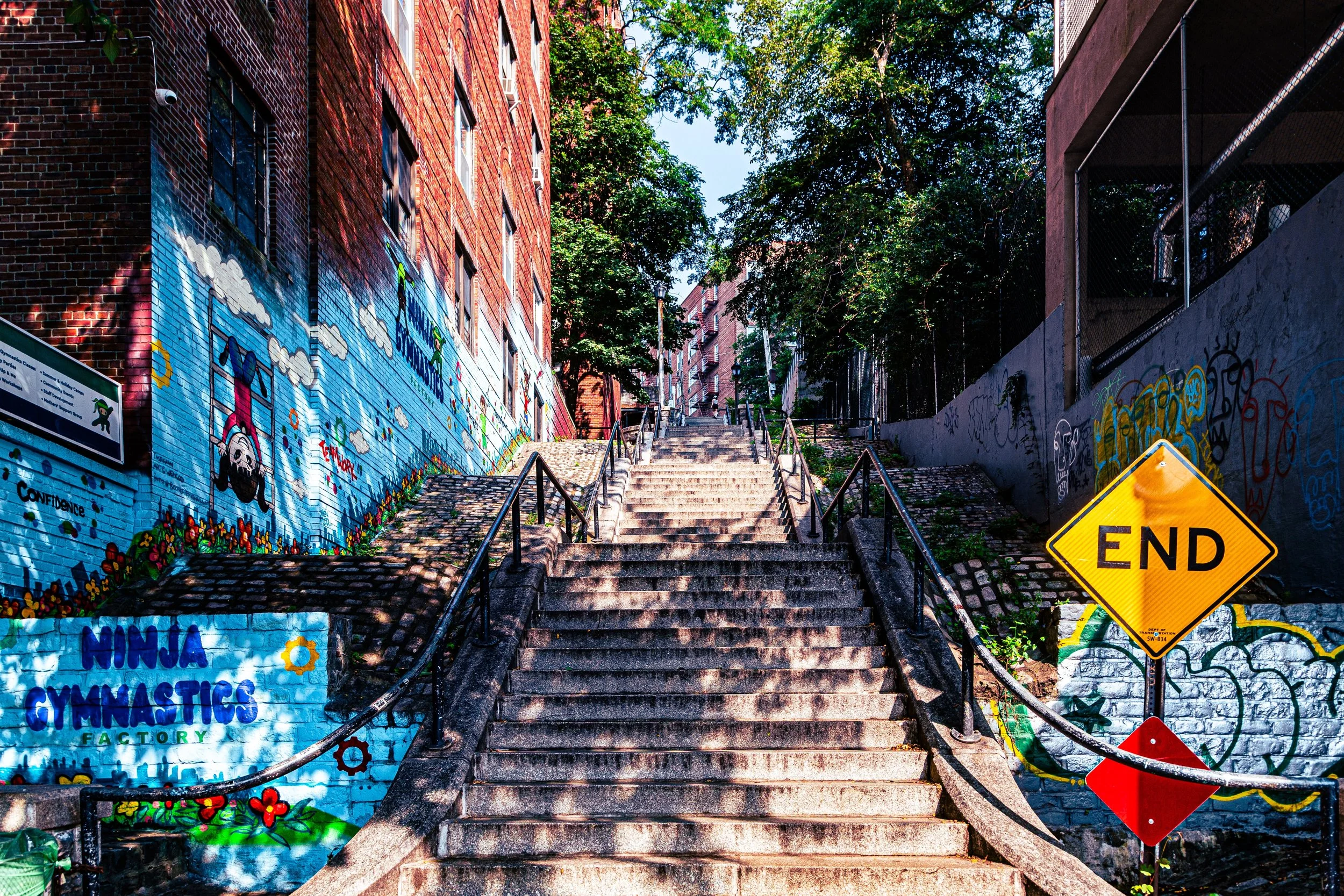
Bounded by Broadway to the east, West 230th Street to the south, Riverdale Avenue to the west, West 238th Street to the northwest, and West 240th Street to the north, Kingsbridge occupies a vital crossroads between the uplands of Riverdale and the lower Harlem River valley. This northwestern Bronx neighborhood lies at the base of steep, wooded ridges, where the topography itself shapes the rhythm of daily life—broad avenues dipping toward the river, narrow side streets climbing the hills, and elevated train lines tracing the district’s urban edge.
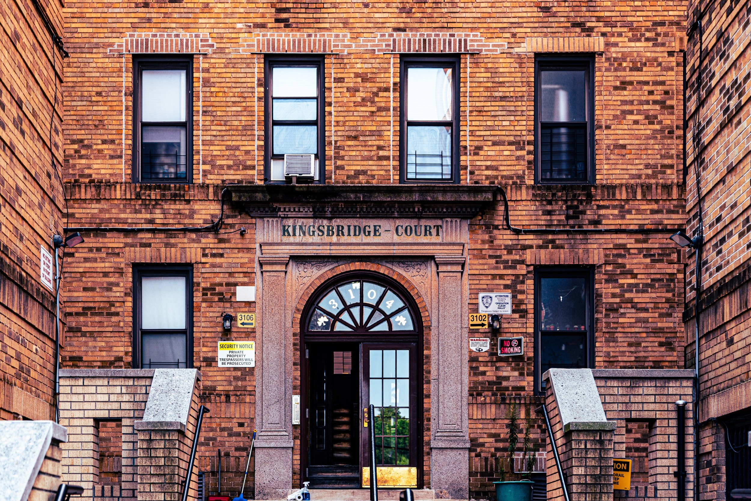
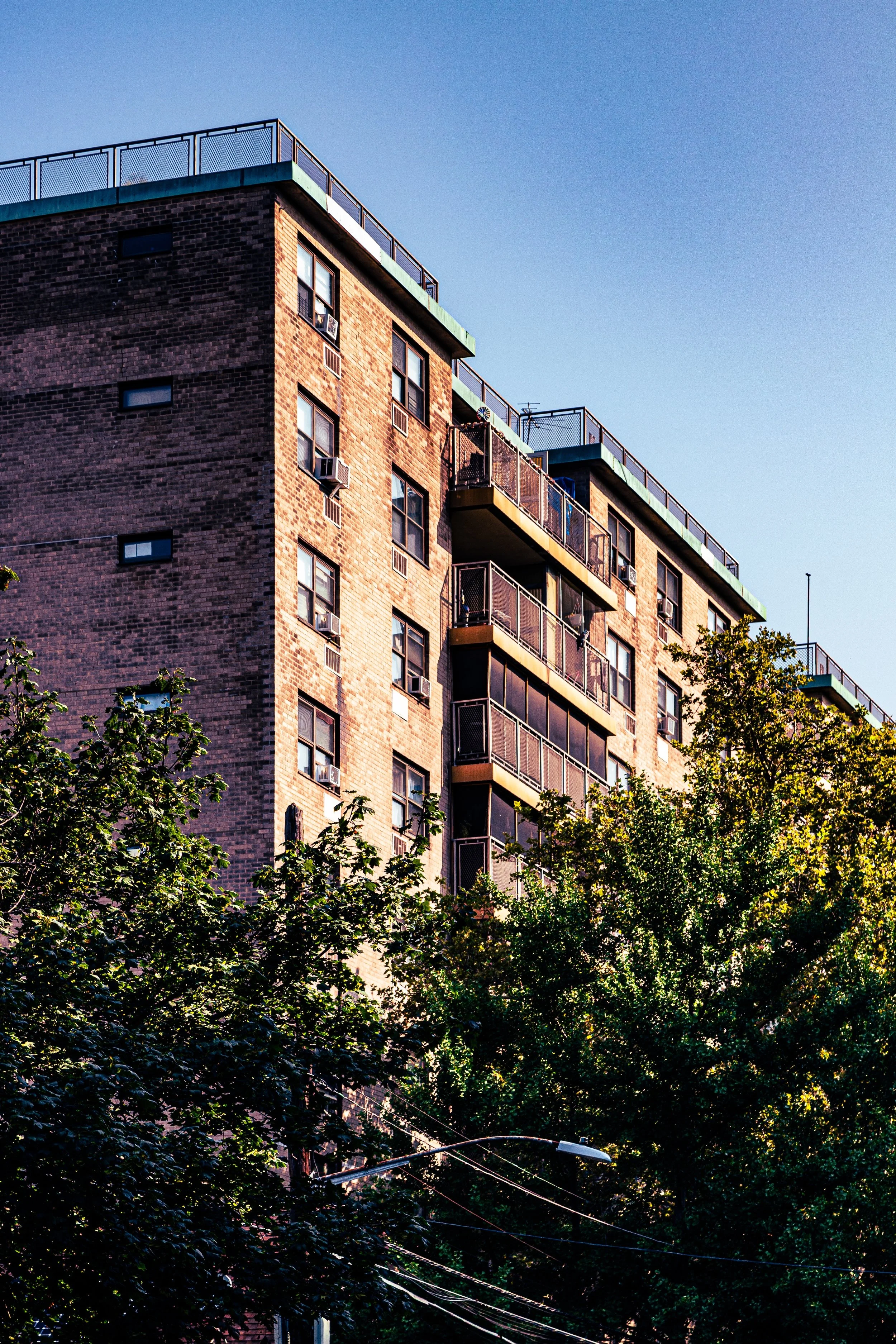
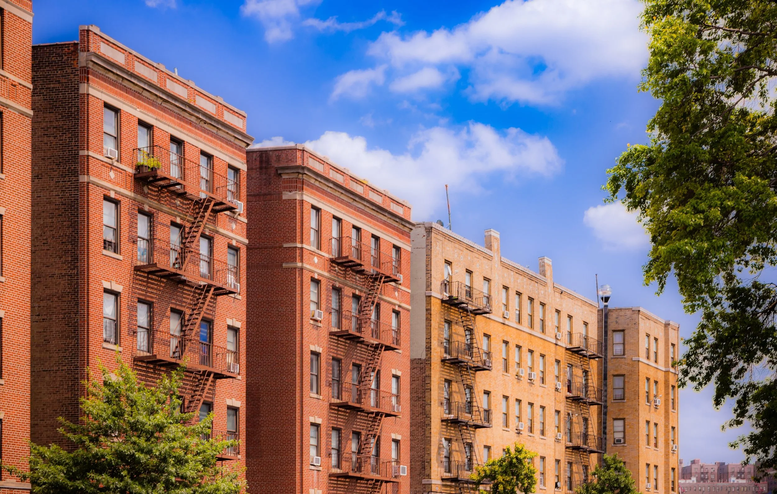
The Broadway corridor, lined with commercial storefronts, schools, and apartment houses, serves as Kingsbridge’s main artery, paralleled by the 1 train running above it. Riverdale Avenue defines the western edge, where the terrain rises toward the stately homes and colleges of Riverdale. Between them stretches a patchwork of prewar apartment buildings, small row houses, and local landmarks like the Kingsbridge Armory, a colossal fortress of red brick and steel that dominates the neighborhood skyline.
To the north lies Van Cortlandt Park, whose rolling meadows and trails provide Kingsbridge with green relief and a link to the Bronx’s great park system. To the south, the grid merges into Marble Hill and Kingsbridge Heights, extending the neighborhood’s sense of continuity within the city’s complex geography. Kingsbridge’s landscape—defined by its hills, its transit corridors, and its mixture of grit and grace—captures the very texture of the Bronx itself.
Etymology
The name “Kingsbridge” dates back to 1693, when Frederick Philipse, a wealthy merchant and lord of Philipsburg Manor, built a wooden toll bridge across the Spuyten Duyvil Creek, connecting Manhattan Island to the mainland of the Bronx. The bridge was erected under a royal charter from King William III, hence its name: “the King’s Bridge.”
For nearly two centuries, this bridge served as the principal land route between Manhattan and the northern colonies. The name outlived the structure itself—Philip’s bridge was replaced several times and finally dismantled in 1910 when the creek was filled in to create the Harlem Ship Canal—but “Kingsbridge” endured, symbolizing both the literal and historical connection between New York City’s heart and its northern frontier.
The Neighborhood
Origins through the 19th Century
Long before urbanization, the Kingsbridge area lay within the domain of the Weckquaesgeek, a Lenape-speaking people who hunted and fished along the Spuyten Duyvil and Harlem River shores. The Dutch arrived in the 17th century, and by 1693, Frederick Philipse’s “King’s Bridge” made the region an essential transportation link between New York and Albany. During the Revolutionary War, the bridge and its approaches were of immense strategic importance: British and Continental troops alike fought over its control, and George Washington himself is said to have crossed it during his retreat from Manhattan in 1776.
In the 19th century, Kingsbridge remained semi-rural, dotted with taverns, inns, and farms catering to travelers on the Albany Post Road. The nearby Spuyten Duyvil Creek, winding through salt marshes and tidal flats, formed both a natural boundary and an obstacle to expansion until it was re-engineered in the 1890s. When the creek was filled and the Harlem River straightened to form the Harlem Ship Canal, Kingsbridge was physically joined to Manhattan’s northern tip—yet administratively remained part of the Bronx, a quirk of geography still visible in the odd, insular shape of Marble Hill.
By the late 1800s, the annexation of the western Bronx into New York City (1874) and the arrival of the New York Central Railroad transformed Kingsbridge from a rural waystation into a developing suburb. Elegant row houses, small apartment buildings, and industrial sites began to appear along Broadway, while new streets climbed the surrounding hillsides.
Early 20th Century: Urbanization and the Armory Era
The early 20th century marked Kingsbridge’s full integration into the modern city. The extension of the IRT Broadway–Seventh Avenue Line (the 1 train) in 1908 connected the neighborhood directly to Manhattan, accelerating residential and commercial development. Six-story apartment buildings rose along Kingsbridge Avenue, Heath Avenue, and Sedgwick Avenue, their brick facades adorned with prewar ornamentation and courtyard entrances that reflected the optimism of the era.
The neighborhood’s most imposing landmark, the Kingsbridge Armory, was constructed between 1912 and 1917 for the New York National Guard. Designed by Pilcher & Tachau, the armory was one of the largest of its kind in the world—its vaulted roof spanning nearly an entire city block. The structure became both a symbol of civic pride and a focal point of community life, hosting parades, exhibitions, and cultural events.
Kingsbridge’s population at this time was primarily Irish, Italian, and Jewish, part of the Bronx’s broader middle-class expansion. The area developed a reputation as a solid, family-oriented district, with vibrant parishes such as St. John’s Church and public schools that anchored community life. The proximity of Van Cortlandt Park, with its open meadows and bridle paths, gave residents the luxury of green space just steps from the urban grid—a hallmark of Bronx planning in the Olmstedian tradition.
Kingsbridge Video Coming Soon
Mid–Late 20th Century: Change, Challenge, and Persistence
After World War II, Kingsbridge—like much of the Bronx—underwent major demographic transitions. The original white ethnic population gradually moved to the suburbs, replaced by Puerto Rican, African-American, and later Dominican and Irish immigrant families. The construction of the Major Deegan Expressway (1956) and the decline of local industry altered traffic patterns and disrupted some traditional commercial corridors.
During the 1970s, Kingsbridge weathered the Bronx’s larger crisis of disinvestment and arson, though it fared better than many southern neighborhoods due to its strong housing stock and engaged civic groups. Organizations such as the Kingsbridge Heights Community Center and local tenant associations played pivotal roles in stabilizing the area, rehabilitating housing, and maintaining public safety.
The Kingsbridge Armory, by then underused by the military, became a subject of debate and vision. Community leaders proposed its conversion into a recreation center or marketplace—a dream that would persist into the 21st century. Meanwhile, local schools, churches, and mom-and-pop businesses along Broadway continued to knit together a resilient neighborhood fabric.
21st Century: Diversity, Redevelopment, and Renewal
In the 21st century, Kingsbridge stands as one of the Bronx’s most dynamic and diverse communities. Its population—Dominican, Puerto Rican, Bangladeshi, West African, and Mexican, alongside older Irish and Italian families—gives the neighborhood a global vibrancy. Broadway, still the commercial backbone, bustles with discount stores, restaurants, and fruit markets that reflect this multicultural blend.
Long-awaited redevelopment of the Kingsbridge Armory remains a focal issue for the community. Plans for the Kingsbridge National Ice Center, a proposed multi-rink facility, have spurred both excitement and debate about jobs, preservation, and gentrification. Meanwhile, new residential construction and retail improvements along West 230th Street and 231st Street have reinvigorated local commerce without erasing the area’s historic character.
Green infrastructure projects have enhanced Van Cortlandt Park and Ewen Park, and initiatives to improve pedestrian safety and transit access along Broadway and Kingsbridge Road have made the neighborhood more livable. Through it all, Kingsbridge has retained its urban authenticity—a place where generations meet, where history is visible in every brick facade, and where community remains the constant amid change.
Kingsbridge Photo Gallery
Spirit and Legacy
The spirit of Kingsbridge is one of endurance through transformation. Born at a literal bridge between islands and boroughs, the neighborhood has long embodied connection—between past and present, water and stone, working-class grit and civic pride. Its hills have witnessed soldiers, horsemen, and subway builders; its streets have carried parades, protests, and ordinary daily life.
New York City
Use this custom Google map to explore where every neighborhood in all five boroughs of New York City is located.
The Five Boroughs
One of New York City’s unique qualities is its organization in to 5 boroughs: Manhattan, Brooklyn, Queens, The Bronx, and Staten Island. These boroughs are part pragmatic administrative districts, and part vestiges of the region’s past. Each borough is an entire county in New York State - in fact, Brooklyn is, officially, Kings County, while Staten Island is, officially Richmond County. But that’s not the whole story …
Initially, New York City was located on the southern tip of Manhattan (now the Financial District) that was once the Dutch colony of New Amsterdam. Across the East River, another city was rising: Brooklyn. In time, the city planners realized that unification between the rapidly rising cities would create commercial and industrial opportunities - through streamlined administration of the region.
So powerful was the pull of unification between New York and Brooklyn that three more counties were pulled into the unification: The Bronx, Queens, and Staten Island. And on January 1, 1898, the City of New York unified two cities and three counties into one Greater City of New York - containing the five boroughs we know today.
But because each borough developed differently and distinctly until unification, their neighborhoods likewise uniquely developed. Today, there are nearly 390 neighborhoods, each with their own histories, cultures, cuisines, and personalities - and each with residents who are fiercely proud of their corner of The Big Apple.


