BROOKLYN HEIGHTS
Brooklyn
Geographic Setting
Bounded by the Brooklyn–Queens Expressway (Furman Street) and the East River to the west, Cadman Plaza West and Court Street to the east, Old Fulton Street to the north, and Atlantic Avenue to the south, Brooklyn Heights occupies a bluff above the riverfront—a natural rise that gives it both its name and its breathtaking views of Lower Manhattan. It is the borough’s oldest and most historically celebrated neighborhood, a place where the story of urban America’s first suburb still echoes through cobblestone streets, brownstone stoops, and shaded promenades.
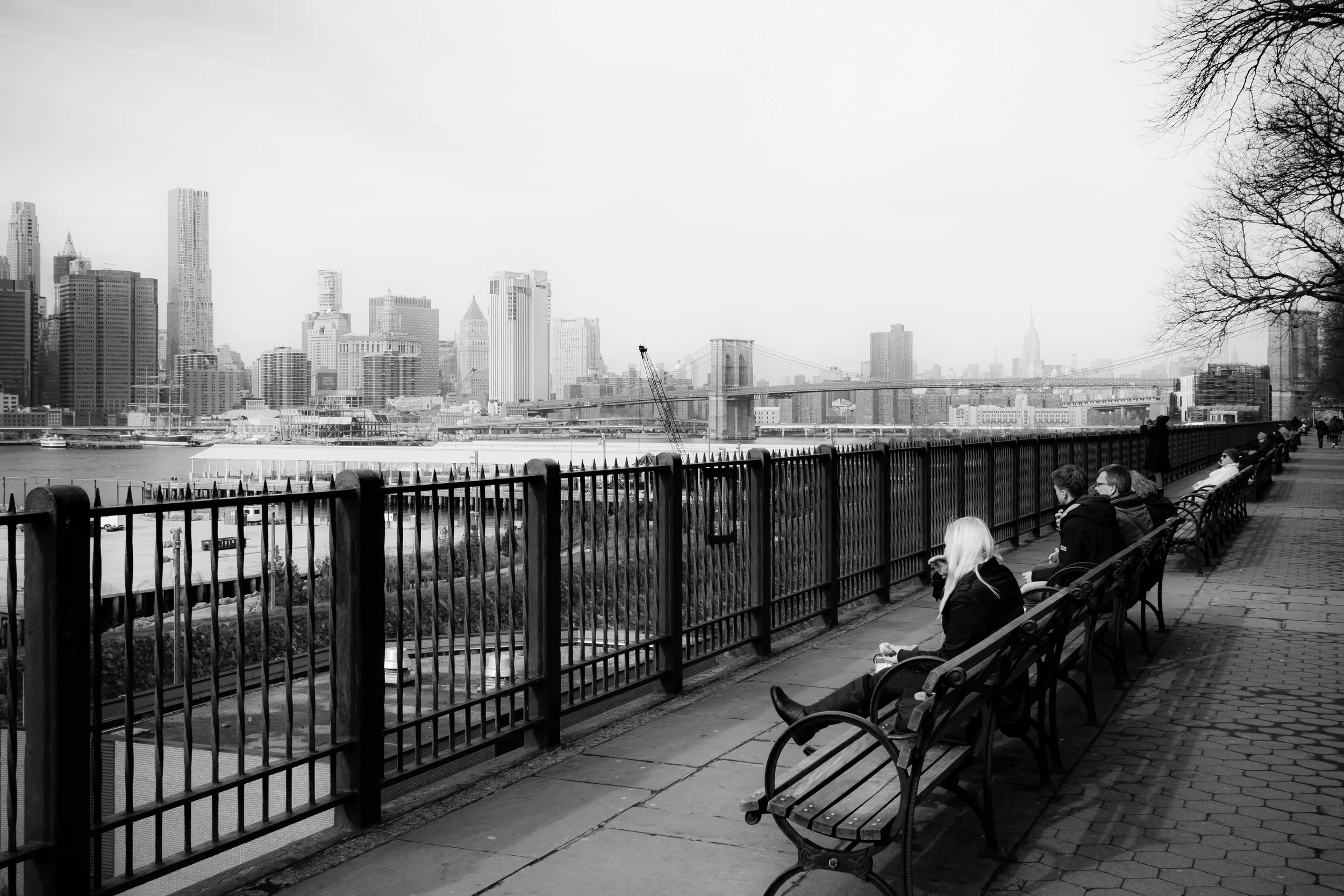
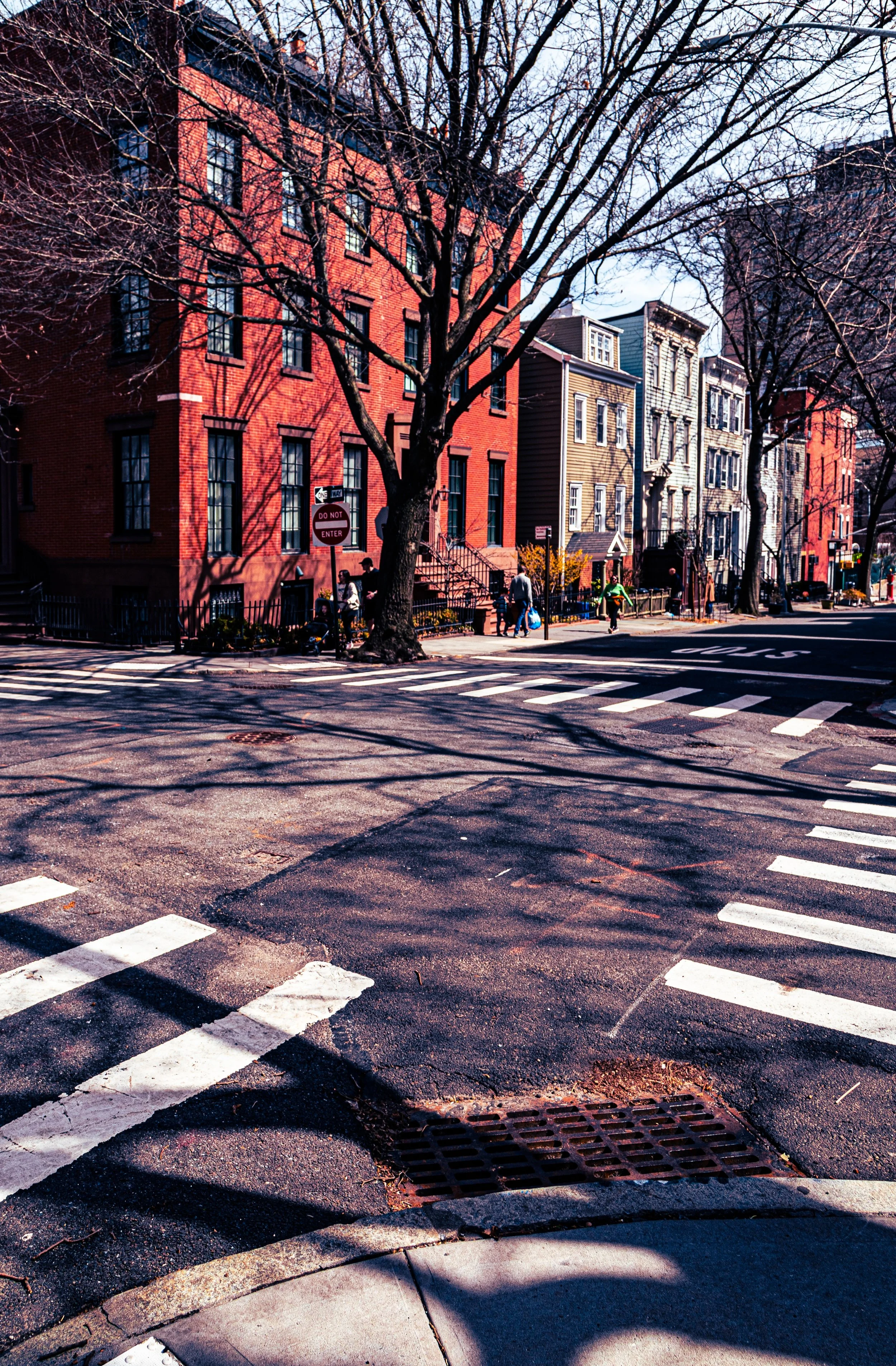
Its street grid, laid out in the 1820s, unfolds as a small, self-contained world of quiet, tree-lined blocks—Willow, Hicks, Pierrepont, and Montague Streets—anchored by 19th-century architecture in near-perfect preservation. The Brooklyn Heights Promenade, cantilevered above the expressway since 1950, offers one of New York’s most iconic vistas: the harbor, the Statue of Liberty, and the skyline rising across the river. Above the bluff, the atmosphere is calm and residential; below it, at the waterfront, modern parks and restored piers of Brooklyn Bridge Park reconnect the neighborhood with the river that first gave it life.
Etymology and Origins
The name “Brooklyn Heights” derives from its geography—a high plateau overlooking the East River—and from the Dutch settlers of the 17th century, who called the area “Breuckelen Heughts.” During the colonial era, the land was farmland and orchards belonging to Dutch and later English families. Its elevation gave it strategic importance during the Revolutionary War, when General George Washington used the ridge as a defensive line during the Battle of Long Island (1776).
By the early 1800s, as ferry service between Fulton Street and Manhattan improved, the Heights became an ideal location for New Yorkers seeking refuge from the city’s industrial sprawl. The Brooklyn and Jamaica Railroad (1836) and the Fulton Ferry (1814) made the area easily accessible, and by the 1830s, Brooklyn Heights had become America’s first commuter suburb—its residents able to live amid fresh air and tree-lined streets while working in Manhattan.
The Neighborhood
19th Century: The Birth of the Suburb
The 1820s–1860s marked Brooklyn Heights’ first great flowering. Elegant Greek Revival and later Italianate townhouses rose along Remsen, Pierrepont, and Clinton Streets, built for merchants, shipowners, and professionals. The grid was deliberately designed for serenity: narrow blocks, uniform setbacks, and leafy canopies that softened the density of city life.
Among the early architectural landmarks were Plymouth Church of the Pilgrims (1849) on Orange Street—where abolitionist preacher Henry Ward Beecher held fiery sermons that drew crowds from across the nation—and the Brooklyn Academy of Music (founded 1859), then located nearby. Wealth and reform coexisted here: Brooklyn Heights became known both for its prosperity and for its civic conscience, a place where prominent families championed abolition, education, and the arts.
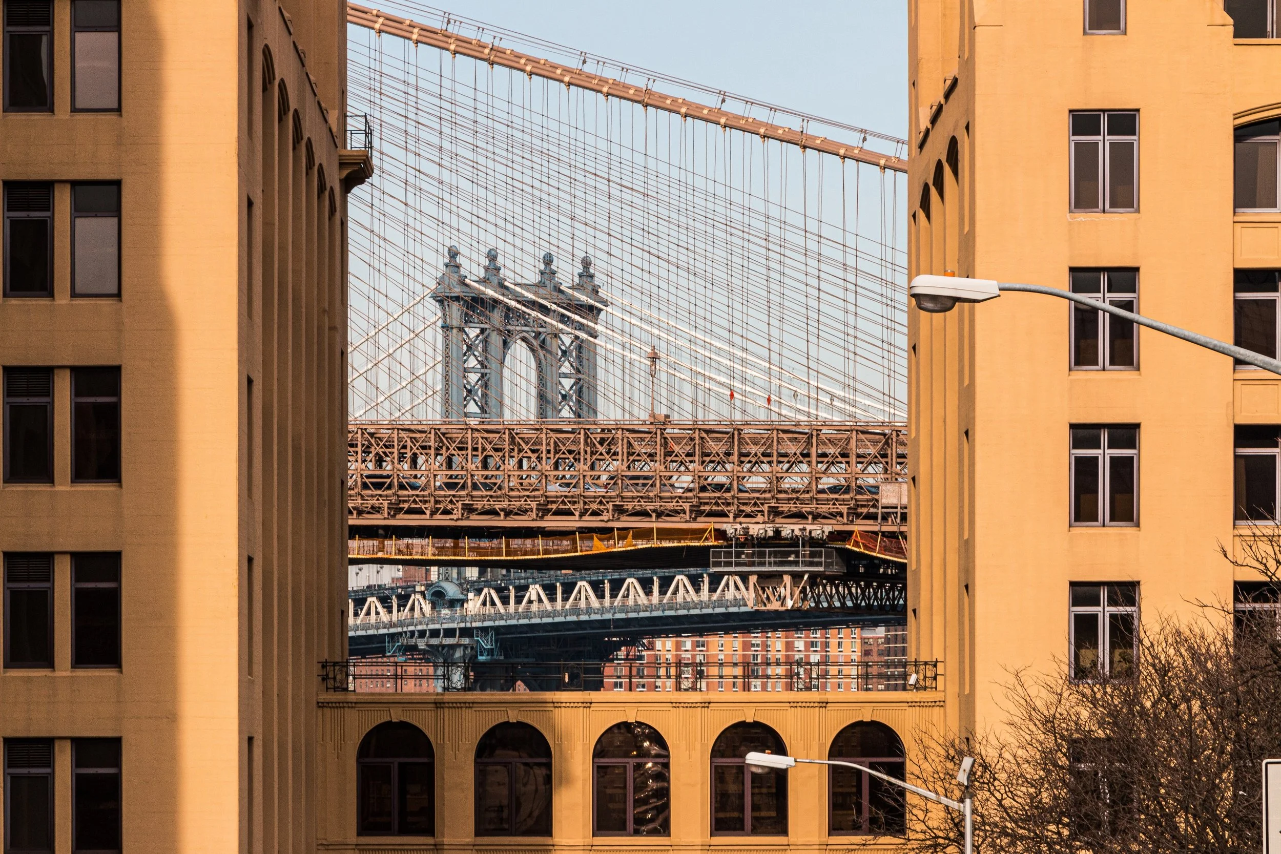
By the 1870s, the neighborhood’s grandeur rivaled any in the city. Mansions lined the bluff, and gas lamps lit Montague Street’s promenades. The opening of the Brooklyn Bridge (1883) made the Heights even more accessible, though it also marked the beginning of change—wealthier families soon moved to newer suburbs like Park Slope and the Heights’ houses began a long period of transition.
Early 20th Century: Transition and Tenacity
In the early 1900s, Brooklyn Heights saw a slow decline in prestige as commercial and multi-family buildings replaced single-family mansions. Boardinghouses and small apartment buildings appeared, attracting artists, writers, and professionals who prized the neighborhood’s charm but could no longer afford its former luxury.
Despite urban pressures, the Heights retained its architectural integrity. The area’s brownstones, though aging, remained largely untouched, and its trees—maple, oak, and sycamore—grew into a canopy that shielded it from the noise of modernity. The New York City subway (IRT line), extended beneath Montague Street in 1908, reconnected the area to Manhattan and helped stabilize its population. By the 1930s, the neighborhood’s character was defined by diversity—old families, new immigrants, and artists living in close proximity within one of New York’s most walkable enclaves.
The construction of the Brooklyn–Queens Expressway (1946–1954) threatened to sever the Heights from its riverfront, but a remarkable compromise—engineered by Robert Moses’ team—produced the Promenade, a triple-deck structure that saved the neighborhood and created one of the city’s greatest public spaces. Its balustrade walk, perched above traffic and facing Manhattan, became both literal and symbolic elevation—proof that preservation and progress could coexist.
Brooklyn Heights Photographic Video
Mid–Late 20th Century: Preservation and Renaissance
The 1950s–1960s brought a rebirth. Residents, alarmed by urban renewal threats, organized the Brooklyn Heights Association to preserve the neighborhood’s unique character. Their efforts culminated in 1965 with the creation of the Brooklyn Heights Historic District—the city’s first designated historic district under New York’s new Landmarks Law. This landmark legislation became a model for preservation across the nation.
The district’s protected architecture—nearly 600 buildings spanning the 1820s–1890s—ensured that the Heights’ brownstones, mansions, and carriage houses would remain intact. Writers and artists, including Truman Capote, who lived on Willow Street while writing Breakfast at Tiffany’s, and Norman Mailer, who kept a nautical-themed apartment on Columbia Heights, helped cement its bohemian reputation. By the 1970s, gentrification had restored many of its buildings, and Brooklyn Heights was once again one of the city’s most desirable addresses.
The area’s cultural institutions flourished: Saint Ann’s School (founded 1965) became a beacon of progressive education, while the nearby Brooklyn Historical Society preserved the borough’s archives. Through these decades, Brooklyn Heights evolved into a place of balance—wealthy yet welcoming, cosmopolitan yet village-like, its sense of history tangible in every cornice and cobblestone.
21st Century: Continuity and the River’s Return
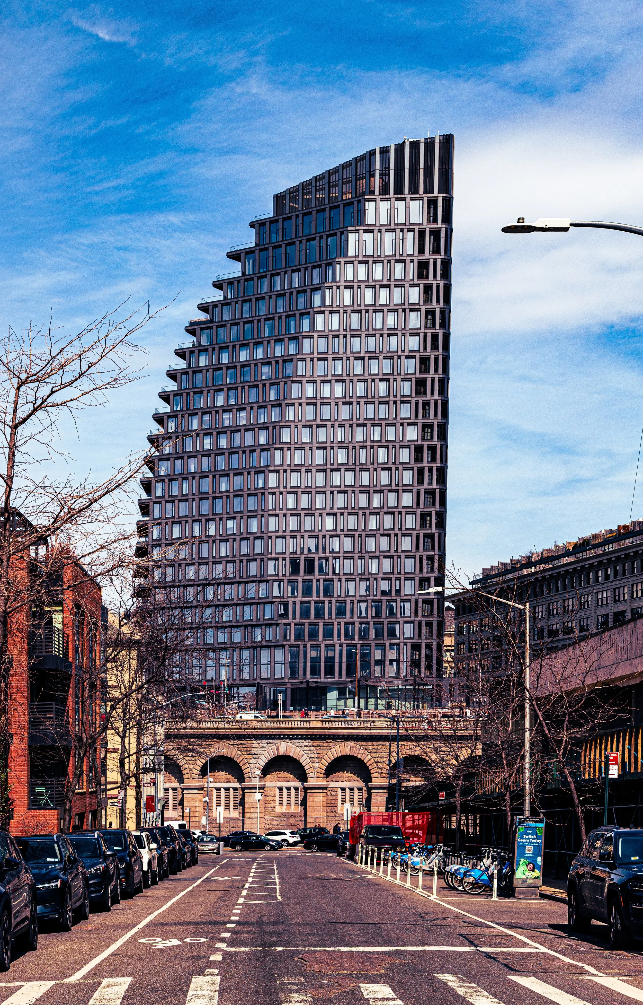
In the 21st century, Brooklyn Heights remains the crown jewel of Brownstone Brooklyn, yet its surroundings have changed dramatically. The creation of Brooklyn Bridge Park (2008–present) transformed the once-industrial waterfront below the Promenade into a series of landscaped piers, lawns, and cultural venues, reconnecting the neighborhood to the East River after nearly a century of separation. The views—of Manhattan’s skyline, the bridges, and the harbor—have become an emblem of modern New York’s reinvention.
Montague Street remains the neighborhood’s main commercial artery, lined with bookshops, cafés, and long-standing institutions. The streets retain their quiet dignity: Cranberry, Pineapple, and Orange Streets—the “Fruit Streets”—still charm with their intimate scale and historic facades. The arrival of high-tech offices and luxury condos nearby has not disrupted the Heights’ essential balance; its residential core endures, defined by stoops, gardens, and the steady rhythm of foot traffic rather than the clamor of cars.
The Promenade continues to serve as both symbol and sanctuary—a place where residents and visitors alike come to pause, breathe, and remember that even within a global metropolis, serenity is possible.
Brooklyn Heights Photo Gallery
Spirit and Legacy
Brooklyn Heights’ legacy is that of America’s first suburb and New York’s first historic district—a place where architectural grace and civic conscience intertwined to preserve a way of life. From the abolitionist pulpits of the 1850s to the preservation battles of the 1960s, it has always been a community defined by purpose as much as beauty. Its streets encapsulate nearly two centuries of urban evolution while maintaining a timeless calm.
New York City
Use this custom Google map to explore where every neighborhood in all five boroughs of New York City is located.
The Five Boroughs
One of New York City’s unique qualities is its organization in to 5 boroughs: Manhattan, Brooklyn, Queens, The Bronx, and Staten Island. These boroughs are part pragmatic administrative districts, and part vestiges of the region’s past. Each borough is an entire county in New York State - in fact, Brooklyn is, officially, Kings County, while Staten Island is, officially Richmond County. But that’s not the whole story …
Initially, New York City was located on the southern tip of Manhattan (now the Financial District) that was once the Dutch colony of New Amsterdam. Across the East River, another city was rising: Brooklyn. In time, the city planners realized that unification between the rapidly rising cities would create commercial and industrial opportunities - through streamlined administration of the region.
So powerful was the pull of unification between New York and Brooklyn that three more counties were pulled into the unification: The Bronx, Queens, and Staten Island. And on January 1, 1898, the City of New York unified two cities and three counties into one Greater City of New York - containing the five boroughs we know today.
But because each borough developed differently and distinctly until unification, their neighborhoods likewise uniquely developed. Today, there are nearly 390 neighborhoods, each with their own histories, cultures, cuisines, and personalities - and each with residents who are fiercely proud of their corner of The Big Apple.


