ELMHURST
Queens
Geographic Setting
Bounded by Roosevelt Avenue to the north, Junction Boulevard to the east, the Long Island Expressway to the south, and the Long Island Rail Road tracks to the west, Elmhurst lies at the geographic and demographic heart of Queens. It is a crossroads in every sense—a place where rail, subway, and highway converge, and where cultures from across the world coexist within a dense urban fabric of apartment houses, small businesses, and prewar streets. Once known as Newtown, Elmhurst has evolved from colonial farmland into one of New York City’s most internationally diverse neighborhoods, defined by constant movement, commerce, and change.
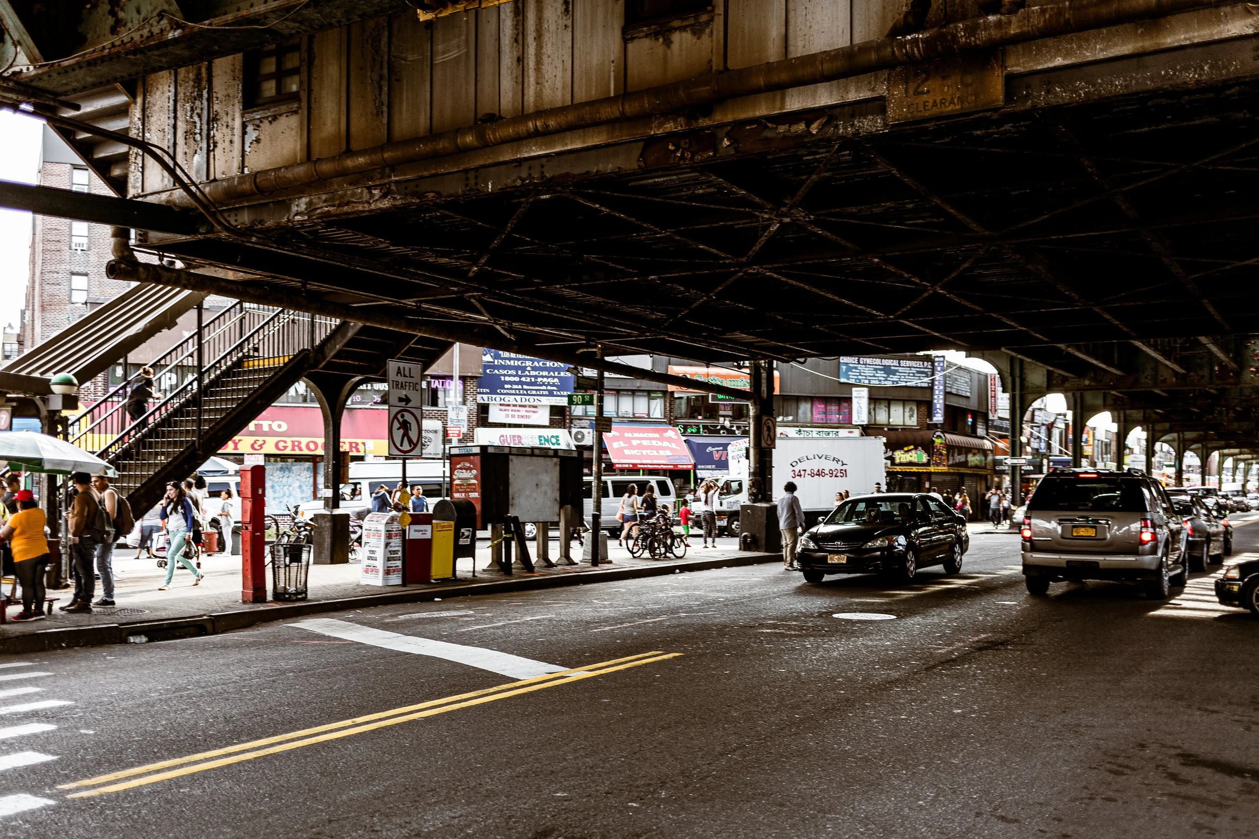
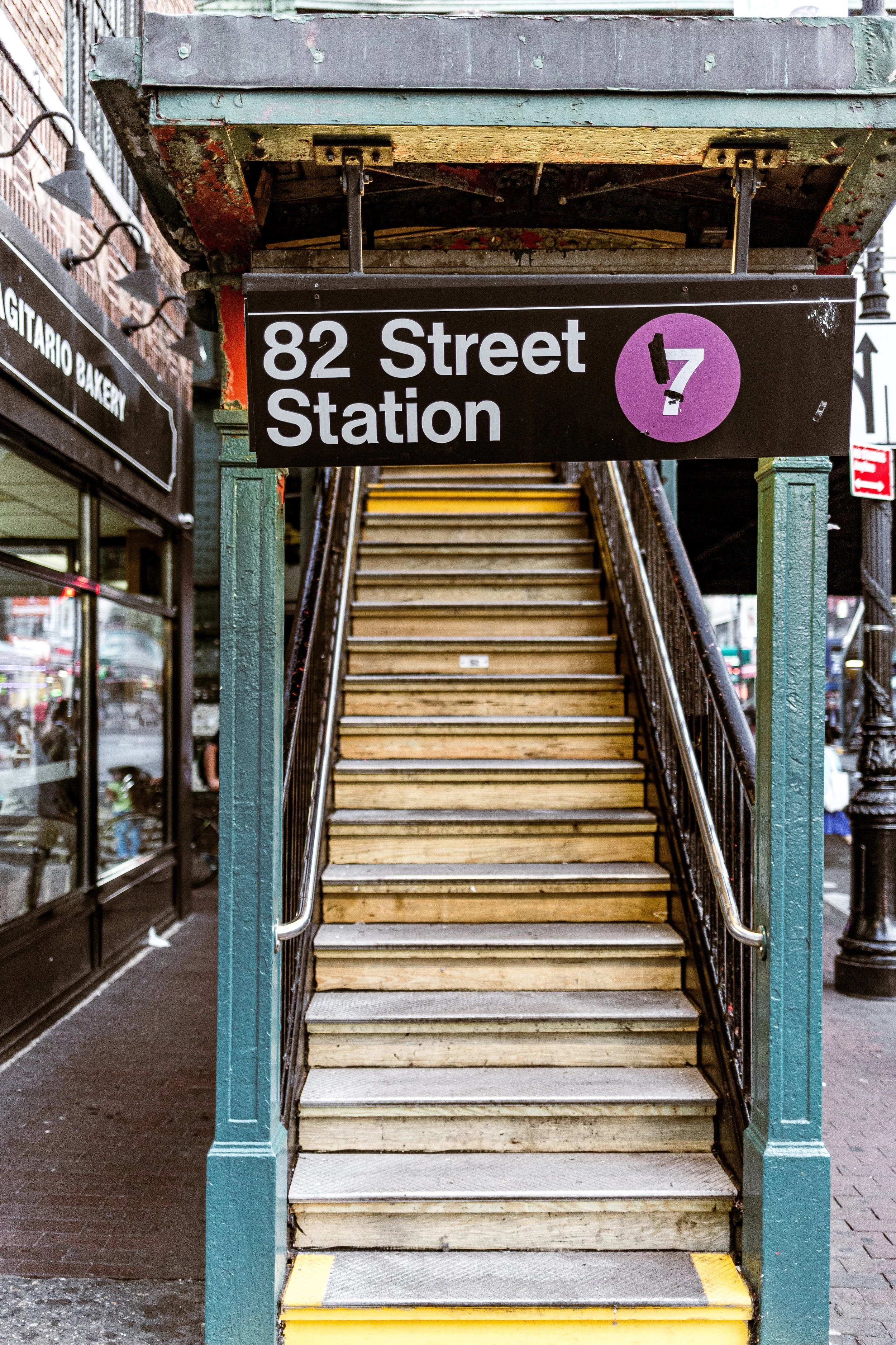
The neighborhood’s main arteries—Broadway, Corona Avenue, and Queens Boulevard—radiate outward from its busy commercial core near Elmhurst Avenue Station on the M and R subway lines. The Grand Avenue–Newtown Station, Roosevelt Avenue–Jackson Heights transit hub, and Woodhaven Boulevard Station extend its reach across Queens. Elmhurst’s built environment mirrors its layered history: stately 1920s apartment houses near Broadway, attached rowhouses along its residential side streets, and modern condominium towers emerging beside century-old storefronts. Despite its density, pockets of greenery—Veterans Grove, Elmhurst Park, and the lawns of St. James Episcopal Church—offer quiet anchors amid the urban rhythm.
Etymology and Origins
Originally settled by English colonists in the mid-17th century, Elmhurst began as the village of Middleburgh, later renamed Newtown when it became the seat of the colonial Town of Newtown. The fertile meadows between Flushing Creek and Newtown Creek supported farms and orchards for nearly two centuries, supplying Manhattan with produce and dairy. By the late 19th century, the arrival of the Grand Street and Newtown Railroad and the Long Island Rail Road transformed the rural hamlet into a growing commuter suburb.
The name “Elmhurst” was adopted in 1896 by real estate developer Cord Meyer Jr., whose Cord Meyer Development Company sought to distance the area from the outdated rural image of “Newtown.” Drawing from the pastoral imagery of elms and hills—“Elmhurst” literally meaning a grove of elms upon a hill—the name embodied the suburban elegance that developers marketed to middle-class homebuyers. This change coincided with rapid infrastructure improvements and the incorporation of Queens into Greater New York City in 1898.
The Neighborhood
Early 20th Century: Suburban Foundations
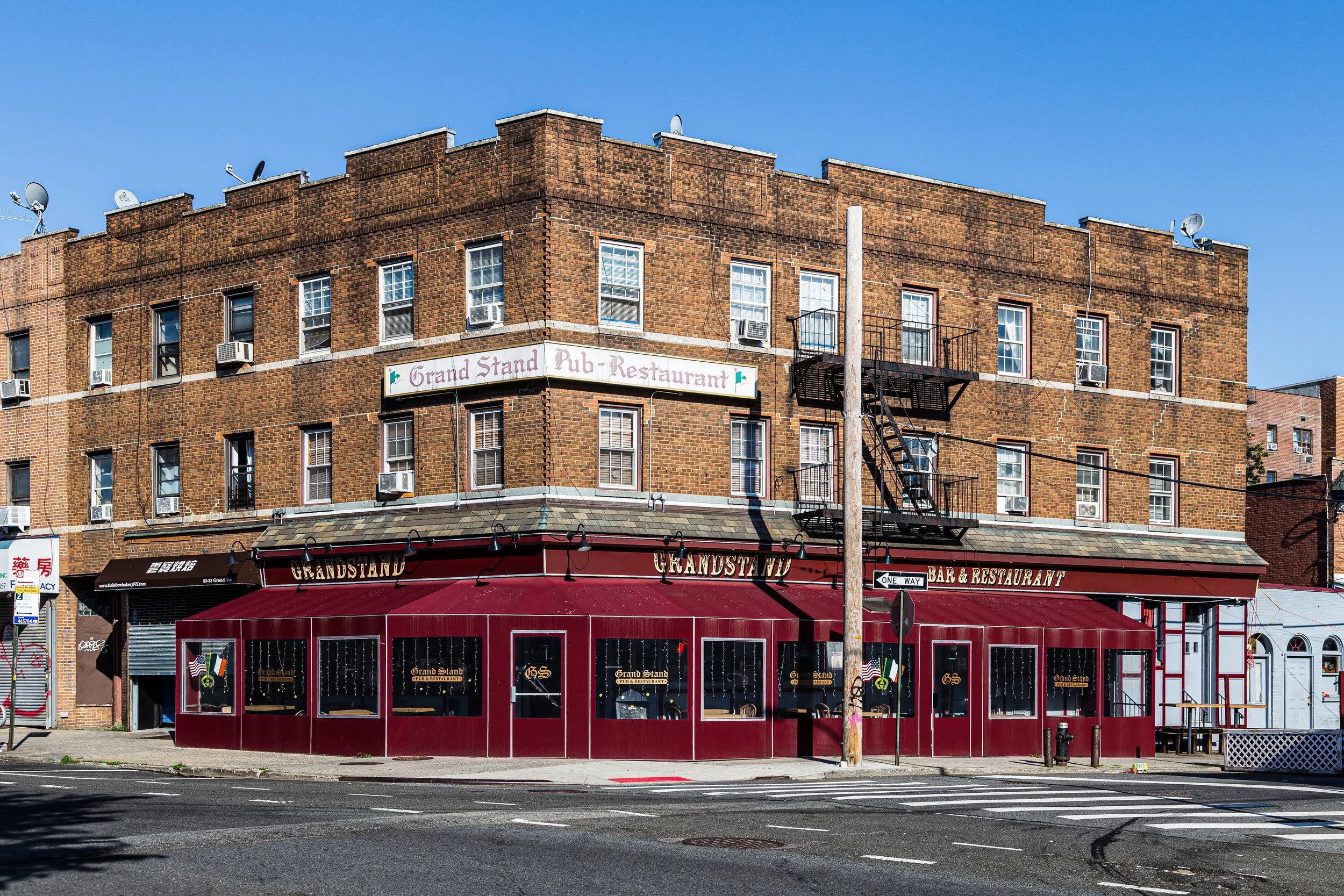
By the early 1900s, Elmhurst had become one of the borough’s most desirable residential districts. The extension of trolley lines and the Queensboro Bridge (1909) made commuting to Manhattan practical, while the opening of Queens Boulevard (1913) connected the neighborhood to Forest Hills and Long Island City. Developers laid out orderly grids of tree-lined streets between Broadway and Corona Avenue, filling them with Colonial Revival, Tudor, and neo-Renaissance homes. Apartment houses followed in the 1920s, catering to a growing middle class drawn by affordability and access.
Elmhurst’s commercial heart developed around Broadway, which became lined with shops, bakeries, and theaters. The opening of the Independent Subway System (IND) in 1936, with stations at Elmhurst Avenue and Grand Avenue–Newtown, spurred another wave of growth, transforming Elmhurst from suburb to city neighborhood. Churches and civic institutions—St. James Episcopal Church (built 1735), St. Adalbert’s Roman Catholic Church, and the First Presbyterian Church of Newtown—anchored the community’s moral and social life, many occupying sites dating back to colonial days.
Mid-20th Century: Urban Density and Demographic Shifts
The postwar decades saw Elmhurst’s transition into one of Queens’ most urbanized communities. The construction of the Long Island Expressway (LIE) in the 1950s bisected the southern edge of the neighborhood, accelerating both development and congestion. High-rise apartment complexes appeared along Queens Boulevard, while small homes gave way to multi-family dwellings. In 1954, Queens Center Mall opened on the site of the former Horse Brook farm—one of the borough’s earliest enclosed shopping centers, symbolizing the era’s suburban consumer culture.
During this same period, Elmhurst’s demographic character began to shift. Italian-American and Jewish families, who had dominated much of the early 20th century, increasingly moved outward to Long Island’s newer suburbs. In their place came immigrants from Latin America, East Asia, and the Caribbean, drawn by affordable housing and the neighborhood’s proximity to transit and jobs. By the 1970s, Elmhurst had become one of the most ethnically mixed areas in the city—a characteristic that would only deepen in the decades ahead.
Elmhurst Video Coming Soon
Late 20th Century: Immigration and Cultural Transformation
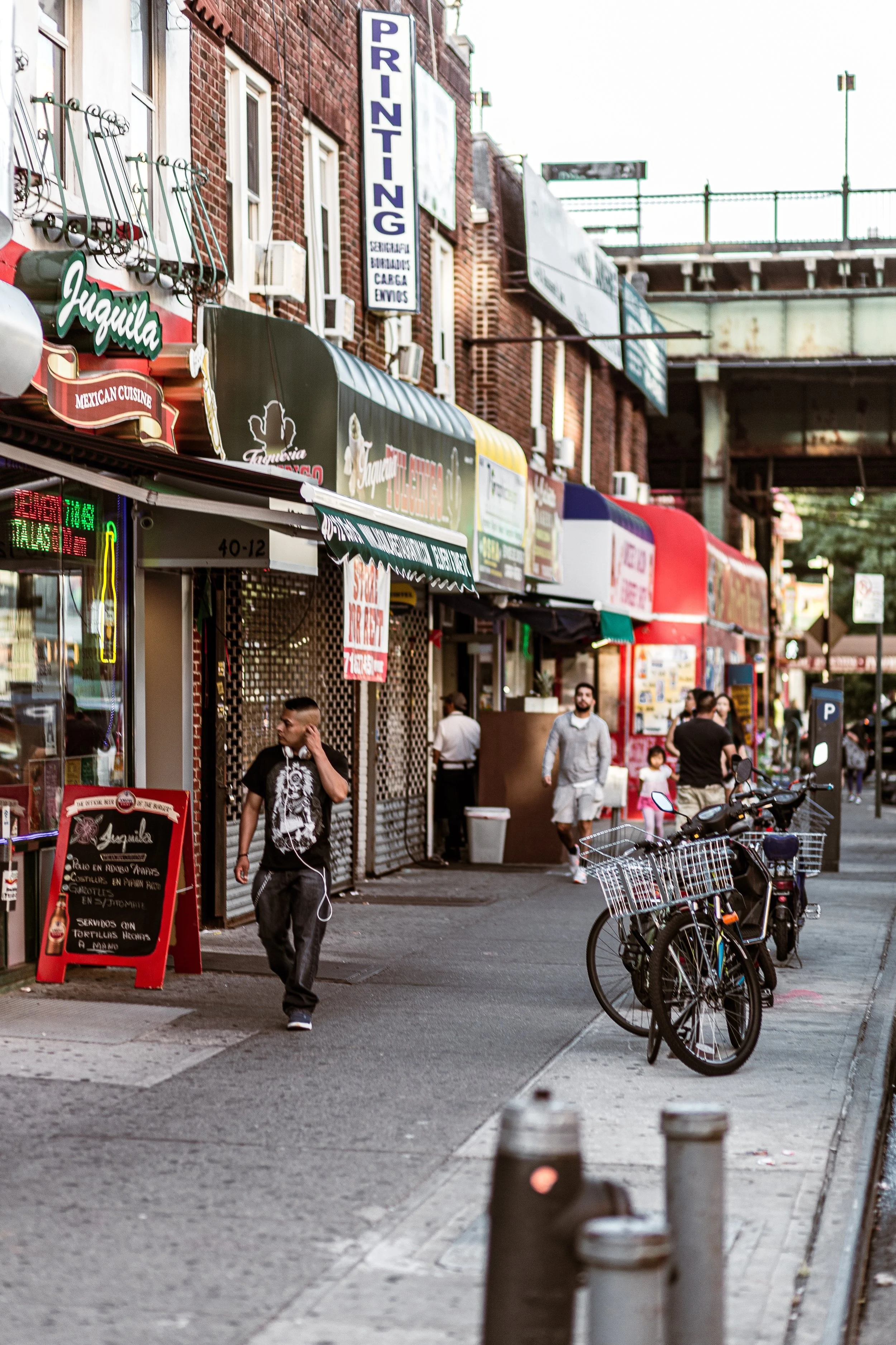
By the 1980s and 1990s, Elmhurst stood at the forefront of Queens’ transformation into a global borough. Waves of immigrants from China, Korea, Ecuador, Colombia, Bangladesh, and the Philippines reshaped the neighborhood’s identity. Broadway, Corona Avenue, and Queens Boulevard evolved into multilingual corridors of commerce where Spanish, Mandarin, Tagalog, and Bengali mingled in the air.
Elmhurst’s dining scene became legendary, offering cuisines from nearly every continent within a few blocks. Small markets and street vendors replaced department stores, while the Queens Center Mall and Queens Place Mall anchored the neighborhood’s retail economy. Community institutions adapted as well: the Queens Library at Broadway, one of the city’s busiest branches, expanded to meet the needs of its multilingual patrons; meanwhile, local schools and civic groups embraced cultural inclusion as a defining strength.
At the same time, Elmhurst faced the challenges of overcrowding and aging infrastructure. The demand for housing led to the subdivision of one-family homes into multi-unit dwellings, while traffic and congestion intensified along the expressway corridor. Yet the neighborhood retained its essential liveliness—its streets alive with small businesses, open-air markets, and the sound of global New York in miniature.
21st Century: Diversity, Density, and Resilience
In the 2000s and 2010s, Elmhurst continued to evolve as one of the most demographically diverse neighborhoods in the United States. Census data regularly ranks it among the top in linguistic variety: more than half its residents are foreign-born, and dozens of ethnic groups coexist within less than two square miles. Roosevelt Avenue to the north links Elmhurst to Jackson Heights and Corona, forming one of the city’s most vibrant immigrant corridors.
The neighborhood’s population has grown denser, and new mixed-use developments have risen near Queens Boulevard and the LIE. Despite rapid change, Elmhurst remains largely low- to mid-rise, preserving its early 20th-century urban form. Parks and public spaces, such as Elmhurst Park—created on the site of the former Elmhurst Gas Tanks—provide much-needed green relief and a symbol of environmental renewal. The park’s open lawns and views toward Manhattan embody the neighborhood’s ongoing transformation from industrial edge to livable urban village.
The COVID-19 pandemic in 2020 placed Elmhurst in national headlines, as Elmhurst Hospital Center became an epicenter of the city’s struggle against the virus. The hospital, long a safety-net institution serving immigrants and the uninsured, became a symbol of both vulnerability and courage. The community’s collective response—mutual aid networks, food drives, and support groups—reinforced Elmhurst’s enduring spirit of solidarity.
Elmhurst Photo Gallery
Spirit and Legacy
Elmhurst’s legacy is one of reinvention and inclusion. From its colonial roots as Newtown to its emergence as a 20th-century commuter suburb and now as a 21st-century microcosm of global migration, Elmhurst has continually reflected the city’s evolution. Its crowded sidewalks, corner markets, and multilingual storefronts embody what New York has always been: a crossroads of people and possibility.
New York City
Use this custom Google map to explore where every neighborhood in all five boroughs of New York City is located.
The Five Boroughs
One of New York City’s unique qualities is its organization in to 5 boroughs: Manhattan, Brooklyn, Queens, The Bronx, and Staten Island. These boroughs are part pragmatic administrative districts, and part vestiges of the region’s past. Each borough is an entire county in New York State - in fact, Brooklyn is, officially, Kings County, while Staten Island is, officially Richmond County. But that’s not the whole story …
Initially, New York City was located on the southern tip of Manhattan (now the Financial District) that was once the Dutch colony of New Amsterdam. Across the East River, another city was rising: Brooklyn. In time, the city planners realized that unification between the rapidly rising cities would create commercial and industrial opportunities - through streamlined administration of the region.
So powerful was the pull of unification between New York and Brooklyn that three more counties were pulled into the unification: The Bronx, Queens, and Staten Island. And on January 1, 1898, the City of New York unified two cities and three counties into one Greater City of New York - containing the five boroughs we know today.
But because each borough developed differently and distinctly until unification, their neighborhoods likewise uniquely developed. Today, there are nearly 390 neighborhoods, each with their own histories, cultures, cuisines, and personalities - and each with residents who are fiercely proud of their corner of The Big Apple.


