
SUNNYSIDE
Queens
Geographic Setting
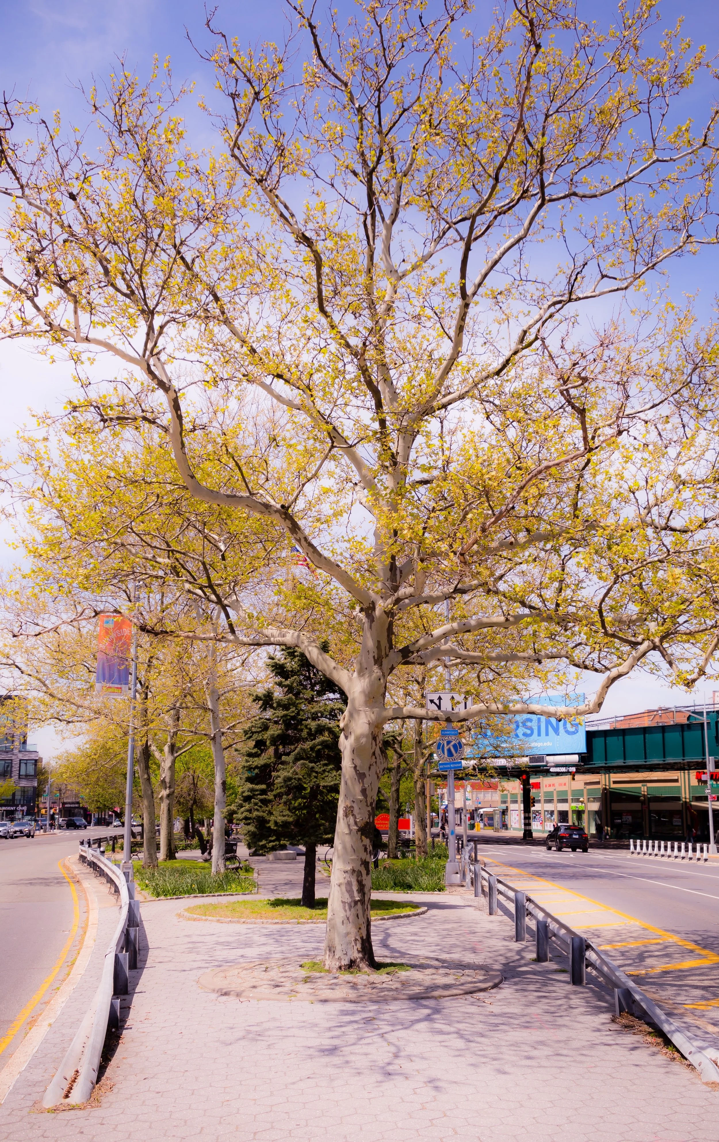
Bounded by the Brooklyn-Queens Expressway (BQE) to the southeast, Newtown Creek to the south, Greenpoint Avenue and 39th Street to the west, the Long Island Rail Road tracks to the north, and 52nd and 58th Streets to the east, Sunnyside occupies a compact yet dynamic corner of western Queens just east of Long Island City. The neighborhood sits on gently rising ground above the industrial flats of Newtown Creek, its orderly residential grid fanning outward from Queens Boulevard—a wide, bustling thoroughfare that bisects Sunnyside into northern and southern halves.
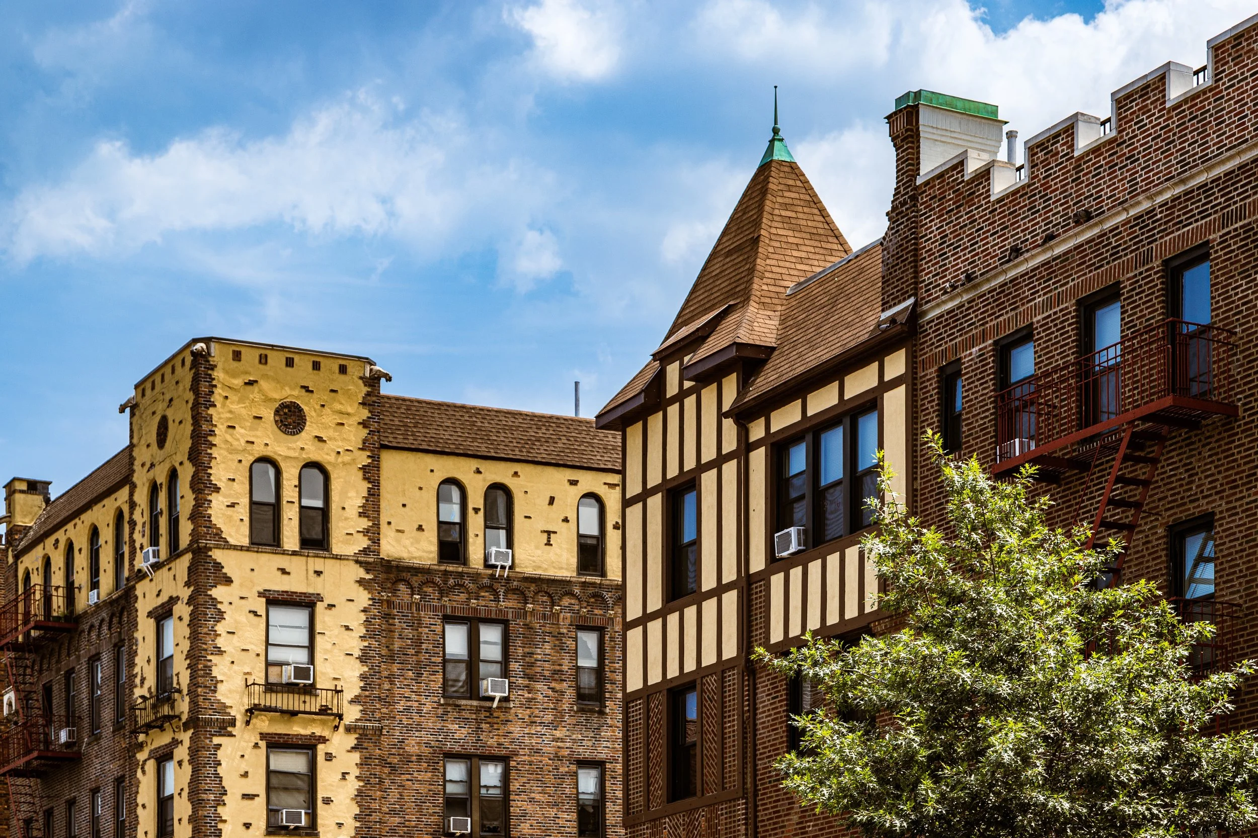
Defined by a mix of prewar apartment buildings, brick rowhouses, and the verdant courtyards of Sunnyside Gardens, the area blends urban density with small-town warmth. The 7 train runs elevated along Queens Boulevard, linking the community directly to Midtown Manhattan in less than 15 minutes, while the BQE, LIRR, and nearby Pulaski Bridge provide regional connections. Commercial corridors along Skillman Avenue, Greenpoint Avenue, and Queens Boulevard are lined with restaurants, cafés, bars, and grocery stores that reflect the neighborhood’s deeply multicultural character.
Sunnyside’s geography—bounded by rail lines, expressways, and waterways—creates a distinct enclave: compact, walkable, and self-contained, with a strong sense of community continuity amidst constant change.
Etymology and Origins
The name “Sunnyside” predates urban development, originating from the Sunnyside Hill estate, a 19th-century farm owned by the Bragaw family. The estate occupied the higher ground north of Newtown Creek and was known for its expansive views and fertile soil. When the land was subdivided in the late 1800s, developers adopted the name “Sunnyside” to evoke brightness, health, and suburban calm—qualities that would come to define its identity even after it urbanized.
Originally part of the Town of Newtown, the area remained rural well into the 19th century, consisting of small farms, meadows, and industrial outposts along the creek. The extension of the Long Island Rail Road and the Queensboro Bridge (1909) brought rapid transformation. By the 1910s, farmland gave way to grid-planned streets, apartment houses, and one of the most visionary planned communities in the United States: Sunnyside Gardens.
The Neighborhood
Early 20th Century: A Model for Urban Living
Sunnyside’s transformation began in earnest in the 1920s, when reform-minded planners and architects—most notably Clarence Stein and Henry Wright of the Regional Planning Association of America—envisioned a neighborhood that would blend urban convenience with suburban serenity. Funded by the City Housing Corporation, Sunnyside Gardens (constructed 1924–1928) became one of America’s first and most influential planned garden communities.
The development covered roughly 77 acres between Queens Boulevard, Barnett Avenue, and 46th to 52nd Streets, featuring brick rowhouses and low-rise apartment buildings arranged around landscaped courtyards and interior gardens. Communal green spaces replaced backyards, encouraging interaction among residents while preserving open land. The design drew inspiration from English garden-city principles—shared greenery, sunlight, and social harmony within a dense city framework.
The experiment succeeded spectacularly. Middle-income families, professionals, and civil servants moved in, drawn by affordable housing and proximity to Manhattan. The community fostered an enduring sense of civic engagement that still characterizes Sunnyside today.
Mid-20th Century: Growth, Diversity, and Continuity
Through the 1930s to 1950s, Sunnyside solidified its identity as a stable, middle-class neighborhood with a cosmopolitan edge. The elevated IRT Flushing Line (7 train)—completed in 1917—anchored its growth, spurring commercial development along Queens Boulevard and Greenpoint Avenue.
A wave of European immigrants—Irish, Italian, Polish, German, and Greek—settled in the area, many working in factories, docks, and city service jobs. Apartment buildings sprouted along Skillman Avenue and 43rd Avenue, complementing the earlier garden homes. Sunnyside Gardens Park, opened in 1926, became one of New York City’s rare privately managed community parks, owned and maintained by local residents—a tradition that continues.
The neighborhood weathered the Great Depression and World War II with remarkable cohesion. Postwar prosperity brought modest modernization but little disruption; its scale and density remained largely unchanged. In contrast to neighboring Long Island City’s industrial sprawl, Sunnyside retained the human proportions of a planned community—walkable, intimate, and architecturally consistent.
By the 1950s and 1960s, the community’s social fabric reflected the optimism of postwar Queens: first-generation Americans buying homes, attending local churches, and organizing civic groups such as the Sunnyside Chamber of Commerce and Sunnyside Community Services.
Sunnyside Video Coming Soon
Late 20th Century: Immigrant Renewal and Cultural Fusion
The 1970s through 1990s brought demographic transformation, as waves of Latin American, South Asian, East Asian, and Eastern European immigrants infused Sunnyside with new energy and cultural diversity. Colombian, Ecuadorian, Bangladeshi, Filipino, and Romanian families joined long-established Irish and Greek residents, creating a tapestry of languages, cuisines, and traditions.
Commercial life along Greenpoint Avenue, Skillman Avenue, and Roosevelt Avenue flourished with multicultural storefronts: taquerias beside Irish pubs, sari shops near Balkan bakeries. Despite citywide fiscal crises and urban decline elsewhere, Sunnyside maintained its stability—thanks in part to strong homeownership in Sunnyside Gardens, effective civic leadership, and a community ethos that prized neighborliness and safety.
The designation of Sunnyside Gardens as a New York City Historic District in 1974 (and later as a National Register Historic District in 1984) ensured the preservation of its architectural integrity. While nearby Long Island City began to industrially decline, Sunnyside quietly thrived as a livable, human-scaled community rooted in both heritage and openness.
21st Century: Gentrification, Preservation, and Civic Renewal
In the 21st century, Sunnyside stands at the intersection of history and change. Its proximity to Manhattan and the explosive redevelopment of Long Island City have attracted young professionals, artists, and families seeking affordability and authenticity. Rents have risen, and new co-ops and condominiums have appeared along the edges of the neighborhood, yet Sunnyside has resisted wholesale transformation.
Skillman Avenue and 43rd Avenue have emerged as cultural corridors, home to cafés, galleries, and small restaurants that balance tradition and modernity. Sunnyside Gardens Park remains a focal point of community life, while Sunnyside Community Services continues to provide vital social support to seniors, immigrants, and working families.
Community activism remains strong: residents advocate for traffic safety, affordable housing, and environmental resilience, particularly around the industrial Newtown Creek waterfront. The 7 train, despite congestion, continues to serve as the neighborhood’s defining lifeline—its elevated tracks an enduring visual and acoustic emblem of Sunnyside’s urban rhythm.
Sunnyside Photo Gallery
Spirit and Legacy
The spirit of Sunnyside lies in its balance—between old and new, density and openness, tradition and reinvention. It is one of the rare New York neighborhoods where the utopian ideals of early 20th-century urban planning have endured: accessible housing, human-scale architecture, shared green space, and genuine community connection.
New York City
Use this custom Google map to explore where every neighborhood in all five boroughs of New York City is located.
The Five Boroughs
One of New York City’s unique qualities is its organization in to 5 boroughs: Manhattan, Brooklyn, Queens, The Bronx, and Staten Island. These boroughs are part pragmatic administrative districts, and part vestiges of the region’s past. Each borough is an entire county in New York State - in fact, Brooklyn is, officially, Kings County, while Staten Island is, officially Richmond County. But that’s not the whole story …
Initially, New York City was located on the southern tip of Manhattan (now the Financial District) that was once the Dutch colony of New Amsterdam. Across the East River, another city was rising: Brooklyn. In time, the city planners realized that unification between the rapidly rising cities would create commercial and industrial opportunities - through streamlined administration of the region.
So powerful was the pull of unification between New York and Brooklyn that three more counties were pulled into the unification: The Bronx, Queens, and Staten Island. And on January 1, 1898, the City of New York unified two cities and three counties into one Greater City of New York - containing the five boroughs we know today.
But because each borough developed differently and distinctly until unification, their neighborhoods likewise uniquely developed. Today, there are nearly 390 neighborhoods, each with their own histories, cultures, cuisines, and personalities - and each with residents who are fiercely proud of their corner of The Big Apple.


