STAPLETON HEIGHTS
Staten Island
Geographic Setting
Bounded by Victory Boulevard to the northwest, Cebra Avenue and St. Paul’s Avenue to the north, Clinton Street and Van Duzer Street to the southeast, and Occident Avenue and Louis Street to the southwest, Stapleton Heights rises dramatically above the harbor-facing lowlands of Stapleton, forming one of Staten Island’s most architecturally distinguished and historically intact hilltop neighborhoods. Perched on the eastern flank of the island’s central ridge, its streets climb steeply from the valley below, affording sweeping views of New York Harbor, the Verrazzano-Narrows Bridge, and the distant skyline of Lower Manhattan.
The terrain shapes everything here: curving, tree-lined roads such as Cebra, Henderson, and Highview Avenues thread across the slopes, lined with stately late-19th- and early-20th-century homes. From their terraces and porches, residents look down toward the waterfront where Stapleton once bustled with shipyards and breweries. In contrast, Stapleton Heights has long embodied a quieter, residential grandeur—a neighborhood conceived as the “hill above the harbor,” balancing urban proximity with scenic retreat.
Etymology
The name Stapleton Heights reflects both geography and lineage. The “Heights” denotes its elevated topography above the harbor plain of Stapleton, while “Stapleton” ties it to the 19th-century harbor village founded by William J. Staples and Minthorne Tompkins. As the lower waterfront grew dense with industry and housing, the hills above were marketed to affluent professionals seeking cleaner air and commanding views.
By the late 1800s, developers and local newspapers referred to the area as “The Heights of Stapleton,” a name that soon formalized into Stapleton Heights. The term captured both its physical prominence and social aspiration—a hillside enclave distinct from, yet historically and economically intertwined with, the maritime community below.
The Neighborhood
Origins through the 19th Century
Stapleton Heights traces its origins to the post–Civil War era, when Staten Island’s North and East Shores began attracting upper-middle-class residents drawn by ferry access to Manhattan and the promise of suburban living. In the 1860s and 1870s, real estate speculators acquired farmland and woodlots above the bustling village of Stapleton, subdividing them into generous plots intended for detached homes. The steep topography discouraged industry and mass housing, preserving the area’s exclusivity.
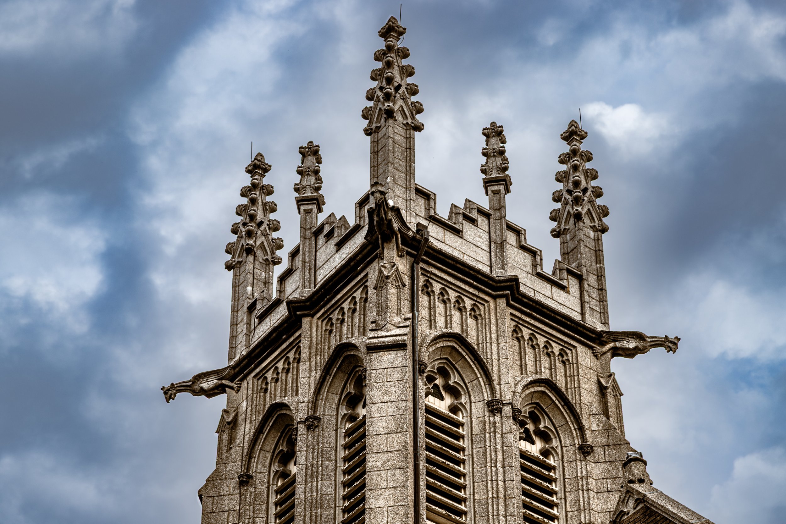
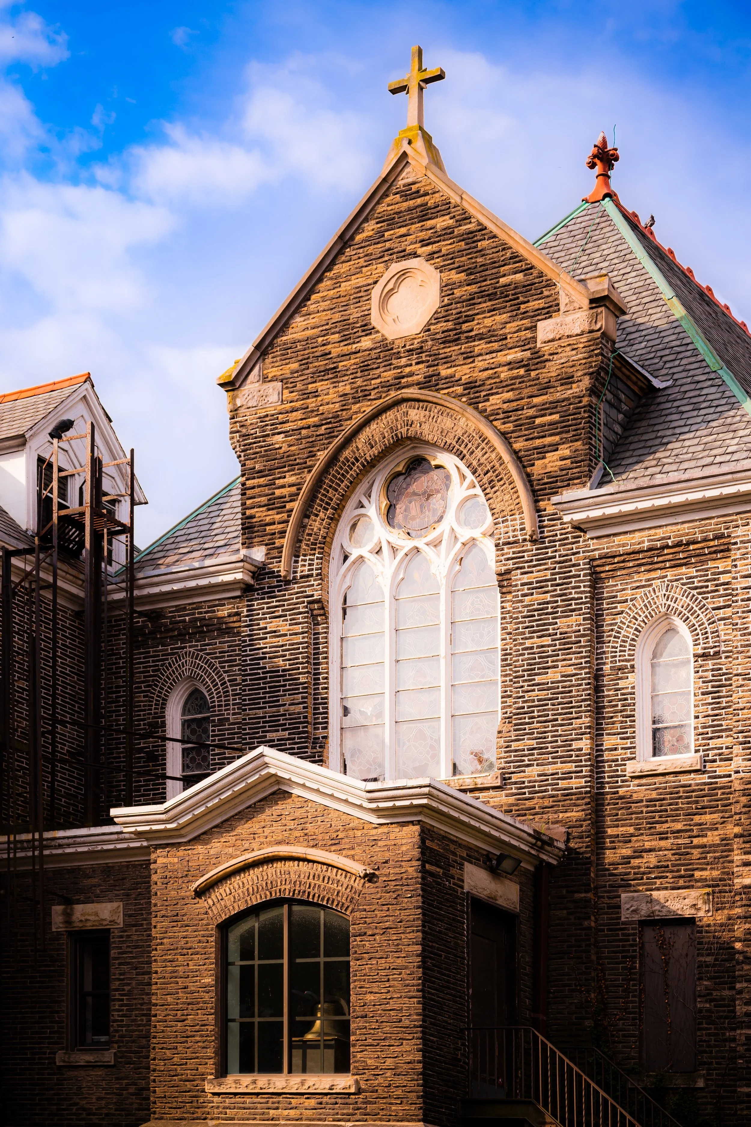
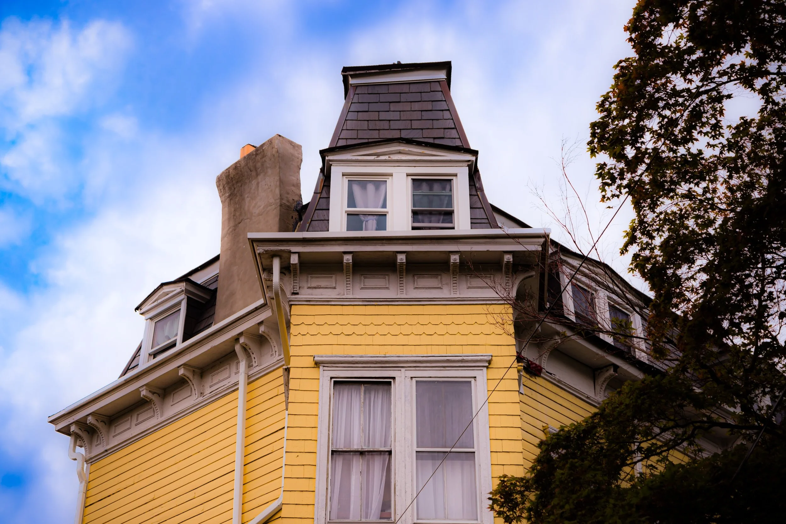
Early residents included shipyard owners, merchants, and professionals who prospered from Staten Island’s maritime economy. They built grand homes in popular styles of the era—Victorian Gothic, Second Empire, Queen Anne, and later Colonial Revival—each taking advantage of the hillside’s dramatic vistas. Architectural details such as turrets, wraparound porches, stained-glass windows, and carved wooden trim became hallmarks of the neighborhood’s skyline.
The arrival of improved roads and streetcar lines along Van Duzer Street and St. Paul’s Avenue further connected the heights to St. George and the ferry. Yet even as the surrounding lowlands urbanized, Stapleton Heights retained the aura of a private suburb. Its winding lanes, mature trees, and large lots gave it the feeling of a hillside garden community—a retreat within the city.
Early 20th Century: Architectural Flourish and Civic Life
At the turn of the 20th century, Stapleton Heights entered its golden age as one of Staten Island’s premier residential enclaves. The neighborhood’s collection of mansions and substantial homes reflected both wealth and aesthetic ambition. Architects and builders continued to design in eclectic styles—Arts and Crafts, Tudor Revival, and Shingle Style—often incorporating locally quarried stone and fine woodwork.
Prominent Staten Islanders made their homes here: lawyers, doctors, ship captains, and civic leaders who shaped the island’s institutions. The elevated setting attracted not only families of means but also artists and intellectuals drawn to its views and tranquility. The St. Paul’s Avenue–Stapleton Heights Historic District, later established to preserve this legacy, encompasses many of these turn-of-the-century homes, which collectively form one of New York City’s richest concentrations of late Victorian architecture.
Social life in Stapleton Heights centered on private gatherings, churches, and nearby civic organizations in Stapleton and St. George. Families patronized local shops on Van Duzer Street and sent their children to parochial and public schools below the hill. The contrast between the industrious waterfront and the genteel heights created a unique social topography—a microcosm of Staten Island’s dual identity as both city and suburb.
Stapleton Heights Video Coming Soon
Mid–Late 20th Century: Preservation amid Change
The mid-20th century brought both challenge and continuity. As Staten Island underwent rapid suburbanization following the Verrazzano-Narrows Bridge (1964), many of the island’s older neighborhoods faced disinvestment or redevelopment pressures. Yet Stapleton Heights weathered these transitions with remarkable integrity. Its location on steep terrain discouraged large-scale construction, while its distinctive architecture attracted preservation-minded residents.
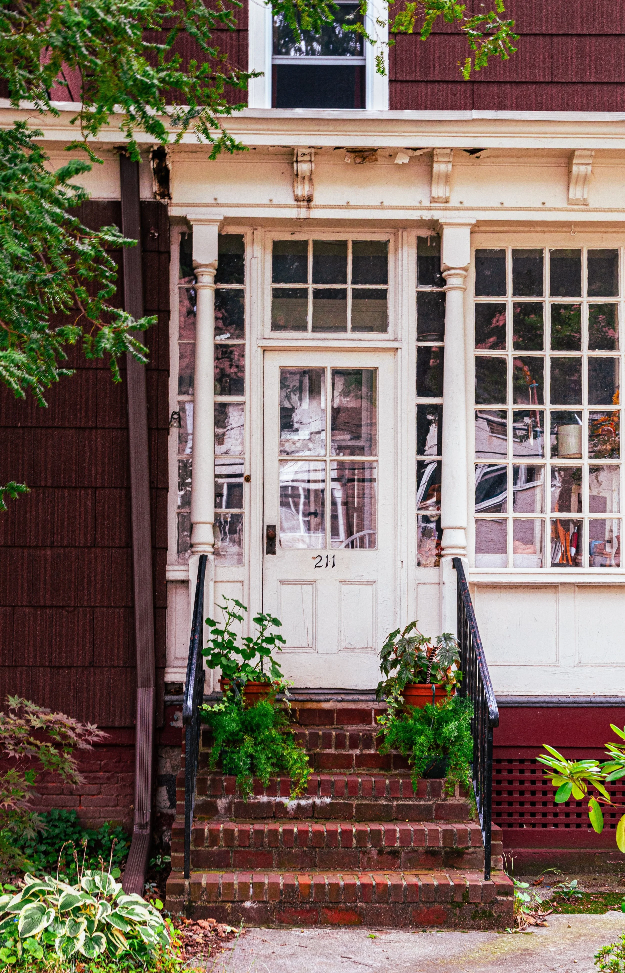
Though some mansions were converted into multifamily homes or apartments in the postwar decades, the overall character of the neighborhood remained intact. Longtime residents and newcomers alike took pride in maintaining its historic charm. The establishment of the St. Paul’s Avenue–Stapleton Heights Historic District (2004) by the New York City Landmarks Preservation Commission formally recognized the neighborhood’s architectural and cultural significance, protecting more than 100 structures built between the 1840s and early 1900s.
During the same period, Staten Island’s civic and cultural revival—anchored in nearby St. George and Stapleton—brought renewed interest in the area’s history. The preservation movement, along with the rise of home restoration enthusiasts, ensured that Stapleton Heights would remain one of Staten Island’s most desirable and visually striking neighborhoods.
21st Century: A Historic Enclave with Modern Vitality
In the 21st century, Stapleton Heights continues to embody a rare combination of historic elegance and urban proximity. Its leafy streets, terraced gardens, and commanding harbor views attract a diverse mix of residents—artists, professionals, and families—drawn to the sense of permanence and character that newer developments often lack. Many of the Victorian and Colonial Revival homes have been meticulously restored, showcasing intricate woodwork, leaded glass, and original stone foundations.
The neighborhood’s proximity to the cultural and economic resurgence of the North Shore has further enhanced its vitality. The nearby Stapleton Waterfront and St. George Theatre, the Empire Outlets, and the Staten Island Ferry Terminal are minutes away, providing both convenience and cultural connection. Yet despite its accessibility, Stapleton Heights retains an atmosphere of retreat: quiet streets shaded by old oaks, distant ferry horns echoing up the hillside, and the lingering sense of a place untouched by the hurried pace of modern life.
Community engagement remains strong. Local preservation groups and civic associations advocate for responsible zoning, architectural integrity, and the upkeep of public spaces. The balance between progress and preservation defines the neighborhood’s ongoing story—a living museum of Staten Island’s architectural evolution that still feels very much alive.
Spirit and Legacy
The spirit of Stapleton Heights lies in its elevation—not only of land, but of vision. From its founding, it has stood as a refuge above the noise of the harbor below, a place where craftsmanship, community, and landscape meet in harmony. Its legacy is written in wood and stone, in gables and porches that have withstood the passage of time and the pull of modernity.
It remains a testament to Staten Island’s complexity: urban yet bucolic, cosmopolitan yet deeply local. Each house tells a story—of ambition, artistry, and endurance—woven together into a hillside panorama that continues to watch over the bay.
Stapleton Heights Photo Gallery
Spirit and Legacy
The spirit of Stapleton Heights lies in its elevation—not only of land, but of vision. From its founding, it has stood as a refuge above the noise of the harbor below, a place where craftsmanship, community, and landscape meet in harmony. Its legacy is written in wood and stone, in gables and porches that have withstood the passage of time and the pull of modernity.
It remains a testament to Staten Island’s complexity: urban yet bucolic, cosmopolitan yet deeply local. Each house tells a story—of ambition, artistry, and endurance—woven together into a hillside panorama that continues to watch over the bay.
New York City
Use this custom Google map to explore where every neighborhood in all five boroughs of New York City is located.
The Five Boroughs
One of New York City’s unique qualities is its organization in to 5 boroughs: Manhattan, Brooklyn, Queens, The Bronx, and Staten Island. These boroughs are part pragmatic administrative districts, and part vestiges of the region’s past. Each borough is an entire county in New York State - in fact, Brooklyn is, officially, Kings County, while Staten Island is, officially Richmond County. But that’s not the whole story …
Initially, New York City was located on the southern tip of Manhattan (now the Financial District) that was once the Dutch colony of New Amsterdam. Across the East River, another city was rising: Brooklyn. In time, the city planners realized that unification between the rapidly rising cities would create commercial and industrial opportunities - through streamlined administration of the region.
So powerful was the pull of unification between New York and Brooklyn that three more counties were pulled into the unification: The Bronx, Queens, and Staten Island. And on January 1, 1898, the City of New York unified two cities and three counties into one Greater City of New York - containing the five boroughs we know today.
But because each borough developed differently and distinctly until unification, their neighborhoods likewise uniquely developed. Today, there are nearly 390 neighborhoods, each with their own histories, cultures, cuisines, and personalities - and each with residents who are fiercely proud of their corner of The Big Apple.


