THE LANDMARKS OF NEW YORK
The landmarks of New York are its great signatures — the visible testament to ambition and endurance written across stone, steel, and sky. From the Statue of Liberty’s raised torch to the Gothic crown of the Woolworth Building, from Grand Central’s constellations to the towering planes of the Empire State, each landmark embodies a chapter of the city’s identity.
They are the fixed points in a landscape of constant change: places of gathering, triumph, and remembrance that bind generations to a shared sense of place. Whether civic, spiritual, or architectural, these monuments reveal the arc of New York’s evolution — how each era reshaped the skyline in its own image.
Landmarks of New York is a study of permanence within motion — a reflection on the forms that outlast the noise, and on the human will that continues to raise new symbols from the island’s bedrock.
The Landmarks:
Brooklyn Bridge
The Brooklyn Bridge spans the East River, linking Lower Manhattan and Downtown Brooklyn in one of the most iconic crossings in the world. Stretching 1,595 feet between its granite towers—and nearly 6,000 feet including approaches—it carries vehicular, bicycle, and pedestrian traffic between City Hall Park in Manhattan and Cadman Plaza in Brooklyn. The bridge’s massive Gothic-style stone arches, sweeping steel cables, and elevated wooden promenade define not just the skyline, but the very idea of connection in New York City.
Beneath its graceful form lies an infrastructure of extraordinary ambition. The Brooklyn Bridge spans a tidal strait that was once one of the busiest waterways on earth, threading between ferries, schooners, and modern cargo ships. Above it all, the bridge’s granite towers rise 276 feet from the water—built on caissons sunk to bedrock below the riverbed. At once an engineering marvel, a civic symbol, and a public space, the Brooklyn Bridge stands as a physical and emotional threshold between boroughs, centuries, and visions of New York itself.

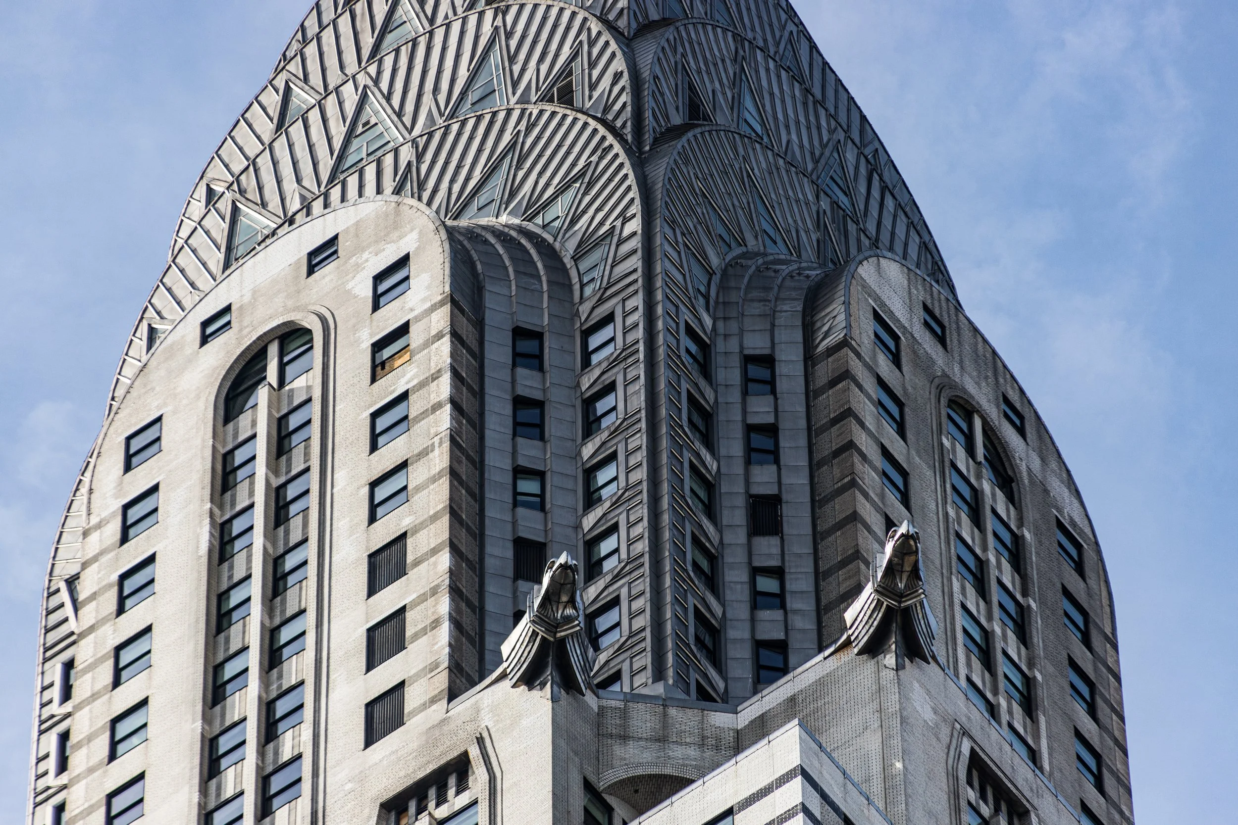
Chrysler Building
The Chrysler Building rises at 405 Lexington Avenue, occupying the block between 42nd and 43rd Streets in Midtown Manhattan—just east of Grand Central Terminal and within the historic Turtle Bay district. At 1,046 feet (319 meters) tall, it was briefly the world’s tallest building upon completion in 1930, before being surpassed by the Empire State Building a year later. Today it remains one of the most recognizable silhouettes in the New York skyline: a shimmering spire of steel and light, its crown gleaming above the canyoned expanse of Midtown East.
Situated within the city’s densest concentration of early skyscrapers, the Chrysler Building embodies the architectural and emotional climax of Manhattan’s 1920s building boom—a structure that fused the machine age’s optimism with the grace of modern art. Its surroundings—Grand Central’s marble concourses, the gray granite of the Bowery Savings Bank, and the bustle of Lexington Avenue—frame it as both centerpiece and beacon of an age when New York imagined itself as the capital of the future.

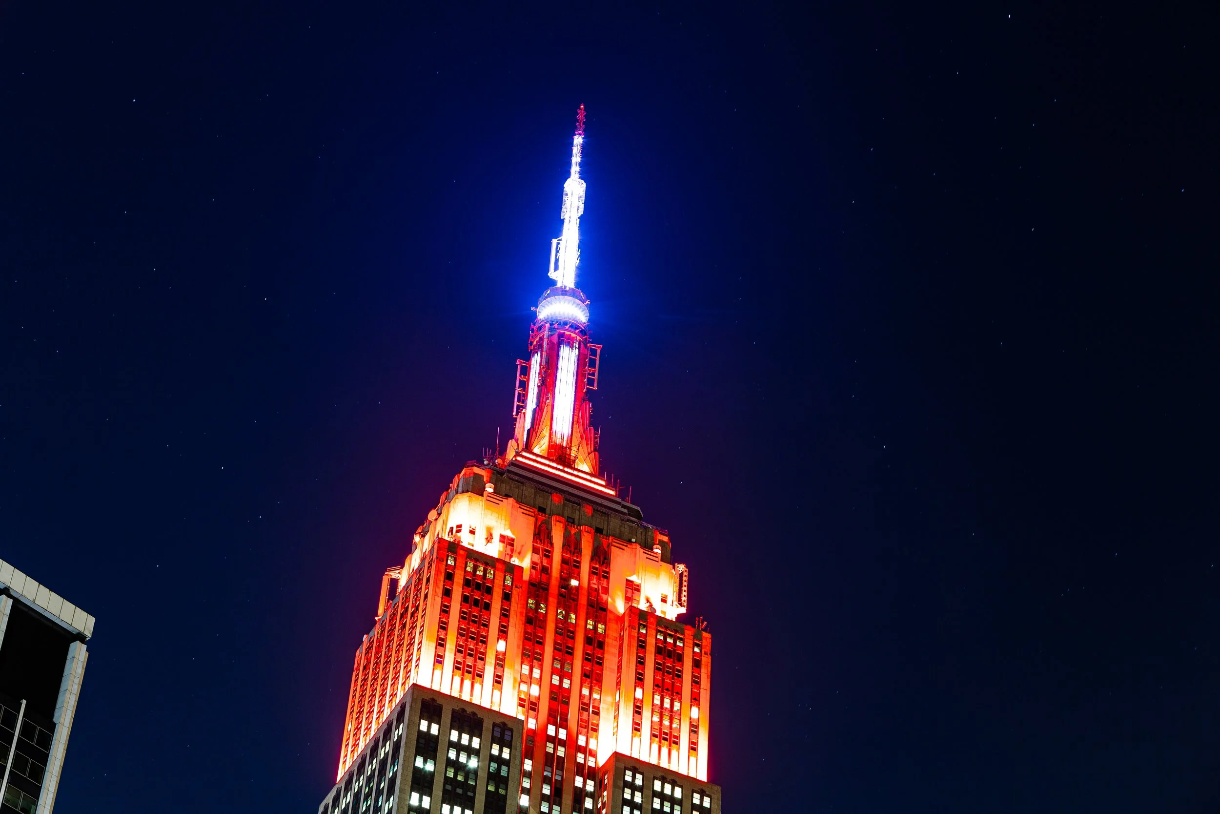
Empire State Building
The Empire State Building rises at 350 Fifth Avenue, occupying the entire block between 33rd and 34th Streets in Midtown Manhattan. Soaring 1,454 feet (443 meters) to the tip of its antenna, the building has long been the defining vertical landmark of New York City—visible from every borough and from the skies above. Its limestone and steel façade dominates the central spine of Fifth Avenue, framed by the retail bustle of Herald Square to the west and the commercial canyons of Murray Hill to the east.
Strategically positioned on what was once the site of the old Waldorf–Astoria Hotel, the Empire State Building anchors the very heart of Manhattan’s grid. Its setbacks rise in disciplined tiers, culminating in a gleaming Art Deco spire that catches sunlight by day and illuminates the skyline by night. From its 86th- and 102nd-floor observatories, visitors gaze over the city’s geometric wonderland—a panorama that remains the quintessential New York view. Both geographically and symbolically, the building stands at the city’s center, its peak the axis around which the myth of Manhattan revolves.
CityChroniclesNYC
-

The Streets
The streets of New York form the living framework of the city — a network of energy and intention carved through centuries of movement. They are the city’s arteries, drawing millions through their corridors each day; a language of pavement and pattern that speaks of order and chaos in equal measure.
-
The Landmarks
The landmarks of New York are its great signatures — the visible testament to ambition and endurance written across stone, steel, and sky. From the Statue of Liberty’s raised torch to the Gothic crown of the Woolworth Building, from Grand Central’s constellations to the towering planes of the Empire State, each landmark embodies a chapter of the city’s identity.
-
The Exhibitions
Few cities have turned creativity into civic identity quite like New York. From the marble halls of The Met and the Cloisters to the experimental pavilions of MoMA PS1, from the sculptural quiet of Little Island to the open canvases of its murals and parks, the city exists as a gallery in perpetual renewal.
-
The Visions
There are as many New Yorks as there are moments of light. Seen through rain or reflection, in twilight haze or midnight flare, the city remakes itself in every frame. Visions of New York captures those transformations — the fleeting alignments of architecture, weather, and mood that define how the city feels.
-
The Explorations
Every photograph begins with a walk — and every walk through New York is a journey through both city and self. Explorations of New York is the ongoing record of those days: a chronicle of routes taken, bridges crossed, seasons observed, and stories found at street level.
-
The Cartographies
Every act of mapping is an act of understanding. Cartographies of New York gathers the city’s form as both geography and imagination — a portrait drawn in lines, borders, and waterways. These maps are not mere diagrams; they are interpretations of space, attempts to make visible the patterns beneath the metropolis.
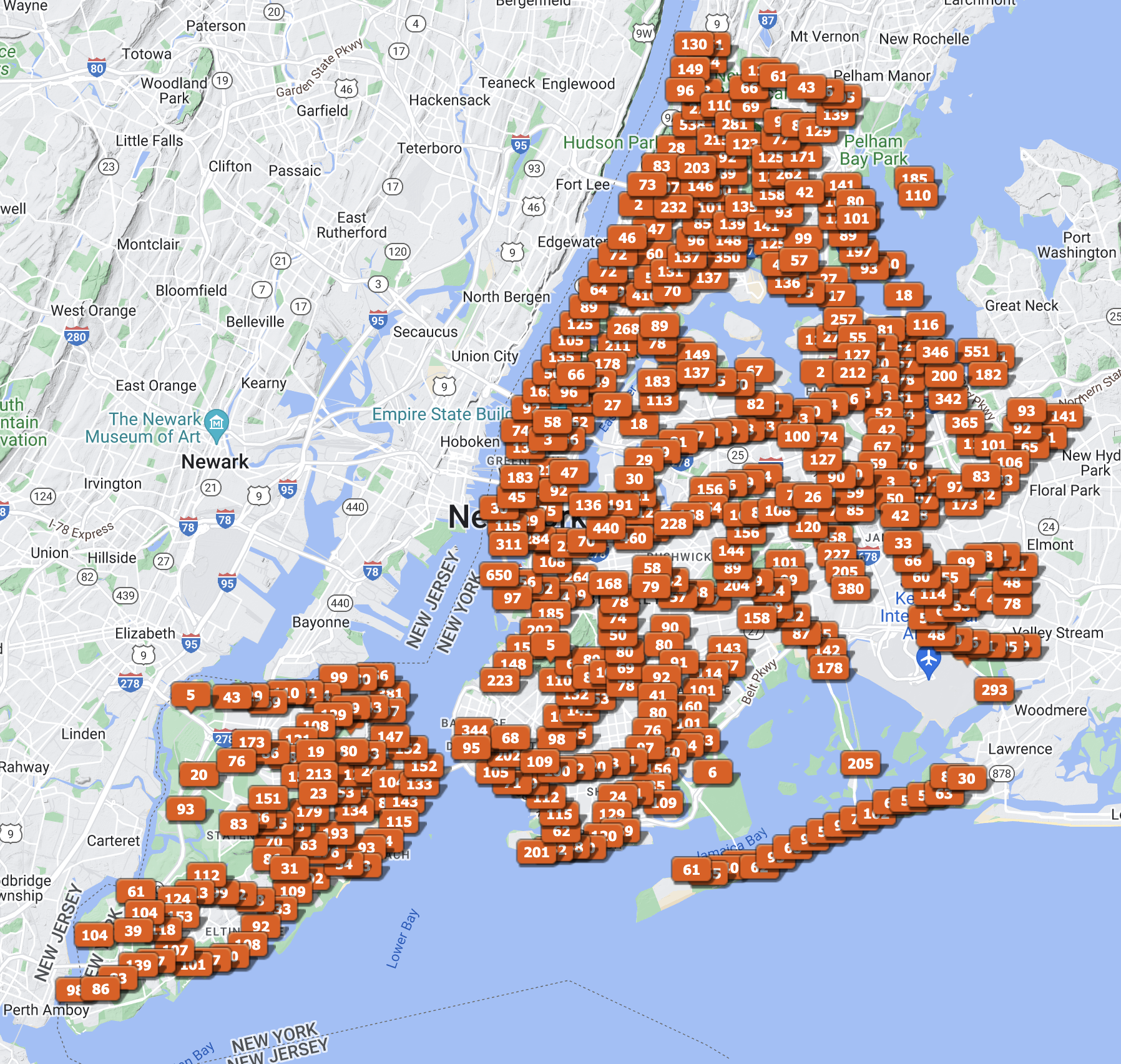
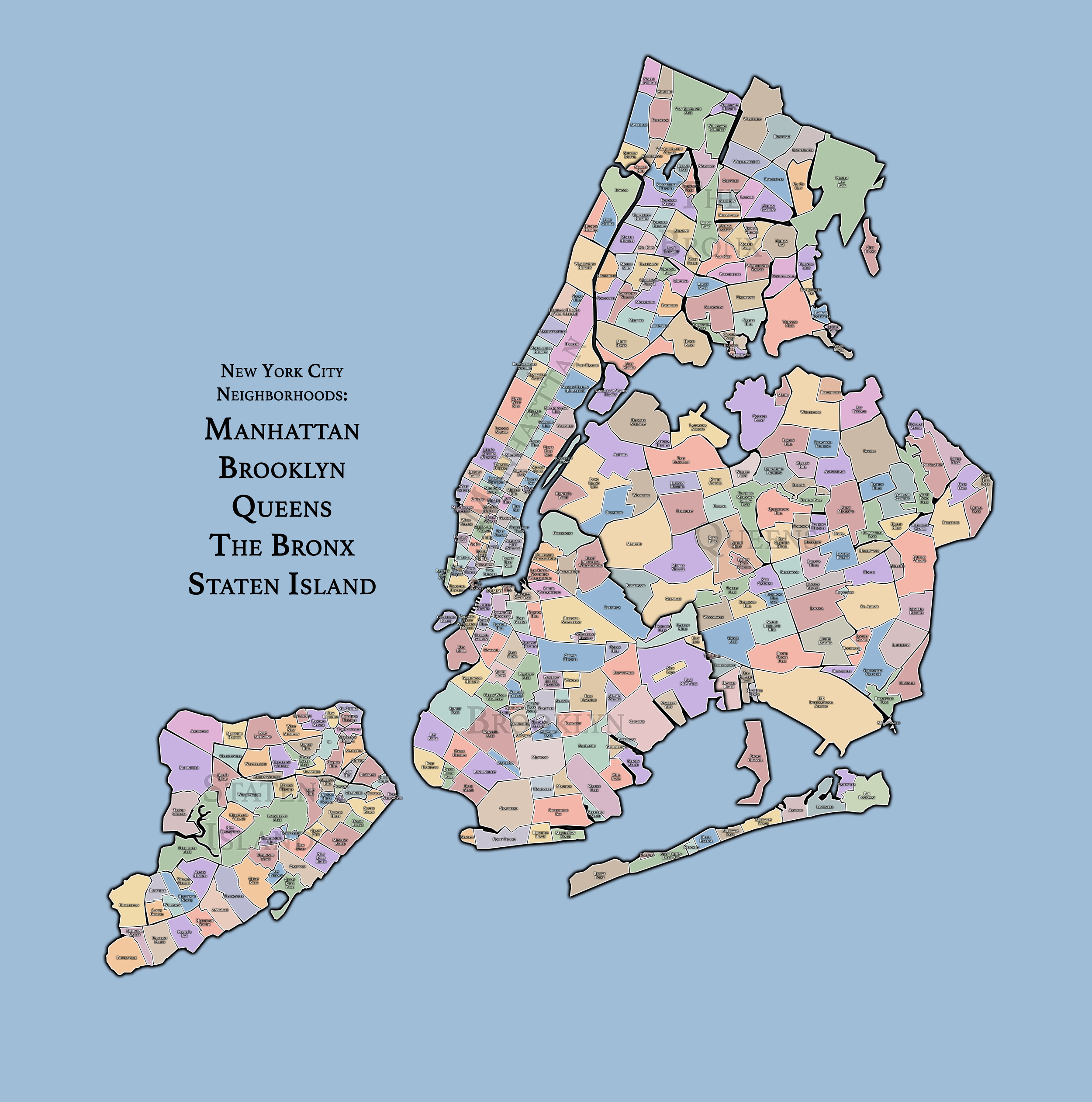
New York City
Use this custom Google map to explore where every neighborhood in all five boroughs of New York City is located.
The Five Boroughs
One of New York City’s unique qualities is its organization in to 5 boroughs: Manhattan, Brooklyn, Queens, The Bronx, and Staten Island. These boroughs are part pragmatic administrative districts, and part vestiges of the region’s past. Each borough is an entire county in New York State - in fact, Brooklyn is, officially, Kings County, while Staten Island is, officially Richmond County. But that’s not the whole story …
Initially, New York City was located on the southern tip of Manhattan (now the Financial District) that was once the Dutch colony of New Amsterdam. Across the East River, another city was rising: Brooklyn. In time, the city planners realized that unification between the rapidly rising cities would create commercial and industrial opportunities - through streamlined administration of the region.
So powerful was the pull of unification between New York and Brooklyn that three more counties were pulled into the unification: The Bronx, Queens, and Staten Island. And on January 1, 1898, the City of New York unified two cities and three counties into one Greater City of New York - containing the five boroughs we know today.
But because each borough developed differently and distinctly until unification, their neighborhoods likewise uniquely developed. Today, there are nearly 390 neighborhoods, each with their own histories, cultures, cuisines, and personalities - and each with residents who are fiercely proud of their corner of The Big Apple.
