WEST NEW BRIGHTON
Staten Island
Geographic Setting
Bounded by Ridgewood Place and Bement Avenue to the east, Forest Avenue to the south, Clove Road to the west, and the Kill Van Kull to the north, with an extension eastward along Castleton Avenue to Ridgewood Place, West New Brighton lies at the historic and geographic heart of Staten Island’s North Shore. Nestled between Silver Lake and the Kill Van Kull, and bordered by Castleton Corners, Clove Valley, and Livingston, it is one of Staten Island’s most architecturally rich and historically significant neighborhoods.
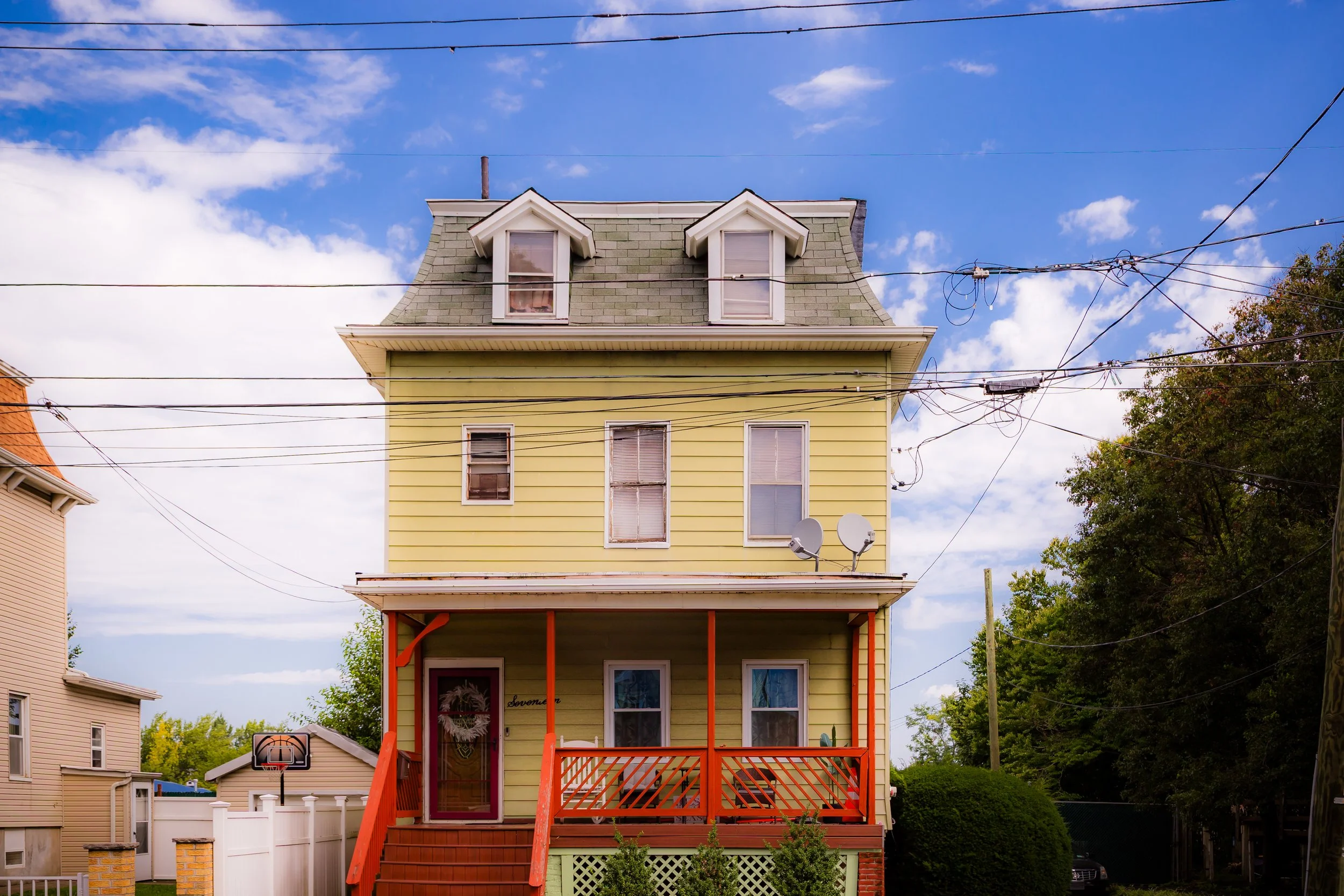
The landscape slopes gently from the wooded uplands near Clove Lakes Park toward the industrial waterfront along the Kill Van Kull, creating a district where natural beauty, civic institutions, and working-class industry have coexisted for nearly two centuries. Today, West New Brighton’s tree-lined avenues—Castleton, Bement, and Henderson among them—are lined with Victorian homes, churches, and schools that evoke its 19th-century origins as a prosperous commuter suburb. It remains one of Staten Island’s most characteristic neighborhoods: diverse, historic, and deeply connected to the borough’s identity.
Etymology
The name West New Brighton reflects both continuity and expansion. It was derived from New Brighton, the neighboring community to the east, which was founded in the 1830s as one of America’s first planned seaside resorts. As settlement expanded inland and westward from the original New Brighton waterfront, the area became known informally as “the western part of New Brighton,” or West New Brighton. The name appeared officially in maps and municipal documents by the mid-19th century.
“Brighton” itself—borrowed from the famed English seaside resort—conveyed refinement and recreation, and its adoption on Staten Island was meant to evoke the same sense of elegance and promise. West New Brighton thus embodied the ambition of a growing borough: a place of comfortable homes, civic virtue, and access to both city and sea.
The Neighborhood
Origins through the 19th Century
Before its urban development, the area that became West New Brighton was part of the sprawling estates and farms that characterized Staten Island’s North Shore in the 18th and early 19th centuries. Fertile soil and proximity to the Kill Van Kull made it ideal for agriculture and trade. Wealthy families, including the Vanderbilts and Wards, established country residences here, drawn by the combination of fresh air, rolling hills, and proximity to the ferry terminals at St. George and Tompkinsville.
The transformation from rural land to residential village began in the 1830s and 1840s, when the success of neighboring New Brighton’s real estate ventures inspired similar subdivisions inland. Streets such as Castleton Avenue and Bement Avenue were laid out, connecting farms and estates with emerging roads to St. George. By the 1850s, West New Brighton had developed a distinct identity: a tranquil, tree-shaded suburb of stately homes, schools, and small shops.
Religious and civic life grew quickly alongside residential expansion. The First Baptist Church of Staten Island (1854) and St. Peter’s Roman Catholic Church (built in nearby New Brighton in 1839) served the community’s spiritual needs. The Staten Island Cricket Club, founded in 1872, established grounds at Walker Park, making West New Brighton one of the oldest centers of organized cricket in the United States—a legacy that endures to this day.
By the late 19th century, the neighborhood’s character was fully formed: a balanced mix of affluent estates and modest cottages, anchored by institutions like Curtis High School (1904) and connected by trolley lines that linked it to the rest of the island. Its graceful streets and proximity to both parks and the harbor made it a model of suburban living in the Victorian era.
Early 20th Century: Community, Commerce, and Civic Life
The early 20th century saw West New Brighton mature into a bustling and self-contained community. Its commercial heart centered along Forest Avenue, which by the 1910s had become one of Staten Island’s liveliest shopping corridors. Grocers, bakeries, haberdasheries, and small theaters lined the avenue, serving the growing population of middle-class families who lived in the surrounding blocks.
The neighborhood’s architecture reflected its diverse population: Queen Anne and Colonial Revival homes stood beside Italianate rowhouses and late Victorian cottages. Immigrant families from Italy, Ireland, and Germany joined earlier English and Dutch settlers, bringing with them new traditions and enterprises. Civic associations, fraternal halls, and labor organizations flourished, reflecting both the area’s industrial employment base along the Kill Van Kull and its strong sense of local pride.
Cultural and recreational life revolved around community institutions. Walker Park (home of the Staten Island Cricket Club) hosted athletic matches and public events, while Clove Lakes Park, completed in the 1920s, provided wooded trails, ponds, and skating rinks just west of the neighborhood. Schools such as P.S. 45 and Curtis High School became anchors of generational continuity, serving families whose roots in West New Brighton stretched back decades.
The waterfront along the Kill Van Kull, though increasingly industrial, remained vital to the local economy. Ship repair yards, warehouses, and small factories provided employment, while residential streets just inland maintained their suburban calm. This juxtaposition—of working harbor and leafy neighborhood—defined West New Brighton’s character as a place where industry and domestic life coexisted in balanced proximity.

West New Brighton Video Coming Soon

Mid–Late 20th Century: Transition and Resilience
The mid-20th century brought both challenges and renewal. The decline of Staten Island’s manufacturing sector after World War II led to job losses along the Kill Van Kull, while suburban expansion elsewhere on the island drew younger families southward. Some of the neighborhood’s grandest Victorian homes fell into disrepair or were subdivided into apartments.
Yet even amid decline, West New Brighton’s core community remained strong. Its central location, sturdy housing stock, and proximity to schools and parks made it an enduringly desirable place to live. Civic organizations such as the West Brighton Community Local Development Corporation (LDC), formed in the 1970s, worked to preserve the neighborhood’s character and assist small businesses.
The city’s investment in public housing—most notably the West Brighton Houses, completed in the 1950s—brought demographic diversity and new social dynamics to the area. Community leaders and faith-based organizations worked tirelessly to bridge divides and revitalize the neighborhood’s civic life. Throughout the 1980s and 1990s, Forest Avenue reemerged as a vital commercial strip, buoyed by family-run shops and restaurants that reflected the borough’s changing demographics.
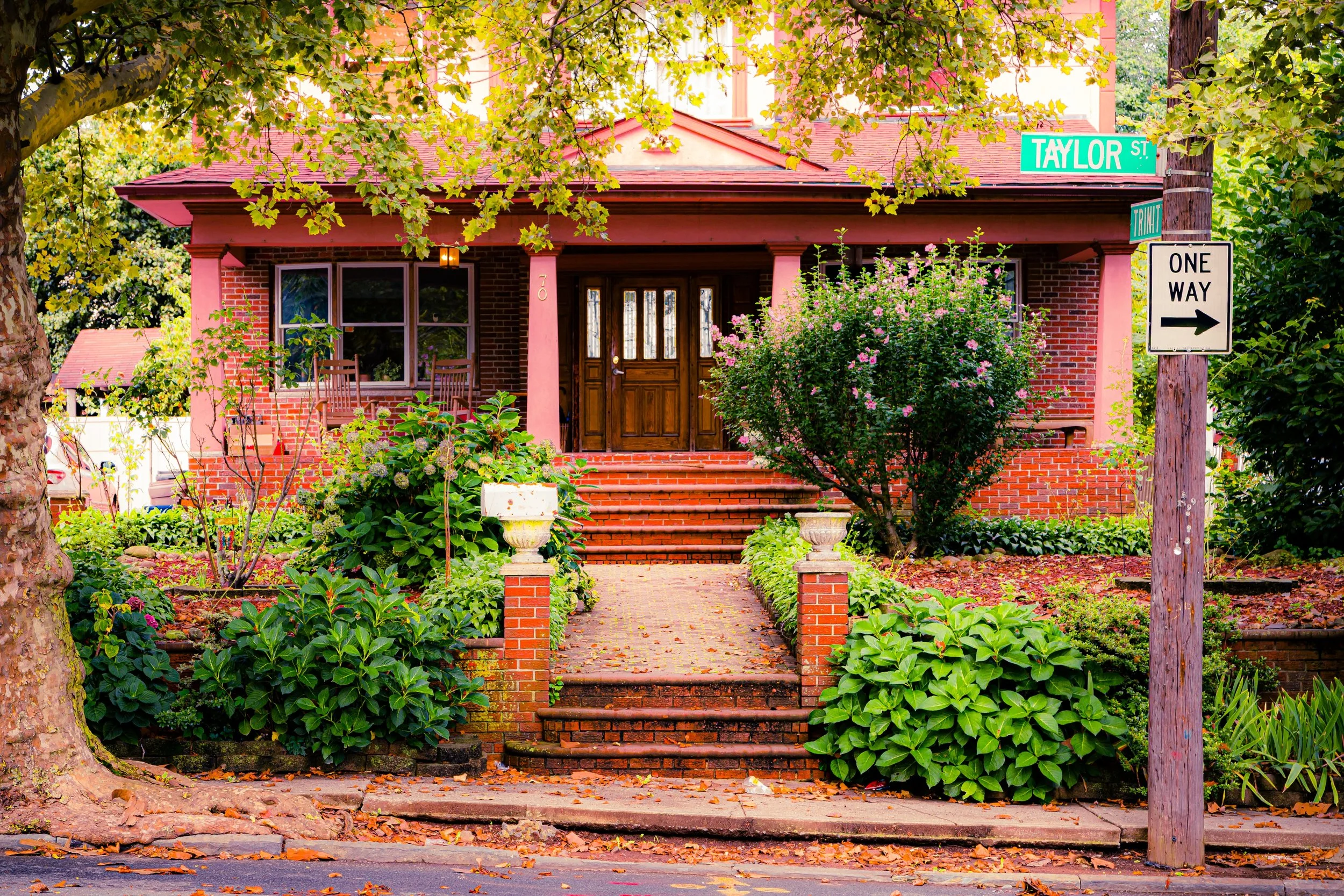
Preservationists also began to recognize the neighborhood’s architectural significance. Many of its late 19th- and early 20th-century structures—particularly along Bement Avenue, Castleton Avenue, and Henderson Avenue—became the focus of local landmarking efforts. Together, these streets preserve one of the most complete ensembles of Victorian-era residential architecture on Staten Island.
21st Century: Heritage, Diversity, and Everyday Vitality
In the 21st century, West New Brighton stands as one of Staten Island’s most dynamic and historically resonant neighborhoods. Its mix of historic homes, cultural institutions, and urban conveniences makes it a microcosm of the borough itself. Longtime families live beside newcomers from Africa, Latin America, and the Caribbean, contributing to one of the island’s most culturally diverse populations.
The neighborhood’s proximity to Clove Lakes Park, Silver Lake Park, and Snug Harbor Cultural Center makes it a hub for recreation and culture. The historic cricket grounds at Walker Park continue to host matches each summer, while new cafés and small businesses have revitalized commercial corridors along Forest and Castleton Avenues. The area’s schools—P.S. 45, I.S. 61, and Curtis High School—remain vital community anchors, blending tradition with modern education.
Architectural preservation remains central to West New Brighton’s identity. Many Victorian homes have been restored, and community associations actively promote historical awareness. The neighborhood’s tree-lined streets and broad sidewalks have regained much of their early 20th-century charm, while modern infrastructure projects have improved traffic flow and park accessibility.
Perhaps most notably, West New Brighton continues to balance its dual heritage: it is both a residential haven and a living reminder of Staten Island’s industrial and civic evolution. Its waterfront legacy endures through the piers and depots along the Kill Van Kull, even as its upland streets hum with family life and local enterprise.
West New Brighton Photo Gallery
Spirit and Legacy
The spirit of West New Brighton lies in its continuity—its ability to evolve without erasing its past. From 19th-century village to 21st-century neighborhood, it has remained grounded in community, architecture, and accessibility. Its streets tell the story of Staten Island’s transformation: from farmland to suburb, from shipyard to civic hub, from insular village to multicultural tapestry.
Its legacy endures in the elegance of its old homes, the laughter in its parks, and the steadfastness of its residents. West New Brighton stands as the beating heart of Staten Island’s North Shore—a neighborhood that has seen the tides of history rise and fall along the Kill Van Kull, yet continues to embody the island’s enduring soul.
New York City
Use this custom Google map to explore where every neighborhood in all five boroughs of New York City is located.
The Five Boroughs
One of New York City’s unique qualities is its organization in to 5 boroughs: Manhattan, Brooklyn, Queens, The Bronx, and Staten Island. These boroughs are part pragmatic administrative districts, and part vestiges of the region’s past. Each borough is an entire county in New York State - in fact, Brooklyn is, officially, Kings County, while Staten Island is, officially Richmond County. But that’s not the whole story …
Initially, New York City was located on the southern tip of Manhattan (now the Financial District) that was once the Dutch colony of New Amsterdam. Across the East River, another city was rising: Brooklyn. In time, the city planners realized that unification between the rapidly rising cities would create commercial and industrial opportunities - through streamlined administration of the region.
So powerful was the pull of unification between New York and Brooklyn that three more counties were pulled into the unification: The Bronx, Queens, and Staten Island. And on January 1, 1898, the City of New York unified two cities and three counties into one Greater City of New York - containing the five boroughs we know today.
But because each borough developed differently and distinctly until unification, their neighborhoods likewise uniquely developed. Today, there are nearly 390 neighborhoods, each with their own histories, cultures, cuisines, and personalities - and each with residents who are fiercely proud of their corner of The Big Apple.


