
AUBURNDALE
Queens
Geographic Setting
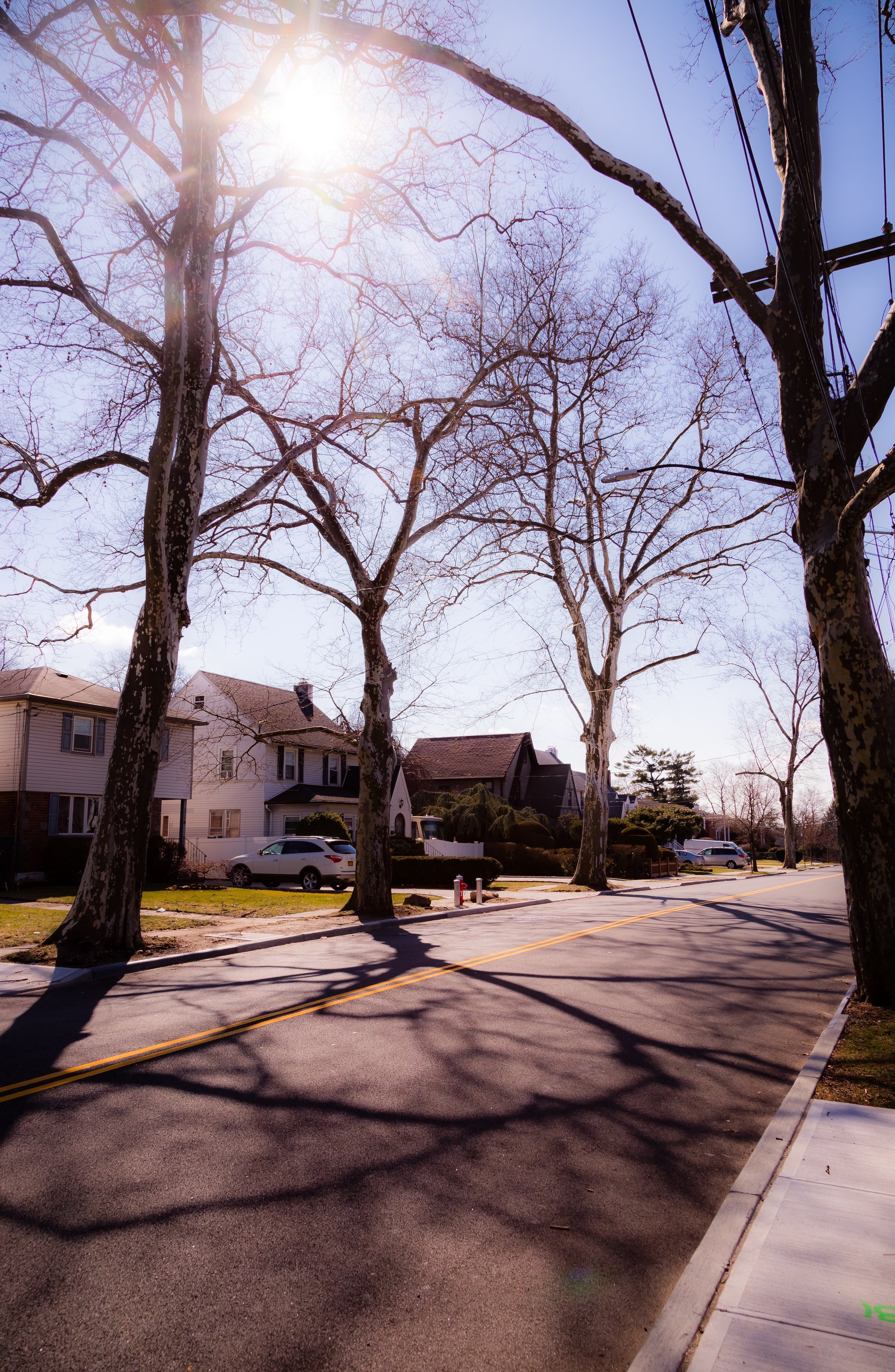
Bounded by 162nd Street to the west, Francis Lewis Boulevard to the east, 47th Avenue and Pidgeon Meadow Road to the south, and Crocheron Avenue to the north, Auburndale lies within the heart of northeastern Queens—a tranquil residential enclave set between Murray Hill to the west and Bayside to the east. The neighborhood’s defining character is one of calm continuity: tree-lined streets, single-family homes with front lawns, and an almost suburban sense of quiet that belies its proximity to Midtown Manhattan. The Long Island Rail Road’s Auburndale Station, located along Northern Boulevard near 192nd Street, anchors the community and provides direct commuter access to the city while reinforcing its long-standing identity as a “railroad suburb.”
Topographically, Auburndale rests on the gentle northward slope that descends toward Little Neck Bay. Its well-drained soil and early 20th-century street plan created a landscape ideal for detached housing, with wide blocks framed by maples, sycamores, and elms planted during the borough’s early development boom. Francis Lewis Boulevard and Utopia Parkway serve as the neighborhood’s major traffic corridors, while Crocheron Avenue, 35th Avenue, and 48th Avenue carry its internal rhythm of quiet residential life. The result is a cohesive and enduring environment—verdant, modest, and distinctly middle-class.
Etymology and Origins
The name “Auburndale” was coined in the late 19th century by L. H. Green, a developer and entrepreneur from Massachusetts who sought to evoke the pastoral charm of Auburn, Massachusetts, near his birthplace. In 1901, Green purchased tracts of farmland between Bayside and Flushing and subdivided them into residential lots, marketing the area as an ideal commuter suburb connected by the Long Island Rail Road’s Port Washington Branch. The name “Auburndale” was chosen to convey rural beauty, modern convenience, and refinement—qualities that appealed to New Yorkers seeking respite from the congestion of the urban core.
Prior to development, the area formed part of the historic Town of Flushing, whose farmlands and meadows stretched toward the bay. Dutch settlers had arrived here in the 17th century, establishing homesteads along Flushing Creek and Pidgeon Meadow Road, the latter named for the once-abundant passenger pigeons that flocked to the area’s wetlands. Through the 19th century, the land was worked by generations of farmers who supplied produce to the growing markets of Brooklyn and Manhattan. The arrival of the railroad in 1854 set in motion a transformation that would ultimately define Auburndale’s modern identity: a shift from field to front lawn.
The Neighborhood
19th Century: From Farmland to Suburban Vision
In the latter half of the 19th century, northeastern Queens entered an era of rapid transition. The completion of the Whitestone Branch of the Long Island Rail Road and improved road connections to Flushing Village brought the once-isolated farmland within commuting range of New York City. Developers like Green capitalized on this access, subdividing estates into gridded plots and constructing the first homes around Station Road (later 35th Avenue). Promotional brochures promised “fresh air, fertile soil, and forty minutes to Manhattan,” an irresistible formula for middle-class families seeking both independence and connection.
The name “Auburndale” began appearing on maps by the 1890s, marking the area’s formal emergence as a community distinct from neighboring Flushing. Early residents—largely professionals, educators, and small business owners—formed civic associations that petitioned for sidewalks, gas lamps, and school construction. The Auburndale Improvement Society, established around 1905, symbolized the neighborhood’s ethos of order, self-sufficiency, and neighborly cooperation.
Early 20th Century: The Commuter Suburb Comes of Age
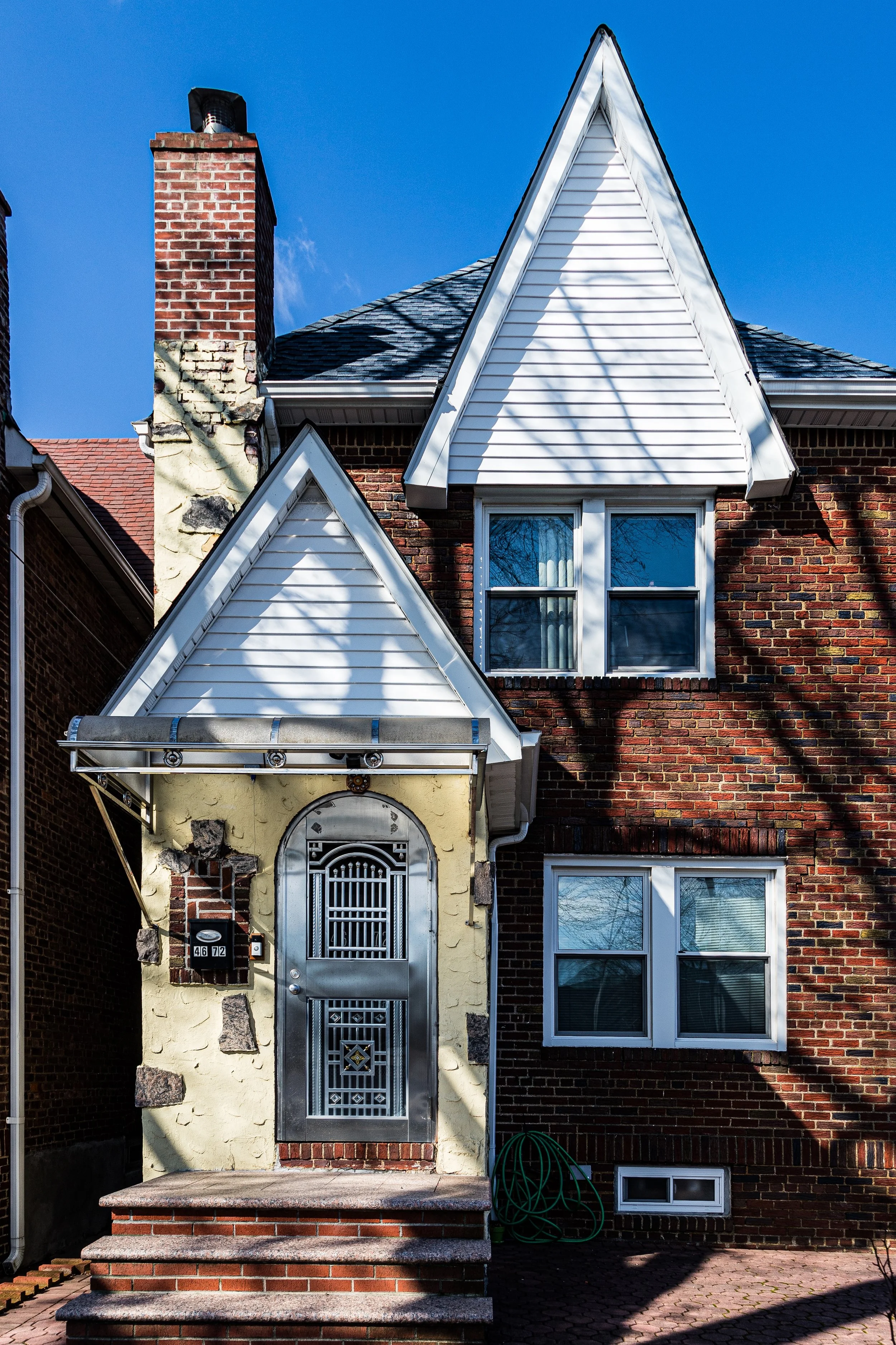
The first decades of the 20th century saw Auburndale mature into a stable, commuter-oriented enclave. The Auburndale LIRR Station, opened in 1901, served as the catalyst for development, spurring the construction of Craftsman- and Tudor-style homes with pitched roofs, porches, and front gardens. The neighborhood’s street grid was carefully planned to ensure generous setbacks and tree-lined continuity, setting it apart from denser sections of western Queens.
During the 1920s and 1930s, the district experienced steady growth as new families—many of Irish, Italian, and Jewish descent—moved from the city’s inner boroughs. Northern Boulevard became the main commercial spine, lined with grocers, tailors, and delicatessens, while churches such as St. Kevin’s Roman Catholic Church (founded 1920s) and Auburndale Presbyterian Church established the spiritual and social core of the neighborhood. The rise of the automobile expanded mobility, but Auburndale retained its commuter ethos; residents prized the convenience of rail access to Manhattan while enjoying the rhythms of suburban domestic life.
Auburndale Video Coming Soon
Mid–Late 20th Century: Preservation and Continuity
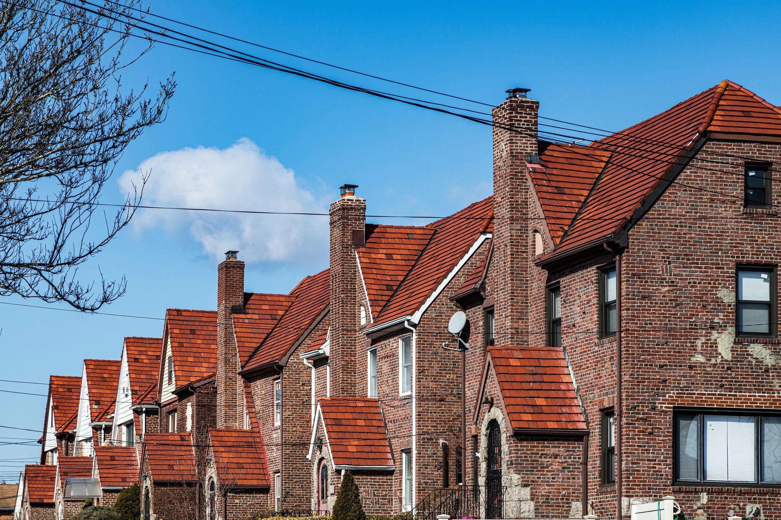
The mid-20th century brought both change and resilience. The postwar housing boom introduced small brick ranches and Cape Cod–style homes alongside older Tudors and Colonials, blending eras into a cohesive architectural patchwork. The Grand Central Parkway and Long Island Expressway, constructed just to the south, enhanced connectivity but also underscored Auburndale’s role as a buffer between the dense urbanity of Flushing and the suburban sprawl of eastern Queens.
Through the 1950s–1970s, Auburndale remained solidly middle-class and remarkably stable, even as neighboring areas experienced rapid demographic shifts. The neighborhood’s civic organizations worked to maintain zoning protections that preserved its low-rise, residential scale. The establishment of Francis Lewis High School (1960) and nearby P.S. 32 reinforced its reputation as a family-oriented community with strong educational anchors. During this era, the population diversified modestly, with Greek, Chinese, and Korean families joining earlier European residents, foreshadowing the multicultural mosaic that would later define Queens.
21st Century: Diversity and Suburban Urbanity
In the 2000s and 2010s, Auburndale continued to evolve while preserving its foundational character. Rising housing prices across New York led to renewed appreciation for the neighborhood’s calm streets, excellent schools, and proximity to transit. Many of its early 20th-century homes have been restored or modestly expanded, though residents and preservation advocates remain vigilant against overdevelopment. The Auburndale Improvement Association, one of the oldest continuous civic groups in Queens, remains active in zoning and beautification efforts.
Today, Auburndale reflects the global diversity that defines modern Queens. Along Northern Boulevard, Korean bakeries, Chinese markets, Italian pizzerias, and Latin American cafés coexist within blocks of one another, serving a population as varied as the city itself. Yet the essential rhythm of the neighborhood remains unchanged: quiet mornings of commuters walking to the station, children biking along tree-shaded streets, and the evening hum of trains gliding past backyards as lights flicker on across the gentle grid.
Auburndale Photo Gallery
Spirit and Legacy
Auburndale’s enduring spirit lies in its balance between city and suburb—a landscape designed for peace without isolation. Built on farmland and vision, it remains a model of livable density: walkable, leafy, and deeply residential. Its history tells of aspiration achieved not through grandeur but through stewardship—the slow, deliberate cultivation of community across generations.
New York City
Use this custom Google map to explore where every neighborhood in all five boroughs of New York City is located.
The Five Boroughs
One of New York City’s unique qualities is its organization in to 5 boroughs: Manhattan, Brooklyn, Queens, The Bronx, and Staten Island. These boroughs are part pragmatic administrative districts, and part vestiges of the region’s past. Each borough is an entire county in New York State - in fact, Brooklyn is, officially, Kings County, while Staten Island is, officially Richmond County. But that’s not the whole story …
Initially, New York City was located on the southern tip of Manhattan (now the Financial District) that was once the Dutch colony of New Amsterdam. Across the East River, another city was rising: Brooklyn. In time, the city planners realized that unification between the rapidly rising cities would create commercial and industrial opportunities - through streamlined administration of the region.
So powerful was the pull of unification between New York and Brooklyn that three more counties were pulled into the unification: The Bronx, Queens, and Staten Island. And on January 1, 1898, the City of New York unified two cities and three counties into one Greater City of New York - containing the five boroughs we know today.
But because each borough developed differently and distinctly until unification, their neighborhoods likewise uniquely developed. Today, there are nearly 390 neighborhoods, each with their own histories, cultures, cuisines, and personalities - and each with residents who are fiercely proud of their corner of The Big Apple.


