BAY RIDGE
Brooklyn
Geographic Setting
Bounded by 86th Street to the south and 65th Street to the north, with the Narrows and Upper New York Bay to the west and the Gowanus Expressway to the east, Bay Ridge occupies the southwestern edge of Brooklyn—a bluff of old glacial moraine overlooking the harbor, where the land meets the sea in a panorama of bridges, ships, and sunsets. Its topography distinguishes it from much of flatland Brooklyn: rolling hills descend toward the water, where Shore Road Park and the Belt Parkway Promenade trace the shoreline with continuous greenery and views across the Narrows to Staten Island.
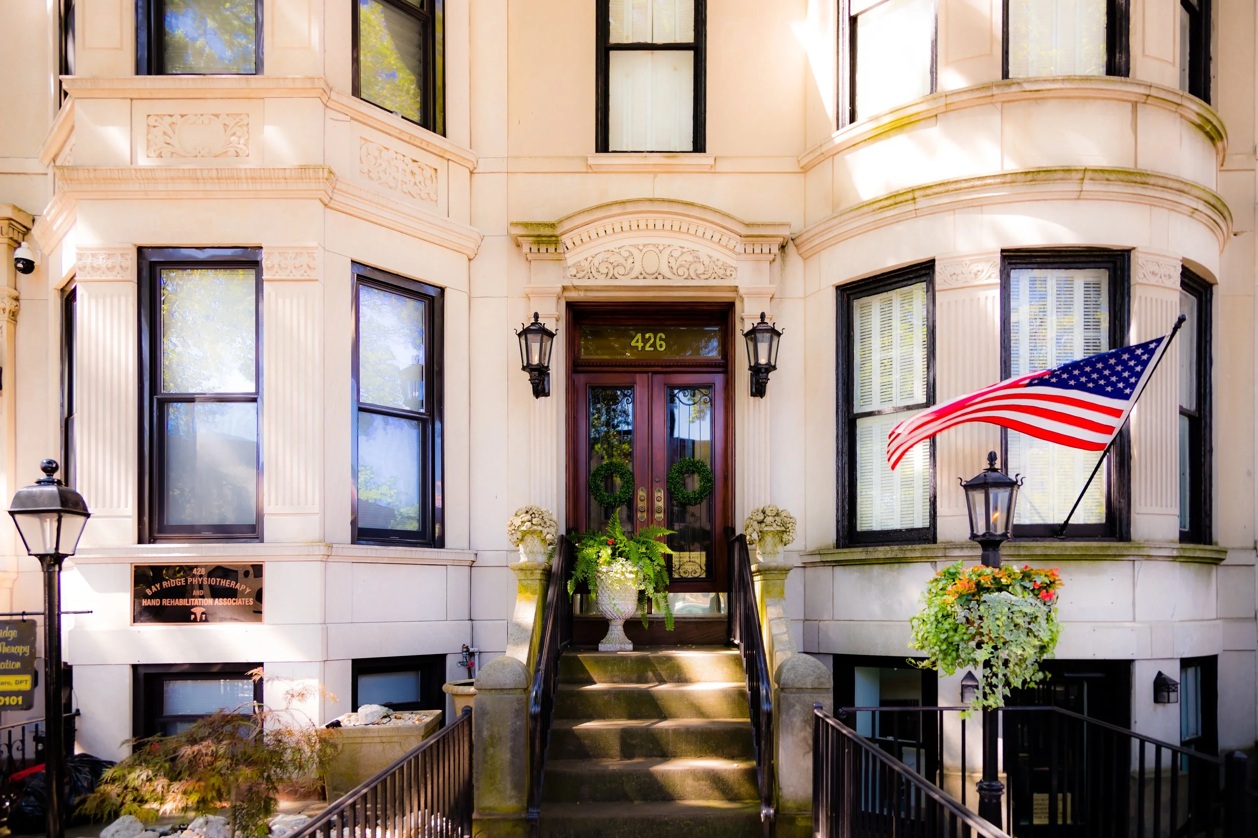
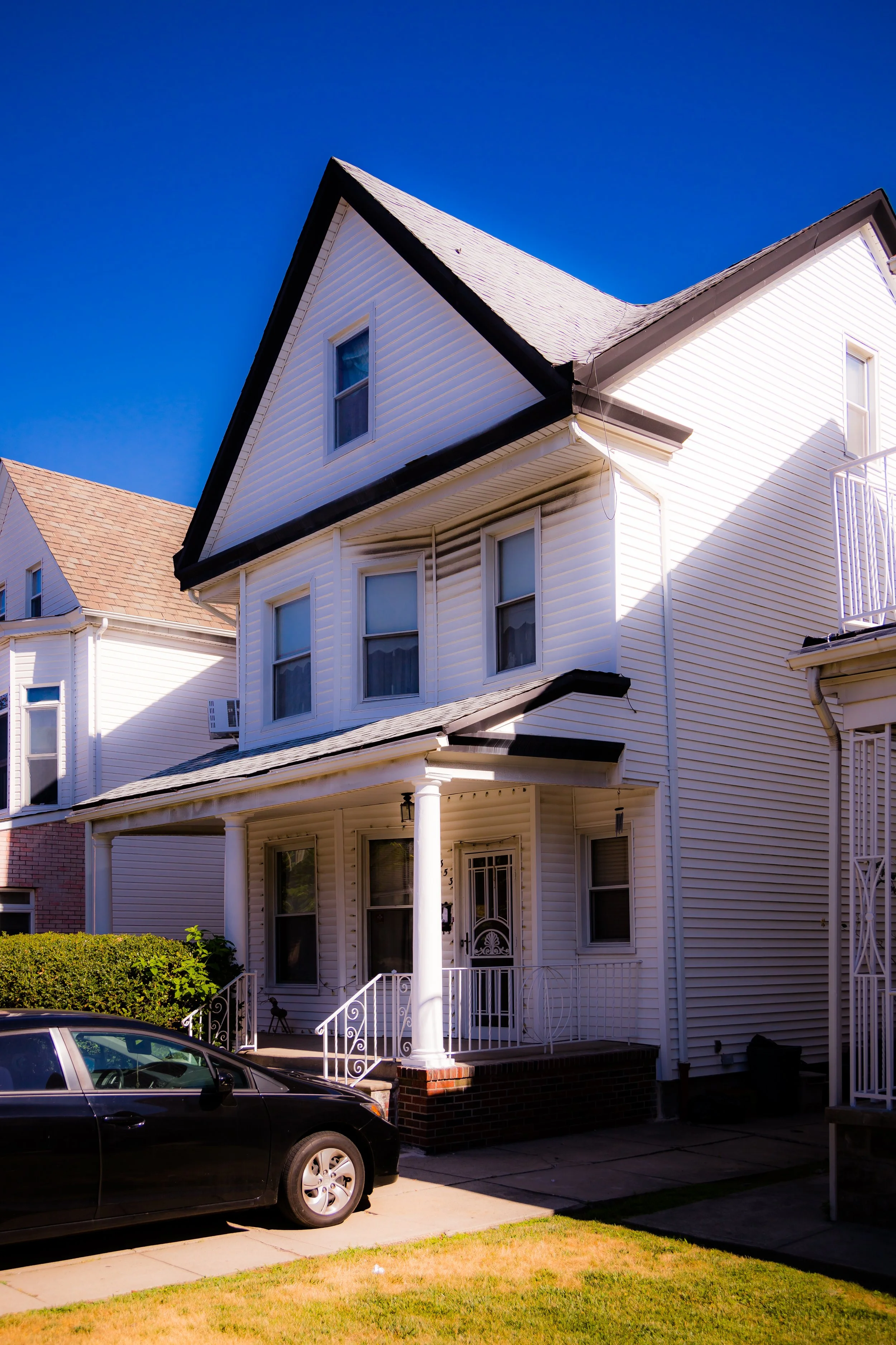
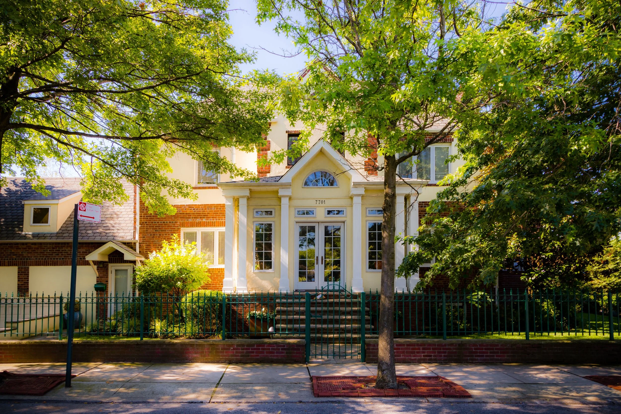
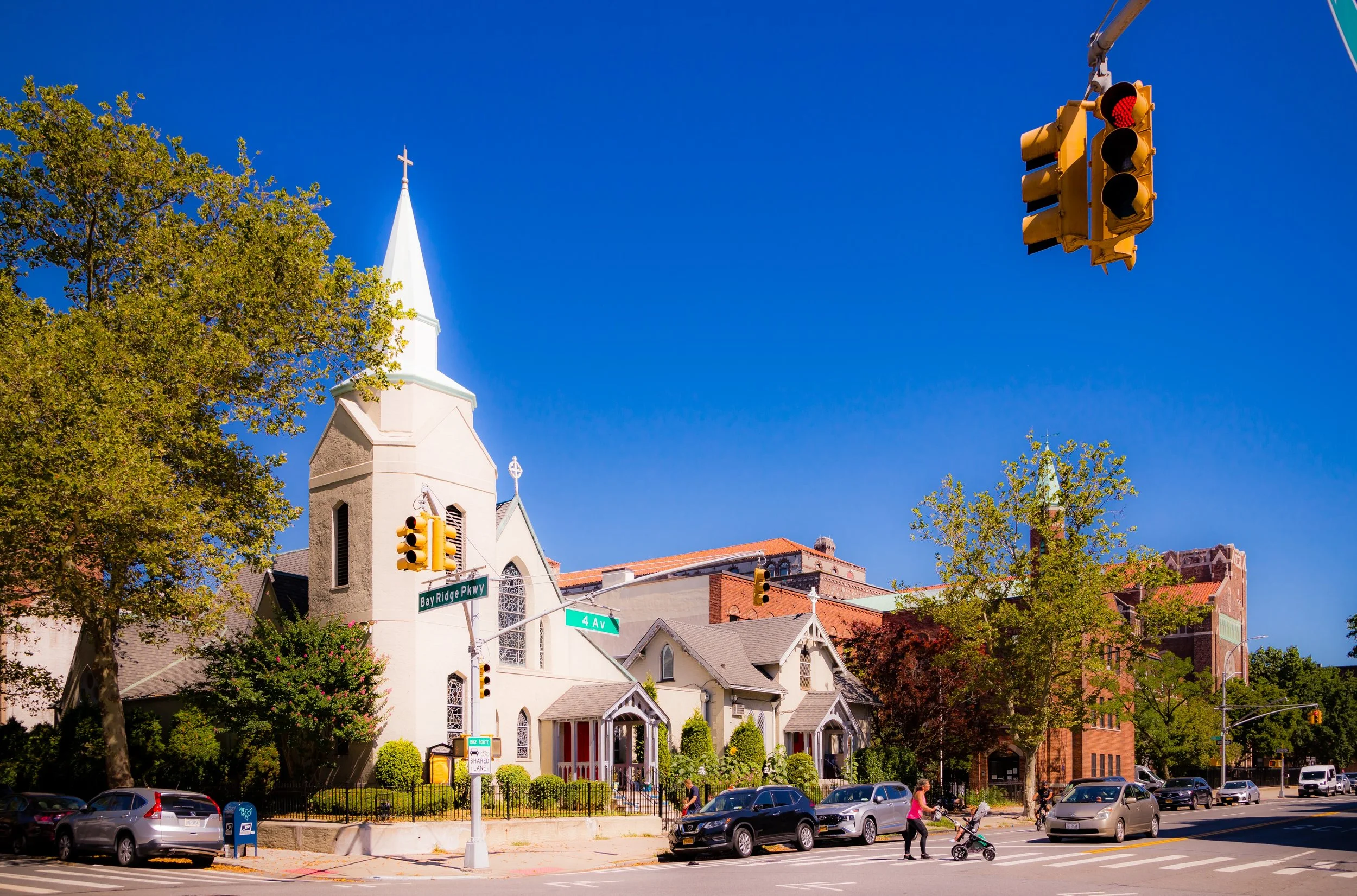
Within these bounds, the neighborhood is a tapestry of broad avenues, low-rise homes, and civic pride. Third Avenue, the bustling main street, pulses with cafés, butchers, and bakeries; Fifth Avenue hums with smaller shops and multicultural restaurants. Residential blocks along Colonial Road, Bay Ridge Parkway (75th Street), and Ovington Avenue reveal a remarkable variety of architecture—Victorian villas, limestone rowhouses, and 20th-century co-ops—reflecting the district’s evolution from seaside suburb to enduring middle-class enclave.
Etymology and Origins
The name “Bay Ridge” dates to 1853, coined for its topographical position—a ridge above the bay. Before that, the area was known as Yellow Hook, a reference to the golden tint of its soil. After the yellow fever epidemics of the 1840s, however, residents sought a new, healthier-sounding name. The rechristened “Bay Ridge” perfectly captured the neighborhood’s geography: its high ground commanding views over the harbor’s channel, known as the Narrows, where the Atlantic Ocean enters New York Bay.
The land originally formed part of the Town of New Utrecht, one of the six Dutch towns of Kings County, settled in the 1650s. Its earliest inhabitants were Dutch and later English farmers, whose homesteads and orchards stretched inland toward today’s 13th Avenue. By the mid-19th century, the completion of the Third Avenue horsecar line and steam ferry service transformed this quiet agricultural outpost into a summer retreat for New Yorkers seeking sea air and open vistas.
The Neighborhood
Mid–Late 20th Century: The Bridge and the Boulevard
The most dramatic change to Bay Ridge’s landscape came with the construction of the Verrazzano-Narrows Bridge (completed 1964) and the Gowanus/Belt Parkway system, which redefined the neighborhood’s edges. While the bridge became a new global symbol of New York, its approach ramps cut through several blocks near Shore Road, displacing homes but also linking Bay Ridge directly to Staten Island and beyond.
Despite the upheaval, Bay Ridge retained its stability through decades when other parts of the city struggled. Italian-American families remained dominant through the 1970s, joined by Irish, Greek, and Middle Eastern residents. Third Avenue’s commercial corridor thrived with small businesses—delis, florists, tailors—many family-owned for generations. Block associations and civic councils kept streets clean, parks maintained, and schools strong, fostering a sense of continuity that would make Bay Ridge one of the most tightly knit neighborhoods in New York.
By the 1980s–1990s, new immigrants—particularly from the Middle East, China, and Eastern Europe—added layers of culture without eroding the neighborhood’s identity. Arabic restaurants, Polish bakeries, and Asian grocers joined the old Italian cafés, creating a quiet cosmopolitanism grounded in tradition.
21st Century: Tradition Meets Transformation
Today, Bay Ridge stands as one of the city’s most balanced neighborhoods—prosperous yet accessible, diverse yet cohesive. The housing stock remains predominantly low-rise, with co-ops, two-family homes, and small apartment buildings preserving a human scale. Along the Shore Road Promenade, joggers, cyclists, and families enjoy views of the harbor’s shipping lanes, framed by the shadow of the Verrazzano’s massive span.
The community’s civic life thrives through organizations such as the Bay Ridge Community Council, the Arab American Association of New York, and the Merchants of Third Avenue, reflecting a shared investment in public life across generations. In local schools, churches, mosques, and parks, the neighborhood’s mosaic continues to expand without losing its cohesion.
Rising real estate prices have brought modernization—renovated brownstones, upscale cafés—but Bay Ridge’s ethos remains proudly rooted in authenticity. It is still a place where neighbors greet each other by name, where weekend block parties spill onto tree-lined streets, and where the rhythms of the city slow just enough to breathe.
Spirit and Legacy
Bay Ridge’s legacy is continuity with grace—a community that has absorbed the tides of history while holding fast to its shoreline soul. From the Dutch farms of New Utrecht to the Verrazzano’s steel cables, from Scandinavian steeples to Arabic calligraphy in shop windows, the neighborhood reflects Brooklyn’s evolution writ small: rooted, resilient, and richly human.
Neighborhood Video Coming Soon
Mid–Late 20th Century: The Bridge and the Boulevard
The most dramatic change to Bay Ridge’s landscape came with the construction of the Verrazzano-Narrows Bridge (completed 1964) and the Gowanus/Belt Parkway system, which redefined the neighborhood’s edges. While the bridge became a new global symbol of New York, its approach ramps cut through several blocks near Shore Road, displacing homes but also linking Bay Ridge directly to Staten Island and beyond.
Despite the upheaval, Bay Ridge retained its stability through decades when other parts of the city struggled. Italian-American families remained dominant through the 1970s, joined by Irish, Greek, and Middle Eastern residents. Third Avenue’s commercial corridor thrived with small businesses—delis, florists, tailors—many family-owned for generations. Block associations and civic councils kept streets clean, parks maintained, and schools strong, fostering a sense of continuity that would make Bay Ridge one of the most tightly knit neighborhoods in New York.
By the 1980s–1990s, new immigrants—particularly from the Middle East, China, and Eastern Europe—added layers of culture without eroding the neighborhood’s identity. Arabic restaurants, Polish bakeries, and Asian grocers joined the old Italian cafés, creating a quiet cosmopolitanism grounded in tradition.
21st Century: Tradition Meets Transformation
Today, Bay Ridge stands as one of the city’s most balanced neighborhoods—prosperous yet accessible, diverse yet cohesive. The housing stock remains predominantly low-rise, with co-ops, two-family homes, and small apartment buildings preserving a human scale. Along the Shore Road Promenade, joggers, cyclists, and families enjoy views of the harbor’s shipping lanes, framed by the shadow of the Verrazzano’s massive span.
The community’s civic life thrives through organizations such as the Bay Ridge Community Council, the Arab American Association of New York, and the Merchants of Third Avenue, reflecting a shared investment in public life across generations. In local schools, churches, mosques, and parks, the neighborhood’s mosaic continues to expand without losing its cohesion.
Rising real estate prices have brought modernization—renovated brownstones, upscale cafés—but Bay Ridge’s ethos remains proudly rooted in authenticity. It is still a place where neighbors greet each other by name, where weekend block parties spill onto tree-lined streets, and where the rhythms of the city slow just enough to breathe.
Bay Ridge Photo Gallery
Spirit and Legacy
Bay Ridge’s legacy is continuity with grace—a community that has absorbed the tides of history while holding fast to its shoreline soul. From the Dutch farms of New Utrecht to the Verrazzano’s steel cables, from Scandinavian steeples to Arabic calligraphy in shop windows, the neighborhood reflects Brooklyn’s evolution writ small: rooted, resilient, and richly human.
New York City
Use this custom Google map to explore where every neighborhood in all five boroughs of New York City is located.
The Five Boroughs
One of New York City’s unique qualities is its organization in to 5 boroughs: Manhattan, Brooklyn, Queens, The Bronx, and Staten Island. These boroughs are part pragmatic administrative districts, and part vestiges of the region’s past. Each borough is an entire county in New York State - in fact, Brooklyn is, officially, Kings County, while Staten Island is, officially Richmond County. But that’s not the whole story …
Initially, New York City was located on the southern tip of Manhattan (now the Financial District) that was once the Dutch colony of New Amsterdam. Across the East River, another city was rising: Brooklyn. In time, the city planners realized that unification between the rapidly rising cities would create commercial and industrial opportunities - through streamlined administration of the region.
So powerful was the pull of unification between New York and Brooklyn that three more counties were pulled into the unification: The Bronx, Queens, and Staten Island. And on January 1, 1898, the City of New York unified two cities and three counties into one Greater City of New York - containing the five boroughs we know today.
But because each borough developed differently and distinctly until unification, their neighborhoods likewise uniquely developed. Today, there are nearly 390 neighborhoods, each with their own histories, cultures, cuisines, and personalities - and each with residents who are fiercely proud of their corner of The Big Apple.


