
PORT MORRIS
The Bronx
Geographic Setting
Bounded by the Major Deegan Expressway to the north, the Bruckner Expressway to the northwest, Leggett Avenue to the northeast, Tiffany Street to the east, the East River to the southeast, the Bronx Kill to the south, and the Harlem River to the southwest, Port Morris occupies the southernmost tip of the Bronx—a low-lying industrial peninsula that juts into the confluence of three waterways. It is both the Bronx’s gateway to Manhattan and its oldest true port, a district where maritime geography and urban history have intertwined for nearly two centuries.
The neighborhood’s terrain is defined by its waterfront edges and its proximity to bridges and expressways: the Third Avenue Bridge, Willis Avenue Bridge, and RFK (Triborough) Bridge all converge nearby, linking Port Morris directly to Harlem and Randall’s Island. Within these borders, wide streets like East 138th Street, East 134th Street, and Bruckner Boulevard cut through a landscape of 19th-century warehouses, rail sidings, and converted industrial lofts. The juxtaposition of brick relics, steel bridges, and new creative spaces gives the area its distinctive atmosphere—a mixture of grit, heritage, and rebirth.
Today, Port Morris stands at the intersection of old industry and new identity. Once the Bronx’s maritime engine, it has evolved into a zone of adaptive reuse, where distilleries, galleries, cafés, and design studios coexist with auto shops and freight depots, all under the shadow of the expressways that both isolated and preserved it.
Etymology
The name “Port Morris” derives from Gouverneur Morris Jr., the 19th-century landowner and industrialist who developed the area as a maritime and manufacturing district. Morris, the son of Gouverneur Morris, one of the signers of the U.S. Constitution, inherited vast estates in the Bronx. In the 1840s, he envisioned transforming the swampy southern tip of his holdings into a modern seaport that would serve the city’s growing need for wharves and rail access.
The “Port” in the name reflected both geography and ambition—Morris intended it to rival the docks of Manhattan and Brooklyn. By the mid-19th century, “Port Morris” had entered official usage, denoting the industrial waterfront that carried his name and his entrepreneurial legacy.
The Neighborhood
Origins through the 19th Century
The story of Port Morris begins with the Morris family estate, a colonial-era tract encompassing much of the southern Bronx. By the early 1800s, Gouverneur Morris Jr. recognized the commercial potential of the peninsula’s deepwater frontage along the Harlem and East Rivers. With the rise of maritime trade and the coming of the railroad age, he launched one of the city’s earliest examples of planned industrial development.
In 1842, the New York and Harlem Railroad extended its line into the Bronx, and Morris lobbied for a spur to his docks—making Port Morris the Bronx’s first integrated rail-and-shipping hub. Warehouses, lumberyards, and coal depots soon clustered along East 134th Street and the Harlem River shoreline, creating an early industrial waterfront that predated similar development in Hunts Point and Mott Haven. By the 1870s, the area’s wharves handled coal, stone, and manufactured goods, linking the Bronx to regional commerce via both river and rail.
During this period, residential life was limited to workers’ housing along East 132nd–134th Streets, while the waterfront remained dominated by factories and storage yards. The landscape was crisscrossed by rail lines and canal basins, its horizon filled with smokestacks and cranes—a quintessential 19th-century industrial panorama.
Early 20th Century: Industry and Infrastructure
The early 1900s solidified Port Morris as one of New York’s most important industrial districts. The arrival of the Harlem River Ship Canal (1895) and the creation of Randall’s Island Bridge connections transformed its waterways into strategic shipping routes. Massive brick warehouses and power plants rose along the river, including the Port Morris Branch of the New York Central Railroad, completed in 1905, which provided direct freight service to the Bronx’s factories and yards.
By the 1920s–1930s, the neighborhood thrived as a logistical powerhouse. Bruckner Boulevard (then Eastern Boulevard) connected the docks to the wider Bronx, while the Harlem River Yards and Bronx Terminal Market to the north fed a continuous flow of goods. Companies like American Bank Note, Gotham Gas Light, and Union Railway established facilities nearby, reinforcing the Bronx’s reputation as the “workshop of the city.”
Residential enclaves persisted in the northeastern corner near Tiffany Street, populated by working-class Irish, Italian, and Eastern European families. Taverns, boardinghouses, and corner groceries served dockworkers and machinists who lived within walking distance of the factories. The proximity of industry and community gave Port Morris a distinctive, blue-collar cohesion.
Port Morris Video Coming Soon
Mid–Late 20th Century: Decline, Isolation, and Resilience
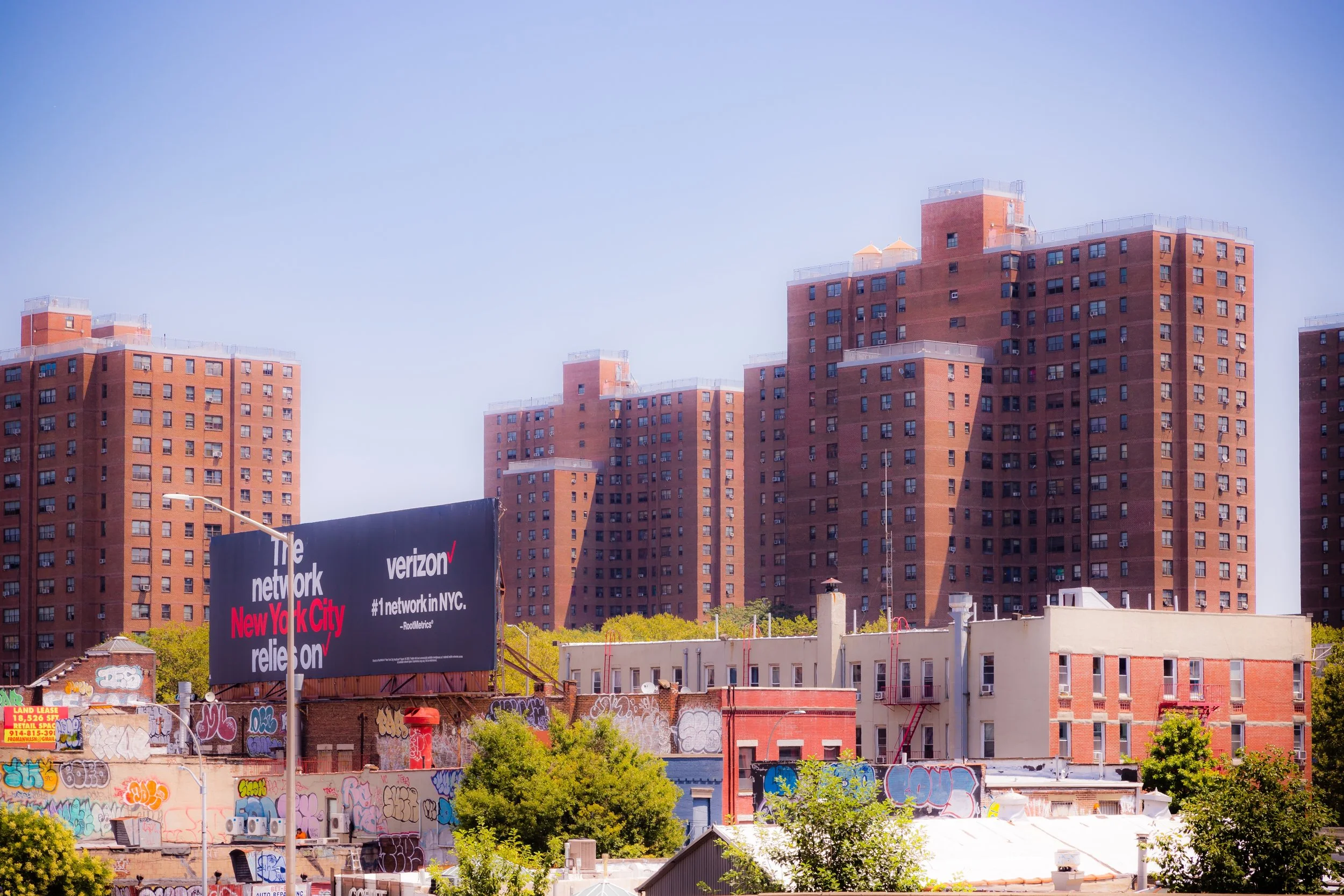
The postwar decades brought both progress and hardship. The construction of the Major Deegan Expressway (1956) and the Bruckner Expressway (1961) reshaped the peninsula, severing it from the rest of the Bronx and accelerating industrial decline. As maritime shipping shifted to containerized ports in New Jersey, the docks of Port Morris fell silent. Many factories closed, and the once-bustling streets grew vacant.
By the 1970s, Port Morris mirrored much of the South Bronx’s decline—abandoned warehouses, illegal dumping, and urban neglect defined its landscape. Yet a handful of industries, especially recycling, metalworking, and construction supply, remained, keeping the district economically alive if physically battered. The small residential pocket near 134th and Cypress Avenues endured through this period, its residents maintaining community ties amid the desolation.
In the 1980s and 1990s, city planners and local organizations began to reimagine the area’s waterfront potential. The Bronx River Alliance and environmental groups launched clean-up initiatives, while artists and small manufacturers—priced out of Manhattan—discovered Port Morris’s cavernous brick buildings and affordable rents.
21st Century: Revival and Reinvention
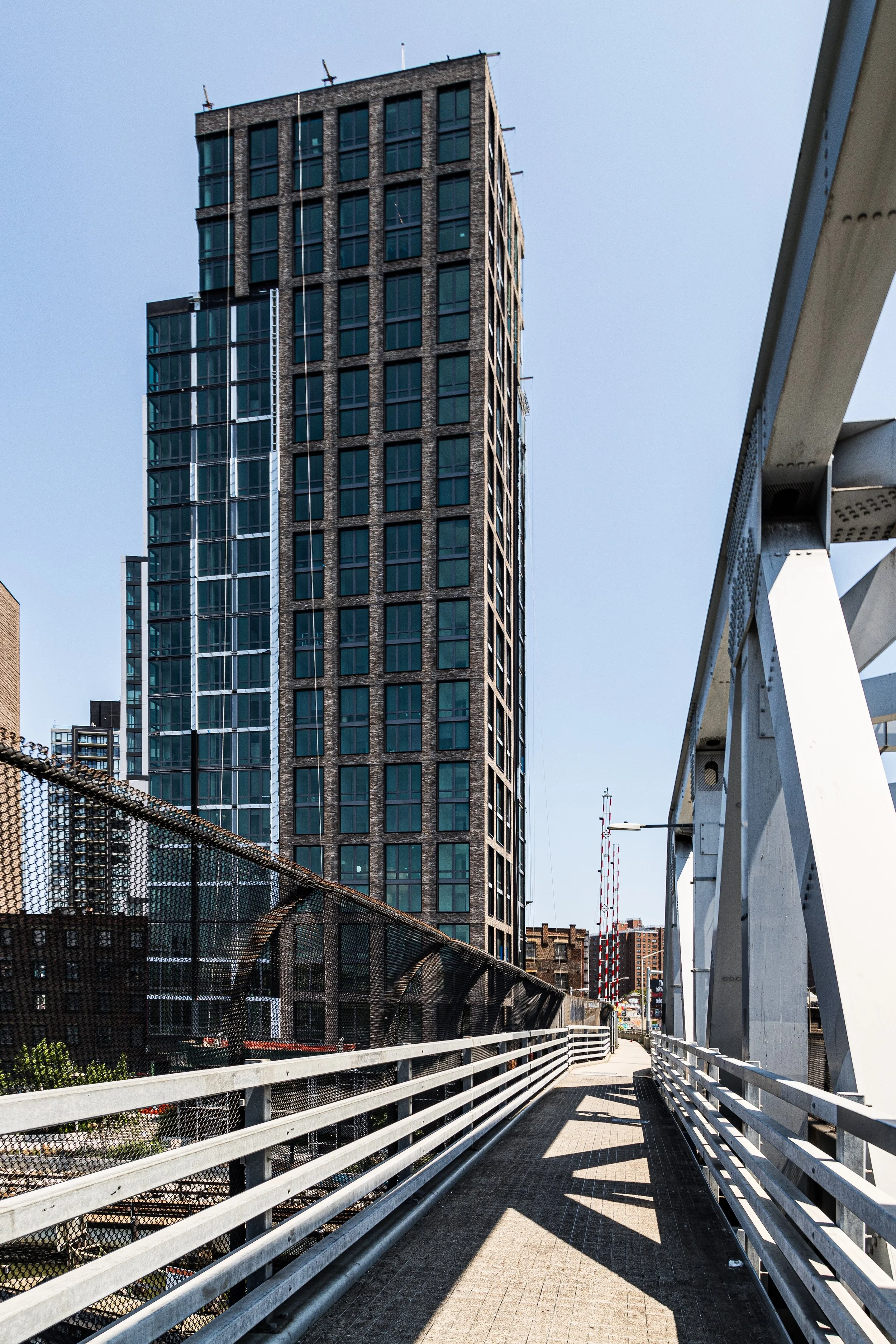
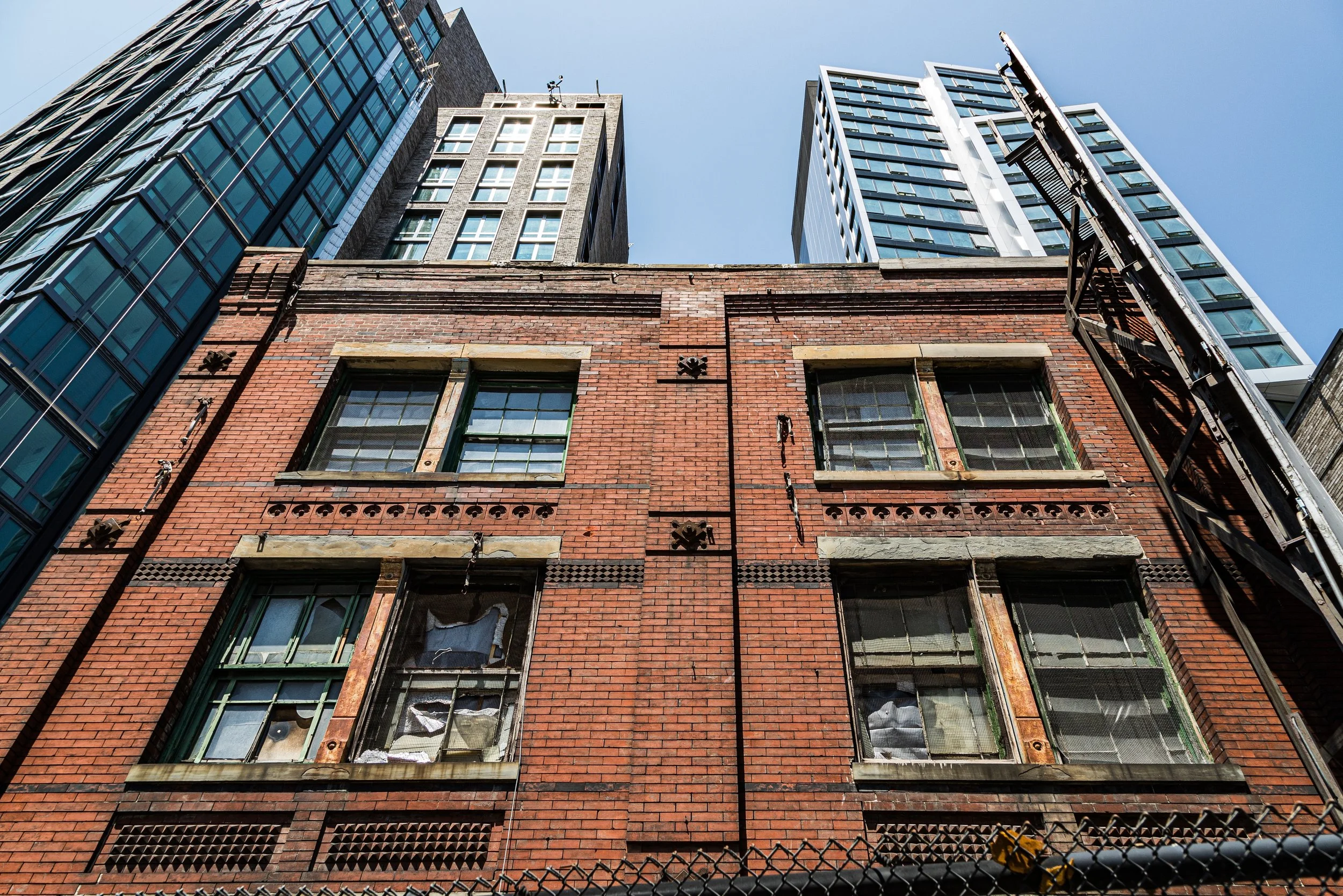
In the 21st century, Port Morris has become one of the Bronx’s most rapidly evolving neighborhoods—a frontier of adaptive reuse and creative enterprise. Former factories have been transformed into loft studios, distilleries, and design workshops, including the now-iconic Bronx Brewery, Port Morris Distillery, and Mott Haven Bar & Grill—symbols of the neighborhood’s cultural rebirth.
At the same time, large-scale development has brought both opportunity and tension. Luxury residential projects along East 134th Street and the Harlem River waterfront signal a new phase of gentrification, raising concerns about displacement and the preservation of industrial heritage. The city’s South Bronx Greenway Initiative, led by community activist Majora Carter, has restored portions of the waterfront for public use, creating bike paths, parklets, and the Randall’s Island Connector, which now links Port Morris to Manhattan and Randall’s Island via a pedestrian bridge.
Despite the influx of investment, Port Morris remains a study in contrasts: art studios beside scrap yards, artisanal cafés beside auto shops. The old industrial core continues to hum—slower, cleaner, and more diverse than before, but still recognizably a place of work. Its street grid, low-rise masonry, and riverside views preserve the texture of its industrial past even as new residents reshape its future.
Port Morris Photo Gallery
Spirit and Legacy
The spirit of Port Morris lies in reinvention without erasure. It is a neighborhood where the iron rails of the 19th century meet the craft breweries and design studios of the 21st, where the scent of river air mingles with the echoes of engines and jazz from the open doors of converted warehouses.
New York City
Use this custom Google map to explore where every neighborhood in all five boroughs of New York City is located.
The Five Boroughs
One of New York City’s unique qualities is its organization in to 5 boroughs: Manhattan, Brooklyn, Queens, The Bronx, and Staten Island. These boroughs are part pragmatic administrative districts, and part vestiges of the region’s past. Each borough is an entire county in New York State - in fact, Brooklyn is, officially, Kings County, while Staten Island is, officially Richmond County. But that’s not the whole story …
Initially, New York City was located on the southern tip of Manhattan (now the Financial District) that was once the Dutch colony of New Amsterdam. Across the East River, another city was rising: Brooklyn. In time, the city planners realized that unification between the rapidly rising cities would create commercial and industrial opportunities - through streamlined administration of the region.
So powerful was the pull of unification between New York and Brooklyn that three more counties were pulled into the unification: The Bronx, Queens, and Staten Island. And on January 1, 1898, the City of New York unified two cities and three counties into one Greater City of New York - containing the five boroughs we know today.
But because each borough developed differently and distinctly until unification, their neighborhoods likewise uniquely developed. Today, there are nearly 390 neighborhoods, each with their own histories, cultures, cuisines, and personalities - and each with residents who are fiercely proud of their corner of The Big Apple.


