FINANCIAL DISTRICT
Manhattan
Geographic Setting
The Financial District, often abbreviated simply as FiDi, occupies the southernmost tip of Manhattan Island—the narrow peninsula where New York first began. Its boundaries are generally defined by City Hall Park and Chambers Street to the north, the East River to the east, Battery Park and New York Harbor to the south, and West Street along the Hudson to the west. Within this tight geography—barely half a square mile—stand some of the most powerful symbols of global commerce and governance: Wall Street, the New York Stock Exchange, Federal Hall, Trinity Church, and the towering cluster of skyscrapers surrounding the World Trade Center.
Topographically, the area slopes steeply from the bluffs of Broadway down toward the East and Hudson Rivers, a reminder of its glacial origin and maritime destiny. The street grid—dense, irregular, and curving—is a living fossil of the colonial Dutch settlement of New Amsterdam, one of the few parts of Manhattan that predates the Commissioners’ Plan of 1811. Today, this maze of cobblestone lanes, canyons of glass and granite, and pocket plazas defines a district that fuses the 17th century’s mercantile village with the 21st century’s financial metropolis.
Etymology and Origins
The name “Financial District” emerged formally in the early 20th century, but its function dates back to 1625, when Dutch traders established New Amsterdam at the island’s southern tip as the headquarters of the Dutch West India Company. The settlement grew around Fort Amsterdam, whose outline survives in the alignment of modern Bowling Green and State Street. The area’s first street, de Waal Straat—Wall Street—took its name from the wooden defensive wall built in 1653 to protect the colony from invasion.
When the English seized the colony in 1664 and renamed it New York, the same streets remained the core of commerce. The Tontine Coffee House on Wall Street became the site of early securities trading in the 1790s, laying the groundwork for what would become the New York Stock Exchange. Even after the nation’s capital moved to Washington, the Financial District remained the capital of American capitalism.
18th–19th Century: Commerce, Shipping, and the Rise of Wall Street
During the 18th century, this district was both the political and economic heart of the new republic. Federal Hall, on Wall and Nassau Streets, hosted the First Congress and George Washington’s inauguration in 1789. Nearby, merchant houses, counting rooms, and taverns buzzed with trade in sugar, furs, and ships’ cargoes. The proximity of deepwater docks along the East River—lined with masts and warehouses—made Lower Manhattan the nation’s busiest port.
By the mid-19th century, the Financial District had fully emerged as the engine of American finance. The New York Stock Exchange (founded 1792) formalized its operations on Wall Street, while banks, insurers, and trading firms clustered nearby. Elegant Greek Revival and Italianate offices rose along Broad Street and Exchange Place, their façades evoking stability and classical virtue. Steamship companies, telegraph offices, and customs brokers created a dense commercial ecosystem tied to global trade.
The Great Fire of 1835, which destroyed much of the lower city, led to reconstruction in brick and stone, setting the stage for the skyscraper age. By the 1880s–1890s, pioneering high-rises such as the Equitable Life Building (1870) and the Gillender Building (1897) turned the narrow colonial streets into vertical canyons. The district’s skyline became synonymous with ambition and enterprise.
Early 20th Century: Skyscrapers and the Capital of Capital
The early 20th century saw the Financial District ascend—literally—to global prominence. Architectural icons such as the Woolworth Building (1913), 40 Wall Street (1930), and the Chrysler Building’s downtown contemporaries defined the skyscraper as both technology and symbol. Wall Street, Broad Street, and Pine Street became shorthand for finance itself—a metonym for the world’s markets.
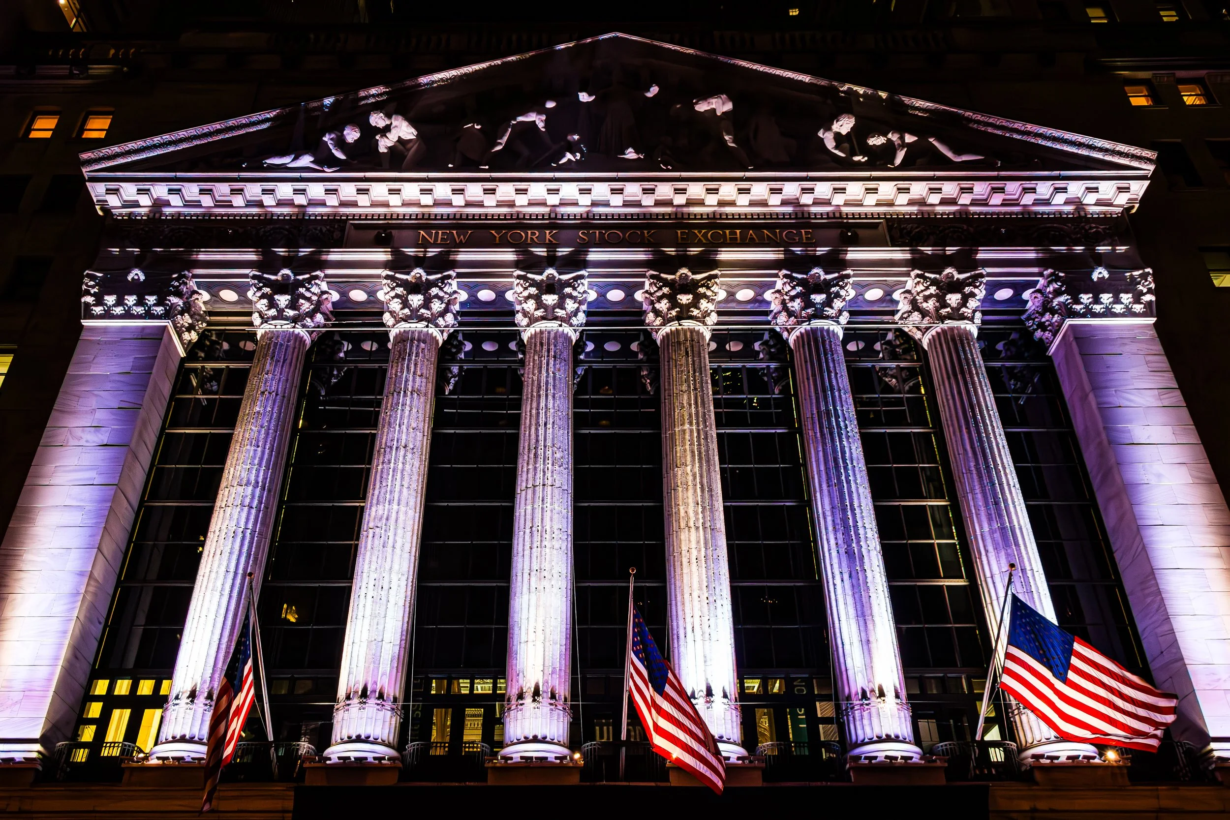
The New York Stock Exchange Building (1903), with its Corinthian columns and pediment sculpture of “Integrity Protecting the Works of Man,” embodied the civic faith in capitalism’s institutions. Surrounding it, the marble and limestone headquarters of firms like J.P. Morgan & Co., Standard Oil, and U.S. Steel represented an architectural vocabulary of permanence.
Yet this was also an era of turbulence: the Panic of 1907, the Crash of 1929, and the Great Depression shook the very foundations of the district’s authority. Nevertheless, even in crisis, the area continued to grow upward and outward, fortified by the city’s infrastructure boom—subways, tunnels, and bridges connecting it to every borough.
Financial District Photographic Video
Mid–Late 20th Century: Decline, Disaster, and Reinvention
After World War II, the Financial District remained powerful but began to hollow out. Containerization moved shipping to Brooklyn and New Jersey, emptying the East River piers. White-collar workers commuted from suburbs, leaving the district nearly deserted after business hours. Yet even amid the exodus, new visions arose. The World Trade Center, conceived in the 1960s by the Port Authority of New York and New Jersey and designed by Minoru Yamasaki, created a new architectural and symbolic focal point when its twin towers opened in 1973.
For nearly three decades, the towers represented the zenith of corporate modernism and international finance. That symbolism was shattered on September 11, 2001, when the terrorist attacks destroyed the World Trade Center and forever altered Lower Manhattan’s landscape and psyche. The aftermath marked both tragedy and transformation: from the smoldering ruins rose a new civic vision, one that fused remembrance with renewal.
21st Century: Global Rebirth and Residential Renaissance
The rebuilding of the World Trade Center site defined the early 21st century. One World Trade Center (completed 2014), rising to a symbolic 1,776 feet, now anchors the skyline beside the 9/11 Memorial and Museum, where twin reflecting pools mark the footprints of the lost towers. Surrounding developments—Liberty Park, 4 World Trade Center, and the Oculus transit hub by Santiago Calatrava—have turned the district into a hybrid of memorial, workplace, and public commons.
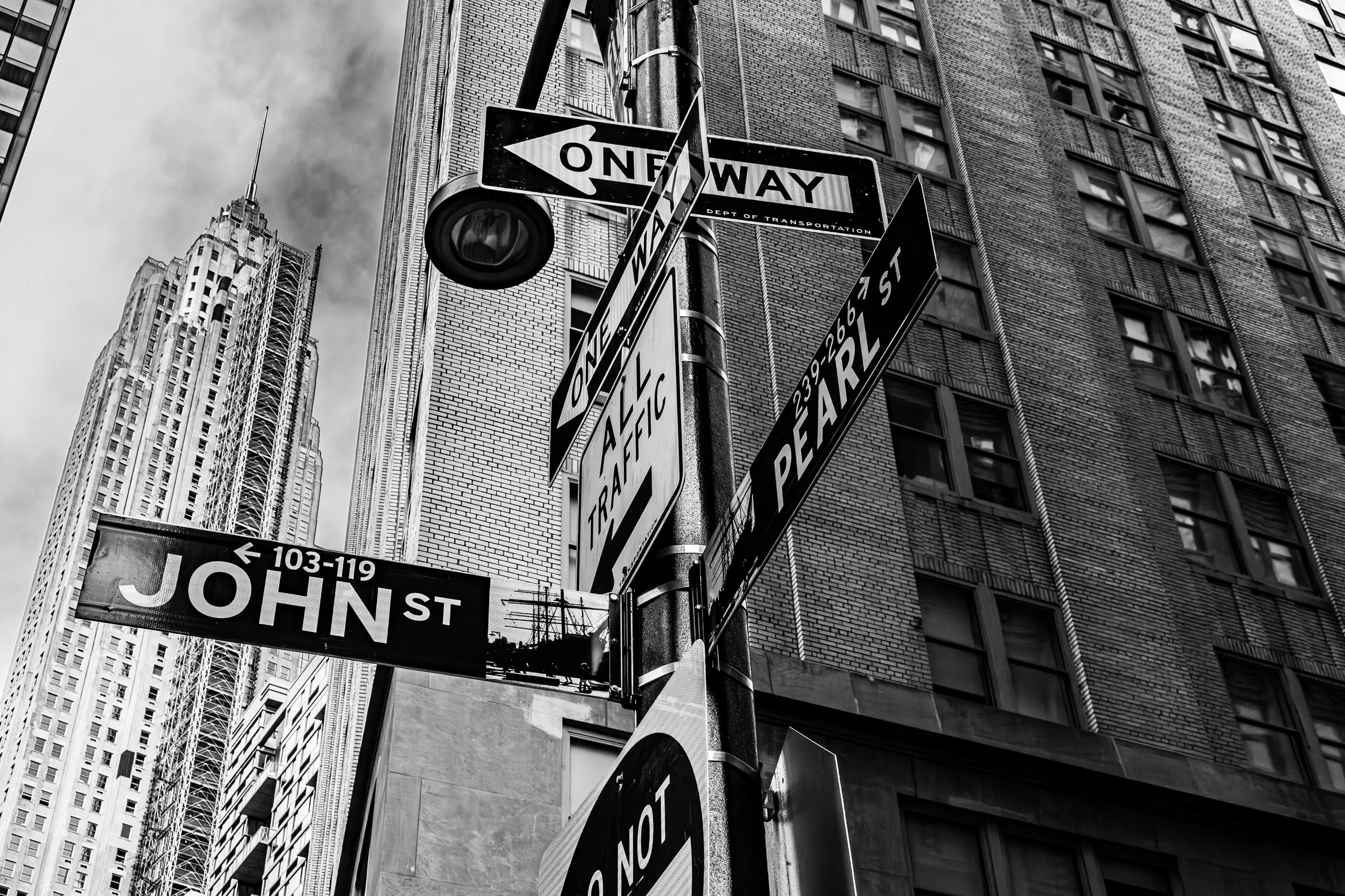
Meanwhile, the Financial District has undergone a profound demographic shift. Once strictly commercial, it is now one of Manhattan’s fastest-growing residential neighborhoods. Historic office towers have been converted into apartments and hotels, creating a 24-hour community. The district’s narrow lanes—Stone Street, Cedar Street, Pearl Street—have become lively corridors of restaurants and outdoor cafés, reviving the intimacy of the colonial port town beneath the shadow of skyscrapers.
The waterfront has also reawakened: the Battery Maritime Building, South Street Seaport, and Pier 17 blend preservation and reinvention, reconnecting FiDi to its maritime origins. The New York Stock Exchange continues to operate as the heart of global markets, while financial technology firms and creative agencies now share the skyline once dominated by banks and insurers.
Financial District Photo Gallery
Spirit and Legacy
The Financial District’s legacy is the story of New York itself—commerce transformed into civilization. From a Dutch trading post to the capital of the world economy, its streets have witnessed every chapter of the city’s rise: the ringing of the Liberty Bell’s echo at Federal Hall, the ticker tape of Wall Street booms and crashes, the smoke and silence of September 11, and the renewal that followed.
New York City
Use this custom Google map to explore where every neighborhood in all five boroughs of New York City is located.
The Five Boroughs
One of New York City’s unique qualities is its organization in to 5 boroughs: Manhattan, Brooklyn, Queens, The Bronx, and Staten Island. These boroughs are part pragmatic administrative districts, and part vestiges of the region’s past. Each borough is an entire county in New York State - in fact, Brooklyn is, officially, Kings County, while Staten Island is, officially Richmond County. But that’s not the whole story …
Initially, New York City was located on the southern tip of Manhattan (now the Financial District) that was once the Dutch colony of New Amsterdam. Across the East River, another city was rising: Brooklyn. In time, the city planners realized that unification between the rapidly rising cities would create commercial and industrial opportunities - through streamlined administration of the region.
So powerful was the pull of unification between New York and Brooklyn that three more counties were pulled into the unification: The Bronx, Queens, and Staten Island. And on January 1, 1898, the City of New York unified two cities and three counties into one Greater City of New York - containing the five boroughs we know today.
But because each borough developed differently and distinctly until unification, their neighborhoods likewise uniquely developed. Today, there are nearly 390 neighborhoods, each with their own histories, cultures, cuisines, and personalities - and each with residents who are fiercely proud of their corner of The Big Apple.


